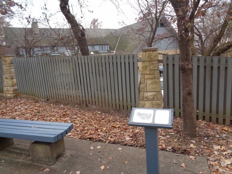
On Lodge Boulevard, on the right when traveling east.
In appearance, the Piasa Bird was a combination of bird, animal, reptile and fish. It preyed on local Indian tribes until it was killed by Illini Chieftan Owatoga, whose village was near Elsah. The original Bluff Picture was painted so Indians, . . . — — Map (db m142762) HM
On Great River Road (Illinois Route 100), on the right when traveling west.
At this place in early August 1673
Marquette, Joliet and five companions entered Illinois dawn-heralds of Religion, Civil Government and Consecrated Labor. — — Map (db m225085) HM
On Great River Road (Illinois Route 100), on the right when traveling west.
Pere Marquette State Park gets its name from Father Jacques Marquette, a French Jesuit missionary priest who came to North America to share his faith with the native people. Father Marquette joined an expedition led by Louis Jolliet, commissioned in . . . — — Map (db m225184) HM
Altitude 791 feet above sea level
372 feet above Illinois River
The Illini Indians once inhabited these ills and the river valley. In 1892, one hundred Indian skeletons were removed from this vicinity by Prof. William McAdams for the . . . — — Map (db m225076) HM
Over the years, about 165,000 individuals were employed in at least 50 Illinois Civilian Conservation Corps camps in Illinois. Many of these worked on projects in Illinois' state parks.
One of the most successful programs to aid Americans . . . — — Map (db m225080) HM
On West Pearl Street at North Washington Street, on the right when traveling west on West Pearl Street.
In memory of the E. D. Lowe Post
Jerseyville, Illinois
presented by the
W. R. C. Auxiliary of the G. A. R. No. 215
and by the
D. U. V. of the Civil War No. 71
May 30, 1937 — — Map (db m292426) WM
On W. Pearl Street at N. Lafayette Street, on the left when traveling east on W. Pearl Street.
Commemorative of
Hamilton Primary School
The first Free School in Illinois
Founded at Otterville in 1835 By Dr. Silas Hamilton
Jersey County Historical Society , 1918
Oscar B. Hamilton President
John W. Winson Secretary . . . — — Map (db m292423) HM
On North Lafayette Street at West Exchange Street, on the left when traveling north on North Lafayette Street.
Since its completion in 1894, the courthouse has undergone numerous changes.
The dome was originally topped with a 9 - foot tall 300 pound zinc statue of Justice, and four gargoyles peered across the city from atop the courthouse roof. . . . — — Map (db m292237) HM
Near North State Street (U.S. 67) just south of Snedeker Street, on the left when traveling south.
This memorial is dedicated to the three mothers and their five children buried in the Hathaway Cemetery. Located in Section 34 of Jersey Township North, the cemetery was the final resting place of: Lydia and John McCluer; Katherine, Elizabeth, and . . . — — Map (db m142828) HM
Near North State Street (U.S. 67) 0.1 miles south of Snedeker Street, on the left when traveling south.
The Lone Star School is one of more than 70 one-room schools once located throughout Jersey County. The school was built in 1877 roughly 13 miles west of Jerseyville, near the intersection of Routes 16 and 100.
For more than 70 years, children . . . — — Map (db m142795) HM
Near North State Street (U.S. 67) 0.1 miles south of Snedeker Street, on the left when traveling south.
Leonard and Clay McAdams built the log cabin on your right in the 1920s in the timbered-covered hills in southwestern Jersey County. The cabin was home to a family of six and looked much as it does today, with one room downstairs and a small loft . . . — — Map (db m142794) HM
On East Pearl Street (County Route 21) near North State Street (U.S. 67), on the right when traveling west.
One of the largest hotels in this area once flourished on this corner.
When the National was built in 1838, it was one of a handful of businesses that dotted State Street. Jerseyville was in its infancy, and Jersey County had not yet been . . . — — Map (db m276001) HM
Near North State Street (U.S. 67) at County Road 1350N, on the right when traveling north.
You are standing in what once was known as Hickory Grove, a tiny settlement that included three log cabins and the Red House.
The four-room Red House, built in 1827, was the first frame home in this area. In 1830, the Red House was converted . . . — — Map (db m142827) HM
Near North State Street (U.S. 67) just south of Snedeker Street, on the left when traveling south.
The Union Forest Church was built in 1920 about eight miles southwest of Jerseyville. Its creation was a community effort: Leslie Stamps donated 1/2 acre of land, local farmers donated and milled the lumber, the Jerseyville Baptist Church donated . . . — — Map (db m142824) HM
On East Pearl Street (County Route 21) east of North State Street (U.S. 67), on the right when traveling east.
George Wonder Ware built this building to house the Ware Drug Store in 1900.
By the turn of the century, brick buildings had largely replaced the original wooden structures that once lined State Street. However, the horse was still king in . . . — — Map (db m276000) HM
In 1834 Dr. Silas Hamilton, physician and humanitarian, bequeathed $4,000 for construction and operation of a building for educational and religious purposes. A stone schoolhouse was opened in 1836, and the tuition-free education for local . . . — — Map (db m142751) HM
Near Bloomington Avenue (Illinois Route 23) north of North 21st Road/West Main Street (County Route 6), on the right when traveling north.
John Huston Finley was born on a farm east of Grand Ridge and attended Grand
Ridge Elementary School. He graduated from Ottawa High School as valedictorian in
1882, and earned his undergraduate degree at Knox College in 1887. He went on to
Johns . . . — — Map (db m239246) HM
On 7th Street west of Union Street, on the right when traveling west.
Dr. Paul Carus
Born July 18, 1852, Ilsenburg in Harz, Germany
Died February 11, 1919, LaSalle, Illinois
Dr. Paul Carus, who lived and worked at 1307 7th St, LaSalle, Illinois, was editor of the Open Court Publishing Company & The Open . . . — — Map (db m65300) HM
On 7th Street at Sterling Street, on the left when traveling east on 7th Street.
has been designated a
National Historic Landmark
This home possesses national significance because
of its architect, W. W. Boyington; its interior designer,
August Fiedler; and as the birthplace of Open Court
Publishing Company, an . . . — — Map (db m185188) HM
On 7th Street at Sterling Street, on the right when traveling east on 7th Street.
Listed on the National Register of Historic Places
Made possible by a challenge grant from the
Richard H. Driehaus Charitable Lead Trust — — Map (db m185187) HM
On 5th Street (U.S. 6) west of Crosat Street, on the right when traveling west.
The story of the twin cities of LaSalle and Peru is closely interwoven with the history of the Illinois River and the Illinois and Michigan Canal. In 1673, Jacques Marquette and Louis Jolliet passed through this area by way of the Illinois River . . . — — Map (db m51066) HM
On 2nd Street at Joliet Street ( Route 351), on the right when traveling west on 2nd Street.
In 1906, Mayor Walter A. Panneck sold 450 city hall bonds to help raise the $75,000 needed to build a new city hall. Designed by local architect Victor A. Matteson and built by M.W. Allen & Sons from Peoria and J.M. Dougherty from Ottawa, the . . . — — Map (db m65301) HM
On East 8th Road (Illinois Route 178) north of Local Road 2199, on the right when traveling north.
Philanthropist - Pioneer Abolitionist - Publisher - Census of Universal Emancipation, Fore-Runner of "Western Citizen" now "Chicago Tribune". He Gave His Life and Fortune For Freedom — — Map (db m197995) HM
On Illinois Route 178 north of North 2199th Road, on the right when traveling north.
William Seeley, who came to LaSalle County in 1828, platted the town of Lowell. A church was built in 1851 serving Anglicans, Baptists, Congregationalists and Methodists. In 1856, in fulfillment of their having built a place of worship, he deeded . . . — — Map (db m197821) HM
On Washington Street east of Main Street (County Route 15), on the right when traveling east.
In memory of those who gave the supreme sacrifice
for their country from the Marseilles, IL area
Civil War 1861-1865
First Illinois Light Artillery Asbury Smith
11th Illinois Infantry Regiment James Anderson • George . . . — — Map (db m239344) WM
On Washington Street at Main Street (County Route 15), on the right when traveling east on Washington Street.
In memory of those who gave the supreme sacrifice
for their country from the Marseilles, IL area
World War I
Edwin Prichard
World War II
Charles Arnold •
Ernest Atchley •
Wayne Berta •
Charles Brinkman •
Charles Ashton . . . — — Map (db m239340) WM
On Washington Street east of Main Street (County Route 15), on the right when traveling east.
[Center]
In memory of
the men and women
of the community
who served their
country
to assure the
American ideals
of liberty
[Left wing] They have not sacrificed in vain if we
[Right wing] continue to protect . . . — — Map (db m239348) WM
Near Main Street (County Highway 15) at Mill Street, on the right when traveling north.
On July 19, 1932, unemployed workers marched toward the Marseilles
Dam, which was using out-of-state workers for a major project. As the
local workers reached the site, gunfire exploded from the dam site. 21
protesting workers were wounded and . . . — — Map (db m239352) HM
On Washington Street east of Main Street (County Route 15), on the right when traveling east.
When the Civil War began
in 1861, while James Sanborn
was a farmer near Marseilles. He
enlisted in Company K of the
39th Illinois Volunteer Infantry.
In 1863 while Sanborn was
waiting for the steamer to go
home on furlough from
South . . . — — Map (db m239343) HM
On Main Street (County Highway 15) at Mill Street, on the right when traveling north on Main Street.
In 1932 the national economic crisis of the Great Depression was still
growing. Workers had no legal right to organize unions, and had little
power individually to prevent lowering standards of living, but an
unemployed movement had formed. Near . . . — — Map (db m239351) HM
On 8th Street at Main Street, on the left when traveling east on 8th Street.
In 1853 two railroads met near this spot and the community of
Mendota was born. Mendota is an Indian word said to mean
"crossing of the trails." The Chicago & Aurora Railroad planned
to expand southwest from Aurora to meet the Illinois . . . — — Map (db m192401) HM
On East Canal Street at Vine Street, on the right when traveling east on East Canal Street.
This one room schoolhouse was originally established as District One in a deed notarized by Horace D. Hickok, brother of "Wild Bill" Hickok on August 8, 1865. It was later referred to as the Aitken School after John Malcolm Aitken, a stalwart friend . . . — — Map (db m185193) HM
On East Canal Street east of Mill Street, on the right when traveling east.
This stone building was a warehouse on the Illinois and Michigan Canal, which was completed in 1848. The building was constructed one year later by James Clark, a resident of Utica. Before the advent of the railroads the canal was the main . . . — — Map (db m185195) HM
On West Johnson Street at South Division Street, on the left when traveling west on West Johnson Street.
[Front]
Born at Laon France June 1 1637 he died near
Ludington Michigan May 18 1675
Devoted missioner and heroic priest-explorer
he offered the Holy Sacrifice of the Mass near
this spot Maundy Thursday and Easter Sunday 1675
and . . . — — Map (db m185190) HM
Near Bluff Trail east of East 8th Road ( Route 178), on the right when traveling east.
The state of Illinois and the river that flows before you were named after the Illinois Confederation who once inhabited areas of Illinois, lowa, Indiana, Wisconsin, Missouri, and Arkansas.
The Grand Village of the Illinois, now a historic . . . — — Map (db m258243) HM
On Church Street at Mill Street, on the right when traveling west on Church Street.
A tornado, with little warning of its violent fury, struck downtown Utica on April 20, 2004. Nine persons perished in its aftermath, with eight of those in the Milestone Tavern. Nine people were rescued. Many homes and buildings were damaged or . . . — — Map (db m185192) HM
On Cleng Peerson Memorial Highway (Illinois Route 71) at East 2631st Road, on the right when traveling south on Cleng Peerson Memorial Highway.
This is the area where the first Norwegian
migrants spent the first winter in the
Fox River settlement in 1834. Across the
road is where Cleng Peterson had his famous
dream and vision of better things for his
countrymen. This resulted in . . . — — Map (db m310036) HM
On Cleng Peerson Memorial Highway (Route 71) at East 2631st Road, on the right when traveling south on Cleng Peerson Memorial Highway.
Here is commemorated the 100th anniversary of the first permanent Norwegian settlement in the United States by Cleng Peerson and other pioneers from Norway. They and their descendants, who still live here have contributed largely to the development . . . — — Map (db m309627) HM
In 1933 the Civilian Conservation Corps (CCC) built the core of Starved Rock Lodge — the lobby, dining room, kitchen and cabins for a cost of $200,000. Also they constructed many of the structures - bridges, shelters, and the trails you see today. . . . — — Map (db m185000) HM
On North Woodland Avenue north of Jordan Street, on the right when traveling north.
A memorial to Brigadier-General Casimir Pulaski
Revolutionary War-hero father of
American cavalry on the 150th
anniversary of his death
Born in Poland in 1748. At the age of 25, had achieved a European reputation as first-class military . . . — — Map (db m213622) HM WM
Near East 875th Road 1.4 miles north of Hiawatha Pioneer Trail ( Route 71).
Presented by the Ladies of the Grand Army of the Republic Department of Illinois. 1861-5 — 1914 Ida E. Wright President Commemorating the Deeds of the Union Veterans of the Civil War ————— ”With malice toward none with charity for all” Lincoln . . . — — Map (db m213925) WM
On West Walnut Street (County Road 23) at East 350 Road, on the right when traveling east on West Walnut Street.
Named after Henry Cox, farmer and jeweler, who donated the land.
A one room, one teacher school stood on this corner until 1976. Teachers served the surrounding community in the school until 1954.
Dedicated to Blanche Maher, (1943 until 1954), the . . . — — Map (db m191419) HM
On Bluff Trail 0.2 miles north of East 875th Road, on the right when traveling west.
<
i> French trade and diplomacy thrived between 1683 through 1691 along the Illinois River at Fort Saint Louis which once encompassed the top of the sandstone butte later known as "Starved Rock."
French explorer Robert Renee Cavalier . . . — — Map (db m258239) HM
Archaeological excavations by the State of Illinois and the University of Chicago have shown Starved Rock the site of the first permanent fortress in the Illinois country. Erected 1682-1683 by La Salle and his Lieutenant Tonti. — — Map (db m207611) HM
On 2625th Road (Illinois Route 351) at East 350th Road (County Road 62), on the right when traveling east on 2625th Road.
On the eminence to the southwest stood Fort Wilbourn, where the Third Army of Illinois volunteers was mustered in for service in the Black Hawk War. Here on June 16, 1832 Abraham Lincoln enlisted as a private in Jacob M. Early's company, his third . . . — — Map (db m184997) HM
On North Woodland Avenue at Jordan Street, on the right when traveling north on North Woodland Avenue.
In honor of those who served in World War II and in Korea and in Southeast Asia in everlasting memory of those who paid the supreme sacrifice
Alfonso Bassetti • Frank Bovee • Ralph Boyd • Cody Calkins • Leroy Carbine • Barrett Corneille • Charles . . . — — Map (db m213442) WM
On North Woodland Avenue at Jordan Street, on the right when traveling north on North Woodland Avenue.
Memorial
dedicated to the soldiers and sailors of Oglesby Illinois who offered their service and lives at the nation's call in the Great World War — 1914-1918
(Star denotes killed in action)
Roll of Honor
Thomas Allen • Thomas . . . — — Map (db m213435) WM
On North Woodland Avenue north of Jordan Street, on the right when traveling north.
Korean War
Not forgotten
Honoring veterans of Korean War who lived in and left from Oglesby, Piety Hill and Jonesville and served between the dates of June 25, 1950 – July 27, 1953
Argubright, Thomas • Baima, Donald • Baima, Martin • . . . — — Map (db m213443) WM
On Jordan Street at North Woodland Avenue, on the right when traveling west on Jordan Street.
Our cause was just
Honoring those who lived in and left from Oglesby, Piety Hill and Jonesville and served between Feb. 28, 1961 and May 7, 1975.
* Denotes killed in action
Allen, Brian A. • Angelo, Frank C. • Arboit, Terry J. • . . . — — Map (db m213355) WM
On North Woodland Avenue north of Jordan Street, on the right when traveling north.
Honoring veterans of World War II who lived in and left from Oglesby, Piety Hill, and Jonesville, between the dates of Dec. 7, 1941 – Sept. 2, 1945
Aimone, Donald •
Akucka, Lawrence •
Allen, Albert H. •
Amadon, Joseph •
Ambrose, Charles . . . — — Map (db m213535) WM
La Salle was a man of vision and courage. He established contact with Native Americans and brought European culture to this area, while acting as a peacemaker in his actions with local Indian peoples. His explorations were responsible for expansion . . . — — Map (db m207606) HM
160 ► Illinois, LaSalle County, Oglesby — The Legend of Starved Rock — A story that has captured and will continue to capture imaginations of visitors for generations — You are now standing 125 feet above the Illinois River on the bluff known as Starved Rock —
Near East 873 Road.
Odawa (Ottawa) war chief Pontiac was said to have been murdered by an Illinois tribe member during a council meeting in today's Joliet. Seeking revenge, the Odawa and Potawatomi attacked the Illinois village near Starved Rock.
The Illinois . . . — — Map (db m207609) HM
This plaque is placed in memory of the Patriots who gave their lives for their country. Soldiers of the American Revolution, and soldiers and sailors of the War of 1812.
Original flag staff and plaque dedicated September 6, 1913
by
The . . . — — Map (db m207607) WM
Prior to the 20th century, the Illinois River was shallow and much of it was not navigable. The Illinois & Michigan (I&M) Canal was built in 1848 to connect Lake Michigan to the navigable part of the Illinois River, thereby connecting this part of . . . — — Map (db m207608) HM
On West Jefferson Street west of Columbus Street ( Route 23), on the right when traveling west.
Established as The Constitutionalist in 1844
The ninth oldest daily newspaper in the State of Illinois
Member
Small Newspaper Group, Inc.
With other publications in: Kankakee, Illinois; Moline, Illinois;
LaPorte, Indiana; Rock . . . — — Map (db m185044) HM
In honor of Abraham Lincoln who practiced law 1851 to 1859 before the Supreme Court of Illinois at its sessions that held in the old LaSalle County Court House on this site. Erected by the Illini Chapter Daughters of the American Revolution 1922 — — Map (db m200089) HM
In honor of the pioneers who, on May 27 1850, took over direction of county affairs from the commissioner's court of 1831-1850 and organized here the first board of supervisors. Erected by the LaSalle County Board of Supervisors 1950 — — Map (db m200088) HM
On Illinois Route 71 0.2 miles east of North 2401st Road (County Road 8), on the right when traveling east.
In the autumn of 1861 the valley before you, bounded by bluff, creek, and river, was known as Camp Hunter. Here on September 26, the 4th Illinois Cavalry mustered for duty, beginning military training and a three-year enlistment. White tents . . . — — Map (db m185004) HM
On Columbus Street (State Road 23/71) just south of East Lafayette Street, on the right when traveling north.
Christ Episcopal Church
has been placed on the
National Register
of Historic Places
by the United States
Department of Interior
c. 1871 — — Map (db m198803) HM
On La Salle Street (Illinois Route 23) at Jackson Street, on the right when traveling north on La Salle Street.
First Lincoln-Douglas Debate
Abraham Lincoln's first heated exchanged with Stephen A. Douglas on Aug 21, 1858 in Ottawa was received coolly by his advisors. They insisted Lincoln had treated Douglas entirely too "tenderly." . . . — — Map (db m65302) HM
On Columbus Street (Illinois Route 23) near East Canal Avenue, on the left when traveling north.
This historic artery of travel was begun in 1836 and finished in 1848. By carrying pioneers and their produce between Lake Michigan and the Illinois Valley, it figured largely in the development of northern Illinois. Superseded by the deep waterway . . . — — Map (db m185049) HM
On Columbus Street (State Road 23/71) north of East Lafayette Street, on the right when traveling north.
Illinois Appellate Court
Third District
Formerly the Northern Grand Division
of the Illinois Supreme Court and the
Second District Appellate Court
has been placed on the
National Register
of Historic Places
by the United . . . — — Map (db m198802) HM
On West Madison Street just east of La Salle Street ( Route 23), on the left when traveling west.
In memory of W.R Foster (1863-1957)
Superintendent of LaSalle County schools for 40 years from 1907 to 1947.
Educator, civic leader and man outstanding, able, inspiring, helpful, humorous, and loyal-- who enriched the lives of hundreds . . . — — Map (db m198468) HM
On West Madison Street at La Salle Street ( Route 23), on the right when traveling east on West Madison Street.
In 1859, Jim Gray, a slave who escaped from Missouri, was apprehended in Illinois by slave hunters. Gray was taken to Ottawa for a hearing before Justice John Dean Caton of the Illinois Supreme Court's northern division.
On October 19, with a . . . — — Map (db m201759) HM
On West Madison Street just east of La Salle Street, on the left when traveling west.
This courthouse was erected in 1881, 82, 83 being the fourth on this site. The first and second were of wood. The third of brick.
This cornerstone was laid by the Masonic Fraternity July 4, 1881.
The cost of the building was 127,127.01. . . . — — Map (db m198464) HM
On Columbus Street (Illinois Route 23) north of East Jefferson Street, on the right when traveling north.
Joseph Otis Glover could boast “Lincoln Slept Here” in a bedroom in his modest home at 810 Columbus St. Traveling political candidates often put up at the homes of supporters. Thus, when Lincoln arrived in Ottawa on August 21, 1858, for his . . . — — Map (db m185038) HM
On West Madison Street at La Salle Street ( Route 23), on the right when traveling east on West Madison Street.
On this site stood the Third LaSalle County Courthouse. Actually the second courthouse to be erected at this location, the Third LaSalle County Courthouse was completed in the latter part of 1841. It was a two-story brick structure, with imposing . . . — — Map (db m65303) HM
In honor of Stephen A Douglas. A great American who spoke on this site October 25, 1840 and September 13, 1854. He also debated the slavery extension issue with Abraham Lincoln August 21, 1858. His last talk in Ottawa was on October 8, 1860 as a . . . — — Map (db m200087) HM
On Columbus Street (Illinois Route 71) just south of Lafayette Street, on the right when traveling south.
On August 21, 1858, the first of seven debates between Abraham Lincoln and United States Senator Stephen A. Douglas took place in this park. Approximately 10,000 people gathered to hear the two candidates discuss the question of slavery in America. . . . — — Map (db m65299) HM
On West Prospect Avenue at Christie Street, on the right when traveling west on West Prospect Avenue.
This tablet marks the home of
John Hossáck
It was here he directed the underground
freedom of slaves 1859
Erected by
Illini Chapter D.A.R.
1947 — — Map (db m185011) HM
On West Lafayette Street west of Columbus Street ( Route 23), on the left when traveling west.
[Center]
Dedicated to the
men and women of
our community who
served our country
World War I
World War II
Korea
Vietnam
1917 - 1973
Rest in Peace
[Left wing]
World War I
Adler, George • Anderson, . . . — — Map (db m185045) WM
On Columbus Street (Illinois Route 71) at Jackson Street, on the right when traveling south on Columbus Street.
On August 21, 1858, the first of the famous debates between Abraham Lincoln and Stephen A. Douglas was held in Washington Square. Here ten thousand heard the two candidates debate for a seat in the United States Senate.
Principally, the great . . . — — Map (db m65325) HM
In appreciation of his service to the Boyhood of America. Inspired by the good turn of an unknown English Scout, he brought scouting to the United States. — — Map (db m82183) HM
480 entries matched your criteria. Entries 101 through 200 are listed above. ⊲ Previous 100 — Next 100 ⊳