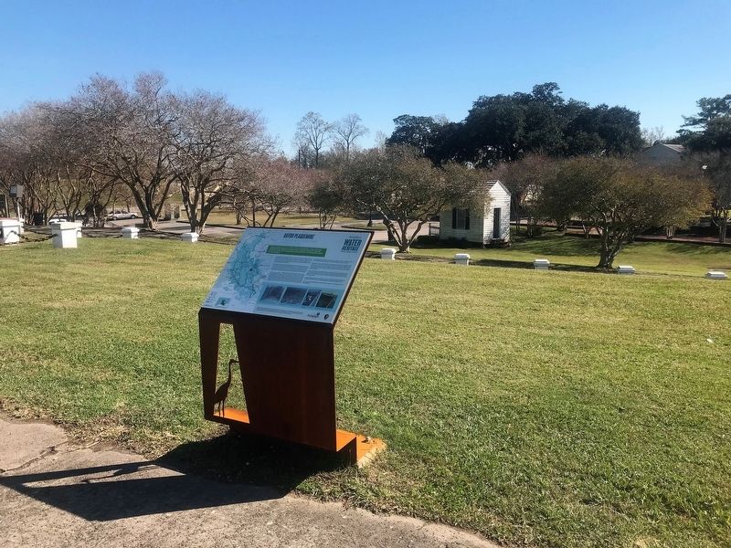
Near Main Street west of Church Street, on the right when traveling west.
Upon completion in 1909, The Plaquemine Lock was an engineering marvel thanks to the unique gravity of water flow system that operated the highest fresh water lock in the world.As a distributary of the Mississippi River and an inland route to . . . — — Map (db m111247) HM
On Bayou Road (State Road 3066) south of Enterprise Boulevard, on the right when traveling south.
Bayou Plaquemine was an important Mississippi River distributary that allowed for boat navigation throughout the Atchafalaya Basin. Travelers left the Mississippi via Bayou Plaquemine, moved west to the Atchafalaya, and then headed further inland . . . — — Map (db m111443) HM
Near Main Street east of Church Street, on the right when traveling west.
Gary J. Hebert
1929-1994
Due to his vigilant and untiring efforts, this historic property still stands. Gary J. Hebert refused to back down despite a tremendous push for destruction of the lock to make way for a four-lane highway. After a two . . . — — Map (db m86843) HM
On Saint Louis Road near Louisiana Highway 1, on the right when traveling west.
On This Site Lie Buried Joseph Erwin Revolutionary Soldier, N.C. 1762-1829 Lavinia T. Erwin Wife 1763-1836 Eliza E. Wilson Daughter 1796-1834 — — Map (db m234218) HM
Joyce S. Hebert worked with her husband, Gary
Hebert
in the fight to save the Plaquemine Lock and a portion of
historic Bayou Plaquemine. Their efforts led to the Lock and
bayou being named a National and a state Historic Site. She
later . . . — — Map (db m281271) HM
On Warren Road (State Highway 988) 1 mile south of South River Road, on the right when traveling south.
On March 13, 1889, Rev. Robert Morrison established the Nazarene Baptist Church one and one half miles north of this site on Australia Point where the community of Morrisonville developed. Due to levee setbacks in 1921 residents relocated to . . . — — Map (db m87258) HM
On Church Street at Main Street, on the right when traveling north on Church Street.
Iberville Parish Courthouse, 1848-1906; Plaquemine City Hall, 1906-85. Built by George and Thomas Weldon of Mississippi. One of Louisiana's oldest public buildings. Listed on National Register of Historic Places. — — Map (db m86841) HM
On Church Street (State Highway 1) north of Meriam Street, on the right when traveling north.
Methodist circuit riders came out of Mississippi into this area
soon after the Louisiana Purchase of 1803. A Union church building was erected in 1841 on what is now the parking lot of the present Methodist Church. This church served Methodists, . . . — — Map (db m127884) HM
On Railroad Avenue south of Court Street, on the right when traveling south.
Memorial tablet Dedicated by Plaquemine Tribe To her hero members who took part in the World War of 1917-1918 Henry Dardenne Kill'd in France Dr. H.F. Vulliamy • Dr. A.A.Landry, M. Tullie • Joe Thibodeaux, W. Richard • Elmer Schuler, W.P. . . . — — Map (db m99152) WM
On Bayou Paul Lane 0.1 miles north of Bayou Paul Rd., on the right when traveling north.
Established by the United Sons and Daughters Benevolent Society, the Bayou Paul Colored School provided elementary education for African-American children in the Bayou Paul community and served as a meeting hall for the Society. The Society built . . . — — Map (db m92741) HM
Co. B - Meriam's Reg't. Louisiana Militia War of 1812 Born - Jan. 9, 1770, St. Servan, France Died - Mar. 14, 1843, Iberville Parish, Louisiana Buried - Old St. Gabriel Church Cemetery St. Gabriel, Louisiana Migrated to Iberville Parish in 1785 . . . — — Map (db m108798) HM
Near State Highway 75 0.2 miles south of Route 74, on the left when traveling south.
Eglise de la côte d'Iberville construite en 1769 par les exilés acadiens. En 1773 elle était sur le Manchac espagnol offert par ce gouvernement. Des colons allemands arrivèrent du Maryland en 1784. English . . . — — Map (db m85716) HM
On State Highway 75 0.2 miles south of State Highway 74, on the left when traveling south.
Acadian exiles arrived from Maryland in 1767 and were given Spanish land grants as was the church. The church was built by Louis LeConte a builder from Lafourche between November 1774 and July 1776 aided by the settlers. The Acadians brought and . . . — — Map (db m127916) HM
Near State Highway 75 0.2 miles south of State Highway 74, on the left when traveling south.
In 1699 Pierre Lemoyne, Sieur D'Iberville, father of Louisiana, explored the Mississippi and its distributary the Ascantia, later called Bayou Manchac. By 1758 exiled Acadians had settled at Manchac. They soon built upstream this cypress church, . . . — — Map (db m127915) HM
On State Highway 405 at Stone Street, on the left when traveling south on State Highway 405.
One of the grandest plantation mansions ever built in Louisiana, Belle Grove was built at the pinnacle of prosperity during the 1850s sugar boom in the South. Sixty-two feet in height, her thirty foot pillars were capped by solid cypress Corinthian . . . — — Map (db m87260) HM
On Bowie Street, on the right when traveling north.
This Municipal Complex is dedicated in memory of Mayor S. J. "Blue" Guercio III and all the past Mayors, Aldermen, Police Chiefs as well as Town Employee's who gave of themselves for the betterment and progress of the Town of White Castle, since . . . — — Map (db m126548) HM
Here in Bayou Goula Bend on December 7, 1968 the Coast Guard Cutter White Alder sank after collision with the Formosan Freighter Helena. This light is dedicated to the crew of the White Alder. Seventeen Coast Guardsmen lost their lives in the . . . — — Map (db m126912) HM
On U.S. 90 at South Jamie Boulevard, on the right when traveling east on U.S. 90.
Named for George Augustus Waggaman, prominent politician, planter and War of 1812 veteran. His plantation, Avondale, was built north of here in 1839. Home consumed by Miss. River in early 1900s. — — Map (db m81061) HM
On U.S. 90 west of West Bank Expressway (Business U.S. 90), on the right when traveling east.
On Feb. 11, 1825, Governor Henry S. Johnson signed legislation creating the Parish of Jefferson out of the Third Senatorial District. It is named for President Thomas Jefferson, who died the following year, July 4. — — Map (db m148816) HM
On U.S. 90 just east of Westbank Expressway (Business U.S. 90), on the right when traveling east.
Pops was a lifelong motorcyclist and champion of motorcycle education and rights. In 1981 he founded the Louisiana chapter of ABATE, American Bikers Active Toward Education, and was its state president for many years. In his interest to serve the . . . — — Map (db m148874) HM
On U.S. 90 east of West Bank Expressway (Business U.S. 90), on the right when traveling east.
Dedicate to the memory of Richard "Pops" Strohman Pops was born in West Texas and moved to Louisiana in the early 1950s. He had already started riding motorcycles in the 1940's and continued riding right up until he passed.In 1981 he decided . . . — — Map (db m149286) HM
On River Road (State Road 611-1) north of St. George Street, on the right when traveling north.
This structure is a combination railroad and highway bridge. Designed by the firm of Modjeski, Masters and Chase, with foundation recommendations by Dr. Karl Terzaghi. It was the first bridge to span the Mississippi River at New Orleans. The . . . — — Map (db m125232) HM
On Jefferson Highway (State Highway 48) at Plantation Road, on the right when traveling north on Jefferson Highway.
During 1930-42 this airport operated passenger, charter, and mail service and a flying school. The company of James R. Wedell and Harry P. Williams designed, built and flew some of the fastest planes in the world. Wedell set a world speed record in . . . — — Map (db m93112) HM
Near Baratania Road (Parish Highway 45) near Lafitte Parkway (Parish Highway 3134).
Between 1805 and 1814 the privateer Jean Lafitte, led 1,000 men of dives (marker damaged) into one of the largest, although illicit, business enterprises of its day. With an alleged 99 vessels, Lafitte and his band of "Baratarians" supplied . . . — — Map (db m247069) HM
On State Highway 1 east of Willow Street, in the median.
This approximately 10-foot long, 32- pounder gun was cast at the Columbia Foundry Georgetown, D.C., for the United States Navy in 1821. It was originally part of the armament of the USS Columbia, until the ship was decommissioned in 1848. . . . — — Map (db m100635) HM
On State Highway 1, on the right when traveling east.
Settled by Indians,"Isle of the Chitamachas" was later owned by Francisco Caminada. Known as "Chico Isle", as "Chita", as Caminadaville. It was home to pirates, fishermen and farmers. On Oct. 1, 1893, a fast moving, late season hurricane from the . . . — — Map (db m62038) HM
On State Highway 1 east of Willow Lane, on the right when traveling east.
Two miles N.E. on Grand Terre. Land occupied by Jean Lafitte until 1814, purchased by U.S. from Etienne DeGruy in 1834. Fort constructed 1841 to defend Barataria Pass. Site never saw combat. Abandoned after the War Between the States, guns were . . . — — Map (db m100013) HM
On State Highway 1 east of Willow Lane, on the left when traveling east.
One of several barrier islands formed about one thousand years ago when the Mississippi River flowed through Bayou Lafourche on its way to the Gulf of Mexico. Today Grand Isle is Louisiana's best known island resort. The Island was settled during . . . — — Map (db m100006) HM
On Louisiana Route 1 east of Willow Lane, on the left when traveling east. Reported missing.
At Southernmost tip of Jefferson Parish, Louisiana's only inhabited barrier island appears in 18th century land-grants. At first part of Orleans Territory, but often administered by Lafourche Parish. Officially part of Jefferson Parish since 1825. . . . — — Map (db m100149) HM
On Louisiana Route 1 0.1 miles east of Willow Lane, on the right when traveling west.
Angelo Adams • Harris Adams • Luke Adams • Ralph Adams • Joseph Augustin • Albert Arbour • Ernest G. Ballard • Elois Barthelemy • Charles Baugh • Henry Baugh • Melvin Billiot • Jules Borgstede • E. L. Bourne, Jr. • Edward Bradberry • Louis . . . — — Map (db m249290) WM
Panel 1 Grand Isle is one of the many barrier islands formed as a result of the dynamic, everchanging Mississippi River. Grand Isle originated as a sandbar connected to the mainland marshes at its western end. When the Mississippi River changed to . . . — — Map (db m115408) HM
On State Highway 1 east of Land Fill Lane, on the right when traveling east.
On Feb. 11, 1825, Governor Henry S. Johnson signed legislation creating the Parish of Jefferson out of the Third Senatorial District. It is named for President Thomas Jefferson, who died the following year, July 4. — — Map (db m100007) HM
On Louisiana Route 1 0.1 miles west of Herbert Street, on the right when traveling east.
An ciel, an ciel, an ciel, J'irai la voir un jour
[English Translation:]
An sky, an sky, an sky, I will go see her one day
Commemorating the holy souls
of the community of Chenière Caminada
who . . . — — Map (db m249294) HM
On Louisiana Route 1 at Willow Lane, on the right when traveling west on Louisiana Route 1.
There is no greater gift man can give than his life for his country.
WWI
Louis Duplesses
WWII
Jules Borgestede • Shafter Santiny
Vietnam
Charles Baugh — — Map (db m249289) WM
On Newton Street at 3rd Street, on the right when traveling south on Newton Street.
On June, 4, 1884 members of the
police jury of Jefferson Parish
Right Bank:
F.H. Hatch, Pres.,
Geo. Bossey • H. Eloi
H. WIlkinson • L.H. Marrero
W. M. Naudain • N. Le Bouef
held their first meeting in this
William Tell . . . — — Map (db m81058) HM
On Huey P. Long Avenue at 11th Street, on the left when traveling north on Huey P. Long Avenue.
Incorporated 20 August 1913. John Ehret, First Mayor. Seat of Jefferson Parish Government since 1884. German settlement laid out in 1836 by Benjamin Buisson for Nicholas Noel Destrehan as Village of Mechanikham. — — Map (db m80973) HM
On Lafayette Street at 2nd Street, on the right when traveling north on Lafayette Street.
This property
David Crockett
Firehall
has been placed on the
National Register
of Historic Places
by the United States
Department of the Interior — — Map (db m81060) HM
On Derbigny Street at 3rd Street, on the left when traveling north on Derbigny Street.
Home of Pierre A.C.B. Derbigny, 6th Governor of La., 1828~1829, member 1st La. Legislature, La. Secretary of State, La. Supreme Court Judge, Battle of N.O. veteran. 1820 operated 1st steam ferry on Miss. River at N.O. Died 1829 from a carriage . . . — — Map (db m80975) HM
On Mississippi River Trail, on the right when traveling south.
Ferry operated from 1898 to 1942 with two transfer boats. One, the Gouldsboro, named for railroad magnate Jay Gould, was built in 1863 as the Federal Monitor Chickasaw and saw action at the Battle of Mobile Bay. — — Map (db m129478) HM
In 1839, St. Mary's Market Steam Ferry Company developed 824 lots along Lafayette Avenue, naming the area Gretna and establishing commercial ferry service between the West Bank and New Orleans. — — Map (db m129780) HM
On 2nd Street at Huey P Long Avenue, on the right when traveling east on 2nd Street.
Built in 1907 as the sixth
Jefferson Parish Courthouse
Annex added 1929
Dedicated Gretna City Hall 1964
National Register of Historic Places 1983 — — Map (db m81107) HM
On Franklin Avenue (State Highway 23) at Virgil Street, in the median on Franklin Avenue.
Founded 1815 by education philanthropist John McDonogh. Also known as Freetown where his freed slaves settled and Gouldsboro for railroad magnate Jay Gould. Incorporated 1913 into City of Gretna. — — Map (db m80976) HM
Near Brooklyn Avenue near Lawrence Street, on the right when traveling north.
In 1813, the former Monplaisir Plantation was purchased
and subdivided by wealthy landowner John McDonogh.
His vast estate was left to the educational systems of
Baltimore and New Orleans upon his death in 1850. — — Map (db m191572) HM
Founded in 1836 by Nicholas Noel Destrehan, Mechanickham was originally part of the Spanish land grant to the Ursuline nuns in 1790. It was incorporated with the villages of Gretna and McDonoghville in 1913 into the City of Gretna, the seat of . . . — — Map (db m129684) HM
On Huey P Long Avenue at 1st Street, on the left when traveling south on Huey P Long Avenue.
Approx. 200 feet SW of this site, cast first gun for the Confederate Navy on 4 May 1861. The gun, a Dalhgren cannon, fired an 8~inch diameter explosive shell. Sylvester Bennett was proprietor. — — Map (db m81063) HM
On First Street near Huey P. Long Avenue, on the right when traveling north.
On February 27, 1948, Royal Brooks, a 44-year old African
American man and union member of Local 309 FTA-CIO, boarded a
bus at Ferry Landing Terminal in Gretna, Louisiana. The woman in
front of him paid her fare of one nickel and then realized . . . — — Map (db m149207) HM
On 6th Street at Lavoisier Street, on the right when traveling east on 6th Street.
Father T. Anwander, C.SS.R., with a group of laymen, organized the mother church of West Jefferson in 1857. Previously Redemptorists crossing the Mississippi from the city of Lafayette had served the German, Irish, French and . . . — — Map (db m81135) HM
Established in 1876, John Stumpf's Son Co. manufactured
insecticides which aided the successful completion of
the Panama Canal. In 1915 "Magic Hoodoo" products
received the Medal of Award at the Panama-Pacific
International Exposition. — — Map (db m129516) HM
Near Mississippi River Trail near Mardi Gras Boulevard, on the right when traveling north.
Completed in 1849, this three story building treated sailors until abandoned after the 1858 Belle Crevasse. During the War Between the States, gunpowder was manufactured at the site and arson was suspected when the building exploded on December 18, . . . — — Map (db m205421) HM
On Jefferson Highway (State Highway 48) 0.1 miles north of Oak Avenue, on the right when traveling north.
Community est. 1914 by Illinois Central Railroad. Named for James Harahan, RR President, 1906-1911. Village incorporated 1920. City incorporated 1953. Francis William Mayo, First Mayor, 1920-1922. — — Map (db m93086) HM
On Jefferson Highway (State Highway 48) at Erin Court, in the median on Jefferson Highway.
Site of plantation acquired in 1808 by Joseph Soniat du Fossat. Visited by Governor William C.C. Claiborne and, legend says, privateer Jean Lafitte. "Chapitoulas" Indians, whose name means "river people," lived in this area. — — Map (db m93056) HM
On 4th Street (State Highway 18) south of Fairmont Street, on the right when traveling south.
In 1736, Claude Dubreuil initiated a canal
at this site, from the Mississippi River
to Bayou Barataria. One hundred years
BEFORE the Harvey Canal, it was the
FIRST man-made waterway accessing
New Orleans to the Gulf of Mexico.
That canal . . . — — Map (db m205429) HM
Built in 1844, Harvey Castle was the Gothic Revival home of Marie Louise Destrehan and her husband Joseph Hale Harvey. It served as the third courthouse of Jefferson Parish, 1874-1884. Located east side of Destrehan Avenue 450 feet north of . . . — — Map (db m52725) HM
On River Road (State Highway 541) at Destrehan Avenue, on the right when traveling west on River Road.
Originally Destrehan Canal, dug before 1845, connecting Mississippi River to Bayou Barataria. "Submarine Railway" lifted boats over the levee until successful completion of locks in 1907. Became part of Gulf Intracoastal Waterway in 1924. — — Map (db m80971) HM
On Jean Lafitte Boulevard (State Highway 45) south of Church Street, on the right when traveling south.
Not far from Manila Village in Barataria Bay, another shrimping village was built by a group of Filipinos led by John (Juan Roxas) Rojas. This smaller version of Manila Village was called Clark Cheniere or Clarksville and was occupied mostly by . . . — — Map (db m109612) HM
On Jean Lafitte Boulevard (State Highway 45) south of Church Street, on the right when traveling south.
At the turn of the 19th century, in nearby Barataria Bay, a group of Filipinos built raised structures on stilts above the water which became known as Manila Village. These shrimp drying platform structures became the forerunners of the Louisiana . . . — — Map (db m109647) HM
On Jean Lafitte Boulevard (State Highway 45) near State Highway 303, on the right.
Named for legendary privateer Jean Lafitte, who helped the United States win the Battle of New Orleans and used area bayous for his smuggling operations. Home to a thriving seafood industry. Incorporated in 1974 as a village. Became a town in 1977. . . . — — Map (db m109936) HM
On River Road (Route 611-1) at Causeway Boulevard, on the right when traveling south on River Road.
In 1862 Confederate and Louisiana authorities laid out Camp Parapet as a part of the defense lines of New Orleans. The works were designed to protect the city against an attack from the north. After the Federals, coming up from the south, captured . . . — — Map (db m92004) HM
On Arlington Street 0.1 miles east of Causeway Boulevard.
Part of Civil War fortification which extended from the river northward about 1-3/4 miles past Metairie Rd. Construction began in 1861 by the Confederates and continued after the fall of New Orleans by Union forces which occupied the area with many . . . — — Map (db m92005) HM
On Jefferson Highway (U.S. 90) at Causeway Boulevard, on the right when traveling east on Jefferson Highway.
In 1862 Confederate and Louisiana authorities laid out Camp Parapet as a part of the defense lines of New Orleans. The works were designed to protect the city against an attack from the north. After the Federals, coming up from the south, captured . . . — — Map (db m92006) HM
On Jefferson Highway (U.S. 90) 0.1 miles east of Beltz Avenue, on the right when traveling east.
Joseph Villars Dubreuil settled here in 1719. He became a pioneer in agriculture and wealthy entrepreneur. Nearby he built the first plantation levee. It led to the creation in 1724 of the Mississippi River's original levee system. — — Map (db m86102) HM
On Jefferson Highway (U.S. 90) south of Clift Street, in the median.
Named for U.S. President Thomas Jefferson. Completed 4 Feb. 1926. "Pine to Palm" route, one of first intercontinental highways. Extends 2,194 miles from Winnepeg, Canada, through Jefferson, ending in New Orleans at St. Charles Ave. and Common St. . . . — — Map (db m100376) HM
On River Road (Highway 611-1) north of Shrewsbury Road, on the left when traveling south.
Opened at 110 Shrewsbury Road in 1944 to serve African Americans during segregation. Proprietor Ellis L. Marsalis, Sr., was Jazz musician family patriarch & Civil Rights pioneer. Closed in 1986. — — Map (db m104702) HM
On River Road (State Road 611-1) at Central Avenue, on the right when traveling north on River Road.
Built in 1857 for François Pascalis de Labarre IV. Occupied by Union Troops during the Civil War. After 1892 was a gambling casino, Jesuit retreat house and St. Agnes Church. Magnolia School since 1935. — — Map (db m125236) HM
On Daniel Street north of 18th Street, on the right when traveling north.
P11 staff car was manufactured for both the US Army and Navy a 6 cylinder sedan the vehicle was often used to transport VIPs or by military police. — — Map (db m236660) HM
On Decatur Street near 4th Street, on the left when traveling north.
Established by the Good Shepherd Family Burial Society of Kenner, around 1860, by a group of African-American men for religious, benevolent and literary purposes. The organization was chartered on December 14, 1898. The present site was purchased . . . — — Map (db m125334) HM
On Reverend Richard Wilson Drive (State Highway 48) at Williams Boulevard, on the right when traveling east on Reverend Richard Wilson Drive.
Zone between les Chapitoulas and the Demeuves Concession. 5 leagues above New Orleans along the Mississippi River. From 1708–1819, this name was in use under French, Spanish, and American rule. Site of present day Kenner. — — Map (db m86098) HM
On Williams Boulevard (State Highway 49) at West Metairie Avenue, in the median on Williams Boulevard. Reported missing.
Named for Kenner brothers George R., Minor, Duncan Farrar, & William Butler, who acquired Oakland, Pasture, & Belle Grove plantations, 1830s-40s. Area subdivided in 1855 as Kennerville with arrival of railroad. Replaced colonial name of Cannes . . . — — Map (db m94073) HM
On Minor Street near 18th. Street, on the right when traveling north.
Side 1 Dedicated to the men and women during the Vietnam War 1959-1975. Side 2 Honor Duty Country Casualties From Kenner 1st. Lt. Joseph Kopfler III U.S.M.C. Spc. 5 Carver English Jr. Army Spc. 4 Ronnie Pounds Army Cpl. William . . . — — Map (db m93586) WM
On Minor Street near 18th Street, on the right when traveling north.
A main weapon used by the U.S. Navy and Marines during the Vietnam War. This lightweight attack plane broke the speed record at the time at 695 mph, and was in continuous production for 25 years, more than any other warplane. — — Map (db m115039) HM
Near 18th Street west of Minor Street, on the right when traveling west.
A supersonic, twin engine fighter plane, was introduced in 1977 and was designed for reconnaissance and fleet defense of U.S. Navy carriers and equipped with air-to-ground ordinance and air-to-air missles — — Map (db m192502)
On Reverend Richard Wilson Drive (State Highway 48) at Williams Boulevard, on the right when traveling east on Reverend Richard Wilson Drive.
On this site, in the City of Kenner, the first World Championship Heavyweight Prize fight held in the United States took place.
In the predawn hours on May 10, 1870, a crowd of about 1,000 people left the New Orleans Jackson Street Railroad . . . — — Map (db m86104) HM
Near Minor Street at 18th. Street, on the left when traveling north.
The 1990-91 Gulf War, known as "Operation Desert Storm" is considered one of the greatest military deployments and victories since World War II. Over 680,000 coalition troops fought in this operation of which the United States Air Force played a . . . — — Map (db m94517) HM WM
First black City Councilman (1979), first black Assistant to the Mayor (1982), educator religious leader, civil rights activist, a great humanitarian. — — Map (db m96470) HM
On Airline Drive (U.S. 61) 0.2 miles east of Farrar Avenue, on the right when traveling east.
On Feb. 11, 1825, Governor Henry S. Johnson signed legislation creating the Parish of Jefferson out of the Third Senatorial District. It is named for President Thomas Jefferson, who died the following year, July 4. — — Map (db m185107) HM
On Minor Street near 4th Street, on the right when traveling north.
Kenner Community Band was organized in 1944 by Henry "Teddy" Stewart and Rodney Jones. Band was under the direction of Maestro Wilson. In 1960, renowned drummer and singer Joseph Williams organized his band, Big Joe Williams & The Rhythm Play . . . — — Map (db m96037) HM
On Reverend Richard Wilson Drive (Route 48) at Duncan Street, on the right when traveling west on Reverend Richard Wilson Drive. Reported missing.
Designed by William T. Nolan, Kenner High School was the first school to be located in the City of Kenner. Originally opened for grades K-12, the school was transformed into a junior high school in 1955. The school also served as a cultural . . . — — Map (db m86099) HM
On Short Street at Daniel Street, on the right when traveling east on Short Street.
The hub of Kenner city government was built in 1926 to house the Town Hall, jail, and courthouse. In 1956, City Hall moved. The jail and courthouse relocated in 1970. Today it houses the Kenner Office of Tourism. — — Map (db m86096) HM
Near Minor Street at 4th Street, on the right when traveling south.
The Kenner White Sox baseball team was organized in 1932 by Henry "Teddy" Stewart. Many of the players subsequently played in the Negro American League.
A resolution adopted by the city of Kenner on January 17, 2002 recognizing the Kenner . . . — — Map (db m308872) HM
Organized in 1957 as the YWCA Kennerettes by a group of young ladies and women from the Kenner / Metairie area.
The organization promotes spiritual, educational, recreational, and social opportunities to many young ladies in the community. The . . . — — Map (db m236664) HM
Near Minor Street north of 18th. Street, on the left when traveling north.
Sponsored by Kenner State Naval Museum Commission Commission Members Pan Chism Burnsed · LTC (R) Theodore R. Dunigan · Denver Mulligan · Dominick L. Seandurro · Joseph P. Sunseri · Claude Todaro · Ryan F. Uhlich Dedicated May 24, 1996 The . . . — — Map (db m94575) HM WM
Near Reverend Richard Wilson Dr. (State Highway 48) near Williams Blvd., on the right when traveling south.
In 1682 the French explorer, Robert Cavalier de la Salle, landed in an Indian village later to be known as the city of Kenner. Proclaiming ownership in the name of Louis XIV, King of France, he erected a cypress cross to commemorate the historic . . . — — Map (db m96428) HM
On Williams Boulevard (State Highway 49) 0.5 miles north of Joe Yenni Boulevard, on the right when traveling south.
Lake Pontchartrain began forming about 5,000 years ago when North America glacier melts caused the Mississippi River to swell and shift to the east. The river deposited sediments into the Gulf of Mexico, creating a broad delta, which would later . . . — — Map (db m99364) HM
Established by the Love and Charity Benevolent Society in 1837, by a group of African-American men and women, for religious, benevolent and literary purposes. The organization was chartered on June 13, 1903. The present site was purchased on . . . — — Map (db m125302) HM
Near Minor Avenue near Florida Avenue, on the left when traveling north.
Awarded to combat wounded veterans by the United States government, and founded by General George Washington on August 1, 1782. There is no exclusion by war or branch of service. The common bond is that they have given their own blood for . . . — — Map (db m115038) HM WM
On Minor Street at 18th Street, on the left when traveling north on Minor Street.
The Kenner Naval Museum Commission acquired the Douglas A-4 Skyhawk aircraft and commissioned its total external restoration. The 122nd Bomb Squadron Restoration Unit of the Louisiana National Guard Jackson Barracks Museum, led by the late Clarence . . . — — Map (db m93579) HM WM
On Daniel Street north of 18th Street, on the right when traveling north.
Known as the PBR was introduced in 1965
in Vietnam to patrol inland waterways,
this 31 foot fiberglass boat could reach
speeds of 32 mph. — — Map (db m236661) HM
On Reverend Richard Wilson Drive (State Highway 48) east of Decatur Street, on the left when traveling east.
Established by the Fratellanza Italiana di Mutua Beneficenza Di Santa Rosalia in 1915. The organization, during a special meeting held on October 17, 1915, authorized the purchase of arpent lots 138 and 139 from Michele Centanni and his children. . . . — — Map (db m125261) HM
Organized in October of 1952 by a group of educators who
worked at Washington Elementary School. The mission of the
organization is to provide humanitarian services to enhance
community life. The biennial debutante ball is a social . . . — — Map (db m236663) HM
Near Minor Street north of 18th Street, on the left when traveling north.
The Infantry, the largest combat branch of the Army, represented the greatest American fighting force ever to enter the field of battle. Six million infantrymen, or foot soldiers, fought the complexities of the war on many battle fronts including . . . — — Map (db m94605) HM WM
Near Minor Street north of 18th. Street, on the left when traveling north.
The U.S. Forces commenced combat operations in Vietnam on 4 Aug 1965. By the time the 27 Jan 1973 cease fire ended the war, 8,744,000 U.S. Military personnel had been called upon to serve in the armed forces, including 794,000 Marines. Military . . . — — Map (db m94516) HM WM
On Minor Street north of 18th. Street, on the left when traveling north.
The United States had a regular Army of only 200,000 men when it declared war on Germany on April 6, 1917.
With a need for a larger army, Congress passed a Selective Service Act that made all able-bodied men between the ages of 21 and 30 . . . — — Map (db m94616) HM WM
Near Minor Street north of 18th Street, on the left when traveling north.
In World War II, U.S. Navy Seamen were members of the most powerful fleet ever established to maintain control of the seas. These courageous fighting men participated in the most important U.S. victories at sea including those fought in the Pacific. . . . — — Map (db m94574) HM WM
On Lafitte Parkway (State Highway 3134) at Barataria Boulevard (State Highway 45), on the right when traveling south on Lafitte Parkway.
Part of the Jean Lafitte National Historic Park and Preserve with 23,000 acres of wetlands. Park was created in 1978 due to persistence of educator and environmentalist Frank John Ehret, Jr. — — Map (db m109427) HM
On Barataria Boulevard 0.1 miles north of Merlin Lane, on the right when traveling north.
To guard New Orleans, Spain in 1779 settled 56 families from the Canary Islands on lands starting at Crown Point. Flooding by the Mississippi River forced most of the settlers to relocate in 1782. Efforts to resettle failed and finally ceased in . . . — — Map (db m81095) HM
Near Barataria Boulevard (State Highway 45) 1 mile north of Lafitte Parkway (State Highway 3144), on the left when traveling north.
This is the Barataria Basin, built of soil washed to this area by the Mississippi River. This soil is still compacting and sinking, a process called subsidence. Most of the Barataria Preserve is less than two feet above sea level, and its . . . — — Map (db m109928) HM
1118 entries matched your criteria. Entries 101 through 200 are listed above. ⊲ Previous 100 — Next 100 ⊳