8511 entries match your criteria. Entries 401 through 500 are listed.⊲ Previous 100 — Next 100 ⊳
Historical Markers and War Memorials in Maryland
By F. Robby, March 3, 2012
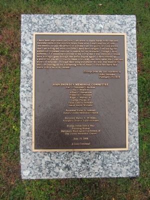
John Snowden Memorial Marker
401 ► Maryland, Anne Arundel County, Annapolis — John Snowden Memorial —  |
| Near West Street (Maryland Route 450) at Brewer Avenue. | |||
| 402 ► Maryland, Anne Arundel County, Annapolis — 4 — Joseph Nicholson Home Site and Bandstand — The Naval War of 1812 in Annapolis — Don't Give Up The Ship |
| Near Blake Road. Reported permanently removed. | |||
| 403 ► Maryland, Anne Arundel County, Annapolis — Katharine Hepburn Slept Here — |
| On State Circle, on the right. | |||
| 404 ► Maryland, Anne Arundel County, Annapolis — Kunte Kinte-Alex Haley Memorial — |
| On Main Street at Compromise Street, on the left when traveling south on Main Street. | |||
| 405 ► Maryland, Anne Arundel County, Annapolis — Kunte Kinte-Alex Haley Memorial — |
| On Memorial Circle. | |||
| 406 ► Maryland, Anne Arundel County, Annapolis — 128 — Lafayette's Tour — Mapping the Farewell Tour — The Lafayette Trail — |
| On College Avenue (Maryland Route 450) just west of King George Street, on the left when traveling west. | |||
| 407 ► Maryland, Anne Arundel County, Annapolis — 156 — Lafayette's Tour — Mapping the Farewell Tour — The Lafayette Trail — |
| On King George Street just east of College Avenue ( Route 450), on the right when traveling east. | |||
| 408 ► Maryland, Anne Arundel County, Annapolis — Leahy Hall — Named in Honor of Fleet Admiral William Danial Leahy United States Navy — (6 May 1875 - 20 July 1959) — |
| On Truxton Road at Parker Lane on Truxton Road. | |||
| 409 ► Maryland, Anne Arundel County, Annapolis — Leonard A. Blackshear Walk — A pathway to reconciliation and healing — 1943 - 2006 — |
| On Main Street at Compromise Street, on the left when traveling south on Main Street. | |||
| 410 ► Maryland, Anne Arundel County, Annapolis — Liberty Tree — Tulip Poplar — |
| On State Circle north of East Street, on the left when traveling north. | |||
| 411 ► Maryland, Anne Arundel County, Annapolis — 4/6 — Lieutenant General John Archer Lejeune — |
| On King George Street at Cooper Road on King George Street. | |||
| 412 ► Maryland, Anne Arundel County, Annapolis — Light House Bistro — |
| On Madison Place at West Street ( Route 450), on the right when traveling south on Madison Place. | |||
| 413 ► Maryland, Anne Arundel County, Annapolis — Lincoln in Annapolis — |
| On West Street at Calvert Street, on the right when traveling west on West Street. | |||
| 414 ► Maryland, Anne Arundel County, Annapolis — Lot 70 Is Historically Significant — |
| On West Street at Church Circle, on the right when traveling west on West Street. | |||
| 415 ► Maryland, Anne Arundel County, Annapolis — Louis L. Goldstein — 1913 - 1998 — |
| On Calvert Street at Bladen Street ( Route 70) on Calvert Street. | |||
| 416 ► Maryland, Anne Arundel County, Annapolis — Macedonian Monument — |
| On Maryland Avenue, on the right when traveling east. | |||
| 417 ► Maryland, Anne Arundel County, Annapolis — Mahan Hall — |
| On Maryland Avenue. | |||
| 418 ► Maryland, Anne Arundel County, Annapolis — 1 — Mahan Hall — The Naval War of 1812 in Annapolis — Don't Give Up the Ship! |
| Near Maryland Avenue. Reported permanently removed. | |||
| 419 ► Maryland, Anne Arundel County, Annapolis — Mahoning Sandstone — (Waffle Rock) Rock Class: Sedimentary Age: 300 million years — |
| Near Taylor Avenue (Maryland Route 435) south of Rowe Boulevard ( Route 70), on the right when traveling north. | |||
| 420 ► Maryland, Anne Arundel County, Annapolis — Mann's Tavern — Site of the Annapolis Convention — September 11-14, 1786 — |
| On Conduit Street near Gorman Street, on the left when traveling south. | |||
| 421 ► Maryland, Anne Arundel County, Annapolis — Marion Warren's six photographs capture this historic Annapolis neighborhood in a sleepier time — Annapolis Charter 300 1708-2008 — |
| On West Street (Maryland Route 450) east of Cathedral Street, on the right when traveling east. | |||
| 422 ► Maryland, Anne Arundel County, Annapolis — Maritime Annapolis: An Enduring Legacy — |
| Near Dock Street 0.1 miles Market Space. | |||
| 423 ► Maryland, Anne Arundel County, Annapolis — Maryland Department of Natural Resources Tawes Parking Lot Rain Gardens — |
| On Herbert M Sachs Drive east of Taylor Avenue ( Route 435), on the right when traveling east. | |||
| 424 ► Maryland, Anne Arundel County, Annapolis — Maryland State House — Built 1772-1779 — Capitol of the United States November 26, 1783 - August 13, 1784 — |
| On State Circle near School Street. | |||
| 425 ► Maryland, Anne Arundel County, Annapolis — Maryland State House — Built 1772–1779 — Capitol of the United States November 26, 1783 - August 13, 1784 — |
| On State Circle at Francis Street on State Circle. | |||
| 426 ► Maryland, Anne Arundel County, Annapolis — Maryland State House — Built 1772–1779 — Capitol of the United States November 26, 1783 - August 13, 1784 — |
| On State Circle at North Street, on the left when traveling south on State Circle. | |||
| 427 ► Maryland, Anne Arundel County, Annapolis — 9 — Maryland State House — The Naval War of 1812 in Annapolis — Don't Give Up the Ship! |
| On State Circle. Reported permanently removed. | |||
| 428 ► Maryland, Anne Arundel County, Annapolis — Maryland World War II Memorial — |
| On Governor Ritchie Highway (State Highway 450) at Chase Road, in the median on Governor Ritchie Highway. | |||
| 429 ► Maryland, Anne Arundel County, Annapolis — Matthew Alexander Henson — Co-discoverer of the North Pole — |
| Near State Circle. | |||
| 430 ► Maryland, Anne Arundel County, Annapolis — Maury Hall |
| On Maryland Avenue 0.1 miles east of Decatur Road. Reported permanently removed. | |||
| 431 ► Maryland, Anne Arundel County, Annapolis — Maynard-Burgess House — Rehabilitation and Adaptive Use Project — Together! We're Building a Strong Annapolis Future. — |
| On Duke of Gloucester Street just west of Market Street, on the right when traveling east. | |||
| 432 ► Maryland, Anne Arundel County, Annapolis — Memorial Circle & Market House Plaza — |
| On Market Space near Main Street, on the left when traveling west. | |||
| 433 ► Maryland, Anne Arundel County, Annapolis — Mexican War Midshipmen's Monument — Mexican War Monument — |
| Near Blake Road. | |||
| 434 ► Maryland, Anne Arundel County, Annapolis — Middleton Tavern — |
| On Market Space at Randall Street, on the right when traveling north on Market Space. | |||
| 435 ► Maryland, Anne Arundel County, Annapolis — Monument to the Battle of Midway — |
| On Buchanan Road at Blake Road, on the right when traveling east on Buchanan Road. | |||
| 436 ► Maryland, Anne Arundel County, Annapolis — N* — |
| On Cooper Road at King George Street, on the right when traveling east on Cooper Road. | |||
| 437 ► Maryland, Anne Arundel County, Annapolis — Naval Academy Alumni Vietnam War Memorial — |
| On McNair Road 0.1 miles east of Decatur Avenue. | |||
| 438 ► Maryland, Anne Arundel County, Annapolis — Naval School — |
| Near Maryland Avenue. | |||
| 439 ► Maryland, Anne Arundel County, Annapolis — Navy-Marine Corps Memorial Stadium — 1984 Summer Olympic Games - Men's Soccer Venue — |
| On Taylor Avenue (Maryland Route 435) south of Herbert M Sachs Drive, on the right when traveling south. | |||
| 440 ► Maryland, Anne Arundel County, Annapolis — Non Sibi Sed Patriae — |
| Near Taylor Avenue (Maryland Route 435) north of Melrose Street, on the right when traveling south. | |||
| 441 ► Maryland, Anne Arundel County, Annapolis — Norman Scott Natatorium — Named in honor of Rear Admiral Norman Scott, U.S. Navy — U.S.N.A. Class of 1911 — |
| On Cooper Road just south of Holloway Road. | |||
| 442 ► Maryland, Anne Arundel County, Annapolis — Old Fashioned Anchors — |
| On Blake Road. | |||
| 443 ► Maryland, Anne Arundel County, Annapolis — Old Treasury Building — Restored 1950 |
| Near State Circle at East Street, on the left when traveling north. Reported permanently removed. | |||
| 444 ► Maryland, Anne Arundel County, Annapolis — On this site on November 25, 1960 — |
| On West Street (Maryland Route 450) at Lafayette Avenue, on the left when traveling east on West Street. | |||
| 445 ► Maryland, Anne Arundel County, Annapolis — On this spot — The Star Spangled Banner — |
| On Blake Road. | |||
| 446 ► Maryland, Anne Arundel County, Annapolis — One Hundredth Anniversary of the U.S. Naval Academy — |
| Near Blake Road, on the right when traveling east. | |||
| 447 ► Maryland, Anne Arundel County, Annapolis — Original Bates Flagpole — |
| On Smithville Street 0.1 miles east of South Villa Avenue, on the right when traveling east. | |||
| 448 ► Maryland, Anne Arundel County, Annapolis — Pearl Harbor Survivors Association — In Memoriam — |
| On Governor Ritchie Highway (State Highway 450) 0 miles north of State Route 648, in the median. | |||
| 449 ► Maryland, Anne Arundel County, Annapolis — Peggy Stewart House — |
| On Hanover Street. | |||
| 450 ► Maryland, Anne Arundel County, Annapolis — Planned in the Past — Main Street — The Nicholson Town Plan — |
| On Main Street at Francis Street, on the right when traveling west on Main Street. | |||
| 451 ► Maryland, Anne Arundel County, Annapolis — Preble Hall — |
| On Maryland Avenue. | |||
| 452 ► Maryland, Anne Arundel County, Annapolis — Primrose Hill — |
| On Primrose Hill Lane, on the right when traveling west. | |||
| 453 ► Maryland, Anne Arundel County, Annapolis — Prisoner of War Memorial — |
| On Ritchie Highway (MD 450). | |||
| 454 ► Maryland, Anne Arundel County, Annapolis — Remembering Congressman Parren J. Mitchell — April 29th 1922 - May 28th 2007 — |
| On Hilltop Lane, on the right when traveling west. | |||
| 455 ► Maryland, Anne Arundel County, Annapolis — Remembering the Foot Soldiers of the March on Washington — Civil Rights Foot Soldiers Memorial — |
| On Calvert Street at Clay Street on Calvert Street. | |||
| 456 ► Maryland, Anne Arundel County, Annapolis — Reynold's Tavern — Built 1737 — |
| On Church Circle at Franklin Street, on the right when traveling east on Church Circle. | |||
| 457 ► Maryland, Anne Arundel County, Annapolis — Ricketts Hall — |
| On Brownson Road, on the right when traveling east. | |||
| 458 ► Maryland, Anne Arundel County, Annapolis — Roger Brooke Taney |
| On State Circle near Francis Street. Reported permanently removed. | |||
| 459 ► Maryland, Anne Arundel County, Annapolis — Roger Brooke Taney, 1777 - 1864 — Chief Justice of the United States Supreme Court |
| On State Circle. Reported permanently removed. | |||
| 460 ► Maryland, Anne Arundel County, Annapolis — Roger W. Moyer — Visionaries of the 1960s — August 16, 1934 — |
| Near Main Street at Market Space, on the right when traveling west. | |||
| 461 ► Maryland, Anne Arundel County, Annapolis — Sacred to the Memory of Baron de Kalb — |
| On State Circle. | |||
| 462 ► Maryland, Anne Arundel County, Annapolis — 3 — Sally Wern Comport's "Shaping a City" — Annapolis Charter 300 1708-2008 — |
| On Compromise Street north of Newman Street, on the left when traveling north. | |||
| 463 ► Maryland, Anne Arundel County, Annapolis — Sampson Hall — |
| On Maryland Avenue 0.1 miles east of Decatur Avenue, on the left when traveling east. | |||
| 464 ► Maryland, Anne Arundel County, Annapolis — San Cayetano — |
| On Blake Road near Maryland Avenue, on the left when traveling west. | |||
| 465 ► Maryland, Anne Arundel County, Annapolis — Sharpening Our Governing Teeth: The 1708 Charter of Annapolis — Annapolis Charter 300 1708-2008 — Commemorating the 1708 Royal Charter under Queen Anne to the City of Annapolis — |
| On West Street (Maryland Route 450) at Westgate Circle, in the median on West Street. | |||
| 466 ► Maryland, Anne Arundel County, Annapolis — Shiplap House — Circa 1715 |
| On Pinckney Street 0 miles north of Market Street, on the right when traveling north. Reported permanently removed. | |||
| 467 ► Maryland, Anne Arundel County, Annapolis — Shiplap House — Circa 1713-15 — |
| On Pinkney Street, on the right when traveling west. | |||
| 468 ► Maryland, Anne Arundel County, Annapolis — Site of Old Fort Severn — |
| On Cooper Road 0.1 miles south of Santee Road. | |||
| 469 ► Maryland, Anne Arundel County, Annapolis — Site of the Annapolis City Gates — 1698-1790 — |
| On West Street (Maryland Route 450) at Calvert Street, on the right when traveling east on West Street. | |||
| 470 ► Maryland, Anne Arundel County, Annapolis — Site of the Methodist Church — 1789–1817 — |
| Near State Circle at North Street, in the median. | |||
| 471 ► Maryland, Anne Arundel County, Annapolis — Smedberg Gate — |
| Near Taylor Avenue (Maryland Route 435) north of Melrose Street, on the right when traveling south. | |||
| 472 ► Maryland, Anne Arundel County, Annapolis — Southgate Memorial — |
| On College Avenue (Maryland Route 450) at Chruch Circle ( Route 450), on the left when traveling west on College Avenue. | |||
| 473 ► Maryland, Anne Arundel County, Annapolis — Spanish 18-Pounder — |
| On Blake Road near Maryland Avenue, on the left when traveling west. | |||
| 474 ► Maryland, Anne Arundel County, Annapolis — Spanish Gun — |
| Near Porter Road east of Buchanan Road, on the right when traveling west. | |||
| 475 ► Maryland, Anne Arundel County, Annapolis — SS Central America Bell — |
| On Blake Road, on the right when traveling north. | |||
| 476 ► Maryland, Anne Arundel County, Annapolis — St. Damian — |
| On Blake Road. | |||
| 477 ► Maryland, Anne Arundel County, Annapolis — St. John Neumann, C.Ss.R. — |
| Near North Bestgate Road west of Dubois Road. | |||
| 478 ► Maryland, Anne Arundel County, Annapolis — St. Joseph — |
| On Blake Road. | |||
| 479 ► Maryland, Anne Arundel County, Annapolis — St. Mary's City Cannon — |
| Near State Circle. | |||
| 480 ► Maryland, Anne Arundel County, Annapolis — Standing Guard — Star-Spangled Banner National Historic Trail — National Park Service, U.S. Department of the Interior — |
| On Jonas Green Park Road. | |||
| 481 ► Maryland, Anne Arundel County, Annapolis — State Circle & Maryland Ave. — A historic perspective — |
| On State Circle at Maryland Avenue on State Circle. | |||
| 482 ► Maryland, Anne Arundel County, Annapolis — State House Square — |
| On College Avenue (Maryland Route 450) near Bladen Street. | |||
| 483 ► Maryland, Anne Arundel County, Annapolis — Still on Patrol — Courage Runs Deep — |
| On Turner Joy Road 0.3 miles east of Santee Road, on the left when traveling west. | |||
| 484 ► Maryland, Anne Arundel County, Annapolis — Streamside Community — |
| Near Taylor Avenue (Maryland Route 435) south of Rowe Boulevard ( Route 70), on the right when traveling north. | |||
| 485 ► Maryland, Anne Arundel County, Annapolis — 1 — Sy Mohr's City Dock Harbormaster Collage — Annapolis Charter 300 1708-2008 — |
| On Craig Street south of Dock Street. | |||
| 486 ► Maryland, Anne Arundel County, Annapolis — Take a Tour of St. John's College–Steeped in United States and Maryland History — |
| On King George Street (Maryland Route 450) north of Wagner Street, on the right when traveling south. | |||
| 487 ► Maryland, Anne Arundel County, Annapolis — Take a Tour of St. John's College–Steeped in United States and Maryland History — |
| On King Street (Maryland Route 450) north of Wagner Street, on the left. | |||
| 488 ► Maryland, Anne Arundel County, Annapolis — Take a Tour of St. John's College–Steeped in United States and Maryland History — |
| On College Avenue (Maryland Route 450) at Prince George Street, on the right when traveling west on College Avenue. | |||
| 489 ► Maryland, Anne Arundel County, Annapolis — Take a Tour of St. John's College–Steeped in United States and Maryland History — |
| Near St. Johns Street north of College Avenue ( Route 450), on the right when traveling north. | |||
| 490 ► Maryland, Anne Arundel County, Annapolis — Take a Tour of St. John's College–Steeped in United States and Maryland History — |
| On College Avenue (Maryland Route 450) at St. Johns Street, on the right when traveling south on College Avenue. | |||
| 491 ► Maryland, Anne Arundel County, Annapolis — Taste — |
| Near Taylor Avenue (Maryland Route 435) south of Rowe Boulevard ( Route 70), on the right when traveling north. | |||
| 492 ► Maryland, Anne Arundel County, Annapolis — Tecumseh — |
| Near Blake Road. | |||
| 493 ► Maryland, Anne Arundel County, Annapolis — The Army of the Severn — Women's Suffrage and the 19th Amendment — |
| On State Circle east of School Street, on the left when traveling east. | |||
| 494 ► Maryland, Anne Arundel County, Annapolis — The Charles Carroll House — |
| Near Duke of Gloucester Street, on the right when traveling south. | |||
| 495 ► Maryland, Anne Arundel County, Annapolis — The Church of the Blessed Virgin Mary Under the Title of the Immaculate Conception — (Saint Mary’s Church) — |
| On Duke of Gloucester Street, on the right when traveling south. | |||
| 496 ► Maryland, Anne Arundel County, Annapolis — The City Spared — Star-Spangled Banner National Historic Trail — War of 1812 — |
| On West Street. | |||
| 497 ► Maryland, Anne Arundel County, Annapolis — The City Water System — Annapolis Charter 300 1708-2008 — Commemorating the 1708 Royal Charter under Queen Anne to the City of Annapolis — |
| On West Street (Maryland Route 450) east of Park Place, on the right when traveling west. | |||
| 498 ► Maryland, Anne Arundel County, Annapolis — The Claude House — 26 West Street — |
| On West Street, on the right when traveling west. | |||
| 499 ► Maryland, Anne Arundel County, Annapolis — The English Frigate “Augusta” — Sixty Four Guns — |
| On Maryland Avenue at Decatur Road, on the left when traveling east on Maryland Avenue. | |||
| 500 ► Maryland, Anne Arundel County, Annapolis — The Government House — |
| On State Circle. | |||
8511 entries matched your criteria. Entries 401 through 500 are listed above. ⊲ Previous 100 — Next 100 ⊳