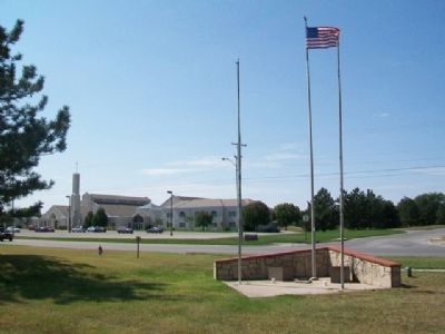
Dedicated to the memory of
those who lost their lives
in the tornado of April 26, 1991,
and those who volunteered
their services in the
reconstruction effort
—————————
Gladys . . . — — Map (db m79200) HM
This log cabin housed the store of C.N. James, Post Office, Masonic Lodge, Baptist and Methodist Services and Public School taught by L.N. Blood.
Restored 1941-1967-1993
by Augusta Historical Society — — Map (db m79202) HM
The 1885 Frisco Wooden Water Tower was built to service the steam locomotives, supply water for feeding stationary boilers, washing cars, and floors, cleaning out boilers, cooling ashes, fire protection, and similar purposes, at shops, engine . . . — — Map (db m60686) HM
In 1879, Beaumont was established as a railroad town. It became one of the most important shipping points in the Flint Hills. Beaumont sat atop the divide that separated Otter Creek and Little Walnut Creek. Westbound trains from Piedmont had nearly . . . — — Map (db m60684) HM
The Flint Hills of Kansas are the last remnant of the great Tallgrass Prairie that once stretched from Texas to the Great Lakes. The calcium rich soil of the Flint Hills is renowned for its capacity to quickly fatten cattle in the spring. Beaumont, . . . — — Map (db m60721) HM
Local lore has it that in 1948 a Wichita businessman wanted to fly into Beaumont to check on his cattle. He asked the hotel if they would block the road for his landing. Since having a plane land in Beaumont was exciting, the residents agreed. . . . — — Map (db m60717) HM
These Frisco Ponds were developed in 1885 along with the now historic wooden water tower. The water was used to fuel the steam locomotives traveling west bound on the Frisco Line that had used all their water pulling the steep grade from Piedmont, . . . — — Map (db m60735) HM
The Historic Beaumont Hotel (Side A)
The Historic Beaumont Hotel was built in 1879 by Edwin Russell. In 1885 the hotel was purchased by the Durham Cattle Company; in 1895 Durham sold the hotel to Reed Church. In 1910, when Charles Church . . . — — Map (db m60623) HM
Brig. Gen. - U.S. Volunteers
Commander [Mississippi] Marine Brigade
Capt. 59th Ill. Inf. Aug. 20, 1861
Lieut. Col. U.S. Volunteers Apr. 28, 1862
Brig. Gen. Nov. 1, 1862
This marker erected in 1979
at the request of his grandson,
the . . . — — Map (db m56037) WM
This is the type of rig used in the 19 teens and into the 1930's during the oil boom in Kansas. Three main sections make up the early rigs: the boiler which was the energy source to power the steam engine that ran the rig; the derrick which was . . . — — Map (db m56040) HM
To Honor Those Who Serve
Liberty For All
[Representative Memorials]
In honor of George F. Austin
for service in the Navy aboard
USS Estes AGC 12
Flag Ship supporting the invasions of
Iwo Jima and Okinawa
witnessing the flag . . . — — Map (db m56220) WM
From the former Midland Refinery. Used to burn off gasses as gasoline and propane were transferred from the refinery into the railroad tank cars. ca. 1920's
Donated by: Frontier Refinery — — Map (db m56165) HM
This house was built in 1918 at 800½ South Main Street, El Dorado, Kansas, (Gordon's Addition, Lot 5, Block 4) in direct response to the oil boom and the massive amounts of people moving to the area looking for housing. Originally the home was . . . — — Map (db m56166) HM
George W. Brown drilled Kansas' first oil well in 1860. Since that time, Kansas oilmen have tested their courage, their fortunes, and their luck in the search for oil in all parts of the state. The Kansas Oil Museum is dedicated to the men and women . . . — — Map (db m56039) HM
This is a Model K Star Drilling Machine, also called a "spudder".
Drilling machines such as this one were used for two purposes:
1. To drill the initial hole for a rotary-drilled well.
2. To drill a complete oil well at shallow depth . . . — — Map (db m56125) HM
In honor of
Mrs. Addie Cowley Bradley
who was the first white girl born
in Eldorado Township;
the first in Butler County;
the first in the Fifth District of Kansas.
Born May 4, 1858. Died Feb. 27, 1932.
Boulder furnished by . . . — — Map (db m56038) HM
Oil field towns such as Oil Hill and Midian were built and maintained by oil companies such as Cities Service. These towns were fast growing and held an excitment in the early years when people moved in at all hours of the day and night. Life here . . . — — Map (db m56168) HM
Once the oil boom began in 1915, men and their families flooded the El Dorado area to find work in the oil fields. Small 2 to 5 room houses were built by the oil companies on land that was leased - thus the lease house or company house. By living . . . — — Map (db m56092) HM
Manufactured by the Spencer Trailer Company in Augusta, Kansas. This was used to haul tubing (the narrow pipe located on the trailer) or casing (wider pipe). Tubing and casing is the various pipe that is used inside the hole.
Donated by: Harvey . . . — — Map (db m56127) HM
With the faith and courage of
their forefathers who made
possible the freedom of these
United States
The Boy Scouts of America
dedicate this replica of the
Statue of Liberty as a pledge
of everlasting fidelity and
loyalty . . . — — Map (db m56179) HM
Our Freedom Began When in 1776
These Courageous Men Signed
The Declaration of Independence
Father of Our County
George Washington
The Voice of Freedom
Patrick Henry
The Pen of Freedom
George Mason
[Signers of the . . . — — Map (db m56184) HM
This machine was probably manufacturing in Chanute, Kansas in the late 1920's. It had been used in Eastern Kansas from the 1920's through the 1950's. This machine was highly portable when completely assembled and moved easily by horses and a . . . — — Map (db m56128) HM
This derrick is one of the last wood and steel oil derricks which once dotted the Butler County countryside. It was built in the mid-1940's and is 100 feet high.
Donated by: Larry Crawford
Donors: Joe Degan Pipe & Supply, Albert Hogoboom, . . . — — Map (db m56088) HM
Central power units were used to pump oil wells in the early days of the Kansas oilfields. One central power could pump as many as eighteen different wells, some up to half a mile away. In the 1950s producers began to replace central powers with . . . — — Map (db m56130) HM
This Cable Tool Drilling Machine, Serial No. 5, was manufactured in Chanute, Kansas by Sutcliffe Pipe & Supply, Joe H. Sutcliffe, owner. Built in early 1949, this is the only known remaining machine.
"The Gypsy" was found on a farm east of . . . — — Map (db m56133) HM
Rack contains various cable tool bits such as fishing tools, jars, rope sockets and elevators. These pieces were used with the adjoining cable tool rig. Many of these pieces of equipment were stored at yards and tool houses. — — Map (db m56090) HM
This railroad tank car has a capacity of 9913 gallons and was built in April of 1929. Used to haul raw crude oil to the refinery.
Donated by: Union Tank Car Company — — Map (db m56163) HM
This staff dedicated to the Veterans of all United States wars who valorously defended the flag it bears
Stars & Stripes waving here perpetually provided by Fred Priestley Post 1174 Veterans of Foreign Wars
Constructed May 1953
Board . . . — — Map (db m56182) WM
Dedicated to the memory of
William Allen White
Boyhood resident
of El Dorado
who became
Kansas' foremost editor
On his one hundredth
birthday anniversary
February 10, 1968 — — Map (db m40003) HM
The town and township lie tucked in the pleasant valley of the Whitewater River, and take their name from the Osage Indian term "many waters." First settler was C.L. Chandler, a returning '49er from the California gold fields who built his cabin . . . — — Map (db m304354) HM
Cottonwood Falls has been the Chase county seat since both town and county were established in 1859. The first log cabin-courthouse was replaced in 1873 by this stately building of native limestone and walnut, which today is the oldest Kansas . . . — — Map (db m49505) HM
Roll of Honor
In memory of those who made the
supreme sacrifice in the World War
1914 - 1918
Delano Earl Bates • Frank D. Coate
Walter L. Crouch • Russell Blackburn
Arthur Edwards • Frank P. Faris
Leonard C. Goad • Don E. Harder . . . — — Map (db m45515) WM
A trail to connect two communities - what a novel idea! This good idea to connect Cottonwood Falls and Strong City was first suggested in 1904. Of course it was to be a limestone sidewalk. Certainly the limestone was available and the equipment and . . . — — Map (db m45578) HM
In 1885, one Kansas writer described the area in generous words, "...at the right of the bridge on the south side of the Cottonwood River is an excellent water mill, and the music of the falling waters as they flow over the dam added to the . . . — — Map (db m45681) HM
"And for the support of this Declaration, with a firm reliance on the Protection of Divine Providence, we mutually pledge to each other our Lives, our Fortunes and our sacred Honor"
--The Declaration of Independence
The Chase County All . . . — — Map (db m45694) WM
Chase County, named after Salmon P. Chase, who was a United States Senator from Ohio and Chief Justice of the Supreme Court of the United States, was organized in 1859 in the Kansas Territory.
James Fisher, from Columbiana County, Ohio was the . . . — — Map (db m45683) HM
The first major bridge at Cottonwood Falls was a 150 foot long iron truss bridge constructed in 1872. The iron bridge was just west of the present arch bridge.
The present bridge was constructed in 1914 by the Missouri Valley Bridge and Iron . . . — — Map (db m45609) HM
The Cottonwood River Dam visible today was built from cut limestone and later coated with concrete. The first dam was constructed of cottonwood logs in 1860 during a severe drought when the river bed was dry. The dam provided water power for a saw . . . — — Map (db m45679) HM
Located south of the Matfield Green service area is mile marker 88, which is 38 degrees North latitude. This latitude became better known as the 38th Parallel at the beginning of the Korean Conflict. Korea was temporarily divided along the 38th . . . — — Map (db m44368) HM
You are in the heart of one of the great grazing lands of the world. Thousands of buffalo, antelope, and elk once roamed here. After the Civil War, and the wild days of the Texas cattle drives, it became famous as a feeding ground for beef cattle. . . . — — Map (db m44367) HM
The vast prairie which surrounds this site is typical of the Bluestem pasture region more commonly known as the Flint Hills. Named for its predominant grasses, the area extends from Oklahoma almost to Nebraska in a narrow oval two counties wide . . . — — Map (db m43260) HM
Originally named Cottonwood Station, Strong City received its current name from W.B. Strong, president of the Atchison, Topeka and Santa Fe Railroad. This was an important railroad town and was also known for its stone quarries and stone . . . — — Map (db m45592) HM
The town of Strong City originated in March of 1871 when the Santa Fe Railroad was completed to the point then known as Cottonwood Station. Strong City was referred to as Cottonwood Station until 1881. In February of 1881 a petition was signed by a . . . — — Map (db m45601) HM
Stephen F. Jones spared no expense in the construction of his Spring Hill Ranch outbuildings.
The Flint Hills provided the main building materials for the ranch -- high quality limestone quarried and hand cut here in Chase County.
Like . . . — — Map (db m268777) HM
When Stephen F. Jones began acquiring this property for his Spring Hill Ranch in 1878, Kansas had been a state for 17 years, and much of the Kansas prairie was already being converted into cropland.
The majority of the land which now comprises . . . — — Map (db m268776) HM
Welcome to Tallgrass Prairie National Preserve
Once covering 170 million acres, the tallgrass prairie has been reduced by about 96 percent. Today, only small fragments of prairie remain, with the exception of a relatively large contiguous . . . — — Map (db m268778) HM
You have arrived at the only unit in the National Park Service dedicated to the tallgrass prairie ecosystem. Tallgrass prairie once covered a vast region that stretched from Mexico into Canada. Today, only a small fraction - perhaps less than four . . . — — Map (db m268774) HM
"It seemed… a lonely little house of scholarship, with its playground worn so bare… But that humble little school had a dignity of a fixed and far off purpose… It was the outpost of civilization… driving the wilderness farther into the . . . — — Map (db m60949) HM
Upon completion, ranch owner Stephen F. Jones learned that his barn was one of the largest barns in the state of Kansas at the time.
Like most of the buildings on the ranch, the Spring Hill barn was built of limestone -- the foundation of the . . . — — Map (db m49498) HM
has been designated a
National
Historic Landmark
This site possesses
national significance in
commemorating the history
of the United States of America — — Map (db m49497) HM
The raised concrete slab behind the house covers a combination storm and root cellar, accessible from a lower level of the house. It is said that Mrs. Jones "feared tornadoes and took extreme precautions against them." This underground chamber also . . . — — Map (db m49501) HM
Model. M65 280 m.m. Weight. 42,500 lbs. Length. 42 feet (1) One of only (3) three in existence, the other two are located at Ft. Sill, Oklahoma and the U.S. Army Ordinance Center in Aberdeen, Maryland. It was placed in service November 17, 1952 . . . — — Map (db m168310) HM
Between 1846 and 1869, thousands of Mormon immigrants traversed the Great Plains enroute to sanctuary in the Great Basin of the Rocky Mountains. The main route ran through Nebraska, paralleling the Platte River.
A cholera epidemic . . . — — Map (db m43936) HM
This area encompasses a portion of the National Rifle Range.
The idea for such a site originated with Congressional legislation in 1904. The Army's growing emphasis on marksmanship and the idea that Fort Riley was the geographical center of . . . — — Map (db m74298) HM
Camp Funston was established as one of sixteen Divisional Cantonment Training Camps during World War I. Construction of the 2,000 acre camp began during the summer of 1917 and eventually encompassed approximately 1,400 buildings Major General . . . — — Map (db m32848) HM
This monument, erected in December 1918, is dedicated to the men who trained at Camp Funston during World War I. Between the fall of 1917 and November 1918, approximately 50,000 soldiers received their basic training at this camp. These soldiers . . . — — Map (db m32847) HM
This building was erected in 1855 in the now extinct town of Pawnee for the first legislature of the territory of Kansas. The members were mostly Missourians, fraudulently elected in an effort to make Kansas a slave state. They came in wagons and on . . . — — Map (db m33038) HM
Artist - James Nathan Muir A tribute to the Cavalrymen and their Horses who so faithfully served our Nation Dedicated October 2003 — — Map (db m74341) HM
On 14 July 1965, the 2nd Battalion, 16th Infantry arrived at Vung Tau, Vietnam, aboard the U.S.N.S Gordon. Three months later, on 10 October 1965, the 1st Battalion, 16th Infantry arrived at Vung Tau aboard the U.S.N.S Mann. During . . . — — Map (db m89131) HM WM
By capturing bridge at Remagen on March 7, 1945 became first allied troops to cross the Rhine. Campaigns: Ardennes • Rhineland • Central Europe — — Map (db m43929) HM
In this area rest the remains of approximately 100 soldiers, civilian workers, and their dependents who perished at Fort Riley, Kansas Territory, during the cholera epidemic in the summer of 1855. These soldiers and civilian workers were engaged in . . . — — Map (db m74308) HM
Erected to the memory of Confederate soldiers whose remains are laid to rest here. They were captured during the New Mexico campaign that culminated in the Battle of Glorieta Pass fought on March 28, 1862 near Santa Fe. Approximately 130 . . . — — Map (db m74309) HM
Used as an indoor training arena by mounted troops, the Cavalry School, and the U.S. Olympic Equestrian Team and for horse shows and polo games until 1948. — — Map (db m66651) HM
Here where the Republican and Smoky Hill rivers unite to form the Kansas, Fremont's expedition of 1843 camped and reported great numbers of elk, antelope and Indians. In 1852 the army selected the site for a Western outpost, temporarily called . . . — — Map (db m32755) HM
In memory
of the one and one half million
horses and mules of the Union and
Confederate armies who were killed
were wounded, or died from disease
in the Civil War
Reverse
Sculpture by Tessa Pullan 1996
Gift to the . . . — — Map (db m88994) WM
This locomotive was donated to Fort Riley by the Union Pacific Railroad on 7 February 1958 for display as a symbol of contribution toward development of the midwest subsequent to 1865. Manufactured as a coal steam engine in 1908 it was . . . — — Map (db m74339) HM
The M3A1 is a light anti-tank weapon developed in 1937 and introduced in 1940. Production was terminated as a result of poor performance during the . . . — — Map (db m80756) HM
This structure is named for Mose Waters, the post sutler who built it in 1888 as a general store and recreation center. It became the first post exchange in 1897 and was converted to living quarters in 1930. — — Map (db m80760) HM
South SideBrevet Major E.A. OGDEN Assistant Quartermaster died at Fort Riley Aug. 3d 1855 Aged 44 years I heard a voice from heaven saying unto me, Write, Blessed are the dead which die in the Lord from . . . — — Map (db m43970) HM
(West side) Brevet Major E.A. OGDEN Assistant Quartermaster U.S. Army died at Fort Riley Aug. 3rd 1855 Aged 44 years And I heard a voice from heaven saying unto me, Write, Blessed are the dead which die in the Lord from . . . — — Map (db m74300) HM
Named in honor of Private Robert T. Henry, 16th Infantry, 1st Infantry Division, posthumously awarded the MEDAL OF HONOR for conspicuous gallantry and intrepidity above and beyond the call of duty in action at Luchen, Germany 3 . . . — — Map (db m43969) WM
Named in honor of the Sturgis family.
Colonel Samuel D. Sturgis fought in the Indian Wars for 40 years (1846-1886) to expand the American Frontier in the west.
His son, Major General Samuel D. Sturgis Jr., served in the U.S. Army with . . . — — Map (db m76642) HM WM
Dedicated to the Third Armored Field Artillery Battalion whose members fought with valor and distinction in the Rhineland, Ardennes and Central Europe campaigns of World War II receiving a Presidential Unit Citation for sustained artillery fire, . . . — — Map (db m43928) HM
This statue, honoring the United States Cavalry and its role in the settlement of the West, is located on what was long known as the Cavalry Parade Ground at Fort Riley.
It was constructed in three dimensions through the artistry of the . . . — — Map (db m74313) HM
COL Hiram E. Tuttle (1882-1956) served at Fort Riley for 12 years. He gained fame as a dressage rider and won a bronze medal for the U.S. Equestrian team in the 1932 Los Angeles Olympics. He competed again in the 1936 Berlin Olympic Games.
COL . . . — — Map (db m80762) HM
Dedicated on June 15, 1975 to the gallant soldiers of the United States Army who for 200 years have died in defense of their country. — — Map (db m74340) HM
(Left of Stairs) West Riding Hall Constructed 1908 Used as an indoor training arena by mounted troops, the Cavalry School, and the U.S. Olympic equestrian team and for horse shows and polo games until 1952 (Right of stairs) . . . — — Map (db m44341) HM
To the soldiers who were killed in battle with Sioux Indians at Wounded Knee and Drexel Mission, South Dakota, December 29 and 30, 1890. Erected as a tribute of affection by their comrades of the Medical Department and Seventh Cavalry, U.S. Army, . . . — — Map (db m74311) WM
Front Dedicated to the military personnel from Fort Riley, Kansas, service in support of Operation Desert Storm July 4, 1991 by friends and neighbors in Junction City and Geary County Funding for this project has been donated by: . . . — — Map (db m43927) WM
616 N. Washington: Cozy Theater Opening in November 1918, the Cozy Theater had the finest motion picture equipment in the Midwest. The building shows influences from the "Prairie School" of architecture originating at the 1893 Chicago World's . . . — — Map (db m131577) HM
722 N. Washington: Masonic Temple Constructed in 1881, the Masons have occupied the building since 1916. The main floor has housed a variety of stores including Ziegler Hardware, Waters Hardware, and department or clothing stores under the . . . — — Map (db m131575) HM
130 West Seventh Street: This building was apparently built before the turn-of-the-century. It housed Gross Furniture, a firm dating to 1860. Later it was occupied by various groceries, cafes, and shops.
103 West 7th Street: George Smith . . . — — Map (db m131576) HM
816 N. Washington: Baskin/Clewell Drug Store Here, in 1978, the last of the "old-fashioned drug stores” in junction City closed. Built in 1904 by pharmacist C.H. Baskin, the building was acquired by Charles Clewell in 1917. Eventually his . . . — — Map (db m131574) HM
Section 1 Top Tablet United States Army The Chief of Staff October 27, 2000 The Junction City - Fort Riley Community and the Buffalo Soldiers I would like to take this opportunity to congratulate the Junction City-Fort Riley community . . . — — Map (db m44250) HM
Left tablet In God We Trust In Memory of the soldiers and sailors of 1861-1865 who inspired by patriotism freely offered their lives for the maintenance of an undivided country. Right tablet 1861-1865 Total Enlistment 2,778,304 . . . — — Map (db m43966) HM
In memory of George Smith
Born 1835 – Died 1905
Pioneer Citizen – Philanthropist
who willed his entire estate, including this site, to the city of Junction City for the establishment and maintenance of a public library and . . . — — Map (db m122958) HM
Five miles to the northeast the Republican and Smoky Hill rivers unite to form the Kansas or Kaw. At the junction, the city which bears the name, was founded in 1857. Before the arrival of the westward-building Union Pacific railroad in 1866, . . . — — Map (db m74013) HM
261 entries matched your criteria. The first 100 are listed above. Next 100 ⊳