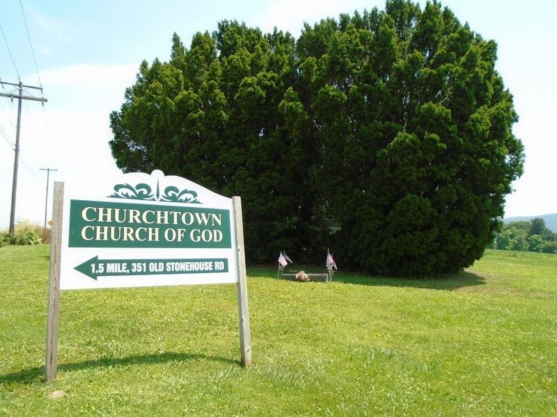
Remembering the founding members, known and unknown
of the Churchtown Church of God who are interred in this cemetery.
They include four veterans of the Grand Army of the Republic.
William B. - son of George M. & Mary A. Reed
Died Apr. . . . — — Map (db m120237) HM
Monroe Township history lives on
in this 300 year old American Sycamore Tree.
Its endurance reminds us of the lasting
contribution of Monroe Township citizens
to Pennsylvania and American history.
Presented by Chairman A.W. Castle, . . . — — Map (db m120239) HM
Founded about 1762 by John Rigbie and Co. Operated after 1781 by Michael Ege, noted ironmaster of the period. Ruins of the charcoal furnace still stand. — — Map (db m27002) HM
Erected in loving memory of all veterans of Cumberland County Dedicated July 4, 1957 with a parade and ceremonies at this spot Built and presented to the veterans by The Boiling Springs Civic Improvement Committee — — Map (db m186210) HM
An Underground Railroad agent from 1835 to 1847, when he was sued by a Maryland slaveowner. He was ultimately fined $4,000 in 1852, in a case that drew wide attention. Kaufman had provided food and transportation to fugitive slaves passing through . . . — — Map (db m186209) HM
Founded 1762
This blast iron furnace represented the start of industrial development in Pennsylvania
Daughters of American Colonists
Cymry Chapter
June 9, 1930 — — Map (db m151497) HM
Medal of Honor SFC Randall Shughart U.S. Army Special Forces Sniper Newville, PA Cumberland County 1958 - 1993 Sergeant Shughart gave the supreme sacrifice during a rescue attempt of a downed helicoptor pilot in Somolia We proudly honor SFC . . . — — Map (db m169221) WM
South Middleton Township is located on the southern side of the Cumberland Valley in the shadow of the South Mountain. The area’s natural beauty, rich farmland, abundant water resources, and historical and recreational assets have attracted . . . — — Map (db m202191) HM
The Appalachian National Scenic Trail is a public footpath that follows more than 2,100 miles of Appalachian Mountain ridge lines between Maine and Georgia. It was designed, constructed, and marked in the 1920s and 1930s by volunteer hiking . . . — — Map (db m120206) HM
The Boiling Springs Park opened in 1904 on the east side of the lake. It was a popular recreational destination until the park closed c. 1930. Most visitors arrived by trolley and came from throughout Cumberland County. Activities included . . . — — Map (db m169224) HM
The iron works operated at this site starting (sic) in the 1760s and ended in 1895, when the new process for making iron superseded the charcoal method. Three successive families owned and managed the complex, the Eges, Ahis, and Butchers. This . . . — — Map (db m202192) HM
This seven-acre, man-made lake was created in the 1750s to power the iron works once located at the lower end. The lake is fed by about 30 natural springs clustered behind the tavern and at the upper end of the lake. The daily output is . . . — — Map (db m120211) HM
The oldest church in the borough of Camp Hill. Congregation dates from 1833. Stone Building was erected in 1849 here on Church St. (later, 21st St.). Previously the Churches of God had conducted camp meetings on the wooded hill just beyond. — — Map (db m108703) HM
Capt. William Hendricks led from nearby Cumberland County points a company of riflemen to Quebec, Canada. There they fought Dec. 31, 1775, at the side of Gen. Richard Montgomery. Hendricks was killed in action. — — Map (db m26954) HM
Farthest advance of a body of Confederate troops toward Harrisburg. Southern units under General A. G. Jenkins of Ewell's Corps reached Oyster Point on June 28, 1863. On the next day defending militia faced them here in a skirmish in which both . . . — — Map (db m26520) HM
A former Camp Hill resident, “Doc” Goddard
served five governors in an unprecedented
career from 1955-1979 as Secretary of Forests
and Waters and the Department of Environmental
Resources. Goddard expanded the state park
system, promoted . . . — — Map (db m202082) HM
Legislator and official lived here in Lowther Manor on land conveyed by the Penns in 1771. At the state's 1787 convention to ratify the U.S. Constitution, Whitehill led the Anti-federalist minority; he presented amendments later embodied in the Bill . . . — — Map (db m26955) HM
Spearheading the Confederate advance on Harrisburg, Confederate General Albert G. Jenkins captured Mechanicsburg on the morning of Sunday, June 28, 1863. From there, Jenkins split his 1,200 man cavalry force—sending some 300-400 northward via . . . — — Map (db m94824) HM
Confederate General Albert G. Jenkins` trot towards Harrisburg was stalled as he neared Oyster’s Point, named for a tavern owned by the Oyster family at the junction of Carlisle Pike and Trindle Springs Road. In 1863, these two roads met to form a . . . — — Map (db m167852) HM
In May 1866, the White Hall School for soldiers’ orphans opened in the 2100 block of Market Street in what is now Camp Hill. Within a year it had 121 boys and 80 girls under its roof, with a faculty of five and a staff of twelve. The students wore . . . — — Map (db m94677) HM
Burial place established by early settlers of this area named for a log church built by Germans of the Lutheran faith. The church stood in a nearby poplar grove. — — Map (db m176888) HM
Present building erected in 1798 by a Reformed congregation. Half-interest in 1806 by a Lutheran congregation; in joint use until 1866. Kept in its original form; used annually by St. John's Lutheran. A half-mile away. — — Map (db m26956) HM
In the late days of 1863, Samuel Albright’s house and farm were used as a Confederate bivouac site and artillery position. In the 1860 Census, Samuel Albright was listed as born “about 1823” and living in what was then East Pennsboro Township. . . . — — Map (db m202107) HM
In the 1780's United Brethren circuit riders began preaching at the home of John Shopp located one half mile north of this site. A Meeting House was erected in the present cemetery in 1827 on land donated by John Shopp. The congregation built a new . . . — — Map (db m99048) HM
Inventor of a telephone for which he sought a patent in 1880. Claims contested by Bell Telephone, which won the court decision in 1888. Born in this village, July 14, 1827, where he developed his inventions; he removed in 1904 to Camp Hill, where he . . . — — Map (db m26951) HM
This bell was placed as part of the
Commonwealth of Pennsylvania's celebrations
for the 250th anniversary of the
United States in 2026.
Presented in Cumberland County
Artist: Phil George
[Images include Benjamin Rush, Molly . . . — — Map (db m304460) HM
The Native American tribes of Pennsylvania and Ohio, who had long traded with the English, asked for Pennsylvania's help to prevent French incursions and trade abuses in the Ohio territory. The Pennsylvania Assembly voted to give aid to the . . . — — Map (db m15793) HM
500 U.S. Soldiers of the Civil War are here Interred John Barney • John P. Beirne • John C. Biglow • William H. Brown John Conway • Albert D. Dailey • Charles David • John Driskell George Earlenbough • Marmaduke Foster • Soloman Francis John . . . — — Map (db m135200) WM
U.S. Colored Troops, 54th & 55th Massachusetts Infantry Regiments and other Colored Civil War Soldiers buried here.
James Alexander; 127th Regt. Co. I ∙ L. James Bailey; 32nd Regt. Co. G ∙ John H. Barton; 7th Regt. Co. H ∙ J. . . . — — Map (db m84021) HM
In tribute to the men, women and children
who lost their lives in the worst terrorist
attack on American soil. We honor all the
fire, police, search & rescue dogs,
rescue personnel, and all others who
selflessly gave their lives and . . . — — Map (db m119979) WM
Site of house where Major Andre and Lieutenant Despard were held prisoners in 1776. Andre was executed as a spy in 1780. Despard was executed for high treason in 1803. — — Map (db m34698) HM
Carlisle At War (center panel) After Confederate forces fired on Fort Sumter, South Carolina, in April 1861, the men of Carlisle responded to the national calls to put down the southern rebellion. Four companies of Pennsylvania infantry . . . — — Map (db m135169) HM WM
On this site, 277 W. Louther Street, from 1932 to 1963 lived the Brothers of Beta Pi Chapter of Kappa Sigma Fraternity.
Presented by the chapter's Alumni Association on
June 7, 2003
in honor of the chapter's 100th Anniversary
at . . . — — Map (db m53633) HM
Among the earliest (c.1820) African American congregations located west of the Susquehanna River. The site of Underground Railroad activity. Abolitionists John Peck and John B. Vashon were members. A.M.E. national Bishops Daniel Payne and Wills . . . — — Map (db m40952) HM
Home of Gen. Ephraim Blaine, Commissary General of Revolutionary Army, stood on this site. George Washington was a guest here, Oct. 4-11, 1794, while mustering an armed force to quell Whiskey Rebellion in Western Pennsylvania. — — Map (db m15855) HM
Begun in 1794 by Colonel Ephraim Blaine – Indian trader, merchant, tavern-keeper, Sheriff, land speculator, and Commissary General of the Continental Army – the Blaine House is one of the finest examples of 18th century architecture still standing . . . — — Map (db m198394) HM
Born enslaved near Winchester, Virginia, c. 1832, John J. Butcher
migrated north through the Cumberland Valley and settled in Carlisle
following the Civil War. Butcher worked as a laborer for local
businessman George Hench. He also made and sold . . . — — Map (db m258301) HM
Founded in 1751 as the seat of Cumberland County. Historic old frontier town. Supplied a contingent for the first regiment of the Continental Army in 1775. March against the Whiskey Rebels began here, 1794. — — Map (db m30318) HM
Founded in 1751 as the seat of Cumberland County. Historic old frontier town. Supplied a contingent for the first regiment of the Continental Army in 1775. March against the Whiskey Rebels began here, 1794. — — Map (db m35806) HM
Founded in 1751 as the seat of Cumberland County. Historic old frontier town. Supplied a contingent for the first regiment of the Continental Army in 1775. March against the Whiskey Rebels began here, 1794. — — Map (db m82790) HM
Second oldest army post in U.S. A powder magazine built by Hessian prisoners, 1777, survives. Burned by Confederates, July 1, 1863. Indian School, 1879-1918. Army Medical Field Service School, 1920-1946. — — Map (db m16073) HM
Erected by Carlisle Civic Club
in memory of the men who lost
their lives in the First World War
1917 - 1918
——————————————
Jacob M. Bonner •
Abram DeWalt . . . — — Map (db m16084) WM
First fort authorized by Pennsylvania. Laid out by Gov. Morris, July, 1755, “in the middle of this town,” on news of Braddock's defeat. Col. John Armstrong's headquarters till 1758. Called “Fort Lowther” by some later writers. — — Map (db m16075) HM
[Mural Key]
1 American Revolutionary Benjamin Rush is the Founding Father of the United States and signer of the Declaration of Independence. In addition to being a physician, politician, humanitarian, and educator, he is . . . — — Map (db m304388) HM
Erected by the Commonwealth of Pennsylvania in grateful appreciation of the services of these soldiers of the Revolutionary War who lie buried here.
Located and verified by The Cumberland County County Chapter of the D.A.R. — — Map (db m16093) HM
Before the erection of Cumberland County - 1750 - this site was the intersection of the Indian trail leading from mountain to mountain across Groghan's Gap westward.
With the laying out of Carlisle in 1751 the square became the center of the . . . — — Map (db m15866) HM
1. Cumberland County, established in 1750, lost its first courthouse to fire in 1845. This Courthouse was built in 1846 and still bears the scars of a Civil War shelling on July 1, 1863.
2. Carlisle's long tradition of education began early, . . . — — Map (db m16094) HM
In 1827, a German Reformed congregation built a stone church at this location. At the time, a Methodist congregation was housed in a church on Church Alley. The location was not ideal due to boisterous behavior in the alley during church services . . . — — Map (db m16080) HM
Robert Magaw, one of Carlisle's principal lawyers prior to the Revolution, lived here. Magaw joined Col. William Thompson's regiment in June 1775 as a Major. After service in Boston in 1776 he was promoted to Colonel in the 5th PA Battalion.
In . . . — — Map (db m15860) HM
Early in the evening of July 1, 1863, Union Brig. General William F. "Baldy" Smith entered Carlisle from Bridgeport (Lemoyne) with 2,500 troops subsequent to the departure of Confederate infantry the prior day, only to find the town facing attack by . . . — — Map (db m135187) HM
Formed January 27, 1750 from Lancaster County. Named for Cumberland County in England, it originally extended to Pennsylvania's western limits. Carlisle, county seat, was founded 1751. Crossed by major roads, county had a key role in westward . . . — — Map (db m15856) HM
In honor of the soldiers of Cumberland County who fell
in defense of the Union during the Great Rebellion.
This monument is created by those who revere Patriotism
and wish to perpetuate the Memory of the Brave Men, who aided
in saving . . . — — Map (db m47312) HM
The Hamilton Library Association was charterd in 1874, and this two-story brick building was erected in 1881 to house its collection. The library was made possible by a bequest of $2,000 from James Hamilton (1793-1873), a prominent Carlisle lawyer . . . — — Map (db m30830) HM
Acquisition of this building
was funded by the
G. B. Stuart Charitable Foundation
established by
George B. Stuart, Class of 1939 — — Map (db m304467) HM
Erected 1895 Destroyed by fire March 3rd 1904 Re-erected 1904 through the generous aid of the Trustees Faculties Students Alumni and Friends of the College and particularly of Public Spirited Citizens of Carlisle — — Map (db m304466) HM
Dr. Benjamin Rush envisioned a new type of education for post-Revolutionary America, a useful education in the liberal arts. Rush, with the assistance of Col. John Montgomery of Carlisle, founded Dickinson College to prepare an engaged citizenry . . . — — Map (db m16085) HM
On Saturday, June 27th, 1863, the infantry division of Major General Robert F. Rodes of the 2d Corps of the Army of Northern Virginia, Confederate States of America, Lieutenant General Richard S. Ewell commanding, took possession of Carlisle, with . . . — — Map (db m152512) HM
Oldest law school in Pennsylvania; founded in 1834 by the Honorable John Reed, eminent jurist, and author of "Pennsylvania Blackstone." Andrew Curtin, Civil War Governor, was one of earliest graduates. — — Map (db m30320) HM
Before the war, the student body of Dickinson College was fairly evenly divided between Northern and Southern students, and thus the college was represented by soldiers on both sides of the conflict. The split is reflected in an autograph book in . . . — — Map (db m35162) HM
These three buildings are the three oldest structures on campus. Together they form Dickinson’s Historic Triangle.
West College, “Old West”, to your left
West College was designed in 1803 by Benjamin Latrobe, the architect . . . — — Map (db m152465) HM
Entering this gateway to Dickinson College, you can see the statue of the college's founder, Dr. Benjamin Rush (1745-1813). The bronze statue, which was erected in 2004, is a replica of a statue unveiled 100 years earlier at the Navy's Bureau of . . . — — Map (db m82795) HM
This statue is a replica of a bronze sculpture of Dickenson College founder Dr. Benjamin Rush that stands of the grounds of the U.S. Navy Bureau of Medicine and Surgery in Washington, D.C. The original statue by Roland Hinton Perry was a gift to . . . — — Map (db m152379) HM
This grand three-story Federal-style house “was by far the most expensive private house ever built in Carlisle,” wrote James Hamilton, Jr. in the 1870s. It was planned and built, c. 1811, by Judge Thomas Duncan's wife as a dwelling for . . . — — Map (db m19457) HM
This square was set apart by the Penns, in 1751, for the Church of England; in continuous use since that time by St. John's Episcopal Church. In 1752, the first church building was erected. — — Map (db m15789) HM
Many of the early settlers of Pennsylvania were Scots-Irish who brought with them their Presbyterian faith. By the early 1730's they were settling the Cumberland Valley, including the fertile land near the Conodoguinet Creek. In 1734, Presbyterians . . . — — Map (db m30296) HM
Congregation organized 1734. Erection of this building begun 1757. Oldest building in Carlisle. Here July 12, 1774, colonists met and declared for American independence.
No. 2 — — Map (db m153869) HM
Oldest public building in Carlisle; erection begun, 1757. Here colonists met in 1774 to declare for independence, and George Washington worshipped, 1794. Congregation organized at Meeting House Springs in 1734. — — Map (db m122382) HM
To capture Fort Duquesne, General Forbes marched an army, in 1758, from his main base at Carlisle to the forks of the Ohio. He followed as closely as he could with army wagons, the Raystown Indian and Traders Path, widened by axemen under Colonel . . . — — Map (db m30322) HM
Per Tot Discrimina Through so many dangers In 1758, at the height of the French & Indian War, British General John Forbes and his troops took on a daunting task: To carve a trail, over 300 miles long, through the Pennsylvania backcountry and take . . . — — Map (db m35554) HM
Frederick Douglass, born into slavery in 1818 and self-taught, became an internationally-renowned reformer and a leading voice in the fight against slavery. Douglass is known to have visited Carlisle on three occasions, although his first visit in . . . — — Map (db m19444) HM
In 1902, Prince Henry, brother of Kaiser Wilhelm II of Germany, visited the United States to cultivate a relationship between the two countries. Wilhelm gave a statue of his ancestor Frederick the Great, known for his military prowess, to the . . . — — Map (db m119069) HM
On a 116-acre tract here stood the model farm created 1857-67 by this agricultural reformer. Watts was the first president of the Pennsylvania Agricultural Society, 1851; a founder of the Farmers' High School (now Penn State); and U.S. Commissioner . . . — — Map (db m84114) HM
“Hero of Kittanning,” Revolutionary officer; member of Continental Congress, County Judge, lived in a house on this site. Died at Carlisle, 1795. Buried in Old Graveyard, two blocks south. — — Map (db m19427) HM
Early Carlisle physician, member of Provincial Convention, Revolutionary officer, commander at Fort Pitt, occupied house that stood on this site before 1800. — — Map (db m19433) HM
Laid out the town of Carlisle 1751
Builder, elder, trustee of First Presbyterian Church, Carlisle
Surveyed supply route for Braddock’s Expedition 1755
Commander of the Kittanning expedition 1756
PA commander of the Forbes expedition to Fort . . . — — Map (db m258302) HM
Here George Washington reviewed militia from Pennsylvania and New Jersey, rendezvoused at Carlisle, October 1794, before marching to the western part of State to quell the Whiskey Rebellion — — Map (db m30299) HM
On this spot
October 11, 1794
George Washington
as Commander in Chief
of the Army of the United States
reviewed the troops
ordered to march to suppress
the Whiskey Rebellion in
Western Pennsylvania — — Map (db m304397) HM
Gen. J.E.B. Stuart's southern cavalry arrived July 1, 1863, by Dover and Dillsburg. Finding Ewell had left the day before, Stuart burned the U.S. Barracks and left for Gettysburg, where the battle had begun. — — Map (db m30284) HM
On June 28, 1863, General Richard Ewell received orders from Robert E. Lee to move Ewell's southern troops out of Carlisle and on to Gettysburg. By June 29th two divisions of Ewell's troops marched over this road through Mt. Holly Springs, York . . . — — Map (db m82791) HM
June 27, 1863, Gen. Ewell's Confederate army, marching over this road toward Harrisburg, reached Carlisle; Jenkins' cavalry went on to reconnoiter. On June 29, Lee ordered Ewell to join the main army at Cashtown. — — Map (db m84115) HM
In 1753, Benjamin Franklin stayed at inn on this site while he, Richard Peters, and Isaac Norris treated with Indians. Hamilton and Knox, members of Washington's cabinet, lodged here in 1794. — — Map (db m15861) HM
Being situated in a hostile area of operations requires constant vigilance. The guard tower provides a first line of defense against enemy forces at the combat outpost. Manned twenty-four hours per day, Soldiers pulling guard duty are required to . . . — — Map (db m308099) HM
Vale-Himes Park
The ground you are now standing on is the Cumberland County Historical Society's Pocket Park. A one-story building that served as a barber shop existed on this site before 1909. Over the years, the building on this . . . — — Map (db m217332) HM
The Borough of Carlisle Historic District – Founded 1751
Green Border indicates Historic District
1. Visitor Center
2. Dickenson College*
3. Penn State Dickenson School of Law*
4. Carlisle Theatre*
5. Cumberland County Historical . . . — — Map (db m153151)
1. PUBLIC SQUARE - deeded by Thomas Penn for public use and laid out in 1751, has continued its function through two historic centuries as the center of Cumberland and Carlisle life.
2. CUMBERLAND CO. COURTHOUSE - SW corner of square, . . . — — Map (db m204092) HM
For more than a century, the second Sunday in May has been set aside to honor mothers everywhere - and it all started with a push from the Fraternal Order of Eagles. On February 7, 1904, Fraternal Order of Eagles Past Grand Worthy President . . . — — Map (db m304324) HM
Chili-Cheese hot dogs beloved by locals and first served by Greek immigrant Charles Kollas at the Hamilton Restaurant CA. 1938. — — Map (db m202092) HM
Founder of the Pittsburgh Academy in 1787
(became the University of Pittsburgh)
Pennsylvania Supreme Court Justice
Revolutionary War Chaplain in Washington's Continental Army
Member of the Pennsylvania State Assembly
Founder of the . . . — — Map (db m304425) HM
Early Carlisle lawyer, and representative to Continental Congress, occupied house that stood on this site. He was a signed of the Declaration of Independence, and one of the framers of the Constitution of U.S. — — Map (db m30300) HM
The Letort Regional Authority
dedicates this bridge to
Jerry Gapp
in gratitude for his outstanding service to the Authority. Jerry established the Friends of the Letort and energized our fundraising efforts to improve our Nature Trail . . . — — Map (db m259229) HM
Distinguished jurist and author of legal books, lived in this house from about 1820 until his death, 1853; Chief Justice of the Supreme Court of Pennsylvania for 24 years of his 37 years membership. — — Map (db m19434) HM
The LeTort Spring Run is named after James LeTort, a French-Swiss trader, who settled near the headwaters of the stream in the early 18th century. This spring-fed stream served a vital role in the establishment of Carlisle in 1751. In selecting . . . — — Map (db m258308) HM
1854 entries matched your criteria. The first 100 are listed above. Next 100 ⊳