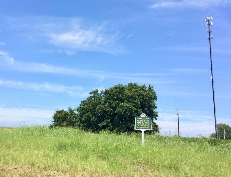
During a raid in the winter of 1864-65, Union Brig. Gen. Benjamin Grierson's cavalry encountered Confederates at Egypt Station on the Mobile & Ohio R.R. The Confederate force included a large number of former Union prisoners of war released on . . . — — Map (db m107541) HM
Schoolhouses have occupied this site since Mississippi Normal College was established here in 1888. The college served as both a grade school for local pupils and a boarding school for college students. Classrooms and an auditorium occupied a pair . . . — — Map (db m155311) HM
(Side 1)
Houston area native Booker T. Washington White (c. 1904–1977) was one of the most expressive vocalists and powerful slide guitarists in the blues. A remarkable lyricist as well, he recorded such classics as “Shake ‘Em On . . . — — Map (db m155277) HM
(Marker #1)
Prehistoric Trade
Raw materials and articles from distant areas reached the Indians of the Bynum site by trade along trails that were the forerunners of the Natchez Trace.
Spool-shaped objects made of . . . — — Map (db m84830) HM
Estab. in 1909, this is one of Mississippi's oldest community libraries and its first Carnegie library. School superintendent L.B. Reid secured money from Andrew Carnegie Foundation for this facility. — — Map (db m107610) HM
(Front Side)
Dedicated to the men
of Chickasaw County
who served in the War for
Southern Independence
1861 - 1865
(Back Side)
Infantry
2nd Miss. Regiment, Co. G
6th Miss. Regiment, Co. F
9th Miss. Regiment, . . . — — Map (db m97568) WM
Dedicated to the citizens
of Chickasaw County
who served our country
in peacetime and war
with honor
Dedicated to the memory of all boys of Chickasaw County who gave their lives in service to their country
World War I
John R. . . . — — Map (db m97569) WM
On Natchez Trace. Named for Sam Houston, friend of Joel Pinson, donor of site. Made county seat at creation of Chickasaw Co., Feb. 9, 1836. In 1909 state's first Carnegie library built here. — — Map (db m107556) HM
Light Columns are architectural features that flank the main entrance steps of many public and government buildings. It is rare to find them on public buildings in small communities, but Houston High School, constructed in 1927, possessed two of the . . . — — Map (db m155310) HM
This monument marks the Natchez Trace through Chickasaw County. By the Treaty of Pontotoc in 1832, the Chickasaw Indians ceded to the United States their lands east of the Mississippi. In 1801-1802 the old Indian trail was converted into a wagon . . . — — Map (db m97567) HM
The original charter to construct what would eventually become the OH& CC Railroad was granted to the Grenada, Houston & Eastern Railway Company on February 6, 1860. Construction did not begin until 1902, with the first train reaching Houston in . . . — — Map (db m155275) HM
Erected in 1982 in honor of Joel Pinson who donated 80 acres original survey for the town of Houston in 1836. He requested it be named for his friend, Sam Houston, previous governor of Tennessee and only president of Republic of Texas. — — Map (db m97570) HM
The first archaeological work at Owl Creek Mounds was supervised by Moreau Chambers in August, 1935. He was employed by the Mississippi Department of Archives and History and assisted by Slater Gordon. E.T. Winston, a Pontotoc journalist and local . . . — — Map (db m84697) HM
In the summers of 1991 and 1992, archaeology field schools from Mississippi State University worked to learn more about the site. Most of the excavations were done on top of Mounds I and II, with small test units dug into Mounds III, IV, and V. . . . — — Map (db m84698) HM
Owl Creek Mounds were built between 800 and 900 years ago and were used for only about 100 years. This was determined by the dating of charcoal samples collected at the site and by studying the artifacts and type of building remains found in the . . . — — Map (db m84699) HM
Hernando De Soto landed in Florida at Tampa Bay in May, 1539. His army numbered around 800 Spaniards including two women. He also had 240 horses and several pigs. The expedition traveled through the Southeast to Texas and returned to the Mississippi . . . — — Map (db m84690) HM
The first humans came to North America by crossing the Bering Strait land bridge, which connected Siberia and Alaska. Their descendants arrived in this part of Mississippi nearly 12,000 years ago. The oldest mounds in the state were built by people . . . — — Map (db m84696) HM
Born circa 1760, William Colbert was a notable Chickasaw warrior. He fought in the American Revolution and beside Piominko in the 1790s. George Washington appointed him a major general in 1795. In 1813, William helped the Americans fight the Red . . . — — Map (db m155285) HM
In this vicinity on February 22, 1864, Benjamin Grierson ordered McCrillis' Federal brigade into a line of battle opposite Col. Barteau's Confederate brigade of Forrest's cavalry corps. Barteau's men, from the ridge east of the railroad, advanced as . . . — — Map (db m102742) HM
On February 22, 1864, Col. Jeffrey Forrest, commanding a Confederate cavalry brigade, was killed in action in this vicinity, near the extinct town of Prairie Mount. Born in 1838, Forrest was the younger brother of Lt. Gen. Nathan Bedford Forrest, . . . — — Map (db m102744) HM
Chickasaw County's tribute
to the sons who wore the gray
and were faithful to the cause.
Erected under auspices of
Okolona Chapter U.D.C. No. 117.
— — Map (db m102750) WM
As a station on the Mobile and Ohio Railroad, Okolona was the site of a large hospital during the Civil War. In 1862, following the battle of Shiloh, hundreds of wounded Confederates were brought here by train. Those who died were buried in this . . . — — Map (db m102747) HM
Founded as Rose Hill 1845. Chartered as Okolona 1850. Named for Chickasaw Indian brave. Scene for three Civil War battles. First Mississippi Cavalry, C.S.A., was organized and equipped here. — — Map (db m102748) HM
Founded as Rose Hill 1845. Chartered as Okolona 1850. Named for Chickasaw Indian brave. Scene for three Civil War battles. First Mississippi Cavalry, C.S.A., was organized and equipped here. — — Map (db m102749) HM
The Okolona Normal and Industrial School was founded in 1902 by Dr. Wallace A. Battle. It educated African Americans through high school and provided industrial training for young adults. At its peak, the school's enrollment topped two hundred . . . — — Map (db m102740) HM
Throughout the Civil War, Confederate forces were stationed in Okolona, taking advantage of the agriculturally rich prairie region. With a large supply depot, the town was the object of Union Raids at least twice. On February 22, 1864, Maj. Gen. . . . — — Map (db m102746) HM
“Dedicated to the loving memory of all the brave young men from the Okolona area who have given their lives for their country in time of war.” — — Map (db m259122) WM
Front
Love's tribute
to a thousand
Southern
soldiers who
sleep in our
Confederate
cemetery, who
died in the war
1861—1865.
Right Side
List of Dead
Rear
List of . . . — — Map (db m102936) WM
(Side 1)
Formed in 1987 when three local musicians — Joe Lee Huffman, Willie Gene Huffman, and Robert Eaton — got together to play music and share supper, the Sparta Opry has become a community institution. Having offered more than 100 country, . . . — — Map (db m155271) HM
Preserved here is a portion of a nearly 200-year old road – the Old Natchez Trace. Maintaining this 500-mile long wilderness road in the early 1800's was a difficult if not hopeless task.
As you look down the sunken trench note the . . . — — Map (db m84832) HM
Chartered February 16, 1884, upon the arrival of the Canton, Aberdeen, & Nashville Railroad, and named for the company's president, William K. Ackerman. Since 1896 County Seat of Choctaw County. — — Map (db m51200) HM
First established as the Ackerman Colored School in the late 1920s, this school was part of the county board of education's plan to consolidate nearly thirty smaller community-based schools from 1931 to 1958. The school's name was changed to the . . . — — Map (db m140791) HM
To the memory of those who served in World War II and these, our dead, in honored glory rest. Rhubert H. Allen • Neubern Atkinson • Herman P. Bennett • William T. Biggers • James B. Blanton • Wade H. Boggan • William J. Cook • . . . — — Map (db m228698) WM
On Yockanookany, 1/2 mi. S., was built in 1836 water mill of W.R. Coleman of Fairfield Co. S.C., first white settler after Choctaw cession in Treaty of Dancing Rabbit Creek. — — Map (db m51198) HM
James Plemon "J.P." Coleman was born in 1914 in Ackerman. A graduate of George Washington University, he served as district attorney for the Fifth Judicial District from 1940 to 1946 and as a judge from 1947 to 1950. Coleman served as a Mississippi . . . — — Map (db m140790) HM
A fourth generation Choctaw countian, Ray Mabus grew up in Ackerman. In 1987 he was elected governor, the youngest in more than 150 years. Appointed Secretary of the Navy in 2009, he served until 2017, the longest tenure since WWI and the third . . . — — Map (db m140788) HM
[Front]
Choctaw County fiddler Hoyt Ming (1902-1985) led the lively string band recorded as “Floyd Ming & His Pep Steppers” at a Memphis Victor session in 1928. His “Indian War Whoop,” with its fiddling “holler,” became an old-time country . . . — — Map (db m140731) HM
On February 15, 1934, while serving as U.S. Congressman from Mississippi, Thomas Jefferson Busby (1884-1964) introduced a bill authorizing a survey of the Old Natchez Trace. Four years later the historic road was designated a unit of the National . . . — — Map (db m87481) HM
Begun in 1840 by Rev. William A.
Gray. First building destroyed
by tornado in 1883 and
rebuilt on same site in 1887.
Known for its campmeetings,
held here annually since before
the Civil War. — — Map (db m244510) HM
Established ca. 1836, Shiloh Methodist Church was disbanded by 1875. Remaining members joined other churches in area, including Mt. Airy, Chestnut Grove, and Bethel. Frederick and Margaret Crawford Bagwell, early settlers of Choctaw County are . . . — — Map (db m140785) HM
During the War between the States there was a “great revival” of religious fervor through the Holy Spirit. In 1865, several Choctaw County Christian families knelt together in prayer and asked for God's guidance to direct them in His way, believing, . . . — — Map (db m244506) HM
Church begun 1865. Campmeeting begun 1872 on land
donated by William Parham
Pollard, 1830s pioneer. Summer
worshippers camped in wooden
tents surrounding the tabernacle.
Cemetery dates to 1840. — — Map (db m244505) HM
(Marker #1)
The Great Eastern Hardwood Forest
Before Columbus, the world of the eastern Indian was one of a vast continuous forest stretching from Canada to the Gulf coast. A mature forest, it changed little over the centuries, and . . . — — Map (db m87480) HM
"Two Steps From the Blues" might refer to Choctaw County's location, a bit off the path from the well-known blues highways and byways of Mississippi, but it is also the title of a classic blues song written by a native of Ackerman, "Texas" Johnny . . . — — Map (db m51199) HM
President pro tem of the state Senate, 1857-65. Defeated by W. McWillie in governor’s race, 1857. Delegate to Charleston Dem. Convention, 1860. Son and grandson of Rev. soldiers. House moved here, 1981, and restored. — — Map (db m87486) HM
Louis Leflore first traded with the Choctaw Indians at a bluff now part of Jackson Mississippi. About 1812 he established his stand 900 feet to the northeast on the Natchez Trace.
Because of the storekeepers nationality, the area was often . . . — — Map (db m87485) HM
This memorial marks a stage on the “Natchez Trace.” The first highway opened through the lower South, by the Treaty of Dancing Rabbit Creek in 1830, between the American government and the Choctaw Indians. The surrounding country became . . . — — Map (db m87495) HM
Pigeon Roost Creek, to your left, is a reminder of the millions of migrating passenger pigeons that once roosted in trees in this area. The species has been completely destroyed.
One mile east where the Natchez Trace crossed the creek, . . . — — Map (db m87484) HM
In the early 1800's many thoughtful Americans believed that isolation and the difficulties of communication would force the Mississippi Valley settlements to form a separate nation. Hoping to hold the frontier, Congress in 1800 established a post . . . — — Map (db m87483) HM
Begun ca. 1839 by Rev. James
Martin. Present building of
virgin pine erected in early
1840s. Known as “a mother of
churches,” it supported a session house, a school, and an
annual campmeeting. — — Map (db m244513) HM
Choctaw County’s blues history is distinguished by the accomplishments of two artists in particular, both of them singers, songwriters, and guitarists; Levester “Big Lucky” Carter, who was born in Weir and raised on his family’s farm in French Camp, . . . — — Map (db m205436) HM
Built 1878. this was the home of Col. John Weir (1833-1900), who was twice wounded during the Civil War. Col. Weir, for whom the town of Weir was named, established a water and saw mill complex near here in 1870. Descendants of John and Emily Weir . . . — — Map (db m205434) HM
Established 1841, this cemetery
served both Concord Baptist Church
and the now extinct community of
New Prospect, founded in the early
1830s. The church moved to a new
location in 1876. Among those
buried here are Dr. Robert Brown,
New . . . — — Map (db m244512) HM
A trade town for local
cotton farms during the
19th century. Est. 1846 and
incorp. 1852. Declined
following shifts in trade to
the town of West Point on
the M. & O. R. R. and to the
nearby village of Abbott. — — Map (db m235115) HM
Excavated June 1934 by
Mississippi Department of Archives and History
Dunbar Rowland, LL.D., Director
Jordan B. Chambers, Archeologist
— Marked 1934 by —
Horseshoe Robertson Chapter
Daughters of the American . . . — — Map (db m107820) HM
Front
Erected 1927 by Horse-Shoe Robertson Chapter Daughters of the American Revolution in tender memory of Clay County World War Veterans.
West Point Army Officers:
Navy - Marine
{List of names}
Clay County Army . . . — — Map (db m107332) WM
One of the giants of post-World War II Chicago blues, Chester Arthur Burnett, aka “Howlin’ Wolf,” was born in White Station, just north of West Point, on June 10, 1910. In his early teens Burnett began performing in the Delta and was . . . — — Map (db m50299) HM
Marked 1934 by
Israel Miller Society
Children of the American Revolution
— Members —
{Listing of members and titles}
Built by A.J. Pearson & Sons — — Map (db m107821) HM
Named for Mary Holmes of Rockford, Illinois, who dedicated her life to education, this school was founded in Jackson in 1892 by the Presbyterian Church (U.S.A.) Board of Missions for Freedmen as a seminary for African American women. Mary Holmes . . . — — Map (db m107537) HM
Constructed ca. 100 B.C.-A.D. 400 for the burial of high-status members of an unknown local tribal group. An associated village site lies across the highway to the Southwest. — — Map (db m107534) HM
Front
In memory of
those who fought to
liberate West Point
Feb. 21, 1864
Their actions resulted
in victory against
a vastly superior
Federal army. Their
bravery will always
be remembered.
Rear . . . — — Map (db m107823) WM
E. 10 mi. Plantation home built c. 1852 by Geo. H. Young. Octagonal cupola. Gen. N.B. Forrest visited here during the Civil War. National Fox Hunters Assn. organized here. — — Map (db m50160) HM
County seat of Clay (formerly Colfax ) County. Chartered November 20, 1858, one year after the arrival of the Mobile and Ohio Railroad. — — Map (db m50298) HM
Unity Presbyterian Church organized in 1828 with the Rev. Thos. Archibald, pastor. Buried here are early settlers, one Revolutionary War soldier, two War of 1812 soldiers, and three Civil War soldiers. — — Map (db m8966) HM
Built in 1946 as the first “Road Switcher” of its type in U.S. Columbus and Greenville Railway’s first diesel powered locomotive. Retired in 1984 after thirty-eight years on freight and passenger trains. — — Map (db m8457) HM
The Beersheba Cumberland Presbyterian Church became part of the Tombecbee Presbytery in 1825 and joined the New Hope Cumberland Presbytery in 1866. The cemetery was established in 1827 and contains the graves of many veterans. The date Beersheba . . . — — Map (db m8477) HM
Congregation established in 1834 by William Ervin, Elizabeth and Drennon Love, James Ervin, Rosamond Odeneal and Thomas and Margaret E. Witherspoon. These Scots-Irish pioneers from Alabama and the Carolinas settled here after the Choctaw Cession of . . . — — Map (db m8484) HM
Here in 1862 Confederacy built huge arsenal employing over 1000 persons. Later one of buildings became original site of Union Academy, first free public school for Negroes in Columbus. — — Map (db m8553) HM
Dedicated in 1863. This is the oldest Catholic Church in NE Miss. It once served a parish that included Corinth & Meridian. The design for the Gothic structure was conceived by Fr. J. B. Mouton, the first pastor. — — Map (db m8486) HM
Originally, 1817-21, known as Possum Town. Became one of richest cities in old Black Prairie cotton belt. Home of state's first free school and M.S.C.W. — — Map (db m8487) HM
The Black Prairies of eastern Mississippi have produced a number of notable blues musicians, including Howlin’ Wolf, Bukka White, and Big Joe Williams. Activity in Columbus, the largest city in the region, centered around areas such as this block of . . . — — Map (db m27607) HM
Began here, April 25, 1866, with first annual placing of flowers on graves of Blue and Gray. Idea originated at meeting in Twelve Gables home of Miss Matt Morton. — — Map (db m8552) HM
The first "laboratory" school for teacher training in the state was established in 1907 by the faculty of Industrial Institute and College (1884), now Mississippi University for Women, the first public college for women in America. The present . . . — — Map (db m8554) HM
Dennis Wicks, Jr. designated land in the early 1900’s to build a pond for family members to water their livestock. The pond was called Wicks Pond. He also donated a water pump for clean drinking water.
Dennis Wicks, Jr.
November 17, 1883 ~ . . . — — Map (db m178992) HM
Organized in 1832 by Thomas Blewett, with Rev. A.S. Bayley serving as the first pastor (1832-1834), this church has erected two sanctuaries. The first was built here in 1838, and the second, this Gothic Revival-style structure designed by Reuben . . . — — Map (db m69565) HM
Founded, 1839, through efforts of Talbert Fanning and David Lipscomb. Present structure, erected 1849-50, housed refugee State Senate in Civil War. Here Tennessee-Tombigbee Waterways Agreement was signed in 1958. — — Map (db m8555) HM
One of America's leading playwrights, Tennessee Williams was born here March 26, 1911. He received the Pulitzer Prize for "Streetcar Named Desire" and "Cat on a Hot Tin Roof." Both stories set in the South. — — Map (db m8556) HM
Oldest church organization in Columbus, dating from 1831. Second structure, built in 1844, became synagogue after building of present church, 1860-1867. — — Map (db m8557) HM
State's oldest free school. Has functioned since 1821. Worthy trustees, using 16th section income & employing able teachers, early made Columbus a cultural center in northeast Mississippi. — — Map (db m8582) HM
SW, 12 blocks. Two state governors, over 1,000 C.S.A. soldiers, including 4 generals, lie here. The decorating of their graves & those of Union soldiers, inspired F.M. Finch's "The Blue and the Gray." 1867. — — Map (db m8583) HM
Henry Armstrong, born Henry Jackson in this area in 1912, began his professional boxing career in 1931. Armstrong became the only boxer to hold world titles simultaneously in three weight divisions. He was named boxer of the year in 1937 and 1938 . . . — — Map (db m13902) HM
James “Jim” Wicks designated land in the early 1900’s to build a school to educate family members. The school was named Wicks Normal School.
James “Jim” Wicks
February 20, 1867 ~ January 2, 1939 — — Map (db m178993) HM
Built by Thomas Blewett circa 1840 for daughter Regina and James Harrison, leading lawyer and politician. Site of 1865 marriage and home of Stephen D. and Regina Harrison Lee. — — Map (db m8584) HM
Joshua Lawrence Meador was born in 1911 in Greenwood, Mississippi, and moved here at age seven. Meador worked for Walt Disney Productions from 1936 to 1965 as head of the effects department. His film credits include Snow White, Fantasia, Bambi, . . . — — Map (db m64694) HM
Built in 1953, the S.D. Lee High School
was designed by Jackson architect R. W. Naef
in the International Style. Named for former
Confederate general Stephen D. Lee, Lee High
School was constructed in the early phases of
the Equalization . . . — — Map (db m244671) HM
[Center] Dedicated to the honor and memory of our men and women of Lowndes County who served our country
World War II ★ Korea ★ Vietnam ★ World War I
[Left wing] In honor of those who gave their lives . . . — — Map (db m244667) WM
Remember WWI Veterans
This gate, a symbol of remembrance, is dedicated to the men and women of Lowndes County who served their country in the World War 1917-1918.
Erected November 11, 1933 by Tombigbee Unit No. 69 American Legion Auxiliary . . . — — Map (db m244666) WM
Built by War Department 1817-20, to connect New Orleans with Nashville. Suggested by & named for Gen. Andrew Jackson. Soon became an important commercial & telegraph route. — — Map (db m8585) HM
Organized by enslaved people in
1833, Missionary Union Baptist
Church is among the oldest black
congregations in northeast
Mississippi. After emancipation,
the church was chartered in 1867
during the pastorate of Rev. Jesse
Freeman Boulden. . . . — — Map (db m244670) HM
The oldest state supported woman's college (1884) in the United States. It pioneered in adding vocational subjects to standard arts-science program. — — Map (db m8586) HM
Established in 1833 when James and Susannah Vaughn donated 5.7 acres of land to the Mt. Pleasant congregation. After Judge John Perkins donated an adjacent 5-acre plot to the congregation in 1851, the church was moved and the original site was . . . — — Map (db m20116) HM
In September 1966, six local African American
women integrated the Mississippi State College for
Women. Undergraduate students Diane Hardy,
Barbara Turner, and Laverne Greene, and graduate
students Jacqueline Edwards, Mary Flowers, and
Eula . . . — — Map (db m244664) HM
Ned Wicks designated land to build a church in the early 1900’s for family members to worship the Lord. The church is called New Zion Missionary Baptist Church.
Ned Wicks
August 1849 ~ circa 1929 — — Map (db m178995) HM
6 mi. N. at mouth of Tibbee and ford in Tombigbee is site of old Indian village, fort, and cotton trading center. Incorporated 1836, but declined with river trade. Now a wilderness.
(supplement)
This sign was originally posted (1952) . . . — — Map (db m178939) HM
The Queen City Hotel, located at this site, was once the cultural hub of the African American community in Columbus. Constructed in the 1880s, the building was opened as a hotel in 1914 by blues guitarist Robert Walker and later owned by Edward . . . — — Map (db m140700) HM
For several decades beginning in the early 1900s, the Queen City Hotel, which stood across the street from this site, was at the center of a vibrant African American community along 7th Avenue North. Clubs and cafes in the area featured blues, . . . — — Map (db m302520) HM
196 entries matched your criteria. The first 100 are listed above. The final 96 ⊳