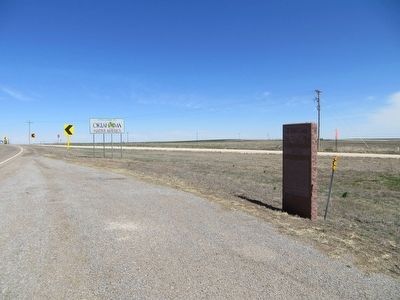
You Are Now Entering Old
No Man's Land
Colorado Kansas 37th Parallel
Called "No Man's Land" until 1890
Known Then as
Beaver County
Became the Panhandle of Okla. Statehood 1907
Texas State Line 36° 30" Parallel
The . . . — — Map (db m93483) HM
Tales of bravery, mischief and morals make up the popular children's book series
"Hank the Cowdog"
What you may not know is that the lively main character in these books was inspired by a real cowdog named Hank who lived and worked on . . . — — Map (db m162469) HM
This 168 mile trail from Mobeetie, Texas, to Dodge City, Kansas,
was laid out by Ed Jones and Joe Plummer in 1874, originally as a
freight trail for hauling buffalo hides purchased from the Buffalo
Hunters in the Texas Panhandle for sale at . . . — — Map (db m162472) HM
You are now entering old ”No Man’s Land”
Colorado/Kansas • 37th Parallel Texas State Line • 36° 30’ parallel New Mexico • 103rd Meridian Cherokee Outlet • 100th Meridian
Called “No Man’s Land” until 1890 Known then . . . — — Map (db m131421) HM
Eureka was established in 1908 with 18 square miles. The high school was started in 1919 when Center, Lincoln, and one half of Pleasant View were consolidated. In 1923, the Nabisco, Happy Flat, and East Banner districts were added and a new building . . . — — Map (db m78816) HM
Surveyed by J.C. Brown 1826-27
Heaviest traffic during California Gold Rush 1849
Abandoned on completion of A.T.&S.F. railroad in 1880 — — Map (db m106477) HM
From September 23 through 27, 1846, the Mormon Battalion crossed the northwestern portion of the Oklahoma panhandle. The little army's 500-plus volunteers, recruited for the Mexican War, were enlisted near Council Bluffs, Iowa, from among the first . . . — — Map (db m55260) HM
(Left Panel)
The Santa Fe Trail
A Bridge Between the United States and Mexico
Before you is a portion of the historic Santa Fe Trail. Established as a wagon route by William Becknell in 1822, the Santa Fe Trail became the . . . — — Map (db m106478) HM
How did Black Mesa become a Preserve?
The Land was acquired in parcels over many years, beginning in 1959 when the State of Oklahoma purchased 100 acres on the top of the Mesa.
In 1989, the Nature Conservancy acquired 1500 acres on the . . . — — Map (db m246882) HM
A rich cultural history of the Old West
The famed Santa Fe Trail, a wagon route linking the eastern United States and Mexico, cut through this corner of Cimarron County. From the 1820s until the construction of the railroads in the 1860s, . . . — — Map (db m246993) HM
Highest point in Oklahoma 4972.97 feet above the sea as determined by a survey ordered by Governor Johnston Murray and completed May 9, 1954 by Oklahoma Highway Department under direction of C.A. Stoldt Director, G.H. Bittle Chemical Engineer, and . . . — — Map (db m247159) HM
Imagine the Black Mesa as a giant book lying on its side.
Each layer of rock is a different chapter in geologic history. The basalt cap on top is the most recent chapter - it's less than 5 million years old. As you go down, each deeper . . . — — Map (db m247123) HM
Established in May 1865, by Kit Carson, hero of Valverde and Brig. Gen., New Mexico Volunteers, to guard Santa Fe Trail and furnish escorts for caravans engaged in Santa Fe trade. Santa Fe Trail crossed this highway here and was first traveled by . . . — — Map (db m39798) HM
(left panel) A Bridge Between the United States and Mexico
Before you is a portion of the historic Santa Fe Trail. Established as a wagon route by William Becknell in 1822, the Santa Fe Trail became the first major trade link between . . . — — Map (db m131308) HM
Eureka was established in 1908 with 18 square miles. The high school was started in 1919 when Center, Lincoln, and one half of Pleasant Veiw were consolidated. In 1923, the Nabisco, Happy Flat, and East Banner districts were added and a new building . . . — — Map (db m200597) HM
Barbed wire didn't tame the west, nor did cowboys. The conqueror of the vast midsection of this country was the stately, creaking, dependable windmill. It brought water to livestock and people, and water was what it took to make the land bloom.
. . . — — Map (db m188368) HM
Edward T. Guymon was born in Illinois in 1859. At 21 he moved to McPherson, Kansas from Coatsburg, Illinois. Story is he sold a cow for $22 to pay his fare west. He loaded coal for the Santa Fe Railroad as a clerk and partner for the Star . . . — — Map (db m55265) HM
Townsite planned on Rock Island Railroad survey by
Inter-State Land & Town Co. in 1900.
Rock Island Railroad built through Oklahoma Panhandle 1901.
Town founded as Sanford Post Office 14 June 1901, changed to
Guymon Post Office on 29 June . . . — — Map (db m55267) HM
Discovered in 1918, and drilled in the 1930's, the Hugoton Gas Field was one of the largest deposits of natural gas in the world. The Hugoton field which is approximately 3000' deep extends from SW Kansas through the Oklahoma Panhandle and into the . . . — — Map (db m55261) HM
The largest individual gas reserve in the United States covers much of the Oklahoma panhandle extending northward from Texas through this area and into Kansas this sprawling Hugoton Panhandle field provides gas to comfort mankind fire the boilers of . . . — — Map (db m78818) HM
The rancher, bringing his cattle, first came to the open range of No Man's Land in the mid-1800s. Barbed wire fences later defined areas of ownership. Confined cattle feedyards developed in the 1950's. These feedlots resulted partly because of the . . . — — Map (db m55264) HM
Homesteading families in the Panhandle commonly had a pig or two for personal consumption. It was not until 1992 when Seaboard Farms announced they were going to build a pork processing plant in Guymon that the pork industry leapt forward here on . . . — — Map (db m55262) HM
Old Hardesty was a typical trade center and the mecca of early cowboys in No Man's Land. The town, located about 3 miles northeast of this marker was named for Col. Jack Hardesty, a prominent rancher in the area. Old Hardesty flourished when trail . . . — — Map (db m188257) HM
This tract donated to the Hardesty Home Demonstration Club in loving memory of the late John H. Randles, Hardesty pioneer who homesteaded this land in 1903. By Mrs. John H. Randles — — Map (db m188272) HM
Preventing wind erosion was the primary objective of Feed Hoeme, a Hooker, Oklahoma farmer, when he developed a heavy-duty chisel plow in 1933. Hoeme and his sons manufactured and sold about 2000 plows from their farmstead. In 1938, W.T. Graham . . . — — Map (db m55270) HM
The post office of Loretta was established May 7, 1898. It was moved to the Texas-Okla. line and the name was changed to Texhoma on Nov. 12, 1901.
The Panhandle of Okla. was called No Man's Land. It was owned by Spain in 1541, . . . — — Map (db m78864) HM
In 1901, when the new Rock Island Railroad tracks reached here, the post office called Loretta, located NW along the Beaver River, was moved to the new tracks and renamed Texhoma for the two states at its location. From only five families living . . . — — Map (db m78865) HM
Organized Baptist work in the Oklahoma Panhandle began Aug. 5, 1894 when the Pleasant View Baptist Church was founded with 8 charter members 1½ mi. N and 1½ mi. E of here. Meetings were in the Pleasant View school house until after the . . . — — Map (db m55272) HM
From this famous well, cattlemen watered their herds of thousands of stock while waiting shipment over the Rock Island Railroad, after long trail drives to the end of the track near old Tyrone. The well was located by J. U. Shade and H. B. Fore in . . . — — Map (db m55271) HM