Near Mercery Lane at Burgate, on the right when traveling north.
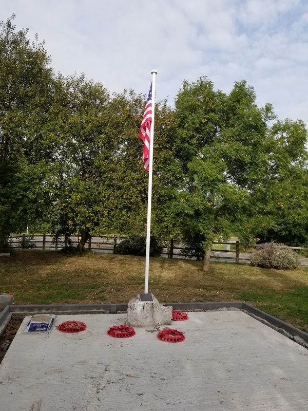
( inscribed around the top of the column )
Dedicated to the Honoured Memory of the Men of who fell in the Great War
In Grateful
Commemoration
Of the Officers
Non-Commissioned Officers
And Men of Canterbury
Who Gave Their . . . — — Map (db m129513) WM
On The Friars at St Peter’s Street, on the left when traveling east on The Friars.
Christopher Marlowe
Born in Canterbury 1564
Died at Deptford 1593
The statuette above represents
Sir Henry Irving
Tamburlaine
The statuette above represents
Sir Johnston Forbes Robertson
Dr. Faustus
The statuette above . . . — — Map (db m129600) HM
Near Burgate at Sun Street, on the right when traveling west.
In Memory of
George Robert Canning
4th Lord Harris
He was distinguished by his public service
beyond the seas and in his own country and county
and held in grateful memory by all lovers of
cricket and field games. His name is inscribed . . . — — Map (db m129521) HM
On High Street close to Best Lane, on the right when traveling north.
For the greater safety
and convenience
of passengers
this bridge was widened
10 feet in the year 1769
Joseph Royle Esq.
being mayor. The expense
was supplied by
voluntary contributions
from this city
and its neighborhood
55 . . . — — Map (db m129526) HM
Near Pin Hill at Castle Row, on the right when traveling west.
To the glorious memory and in grateful
remembrance of the devoted & heroic services
of the officers, non-comd officers and men of
The Buffs — East Kent Regiment
and of the
Imperial Yeomanry of East Kent
Who gave their lives in . . . — — Map (db m129601) WM
On High Street at Mercery Lane, on the left when traveling north on High Street.
To
The Memory of
the
Officers
Non-Commissioned
Officers and Men
Royal East Kent
Yeomanry
Royal East Kent
Yeomanry
Raised 1794
Disbanded 1921
South Africa
1900 — 1901
“Gallipoli 1915”
“Egypt . . . — — Map (db m129523) WM
Near Burgate at Sun Street, on the right when traveling west.
The Buffs
(Royal East Kent Regiment)
1572 — 1967
Veteri Frondescit Honore
( back )
A Man of Kent
This Statue was Unveiled
by
Her Majesty Queen Margrethe II
Of Denmark
on
11th September 2015
The Commission of . . . — — Map (db m129520) HM WM
Near Pin Hill at Castle Row, on the right when traveling west.
This field and hill were improved, and these terraces, walks and plantations, made in the year 1790, for the use of the public, at the sole expense of James Simmons, Esq of this city, alderman and banker, to perpetuate the memory of which generous . . . — — Map (db m129603) HM
On Watling Street, on the right when traveling south.
This inn lies on the site of Canterbury's Roman Theatre which was first built about AD80, about the same time as the Colosseum in Rome. It was rebuilt in about AD 210 as one of the largest theatres in Britain. The walls were mainly robbed out by . . . — — Map (db m246323) HM
On St Peter’s Place at Pound Lane, on the right when traveling north on St Peter’s Place.
Westgate
The Westgate, built in c. 1380 on the site of a Roman gate, is one of the finest surviving medieval gateways in Britain and one of the first major fortifications to incorporate facilities for guns. Though built as a fortification against . . . — — Map (db m129527) HM
On Pin Hill close to Castle Row, on the right when traveling west.
In 1548 Worth Gate was blocked and a new street (Castle Row and Worthgate Place) was formed to by-pass the castle. This new road which went round the bailey wall and ditch on the east had a new opening, Wincheap Gate, created for it in the city . . . — — Map (db m129606) HM
On Victoria Road (England Route A258) at Deal Castle Road, on the right when traveling north on Victoria Road.
Historic Deal
Deal Castle
Historic Deal
In 1539-1540 King Henry VIII carried out an enormous programme of defensive building round the eastern and southern coasts of England. Having renounced catholicism, he was expecting invasion from his . . . — — Map (db m128669) HM
A View of the Harbour
Below you is Admiralty Harbour, the naval and merchant port that made Dover so important in the First and Second World Wars. There has been a harbour here since Roman times: this one was built in stages between 1847 and 1909 . . . — — Map (db m128521) HM
Near Castle Hill Road at Canons Gate Road, on the left when traveling south.
A View to the East
This view along the coast reveals the towering height of the famous White Cliffs, elements of Dover's past defences and its ever-changing port.
On the distant hill, a tall mast occupies the site of Langdon Battery, where . . . — — Map (db m128520) HM
Near Castle Hill Road at Canons Gate Road, on the left when traveling south.
A View to the West
This view looks down into the ancient heart of Dover.
The Romans built two forts and a settlement, known as Portus Dubris. These were succeeded by a thriving Saxon and a later medieval walled town, all nestled in the . . . — — Map (db m128522) HM
Near Castle Hill Road at Canons Gate Road, on the left when traveling south.
Admiral Sir Bertram Ramsay
KCB KBE (1883-1945)
This statue commemorates Admiral Sir Bertram Home Ramsay, the inspirational commander of the naval forces during the Dunkirk evacuation in 1940 and D-Day in 1944. He served in the tunnels below Dover . . . — — Map (db m128560) HM
Near Castle Hill Road at Canons Gate Road, on the left when traveling south.
In Memory Of
Admiral Sir Bertram Ramsay
KCB KBE MVO 1883 — 1945
Vice Admiral Dover 1939 – 42
C-inC Allied Naval Expeditionary Force
June 1944 and of those who died in the
Dunkirk and Normandy operations
( back )
I . . . — — Map (db m128561) HM
Near Castle Hill Road close to Canons Gate Road, on the left when traveling south.
St Mary-in-Castro church was built around AD 1000, before the Norman Conquest.
The pharos is a Roman lighthouse and the oldest building in the castle.
The Duke of Suffolk’s Lodgings, a castle building modified for the Duke of Buckingham in . . . — — Map (db m128503) HM
Near Castle Hill Road at Canons Gate Road, on the left when traveling south.
Command, Control and Communication
This building began in 1874 as a gun battery to defend Dover from attack by enemy ships. Beginning in 1891, the battery was decommissioned and the structure adapted so that, by the First World War, it fulfilled . . . — — Map (db m128518) HM
Near Castle Hill Road at Canons Gate Road, on the left when traveling south.
Dover's defences
A mighty fortress
There was a castle here shortly after the time of the Norman Conquest in 1066. The medieval defences visible today were built in three periods between 1179 and 1256. They evolved over the next 700 years, . . . — — Map (db m128505) HM
Near Castle Hill Road close to Canons Gate Road, on the left when traveling south.
Dover’s early history
Long before the castle
People occupied this hill over 2,000 years ago and as much as 1,200 years before Dover Castle was first built. the huge earthworks of the castle outer bailey probably began as the ramparts of an . . . — — Map (db m128500) HM
Near Castle Hill Road close to Canons Gate Road, on the left when traveling south.
Fighting the Enemy in the Sky
The First World War brought a new threat of destruction to home shores from airships and aircraft, invented just a few years earlier and recently armed. This was a terrifying development that needed a quick response, . . . — — Map (db m128515) HM
Near Castle Hill Road at Canons Gate Road, on the left when traveling south.
Finding the Enemy
This tiny structure, a Position-Finding (PF) Cell, performed a major role in the period 1891-1918. It was used to pinpoint the position of enemy ships and to relay that information to the coast defence guns at Langdon Battery, 1km . . . — — Map (db m128516) HM
Auguste Louis Blériot
(b.July 1, Cambrai, France 1872; d.August 2, 1936), graduated from École Centrale Paris with a degree in engineering.
At 30 he taught himself to fly in an aircraft of his own design, his skills as a pilot and designer . . . — — Map (db m128568) HM
On Cannon Street at Market Square, on the right when traveling west on Cannon Street.
( west side )
Historic Dover
Market Square
A fair or market has been held in the Square since at least 1160, the most important being the annual St. Martin's Fair. Dover's Guildhall was built in the centre of the Square in 1605 on . . . — — Map (db m168140) HM
Near Castle Hill Road at Canons Gate Road, on the left when traveling south.
Medieval Dover
The heart of the medieval castle
The inner bailey of the castle was built for King Henry II by his engineer, Maurice, largely between 1179 and 1199. It contained the Great Tower, which formed the ceremonial, defensive and . . . — — Map (db m128504) HM
Near Castle Hill Road at Canons Gate Road, on the left when traveling south.
In
Memory Of
The Rescue Of Allied Forces
From Dunkirk, May - June 1940
To The Rescuers
Whose Courage Made It Possible
And To The Rescued
Who Lived To Fight Again
May 2015 — — Map (db m128559) WM
On Marine Parade just east of Wellesley Road, on the right when traveling west.
Side A
During 1941, the German Battle Cruiser SCHARNHORST operated unchallenged in the Atlantic resulting in the sinking of 115,622 tons of British Merchant Shipping. Requiring maintenance it went to Brest harbour where it was joined by its . . . — — Map (db m132492) HM
Near Castle Hill Road at Canons Gate Road, on the left when traveling south.
Ramsay: retreat and return
Operation Dynamo 1940
The German attack into western Europe in May 1940 led to the allied armies rapidly retreating. By late May, the British Expeditionary Force and parts of the French and Belgian armies were trapped . . . — — Map (db m128558) HM WM
Near Castle Hill Road at Canons Gate Road, on the left when traveling south.
Saluting Platform
Beneath here is the Long Gun Magazine,
a gunpowder magazine of c1800. This was
buried in the 1930s to form this
parade ground and saluting platform. — — Map (db m128562) HM
On Cannon Street close to New Street, on the right when traveling north.
St. Mary’s Church and Cannon Street
Historic Dover
The Church of St. Mary the Virgin has been one of Dover's main parish churches for over 400 years. The building is of early Norman origin, and Norman architecture can still be seen in the lower . . . — — Map (db m128567) HM
Near Castle Hill Road at Canons Gate Road, on the left when traveling south.
The Signal Platform
Below you, the roof of the Port War Signal Station (PWSS) formed a signalling platform during the First World War. It was replaced in the Second World War by the roof you are standing on.
Signallers on the roof sent messages . . . — — Map (db m128519) HM
On Church Lane at The Street, on the right when traveling north on Church Lane.
Historic Village
East Langdon
Langdon means “at the long down" or "at the long hill”. The village is to the east of the long down stretching from Whitfield to Deal. We do not know when people first settled here but the name Langandune . . . — — Map (db m128672) HM
On Court Street, on the left when traveling north.
After being captured by Faversham fishermen in December 1688 while trying to escape to the continent, King James II was detained for 3 days in this house then the home of the mayor, Thomas Southouse, and later that of Richard Marsh, owner of this . . . — — Map (db m244785) HM
On Market Street, on the left when traveling north.
Since the 16th Century when Henry VIII's fleet lay at anchor in Faversham Creek, an Inn has stood on this site. Originally a simple wine tavern called "The Shippe", over the centuries the enlarged "Ship Inn" became an important stagecoach stop . . . — — Map (db m244787) HM
On New Dover Road (England Route B2011) at Old Dover Road, on the right when traveling east on New Dover Road.
The Christopher Foxley-Norris
Memorial Wall
Is Dedicated To The Aircrew
Who Flew During
The Battle of Britain
10th July 1940 — 31st October 1940
“Never in the field of human conflict
was so much owed by so many to so . . . — — Map (db m123862) WM
On School Hill (England Route B2162) at Parsonage Lane, on the right when traveling north on School Hill.
In Grateful Memory
— of —
The 47 Men of Lamberhurst
Who Loving Honour Above Ease
Died for Their Country
In the Great War 1914 - 1918.
And the Second World War 1939 - 1945
W.W.1.
Bailey Alban · Bailey Carl · Bartholomew . . . — — Map (db m129607) HM
Near Ashford Road at Route B2163, on the right when traveling east.
Aragon the Dragon
This Cedar Tree was planted over 200 years ago and once stood 23 metres tall. Examinations of the tree revealed it was suffering from severe decay and with its decline accelerating, it caused a risk to public safety. The decision . . . — — Map (db m128466) HM
Near Ashford Road at Route B2163, on the right when traveling east.
Leeds Castle
Leeds Castle gets its name from the ancient Saxon manor of Esledes recorded on this site in the Domesday Book of 1086. Following the Norman Conquest of 1066, many manors in Kent were fortified to remind the local people and any . . . — — Map (db m128467) HM
Near Ashford Road at Route B2163, on the right when traveling east.
The castle was built on two islands in the middle of a man-made moat, which was created by Edward I in the 13th century by diverting the river Len.
The surrounding estates were farmed to supply food for the castle's tenants and the needs of . . . — — Map (db m128470) HM
Near Ashford Road at Route B2163, on the right when traveling east.
New Castle
Built in 1822 by the Wykeham Martin family on the site of an earlier building.
Bridge Corridors
Replaced in the form you see today in the 19th century.
Clock Tower
15th century
Keep or ‘Gloriette’
13th century with . . . — — Map (db m128471) HM
Near Ashford Road at England Route B2163, on the right when traveling east.
Main Castle Island
The central tower of the Gatehouse built in 1278 and through which you have just passed served as a look-out point for the garrison soldiers responsible for defending the castle.
The management of the castle was left in . . . — — Map (db m128469) HM
Following much local debate about how best to celebrate Queen Victoria's Golden Jubilee in 1887, the choice of the townspeople was to build a Clock Tower. A Committee was formed, chaired by the Mayor of Margate, to oversee arrangements and . . . — — Map (db m246327) HM
This lighthouse was erected in 1954 to replace the original lighthouse destroyed by the gale and flood of Jan. 31 - Feb. 1. 1953.
It was designed by W.R.H.Gardner, F.R.I.B.A. and built by Dorman, Long & Co. Ltd.
Wm. C. Redman, . . . — — Map (db m246247) HM
On Station Approach at Station Road, on the left when traveling south on Station Approach.
Historic Village
Martin Mill
Martin Mill lies on-an ancient trackway from St. Margaret's Bay near Dover leading towards Canterbury. In the middle of the 18th century a miller from St. Margaret's built an early type of Kentish smock windmill . . . — — Map (db m128671) HM
On Madeira Walk, on the right when traveling east.
Local secondary school students aged thirteen visited Pugin's house and church in Ramsgate to study his designs. Inspired by his work, they created these contemporary tile designs to decorate Kent Steps. The tiles were installed in 2020 and are now . . . — — Map (db m246204) HM
On Harbour Parade, on the right when traveling east.
Now a grade II listed building, this striking example of seaside architecture was designed by Stanley Davenport Adshead.
Built as a concert hall and assembly rooms, it stands on the site of an old stone yard. It is said to have been built in . . . — — Map (db m246255) HM
On Strand Street, on the left when traveling south.
From AD 979 until 1290, the port of Sandwich was owned by the monks of Christchurch, Canterbury. Even after the monks returned the port to the King, they continued to enjoy many privileges, including ferry rights and haven dues, ownership of . . . — — Map (db m246329) HM
Born 19 August 1904, Chigwell, Essex
Died 25 April 1972, Sandwich, Kent
As a Lieutenant Colonel in The Essex Regiment attached to No. 2 Commando, aged 37, Augustus C Newman took part in "Operation Chariot" for which action he was awarded the . . . — — Map (db m246250) HM
On High Street, on the right when traveling south.
The development and occupation of Richborough Port by the Royal Engineers, and their association with the town of Sandwich in both World Wars, is commemorated by this plaque, unveiled at the Sandwich Festival on 27 August, 1995, by Major-General . . . — — Map (db m246254) HM
On High Street at The Quay, on the left when traveling north on High Street.
This plaque is to commemorate the Richborough Transit Camp 1939-1940 where 5000 men found refuge from Nazi persecution on the Continent. During the Second World War most of them volunteered to fight for the Allied cause.
Erected in gratitude . . . — — Map (db m246252) HM
To commemorate Lady Boswell's School Endowed in Sevenoaks in 1675
Established on this site from 1818 until 1972 and now located at Plymouth Drive Sevenoaks. — — Map (db m216493) HM
The Vine cricket ground is one of the oldest in existence and was given to the town by the 3rd Duke of Dorset in about 1778. The first fully reported match took place here in 1734.
The pavilion, home to The Vine Club, was erected in 1850 and . . . — — Map (db m223372) HM
Near Station Road at Rogersmead, on the right when traveling north.
Ashford Railway Works - the early years
As early as 1834 The South Eastern Railway looked towards a line between London and Dover and by February 1846 the Directors had spent £21,000 to purchase 185 acres of countryside for what was quaintly . . . — — Map (db m129421) HM
Near Station Road at Rogersmead, on the right when traveling north.
Ashford’s legacy at the K&ESR today
"Birdcage" Brakes
Following the formation, in 1899, of the SE&CR Managing Committee (an amalgamation in everything but name of the London Chatham & Dover and South Eastern Railways) new passenger rolling . . . — — Map (db m129418) HM
Near Station Road at Rogersmead, on the right when traveling north.
Ashford’s legacy at the K&ESR today
SE&CR P Class 0-6-OT Side Tank. K&ESR No. 11
No. 11, (SE& CR No. 753, SR Nos. A556, 1556, BR No. 31556, Pride of Sussex)
In the early 1900s the SE&CR tried out steam railcars on a number of branch and . . . — — Map (db m129419) HM
Near Station Road at Rogersmead, on the right when traveling north.
Kent & East Sussex Railway
Tenterden • Northiam • Bodiam
• Opened in 1900 to serve the farmers of the Rother Valley.
• Closed in 1954, unable to compete with more convenient road transport.
• Re-opened in 1974, thanks to a small band of . . . — — Map (db m129417) HM
On High Street at Highbury Lane, on the right when traveling east on High Street.
In Memory of
Leslie Chalk. F.A.I.
Agrcultural Valuer.
Auctioneer & Land Agent
In Tenterden from
1912 to 1965
Also Mayor & Freeman of
The Ancient Borough of
Tenterden.
Summer 1993 — — Map (db m129510) HM
Near Station Road at Rogersmead, on the right when traveling north.
This tablet commemorates the inauguration
of a special carriage for disabled passengers by
H.M. Queen Elizabeth the Queen Mother
Lord Warden of the Cinque Ports
9th June 1982 — — Map (db m129416) HM
Near Station Road at Rogersmead, on the right when traveling north.
Rye & Camber Coach Chassis
This chassis is from the first coach built by Bagnall's for the opening of the Rye & Camber Tramway in 1895.
The wooden coach body was originally built for three classes of traffic, but was progressively rebuilt over . . . — — Map (db m129414) HM
Near Station Road at Rogersmead, on the right when traveling north.
Kent & East Sussex Railway
Tenterden Town Signal Box
Tenterden signal box was re-constructed at Tenterden in 1973 and commissioned in 1976, having been moved from Chilham, Kent, its former home on the rail network.
The Tablet System
Among the . . . — — Map (db m129415) HM
Near Station Road at Rogersmead, on the right when traveling north.
Kent & East Sussex Railway
Tenterden Town
The First Station Building
This building is a reduced size representation of the original station building erected when the Railway first reached this site in March 1903.
Situated where the . . . — — Map (db m129423) HM
On High Street at Malt House Lane, on the right when traveling east on High Street.
1914 1919
To the Men of Tenterden
Who Gave Their Lives
During the Great Wars
Live Thou for England
We for England Died
1914 1919
H.H. Edwards. Pte. · H. Fuggle. Pte. · C.E. Fuggle. Pte. · O.L. Fuggle. Pte. · F.J. Gilbert. Pte. · . . . — — Map (db m129509) WM
Near Station Road at Rogersmead, on the right when traveling north.
Tenterden Yard Crane
This crane was manufactured by Charles D. Philips, Engineers, of Newport Monmouthshire.
It was erected at Tenterden station about 1910 when it served two sidings for the exchange of materials between road and rail . . . — — Map (db m129422) HM
On High Street at Six Fields Path, on the right when traveling east on High Street.
This Building was
Presented to the Borough by
Mrs Alice Wood
To Perpetuate the Memory
Of Those of the Borough
Who Laid Down Their Lives
In the War of 1939 - 1945 — — Map (db m129512) HM WM
On Poplar Road (Route B2082) at The Street, on the right when traveling east on Poplar Road.
In grateful memory of
Violet Rosa Carruthers
(Violet Markham)
Companion of Honour
1872 — 1959
who planted and endowed this garden
The Friends of the Green — — Map (db m129385) HM
On Front Road at an unnamed road, on the right when traveling north on Front Road.
Ranter’s Oak
This piece of oak is part of the Ranter’s Oak
from Rolvenden.
The reason it is so called is because John Wesley,
founder of the Methodist movement, preached
and “ranted” from its branches.
Queen Elizabeth . . . — — Map (db m128472) HM