661 entries match your criteria. Entries 101 through 200 are listed.⊲ Previous 100 — Next 100 ⊳
United Daughters of the Confederacy Historical Markers
Markers erected by or related to the United Daughters of the Confederacy (UDC). UDC is an American hereditary association of Southern women established in 1894 in Nashville, Tennessee. The purpose of the organization includes the commemoration of Confederate soldiers and the funding of the erection of memorials to these men.
Near West Markham Street at Ashley Street, on the right when traveling west.
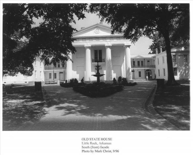
Arkansas State Capitol Built in 1836 The Ordinance of Secession was adopted here, May 6, 1861. This tablet placed by Memorial Chapter No. 48, United Daughters of the Confederacy, June 15, 1936, the one-hundredth birthday of this . . . — — Map (db m157495) HM
Near West Markham Street at Ashley Street, on the right when traveling west. Reported permanently removed.
David O. Dodd Arkansas Boy Martyr of the Confederacy Born Nov. 10, 1846 Executed Jan. 8, 1864 ”Aye, such was the love of the boy for his Southland, Such his endurance, his courage, his pride, That e'er he'd betray his own beloved band He . . . — — Map (db m157596) HM WM
Near West Markham Street at Ashley Street, on the right when traveling west.
Erected by the J.M. Keller Chapter, Daughters of the Confederacy Little Rock, Nov. 9, 1910. In Loving Remembrance of the Confederate Women of Arkansas. ”O dearly loved! Though ye have gone to other stars or spheres, we still have for you . . . — — Map (db m157555) WM
On July 27, 1864 Confederates led by Gen. Richard M. Gano surprised an outpost of the Sixth Kansas Cavalry at nearby Caldwell's Place. The Federal force was routed with a loss of 25 killed and wounded, 127 prisoners and much equipment. The . . . — — Map (db m52566) HM
On Center Street at East Avenue, on the left when traveling west on Center Street.
Near this spot a flag
was presented to the
First Confederate Company
organized in
Washington County
Co. E, 2nd Cavalry Reg’t
Arkansas Volunteers
Capt. T.J. Kelly
May 1861 — — Map (db m59902) HM
On North College Avenue (Business U.S. 71) 0.1 miles north of East Spring Street, on the right when traveling north.
This corner was the scene of hot fighting by Confederate troops under Brig. General W. L. Cabell and Federal forces commanded by Colonel M. LaRue Harrison on April 18, 1863. — — Map (db m224236) HM
On East Douglas Street (U.S. 62), on the right when traveling west.
The original 10 acres of Battlefield Park were purchased in 1908 by the Prairie Grove chapter of the United Daughters of the Confederacy and maintained by the U.D.C. for nearly 50 years as a memorial park. From 1886 to 1926 an annual reunion of . . . — — Map (db m35272) HM
On West Buchanan Street (U.S. 62) at Katie Smith Street, on the right when traveling west on West Buchanan Street.
Site of the first Cumberland Presbyterian Church. Used as a hospital during the battle of Prairie Grove 1862 marked by Prairie Grove Chapter U.D.C. 1930. — — Map (db m88394) HM
On South Battlefield Park Road (County Route 80) at East Douglas Street (U.S. 62), on the right when traveling north on South Battlefield Park Road.
During the Battle of Prairie Grove Gen. Robt. G. Shaver established his head- quarters under this tree Dec. 7, 1862 This spot marked by U.D.C. June 20, 1932. — — Map (db m35332) HM
On West Main Street (Arkansas Route 38) east of Elm, on the right when traveling east.
July 7, 1862, the 11th Wisconsin Infantry of the Federals, commanded by Colonel Hovey, met the Confederate Texas Cavalry commanded by General Rust at Hills Plantation and engaged in a bitter fight.
The Battle of Cache River or Cotton Plant is . . . — — Map (db m116454) HM
On Union Street (Arkansas Route 27) west of North Front Street, on the right when traveling west.
This highway, one of the earliest military roads in Arkansas, was named in honor of Jefferson Davis President of the Confederacy by act of the General Assembly of 1925. — — Map (db m170336) HM
Jefferson Davis, “Father of National Highways,” as Secretary of War 1853-57 sponsored the importation of 33 camels for transporting military supplies to the west coast. The camel trail survey ran from San Antonio, Texas to Fort Tejon which marks the . . . — — Map (db m32823) HM
The Great Seal of the State of California
designed by
Major Robert Selden Garnett,
U.S. Army,
and adopted by the Constitutional
Convention of 1849 at Monterey.
Commissioned a Brigadier General
in the Confederate States Army
He . . . — — Map (db m33659) HM
Base inscription-erected by the United Daughters of the Confederacy Caleb Ross
Chapter #2635 and the Sons of Confederate Veterans, Delaware Grays Camp #2068. Front text-not legible, back text-not legible, side text-Smith Gilley, Confederate Army, . . . — — Map (db m105569) WM
Near R Street Northwest east of 29th Street Northwest, on the left when traveling east.
In memory of Ann Lillie Mackall, friend of Rose O'Neal Greenhow and brave-hearted Confederate courier, who Died December 12, 1861, Aged 22 years — — Map (db m68745) HM
On South Main Street (State Road 329) near East University Avenue (State Road 24 / 26), on the left when traveling south. Reported permanently removed.
(North face)
In Memory Of
The
Confederate
Dead
1861 1865.
(East face)
"They Fell For Us, and For Them
Should Fall
The Tears Of A Nation's Grief."
(West face)
They Counted The Cost
And In . . . — — Map (db m224351) WM
Near Battlefield Trail, 0.2 miles north of U.S. 90.
Here was fought on February 20, 1864
the Battle of Ocean Pond
under the immediate command of
General Alfred Holt Colquitt
"Hero of Olustee"
This decisive engagement prevented a
Sherman-like invasion of Georgia from
the south. . . . — — Map (db m54361) HM
Near Battlefield Trail (17 Mile Camp Road), 0.3 miles north of U.S. 90, on the right when traveling north.
Placed by
The United Daughters
of the Confederacy
Florida Division
In Memory of
Brig. Gen.
Joseph Finegan
Commander of the District of
Middle and East Florida
"So well did he perform
his part that a . . . — — Map (db m54978) HM
On Battlefield Trail at U.S. 90, on the right when traveling west on Battlefield Trail.
(Front):The Battle of Olustee was fought on this ground February 20th, 1864. Between 5,000 Confederate troops commanded by General Joseph E. Finegan and 6,000 Federal troops under General Truman Seymour. The Federals were defeated with a loss . . . — — Map (db m13708) HM
On Ernona Street, 0.1 miles north of Cassidy Road when traveling north.
On March 1st, 1864, in this general area, the final battle of the Olustee Campaign was fought. Many of the dead from the Skirmish at Cedar Creek reside within these gates. — — Map (db m149080) HM
On Sawpit Road, 0.1 miles north of Flounder Road, on the left when traveling north.
Side 1
Sawpit Bluff Plantation, located on Black Hammock Island, was built in the 1750s by Edmund Gray. The plantation was named for the sawpit excavated to accommodate the up and down motion of a vertical saw blade. The plantation house . . . — — Map (db m92973) HM
On New Berlin Road at Olympia Avenue, on the right when traveling east on New Berlin Road.
A Confederate earthworks designed and located by General Robert E. Lee as one of a series of forts for the defense of the Saint Johns River. This fort was occupied by both Confederate and Union forces during the course of the war and is today in its . . . — — Map (db m33458) HM
Confederate Plot Section Six is the final resting place for the Confederate Veterans who
resided at the Old Soldiers and Sailors Home, a refuge for aged and disabled Veterans. The Florida Soldiers Home
Association was formed in 1888 with . . . — — Map (db m57549) HM
On North Pinewood Avenue at East Brandon Boulevard (State Road 60), on the left when traveling north on North Pinewood Avenue.
In 1910, the United Daughters of the Confederacy,
Tampa Chapter No. 113, began to raise funds for a
monument to honor the soldiers and sailors of the
Confederate States of America, The Hillsborough
County Commission granted the chapter, . . . — — Map (db m32979) HM
On East Brandon Boulevard (State Road 60) at North Pinewood Avenue, on the left when traveling east on East Brandon Boulevard.
(West face)
1861
To the Honor and Courage
of the patriots of the
Confederate States
of America,
This monument is dedicated by
Tampa Chapter,
No.113, U. D. C.,
and the citizens of Tampa.
January 1911.
Memoria . . . — — Map (db m26385) WM
On North Collins Street at East Gilchrist Street, on the left when traveling north on North Collins Street. Reported permanently removed.
(Front face)1863 - 1865 Erected by Plant City Chapter #1931 United Daughters of the Confederacy November 17, 2007
By 1863 the Confederate Army was suffering severe food shortages. Capt. John T. Lesley was commissioned to recruit from . . . — — Map (db m46292) HM
On North Ashley Drive south of East Twiggs Street, on the left when traveling north. Reported missing.
In 1848 a Board of Engineers with Lt. Col. Robert E. Lee, USA as recording officer visited Fort Brooke (Tampa). Aboard the Schooner Phenix they made a survey of Tampa Bay; requested government reservation of the bay keys and erection of defense . . . — — Map (db m216190) HM
On Lafayette Street (U.S. 90) at Wynn Street, on the right when traveling west on Lafayette Street.
Here at high noon on September 27, 1864, a Federal raiding force of 900 men under Brigadier-General Alexander Asboth fought a Confederate home guard of 95 old men and boys under Captain Jesse J. Norwood. Entering Marianna from the west, the main . . . — — Map (db m68796) HM
On Natural Bridge Road, 6 miles east of Woodville Highway (State Highway 363), on the left when traveling east.
(south)In Loving Memory 1861-1865 Defenders of Natural Bridge Lest We Forget (east) This monument erected under authority of an act of the legislature of Florida of 1921 as a just tribute of the people of Florida to commemorate the . . . — — Map (db m157200) HM WM
On North Martin Luther King Jr. Boulevard at West Park Avenue, on the left when traveling north on North Martin Luther King Jr. Boulevard.
The present boundaries of the Old City Cemetery were established by the Florida Territorial Council in 1829. Many pioneers and their slaves are buried here, although some early Tallahasseans were buried several hundred feet east of this site. The . . . — — Map (db m79582) HM
On 3rd Street West north of 9th Avenue West, on the right when traveling north.
This plot was donated by Major Alden Joseph Adams to the village of Manatee in 1892 "to be used as a burying ground forever." It was first called New Cemetery. Members of pioneer families, including Major Adams, are interred here. The property is . . . — — Map (db m72423) HM
On 15th Street East at 5th Avenue East, on the right when traveling west on 15th Street East.
Marker Front: This is one of the oldest organized burying grounds on the Gulf Coast of Florida. The property was deeded on May 30, 1850, and since 1892 only immediate members of families already interred here can be buried in the cemetery. . . . — — Map (db m72424) HM
[Marker Front]:
At the close of the Seminole War in 1842, this frontier was opened to settlement. Major Robert Gamble and other sugar planters soon located along the rich Manatee River valley, and by 1845 a dozen plantations were producing . . . — — Map (db m15665) HM
On Eola Street, on the right when traveling south. Reported permanently removed.
(Side one): To the honored memory of The Soldiers, The Sailors, The Statesmen of the Confederate states of America. "Time cannot teach forgetfulness when grief's full heart is fed by fame." (Side two): "Tis wreathed around with . . . — — Map (db m212352) HM
On Bayshore Drive SE at Central Avenue SE, on the left when traveling north on Bayshore Drive SE. Reported permanently removed.
This marks the terminal of the Stonewall Jackson Memorial Highway. Erected by Dixie Chapter United Daughters of the Confederacy, St. Petersburg, Fla. Jan. 22, 1939. — — Map (db m4670) HM
Near Lake Beulah Drive south of West Lemon Street, on the left when traveling south.
Confederate Dead
(Left face)
In memory of that noble band,
who have crossed the mystic
stream,
and are resting now in that
happy land,
where peace and pleasure
reign supreme.
The heroic deeds will never
fade, . . . — — Map (db m212022) WM
On St Johns Avenue at North 4th Street, on the right when traveling west on St Johns Avenue.
(front)
"1861-Our Confederate heroes-1865"
Although the flag they died to save
floats not over any land or sea
throughout eternal years shall wave
the banner of their chivalry.
(right)
The principles
for which they . . . — — Map (db m155287) WM
On Florida 13 at Cordova Street, on the left when traveling east on Florida 13.
(Front):In memory of a distinguished American soldier, citizen of St. Augustine, Fla. Born December 4, 1818. Died December 30, 1885. His courage in battle was conspicuous; His devotion to duty unfailing; His ability recognized by three . . . — — Map (db m220164) HM
This monument is dedicated to Remember and honor
Our Confederate veterans who endured so much
For their homes, their wife’s and their sweet hearts;
So as we now bow our heads in prayer for our Confederate Veterans
May we remember to . . . — — Map (db m185310) WM
On North Beach Street north of International Speedway Boulevard (U.S. 92). Reported permanently removed.
Given in loving memory of
our Confederate dead
by the Southern citizens of
Daytona Beach
Sponsored by
the United Daughters of the Confederacy,
Chapter 1955 — — Map (db m46876) WM
On South Jefferson Street near East Greene Street, in the median.
South (Front)
CSA
This tribute to the
memory of the
Confederate Soldier,
unveiled April 26, 1912.
West
His heroism, in the
presence of the
conquering foe was
equaled only by
his . . . — — Map (db m103412) WM
This marks the original site
of the Methodist Church erected
about the year 1805.
Bishop Asbury and Bishop
McKendree in 1815 held here
a conference which James O.
Andrew attended.
Bishop Capers, Dr. Lovick Pierce,
and many other . . . — — Map (db m42773) HM
On Cassville-White Road at Shinall Gaines Road NW, on the right when traveling east on Cassville-White Road.
In this cemetery are buried about 300 unknown Confederate soldiers who died of wounds or disease in the several Confederate hospitals located in Cassville. These hospitals operated from late 1861 until May 18, 1864, then moved south out of the path . . . — — Map (db m13978) HM
On Georgia Avenue at Bond Street, on the right when traveling west on Georgia Avenue.
Here ex-president Jefferson Davis, Mrs. Davis and their two daughters Mrs. Margaret Hayes and Varina Ann (Winnie) Davis were the house guests of Capt. and Mrs. Joseph Marshall Johnston from Oct. 24 to Nov.2, 1887, coming to attend the Confederate . . . — — Map (db m186638) HM
On Willie Smokie Glover Drive east of Riverside Drive, on the left when traveling east.
While in the city to attend a reunion
of Confederate veterans, Jefferson Davis, ex-president of the Confederate States
of America, addressed the veterans from
this speakers stand on Wednesday, October 26, 1887. On the following Saturday, Mr. . . . — — Map (db m236924) HM
On North Second Street at East Dykes Street (Georgia Road 26/112) on North Second Street.
(Side A)
In memory of
our
Confederate
soldiers
(Side B)
Erected by the
Cochran Chapter
No. 764 U.D.C.
to the
Confederate veterans
of Pulaski County, 1910
“When the last trumpet
is sounded, may each one . . . — — Map (db m197980) WM
On Thomasville Road (U.S. 84) 0 miles west of South Laurel Street, on the right when traveling east.
In this cemetery, during the last year of the War Between the States, a number of Confederate soldiers, 17 of them unknown, were buried. Memorial services for these soldiers were held as early as 1869. In 1871, on Memorial Day, April 26, a group of . . . — — Map (db m26978) HM
On East Main Street (State Highway 24) near South Main Street (U.S. 301).
South Face
Comrades
In Memory Of
The
Confederate Soldier
1861 - 1865
West Face
" How many a glorious
name for us,
How many a story of
fame for us
They left ! Would it
not be a blame for us . . . — — Map (db m10718) HM
Near Bark Camp Church Road, on the left when traveling west.
Constituted in 1788, Bark Camp Church was the center for worship, culture and hospitality in Bark Camp,
one of the oldest settlements in Burke County.
Many of the congregation honorably served during the War Between the States as soldiers . . . — — Map (db m97007) HM
Near Woodcock Street/Fort Jackson Road, 1.2 miles north of East President Street, on the right when traveling north.
Fearful of U.S. invasion during the Civil War, two Macon women prompted a statewide campaign to build an ironclad vessel for the protection of Georgia's coastal and riverside towns. By March 1862, the Ladies Gunboat Association had formed to raise . . . — — Map (db m133215) HM
Near Ft Pulaski Drive, on the right when traveling east.
This Memorial Commemorates the act of Lieutenant Christopher Hussey Of the Montgomery Guards and Private John Latham of the Washington Volunteers, the first volunteer regiment of the State of Georgia.
While under fire during the bombardment of . . . — — Map (db m4231) HM
Mattie Harris Lyon, 97, the “Mother of Marietta,” was known for her years of zealous and affectionate service in religious, civic, welfare and patriotic activities. Her life was dedicated to the service of people of all races. A true humanitarian, . . . — — Map (db m5198) HM
On Depot Street west of W Park Square, on the left when traveling west.
The Kennesaw Chapter United Daughters of the Confederacy was organized July 29, 1898, in the parlors of the Kennesaw House on the second floor corner nearest the railroad station. Mrs. R. L. Nesbitt was elected the first president. There were forty . . . — — Map (db m1665) HM
On South Peterson Avenue near West Ward Street (Georgia Road 32W), on the right when traveling south.
East face:
In Memory Of Our
Confederate Soldiers
North face:
1861 - 1865
[Crossed Flags]
West face:
Erected by the Robert E. Lee Chapter, U.D.C.
Oct. 1911 — — Map (db m24604) HM
On South Main Street (Business U.S. 319) at 1st Avenue Southeast (Georgia Route 37), on the left when traveling south on South Main Street.
Erected by Moultrie-McNeill Chapter of The Daughters of the Confederacy. Moultrie Georgia. 1909. In honor of our Confederate Dead. ——— ”On fame’s eternal camping ground, their silent tents are spread, and glory guards with solemn round, the bivouac . . . — — Map (db m197773) WM
On Greenfield Church Road at Kilgore Road, on the right when traveling east on Greenfield Church Road.
Used as a hospital and recruiting station during War Between the States.
This marker placed by Moultrie McNeil Chapter United Daughters of the Confederacy
Date 1929.
Mrs. J. R. Hall, Jr. President. — — Map (db m40692) HM
On West Court Square at North Court Square, on the left when traveling west on West Court Square.
In Memory of
William Thomas Overby
Confederate Hero.
Enlisted May 31, 1861, Co. A. 7th Ga. Infantry. Wounded at Second Manassas Aug. 30, 1862. Then joined Co. D, 43rd Batln. Mosby's Rangers.
Raided within Federal lines to . . . — — Map (db m70865) HM WM
Near South 7th Street (U.S. 41) at 11th Avenue East, on the right when traveling north.
In 1865, Capitol of Georgia moved here by Governor Joe Brown. The Great Seal and Treasury moved from here to Canada and later returned to the Governor of Georgia. The old well under this spot furnished the water supply for the refugee capitol. . . . — — Map (db m174448) HM
Near North Broad Street (U.S. 27) at West Broughton Street.
The Bainbridge Volunteers
Later
The Bainbridge Independents
Organized 1859, by
Captain Charles G. Campbell,
assembled here in March 1861 and
entered service under the command
of Captain John W. Evans . . . — — Map (db m57419) HM
On East Court Square, 0.1 miles south of Ponce de Leon Avenue, on the right when traveling south.
During the
Battle of Decatur July 22nd 1864
there was hot fighting in and
around the old courthouse which
stood on this square.
Wheeler's Cavalry made a
gallant charge here and captured
a battery of Federal artillery
with . . . — — Map (db m8756) HM
On Commerce Drive (Route 155) 0.1 miles east of North Candler Street, on the right when traveling west.
This cemetery was the scene of an engagement between 8th Confederate Cavalry Col. J. S. Prather commanding and a large force of Federal troops. The latter were repulsed and 225 prisoners taken. — — Map (db m29168) HM
On Foster Street just north of Dublin Highway (Anson Avenue) (Georgia Route 117), on the right when traveling north.
[west]Erected by the Fannie Gordon Chapter United Daughters of the Confederacy April 1910. ”No nation rose so pure and white; none ever fell so spotless.”[north]”To those who fought and lived, to those who fought and died.” This stone . . . — — Map (db m184964) WM
On North Oak Street near Jackson Street, on the left when traveling east.
1861 1865 To Honor The Confederate Heroes
Of Effingham County
Reverse
Erected by Salzburger Chapter
United Daughters Of The Confederacy
April 26, 1923 — — Map (db m7504) HM
On West Main Street, on the left when traveling south.
South
Gratefully Dedicated to
The Patriotic Memory of American
Revolutionary Soldiers
Buried in Emanuel County
Wilson Drew Jacob Durden
David Edenfield Ephriam Herrington James Moore
Joseph Sumner Reuben Thompson . . . — — Map (db m21372) HM
Near Oakland Avenue SE at Martin Luther King, Jr. Drive SE.
Vice-President of the Confederacy, 1861-1865, died while Governor of Georgia on March 4, 1883 and was first buried in this vault. In 1884, he was reinterred at his home, “Liberty Hall”, at Crawfordville, Georgia.
Though small in stature, “Little . . . — — Map (db m186563) WM
Clement A. Evans, Brig. Gen., C.S.A., began his military career in his native Stewart Co., Ga., where he was commissioned Major in Co. E, 31st Ga. Infantry. He rapidly rose in rank and in Nov. 1864, was put in command of a division, succeeding . . . — — Map (db m64826) HM
A native of Upson County, Georgia, and a Major General, Confederate States Army, was one of General Lee's most trusted and outstanding officers. He brilliantly led his devoted men in every engagement in which the Army of Northern Virginia . . . — — Map (db m64831) HM
On West Marietta Street, 0.1 miles west of Joseph E. Lowry Boulevard, on the left when traveling west.
Where on July 18, 1864, the transfer of the command of the Army of Tennessee was made to General John B. Hood.
Atlanta Chapter
Restored by Atlanta Paper Co. 1955
Restored by Mead Containerboard 1996 — — Map (db m55625) HM
Erected under the auspices of the Old Guard and Atlanta Chapter U.D.C.
A.D. 1919 in memory of Andrew J. West.
Beloved citizen Captain C.S.A.-General U.C.V.
The damage at the base of this lamp post was caused by a shell during The War Between . . . — — Map (db m18622) HM
On Fairburn Campbellton Road near Cochran Road SW, on the right.
Where, in June 1867 the widow of Captain T.C. Glover called a reunion of the survivors of Company A, 21st Georgia, C.S.A. who agreed to hold annual meetings. — — Map (db m21432) HM
Near Confederate Cemetery Road, 0.4 miles east of U.S. 41 when traveling east.
In remembrance and appreciation for her service and dedication in locating and collecting the remains of the soldiers who died on the Resaca battlefield and re-interring them in a plot of land that would become the first Confederate cemetery in . . . — — Map (db m170950) WM
On Confederate Cemetery Road, 0.4 miles east of Battlefield Parkway (U.S. 41), on the right when traveling east.
This tablet is dedicated by the Atlanta Chapter of the United Daughters of the Confederacy to the memory of Miss Mary Green, who established this Resaca Cemetery –- the first in this state -- for our Confederate soldiers.
Made by . . . — — Map (db m26347) HM
On Lawrenceville Highway (U.S. 29) east of North Perry Street (County Route 20), on the left when traveling west. Reported permanently removed.
In remembrance
of the citizens
of Gwinnett
County who
honorably served
the Confederate
States of America
"Any people with
contempt for their
heritage have lost
faith in themselves
and no nation can long
survive without . . . — — Map (db m85724) WM
On Broad Street (Georgia Route 120) at Bowden Street (Georgia Route 100), on the left when traveling west on Broad Street.
This road was originally the Sandtown Trail traveled by several tribes of Creek Indians. It connected Sandtown on the Chattahoochee River near Atlanta, Ga. with another Sandtown in Tallapoosa Co., Ala. Later became Old Ala. Road over which early . . . — — Map (db m11176) HM