779 entries match your criteria. Entries 201 through 300 are listed.⊲ Previous 100 — Next 100 ⊳
William G. Pomeroy Foundation Historical Markers
Since its inception, the Foundation has grown to six historic signage programs, funding over 1,000 markers & plaques in New York, Ohio and beyond, all the way to Alaska. Does not include the William G. Pomeroy Foundation Legends & Lore Series.
On Hallock Hill Road, on the right when traveling east.
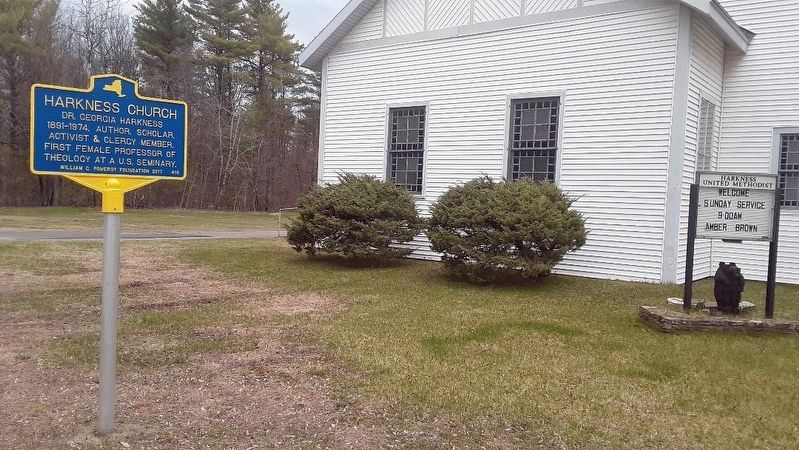
Dr. Georgia Harkness
1891-1974. Author, scholar,
activist & clergy member.
First female professor of
theology at a U.S. seminary. — — Map (db m132695) HM
Cemetery est. Nov. 21, 1876
resting place of many early
area families - Eels, Keet,
Mason, Merchant, Lobdell,
Ladue, Turner, Weaver — — Map (db m133082) HM
On U.S. 9 (New York State Route 9) north of Champlain Drive, on the right when traveling north.
Catholic Summer School of America 1896-1941 on this site. Resort and educational campus with cottages, chapel, dining hall, auditorium & post office. — — Map (db m106622) HM
On Boston Corners Road at Harlem Valley Rail Trail, on the left when traveling south on Boston Corners Road.
Stone survey marker on this
site determined southwest
corner of Massachusetts,
aka Boston Corner. Land ceded
to New York State in 1855. — — Map (db m245239) HM
On New York State Route 66, 0.1 miles north of Farm Road, on the right when traveling north.
By 1916 Thomas Buckley's
lumber & cider mills, Borden
milk plants, coal yard and
railroad siding operated
in this former hamlet. — — Map (db m236941) HM
Near this site 3 homes built
ca. 1850 by Lemuel Pomeroy
family. Founders of Copake
Iron Works. Remaining home
acquired by park in 1928. — — Map (db m132778) HM
On New York State Route 66 south of Nelson Avenue, on the left when traveling north.
From ca. 1830-1953. Sheltered
approx. 150 of county's sick
and poor. 200 acres farmed
by residents. Barns sold 1955,
Home burned 1979. — — Map (db m236938) HM
On New York State Route 66 at George Street, on the right when traveling south on State Route 66.
By 1858, two railroad lines
converged here. Bartlett
House, Ghent Hotel & other
businesses followed.
Service discontinued 1954. — — Map (db m235616) HM
On Route 66 at Town Hall Place, on the right when traveling north on Route 66.
By 1892, 3 horse-powered
hay presses operated here.
In 1894 fire destroyed barns
and 100 tons of hay and
straw stored for shipment. — — Map (db m235617) HM
On Water Street, on the left when traveling north.
On Sept. 17, 1824, General Lafayette was welcomed in Hudson on his way upriver to Albany. A procession led him around the main streets. — — Map (db m228826) HM
On New York State Route 203 at South Street, on the right when traveling west on State Route 203.
Spencertown Historic District
has been placed on the
National Register of
Historic Places in 2018
by the United States
Department of the Interior — — Map (db m145533) HM
On Taylor Valley Road (County Route 600) 1 mile east of Hawley Woods Road (County Route 159A), on the right when traveling west.
aka Hawley burial ground
Early burials in mid 1820s
and final resting place of
Revolutionary War soldiers
Henry and Jacobus Bush — — Map (db m146731) HM
On Stevens Road, on the left when traveling north.
Dr. James Henry Salisbury
1823. Pioneer in germ theory
research. Invented salisbury
steak to combat illness
in Civil War soldiers. — — Map (db m128005) HM
On Cayuga Street (New York State Route 90) 0.1 miles west of Main Street (U.S. 11), on the left when traveling west.
Former dry goods merchant established
floral shop and greenhouse here 1892.
Later operated with son Charles H. Arnold,
1879-1953. — — Map (db m207583) HM
On Route 11 near Hooker Avenue, on the right when traveling south.
Lived solo in a lean-to six wintry weeks 1791-1792 subsisting on roots & bark until men returned with provisions from Windsor, NY — — Map (db m227319) HM
On Red Flynn Drive, on the left when traveling north.
On Sept. 19, 1824, General Lafayette arrived here to visit Mrs. Caroline Dewindt, granddaughter of former Pres. John Adams, at her home. — — Map (db m206369) HM
On Wolcott Avenue (New York State Route 9D) at Main Street, on the left when traveling south on Wolcott Avenue.
First woman reporter for
New York Tribune wrote
"Woman in the Ninteenth
Century" at Van Vliet House
Fishkill Landing, Fall 1844 — — Map (db m124895) HM
On London Drive at Old Main Street on London Drive.
Samuel Loudon
printed the NY State
constitution in Fishkill
in 1777. Fishkill postmaster
during the Revolutionary
War years 1777-1783 — — Map (db m237232) HM
On East Market Street (County Route 41) 0.1 miles west of Pine Woods Road, on the right when traveling west.
New Guinea Community Site has been placed on the National Register of Historic Places in 2018 by the United States Department of the Interior — — Map (db m146986) HM
On Albany Post Road (U.S. 9) at East Market Street, on the right when traveling north on Albany Post Road.
Reformed Dutch
Church of Hyde Park
Established 1789 as the
Stoutenburgh Religious
Society. Oldest continuous
Congregation in Hyde Park.
William C. Pomeroy Foundation 2015 — — Map (db m83232) HM
Near North Water Street, 0.3 miles north of Main Street, on the left when traveling north.
has been placed on the National Register of Historical Places in 1979 by The United States Department of the InteriorWilliam G. Pomeroy Foundation 2019 • 201 — — Map (db m136100) HM
On South Broadway north of Fraleigh Street, on the right when traveling north.
Built 1865 for Allen B. and
Anna R. Hendricks in the
octagonal & concrete form
popularized by O.S. Fowler.
Red Hook Library since 1935 — — Map (db m128010) HM
On East Avenue, 0.1 miles west of Crittenden Road, on the left when traveling west.
Dennis E. Nolan 1872 - 1956 West Point grad & Major General lived here as a child. WWI veteran who organized Military Intelligence Service — — Map (db m128610) HM
On Feddick Road (County Route 469) 0.6 miles south of Keller Road, on the right when traveling south.
West Boston A German evangelical church was organized 1834 with 20 members. Rev. Jacob Bastian served for many years. All that remains ia a cemetery. — — Map (db m93781) HM
Near Main Street (New York State Route 5) 0.2 miles north of West Delavan Avenue.
Erastus Granger Seneca Indian Agent, judge, Post Master & Collector of the Port, lived here 1806-1826. He rallied Seneca to defend Buffalo during War of 1812. — — Map (db m92785) HM
On Delaware Avenue (New York State Route 384) 0.1 miles south of Johnson Park, on the right when traveling south.
On Aug. 25, 1868, Frederick Law Olmsted first described his parks and parkways system for Buffalo here at Sherman S. Jewett's Mansion. — — Map (db m179110) HM
On Main Street at East Tupper Street, on the right when traveling north on Main Street.
Samuel Helm A German-American settled near here in 1809 Killed during British raid in War of 1812. Namesake of Steuben Society Unit 144 — — Map (db m131843) HM
On Niagara Street (New York State Route 266) 0.1 miles south of Auburn Avenue, on the right when traveling south.
General, Congressman and later Sec. of War, lived here until his home was destroyed by the British at the burning of Buffalo 1813 — — Map (db m171192) HM
On New Oregon Road (County Route 446) at Clarksburg Road, on the right when traveling south on New Oregon Road.
Clarksburg Est. 1819. Named for early settler Simeon Clark, who built a sawmill & gristmill near here ca.1820. First school established ca. 1839. — — Map (db m94050) HM
Since ca. 1817 saw and
grist mills operated here.
Lumber, baskets, shingles,
feed & flour were produced.
Water powered until 1929. — — Map (db m132677) HM
On Jamison Road at Creek Road, on the left when traveling east on Jamison Road.
East Elma ca. 1865. Had woolen mill, sawmill, blacksmith, grocery, Post Office & swimming hole. Later called Frog Pond. Originally home of Senecas. — — Map (db m131847) HM
On Bowen Road (County Route 242) 0.3 miles north of Rice Road, on the right when traveling north.
Elma Centre prospered around R.R. depot est. near here ca. 1870. Coal & lumber dealers, blacksmith, saloon, Post Office & school built nearby. — — Map (db m187871) HM
On Seneca Street (New York State Route 16) at Northrup Road, on the right when traveling south on Seneca Street.
Purchased land here in 1845. By 1866 site included home, store, dam for his saw and grist mills, and bridge over Cazenovia Creek. — — Map (db m186374) HM
On Ridge Road west of Franklin Street, on the right when traveling west.
With Pioneer Study Club, secured funding from Carnegie Corp. of New York to establish Lackawanna Public Library. Building dedicated July 1922. — — Map (db m214182) HM
On Broadway (U.S. 20) near Central Avenue, on the right when traveling east.
Broadway Historic District
has been placed on the
National Register of
Historic Places in 2015
by the United States
Department of the Interior — — Map (db m169859) HM
On Broadway (U.S. 20) at Central Avenue, on the left when traveling east on Broadway.
Central Avenue Historic District
has been placed on the
National Register of
Historic Places in 2015
by the United States
Department of the Interior — — Map (db m169868) HM
On Genesee Street (New York State Route 33) at Pavement Road, on the right when traveling west on Genesee Street.
Hull House Federal Style stone house built ca. 1810 by Warren Hull Revolutionary War veteran and Holland land purchase settler. — — Map (db m131840) HM
Near South Lincoln Avenue, 0.1 miles south of West Highland Avenue.
Erected in 1911 by the Buffalo, Rochester and Pittsburgh Railway through the generous efforts of wealthy Orchard Park philanthropist, Harry Yates. In 1971, the vacant depot and freight house were purchased by local resident developers, Mr. & . . . — — Map (db m80566) HM
To avoid the strong current of the mighty Niagara River, the Erie Canal was built adjacent to the river from here to Buffalo in 1825. — — Map (db m78352) HM
On Mill Road just south of Mill Road and Main Street, on the right when traveling north.
Community of True Inspiration Residence has been placed on the National Register of Historic Places in 2013 by the United States Department of the Interior
William G. Pomeroy Foundation 2013 — — Map (db m71885) HM
On Orchard Park Road (New York State Route 240) at Reserve Road, on the right when traveling south on Orchard Park Road.
St. Peter's UCC Completed in 1857 by a group of immigrants from Germany, services were held in German until 1929. Church moved from road in 1980. — — Map (db m94052) HM
On Route 73 just north of Nature Way, on the right when traveling north.
Led Suffrage Campaign in the Adirondacks 1914-17. Former Summer home was HQ for Essex County Society of the New York State Women's Suffrage Assn. — — Map (db m238326) HM
On Main Street east of Beach Street, on the left when traveling east.
Water from this spring was used medicinally & later sold in molded bottles as Dietade, flat or sparkling, from 1914 to 1942.
William G. Pomeroy Foundation 2019 • 561 — — Map (db m137823) HM
On U.S. 9, on the left when traveling north on U.S. 9.
Lived and buried near here.
Astride a white horse, led 1913
Suffrage Parade in Washington
DC. Died at age 30 campaigning
for women's right to vote. — — Map (db m136667) HM
On Main Street (New York State Route 9N/22) at Tobey Street, on the left when traveling north on Main Street.
Inn and restaurant serving
iron ore industry workers,
railway workers, travelers,
and visiting officials
early 1880s to ca. 1964 — — Map (db m109058) HM
On New York State Route 30 near County Route 152, on the right when traveling north.
FJ&G RR Crossed Here
At Levi & Zeruah Sweet Farm.
The Sweet Family Provided
Food to Stranded Passengers
During Blizzard of March 1888
— — Map (db m88054) HM
On Knowlesville Road (County Route 23) 0.8 miles south of Podunk Road, on the right when traveling south.
This Waterway Old Orchard Creek designated a public highway May 8, 1837 in the towns of Alabama and Shelby by an act of the New York State legislature. — — Map (db m134061) HM
On Harvester Avenue, 0.1 miles south of Main Street (New York State Route 33/5), on the left when traveling south.
Batavia Cemetery
Has been placed on the
National Register of
Historic Places in 2002
by the United States
Department of Interior — — Map (db m158623) HM
On Upton Road, 0.2 miles south of Lear Road, on the left when traveling south.
Birthplace of Emory Upton 1839 - 1881. West Point graduate. U.S. Army General and Civil War veteran. Influential military author & stategist — — Map (db m126158) HM
On East Main Street (New York State Route 5) at Ward Street, on the right when traveling west on East Main Street.
Cary House Site Location of mansion ca 1817 to 1964, a gift to his wife by Trumbull Cary, merchant, bank founder, NYS Senator, & first Batavia treasurer. — — Map (db m83068) HM
On South Lyon Street, 0.2 miles south of West Main Street (New York State Route 5), on the right when traveling south.
Early Cemetery in village of Batavia on this site deeded August 10, 1820. Bodies were re-interred to other cemeteries in Batavia — — Map (db m94895) HM
On South Main St (New York State Route 98) south of Chapel Street, on the left when traveling south.
First rural free delivery of
U.S. Mail in New York State
occurred October 15, 1896 in
Elba. Successful test led to
statewide implementation. — — Map (db m169563) HM
On Main Street (New York State Route 5) at Mill Street, on the right when traveling west on Main Street.
Le Roy post office
has been placed on the
National Register of
Historic Places in 1989
by the United States
Department of the Interior — — Map (db m142119) HM
On Main Road (New York State Route 5) at Morganville Road (New York State Route 237), on the right when traveling west on Main Road.
East boundary Holland land purchase 3.3 million acres Transit line ran N.& S. from PA. to Lake Ontario Surveyed between 1798-1800 — — Map (db m77687) HM
Erected 1883 to shelter Greene
County's sick and destitute.
Farm worked by residents.
Closed 1962. Converted to
County Office Bldg in 1963. — — Map (db m133071) HM
On Main Street at Bridge Street when traveling north on Main Street.
On Sept. 17, 1824, General Lafayette visited Catskill and was escorted from a
steamboat to meet local envoys at Croswell's Hotel. — — Map (db m232010) HM
On Mansion Street (New York State Route 385) at Spencer Street, on the right when traveling west on Mansion Street.
This African Methodist Episcopal Congregation was established in 1853 by free &
formerly enslaved people of Coxsackie. Church built 1856. — — Map (db m175175) HM
On New York State Route 81, 0.2 miles west of Guild Road, on the right when traveling east.
Oak Hill Cemetery
has been placed on the
National Register of
Historic Places in 2011
by the United States
Department of the Interior — — Map (db m145171) HM
779 entries matched your criteria. Entries 201 through 300 are listed above. ⊲ Previous 100 — Next 100 ⊳