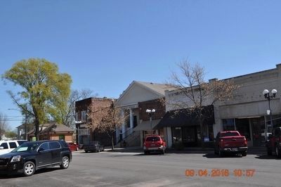
On North Marion Strret south of Hobbs Street, on the left when traveling north.
The First Baptist Church, organized in 1824, built a meeting house in 1826. A brick structure was erected in 1831 but was replaced with the above building in 1909. This church located on the north west corner of Clinton and Hobbs streets, was later . . . — — Map (db m93883) HM
On High Street south of North Street Southeast, on the right when traveling north.
Cottonport
The town of Cottonport flourished in the early years of Limestone County. It was settled in 1818 and chartered in 1824. It was located approx. 1½ miles S.E. near the point where Limestone Creek flowed into the Tennessee River and . . . — — Map (db m256322) HM
On Oakleigh Place at Savannah Street, on the left when traveling north on Oakleigh Place.
Started in 1833 by James Roper on a Spanish land grant, “Oakleigh” was named for the magnificent oaks around it. The “T” shaped dwelling with elegant parlors and curved outside stairway from the brick terrace to front gallery . . . — — Map (db m85908) HM
On Bank Street Northeast north of Church Street Northeast, on the left when traveling north.
Decatur had close to 800 residents in 1860, not many more than the 606 persons counted in the 1850 census. Included in the 1860 census were 267 white males, 206 white females, three free blacks including two males and one female, and 130 slaves of . . . — — Map (db m28209) HM
On Charles (Main) Street (State Highway 140) at 5th Street, on the left when traveling south on Charles (Main) Street.
Built in 1859 by John F. McNamera, destroyed by fire in 1866, rebuilt in 1867 by Herman Schlageter, Presidents Grant & Garfield stayed here, Walter & Clarice Robinson acquired ownership in 1963. — — Map (db m298382) HM
On West Street at Terrace Place, on the left when traveling west on West Street.
There are monuments located throughout our city that serve as a reminder of those who have served our country.
The dedication of the Civil War Soldier’s Monument took place on May 27, 1880 in City Hall Square. The 32-foot high granite . . . — — Map (db m71246) HM
On Columbus Circle Northeast at Delaware Avenue Northeast, on the right when traveling east on Columbus Circle Northeast.
Union Station
Architecture by
Daniel Burnham, 1908
Designed in the Beaux-Arts style, this was the world's largest train station when it opened - the station and terminal zone originally covered approximately 200 acres and included 75 . . . — — Map (db m8442) HM
On 13th Street Northwest at K Street Northwest, on the right when traveling north on 13th Street Northwest. Reported permanently removed.
"going into the country"
This urban oasis exists because President Andrew Jackson needed water. The site of excellent springs (a rare commodity in the early city when everyone was dependent on private wells), . . . — — Map (db m29594) HM
On 13th Street Northwest at K Street Northwest (U.S. 29), on the right when traveling north on 13th Street Northwest.
"Going into the country"
This urban oasis exists because President Andrew Jackson needed water. The site of excellent springs (a rare commodity in the early city, when everyone was dependent on private wells), . . . — — Map (db m211818) HM
Near 15th Street Northwest south of G Street Northwest, on the right when traveling south.
This montage showing four presidential inaugural parades along 15th St., NW is based on artist Earl Minderman's 1980 visioning of President thomas Jefferson's inaugural parade as well as historic photos of the inauguration of Presidents . . . — — Map (db m91808) HM
On D Street Northwest west of 5th Street Northwest.
DC’s Art Deco/Art Moderne Recorder of Deeds Building (1941) houses city land records. Many notable African Americans have served as recorders of deeds since President Garfield appointed Frederick Douglass to the post in 1881. These include Branche . . . — — Map (db m29657) HM
On Indiana Avenue Northwest east of 5th Street Northwest, on the right when traveling west.
This imposing, Greek Revival style structure was designed by George Hadfield as Washington's first City Hall/Courthouse. Throughout its history, the building has housed the local and federal courts for DC, presided over by judges appointed by . . . — — Map (db m58366) HM
On 14th Street Northwest at Thomas Circle Northwest when traveling south on 14th Street Northwest. Reported damaged.
Through The 1960s President Lyndon B. Johnson and his family worshipped across the street to your left at National City Christian Church. The First Family sat near the front in the pew deemed safest by their Secret Service agents. The church . . . — — Map (db m130858) HM
On Madison Drive Northwest west of 4th Street Northwest, on the left when traveling west.
President James A. Garfield was leaving Washington, DC for his college reunion. He entered the Baltimore & Potomac Railroad station that would have been standing in front of you on the morning of July 2, 1881. Charles Guiteau, a mentally ill office . . . — — Map (db m127343) HM
On Madison Drive Northwest west of 4th Street Northwest, on the left when traveling west.
In front of you stood the Baltimore & Potomac Railroad Station where President James A. Garfield was shot in 1881. Garfield served as the United States' 20th president for only four months before he was assassinated. A modest memorial to Garfield . . . — — Map (db m127347) HM
On 1st Street Southwest at Garfield Circle Southwest on 1st Street Southwest.
The Peace Monument
By Franklin Simmons, 1878
The Peace Monument, also called the Naval Monument, was erected to commemorate the naval deaths at sea during the Civil War. At the top of the 44-foot monument, Grief, sometimes called . . . — — Map (db m110449) HM
On East Capitol Circle Southwest at Maryland Avenue Southwest, in the median on East Capitol Circle Southwest.
(Front):James A. Garfield 1831 - 1881 (Left):Major General USV, Member of Congress, Senator and President of the United States of America. (Right):Erected by his comrades of the Society of the Army of the Cumberland May 12 . . . — — Map (db m18602) HM
On Jefferson Drive Southwest east of 12th Street Southwest, on the right when traveling east. Reported permanently removed.
The Arts and Industries Building, the second oldest Smithsonian building, was the first building designed for the National Museum, as the Smithsonian's first museum was known. It was constructed between 1879 and 1881 to meet the need for more . . . — — Map (db m108904) HM
On Jefferson Drive Southwest 0.1 miles west of 7th Street Southwest, on the right when traveling east.
More than a museum, the Arts + Industries Building (AIB) is a part of our nation's history. A destination for big ideas for more than 140 years. AIB is now poised for the next great chapter in its impressive story.
1876
World's Fair Sparks . . . — — Map (db m211333) HM
On Old Plantation Road north of Schoolhouse Lane, on the right when traveling north.
Chartered by the State of Georgia to be trustworthy stewards of the island, the Jekyll Island Authority has been very active in the preservation of the National Historic Landmark District. The rehabilitation of Crane Cottage and Cherokee in . . . — — Map (db m115119) HM
On North Central Park Avenue north of Lake Street, on the right when traveling south.
Originally known as Central Park, Garfield Park was conceived as the centerpiece of the West Park System in 1869, and was renamed after President James Garfield's assassination in 1881. Plans for the entire ensemble of Humboldt, Garfield, Douglas . . . — — Map (db m241108) HM
On Central Park Avenue at Lake Street on Central Park Avenue.
In 1871, William Le Baron Jenney (best known for his innovations in skyscraper technology) created a master plan for the city's West Park District, consisting of three parks and connecting boulevards. In what would later become Garfield Park, he . . . — — Map (db m241133) HM
On Lake Street near Central Park Avenue, on the right when traveling west.
Chicago’s Boulevards are one of the city’s most overlooked treasures, and one of the largest and oldest boulevard systems in the nation. The 28-mile system contains 540 acres of green space, and provides a link between seven inland parks and . . . — — Map (db m241131) HM
On South Hamlin Boulevard north of West Washington Boulevard, on the left when traveling south.
[East-facing side:]
A tribute
to those of the
132nd Infantry
(2nd Ill.)
who gave their lives
in the service
of our country
[North-facing side:]
Organized Dec. 21, 1875
Service
War with Spain
(Cuban occupation) . . . — — Map (db m243644) WM
On South Hamlin Boulevard at West Madison Street, on the right when traveling north on South Hamlin Boulevard.
Originally known as Central Park, Garfield Park was conceived as the centerpiece of the West Park System in 1869, and was renamed after President James Garfield's assassination in 1881. Plans for the entire ensemble of Humboldt, Garfield, Douglas . . . — — Map (db m243680) HM
On North Hamlin Avenue south of West Lake Street, on the right when traveling north.
Originally known as Central Park, Garfield Park was conceived as the centerpiece of the West Park System in 1869, and was renamed after President James Garfield's assassination in 1881. Plans for the entire ensemble of Humboldt, Garfield, Douglas . . . — — Map (db m243684) HM
On West Congress Parkway at Independence Boulevard, on the right when traveling west on West Congress Parkway.
In 1871, William Le Baron Jenney (best known for his innovations in skyscraper technology) created a master plan for the city's West Park District, consisting of three parks and connecting boulevards. In what would later become Garfield Park, he . . . — — Map (db m244569) HM
On South Central Park Boulevard at West Jackson Boulevard on South Central Park Boulevard.
Originally known as Central Park, Garfield Park was conceived as the centerpiece of the West Park System in 1869, and was renamed after President James Garfield's assassination in 1881. Plans for the entire ensemble of Humboldt, Garfield, Douglas . . . — — Map (db m244575) HM
On West Madison Street at Homan Avenue, on the right when traveling west on West Madison Street.
Originally known as Central Park, Garfield Park was conceived as the centerpiece of the West Park System in 1869, and was renamed after President James Garfield's assassination in 1881. Plans for the entire ensemble of Humboldt, Garfield, Douglas . . . — — Map (db m244582) HM
On South Central Park Boulevard near Madison Street, on the right when traveling north.
Originally known as Central Park, Garfield Park was conceived as the centerpiece of the West Park System in 1869, and was renamed after President James Garfield's assassination in 1881. Plans for the entire ensemble of Humboldt, Garfield, Douglas . . . — — Map (db m244584) HM
On West Lake Street west of North Homan Avenue, on the left when traveling west.
Originally known as Central Park, Garfield Park was conceived as the centerpiece of the West Park System in 1869, and was renamed after President James Garfield's assassination in 1881. Plans for the entire ensemble of Humboldt, Garfield, Douglas . . . — — Map (db m244586) HM
On North Central Park Avenue 0.1 miles north of West Washington Boulevard, on the left when traveling north.
The Garfield Park Fieldhouse, constructed in 1928 as the West Park Commission administrative headquarters, is one of the most lavish buildings on Chicago's west side. Designed by architects Michaelsen & Rognstad this "Gold Dome Building" has a 23 . . . — — Map (db m243639) HM
Near North Central Park Avenue 0.2 miles north of West Washington Boulevard, on the left when traveling north.
Butterflies, birds, fish, and other wildlife find food and shelter at Garfield Park Natural Area. People find fresh air and explore nature throughout the seasons. Stroll along the paths to enjoy the scenic and natural areas of Garfield Park. . . . — — Map (db m243681) HM
On Schraeder Drive west of North Central Park Avenue, on the right when traveling east.
Butterflies, birds, fish, and other wildlife find food and shelter at Garfield Park Natural Area. People find fresh air and explore nature throughout the seasons. Stroll along the paths to enjoy the scenic and natural areas of Garfield Park. . . . — — Map (db m243682) HM
On North McCrea Drive north of West Washington Boulevard, on the right when traveling north.
Butterflies, birds, fish, and other wildlife find food and shelter at Garfield Park Natural Area. People find fresh air and explore nature throughout the seasons. Stroll along the paths to enjoy the scenic and natural areas of Garfield Park. . . . — — Map (db m243683) HM
On Central Park Avenue north of Washington Boulevard, on the right when traveling north.
Butterflies, birds, fish, and other wildlife find food and shelter at Garfield Park Natural Area. People find fresh air and explore nature throughout the seasons. Stroll along the paths to enjoy the scenic and natural areas of Garfield Park.
. . . — — Map (db m265926) HM
On Washington Boulevard 0.2 miles east of Hamlin Street, on the right when traveling west.
The Talking Trees Project recognizes three community leaders in Garfield Park. Listen to their heartfelt stories about their strong connections to the park and their contributions to the community.
Rev. Donald McFadden
Rev. Donald . . . — — Map (db m265922) HM
On Central Park Avenue 0.1 miles north of Washington Boulevard, on the right when traveling south.
The Talking Trees Project recognizes three community leaders in Garfield Park. Listen to their heartfelt stories about their strong connections to the park and their contributions to the community.
Jim Hobson
After 31 years, Jim Hobson . . . — — Map (db m265927) HM
On Prospect Avenue north of Church Street, on the right when traveling north.
"Always Remember"
A memorial dedicated to all U.S. veterans who have honorably served our country to defend our freedom and American way of life. — — Map (db m256915) WM
During his presidency, Abraham Lincoln had promised to care for the men in the armed services-and for their widows and orphans. Lincoln was unable, however, to keep that promise. In response, the Grand Army of the Republic or G.A.R. . . . — — Map (db m56908) HM
William M. Ager •
William Bargrett •
William Bowers •
John P. Buchanan •
William H. Bush •
William H. Albertson •
James Alexander •
John Barnett •
Henry C. Bowman •
David Barnett •
Samuel Brelsford •
James O. Campbell • . . . — — Map (db m161526) WM
On 5th Street at 3rd Avenue, on the left when traveling west on 5th Street.
Kirkwood is the only Iowan to serve as governor, U.S. senator and as a cabinet member. He came to Iowa in 1855 to operate a grist mill in this vicinity. Elected governor in 1859 as a Republican, Kirkwood administered the office with forcefulness and . . . — — Map (db m33204) HM
Near Kentucky Route 114 0.1 miles east of Route 404, on the right when traveling east.
The Union and Confederate forces were led by two very different men. Humphrey Marshall was a Kentucky blue blood and a representative of one of the state's leading families. James A. Garfield was a self-made man born in a log cabin on his father's . . . — — Map (db m69138) HM
On Huffman Avenue at Main Street, on the right when traveling east on Huffman Avenue. Reported unreadable.
James Abram Garfield was born in Cuyahoga County, Ohio, November 10th, 1831. An 1856 graduate of Williams College, he taught classics and became President of Western Reserve Eclectic Institute (later Hiram College), Ohio. In 1859 he was elected to . . . — — Map (db m146171) HM
Near Huffman Avenue at Main Street, on the right when traveling east. Reported unreadable.
In December 1861, Col. James A. Garfield, 42nd Ohio Infantry, was selected by General Don Carlos Buell to take a force to the Big Sandy Valley of Kentucky to clean the region of the Rebels. The previous month, Union General William “Bull” Nelson had . . . — — Map (db m146170) HM
Near Huffman Avenue at Main Street, on the right when traveling east.
Here Col. Garfield was commissioned Brigadier General in the Union army. The man who later became president was sworn in as general by Squire Charles of Pike County January 1862. — — Map (db m146169) HM
On West Liberty Street near South 2nd Street, on the left when traveling west.
Directly behind you, John W. Garrett built Garrett Memorial Church in 1869 as a memorial to his brother Henry S. Garrett who died in 1867. The site was originally chosen by his brother for a church, but he died before steps could be taken to build . . . — — Map (db m467) HM
On Lake Street (Michigan Route M-25) south of Madison Street, on the left when traveling south.
A native of New York, contractor Charles G. Learned helped build New York City’s waterworks system and the Erie Canal. Around 1857, Learned and his brother-in-law purchased several thousand acres of pine land in Michigan’s Thumb area. Two years . . . — — Map (db m160068) HM
On Highway 93 near Heritage Drove, on the left when traveling south.
In the Hellgate Treaty negotiations (1855), Xwetxxcln (Plenty Horses or chief Victor) and the Selíš people rebuffed efforts of US officials to get them to abandon the choice lands of their ancestral Bitterroot Valley. After Xwetxxcln died, settlers . . . — — Map (db m123513) HM
On U.S. 302 0.3 miles east of Mt Clinton Road, on the right when traveling east.
Abel Crawford and son, Ethan Allen Crawford, built the first Crawford House in 1828. It was run by Ethan's brother, Thomas, until sold in 1852. Fires in 1854 and 1859 destroyed the original inn and a replacement. Col. Cyrus Eastman erected the . . . — — Map (db m75236) HM
On Bay Parkway at Stillwell Avenue, on the right when traveling east on Bay Parkway.
This playground honors Seth Low (1860-1916), former president of Columbia University (1890-1901)—now Columbia University—and mayor of New York (1901-1903). Low was born in Brooklyn and educated at Brooklyn Polytechnic Institute and Columbia . . . — — Map (db m265233) HM
On Bay Parkway at Stillwell Avenue, on the right when traveling east on Bay Parkway.
What was here before?
Bensonhurst was once a rural section of the Dutch colonial town of New Utrecht. In the 1880s, land developer James Lynch bought land from the Benson family, after whom the neighborhood is named, and converted into an . . . — — Map (db m265232) HM
In 1881, Worth’s Museum and Congress of Living and Intimate Curiosities opened at 101 Bowery. Like other dime museums which lined the Bowery, Worth’s offered a variety of freakish amusements, such as the largest specimen of giant squid in North . . . — — Map (db m132411) HM
Here on September 20, 1881, at 2:15 A.M., Chester Alan Arthur took his oath of office as 21st president of the United States upon the death of president James A. Garfield, killed by a disgruntled office seeker. Garfield's death stirred nationwide . . . — — Map (db m99292) HM
Life aboard the canal barges involved hard work. All members of the family had important roles. The man would be in charge of the animals and manage the entire operation. The wife (and mother) had many chores in addition to caring for the . . . — — Map (db m76893) HM
On Main Street (New York State Route 7) 0.2 miles west of Hollenbeck Road, on the left when traveling east.
Site of home of Solomon
Garfield and son Thomas.
Abram Garfield, father of
President James A. Garfield
lived here prior to 1827. — — Map (db m144221) HM
On Plank Road at Route 351, on the left when traveling east on Plank Road.
In 1855 James A. Garfield, while a student at Williams College, preached
in the Church of Christ, Disciples. The church occupied the rear of this
site facing the "back street". Garfield also taught penmanship to
children in a room on the second . . . — — Map (db m148086) HM
On U.S. 250 0.2 miles west of County Road 175, on the left when traveling west.
Near this spot in Sept. 1861 James Garfield, who later became 20th President of the Nation, recruited 50 members of Co. C for his regiment, the 42nd Ohio Volunteer Infantry, for Civil War service. — — Map (db m137858) HM WM
On Main Street at 4th Street, on the right when traveling north on Main Street.
Here James A. Garfield, Abraham Lincoln and Andrew Johnson spoke. Gen. Lewis Cass, U.S. Sec'y of State, was a guest, and Gen. John H. Morgan, C.S.A., "The Raider", was a prisoner of war. — — Map (db m156051) HM
[Mural is on both sides of brick walls on the northern end of town that lie on both sides of the street:]
Wellsville Revitalization Committee Picnic
"Riverside"
Presbyterian Church, USA
525 Riverside Ave.
Founded April 5, 1831 . . . — — Map (db m156060) HM WM
On Wooded Road north of Bellevue Road, on the left when traveling north.
President Garfield was a man of the people, in life and death. His assassination set in motion one of America's earliest crowdfunding campaigns - to construct a memorial to a man whose legacy was as grand as the whole Republic. Penny by penny, . . . — — Map (db m296750) HM
Near S.O.M. Center Road (Ohio Route 91), on the right when traveling south.
November 19, 1831 This boulder marks the Site of the Birthplace of James A. Garfield the twentieth President of the United States November 19, 1931 — — Map (db m279231) HM
James Abram Garfield, 20th President of the United States, was born here in 1831. His father died when he was two, but the family remained on the farm where James helped when he was not attending school. He continued to live here through his years . . . — — Map (db m118214) HM
Near S.O.M. Center Road (Ohio Route 91), on the right when traveling south.
At the time of her husband’s death, only thirteen acres were cleared and the farm was indebted. Eliza had four small children and a temporary dwelling in which to live. She made the courageous decision to stay and keep her family together. She and . . . — — Map (db m279251) HM
Near S.O.M. Center Road, on the right when traveling south.
James Abram Garfield, 20th President of the United States, was born on this land in 1831. He was the last president to be born in a log cabin. The Birthplace Park in Moreland Hills is where his story begins. Follow the path ¼ mile to the site of . . . — — Map (db m279315) HM
On S.O.M. Center Road, on the right when traveling south.
William T. Moore’s statue of James A. Garfield was dedicate in 1991. It is placed here to remind us of the young boy who lived in a log cabin, had limited financial means, worked hard on the family farm, and was educated in local one room schools. . . . — — Map (db m279276) HM
Near S.O.M. Center Road (Ohio Route 91), on the right when traveling south.
Young Garfield worked as a school teacher in the Ledge School District in Solon and later in the Warrensville Schools. Although he had to deal with many disciplinary problems, he excelled as a teacher and went on to teach at Hiram Eclectic . . . — — Map (db m279254) HM
Near S.O.M. Center Road (Ohio Route 91), on the right when traveling south.
James A. Garfield was born in a cabin in the wilderness on November 19, 1831. The cabin was 20 by 30 feet, made of unhewn logs, notched and laid one upon another in what was called the “cob house” style. The height was 12 feet or more in front and . . . — — Map (db m279242) HM
On West Broad Street (Old National Road) (U.S. 40) west of South Roys Avenue, on the left when traveling west.
Camp Chase was named in honor of Salmon P. Chase, former governor of Ohio and Secretary of the Treasury in President Abraham Lincoln’s Cabinet.
In July 1861, a small prison was erected at Camp Chase to handle the influx of political prisoners . . . — — Map (db m135244) HM
In 1877, Burton Village merchants purchased this ten-pound Parrott gun from the War Department in Washington, D.C. The cannon is said to have been fired at Lookout Mountain, Tennessee, during the Civil War.
The inauguration of Rutherford B. . . . — — Map (db m122771) HM
This small building buzzed with activity during the 1880 presidential campaign. Garfield changed this library into the headquarters for his political supporters and a meeting room for the press who covered the election campaign that summer and . . . — — Map (db m49010) HM
The first house here, built in 1831-32 by James Dickey, stood only 1 1/2-stories tall. In 1876, Congressman James A. Garfield bought the Dickey farm and, in 1880, had the house extensively remodeled. By raising its roof and expanding its outer . . . — — Map (db m49132) HM
This barn, originally locate near Mentor Avenue, was built for James A. Garfield in 1877. Although part of a larger barn complex during Garfield's time, the horse barn was relocated here. After Garfield's death, his widow, Lucretia, had the . . . — — Map (db m49093) HM
His oratorical powers made him a master recruiter.
His willingness to learn earned him important field commands.
His talents for organization won him praise, distinction and the rank of Major General at the Battle of Chickamauga.
His gallant . . . — — Map (db m39864) HM
Near Mentor Avenue (U.S. 20), on the left when traveling east.
James A. Garfield Home “Lawnfield” has been designated a Registered National Historic Landmark Under the provisions of the Historic Sites Act of August 21, 1955 this site possesses exceptional value in commemorating and illustrating the history . . . — — Map (db m279858) HM
In 1876, James A. Garfield bought this 118-acre farm in the rural village of Mentor, Ohio, and soon purchased an additional 40 acres. Over the next four years, Garfield doubled the size of the house and made it a home for his wife, Lucretia, their . . . — — Map (db m49084) HM
Home of
James A. Garfield
Twentieth President of the
United States of America
"How sweet and inviting the
dear home beckons me away among
the green fields of Mentor."
From a letter written by
James Garfield to his wife . . . — — Map (db m49085) HM
This dirt lane once led to the farm's northern fields and the Lake Shore & Michigan Southern Railroad tracks, about 3/4 mile from here.
During the 1880 presidential campaign, the railroad ran special trains that stopped at Garfield's Farm. From . . . — — Map (db m49119) HM
On South River Road (U.S. 24) at Grand Rapids Road ( Route 295), on the right when traveling east on South River Road.
The ghost town of Providence was once a booming
city with warehouses, shops, and the canal.
Colorful characters such as these would have been
seen throughout canal towns and villages. Thanks to illustrator Bill Kuhlman we have a peek at . . . — — Map (db m173218) HM
On Mahoning Avenue 0.3 miles north of West Market Street, on the right when traveling south.
This ornate Victorian/Italianate house was constructed in 1871 as the home of Henry Bishop Perkins, Sr., a civic, business, and political leader of the Western Reserve. During the 19th and early 20th century political figures such as U.S. Grant, . . . — — Map (db m278699) HM