On Bartley Road, on the right when traveling north.
In 1861 the Wm. Bartley & Sons foundry was established here along the South Branch of the Raritan River. Workers made bridges, farm machinery, steam engines, and turbines. The High Bridge branch of the Central Railroad of New Jersey gave the foundry . . . — — Map (db m22514) HM
On Myrtle Avenue (U.S. 202), on the left when traveling north.
The DL&W Railroad built this prairie style station in 1904. Passenger trains served the growing commuter population. Freight trains delivered coal to heat homes and power local mills, then departed with products headed to market. Morris . . . — — Map (db m33493) HM
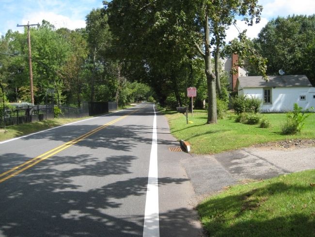
On Myrtle Avenue (U.S. 202) at Main Street (County Route 511), on the left when traveling north on Myrtle Avenue.
Dr. Taylor resided and practised medicine here. Dwelling purchased 1921 by town of Boonton as memorial to World War I veterans. Town Hall until 1965. Headquarters, Post 124, American Legion. — — Map (db m192212) HM
On Main Street (County Route 511) just east of Church Street, on the right when traveling west.
Original Greek Revival dwelling built for commercial use 1849. Purchased for residence 1856 by James Holmes, prominent Boonton citizen. Building enlarged and converted to Holmes Library 1893.
National Register of Historic Places • New Jersey . . . — — Map (db m37923) HM
On Loantaka Way, on the right when traveling north.
William Gibbons, prominent racing patron, built stable to house his thoroughbred racehorses, including Fashion, "Queen of the American Turf". Barn is outstanding example of an early 19th century horse barn. — — Map (db m192217) HM
On Main Street (County Route 124) at University Avenue, on the right when traveling east on Main Street.
During the Revolution, former soldier Shepard Kollock printed the New Jersey Journal on this site “to maintain the cause of freedom” and serve the army in Morristown. The Journal, north Jersey’s only wartime newspaper, founded in 1779, . . . — — Map (db m8878) HM
On Southern Blvd at Fairmount Avenue, on the left when traveling south on Southern Blvd.
Built around 1860 as one room schoolhouse. Served until 1928 as one of four township schools. Renovated as Chatham Township Hall 1959. — — Map (db m8879) HM
On Main Street (New Jersey Route 24), on the right when traveling west.
Federal style structure built for Zephaniah Drake as stage coach stop. Purchased 1854 by William Rankin who added two wings, and converted inn to Chester Institute. — — Map (db m20328) HM
Original gristmill circa 1788. Owned by Elias Howell. Present gristmill built 1826 by Nathan Cooper. Only surviving structure of the industrial community, Milltown, — — Map (db m20322) HM
On Hillside Road, on the right when traveling north.
Congregation, organized 1740. Oldest of this denomination west of the Hudson River. Built 1856. Notable for Greek Revival architecture and rare interior Trompe L'Oeil painting. — — Map (db m23022) HM
On Longview Road, on the left when traveling north.
Home of Martha Brookes Hutcheson, prominent early woman landscape architect who transformed this 18th century working farm into outstanding example of natural and classic landscape design. — — Map (db m33169) HM
A Revolutionary tavern, owned by Colonel Ellis Cook, member of the Morris County Militia. The tavern derived its name from Sussex County farmers who stopped here enroute to Newark markets. Morris County Heritage Commission New Jersey Register . . . — — Map (db m32272) HM
On Old Mt Pleasant Avenue at Hanover Road, on the right when traveling west on Old Mt Pleasant Avenue.
Oldest Religious congregation in Morris County, established in 1718. Relocated at Meeting House here in 1755. Present church built in 1835. — — Map (db m32273) HM
On Eagle Rock Road at River Road, on the right when traveling west on Eagle Rock Road.
Founded 1739. George Washington and Continental Army encamped here, 1777, and 1779 – 1780. Major iron-producing center in the nation during the 19th century. — — Map (db m33487) HM
On Ridgedale Avenue at Columbia Turnpike (County Route 510), on the right when traveling south on Ridgedale Avenue.
Built on site of 1830 wooden school. Present structure predates Florham Park borough by 33 years. Classes held here continuously until 1914. Morris County Heritage Commission New Jersey Register of Historic Places National Register of . . . — — Map (db m36415) HM
On Brooklake Road, on the left when traveling south.
Property acquired by Deacon Gideon Hedges, and still owned by Fish descendants. Farm contracted to supply Continental Army with oats For forage 1779. — — Map (db m43324) HM
On Whippany Road, on the left when traveling north.
Founded by Demas Ford, this village was located on the King’s Road (now Whippany Road) and became a stagecoach stop between Morristown and Whippany. — — Map (db m36410) HM
On Paterson Hamburg Turnpike (New Jersey Route 23) at Northgate Road, on the right when traveling south on Paterson Hamburg Turnpike. Reported damaged.
In this area, Peter Hasenclever built iron works for the “American Company.” Operation of furnace and three forges later managed by John-Jacob Faesch and Robert Erskine. — — Map (db m156028) HM
On Central Avenue, on the right when traveling north.
This planned industrial village, constructed when the railroad was built, included small factories, workers housing, stores, churches, and a school. Silk manufacturing drew skilled immigrants here from Europe and the Middle East. — — Map (db m146722) HM
On Schooleys Mountain Road, on the right when traveling south.
Palatine Germans seeking refuge from war and famine settled here c1740. By 1760 they had established farms and mills as well as Lutheran and German reformed Congregations. Many of the stone houses they built still stand. In July 1918 during World . . . — — Map (db m73488) HM
Near Madison Avenue, on the right when traveling east.
Greek Revival mansion, built by William Gibbons, part of estate, "The Forest". Purchased 1868 by Daniel Drew for Drew Theological Seminary. Mansion named for Roxanne Mead Drew.
New Jersey Register of Historic Places — — Map (db m32994) HM
On Ridgedale Avenue close to Oxford Lane, on the right when traveling east.
Pre-Revolutionary house owned by Josiah Miller. Inherited by his son Luke, Major in the Morris County Militia. Property remained in family until 1889. — — Map (db m36336) HM
On New Jersey Route 24 at Hilltop Road, on the right when traveling west on State Route 24.
Farmhouse home of Ebenezer Byram, one of Mendham's founding fathers. In 1742 opened as tavern to travelers. In continuous operation as hostelry over two hundred years. — — Map (db m18219) HM
On E. Main Street, on the right when traveling east.
Water power and natural resources made this a busy industrial village from the early 18th century through 1900. Visible today are waterways that powered sawmills, grist mills, wagon shops, a glass factory, and cottage industries. — — Map (db m36860) HM
On Hilltop Road at Talmadge Road, on the right when traveling north on Hilltop Road.
The original church chartered in 1745. Served as a hospital for the Continental Army in 1777. The present church was built in 1860. — — Map (db m32997) HM
On West Main Street (New Jersey Route 24), on the right when traveling west.
Lebbeus Dod, Captain of the Morris County Militia during the Revolution; also renowned craftsman noted for his clocks and mathematical instruments. — — Map (db m18218) HM
On U.S. 24 at Roxiticus Road, on the right when traveling west on U.S. 24.
Logan's grist mill supplied food to Washington's troops during Jockey Hollow encampment. John Ralston, early industrialist, occupied the manor house 1786-1819, and operated the general store, subsequently a post office 1892-1941. — — Map (db m18217) HM
On Union Schoolhouse Road at Mosele Road & Pleasant Valley Road, on the right when traveling south on Union Schoolhouse Road.
Built and operated as a one room school until 1928, when students transferred to Mendham Borough School. Remodelled as private dwelling after acquisition by Schiff Scout Reservation, 1941 — — Map (db m16981) HM
On Wahington Valley Road at Schoolhouse Lane, on the right when traveling east on Wahington Valley Road.
Built on site of original 1813 "Brick School". Educated 30-40 children yearly until 1913. Served as a Sunday School 1875-1937. In continuous use as a community meeting place since 1851. — — Map (db m36859) HM
On Long Hill Road, on the right when traveling south.
Built in early 19th century as one room school. Classes held continuously until 1926. Addition added 1910. Since 1928 used as Passaic Township Hall. Public school classes discontinued in 1933. — — Map (db m32987) HM
On Valley Road at River Road, on the right when traveling east on Valley Road.
Founded 1739. George Washington and Continental Army encamped here, 1777, and 1779-1780. Major iron-producing center in the nation during the 19th century. — — Map (db m20153) HM
Original dwelling built by Ebenezer Stiles about 1752. Lighthorsemen quartered here during Revolution. House enlarged 1868 by Jonathan Roberts, founder of Library Association 1881. — — Map (db m33491) HM
On Mt. Kemble Avenue (U.S. 202), on the right when traveling south.
Oldest schoolhouse still standing in Morris township. Addition built in 1899. School held here continuously from 1810-1914. Morris County Heritage Commission — — Map (db m8595) HM
On Mendham Avenue (County Route 510), on the right when traveling west.
Artillery Brigade Cantonment commanded by General Henry Knox hutted near this site during second winter encampment of Continental Army in 1779 – 1780. — — Map (db m9662) HM
On Lafayette Avenue at Kary Way, on the right when traveling west on Lafayette Avenue.
Victorian Italianate house purchased by Augustus Crane 1857. Home until 1971 of Crane- Hone family who contributed greatly to Morristown civic, cultural and business life. National Register of Historic Places New Jersey Register of Historic . . . — — Map (db m36406) HM
On Madison Avenue, on the right when traveling east.
Built during Morristown’s Gilded Age for General Edward Meany, New Jersey Advocate General, 1893, and a Director of American Telephone and Telegraph Company. Architecture reflects English Medieval Castle influence. — — Map (db m42203) HM
On Olyphant Place, on the right when traveling north.
Home of Jabez Campfield, where Alexander Hamilton courted Betsy Schuyler in 1780. Her uncle, Surgeon General of the Continental Army, Dr. John Cochran, quartered here. — — Map (db m7360) HM
On Maple Avenue at Madison Street, on the right when traveling south on Maple Avenue.
Gothic revival building is oldest standing church in Morristown. Replaced 1848 wooden church which ministered to Irish immigrant families in surrounding Dublin area. Morris County Heritage Commission New Jersey Register of Historic Places . . . — — Map (db m32678) HM
On Kahdena Road at Knox Hill Road, on the left when traveling north on Kahdena Road.
Neo-gothic house built by General Joseph Revere, grandson of Paul Revere. Purchased 1881 by Charles Foster, whose daughter, Caroline, donated the property as living farm to Morris County Park Commission in 1973. Morris County Heritage . . . — — Map (db m42209) HM
On Speedwell Avenue (U.S. 202) at Sussex Avenue, on the right when traveling north on Speedwell Avenue.
First Jewish place of worship in Morristown incorporated 1899. Present center, housing synagogue, chapel, Hebrew school and related organizations built by descendants of original congregation. — — Map (db m32673) HM
On Washington Street (County Route 510), on the right when traveling south.
One of the finest examples of public buildings in the Federal style in New Jersey. Original Court House on the Green built in 1755. Morris County Heritage Commission — — Map (db m9689) HM
On Mt Kemble Avenue (U.S. 202) at Macculloch Avenue, on the right when traveling north on Mt Kemble Avenue.
Non-sectarian home for deserving elderly women founded by women members of Morristown Presbyterian Church. In continuous service since 1883. Known as “Old Ladies Home” until present name adopted 1950. Morris County Heritage . . . — — Map (db m33834) HM
Near Lafayette Avenue at Kary Way, on the right when traveling west.
New Jersey’s Revolutionary War powder mill, built near this site by Jacob Ford, Jr. in 1776, supplied critically needed gun powder to the Continental Troops. — — Map (db m42210) HM
On South Street (County Route 124) at Miller Road, on the right when traveling south on South Street.
The churches of Medieval England inspired the design of this gothic revival edifice by architects McKim, Mead, and White. Built 1887 – 1911, it replaced an 1828 structure. Features include English stained glass, a 49-bell carillon, a rood . . . — — Map (db m32676) HM
On DeHart Street, on the right when traveling south.
Monsieur Louis Sansay, French dancing school here. House was site of ball honoring Lafayette in 1825. Later home of General Joseph Revere. National Register of Historic Places New Jersey Register of Historic Places Morris County Heritage . . . — — Map (db m32669) HM
On Cutler Street, on the right when traveling west.
Home of Silas Condict, colonial patriot, and subsequently home of General Joseph Cutler and his son, Augustus, congressman and father of the Free School System. Morris County Heritage Commission New Jersey Register of Historic Places . . . — — Map (db m42204) HM
On W Park Place (County Highway 124) at Market Street, on the left when traveling south on W Park Place.
Site of Morris County's two earliest court houses. The Green, purchased in 1816 from the Presbyterian Church, owned and continuously administered by the trustees of the Morristown Green. — — Map (db m5948) HM
On Washington Valley Road, 0.1 miles west of Mendham Road, on the right when traveling west.
World famous center for training dogs to lead blind persons. Founded in 1929 by Dorothy Harrison Eustis as first dog guide school an United States. Present headquarters built 1965. — — Map (db m36858) HM
On Mills Street, on the right when traveling north.
Oldest house in Morristown on its original site. Home of a patriot, artisan, government official and Presbyterian Elder. Morris County Heritage Commission New Jersey Register of Historic Places National Register of Historic . . . — — Map (db m42205) HM
On Speedwell Avenue (U.S. 202) 0.2 miles north of Cory Road, on the right when traveling north.
Stephen Vail, owner of Speedwell Iron Works, built machinery for S.S. Savannah, first trans-Atlantic steamship, in 1819. His son, Alfred Vail, and Samuel Morse first publicly demonstrated electromagnetic telegraph in 1838.National Register of . . . — — Map (db m32694) HM
On Whippany Road at Woodruff Road, on the left when traveling north on Whippany Road.
Georgian mansion built as summer home by George Frelinghuysen during Morristown’s “Golden Era.” His daughter, Matilda, donated property as arboretum to Morris County Park Commission, 1969. Morris County Heritage Commission New . . . — — Map (db m33180) HM
On Mt. Kemble Avenue (U.S. 202), on the right when traveling south.
1847 Gothic Revival villa, “Mount Kemble,” built for Henry and Frances Duer Hoyt on the site of the house of colonial official Peter Kemble, reluctant host to Continental Army. Renamed “Glen Alpin” by David H. McAlpin in 1885. — — Map (db m8594) HM
On Ladgewood Avenue (New Jersey Route 183) at Main Street, on the right when traveling north on Ladgewood Avenue.
Created in 1846 as the Morris Canal’s Stanhope Reservoir. This lake supplied water that filled the canal and powered local industries. Mules treading an earthen causeway across the lake pulled boats loaded with coal, iron ore, or freight along a . . . — — Map (db m37927) HM
On Village Road at Millbrook Road, on the right when traveling east on Village Road.
Crossroads community, first settled 1727. Contains homes representing Colonial, Greek Revival and Victorian architecture. Additional dwellings include former general store, blacksmith home, academy and Presbyterian Church. Morris County . . . — — Map (db m8880) HM
On Old Parsippany Road, on the left when traveling north.
Revolutionary War refuge Home of William Livngston and his family. Livingston was the first elected Governor of New Jersey. Morris County Heritage Commission National Register of Historic Places New Jersey Register of Historic . . . — — Map (db m229214) HM
Congregation organized 1736 as
Reformed Netherlands Dutch
Church. Original church built
1771. Restored in 1937 after
fire destroyed all but walls.
Notable for Christopher Wren
steeple. — — Map (db m41904) HM
On Newark Pompton Turnpike, on the right when traveling east.
Built by Giles Mandeville for
his bride, Sarah Roome. Later
served as Pompton Plains'
first post office. Since 1953
manse of First Reformed Church — — Map (db m41901) HM
On Route 15 N at Parker Road, on the right when traveling north on Route 15 N.
Established in 1880 as War Department’s first official powder depot. Site of 18th century Mt. Hope Ironworks. Major explosion devastated base 1926. Since 1977 major armament research and development center. — — Map (db m51232) HM
On Church Street at Academy Street, on the right when traveling south on Church Street.
First Meeting House built 1758. During struggle for Independence, church furnished leadership and public forum for patriots. Burying place of General William Winds. Present church built 1832. — — Map (db m43327) HM
In 1778, soldiers ill with small pox were brought here to relieve the overcrowding of the Succasunna Presbyterian Church, then used as a hospital. — — Map (db m33181) HM
Congregation organized 1756. First Meeting House erected about 1760. Used as hospital and arsenal for Continental Army in 1777. Present church built 1853. Burying place of Governor Mahlon Dickerson. — — Map (db m33182) HM
On Long Hill Road, on the right when traveling west.
Pre-Revolutionary center section of building was home of Cornelius Ludlow, Colonel in Eastern Battalion of Morris County Militia, and later Morris County judge. — — Map (db m19590) HM
On Main Street (U.S. 202) at Heritage Ct., on the left when traveling north on Main Street.
Circa 1760 Dutch Stone House where George Washington and Alexander Hamilton stayed June 25-27, 1780, following the Battle of Springfield. French forces under Gen. Rochambeau rested in the orchard August 27, 1781, en route to Yorktown.
. . . — — Map (db m165838) HM
On Church Street, on the right when traveling west.
This village spanning Mt. Olive and Washington Townships arose after Ebenezer Drake bought 200 acres here in 1759. An early tavern closed by the mid-1800s. By 1837 a school, store, and post office served local farm families. The 1855 Methodist . . . — — Map (db m22515) HM
On Mt. Hope Road, on the right when traveling north.
Manor house built by Jacob Ford, Jr. subsequently home of John Jacob Faesch who directed the iron mining operations which provided the Continental Army with ammunition and ordnance. Morris County Heritage Commission New Jersey Register of . . . — — Map (db m192223) HM