On S Barnstead Road (New Hampshire Route 126) north of Gray Road, on the left when traveling north.
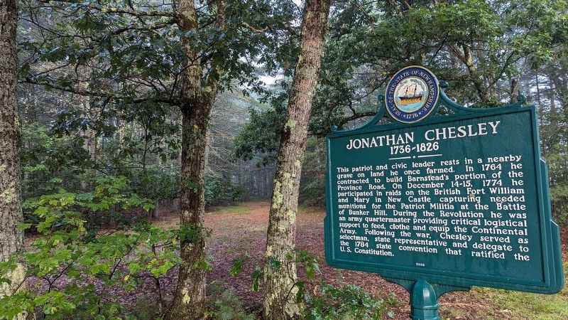
This patriot and civic leader rests in a nearby grave on land he once farmed. In 1764 he contracted to build Barnstead's portion of the Province Road. On December 14-15, 1774 he participated in raids on the British Fort William and Mary in New . . . — — Map (db m235107) HM
On New Hampshire Route 119 at Templeton Turnpike, on the left when traveling south on State Route 119.
In honor and memory of Brigadier General James Reed Born at Woburn, Mass. Jan. 8, 1723 Died at Fitchburg, Mass. Feb 13, 1807 One of the proprietors of Monadnock No. 4, and a founder of this town. A leader in its civil and religious life. . . . — — Map (db m152116) HM WM
On New Hampshire Route 119 west of Templeton Turnpike, on the left when traveling west.
This veteran Captain of the French and Indian War, born in Woburn, Mass., settled here about 1765 as an original proprietor of Monadnock No. 4, now Fitzwilliam. After the Battle of Lexington, he recruited several companies to form the Third New . . . — — Map (db m136527) HM WM
On Main St. (New Hampshire Route 12) at Baker Street, on the right when traveling north on Main St..
Erected by Ashuelot Chapter Daughters of the American Revolution, April 12, 1902, to mark the beginning of the Old Road to Boston, over which the soldiers of the revolution from Keene marched under Captain Isaac Wyman, April 21, 1775, in response to . . . — — Map (db m59828) HM
On Prospect Street (U.S. 3) at Portland Street (U.S. 2), in the median on Prospect Street.
On the site of the
Meetinghouse of the Pioneers
Erected 1784 the Town of
Lancaster builds this
monument in memory of
her citizens who served
in the wars of the Country
“Dulce et Decorum Est Pro Patria Mori”
CIVIL . . . — — Map (db m157329) HM WM
On Darthmouth College Highway at Horse Meadow Road on Darthmouth College Highway.
Born in Boston and a veteran of the 1758 Battle of Ticonderoga. As a known participant in the Boston Tea Party, for his own and his children’s safety, he walked to North Haverhill in early 1774. He later served in the Northern Army under Gen. Gates . . . — — Map (db m77798) HM
On North Park Street at Bank Street, on the right when traveling east on North Park Street.
(right plaque)
In Memory Of
Lebanon Soldiers of the American Revolution
Zalmon Aspinwall • Thomas Baldwin • Rufus Baldwin • Azariah Bliss • Stephen Bliss • Daniel Bliss • Azariah Bliss Jr. • Nathan Bicknell • Samuel Bailey • Ellis . . . — — Map (db m98082) WM
On Main Street (U.S. 3) at Court Street, on the right when traveling south on Main Street.
General John Stark captured this cannon from British troops commanded by General John Burgoyne, on Aug. 16, 1777, at the Battle of Bennington. General Stark's victory was a turning point the Revolutionary War.
The barrel of cannon bears the . . . — — Map (db m243947) HM
On School Street north of Myrtle Street, on the right when traveling north.
Hillsborough dedicates this memorial in recognition of the service rendered by its citizens in the wars of our country 1775 • 1812 • 1846 • 1861 • 1898 • 1917 — — Map (db m152125) WM
On Second New Hampshire Turnpike (New Hampshire Route 31) 0.1 miles north of West Main Street, on the right when traveling north.
The Pierce Homestead was built in 1804 by Benjamin Pierce, a general in the American Revolution, twice governor of New Hampshire (1827-28, 1829-30), and father of Franklin Pierce, the 14th President of the United States (1853-57). Franklin Pierce . . . — — Map (db m83659) HM
On Market Street east of Franklin Street, on the left when traveling east.
"There they are boys!
We beat them today
Or Molly Stark sleeps
A widow tonight!
Design by John Rogers - 1889
Sculpture by Robert Shure
Gift of John Brooks Threfall - 1999 — — Map (db m117677) WM
On Bridge Street at Union Street, on the right on Bridge Street.
Main inscription Brigadier General Kasimir Pulaski Born 1748 Died 1779 Marshall General of Poland
Front Charleston • Savannah • Germantown Side Script Father of American Cavalry • Chief of Dragoons • Continental Army • . . . — — Map (db m96025) HM
On Emmerson Road east of New Hampshire Route 13, on the left when traveling east.
These two Revolutionary soldiers were settlers near here in the town of Monson (afterward Amherst, now Milford). Captain Crosby served with distinction at Bunker Hill and marched in defense of Ticonderoga in 1777 and of Rhode Island in 1778. He . . . — — Map (db m161187) HM
This brass four-pounder, cast in 1743, was captured August 15, 1777 at the Battle of Bennington by Gen. John Stark's troops. Gen. Stark presented "Old Molly" to the New Boston Artillery Company of the 9th Regiment of New Hampshire Militia, for its . . . — — Map (db m225989) HM
On Gen. Miller Highway at Cemetery Lane, on the right when traveling north on Gen. Miller Highway.
Here were buried most of first settlers in Temple including Rev Samuel Webster, Patriot-Preacher. Francis Blood-Moses Child whom Gen. Washington sent on spy mission to Nova Scotia - Ebenezer Edwards who fought at Concord Bridge - First Burial in . . . — — Map (db m235451) HM
On South Stark Highway (New Hampshire Route 114) 0.1 miles south of Orchard Hill Road, on the right when traveling south.
On this site in 1772 stood Aaron Quimby's tavern
where, on the morning of April 14th, Ebenezer
Mudgett and other men from Weare, incensed at their
impending arrest for cutting pine trees greater than
one foot in diameter, in violation of the . . . — — Map (db m230480) HM WM
On NW Road (Route 132) 0.1 miles south of Rum Brook Road, on the right when traveling south.
1741 1820
This tablet marks site of last residence of
Henry Parkinson, A. M.
Nassau Hall, now Princeton University, 1764,
an excellent classical preceptor,
a Patriot of the Revolution.
Regimental Quartermaster under
Colonel . . . — — Map (db m149043) HM WM
On Industrial Drive at S Fruit Street, on the left when traveling east on Industrial Drive.
Lafayette Posts
Between these posts
originally in front
of the State House
General Lafayette
entered the capitol
grounds on his visit
to Concord
June 22, 1825 — — Map (db m140984) HM
On North Main Street at Capitol Street, on the right when traveling south on North Main Street.
Born in Londonderry N.H. Aug 28 1728 Died in Manchester N.H. May 8 1822 Erected by the State of New Hampshire A.D. 1890 Bennington Bunker Hill — — Map (db m77061) HM
On Stark Highway South (New Hampshire Route 13) at New Hampshire Route 77, on the right when traveling south on Stark Highway South.
Built by her father, Capt. Caleb Page, c. 1759,
this was Molly Page's home in her youth and
as the wife of Gen. John Stark. Their first
son, Caleb, who served with his illustrious
father during the Revolution, was born here,
as was Molly''s . . . — — Map (db m130082) HM
On Dover Road (U.S. 202), on the right when traveling west.
Andrew McClary served in the famed Rogers Rangers. He participated in the December 1774 raids on the British Fort, William & Mary in New Castle, at which time powder and munitions were seized. Learning of the pending conflict at Bunker Hill while . . . — — Map (db m96960) HM
On Main Street (New Hampshire Route 114) at Seamans Road, on the left when traveling south on Main Street.
In memory of our citizens who offered their lives to preserve the Union.
Commissioned officers.
General Joseph M. Clough
Major Geaorge W. Everett
Captain Andrew J. Sargent
Captain Samuel M. Carr
Captain Charlew Woodward
Captain MAthew . . . — — Map (db m104575) WM
Side 1:
In memory of the 155 men of Candia who served in the War of Revolution
Killed: Lieut T Dearborn, P Hills
In memory of the 5 men of Candia who served in the French and Indian War of 1756
Side 2: In honor of the 126 men of . . . — — Map (db m105524) WM
On Haverhill Road (New Hampshire Route 121) at Raymond Road (New Hampshire Route 102), on the left when traveling west on Haverhill Road.
Dedicated to the men
of Chester who served
in the war of the
American Revolution.
They served their
country well and faithfully. — — Map (db m159857) WM
On Chester Street (New Hampshire Route 121) at Raymond Road (New Hampshire Route 102), on the left when traveling east on Chester Street.
Isaac Blasdel, 1738-1791, son and father
of clockmakers, settled in Chester in
1762 and commenced manufacturing
one-day, striking, wall and tall-case
clocks with one weight and metal works.
He was an Association Test signer,
Revolutionary War . . . — — Map (db m159909) HM
On North Road (New Hampshire Route 107) at Meeting House Hill Road, on the left when traveling north on North Road.
Born In Deerfield and buried in Old Center Cemetery on road west, he gained fame by the unauthorized firing of the first shot at Bunker Hill while serving as a private in Captain Dearborn's Company of Colonel Start's Regiment. Although . . . — — Map (db m115947) HM WM
On Newfields Road (New Hampshire Route 85), on the right when traveling north.
Born in Andover, Mass. June 21, 1736, Enoch Poor settled in Exeter, becoming a successful merchant and ship-builder. In 1775 he was appointed colonel in the 3rd New Hampshire Regiment. Poor was at Stillwater, Saratoga and Monmouth, and served under . . . — — Map (db m75241) HM
On Front Street at Court Street, on the right when traveling north on Front Street.
The historic Town House of Exeter stood near this site. Here on January 5, 1776, the Provincial Congress adopted and signed the first state constitution thereby establishing an independent state government, the first of the thirteen colonies. The . . . — — Map (db m75242) HM
Built about 1721 as one of New Hampshire’s earliest brick houses, and enlarged and clapboarded in the 1750s, this dwelling served as the state treasury during the Revolution. Here were born John Taylor Gilman (1753-1828), who was elected governor . . . — — Map (db m75243) HM
At this site on the Squamscott river stands the storehouse for the town’s powder used during the American Revolution and the War of 1812. Powder captured from the British at New Castle was stored here and later used at the Battle of Bunker Hill. — — Map (db m41157) HM
On Swasey Parkway, on the right when traveling north.
Directly across the Squamscott river stands the storehouse for the towns powder used during the American Revolution and the War of 1812. Powder captured from the British at New Castle was stored here and later used at the Battle of Bunker Hill. — — Map (db m41158) HM
On Front Street, on the right when traveling north.
Founded by Rev. John Wheelwright in 1638, Exeter was one of the four original towns in the colony. Following New Hampshire’s provisional declaration of independence on January 5, 1776, it served as the capital of the new state during the period of . . . — — Map (db m75244) HM
On Main Street (New Hampshire Route 107) 0.2 miles north of Scribner Road, on the left when traveling north.
Buried here are prominent NH Gunsmiths John & Andrew Brown; Pioneer Surgeon Laura (Fellows) Noyes; Austin Wiggin founder & father of the 1960's all-girl Shagg's Band; 1940's Baltimore Colts football player Carmen Ragonese; Politicians Stephen A. . . . — — Map (db m115817) HM
On Main Street (New Hampshire Route 107) south of Sandown Road, on the right when traveling south.
(side 1)
Historic Black Rocks Village
Settled in the 1720's this section of Poplin, (now Fremont) between Scribner Road & Rowe's Gas Station at 225 Main Street, gradually grew into a thriving settlement called "Black Rocks . . . — — Map (db m115780) HM
On Main Street (New Hampshire Route 107) at Sandown Road, on the right when traveling north on Main Street.
This old Inn/Tavern is one of the most historic landmarks in Fremont.
The first Poplin (now Fremont) Town Meeting was held here at Lovering's Inn on August 27, 1764, as were many other Town Meetings.
The towns' name was changed from Poplin . . . — — Map (db m115814) HM
On West Main Street, on the right when traveling north.
Distinguished participant in the founding of the Republic as signer of the Declaration of Independence and Articles of Confederation, and prominent in this State as Chief Justice of two courts and first holder of the title of Governor. An innovator . . . — — Map (db m75245) HM
In commemoration of the first victory of the American Revolution the capture on this site of Fort William and Mary 14-15 December 1774
In Admiration of the gallantry of Capt. John Langdon and Maj. John Sullivan Leaders of the . . . — — Map (db m85341) HM WM
Near Sullivan Lane, 0.2 miles east of Wentworth Road.
Replaced by the New Hampshire Daughters of the American Revolution commemorating the capture of the fort by New Hampshire Patriots December 14, 1774. — — Map (db m135324) HM
On Wentworth Road at Ocean Street, on the right when traveling west on Wentworth Road.
December 14-15, 1774, several hundred
men overpowered the small British
garrison at Castle William & Mary,
now Fort Constitution, New Castle,
and removed quantities of military
supplies. These raids, set off by
Paul Revere's ride to Portsmouth . . . — — Map (db m85343) HM WM
Upon invitation of President Monroe, issued at the request of the Congress, Marquis de LaFayette, Revolutionary War hero, revisited the United States for a goodwill tour which included an extensive visit to New Hampshire towns. He passed this spot . . . — — Map (db m77815) HM
On Raymond Road (New Hampshire Route 156) at Ledge Farm Road, on the right when traveling north on Raymond Road.
The Town of Nottingham was created by a Royal Charter in 1722. A plan of the town was completed in 1724; at that time the design of the Nottingham Square was laid out with house lots and the intersecting streets Bow, Fish, King and North. The . . . — — Map (db m235102) HM
On this site were leased lots provided by the North Church Parish dating from 1709. One such parcel was the home of Hunking Wentworth, Chairman of the Committee of Public Safety and zealous patriot on behalf of the American Revolution. The site was . . . — — Map (db m76460) HM
On Atkinson Street at Court Street on Atkinson Street.
In the midst of the American Revolution in 1777, James, enslaved by tavern owner John Stavers, was ordered to stop a zealous patriot from chopping down the tavern sign. Although James nearly killed the man, it was his owner, a suspected Tory, who . . . — — Map (db m115986) HM
On State Street (U.S. 1) at Court Place, on the right when traveling north on State Street.
In 1717 Portsmouth's first identified black family was baptised by South Church.
Baptisms of enslaved people became more frequent in local churches; black marriages, however, were not included in town records until the Revolutionary Era, when . . . — — Map (db m115979) HM
Near State Street north of Marcy Street, on the right when traveling north.
The revival of Portsmouth’s commerce after the American Revolution spurred the development of new roads, bridges, and wharves. In 1795, several leading merchants incorporated as the Proprietors of the Portsmouth Pier.
This private company . . . — — Map (db m116003) HM
Prince, enslaved by General William Whipple and his wife Katharine Moffatt, accompanied the general through several battles of the American Revolution but was not freed until 1784. In 1779, however, Prince and Winsor were two of twenty African-born . . . — — Map (db m115985) HM
On Middle Street (U.S. 1) north of State Street, on the right when traveling north.
On Rindge’s Wharf, Portsmouth,
May 21, 1776,
six weeks before
The Declaration of Independence,
there was launched
The Continental Frigate “Raleigh,”
the First
American Man-of-War
built on the Piscataqua,
keel laid . . . — — Map (db m115998) HM
On Boston Harbor Rd. (U.S. 4 at milepost 101.6), on the right when traveling east.
A Revolutionary patriot, soldier, and adopted son of Durham, N.H., Alexander Scammell served with distinction through six years of the war from Bunker Hill to Yorktown, where he was wounded, captured, and died six days later, Oct. 6, 1781. Born in . . . — — Map (db m74582) HM WM
On Newmarket Road (New Hampshire Route 108), on the left when traveling west.
Revolutionary patriot, soldier, politician, first Grand Master of Masons in New Hampshire, and a resident of Durham. He left the Continental Congress to serve under Washington from Cambridge to Valley Forge. Commanded at Rhode Island in 1778, and . . . — — Map (db m96438) HM
The plaque commemorates the 200th anniversary of the first organized fight of the Revolution and the transport by gundalow of gunpowder taken from the British at Fort William and Mary in New Castle on Dec. 14, 1774, concealed at this spot and . . . — — Map (db m96441) HM
On Main Street (SR 12) at Elm Street on Main Street (SR 12).
To impede a British invasion from Canada into eastern New York, the New Hampshire legislature on July 19, 1777, commissioned John Stark of Derryfield to recruit and lead a force of 1500 New Hampshire militiamen. At Charlestown’s Fort No. 4, forces . . . — — Map (db m74585) HM
On Main Street (New Hampshire Route 12) north of Olcott Lane, on the left when traveling north.
Front Panel This American Liberty Elm was named after "The Liberty Tree: Our Country's first Symbol of Freedom." On the morning of August 14, 1765, the people of Boston awakened to discover two effigies suspended from an elm tree in protest . . . — — Map (db m66280) HM
On Opera House Square at Pleasant Street (New Hampshire Route 11/12), in the median on Opera House Square.
On June 27, 1825, General Lafayette was greeted by crowds & 13 gun salute. He stayed at Stevens' Hotel, and left the next morning for VT. — — Map (db m230224) HM