Near West Academy Street west of South Main Street, on the left when traveling west.
The Single Brothers' Diaconie, or business organization, played a major role in the economy of Salem. Their operation was vast, stretching before you to the west, and included the Single Brothers' House (1769) and the large log workshop (1771), . . . — — Map (db m172062) HM
On South Church Street just north of Race Street, on the right when traveling north.
The only gravestone not removed during the 1913 landscaping was Squire's, which archaeologists discovered in place. Squire, an enslaved African American, was digging a well near the wool factory that was built for land owned by Moravian . . . — — Map (db m172105) HM
On South Broad Street at Wachovia Street, on the right when traveling south on South Broad Street.
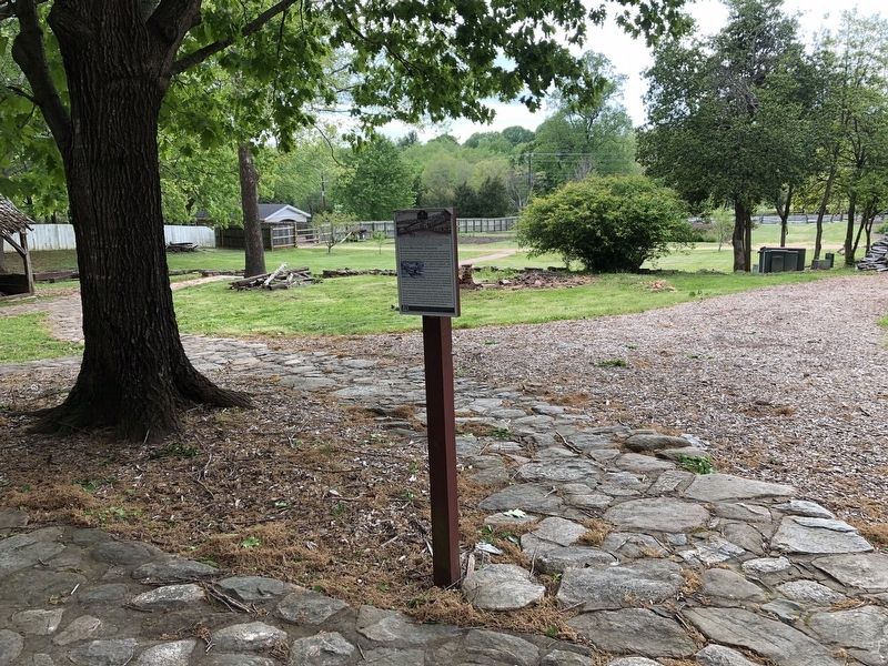
St. Philips Moravian Church is the only historic
African American Moravian church in the United
States. Christian outreach to enslaved people in and
around Salem was initiated by the Salem Female
Missionary Society. The “Negro Congregation” . . . — — Map (db m239161) HM
On South Church Street just north of Race Street, on the right when traveling north.
What began as the Parish Graveyard was extended westward to the street and designated in 1816 as the resting place for all African Americans, Moravian or not, who died in and around Salem. From that date forward, all Christian whites were then . . . — — Map (db m172103) HM
On Alder Street at Mock Street, on the left when traveling south on Alder Street.
The Brothers' Spring, located down this slope, provided clean water, an important campsite, and a recreational park in the 18th and 19th centuries. On this hill in 1867, freedmen of the area and the Salem African Church (St. Phillips Moravian) . . . — — Map (db m136558) HM
On South Church Street just north of Race Street, on the right when traveling north.
During the early nineteenth century much of the landscape south of St. Philips Church was undeveloped or used for agricultural purposes. Beyond Salem Creek, which can still be seen running through Central Park, was Shuman's Plantation. This . . . — — Map (db m172118) HM
On Second Street at North Main Street, on the left when traveling east on Second Street.
This site marks the location where Thomas J. Wilson built the first home in what would become the town of Winston. Wilson had received permission from the Moravian Church in 1847 to erect his dwelling north of Salem's central area, as he wanted to . . . — — Map (db m98780) HM
On Bethabara Road, 0.1 miles south of Bethania Station Road, on the right when traveling south.
In 1756, three years after their arrival in Wachovia, the Moravians completed construction on the first Gemeinhaus in Bethabara. This log structure not only served as a worship space, but also as a meeting space for the community and a place of . . . — — Map (db m234124) HM
Near Mountain Island Highway (State Highway 273) at Sandy Ford Road (County Highway 1918), on the left when traveling north.
Dedicated in 1843 by Bishop I.A. Reynolds, D.D. of the Diocese of Charleston, South Carolina
St. Joseph's is the oldest standing Catholic Church in the state of North Carolina. — — Map (db m156457) HM
On U.S. 15 (U.S. 15) at Stovall Road (Local Route 1506), on the left when traveling north on U.S. 15.
Presbyterian minister, legislator, author of textbooks. Served many churches in Virginia & North Carolina. Home & school ¼ mile West. — — Map (db m219636) HM
On East McClanahan Street east of College Street (U.S. 15), on the right when traveling east.
In loving memory of Katherine Blount Skinner Lassiter (1826–1903) and of those who in this home lived under her Christian influence and in the shadow of old Saint Stephen’s Church during the days of the War Between the States, this house is . . . — — Map (db m222545) HM
On Main Street just north of East Spring Street, on the right when traveling north.
This property
has been placed on the
National Register
of Historic Places
by the Untied States
Department of the Interior
Oxford Baptist Church
1928 — — Map (db m181042) HM
On Salem Road (County Road 1552) 0.3 miles east of Huntsboro Road (County Road 1521), on the left.
Salem United Methodist Church
built in 1860
has been placed on the
National Register
of Historic Places
by the United States
Department of the Interior
— — Map (db m219622) HM
On Holts Store Road east of Brick Church Road, on the left when traveling east.
Originally German Reformed. Now United Church of Christ. Served in 1759 by James Martin. This church was begun in 1813 and was remodeled in 1840. — — Map (db m216920) HM
On Presbyterian Road just north of Millpoint Road, on the left when traveling north.
First Alamance Church building about) 1762 - about) 1800. Second Alamance Church building about) 1800 - 1844.
In the church on this spot, the Presbyterian Synod of North Carolina was organized Oct. 7th, 1813. — — Map (db m175453) HM
On Odell Place just west of College Place, on the right when traveling west.
Built 1907 by Rev. Walter Makepeace Curtis (b. 1867 - d. 1955) Secretary-Treasurer and Business Manager of Greensboro College from 1905 - 1939 — — Map (db m219363) HM
On Martin Luther King Junior Drive at E Bragg Street, on the right when traveling north on Martin Luther King Junior Drive.
[ Upper Marker ]
Dr. Martin Luther King, Jr.
by Wilbur Lee Mapp
1994
[ Main Marker ]
Dr. Martin Luther King, Jr., planned to speak at Trinity AME Zion Church in Greensboro (a few blocks from here) on April 4, 1968. He canceled his . . . — — Map (db m219603) HM
On Battleground Avenue just north of West Smith Street, on the right when traveling north.
Crisscrossed by a stream and swampy valley, and with limited access to the central hub of Elm Street, the area that is now known as Fisher Park remained undeveloped until the late nineteenth century.
Fisher Park is named for Captain Basil . . . — — Map (db m219364) HM
On Presbyterian Road, 0.1 miles south of Millpoint Road, on the right when traveling south.
There were Presbyterians in North Carolina from the earliest days of the Colony. The most numerous groups, the Scots-Irish and the Highland Scots, arrived in large numbers during the 18th century. The former settled largely in the Piedmont and . . . — — Map (db m216363) HM
On South Elm Street north of West McGee Street, on the left when traveling north.
(side 1)
Original Methodist Church
1831
Here in 1830-31, 64 Methodists led by Peter Doub built the first church in Greensboro. Moving to a second church on West Market Street in 1851, the congregation relocated a third and final . . . — — Map (db m35093) HM
On Summit Avenue, 0.2 miles south of East Lindsay Street, on the left when traveling south.
On this site, members of the First Presbyterian Church of Greensboro built their first house of worship in 1832, and on the adjacent land citizens of Greensboro erected the first graded public school in North Carolina in 1875. These grounds and the . . . — — Map (db m54095) HM
On Washington Street at Hobson Street, on the right when traveling west on Washington Street.
Here stood the First Baptist Church from 1907
to 2015. Born in the midst of Reconstruction,
galvanized in the heat of forced racial divide,
and often blistered by the minds of social
oppression, it stood firm. Over the course of
its history it . . . — — Map (db m234024) HM
On Washington Street at Day Place, on the left when traveling east on Washington Street.
In 1891, the New York Yearly Meeting of the
Religious Society of Friends (Quakers) moved
their Normal School from Asheboro, North
Carolina to High Point, North Carolina. High
Point Normal and Industrial Institute was a
private, co-educational . . . — — Map (db m234101) HM
On Extraordinary Way, 0.3 miles west of Montlieu Avenue, on the right when traveling west.
This marker contains brick from the Jamestown Female College opened by the Methodist Protestant Church, Jamestown, N.C. 1859 and destroyed by fire 1861. — — Map (db m175464) HM
On Underhill Street just north of East Washington Drive, on the right when traveling north.
John Coltrane (b.1926 - d.1967), world renowned jazz saxophonist and composer of the suite "A Love Supreme", lived with his extended family at 118 Underhill St. from 1928-1943. His family was headed by his maternal grandfather, Rev. W.W. Blair, who . . . — — Map (db m172052) HM
On Model Farm Road at Baltimore Street, in the median on Model Farm Road.
Established by Quakers 1867 to stem westward migration by promoting improved agricultural practices. Tract, sold in 1891, was ½ mi. E. — — Map (db m216186) HM
On East Lexington Avenue at Terrell Drive, on the left when traveling east on East Lexington Avenue.
Colonial home of Mary and Philip Hoggatt A Quaker Potter Typical example of a Pre-Revolution home Built in Guilford County ca. 1754 In continuous use until the 1960's. — — Map (db m213709) HM
On Taylor Avenue just west of Gordy Place, on the right when traveling west.
An American nonviolent Civil Rights activist and preacher, one of the original 13 Freedom Riders while Pastor 1958-1968 of Pilgrim Congregational Church located originally ½ block east. — — Map (db m175494) HM
On South Main Street (North Carolina Route 1993) at East Fairfield Road (North Carolina Route 610), on the right when traveling north on South Main Street.
Established in 1773 and organized as a Monthly Meeting, 1790. Building erected 1927 on original site is ½ mile east. — — Map (db m216185) HM
On East Lexington Avenue near Terrell Drive, on the left when traveling east.
Philip & Mary Hoggat built this house in 1754, 4 miles southwest of here. The Hoggats were among the first Quakers to move to this area. Donated by Mrs. Betty Jo Kellam, the cabin was relocated to this site in 1973 & restored with funds from the . . . — — Map (db m213711) HM
On Extraordinary Way, 0.3 miles west of Montlieu Avenue, on the right when traveling west.
A Methodist Protestant institution awarded degrees and diplomas, conducted until said churches opened High Point College.
Builders
First campus and building donated by Hon. Henry Walser, founder, 1856; furnishings by D.L. Michael. . . . — — Map (db m175463) HM
Near W Parkside Drive, on the left when traveling north.
This Quaker place of worship, built by the Mendenhall family around 1819, was used when bad weather made the one-mile trip to Deep River Fiends Meeting House impossible. It is located on its original site, across from Mendenhall Plantation. The . . . — — Map (db m34704) HM
On Oakdale Road, 0.1 miles south of Oak Village Drive, on the right when traveling south.
Oakdale United Methodist Church began as a brush arbor meeting at the entrance to the mill village, built by members of the community. After the Little Schoolhouse was built in the early 1880's, the church met here there. In 1915, a church was built . . . — — Map (db m98613) HM
On State Highway 68 just north of Alcorn Road, on the right when traveling north.
A church has existed here since the early 1800s. Constructed as a one-room church in 1901 and expanded to cruciform structure in 1929. Ai refers to Old Testament hilltop Canaanite royal city. Adjacent cemetery includes 1819 grave of Nathan Dillon, . . . — — Map (db m246370) HM
On Oak Ridge Road (State Highway 150) 0.2 miles east of State Highway 68, on the right when traveling east.
Constructed by ORMA President T.E. Whitaker chapel to replace origînal (1884) destroyed by fire in early 1914. Like Alumni Hall, the Chapel features a Classical pedimented portico with Ionic columns and a lunette window. Named for R.N. “Buster” and . . . — — Map (db m181193) HM
On Oak Ridge Road (State Road 150) 0.1 miles east of Sandylea Road, on the right when traveling south.
Church site purchased in 1889 by Oak Ridge's oldest African-American congregation. Sanctuary served as classroom for African American students until a schoolhouse was built next door c. 1915. Indoor plumbing and fellowship hall added in 1980s. . . . — — Map (db m234041) HM
On Scalesville Road at Mound Road, on the left when traveling west on Scalesville Road.
Founded in 1840, Peace United Methodist
Church was a Quaker “Sabbath School” for
freed slaves. Later purchased by the Northern
Methodist Conference, it was given to the local
congregation, which birthed Laughlin School.
The black and white . . . — — Map (db m234117) HM
On North Carolina Route 561, 0.8 miles east of North Carolina Route 48, on the left when traveling east.
Methodist Protestant minister. President of the General Conference, 1866. Head of Halifax Male Academy & Elba Female Seminary. Grave here. — — Map (db m220890) HM
On North Carolina Route 481 east of Woodridge Road, on the right when traveling west.
Early Methodist Protestant minister; educator; and soldier in the Revolution. Founded Bradford's Church on this site circa 1792. — — Map (db m221527) HM
On Thirteen Bridges Road, 0.4 miles east of Douglas Hill Farm Road, on the right when traveling east.
Originally Anglican, 1740; later Methodist. In 1828 first annual conference of Methodist Protestant Church met here. This is third building on site. — — Map (db m221585) HM
On North Carolina Route 481 at Gravel Pit Road, on the left when traveling east on State Route 481.
Established as Anglican 1747; James Moir first priest. Became Baptist 1783; inactive since 1933. Present building, 1849, moved 1 mi. S.W. In 1878. — — Map (db m221581) HM
On King Street at Market Street, on the right when traveling north on King Street.
In 1793, the first Halifax church was built at this location. The Free Church was open to all denominations. Services were held until the 1850’s when congregations began to build their own churches. In 1911 the church fell in disrepair and . . . — — Map (db m222096) HM
Near West Commerce Street at North Poplar Street, on the right when traveling west.
This church was built in the 1880's as a Methodist "Meeting House" at Hobgood Fork. When the Village of Hobgood was incorporated in 1891, a corner of E.P. Hyman's garden was designated as a permanent site for the Methodist Church. The church . . . — — Map (db m227069) HM
On Lake Logan Road (State Road 215) at Friendly House Road (State Road 1128) on Lake Logan Road.
Founded 1868. Oldest
Universalist church in
western N.C. Hannah J.
Powell led mission work
and school, 1921-42, at
site 100 yards south. — — Map (db m229442) HM
On Locust Street at Pennsylvania Avenue, on the left when traveling south on Locust Street.
The first Locust Old Fields Baptist Church was established here in 1803. It was among the first churches established west of Asheville. Although the original building no longer stands, it served the small community here for many years as a house of . . . — — Map (db m75504) HM
On Carolina Boulevard (U.S. 23) at Morgan Street on Carolina Boulevard.
Home of Jacob Shook and Preaching place of Francis Asbury, pioneer bishop of American Methodism. "After crossing other streams, and losing ourselves in the woods, we came in about 9 o'clock at night to Vater Shuck's. What an awful day!"
Asbury's . . . — — Map (db m33716) HM
On Big Creek Park Road at Mount Sterling Road (County Route 1397), on the left when traveling south on Big Creek Park Road.
Francis Asbury, first elected Bishop of Methodism in the U.S.; rode on horseback over 275,000 miles over pioneer trails averaging one sermon a day. From New England to Charleston, S.C. More than 60 times he crossed the Appalachians. Once following . . . — — Map (db m90574) HM
On Russ Avenue (U.S. 276) at Maple Grove Church Road, on the right when traveling north on Russ Avenue.
Founded 1865 by Capt. John Turpin, CSA (NC)-POW
Non-denominational until 1885. Became Turpin's
Chapel MEC (South) 1885. Name changed to Maple
Grove MEC (South) 1912. Became Maple Grove Methodist Church 1949 and Maple Grove United Methodist Church . . . — — Map (db m19734) HM
On Hendersonville Road (State Highway 25) at Old Calvary Road on Hendersonville Road.
One of the oldest Churches in
Western North Carolina
Organized 1857 - Built 1859
Consecrated by the Rt. Rev. Thos. Atkinson
Bishop of North Carolina
August 21, 1859
During the Civil War this church was used as
barracks by Confederate . . . — — Map (db m12883) HM
On Old Airport Road (Route 1547) near Henderson Road (U.S. 25), on the left when traveling east.
In Loving Memory
George Westfeldt
A member of Calvary Episcopal Church
Fletcher, N.C.
to whom
Sidney Lanier
a visitor here
beloved poet of the South
dedicated his last poem, "Sunrise,"
"Send him my sunrise, That he may know How . . . — — Map (db m81018) HM
On Fleming St. at 6th Ave. (U.S. 64), on the right when traveling south on Fleming St..
Baptist. Chartered in 1861 as Judson Female College; later coeducational. Operated 1882-1892 in building which stood three blocks S.W. — — Map (db m12418) HM
On Brevard Road (U.S. 64) at Campground Road (County Highway 1311), on the left when traveling east on Brevard Road.
Methodist. Congregation was organized at a camp meeting ca. 1810, on land donated by
James Johnston. Church, 1905, is .3 mi. N. — — Map (db m156272) HM
On Laurinburg Road (U.S. 401) at John Russell Road (County Road 1207), on the right when traveling west on Laurinburg Road.
General Sherman, with a part of his army, on March 9-10, 1865, camped here at Bethel Presbyterian Church (organized before 1800). — — Map (db m31255) HM
On Little Wilkesboro Road at Tomlinson Avenue, on the left when traveling north on Little Wilkesboro Road.
A two-week camp meeting was organized here as early as 1846 by North Iredell Protestants.
It continues today on the second Sunday in October as a one-day event.
Harmony School is built on the original site. — — Map (db m55345) HM
On Centre Church Road (State Road 1245) 0.1 miles south of Fairview Road, on the right when traveling south.
The History of Centre Presbyterian Church Centre Church was organized in 1765 and held meetings at Osborne's Meeting House. This new congregation's mission was centrally located between five other missions: Sugar Creek, Hopewell, Fourth Creek . . . — — Map (db m237253) HM WM
Near McKendree Road at Fulton Farms Lane, on the right when traveling south.
The Library of Congress, Washington, D.C. records that His Excellency Governor Thomas Mayhew, born 1593 Tisbury, England, who was the English Crown Governor of the Elizabeth Island chain including Martha's Vineyard and Nantucket islands off the . . . — — Map (db m237235) HM
On State Highway 115 at Bailey Farm Road, on the right when traveling north on State Highway 115.
A school established about 1778 by the Rev. James Hall. Trained many prominent men. Closed about 1787. Was a few hundred yards E. — — Map (db m51207) HM
On East Sharpe Street at South Tradd Street, on the right when traveling east on East Sharpe Street.
[Top plaque]
This property has been
placed on the
National Register
of Historic Places
by the United States
Department of the Interior
[Bottom plaque]
St. Philip the Apostle
Catholic Church
1898-1956 . . . — — Map (db m237112) HM