On Front Street near South 5th Avenue, on the right when traveling north.
The Northern Pacific Railroad surveyed along the north side of the Yellowstone River during the summers of 1871 and 1873, a time when the still-powerful Lakota controlled the unceded land south of the river. A a result, the survey crews required . . . — — Map (db m188744) HM
On Old Highway 10 near Smith Creek Road, on the left when traveling west.
When General Terry, Custer and Gibbon met on the steamer Far West to coordinate the final plan of action against the hostiles, it was decided that the Indians were probably camped along the Little Bighorn. Custer was to lead the Seventh Cavalry to . . . — — Map (db m165235) HM
On Rosebud Creek Road (County Road 447) at Snider Creek Road, on the left when traveling south on Rosebud Creek Road. Reported unreadable.
In the aftermath of the Rosebud and Little Bighorn battles, both Generals Terry and Crook withdrew to their respective base camps waiting for additional troops and supplies. Even though the commands were only about 100 miles apart, communication . . . — — Map (db m189247) HM
On Main Street near River Road, on the right when traveling west.
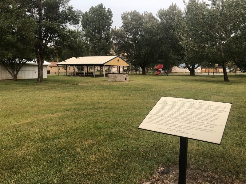
At noon on June 22, 1876, the Seventh Cavalry under the command of Lieutenant Colonel George Armstrong Custer began its ill-fated march to the Little Bighorn near this location.
General Alfred Terry, having ordered a parade review send-off for . . . — — Map (db m189167) HM
On Rosebud Creek Road (County Road 447) 9 miles south of Interstate 94, on the left when traveling north.
At noon, on June 22, 1876, Lt. Colonel George Armstrong Custer's command broke camp along the Yellowstone River, passed in review of General Terry and Colonel Gibbon, and marched to the mouth of Rosebud Creek. The Seventh Cavalry then proceeded . . . — — Map (db m189172) WM
On Rosebud Creek Road (County Road 447) 4 miles south of Interstate 94, on the left when traveling north.
In 1886, ranchers buried near here what many believe to be the remains of Private Nathan Short, Co. C, 7th U.S. Cavalry. Short was believed to be carrying a message from General Custer at the Battle of the Little Bighorn, 7 miles S.W, of this point . . . — — Map (db m189169) HM
A few days after the Custer disaster on June 25, 1876, General Alfred Terry moved the decimated Seventh Cavalry to Fort Pease on the Yellowstone waiting nearly a month for additional troops and supplies.
By late July, the steamboats contracted . . . — — Map (db m164626) HM
Near Interstate 94 at milepost 117 near Graveyard Creek Road, on the right when traveling west.
From July 28, 1806, when William Clark passed Rosebud Creek on his way down the Yellowstone, this river valley has served as one of the major avenues for development and trade in eastern Montana. Innumerable trappers and traders followed Clark's . . . — — Map (db m164409) HM
In June 1876, the column of General John Gibbon and Lieutenant Colonel George Armstrong Custer, both under the command of General Alfred Terry, met near here at the mouth of Rosebud Creek aboard the steamer Far West. They were under orders to . . . — — Map (db m164624) HM
On Frontage Road/Old Highway 10 near Interstate 94, on the left when traveling west.
Beginning in early May, 1876 when the Lakota ran off about thirty horsed belonging to the Crow scouts, patrols from the Montana Column reported Indian sightings almost every day from the Big Horn River on down to Rosebud Creek. All signs indicated a . . . — — Map (db m164542) HM
On East 1st Avenue (State Highway 16/5) 0.3 miles east of Lavalley Street, on the right when traveling east.
Sitting Bull was a great American Indian and Statesman. He struggled to keep his people free and united by fleeing with them into Canada. Louis Legare, a French trader and Sitting Bull’s friend, persuaded him to return to the United States and . . . — — Map (db m202834) HM
Near Interstate 90 at milepost 419, on the right when traveling west.
Fighting escalated between the Lake and Northern Cheyenne Indians and American miners and settlers in early 1876. Increasing pressure from non-Indians in the region, coupled with a desire by the Indians to live free on the northern Great Plains, . . . — — Map (db m190923) HM
On Interstate 90 at milepost 419, on the right when traveling east.
Fighting escalated between the Lake and Northern Cheyenne Indians and American miners and settlers in early 1876. Increasing pressure from non-Indians in the region, coupled with a desire by the Indians to live free on the northern Great Plains, . . . — — Map (db m190928) HM
On U.S. 2 at milepost 283 near Kraft Road, on the left when traveling east.
On January, 23, 1870, soldiers commanded by Colonel Eugene Baker killed 173 Blackfeet Indians in a surprise attack on Heavy Runner's camp near here on the Marias 1869. A man of peace, Heavy Runner had no quarrel with the US Army. His people did not . . . — — Map (db m161387) HM
On Old Highway 10/Sitting Bull Avenue near Big Horn Road, on the left when traveling west.
As late as mid-June 1876, the military still considered Tullock's Creek as a possible location for the big Indian village even though most of the planning by General Terry and Custer a few days prior to the battle focused on the Little Big Horn . . . — — Map (db m165443) HM
On Elliot Avenue at Division Street, on the left when traveling west on Elliot Avenue.
Fort Pease was established in June of 1875 a few miles below the mouth of the Bighorn by Bozeman businessmen speculating that the fort would serve as the head of steamboat navigation on the Yellowstone.
For much of the winter of 1875-76, the . . . — — Map (db m165326) HM
Near Myers Road (State Highway 311) near Old Myers Road, on the right when traveling west.
Custer's first skirmishes with the Lakota occurred along the Yellowstone River during
the summer of 1873. At this time the Seventh Cavalry was assigned to Colonel David Stanley command to protect Northern Pacific railroad surveyors operating on the . . . — — Map (db m189442) HM
On Old Highway 10 near Cole Lane, on the left when traveling west.
When William Clark passed through this area on July 27, 1806, he described "estonishingly noumerous" bison and elk as well as his last glimpse of the snow-clad Big Horn Mountains. Most importantly, his report of abundant beaver "sign" quickly drew . . . — — Map (db m165322) HM
On 6th Avenue Bypass, 0.1 miles south of E. Airport Road, on the left when traveling south.
Named Boothill because so many of its occupants went to their deaths with their boots on, this cemetery was the burying ground for Coulson, Yellowstone River town existing from 1877-1885 on the edge of what was to be Billings. Most famous buried . . . — — Map (db m28939) HM
On Montana Avenue (Business Interstate 90) near North 22nd Street, on the right when traveling east.
Born in 1849 in Geneva, New York, Luther Sage "Yellowstone Kelly was a trapper, hunter, and guide in Montana during the 1860s and 1870s. He also served as a military scout and hunter during the United States' campaign against the Indian tribes of . . . — — Map (db m168012) HM
On Chief Black Otter Trail near Rimtop Drive, on the right when traveling south.
(Twelve panels make-up this marker. The kiosk where this marker is found has three sides. On each side there are four panels. Panels are present clockswise beginning at the upper left.)
Luther Sage Kelly, 1870s.
. . . — — Map (db m167406) HM
Near Chief Black Otter Trail near East Airpot Road, on the right when traveling east.
Born on July 27, 1late 1860s and 1870s. Kelly, a native of Geneva, New York, is best known as an army scout during the Army's closing campaign against the nomadic Indian tribes of the Northern Plains.
Always a restless spirit, Luther S. Kelly . . . — — Map (db m166850) HM
On Montana Avenue (Business Interstate 90) near North 22nd Street, on the right when traveling east.
This famous battle pitted federal troops of the U.S. Army's 7th Cavalry, led by Lt. Colonel George Armstrong Custer, against Lakota (Sioux), Northern Cheyenne, and Arapaho warriors. Custer and his command of 259 men were soundly defeated. "Custer's . . . — — Map (db m168088) HM
On Montana Avenue (Business Interstate 90) near North 23rd Street.
The ancestral relatives of the Northern Cheyenne, the Tsitsistas and Suhtai, merged as one tribe in the 1700s. The unified Cheyenne made their home in the Dakotas and Northern Plains. After signing of the 1825 Friendship Treaty, U.S. armed forces, . . . — — Map (db m168091) HM
On Montana Avenue (Business Interstate 90) near North 23rd Street, on the right when traveling east.
The Nez Perce (Nee-Me-Poo) National Historic Trail marks the path of U.S. soldiers pursuing Chief Looking Glass and Chief Joseph of the Nez Perce during the summer of 1877. Treaties forced bands of Nez Perce from their homes In Idaho and Oregon. . . . — — Map (db m168015) HM
On 8th Street near 4th Avenue, on the right when traveling south.
By mid-April 1876, Colonel John Gibbon's most immediate concern was crossing to the north side of the Yellowstone before reaching the confluence of the Bighorn River. Plans called for the Montana Column to patrol the lower Yellowstone from the . . . — — Map (db m165445) HM
On Interstate 94, on the right when traveling east.
The mouth of the Bighorn River as it enters the Yellowstone, 13 miles east of here, is one of the most significant areas in Montana history.
The Crow Indians knew the Yellowstone as the Elk River. French explorers called it the
la Roche . . . — — Map (db m163404) HM
Near Interstate 94 at milepost 41, on the right when traveling west.
The area that surrounds the mouth of the Bighorn River as it enters the Yellowstone 13 miles east of here is one of the most significant areas in Montana history.
The Indians knew the Yellowstone as the Elk River. French explorers called it . . . — — Map (db m165450) HM
On Lipp Road at Buffalo Trail Road, on the right when traveling north on Lipp Road.
As soldiers and warriors exchanged fire here at the Canyon mouth, most of the Nez Perce were escaping up a side canyon to the plateau above. The US Army incurred too many casualties to pursue. At the base of the butte near the cottonwoods they . . . — — Map (db m154002) HM WM
On Lipp Road at Buffalo Trail Road, on the right when traveling north on Lipp Road.
In the distance the US Army troops were approaching at a gallop in pursuit of the Nez Perce. After fleeing for 26 miles, the Nez Perce chose this place to make a stand because of the canyon mouth offering natural defenses. Positioned high on the . . . — — Map (db m154003) WM
On Buffalo Trail Road at Lipp Road, on the right when traveling north on Buffalo Trail Road.
Soldiers were elements from the Seventh and First Cavalry and the Fourth Artillery. Col. Samuel Sturgis commanding. Casualties; Three dead, eleven wounded.
Indians engaged wee the Nez Perce triple, escaping from their reservation and fleeing to . . . — — Map (db m190839) HM
On Lipp Road at Buffalo Trail Road, on the right when traveling west on Lipp Road.
The park links a series of widely separated sites of deep significance to the Nez Perce historic villages, battlefield, and legends sites. The park experience involves a journey across both time and territory. Although firmly connected to homeland, . . . — — Map (db m154503) HM
On East Main Street (Old U.S. 10) near 1st Avenue, on the left when traveling west.
In June 1877, several bands of the Nez Perce, resisting relocation from their native lands in northeast Oregon to a reservation in North-Central Idaho, attempted to escape to the east through Idaho, Montana, and Wyoming over the Rocky Mountains into . . . — — Map (db m190773) HM
Near Old Highway 312, 0.5 miles east of Bundy Road.
The Yellowstone Valley at Pompeys Pillar was a crossroads for travelers and wildlife and a cavalry campsite and staging area.
The artist’s rendering on this sign depicts the area directly across the river as it may have looked in 1873 when Lt. . . . — — Map (db m82763) HM
On Old Highway 312, 0.3 miles east of Bundy Rd, on the left when traveling east.
In June, 1873, a Northern Pacific Railroad surveying party escorted by 1,500 soldiers, including the 7th Cavalry under the command of George Armstrong Custer, and 325 civilians, left Dakota Territory for the Yellowstone Valley to survey a route for . . . — — Map (db m62147) HM
135 entries matched your criteria. Entries 101 through 135 are listed above. ⊲ Previous 100