Robert Lee Doughton, for whom Doughton Park is named, was born in Alleghany County, North Carolina, November 7, 1863. An original and leading advocate of the establishment and development of the Blue Ridge Parkway, he was a member of the United . . . — — Map (db m91786) HM
On Andrew Jackson Highway (U.S. 74) at Clark Mountain Road (County Route 1744), on the right when traveling west on Andrew Jackson Highway.
Jurist & Antifederalist leader. Member of court which in 1787 issued the first reported precedent for judicial review. His home stood 3 miles N.E. — — Map (db m77357) HM
On Bridge Street (U.S. 17), on the right when traveling north.
Congressman from New York, 1821-39; House leader for Jackson & Van Buren; minister to Russia; merchant. Was born in this town, 1786. — — Map (db m65820) HM
On West Main Street near South Respess Street, on the right when traveling south.
Governor, 1889-91, state Adjutant General, 1863, Confederate officer, superior court judge, state legislator. His home was here. — — Map (db m65862) HM
On Cypress Road at Governor Eden House Road, on the left when traveling east on Cypress Road.
Along the banks of the Chowan River and Salmon Creek, the seeds were planted for the colony and state of North Carolina. From these roots in the 1600s emerged the refined plantation life of the ruling colonial gentry in the 1700s, made possible by . . . — — Map (db m56927) HM
On South King Street (State Highway 308) at East Gray Street, on the right when traveling south on South King Street.
Member of Continental Congress, signer of the Federal Constitution, governor S.W. Territory, Senator from Tennessee. Birthplace ⅕ mi. S.W. — — Map (db m60649) HM
1927
Buncombe
County Court House
Erected by the People of
Buncombe County
Board of County Commissioners
Hon.E.M.Lyda
Chairman
Hon.W.E.Johnson~Hon.W.E.McLean
Burgin Pernnell
County Attorney
L.E.Jarrett
County . . . — — Map (db m18694) HM
On Market Street at Collage Street on Market Street.
Asheville's central square has long served the
needs of government and commerce. From
1892 to 1926 a massive city hall with a bell
tower dominated the east end. The building
housed police and fire departments in addition
to municipal offices. . . . — — Map (db m17062) HM
On Riverside Drive (State Highway 251) south of Pearson Bridge Road, on the right when traveling south.
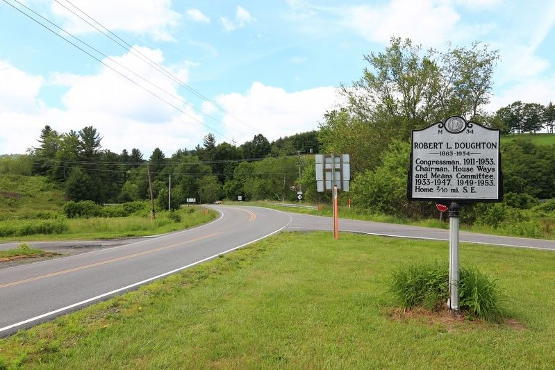
Congressman, 1895-1901; U.S. Minister to Persia, 1902-07, and to Greece and Montenegro, 1907-09. His home, “Richmond Hill,” was ½ mile N.W. — — Map (db m209952) HM
On Broadway Street at Ocala Street, on the left when traveling north on Broadway Street.
Graves of Thomas Wolfe & "O. Henry," authors; Zebulon B. Vance, governor; Thomas L. Clingman and Robert R. Reynolds, U.S. senators. One-half mile W. — — Map (db m97532) HM
Built of local cut stone, ca. 1835, by James Binnie. August terms of State Supreme Court held here, 1847-61. Raided by Union force 1865. Remodeled 1901. — — Map (db m99610) HM
Near McConnaughey Lane, 5 miles south of Swan Pond Drive (County Road 1297), on the left when traveling south.
Col. Waightstill Avery
1741-1821
Revolutionary War
Patriot
Col. Waightstill Avery
First Attorney General
for the
State of North Carolina
1778-1779 — — Map (db m210351) HM WM
On North Green Street (State Highway 181) at Bost Road on North Green Street.
First Attorney General of North Carolina, 1777-79, member provincial Congresses, colonel in Revolution. "Swan Ponds," his home, was 3 mi. S.W. — — Map (db m99607) HM
First Marker:Centennial Seal
Official Seal of the 100th
Celebration of the founding
of Valdese
Future
From an agrarian beginning
through Industrial growth,
comes a bright horizon
Civic
Citizens Band together . . . — — Map (db m20396) HM
On Union Street South just south of Means Avenue Southeast, on the right when traveling south.
This magnificent Concord City Hall was built in 1902 and sadly demolished in 1957. It anchored the northwest corner of South Union Street and Barbrick Avenue and was replaced by a new City Hall built on the same spot, now called the City Hall . . . — — Map (db m175762) HM
On Union Street S just north of Means Avenue Southeast, on the right when traveling south.
This image shows the original Cabarrus County Courthouse, built after the Town of Concord was laid out in 1796 on a 26 acre tract of land called 'Pea Ridge' near the old Indian Trading Path. It was a modest frame structure 30 feet wide and 30 feet . . . — — Map (db m175757) HM
On State Highway 343 at NC Highway 34 North (U.S. 158), on the left on State Highway 343.
Member of provincial congresses, 1775–1776; lieutenant colonel of militia in Revolution; Congressman, 1795–99. Grave is 7 miles S.E. — — Map (db m2768) HM
On U.S. 158 at 343, on the right when traveling east on U.S. 158.
Member provincial congress, 1775; brigadier general of militia in Revolution; member N.C. conventions, 1788-1789. Home is 4 miles S.E. — — Map (db m165197) HM
On State Highway 343, 0.1 miles south of U.S. 158, on the right when traveling south.
Member provincial congress, 1775; brigadier general of militia in Revolution; member N.C. conventions, 1788-1789. Home was 4 mi. S.E. — — Map (db m165199) HM
On Highway 158 just east of Havenwood Drive (County Road 1257), on the right when traveling west.
Author of "Blackbeard, a Comedy," 1824, an early drama on North Carolina, & other works. Member of Congress. Grave 160 yds. N.W. — — Map (db m165205) HM
On Fairview Drive, 0.1 miles north of Broad Street (State Highway 57), on the right when traveling west.
Built by Asa Thomas, is the oldest structure in the town of Milton. It was built in the 1783. Romulus Saunders, Ambassador to Spain, once traded Longwood Plantation and 1500 acres to purchase Fairview in order to entertain dignitaries. Although . . . — — Map (db m171796) HM
On Fairview Drive, 0.1 miles north of Broad Street (State Highway 62), on the left when traveling north.
Built by Robert Lewis Walker, who served in the North Carolina Senate from the 19th District. A two story brick Victorian with a detached kitchen. Living and dining rooms have original slate fire places painted to look like marble. Beautiful Ruby . . . — — Map (db m171795) HM
On Main Avenue Northeast at North Center Street, on the right when traveling east on Main Avenue Northeast.
In 1913, Hickory became the first city in North Carolina to adopt the council-manager form of government, which combines the leadership of elected officials and the administrative experience of a manager. The mayor and city council set policy and . . . — — Map (db m210398) HM
On South College Avenue, 0.1 miles north of East Herman Street, on the left when traveling north.
Secretary of Interior, 1893-1896, Governor of Georgia, United States Senator, was born, 1855 at Catawba College, then located at this point. — — Map (db m156714) HM
On East Church Street east of North Broad Street, on the left when traveling east.
The house you see today appears as his son, James Iredell, Jr. would have known it. In 1800 the simple two-story addition was added on the east end of the house. Then, in 1827 the original portion of the house was razed and replaced by a more . . . — — Map (db m224718) HM
James Iredell (1751-1799), Attorney General of North Carolina, 1779 to 1781. Fought for NC's ratification of the United States Constitution. Nominated Associate Justice of the first US Supreme Court Feb. 8, 1790 by President George Washington, . . . — — Map (db m34967) HM
On West Marion Street at North Martin Sreet, on the right when traveling west on West Marion Street.
Governor, 1929-33; under Secretary of U.S. Treasury; appointed Ambassador to Great Britain, 1946. Birthplace stands here, grave 300 yds. N. — — Map (db m23533) HM
On East Warren Street at South Washington Street, on the right when traveling east on East Warren Street.
Confederate captain; legislator; member of conventions of 1868, '75; conservative leader in Reconstruction period. His home was 100 ft. S. — — Map (db m23535) HM
On Broad Street (Business U.S. 17) at Middle Street, on the right when traveling west on Broad Street.
Early American precedent for judicial review of legislation, was decided nearby, 1787, by Judges Samuel Ashe, Samuel Spencer, John Williams. — — Map (db m23502) HM
On Broad Street (Business U.S. 17) at Middle Street, on the right when traveling east on Broad Street.
Secretary of the Navy, 1841; United States Senator, 1846-55; judge of the superior court; staunch nationalist. Birthplace was 80yds S. — — Map (db m76991) HM
On Cypress Street at Smith Street, on the right when traveling west on Cypress Street.
Greenwood Cemetery, established in 1882 on the grounds of an earlier cemetery, is New Bern’s second-oldest public cemetery and the first city-owned cemetery for African Americans. Thirteen grave markers are dated between 1816 and 1859. At least . . . — — Map (db m76972) HM
On George Street just north of Pollock Street, on the right when traveling south.
Home of Revolutionary War leader; and his son John, Congressman & state legislator. House moved and restored 1966-70 by the Tryon Palace Commission. — — Map (db m23508) HM
Educated in Scotland at University of Glasgow; Aide-de-Camp to Major-General Richard Caswell during the Revolution, and Lieutenant-Colonel Commandant of Artillery after that war; representative of the Borough of New Bern for five terms and of the . . . — — Map (db m45114) HM
On Broad Street (U.S. 17) at Craven Street, on the left when traveling east on Broad Street.
Graduate and for twenty-nine years a trustee of the University of North Carolina, member of the North Carolina House of Commons for one term, and of the State Senate for fourteen terms, member of the eighteenth Congress of the United States; Grand . . . — — Map (db m45115) HM
On Broad Street (Business U.S. 17) at George Street, on the right when traveling east on Broad Street.
Historic Capitol and Governor's residence of N.C., 1770-1794. Burned 1798, and restored in 1952-1959. Open to the public. One block south. — — Map (db m76997) HM
On Broad Street (Business U.S. 17) at Craven Street, on the right on Broad Street.
Justice of N.C. Supreme Court, 1833-44; lawmaker. An advocate for state's Catholics. Wrote state song. "The Old North State." Lived 1 block N. — — Map (db m76978) HM
On Cool Spring Street at Meeting Street, on the right when traveling south on Cool Spring Street.
The Fayetteville Independent Light Infantry is North Carolina's oldest military unit and the second-oldest militia organization in the U.S.
At the start of the Civil War, after North Carolina seceded, the company enrolled in active service for . . . — — Map (db m31109) HM
On Old Bluff Church Road, 1.2 miles west of Sisk Culbreth Road when traveling west.
Near this spot at Old Bluff Church is buried Colonel Alexander McAllister; Patriot and Revolutionary Hero; Colonel of Cumberland County Militia; Representative First Assembly in Newbern, December 1773; Representative Second Assembly in Newbern, . . . — — Map (db m31594) HM
On Courthouse Road (State Highway 1242) near Caratoke Highway (State Highway 168), on the right when traveling north.
Thursday the 31st December 1767
"On motion the following Bills were ordered to be read ... A Bill to impower the justices of Currituck County to build a prison pillary and stocks in the said county on the lot were the Court House stands for the . . . — — Map (db m9468) HM
On Kohler Road, 0 miles east of North Carolina Highway 12, on the right when traveling east.
Orchestrated by Union Colonel Rush C. Hawkins, the Hatteras Convention was held nearby on November 18, 1861. The state's secession was declared null and void, Hatteras was proclaimed the capitol and Marble Nash Taylor became provisional governor. . . . — — Map (db m207709) HM
[Center Panel]:
“By your courage in tribulation, by your cheerfulness before the dirty devices of this world, you have won the love of those who have watched you.”
- Guy Chapman
Dedicated: November 11, 1991.
[Left . . . — — Map (db m9631) WM
On Wilkesboro Street (U.S. 64), on the left when traveling east.
Author of The Impending Crisis,
a bitterly controversial book which denounced slavery; U.S. Consul at Buenos Aires, 1861-66. Born 150 yds. N. — — Map (db m53186) HM
"Mutt" and Sara Evans were civic, business and faith leaders during Durham's fast-changing, mid-20th century decades. Elected Mayor for a record six terms, Mutt Evans served from 1951 to 1963, holding together a diverse coalition of interests . . . — — Map (db m218170) HM
On East Parrish Street at East Parrish Street, on the right when traveling west on East Parrish Street.
Through strategic leadership and funding since 1935, Black entrepreneurs on Parrish Street are active participants in the founding of the Durham Business and Professional Chain, the Durham Committee on the Affairs of Black People, Black newspapers . . . — — Map (db m218173) HM
On East Main Street east of North Church Street, on the right when traveling east.
Member of the General Assembly of the State
Mayor of Durham
Chairman of the Commissioners of the County
Justice of the Peace for Fifty Years
His life was given to the service of his neighbors to whom he was ever a symbol of . . . — — Map (db m210741) HM
On West Forest Hills Boulevard north of Westwood Drive, on the right when traveling north.
Mother, activist, politician, and philanthropist, Mary was the granddaughter of Benjamin N. Duke and the great-granddaughter of Washington Duke.
In 1951, Mary Semans was the first woman elected to the Durham City Council, and she served as . . . — — Map (db m232514) HM
On East Raleigh Boulevard (Business U.S. 64) at Wake Street, on the right when traveling west on East Raleigh Boulevard.
Former slave. Voted for better roads, schools, and colleges as State representative, 1879, 1887; and State senator, 1889. His home stands here. — — Map (db m225618) HM
On Alternate U.S. 64 near Kingsboro Road (State Highway 1225), on the left when traveling east.
Confederate general. His brigade fought in last infantry action at Appomattox. Later Congressman; Secretary U.S. Senate. Home here. — — Map (db m44997) HM
319 entries matched your criteria. The first 100 are listed above. Next 100 ⊳