On 2nd Street (U.S. 52) west of Jack Roush Way, on the right when traveling west. Reported missing.
Israel Donalson, member of the First Constitutional Convention of Ohio.
In May 1800, Congress passed an act building the Northwest
Territory, with the western division becoming Indiana
Territory and the eastern called the Territory of the . . . — — Map (db m136539) HM
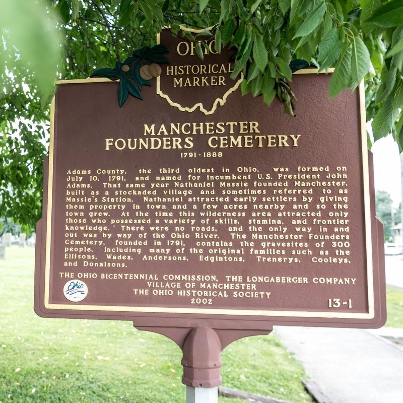
Near East 8th Street, 0.2 miles east of Cemetery Street, on the right when traveling east.
Son of Nathan Ellis 1749-1819 Founder of “Ellis Ferry,” now Aberdeen, Ohio Established the Ellis Family Graveyard on his farm near Ellis’ Landing on the Ohio River Sprigg Township, Adams County, Ohio about 1820 ———— It was with thoughtful . . . — — Map (db m185498) HM
Near East 8th Street, 0.2 miles east of Cemetery Street, on the right when traveling east.
A local preacher organized a Methodist Society in 1797 at his home on the Scioto Brush Creek north of the village of Blue Creek in Adams County in the Northwest Territory. In August 1800 the Society built a log church on a site provided by Mr. . . . — — Map (db m185497) HM
Near Ohio Route 73, 0.9 miles west of Horner Chapel Road (County Road T-116), on the right when traveling west.
"Serpent Mound was purposefully built for a special, sacred purpose. I should think that anyone that views the Serpent will realize its sacredness and treat this place as they would any cathedral, synagogue, or mosque. When we see . . . — — Map (db m214419) HM
Near South Cherry Street south of West South Street, on the right when traveling south.
The William Lafferty Memorial Funeral and Carriage Collection shows the development of the
funeral business since the mid-1800s through an
exhibit of caskets, funeral clothing, and hearses
collected and preserved by James William . . . — — Map (db m135347) HM
On North Pevee Road, on the right when traveling north.
Upon this hallowed ground. Pleasant Hill Methodist Church stood for nearly a century (1887 - 1982) serving well the surrounding community of farm families, many of whose members lie at rest in the adjacent cemetery. — — Map (db m238508) HM
Near West Main Street west of South Greenlawn Avenue, on the left when traveling west.
Sacred to the memory of
Abraham Doner
1795-1854
Founder of several Lutheran Congregations in Allen County, Ohio Buried with other Lutheran Pioneers on this site — — Map (db m196321) HM
On Eastown Road, on the left when traveling north.
Former location of East Cemetery relocated in 1996 to Greenlawn Cemetery American Township.
In 1832 John East of Pickaway County came to Allen County with his wife, Elizabeth Huffer, and family Mary, Isaac, Abraham, Elizabeth, and Samuel. He built . . . — — Map (db m105378) HM
On Central Avenue, on the right when traveling north.
Site of Lima's First cemetery and burial place of Pvt. Elijah Stites 1758-1843 Minute Man of the Revolution who served in the Essex County Militia 1st Regiment New Jersey. — — Map (db m93047) HM
On Bluelick Road, 0.1 miles west of Sugar Street, on the right when traveling west.
In 1959 this area was discovered to be an almost four thousand year old burial ground of the Glacial Kame People-named for the distinctive gravel elevations in which their dead were buried. The area was once a farm owned by Henry Boose, an early . . . — — Map (db m78679) HM
On Defiance Trail, on the right when traveling north. Reported missing.
Do you see the little cemetery to the east, high on the west bank of the Auglaize? It's all that remains of Hartford, thriving town in the 1830's with, it was expected, a bright future, since the new Miami and Erie Canal would one day be serving . . . — — Map (db m236836) HM
Near South Ridge Road (Ohio Route 84) at County Line Road.
On June 28, 1798
Colonel Alexander Harper
At the head of a party of 25
Landed at the mouth of Cunningham Creek
3 miles North of here
And founded here
The first permanent settlement in Ashtabula Co.
At the time of his arrival
There . . . — — Map (db m163110) HM
Near West State Street, 0.1 miles west of North Lancaster Street, on the right when traveling west.
As a tribute to the loyalty,
faithfulness, and heroism of
Eliza Davidson
this memorial is erected by the
school children and citizens of
Athens County, June 14, 1934
Born a slave, emancipated, she became the faithful companion of . . . — — Map (db m173927) HM WM
Near West Bailey Road, 0.1 miles west of Converse Street (Ohio Route 13), on the left when traveling west.
During the War of the Rebellion three young men from Chauncey traveled to Parkersburg and Clarksburg, VA., to enlist in what was then the 1st Virginia Cavalry (USA). These "Loyalist Regiments” became West Virginia regiments in June 1863 just . . . — — Map (db m242161) HM
On West Washington Street at Fort Street, on the left when traveling east on West Washington Street.
This tablet is erected in honor of
Daniel Nelson
founder of Nelsonville
who donated the ground for the
Fort Street Cemetery
the Public Square and this lot
for School and Meeting House purposes
This stone was a part of the doorway . . . — — Map (db m37040) HM
On Cemetery Road (County Road 161) north of Santa Fe-New Knoxville Road (County Road 100), on the right when traveling north.
This monument markes the site of the altar in that church. The first priest stationed here was Rev. Martin Bobst, who died Nov. 28, 1894, and is intered here.
Reduiescat in pace
[Rest in peace]
. . . — — Map (db m239927) HM
On Ohio Route 198, 0.2 miles south of Deep Cut Road (Local Highway 230), on the right when traveling north.
In Memory Of
The 75 Unknown American Soldiers
of the War of 1812
buried in this cemetery.
Death came to these Patriots ether while on duty
at For Amanda or while in the Fort Hospital to
which wounded were returned from the forward
area. . . . — — Map (db m167040) WM
On Ohio Route 198, 0.2 miles south of Deep Cut Road (Local Highway 230), on the right when traveling north.
Sick and Injured
Between 1812 and 1814, soldiers who had become
sick or sustained injuries in battles were brought back
to Fort Amanda. Some died from their injuries, while
others succumbed to germ-related maladies such as
dysentery, . . . — — Map (db m167039) HM
On Ohio Route 198 south of Deep Cut Road (Local Highway 230), on the right when traveling north.
76 Troops
Captain Daniel Hosbrook's Company
Ohio Militia
(Formed in Hamilton County, Ohio)
Commandant - Daniel Kain •
Hosbrook, Daniel Captain •
Davis, Joseph Lieutenant •
Schillinger, William Ensign •
VanWinkle, David R. 1st . . . — — Map (db m167043) WM
Near East 1st Street, on the right when traveling east.
In pious memory of all our cholera victims
over 300 especially of the year 1849
Eternal rest grant unto thee O Lord
Erected in 1937 — — Map (db m100145) HM
On South St. Marys Street north of West German Street, on the right when traveling south.
Restoration of the Methodist Cemetery is dedicated to the settlers from Ladbergen, Germany.
In memory of Lawrence and Elizabeth Meckstroth — — Map (db m236425) HM
On South West Street south of West German Street, on the right when traveling north.
H.H. Fledderjohann, Sr., along with his wife and three sons immigrated to America in 1835 from Ladbergen, Germany. In the cholera epidemic of 1849 nine members of the family died in twelve days. H.H. Jr., the only surviving son, buried his family . . . — — Map (db m236429) WM
On Center Street west of Walnut Street, on the left when traveling west.
Blackhoof: Born in Florida about 1721. Arriving in this vicinity 1783 - Surnames: Cut-The-We-Ka-Saw or Catahecassa - Principal Chief of Shawnee Indian Nation - erected here in 1822. In a clearing of the vast forest a two story 18'x24' log house - . . . — — Map (db m237214) HM
On U.S. 33 at Ohio Route 65, on the left when traveling east on U.S. 33.
Nearby sleeps Chief (Blackhoof) Catahecassa, last principle chief of the Shawnees prior to their removal to Kansas in 1832. This was Blackhoofs town where he lived and died in Sept. 1831, at the age of 109. He fought with the French against Braddock . . . — — Map (db m16971) HM
Near East Greenville Road, 0.3 miles east of South Main Street (Ohio Route 66), on the right when traveling west.
First civilian cemetery in the area est. after Treaty of St. Marys in 1817. By Charlie Murray, one of the first Indian traders, who acquired his trading post south of here, after the Treaty of Greenville from James Girty. Murray purchased trade . . . — — Map (db m244296) HM
On Greenville Road at South Ash Street, on the right when traveling east on Greenville Road.
Loyalty
Erected 1915 by past and present patriotic citizens of St. Marys. In commemoration of our volunteers of the Civil War
1861 - 1865 — — Map (db m244187) WM
On Oakes Place, 0.2 miles Flat Rock Road, on the right when traveling south.
This cemetery stands as evidence of a once thriving African American farming community established in the 1820s. With the aid of community leader, Alexander "Sandy" Harper (c.1804-1889), Captina, originally called Guinea, became a stop on the . . . — — Map (db m79263) HM
On Church Street at Greenbank Avenue, on the left when traveling north on Church Street.
Burial Site of American Patriots
Molly Scott - Defender in Revolutionary War
Ruhamark Hukill - Jessie Walker
Veterans of War of 1812
David Morton - Veteran of War with Mexico
Martin V. Baile - Joseph B. Frasier - Calvin . . . — — Map (db m226396) HM WM
On Negus Road (County Route 456), on the right when traveling west.
Colerain Township was the location of the
earliest Quaker settlement and the first
organized Friends Meeting in Ohio. The first
meeting house was built in 1800. The log
structure burned and was replaced with
this brick building in 1815. . . . — — Map (db m89234) HM
On Negus Road (County Route 456), on the right when traveling west.
A Quaker, he wielded great influence
in ship design during the
early years of our country
1794 clerk, United States War Department
1795- 1798 assistant Navy Constructor
1798- 1801 Navy Constructor and Superintendent of
Buildings, Gosport, . . . — — Map (db m89226) HM
On North 4th Street, 0.1 miles north of Ellet Street, in the median.
This Confederate cannon and historic cemetery was restored by the Ohio Valley Civil War Roundtable. Dedicated to those brave and heroic sons and daughters of the North and South, whose deeds of valor and memory we shall not forget. — — Map (db m196289) WM
The Walnut Grove Cemetery is the burial place of members of the Zane and Martin families. Their graves lie within the brick enclosure. The cemetery is also the resting-place of many early Martins Ferry residents, including veterans of the . . . — — Map (db m28444) HM
On Newell Avenue east of North Market Street, on the left when traveling east.
Here lies Thomas Drummond (1832-1865) - legislator, abolitionist and soldier. Raised in eastern Ohio, he moved to Iowa where he served in the General Assembly and secured the location of the State Asylum for the Blind at Vinton. As editor of the . . . — — Map (db m214490) HM
Near Maple Avenue (Ohio Route 9) north of Bett-Mar Lane, on the right when traveling north.
Marking the original site of the Richland Cemetery Presbyterian Church, founded 1798. Here worshiped the oldest congregation in Eastern Ohio, presently called the First Presbyterian Church, located at Marietta and Woodrow in St Clairsville. Tread . . . — — Map (db m226472) HM
On Anderson State Road (U.S. 50), on the right when traveling south.
In honor of God
and in memory of
the members of ths parish
who served in World War II
Flischel, Robert E.
killed in action December 31, 1944
(38 names) — — Map (db m95538) WM
On Seward Road at Dixie Hwy (Ohio Route 4), on the left when traveling south on Seward Road.
Sergeant • Northern Continental Army
Captain James Osgood’s Company of Rangers
enlisted July 15, 1775
born February 22, 1745, in Rumsford, NH
died July 22, 1823 in Butler Co., OH
marker placed by John Reily Chapter, NSDAR
and . . . — — Map (db m116555) HM WM
On River Road at Lakeside Drive, on the right when traveling north on River Road.
Miami Chapel Cemetery. Around 1843, local Methodists organized a new Methodist Episcopal church at Fair Play and later erected a brick chapel. The congregation was short-lived, however, and fell into decline after one of its leading members, . . . — — Map (db m158422) HM
On South Third Street near Charles Str, on the left when traveling south.
- “I declare the earth is hollow and habitable within,” said John Cleves Symmes in summarizing his “Theory of Concentric Spheres and Solar Voids” to a doubting scientific world in the early 1820’s. His theory is commemorated . . . — — Map (db m116622) HM
On South Third Street, on the left when traveling south.
Capt. John Cleves Symmes
as a philosopher,
and the originator of
‘Symmes Theory of Concentric
Spheres and Polar voids.’
He contended that the Earth
is hollow and habitable
within.
Capt.
John C. Symmes
a Native of
New . . . — — Map (db m116618) HM
Honoring all Veterans
in times of peace and war
[Includes an Honor Roll of]
Area Veterans Who Died in the
Service of Their Country
Dedicated July 4, 2004 — — Map (db m29991) HM
Dedicated by the grateful citizens
of Middletown to the members
of the armed services who gave
their lives to preserve the
American ideals of liberty
justice and democracy
World War II Memorial
This plot contains a cross for . . . — — Map (db m29979) HM
On Elk Creek Road at Howe Road, on the right when traveling north on Elk Creek Road.
The village of Miltonville, located along the banks of Elk Creek, was platted in 1816 by George Bennett, Theophilus Eaglesfield, and Richard V. V. Crane. The creek served two grist mills, one built around 1804 and operated by a free black, Bambo . . . — — Map (db m28776) HM
On Reily-Millville Road (County Route 29) 0.2 miles west of Bunker Hill Woods Road, on the right when traveling east.
(side A)
Bunker Hill Universalist Church
The Bunker Hill Society was organized about 1845 and fellowshipped in 1854. A frame meeting house, capable of seating 300, was dedicated in 1855. Thirty people united with the church . . . — — Map (db m107789) HM
On Indian Creek Road (County Route 37), on the left when traveling east.
The Indian Creek Regular Baptist Church was established in 1810 as an arm of the Little Cedar Creek Church of Brookville, Indiana. The congregation purchased three acres of land for a burial ground and church and built a log structure here in . . . — — Map (db m120291) HM
Near Indian Creek Road, 0.7 miles north of Imhoff Road, on the right when traveling north.
Brick church built - 1829
Indian Creek Cemetery on first county land sold for public burial
Preserved by Indian Creek Cemetery Association, 1880 - 1959 — — Map (db m166727) HM
Near Oxford Millville Road (U.S. 27) 0.3 miles north of Stillwell Beckett Road, on the right when traveling north.
side A
A cemetery was established on the site in 1811 and became the final resting place for many of the area's early pioneer families. The Hanover Township Trustees obtained title to the land in 1823 from John and Anna Farnsworth, and it . . . — — Map (db m97814) HM
On Brown Road, 0.2 miles south of Doty Road, on the right when traveling south.
Side A: The Restoration Movement
In the early years of the nineteenth century, a religious unrest known as the Second Great Awakening spread across much of the American frontier. Among the most influential of the evolving religious . . . — — Map (db m24051) HM
On East Chestnut Street, on the left when traveling west.
Woodside Cemetery
Established as the Oxford Township Cemetery in 1880, this public graveyard replaced the original one at the corner of College Avenue and Spring Street. That earlier burial ground was abandoned when the railroad bisected it . . . — — Map (db m227942) HM
On Cincinnati-Brookville Road (Ohio Route 126), on the right when traveling east.
The foundation for the first Welsh settlement in Ohio was laid on June 29, 1801, when William and Morgan Gwilym purchased land in what is now Morgan Township at the Cincinnati Land Office. The Welsh, who settled in Pennsylvania beginning in the late . . . — — Map (db m23991) HM
On State Street (Ohio Route 73) at Miami Street / Hamilton Road, on the left when traveling west on State Street.
Side A: The Village of Trenton
Platted 1816. Incorporated as Village 1895. Became a city 1971
Trenton's founder, Michael Pearce, came to the area in 1801. The original village of 33 lots was named Bloomfield. When the post office was . . . — — Map (db m28792) HM
This memorial is in memory of Jacob
and Martha Boggs Johnson, and marks
the spot where the Indian cabin stood
Into which they moved April 1. 1805. With
other pioneers they came as the Indians
departed and worthily bore their part
in subduing . . . — — Map (db m127297) HM
On Inskeep Road (County Route 144) at Clay Street, on the left when traveling north on Inskeep Road.
President Abraham Lincoln's assassination on April 14, 1865, created a national tragedy, and the nationl mourned as his body was transported by rail from Washington, D.C. back to Springfield, Illinois, where he would be buried. As the nine-car . . . — — Map (db m84946) HM
On Ohio Route 245, 0.2 miles south of Mt. Tabor Road (Ohio Route 507), on the right when traveling north.
Mt. Tabor Church. The first Mt. Tabor Church, a log meetinghouse, was erected on this site in 1816. It stood on land originally selected by Griffith and Martha Evans for a graveyard at the death of their daughter circa 1812. Deeds show the . . . — — Map (db m198029) HM
On Sandusky Street (Ohio Route 4), on the right when traveling east.
Side A:
This site has long served the religious, education, and public interests of the residents of Mechanicsburg. A local Methodist congregation built its first church here in 1820, and the townspeople also used the structure as its . . . — — Map (db m13731) HM
On W, Elm Street (County Route 111) near Winder St, on the right when traveling east.
Friends Church
Among the earliest settlers to Rush Township were members of the
Religious Society of Friends or Quakers, who emigrated from the
eastern states, mostly Pennsylvania and North Carolina. At first
religious services were held in . . . — — Map (db m86266) HM
Near Cemetery Lane east of Patrick Avenue (Ohio Route 54), on the left when traveling east.
The Grave of
Capt. Simon Kenton
1755 - 1836
Revolutionary War Soldier
Clark Illinois Regiment, Virginia State Troops
Brigadier General of the Ohio Militia - 1812
Inscription on Gravestone:
In
Memory
of
Gen. Simon . . . — — Map (db m38277) HM
On Patrik Avenue (Ohio Route 54) 0.1 miles south of Jefferson Avenue, on the left when traveling south.
Simon Kenton who is buried here. During the Revolutionary War he frequently served as scout under George Rogers Clark and later praised Clark for his role in saving the Kentucky settlements. Kenton's Indian captivity of 1778-79 acquainted him with . . . — — Map (db m34088) HM
On Kennard- Kings Creek Road (County Route 130) at East Kings Creek Road (County Route 125), on the left when traveling north on Kennard- Kings Creek Road.
Side A The founders of what would become the Kings Creek Baptist Church first met on June 29, 1805 in the log home of local residents James and Ann Turner. The Baptist congregation continued to meet in people's homes until 1816 when . . . — — Map (db m84858) HM
On North Main Street (U.S. 68) at Fyffe Street, on the left when traveling north on North Main Street.
(Side A)
The nine-car funeral train for President Abraham
Lincoln departed Washington, D.C. on April 21, 1865.
It arrived in Urbana on April 29 at 10:40p.m.
Urbana’s citizens erected an arch of evergreens and
flowers near the station . . . — — Map (db m84960) HM
On Scioto Street east of North Main Street (U.S. 68), on the right when traveling west.
1755 - Simon Kenton - 1836
»»««
In Oakland Cemetery, one
mile east,is the grave and
monument of Simon Kenton,
pioneer, soldier, Indian scout.
Also, "The Indian Hunter,"
by J.Q.A.Ward, noted sculptor
and native of . . . — — Map (db m44106) HM
On KentonStreet at Ward Street, on the right when traveling north on KentonStreet.
War Council of 1812. To confirm that the Treaty of Greenville would be upheld, Ohio Governor Return J. Meigs called a council with Native Americans June 6-9, 1812. He sought approval to cross native land when marching to Canada and to ensure . . . — — Map (db m81636) HM
On U.S. 36, 0.2 miles west of Ohio Route 560, on the left when traveling east.
Baseball great Harvey Haddix was born on September 18, 1925, and grew up on a farm just south of Westville. He attended Westville School until March 1940 and played his first organized baseball at this site. Entering Major League Baseball in 1952, . . . — — Map (db m13888) HM
On Urbana Woodstock Pike (County Route 2) 0.5 miles west of Main Street (Ohio Route 559).
Roll of Honor of Woodstock Precinct
(147 names)
recorded by Warren Cushman Sculptor- 1895.
Uncle George Gifford
was a soldier
in the 134 O.V.I.
1864
Bro. Charles Cushman
The first man that offered
to go to war to the . . . — — Map (db m85202) WM
On Urbana Woodstock Road (County Route 2) 0.4 miles west of Main Street (Ohio Route 559), on the right when traveling west.
President Abraham Lincoln's assassination on April 14, 1865, created a national tragedy, and the nation mourned as his body was transported by rail from Washington, D.C. back to Springfield, Illinois, where he would be buried. On its way the Funeral . . . — — Map (db m84945) HM
On Indian Drive at Mound Circle, in the median on Indian Drive.
This Adena Mound is the second largest
conical mound in Ohio. These large conical
mounds are believed to be Adena while the
many small or effigy mounds are Hopewell,
a later culture.
This mound is the property of the Village
of Enon. . . . — — Map (db m100536) HM
Asa Smith Bushnell, born in Rome, New York, settles in Springfield in 1850. After serving in the Civil War, Bushnell begins to work for a company partially owned by Benjamin Warder, eventually becoming a partner, now the Warder, Bushnell, and . . . — — Map (db m81955) HM
In memory of the men
buried in Clark County
who fought in the
American Revolution
1775 - 1783
Lt. John Bancroft • Jacob Ellsworth
William McIntire • Frederick Brown
Samuel Lippincott Sr. • James Kelly
Corneilus Toland • Isaac . . . — — Map (db m28796) HM
"Mother Stewart" as she is affectionately called, is the pioneering spirit behind the local and statewide temperance movement. In 1858 she lectures on and promotes temperance for the "Good Templars Society". During the Civil War she serves the . . . — — Map (db m81938) HM
Near West Columbia Street (U.S. 40) just east of North Wittenberg Avenue, on the left when traveling east.
James Demint, a Virginian by birth, came to this area from Cincinnati with his family in 1799. Prior to his arrival, he purchased 640 acres from John Cleves Symmes, owner of a large amount of land located between the Great and Little Miami . . . — — Map (db m224414) HM
Springfield's "first inventor", born in Virginia, brings a genius previously unparalleled in the history of our community. His passion for the use of the abundant water supply in the area accelerates Springfield into the early beginnings of the . . . — — Map (db m81932) HM
Jeremiah and his wife Ann, wealthy Quakers from Philadelphia, arrive in Springfield in 1830 to claim extensive acreage inherited from his late father’s estate. That same year, he purchases from the estate the village of Lagonda consisting of . . . — — Map (db m81890) HM
John Dick, born in Aryshire, Scotland and educated at the Royal Botanical Gardens in Edinburgh, comes to the United States with his family in 1854 spending several years working on Long Island laying out the park system. He later moves to . . . — — Map (db m81892) HM
Affectionately called by some, “The Father of Ferncliff Cemetery”, John Ludlow is a member of an early pioneer family in Clark County, eventually becoming a well-known pharmacist. In 1851, he is elected as a director of the Springfield . . . — — Map (db m81896) HM
O. S. Kelly grows up on a farm in Greene Township of Clark County later turning his efforts into carpentry trade. In 1852, Kelly temporarily leaves his family to seek his fortune in the California gold rush building dwellings for the miners, . . . — — Map (db m82050) HM
On West Columbia Street (U.S. 40) 0.1 miles east of North Wittenberg Avenue, on the right when traveling east.
The pioneers James and Elizabeth Demint settled this land on the banks of Buck Creek in 1799, four years after the Treaty of Greenville opened this portion of the Northwest Territory to western settlement. James Demint's original plat contained . . . — — Map (db m217130) HM
Near West McCreight Avenue (Ohio Route 41) near St Paris Pike, on the left when traveling west.
“Once let the black man get upon his person the brass letter, U.S., let him get an eagle on his button, and a musket on his shoulder and bullets in his pocket, there is no power upon earth that can deny that he has earned the right to full . . . — — Map (db m168921) HM WM
Dedicated to the honor and glory of all veterans of Clark County who have so nobly served their country in all its wars and who, by offering their last full measure of devotion, have purchased freedom for our beloved nation — — Map (db m81873) WM
Known nationwide as the “Reaper King”, William Whiteley places Springfield on the map with his innovative improvements of Cyrus McCormack’s reaper. A born machinist with an inventive mind, Whiteley is constantly seeking ways to improve . . . — — Map (db m82049) HM
In 1803. Reverend John Collins and his family settled in Clermont County to farm, and one year later donated the land for this Methodist church and cemetery. This church became part of a network of other churches in the area nicknamed the "Collins . . . — — Map (db m227930) HM
On Old Bullskin Trail (Ohio Route 133) at West Circus Street, on the left when traveling north on Old Bullskin Trail.
Resting here among other pioneers are:
Obed Denham,
native of Plainfield, New Jersey, donor of this plot, founder of
Bethel in 1798, and pioneer abolitionist;
Thomas Morris,
antislavery leader, veteran state legislator, U.S. senator . . . — — Map (db m224989) HM
On Ohio Scenic River Byway (U.S. 52) 0.1 miles east of Woods Hill, on the left when traveling east.
There rests here, in the quiet beauty of the
valley of the Ohio, the dust of a young girl.
On July 23, 1823, a wagon train, creaking
toward the west came to a halt close by.
When the train moved forward, one of its
party had been . . . — — Map (db m166841) HM
On Mount Moriah Drive, on the left when traveling east.
The Union Township Trustees operate
and maintain the cemetery. It is situated on
land purchased in 1800 by Withamsville founder,
Maurice Witham. Interred here are some
prominent pioneers and citizens - - the Witham
family, Indian fighter . . . — — Map (db m99695) HM
On Ohio Route 727, 0.4 miles east of Ohio Route 133, on the right when traveling east. Reported missing.
In this cemetery is buried William Slone, Revolutionary War soldier, bugler in General Wayne’s army at battle of Fallen Timbers, 1794. First settler in Wayne Township, Clermont County. — — Map (db m204978) HM
On Glendale Milford Road (Ohio Route 126) at Center Street, on the right when traveling west on Glendale Milford Road.
Here lies
Charlie Henry Rich
who dealt
“Aces and Eights”
to Wild Bill Hickok
in the Blackhills of
Deadwood South Dakota
in No. 10 Saloon
August 2, 1876 — — Map (db m99468) HM
523 entries matched your criteria. The first 100 are listed above. Next 100 ⊳