66 entries match your criteria.
Entries Containing All of the Phrases «charles county» AND «maryland»
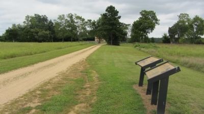
By F. Robby, August 19, 2013
Mount Calvert, Early Town Marker
RANKED BY RELEVANCE
1 ► Maryland, Prince George's County, Croom — Mount Calvert, Early Town —  |
| On Mount Calvert Road 0.3 miles east of McClure Road, on the right. | |||
| 2 ► Maryland, Charles County, Port Tobacco — Port Tobacco: A Maryland Mosaic — |
| Near Warehouse Landing Road 0.2 miles west of Chapel Point Road, on the right when traveling south. | |||
| 3 ► Maryland, Charles County, Port Tobacco — Daniel of St. Thomas Jenifer — |
| On Port Tobacco Road (County Route 6) at Port Tobacco Road & Howard Drive on Port Tobacco Road. | |||
| 4 ► Maryland, Charles County, Nanjemoy — Mallows Bay — Wildlife Refuge from WWI Shipwrecks — |
| Near Wilson Landing Road 0.7 miles west of Riverside Rd. | |||
| 5 ► Maryland, Charles County, Indian Head — Navy Railroad — Historical Role in Our Nation’s Defense — Indian Head Rail Trail — |
| On Indian Head Rail Trail east of Mattingly Street. | |||
| 6 ► Maryland, Charles County, Nanjemoy — Bald Eagle — |
| Near Friendship Landing Road 1.3 miles Ironsides Rd (County Route 425). | |||
| 7 ► Maryland, Charles County, Nanjemoy — Unique Environment — This area is home to a distinctive ecosystem, a long human history — and a community working to preserve its environment. — |
| Near Riverside Road (Route 224) 1.1 miles Liverpool Point Road (Route 426). | |||
| 8 ► Maryland, Charles County, Port Tobacco — Port Tobacco: Commerce — |
| Near Commerce St 0.1 miles west of Chapel Point Road. | |||
| 9 ► Maryland, Harford County, Aberdeen — Nationals Park — Home of the Washington Nationals — Washington, D.C. — |
| Near Long Drive 0.2 miles east of Camden Way, on the right when traveling east. | |||
| 10 ► Maryland, Charles County, Bel Alton — Archaeology Provides a Key to the History of Rich Hill — |
| Near Bel Alton Newtown Road 0.1 miles east of Rich Hill Farm Road, on the left when traveling east. | |||
| 11 ► Maryland, Charles County, Bel Alton — Rich Hill Farm in the 19th Century: Samuel Cox and his Award-Winning Farm — |
| On Bel Alton Newtown Road just east of Rich Hill Farm Road, on the left when traveling east. | |||
| 12 ► Maryland, Charles County, Bel Alton — Rich Hill Farm in the 20th Century — The Garners, Tenant Farmers of Rich Hill — (1916 - 1920 and 1945 - 1954) — |
| Near Bel Alton Newtown Road east of Rich Hill Farm Road, on the left when traveling east. | |||
| 13 ► Maryland, Charles County, Indian Head — The Village of Pomonkey — |
| On Metropolitan Church Road. | |||
| 14 ► Maryland, Charles County, Nanjemoy — Carroll Farmhouse & Cemetery — |
| On Poseytown Road at Special Place, on the right when traveling east on Poseytown Road. | |||
| 15 ► Maryland, Charles County, Nanjemoy — Mount Hope Church — |
| On Bowie Road at Gilroy Road, on the right when traveling south on Bowie Road. | |||
| 16 ► Maryland, Charles County, Port Tobacco — Port Tobacco: Conspiracy & the Plot to Assassinate President Lincoln — |
| Near Commerce Street west of Chapel Point Road when traveling west. | |||
| 17 ► Maryland, Charles County, Port Tobacco — Thomas Stone — Born 1744-Died 1787 — |
| On Hawthorne Road at Ropse Hill Road, on the right when traveling east on Hawthorne Road. | |||
| 18 ► Maryland, Frederick County, Frederick, Downtown — John Hanson — |
| Near West Patrick Street. | |||
| 19 ► South Carolina, Abbeville County, Abbeville — 1-3 — Bowie Family Memorial — |
| On Greenville Street (State Highway 20) at Central Shiloh / Milford Dairy Road (State Highway S-1-100), on the left when traveling south on Greenville Street. | |||
| 20 ► Alabama, Mobile County, Mobile — Admiral Raphael Semmes, CSA — 1861–1865 |
| On Government Street, in the median. Reported permanently removed. | |||
| 21 ► Maryland, Prince George's County, Beltsville — Iron Production: Maryland's Industrial Past / The Iron Making Process |
| Near Old Muirkirk Road. Reported permanently removed. | |||
| 22 ► Maryland, Charles County, La Plata — Star Memorial Garden — |
| On Firehouse Alley 0.1 miles west of St. Mary's Avenue. | |||
| 23 ► Maryland, Prince George's County, Rosaryville — Frederick Lee Eskew — |
| Near West Marlton Avenue west of Crain Highway (U.S. 301), on the right when traveling south. | |||
| 24 ► Maryland, Charles County, La Plata — Courthouse at Moore's Lodge — |
| On Crain Highway (US 301). | |||
| 25 ► Maryland, Charles County, Newburg — Popes Creek Generating Plant — |
| On Popes Creek Road. | |||
| 26 ► Maryland, Charles County, Rison — Christian Temple Manor — |
| On Sweden Point Road. | |||
| 27 ► Maryland, Charles County, Waldorf — John Thomas Parran, Jr — |
| Near St. Linus Drive 0.2 miles Piney Church Rd. | |||
| 28 ► Maryland, Charles County, Bel Alton — Rich Hill Historic Site — Historic Preservation/Public Archaeology |
| Near Rich Hill Farm Road 0.1 miles north of Bel Alton Newtown Rd. Reported permanently removed. | |||
| 29 ► Maryland, Charles County, Nanjemoy — Friendship House…one of Charles County's Oldest — |
| Near Friendship Landing Road 1.3 miles Ironsides Rd (County Route 425). | |||
| 30 ► Maryland, Prince George's County, Oxon Hill — John Hanson — Honored Patriot of the American Revolution — Oxon Hill Manor — |
| On Oxon Hill Road (Maryland Route 414) west of Indian Head Highway ( Route 210). | |||
| 31 ► Virginia, King George County, King George, Dahlgren Center — Mathias Point — Booth & Herold Flee to Virginia — John Wilkes Booth - Chasing Lincoln's Assassin — |
| On James Madison Parkway (U.S. 301) at Roseland road, on the left when traveling north on James Madison Parkway. | |||
| 32 ► Maryland, Charles County, Hughesville — Maxwell Hall — National Register of Historic Places — circa 1860 • House built 1768 • Renovations 1833 and 1980 — |
| Near Teagues Point Road 0.1 miles south of Fairfax Court. | |||
| 33 ► Maryland, Charles County, La Plata — From Creek to the College of Southern Maryland — |
| Near North Campus Drive west of Cross Campus Drive, on the left when traveling south. | |||
| 34 ► Maryland, Montgomery County, Sandy Spring — A Tribute to Josiah Henson — June 15, 1789 - May 5, 1883 — [Sandy Spring Slave Museum & African Art Gallery] — |
| On Brooke Road 0.1 miles west of Chandlee Mill Road, on the right when traveling west. | |||
| 35 ► Maryland, St. Mary's County, Mechanicsville — Amish Community — Three Notch Trail — |
| Near New Market Road (Maryland Route 6) 0.1 miles west of Three Notch Road ( Route 5), on the right when traveling west. | |||
| 36 ► Maryland, St. Mary's County, Hollywood — Sotterley Plantation — A Generation Divided, A Battle Joined — |
| On Sotterley Lane north of Sotterley Wharf Road, on the right when traveling north. | |||
| 37 ► Virginia, Prince William County, Montclair — Maddox Cemetery — |
| On Kapel Drive at Hope Hill Avenue, on the right when traveling south on Kapel Drive. | |||
| 38 ► Maryland, Anne Arundel County, Annapolis — Annapolis & The Maryland Signers — Annapolis Charter 300 1708-2008 — Commemorating the 1708 Royal Charter under Queen Anne to the City of Annapolis — |
| On West Street (Route 450) near Munroe Court, on the right when traveling west. | |||
| 39 ► Maryland, Frederick County, Frederick, Downtown — John Hanson — |
| Near West Patrick Street. | |||
| 40 ► Maryland, Prince George's County, Forest Heights — Africans Becoming Americans — |
| Near National Harbor Boulevard south of Capital Beltway (Interstate 95), on the right when traveling south. | |||
| 41 ► Maryland, Prince George's County, Forest Heights, National Harbor — The Addisons of Oxon Hill Manor |
| Near National Harbor Boulevard south of Capital Beltway (Interstate 95), on the right when traveling south. Reported missing. | |||
| 42 ► Maryland, Prince George's County, Fort Washington — 40 Members of the Col. John Addison Family — |
| Near Livingston Road south of Old St. Johns Way, on the right when traveling south. | |||
| 43 ► Virginia, Fairfax County, Lorton — What Lies Beneath — |
| Near Gunston Road (Virginia Route 242) south of Springfield Drive, on the left when traveling south. | |||
| 44 ► Maryland, Anne Arundel County, Severna Park — Governor William Stone — |
| On Governor Stone Parkway at Benfield Boulevard, on the right when traveling north on Governor Stone Parkway. | |||
| 45 ► Maryland, Montgomery County, Gaithersburg — Childhood and Slavery in Maryland — |
| On Rock Creek Park Road 0.5 miles north of Muncaster Mill Road, on the right when traveling north. | |||
| 46 ► Maryland, St. Mary's County, Oraville — De La Brooke Manor — Surveyed July 28, 1630 — |
| On New Market Turner Road (SR 6). | |||
| 47 ► Indiana, Vermillion County, Universal — Major John T. Chunn — |
| On East Wood Avenue west of Bunsen Street, on the right when traveling west. | |||
| 48 ► Maryland, Montgomery County, Sandy Spring — Reverend Josiah Henson — June 15, 1789 - May 5, 1883 — [Sandy Spring Slave Museum & African Art Gallery] — |
| On Brooke Road west of Chandlee Mill Road, on the right when traveling west. | |||
| 49 ► Texas, Galveston County, Port Bolivar — 16374 — Jane Herbert Wilkinson Long — (July 23, 1798 – December 30, 1880) — |
| On State Highway 87 at Anderson Avenue, on the right when traveling east on State Highway 87. | |||
| 50 ► Virginia, Orange County, Lake of the Woods — United States Colored Troops at the Battle of the Wilderness — May 6-7, 1865 — Civil War Study Group | Battle of the Wilderness... literally in OUR yards! — |
| On Lakeview Parkway near Shoosmith Road, on the left when traveling north. | |||
| 51 ► Alabama, Barbour County, Eufaula — Fendall Hall / Young and Dent — The Young - Dent Home — |
| On West Barbour Street, on the left when traveling west. | |||
| 52 ► Maryland, Charles County, Cobb Island — Milestone in Radio History — December 23, 1900 — |
| On Neale Sound Drive at Cobb Island Road on Neale Sound Drive. | |||
| 53 ► Maryland, Charles County, La Plata — World War I Enlisted Military Memorial — |
| On Crain Highway (U.S. 301) south of Hawthorne Road, on the right when traveling south. | |||
| 54 ► South Carolina, Abbeville County, Lowndesville — 1-12 — Lowndesville — |
| On Main Street. | |||
| 55 ► West Virginia, Preston County, Arthurdale — “Arthurdale” — |
| On U.S. 92 just south of X Road, on the right when traveling south. | |||
| 56 ► District of Columbia, Washington, Southeast Washington, Anacostia Park — Assassin's Trail — Anacostia Park — National Park Service, U.S. Department of the Interior — |
| On Anacostia Drive Southeast north of Marion Barry Avenue Southeast, on the left when traveling north. | |||
| 57 ► Maryland, Charles County, La Plata — World War I Memorial — |
| On Crain Highway (U.S. 301) south of Hawthorne Road, on the right when traveling north. | |||
| 58 ► Maryland, St. Mary's County, Lexington Park — Medals of Honor — St. Mary's County U.S. Colored Troops — |
| On Three Notch Road (Maryland Route 235) 0.1 miles north of Buse Road, on the left when traveling south. | |||
| 59 ► Maryland, Charles County, Benedict — The British are Coming — Star-Spangled Banner National Historic Trail — |
| On Benedict Avenue at Potomac Avenue, on the left when traveling south on Benedict Avenue. | |||
| 60 ► Maryland, Charles County, Indian Head — The Story — Indian Head Rail Trail — |
| Near Livingston Road (Maryland Route 224) 0.5 miles east of Hawthorne Road ( Route 225), on the left when traveling east. | |||
| 61 ► Maryland, Montgomery County, Rockville — Dawson Farm - 1840-1979 — Dawson Farm Park - Rockville’s History in Your Own Backyard — |
| Near Ritchie Parkway. | |||
| 62 ► Maryland, Montgomery County, Silver Spring, Aspen Hill — Matthew Henson — A Lifetime of Exploration — |
| On Matthew Henson Trail south of Hewitt Avenue, on the right when traveling east. | |||
| 63 ► Maryland, Montgomery County, Silver Spring, Layhill — Matthew Henson — A Lifetime of Exploration — |
| On Layhill Road (Maryland Route 182) north of Middlevale Lane, on the left when traveling north. | |||
| 64 ► Texas, Austin County, San Felipe — A Home on Commerce Square — Lots 537 & 538 — |
| Near 2nd Street at Farm to Market Road 1458. | |||
| 65 ► Maryland, Charles County, Newburg — "Huckleberry" — |
| On Popes Creek Road 1 mile south of Crain Highway (U.S. 301), on the right when traveling south. | |||
| 66 ► District of Columbia, Washington, Northwest Washington, The National Mall — A Memorial to the 56 Signers of the Declaration of Independence — A Gift From The American Revolution Bicentennial Administration — 1976 — |
| Near Constitution Avenue Northwest (U.S. 50) east of 19th Street Northwest, on the right when traveling east. | |||
Thin black lines indicate changes in relevance. Between each pair of lines entries are ordered geographically but all have the same relevance.
* Inflectional forms of words are their plurals, singulars, and possessives as well as gramatical tenses and similar variations.
Nov. 12, 2026