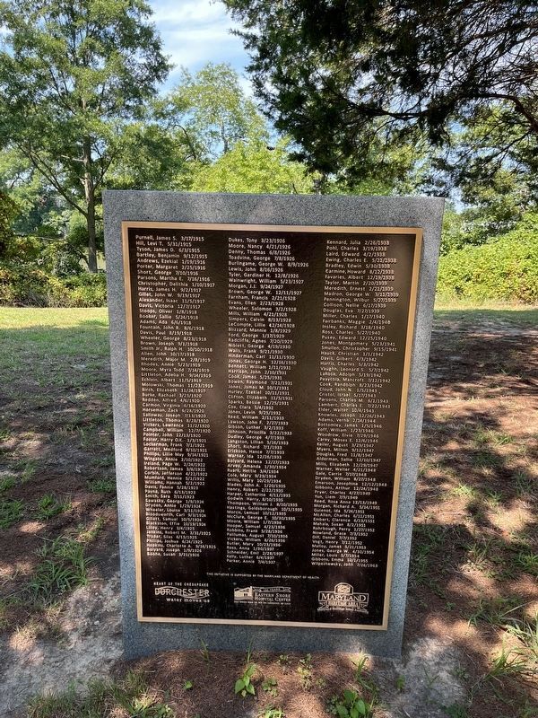
Near Marsh Elder Drive 0.4 miles north of Heron Boulevard, on the right when traveling north.
The Eastern Shore Hospital Center had its beginning in 1912 as a result of the General Assembly's decision to provide care for the mentally ill residents of the Eastern Shore counties of Maryland. The hospital was built on approximately 250 acres . . . — — Map (db m205105) HM
On Main Street (Maryland Route 16) at Academy Street ( Route 14), on the left when traveling north on Main Street.
Originally “Crossroads,” later “New Market.” Post for trading with Indians erected 1767. In Revolution, “New Market Blues,” volunteer militiamen, were organized in this supply center for Continental army. South on . . . — — Map (db m3979) HM
Near Hudson Road (Maryland Route 343) east of Castle Haven Road, on the right when traveling east.
The earliest mills, like the Spocott Windmill, were post mills in which the entire mill housing pivots on a central post. Dorchester also had tower and smock mills in which only the building cap rotated into the wind. Every major farming area had . . . — — Map (db m205113) HM
On Water Street just south of Race Street, on the left when traveling south.
Most of the town of Vienna lies within the "Critical Area" of land within 1,000 feet of a tidal wetland or waterway. The development of this riverwalk and park on the scenic Nanticoke represents a coordinated effort among federal, state, and . . . — — Map (db m190252) HM
Near Rosehill Place 0.1 miles north of Byrn Street, on the right when traveling north.
Senator Mikulski has fought tirelessly to improve the Bay's health and has supported the communities who depend on it for their livelihoods. She has earned the respect and affection of Chesapeake Bay watermen and the entire seafood industry for . . . — — Map (db m258549) HM
Near Solomons Island Road South (Maryland Route 2) just south of Thomas Johnson Road, on the left when traveling south.
John A. Ryder represents the most common type of Chesapeake Bay workboat, with its V-bottom and flat box-stern. These gradually replaced earlier powerboats like the adjacent Penguin.John A. Ryder was built in 1944 as the . . . — — Map (db m138589) HM
Near Solomons Island Road South (Maryland Route 2) south of Thomas Johnson Road, on the left when traveling south.
Penguin represents a once-numerous class of V-bottom boats known as Hooper Island launches, draketails, ducktails, or torpedo-sterns. Many were built on Hooper Island, Maryland, in the 1920s and 1930s; hence the name. The launches were . . . — — Map (db m138592) HM
On Academy Street at Cemetery Avenue, on the left when traveling south on Academy Street.
In this cemetery is the grave of Thomas Holliday Hicks, Governor of Maryland 1858-1862 and United States Senator from Maryland 1862-1865. At the beginning of the Civil War during his tenure as governor, the position of Maryland was more important . . . — — Map (db m3971) HM
On Key Wallace Drive-Entrance Road to Visitor Center.
Blackwater was established in 1933 as a haven for migratory waterfowl. Although management for migratory birds remains a primary focus over 80 years later, the refuge also protects and manages habitat for threatened and endangered species and . . . — — Map (db m78873) HM
Near High Street just north of Church Street, on the left when traveling north.
Emerson Columbus Harrington was born March 26, 1864 in Madison, MD, the son of John Edward and Anne Aurelia Thompson Harrington. He married Gertrude Johnson.
Emerson Harrington attended public schools and St. John's College in Annapolis . . . — — Map (db m205035) HM
On Gay Street at Spring Street, on the right when traveling west on Gay Street.
During the Civil War, Union Co. James Wallace (1818-1887), 1st Regiment, Eastern Shore Maryland Volunteers, used this building as his headquarters. The unit, which camped east of here, enlisted most of its members from the Eastern Shore. It . . . — — Map (db m205006) HM
Near Golden Hill Road south of Key Wallace Drive, on the right when traveling south.
Discover the extraordinary life and legacy of Harriet Tubman in the landscape of her childhood and early adult life.
Harriet Ross Tubman, an American legendary human rights advocate and suffragist, was born in enslaved in Dorchester . . . — — Map (db m114438) HM
On Smith Street just east of Crusader Road, on the left when traveling east. Reported permanently removed.
This Georgian-style home was built about 1760. It contains furniture of the Federal and Victorian periods, portraits of people who once lived in Dorchester County, china, silver, handmade quilts, clothing, and toys. The Governor room displays . . . — — Map (db m138288) HM
Near Cemetery Avenue east of Academy Street, on the right when traveling east.
This monument, erected by the state in 1868, honors Thomas Holliday Hicks, a native and life resident of Dorchester County. Late in 1860, and early 1861 as Maryland’s first Civil War governor, he opposed the doctrines of secession and coercion. In . . . — — Map (db m113146) HM
On Pine Street just south of Cross Street, on the right when traveling south.
In the early 1900's businesses were numerous and prosperous from the south end of Pine to where it intersects with High Street.
The neighborhood was filled with beauty salons, barber shops, funeral homes, and taxi cab stands, shoe repair . . . — — Map (db m138279) HM
On Hoopers Island Road (Maryland Route 335) 3 miles south of Meekins Neck Road, on the right when traveling south.
Long a community of watermen, this chain of islands bears name of family who settled in Dorchester County from southern Maryland in latter part of 17th century. Active in colonial affairs in 18th century was Col. Henry Hooper, whose seat was . . . — — Map (db m3997) HM
On East New Market Ellwood Road (Maryland Route 331) 0.4 miles south of Preston Road ( Route 318), on the right when traveling south.
We the people honor these men who brought democracy to Dorchester County July 8, 1985 by a change of the Constitution of Maryland ordered by the United States Courts:
George C. Jones, Charles F. Hurley Sr., Don W. Bradley, Oliver Harding, . . . — — Map (db m45944) HM
Near Teagues Point Road 0.1 miles south of Fairfax Court.
George Maxwell and Maxwell's Seat
George Maxwell, a Scottish immigrant, was present in Charles County, MD by 1745. He was a successful Chesapeake merchant with many business ventures and partnerships. Maxwell's Seat was purchased from Charles . . . — — Map (db m274119) HM
On Washington Street (Maryland Route 343) at Ocean Gateway (U.S. 50), on the right when traveling west on Washington Street.
A year after her escape, Harriet made it her mission to, with the help of God, free her family from slavery. In December 1850, she secretly planned her first rescue.
Harriet Tubman's niece, Kessiah Bowley, and her two children were to be . . . — — Map (db m204997) HM
Near High Street at Court Lane, on the left when traveling north.
Phillips Lee Goldsborough was born in 1865 the son of Martin Worthington and Henrietta Maria Jones Goldsborough. He married Ellen Showell of Berlin, MD.
Mr. Goldsborough was educated in Dorchester County, studied law with Daniel M. Henry, . . . — — Map (db m205036) HM
Near High Street just north of Church Street, on the left when traveling north.
Governor Henry Lloyd was the son of Daniel and Catherine (Kitty) Henry Lloyd. He was born on February 21, 1852. In 1886 he married Mary Elizabeth Stapleforte with whom he had one son Henry Lloyd, Jr.
Henry Lloyd graduated from the Cambridge . . . — — Map (db m205038) HM
On Rosa Parks Drive just west of French Street, on the left when traveling west.
Thomas Garrett, John Hunn, Ezekial Jenkins, Samual D. Burris, and many other Delawareans were prominent abolitionists of pre-Civil War days. Their activities with Harriet Tubman, an escaped slave from Dorchester County, Maryland, frequently referred . . . — — Map (db m184942) HM
On Washington Street (Maryland Route 343) at Ocean Gateway (U.S. 50), on the right when traveling west on Washington Street.
"I was a stranger in a strange land; and my home, after all, was down in Maryland, because my father, my mother, my brothers, and sisters, and friends were there. But I was free, and they should be free."
Harriet Tubman to . . . — — Map (db m205004) HM
Near High Street just north of Church Street, on the right when traveling south.
Henry Steele, the first member of the Steele family in Dorchester County Maryland, came from White Haven Cumberland County, England in 1740. He settled near Vienna and married Ann Billings, daughter of James and Ann Rider Billings.
Henry . . . — — Map (db m205008) HM
On West Market Street (Business U.S. 113) just east of Franklin Street, on the right when traveling east.
"I met one boy with a flint-lock rifle and a Confederate uniform. He acknowledged to have been in Confederate service, but that last night they all dispersed. I could see them running in every direction, hiding their arms." . . . — — Map (db m206338) HM
Near South Morris Street at Market Street, on the right when traveling north.
1668
A parcel of land, including the area that will become Oxford, is traded from Edward Lloyd to William Stephens, Jr., a Quaker from Dorchester County.
1670
The name "Oxford" first appears on a map of Maryland and Virginia . . . — — Map (db m204977) HM
Near South Morris Street (Maryland Route 333) at Market Street, on the right when traveling north.
1812-15
War rages between the US and Britain, partly over the impacts of British restrictions on US maritime trade. British troops occupy Tilghman's, Poplar and Sharp's Islands.
1814
British troops burn Washington and bomb Fort . . . — — Map (db m204972) HM
On Washington Street (Maryland Route 343) at Ocean Gateway (U.S. 50), on the right when traveling west on Washington Street.
When Harriet Tubman engaged with the Underground Railroad, she tapped into a secret network of people who firmly believed it was time to end slavery. There were always some enslaved people who seized opportunities to flee to freedom, but by the . . . — — Map (db m205003) HM
The landscapes here may look timeless—but they’re constantly changing. Since the Chesapeake Bay reached its present shape about 4,000 years ago, tides continue to tug at the shore, wind and storms, reshape the coastline, land settles, and the . . . — — Map (db m78735) HM
On East Freedom Way east of Rosa Parks Street, on the left when traveling east.
Harriet Tubman (born Araminta Ross ca. March 1822 - March 10,1913), was an American abolitionist, political activist, liberator, nurse, war hero, and human rights advocate. Araminta was born enslaved to Harriet Green and Benjamin Ross in Dorchester . . . — — Map (db m244861) HM
Near John F. Kennedy Memorial Highway (Interstate 95), in the median.
Honoring women from the State of Maryland, past and present, who have served our nation honorably and proudly, in war and peace.
Notable Accomplishments of Women in Military Service
Although women have served as true volunteers in a . . . — — Map (db m145479) HM WM
On Rose Hill Place at Radiance Drive, on the right when traveling north on Rose Hill Place.
A Landscape and Lifestyle Defined by Water Dorchester County consists of 688 square miles of which approximately 1/3 is water. The extensive waterways and marshland have played a significant role in the development of the county. Only 20 miles . . . — — Map (db m8349) HM
On Greenway Drive east of Abacco Lane, on the right when traveling east.
This Georgian-style home was built about 1760. You may notice that the original brick portion is quite symmetrical. The addition is believed to have been from the late 1800s. The house is furnished with many unique artifacts from Dorchester . . . — — Map (db m302819) HM
Early History
1768-The Indian Reservation at Chicone was dissolved by the Maryland Colony. 484 acres of Handsell went to Ann Billings and her husband, Henry Steele. According to oral history the Steeles built a “large pretentious home”, . . . — — Map (db m66617) HM
On Rock Creek Park Road 0.5 miles north of Muncaster Mill Road, on the right when traveling north.
What was enslavement like for a young child of African descent? Only the men and women who endured slavery and lived to share their experiences either in published autobiographies or in recorded oral histories could answer that painful question. . . . — — Map (db m197907) HM
On Pine Street just south of Dunns Court, on the right when traveling south.
The purpose of the gallery is to stimulate the renewal of the African American Community in this area and to promote and educate about the life of Harriet Tubman, leader of the Underground Railroad.
Formally opened on September 7, 1992 as . . . — — Map (db m258470) HM
Museum craftsmen are restoring this historic skipjack, which was built in 1955 to dredge oysters from the bottom of the Chesapeake Bay.
Why is this skipjack important? The celebrated Dorchester County boatbuilder Bronza Parks built Rosie Parks . . . — — Map (db m61527) HM
Near High Street north of Church Street, on the left when traveling north.
Richard Pattison, the son of Jacob Pattison, was born on Taylors Island. He was married to Mary McKeel.
During the Revolutionary war Richard Pattison was in the company of lower Dorchester County under Captain Charles . . . — — Map (db m205025) HM
On Taylors Island Road (Maryland Route 16) 0.2 miles east of Church Creek-Golden Hill Road ( Route 331), on the right when traveling west.
Under this tree the early settlers and Indians of the Choptank tribe conferred in the purchase of this section. An Indian princess is supposed to have negotiated this sale for which the red men received four guns , a few gunning coats and some . . . — — Map (db m3976) HM
On Lighthouse Boulevard east of Hemlock Drive, on the left when traveling east.
Calvert Cliffs
The Calvert Cliffs stretch more than thirty miles, from Drum Point, Calvert County, to Fairhaven, Anne Arundel County, rising in places to a height of more than 100 feet. The cliffs represent the eroded sides of the . . . — — Map (db m307391) HM
Boarded by two rivers that flow into the Chesapeake Bay, Dorchester County is graced with expansive marshes, fertile farmland, and scented pine forests. Here on the south shore of the Choptank River, the county seat of Cambridge boasts the only . . . — — Map (db m66638) HM
On High Street at Spring Street, on the right when traveling north on High Street.
The Call of Freedom
Dorchester County occupies a central place in the story of the Underground Railroad, the secret network of "stations" and "conductors" that sheltered and shepherded hundreds of enslave African Americans to freedom in the . . . — — Map (db m3964) HM
On High Street south of C Street, on the right when traveling south.
Perhaps one of the oldest buildings in Cambridge, the Bayly home was lived in by affluent and accomplished Maryland families. Although we know a fair amount about Dr. Alexander Hamilton Bayly, there is little known about the dozens of enslaved . . . — — Map (db m205047) HM
Near Mill Street just east of Burns Street, on the left when traveling east.
Dovetail boats were built in the early 1900s with gasoline engines and a special stern that looked like a motor racer. Martha was built in 1934 for $350 and was probably used for oyster tonging and trotlining for crabs. She was named after . . . — — Map (db m138357) HM
On Denton Road 0.2 miles north of Laurel Grove Road, on the left when traveling north.
Exeter
Exeter is one of the oldest remaining structures in the southern part of Caroline County. According to land records, the Reverend Thomas Dill (Dell) was granted a survey certificate and patent for 50 acres of land in Dorchester . . . — — Map (db m137763) HM
On Central Avenue (Maryland Route 312) at East Belle Street, on the right when traveling south on Central Avenue.
The Railroad was completed to Ridgely in 1867. The Saulsbury home was one of the earliest residences in Ridgely. Erected in 1867 by James K. Saulsbury, the building combined a large store where a widely known general merchandise business was . . . — — Map (db m205482) HM
Near High Street north of Church Street, on the left when traveling north.
Major Francis Turpin was the son of Beauchamp and Mary Cannon Turpin. He first married Ann Smith, second married Ann Chance and third married Nancy Dill. — — Map (db m205030) HM
On Washington Street (Maryland Route 343) at Ocean Gateway (U.S. 50), on the right when traveling east on Washington Street. Reported permanently removed.
Harriet Tubman led many slaves from Dorchester County to Canada (via the suspension bridge at Niagara Falls). One trip with "fugitive slaves" occurred in November 1856, when Tubman conducted Josia (Joe) Bailey, William Bailey, Peter Pennington . . . — — Map (db m109913) HM
Thin black lines indicate changes in relevance. Between each pair of lines entries are ordered geographically but all have the same relevance.
* Inflectional forms of words are their plurals, singulars, and possessives as well as gramatical tenses and similar variations.