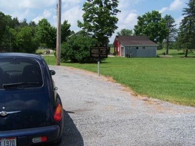
Greenville Treaty Line | Organized 1797
The starred line marks the
crossing of Knox County of the
Greenville Treaty Line as
surveyed by Israel Ludlow between
1797 and 1799; that part running
from near Fort Laurens in the
eastern part . . . — — Map (db m77401) HM
Mary Ann Ball was born in this vicinity in 1817 and began her nursing career at age 20. When the Civil War broke out in 1861, Mary at the age of 45 went to the soldiers' aid. Ignoring rank, protocol, and allegiance, she pursued fearlessly and with . . . — — Map (db m12723) HM
Dr. Frank Carter Larimore was
the creator of the first “hospital”
in Mount Vernon.
During the Civil War, Mr.
Larimore served in Ohio infantry
brigades. War injuries rendered
Mr. Larimore unable to work as a.
farmer after the war. He . . . — — Map (db m247648) HM
Wayman Chapel was dedicated in 1874 as part of Ohio’s Third District of the African Methodist Episcopal Church. The first Black church in Knox County, it began in 1870 under the guidance of Rev. James A. Ralls. The congregation met in local homes . . . — — Map (db m247534) HM
Named for the Native Americans who first dwelled here along both sides of the Kokosing River, the Little Indian Fields is adjacent to the site of the first white settlement of Knox County. Early white inhabitants of this land were Andrew and . . . — — Map (db m18747) HM
This park is owned and managed by the Morrow County Park District (MCPD). Sheedy Sanctuary contains over 40 acres of forested landscape encompassing large stands of previously cultivated white pines, dense stands of deciduous woodlands and . . . — — Map (db m236799) HM
While it may seem like time moves slowly in Knox County, our community and landscape have experienced profound changes. Pioneers roaming Ohio's vast forests couldn't have imagined our world of open fields, bustling highways, and instant . . . — — Map (db m298938) HM
Knox County Poor Farm
The surrounding 132 acres of land served as the Knox County Poor
Farm (aka Knox County Infirmary and County Home) from 1842 to
1955. The farm was nearly self-sustaining. Able residents grew
their own food, raised . . . — — Map (db m108925) HM
The stone masons brought from England by
Bishop Chase to construct the early buildings at
Kenyon College settled in this area. In the
1850’s with the help of Episcopal Bishop
Gregory T. Bedell, they and other families in
the community built . . . — — Map (db m94916) HM
Stone Arch at Howard, Ohio. The arch at Howard, built in 1874, is a bridge for U.S. Route 36 over the old Cleveland, Mt. Vernon, and Delaware Railroad bed, a part of the Kokosing Gap Trail. Samuel Israel, Sr. (1810-1889) sold the right to quarry . . . — — Map (db m154402) HM
Ellamae Simmons, M.D. (1918-2019). Ellamae Simmons, born and raised in Mount Vernon, became the first African American woman physician to specialize in asthma, allergy, and immunology in the country. Graduating in the top of her high school . . . — — Map (db m184225) HM
On May 1, 1863, Peace Democratic Party leader Clement L. Vallandigham spoke to 10,000 people from this spot. Vallandigham's party, known by their opponents as "Copperheads," opposed the Civil War as an encroachment on both individuals' and . . . — — Map (db m12726) HM
(Front):4th Ohio Infantry. 1st Brigade, 3rd Division, 2nd Corps. Carroll's Brigade. Ohio's Tribute. (Left):On the evening of July 2, 1863. Carroll's Brigade was sent from its position with the 2nd Corps to re-enforce this position of . . . — — Map (db m16945) HM
A descendent of Knox County’s earliest pioneers, Confederate Brigadier General Daniel Harris Reynolds was born just three miles west of Centerburg in 1832. He attended Ohio Wesleyan University in Delaware, where he became a close friend of Otho . . . — — Map (db m59460) HM
On August 13, 2004 the Ohio Dept. of Transportation designated the Wally Road in Ashland, Holmes, and Knox counties Ohio's 19th scenic byway.
Most of it follows the road bed of the old Toledo, Walhonding Valley, and Ohio Railroad, 1892-1942, . . . — — Map (db m281519) HM
In just two hundred years Ohio has experienced extraordinary changes. What will our surroundings look like in 2100? The goal of the BFEC is to help the land return to a healthy, self-sustaining ecosystem through strategies ranging from reforestation . . . — — Map (db m298940) HM
In 1823, Ohio Episcopal Bishop Philander Chase purchased 8,000 acres of what he called the “beauty spot” of Knox County. Here, he founded Kenyon College, the first men's college west of the Allegheny Mountains, and the second oldest . . . — — Map (db m13873) HM
250 yards east, near the mouth of First Creek, William Blount, Governor of the Territory South of the River Ohio, on July 2, 1791, signed a treaty with 48 chiefs of the Cherokee. It ceded a tract of land east of Clinch River extending approximately . . . — — Map (db m62517) HM
Here was the site of Amaquon a Potawatomi village with gardens and corn fields on the river bottom to the south and occupied by the Indians until 1832 – This was a center of widely diverging trails traveled by many tribes – Some trails led to . . . — — Map (db m313292) HM
The Civil War began at Fort Sumpter on April 12, 1861 and Alton became a stopping off point for thousands of Union soldiers. Rail lines brought the soldiers to the river front and they boarded steamers for Southern battlefields.
By December, . . . — — Map (db m211069) HM WM
This starred line marks the crossing in Knox County of the Greenville Treaty Line as surveyed by Israel Ludlow between 1797 and 1799; that part running from near Fort Laurens in the eastern part of the state, to a point near Fort Recovery, thence . . . — — Map (db m17478) HM
When Alvarado A. Geitgey (pronounced Get-gee) moved to Baker County, he became legendary. A self-made prosperous and shrewd business man purchased large tracts of land in the area and began pecan groves, grape orchards, citrus groves and a dairy . . . — — Map (db m206585) HM
Entered 1976 as national historic site
[Second plaque] This property has been placed on the National Register of Historic Places
Tuttle House circa 1840 — — Map (db m247504) HM
Knox County
Established 1792; named in honor of
Maj. Gen. Henry Knox
Washington's Chief of Artillery in the Revolutionary War. Secretary of War in Washington's Cabinet. One of the founders and first secretary of the Society of the . . . — — Map (db m109332) HM
This cabin was also known as the Wilson Cabin, the mystery cabin and the Dodd Gibson property. The cabin was built about 1790 on a cliff's edge overlooking the Ohio River at Elizabethtown, Illinois. The site afforded a view of the river more than 10 . . . — — Map (db m146878) HM
Edina, the seat of Knox County, was laid out here in the glacial plains of northeast Missouri, 1839, by W.J. Smallwood. Scotsman S.W.B. Carnegy, who surveyed the new town, named it the poetic form of Edinburgh. The county, formed 1843 and organized . . . — — Map (db m144472) HM
(south face)
“Dulce et decorum est pro patria mori”
In grateful appreciation of the Patriotism and selfsacrifice of the lamented sons and soldiers of Knox Co. who for their Country and for freedom, laid down their lives in the . . . — — Map (db m12727) HM
In recognition of
the patriotism of
the people of
Knox County
who oversubscribed their
War Savings Quota in 1918
this tablet is
gratefully erected by the
Ohio War Savings Committee — — Map (db m205937) HM
Alfred Buffat (1840-1908) came to Knox County at the age of 10 with his parents from Switzerland in search of religious tolerance and economic opportunity.
In 1851, the water milling enterprise was started to supplement the Buffat family's farm . . . — — Map (db m195475) HM
Greenville Treaty Line / Organized 1797
The starred line marks the
crossing of Knox County of the
Greenville Treaty Line as
surveyed by Israel Ludlow between
1797 and 1799; that part running
from near fort Laurens in the
eastern part . . . — — Map (db m77337) HM
Construction
Known as the "Workman Cabin,” this log home was built between 1838 and 1840 by Morgan Workman.
It originally stood three miles
northeast of Loudonville along what was once the old Wooster-Mt.
Vernon Pike & Stage Route—which . . . — — Map (db m166359) HM