74 entries match your criteria.
Transcontinental Railroad Historical Markers
By Kevin Craft, November 3, 2014
Transcontinental Railroad Centennial Marker
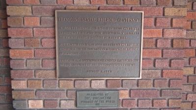
| 1 ► Arizona, Coconino County, Flagstaff — Transcontinental Railroad Centennial — |
| Near East Route 66. | |||
| 2 ► California, Alameda County, Alameda — 440 — Alameda Terminus of the 1st Transcontinental Railroad — |
| On West Mall Square, on the right when traveling north. | |||
| 3 ► California, Alameda County, Niles — Completion of the Transcontinental Railroad — Niles, California — |
| Near Niles Boulevard near J Street. | |||
| 4 ► California, Alameda County, Sunol — Niles Canyon Railway — |
| Near Kilkare Road near Main Street, on the left when traveling north. | |||
| 5 ► California, Nevada County, Norden — Great Summit Tunnel of the Sierra Nevada — |
| Near Old Donner Summit Road (Pacific Crest Trail), 0.5 miles south of Donner Pass Road, on the right when traveling south. | |||
| 6 ► California, Nevada County, Norden — 29 — Transcontinental Railroad — Hwy 40 Scenic Bypass — |
| On Donner Pass Road, on the left when traveling east. | |||
| 7 ► California, Nevada County, Truckee — Boca Townsite — |
| Near Stampede Meadows Road, 0.3 miles Interstate 80. | |||
| 8 ► California, Nevada County, Truckee — Donner Pass — Who Passed This Way — |
| On Donner Pass Road (Old Highway 40). | |||
| 9 ► California, Nevada County, Truckee — 780-6 — First Transcontinental Railroad - Truckee — |
| Near Donner Pass Road. | |||
| 10 ► California, Nevada County, Truckee — The Transcontinental Railroad and Boca Dam — The First Transcontinental Railroad — |
| On Stampede Meadows Road near Boca Dam Reservoir Road, on the left when traveling north. | |||
| 11 ► California, Placer County, Auburn — Auburn Depot — |
| Near Lincoln Way at Elm Avenue. | |||
| 12 ► California, Placer County, Auburn — Bloomers Cut — |
| On Herdal Drive at Quinn Way on Herdal Drive. | |||
| 13 ► California, Placer County, Auburn — 780-4 — First Transcontinental Railroad — Auburn — |
| On Lincoln Way, 0.1 miles south of The Golden Chain Highway (California Highway 49), on the right when traveling north. | |||
| 14 ► California, Placer County, Colfax — 780-5 — Colfax — First Transcontinental Railroad — |
| On East Grass Valley Street, on the right when traveling south. | |||
| 15 ► California, Placer County, Gold Run — Chinese Railroad Workers — |
| On Interstate 80. | |||
| 16 ► California, Placer County, Loomis — Loomis - Transcontinental Railroad — |
| Near Horseshoe Bar Road. | |||
| 17 ► California, Placer County, Newcastle — 780-3 — First Transcontinental Railroad — Newcastle — |
| On Main Street at Page Street, on the right when traveling south on Main Street. | |||
| 18 ► California, Placer County, Rocklin — 780-2 — Rocklin — First Transcontinental Railroad — |
| On Rocklin Road south of Front Street, on the right when traveling north. | |||
| 19 ► California, Placer County, Roseville — 780-1 — Roseville — First Transcontinental Railroad — |
| On Church Street at Washington Boulevard, on the right when traveling east on Church Street. | |||
| 20 ► California, Sacramento County, Rancho Cordova — Sacramento Valley Railroad — "First in the West" — |
| Near Mills Station Road west of Mather Field Road, on the right when traveling west. | |||
| 21 ► California, Sacramento County, Sacramento, North Sacramento — 780-8 — First Transcontinental Railroad — Western Base of the Sierra Nevada — |
| Near Fulton Avenue. | |||
| 22 ► California, Sacramento County, Sacramento, Old Sacramento — Freight on the Move — Central Pacific Railroad |
| Near Front Street. Reported permanently removed. | |||
| 23 ► California, Sacramento County, Sacramento, Old Sacramento — 812 — Old Sacramento — |
| On 2nd Street, on the left when traveling south. | |||
| 24 ► California, San Diego County, National City — 1023 — National City Depot — Transcontinental Railroad — |
| Near Bay Marina Drive west of West 23rd Avenue, on the right when traveling west. | |||
| 25 ► California, San Joaquin County, Lathrop — 780-7 — First Transcontinental Railroad — Site of Completion of Pacific Railroad |
| On South Manthey Road, on the right when traveling west. Reported missing. | |||
| 26 ► Colorado, Sedgwick County, Julesburg — Transcontinental Railroad — Wickedest City in the West — |
| Near U.S. 138 near U.S. 385, on the left when traveling north. | |||
| 27 ► Nebraska, Dawson County, Cozad — 17 — The 100th Meridian — |
| On U.S. 30 at North Meridian Avenue, on the right when traveling east on U.S. 30. | |||
| 28 ► Nebraska, Dawson County, Lexington — Plum Creek Railroad Attack — |
| On U.S. 30, 0.1 miles west of Road 430, on the right when traveling east. | |||
| 29 ► Nebraska, Douglas County, Omaha, Downtown — Site of Union Pacific's Omaha Shops — |
| On 10th Street near Cuming Street, on the right when traveling south. | |||
| 30 ► Nebraska, Keith County, Ogallala — 6 — The Union Pacific — |
| On West A Street near West Second Street. | |||
| 31 ► Utah, Box Elder County, Corinne — Centre Siding — 1879-1899 — |
| On Transcontinental Railroad Back Country Byway, on the right when traveling west. | |||
| 32 ► Utah, Box Elder County, Corinne — Monument — |
| On Transcontinental Railroad Back Country Byway, on the left when traveling west. | |||
| 33 ► Utah, Box Elder County, Corinne — Rozel — 1869-1942 — |
| On Transcontinental Railroad Back Country Byway, on the left when traveling west. | |||
| 34 ► Utah, Box Elder County, Corinne — The Track that United the States — Golden Spike National Historic Site — |
| On West Golden Spike Drive, 0.6 miles east of N East Promontory Road (County Road W 7200N), on the right when traveling west. | |||
| 35 ► Utah, Box Elder County, Park Valley — Bovine — |
| On Transcontinental Railroad Back Country Byway, on the left when traveling west. | |||
| 36 ► Utah, Box Elder County, Park Valley — Historic Lucin — |
| On Transcontinental Railroad Back Country Byway, on the left when traveling west. | |||
| 37 ► Utah, Box Elder County, Park Valley — Kelton — |
| On Transcontinental Railroad Back Country Byway near Kelton Road, on the right when traveling west. | |||
| 38 ► Utah, Box Elder County, Park Valley — Matlin — |
| On Transcontinental Railroad Back Country Byway near Flat Road, on the right when traveling west. | |||
| 39 ► Utah, Box Elder County, Park Valley — Medea Siding — 1899-1906 — |
| On Transcontinental Railroad Back Country Byway, on the right when traveling west. | |||
| 40 ► Utah, Box Elder County, Park Valley — Old Terrace — |
| On Transcontinental Railroad Back Country Byway, on the left when traveling west. | |||
| 41 ► Utah, Box Elder County, Park Valley — Ombey — |
| On Transcontinental Railroad Back Country Byway, on the left when traveling west. | |||
| 42 ► Utah, Box Elder County, Park Valley — Peplin — |
| On Transcontinental Railroad Back Country Byway, on the right when traveling west. | |||
| 43 ► Utah, Box Elder County, Park Valley — Red Dome Siding — 1895-1907 — |
| On Transcontinental Railroad Back Country Byway, on the right when traveling west. | |||
| 44 ► Utah, Box Elder County, Park Valley — Romola — |
| On Transcontinental Railroad Back Country Byway, on the left when traveling west. | |||
| 45 ► Utah, Box Elder County, Park Valley — Terrace — |
| On Transcontinental Railroad Back Country Byway, on the left when traveling west. | |||
| 46 ► Utah, Box Elder County, Park Valley — Terrace Cemetery — 1869- ca. 1910 — |
| On Transcontinental Railroad Back Country Byway, on the left when traveling west. | |||
| 47 ► Utah, Box Elder County, Park Valley — Walden Siding — 1898-1906 — |
| On Transcontinental Railroad Back Country Byway, on the right when traveling west. | |||
| 48 ► Utah, Box Elder County, Park Valley — Watercress — |
| On Transcontinental Railroad Back Country Byway, on the left when traveling west. | |||
| 49 ► Utah, Box Elder County, Promontory — The Southern Pacific Monument — Golden Spike National Historic Site — |
| Near Golden Spike Road, 0.1 miles south of 6400 N Road. | |||
| 50 ► Utah, Box Elder County, Promontory Summit — Golden Spike — National Historic Site — |
| On North 22300th Street West, on the right when traveling south. | |||
| 51 ► Utah, Box Elder County, Snowville — Elinor — |
| On Transcontinental Railroad Back Country Byway, on the right when traveling west. | |||
| 52 ► Utah, Box Elder County, Snowville — Nella Siding — (???)2-19(?)6, 1916-???? |
| On Transcontinental Railroad Back Country Byway, on the right. Reported damaged. | |||
| 53 ► Utah, Box Elder County, Snowville — Seco — |
| On Transcontinental Railroad Back Country Byway, on the left when traveling west. | |||
| 54 ► Utah, Box Elder County, Snowville — Ten-Mile — |
| On Transcontinental Railroad Back Country Byway, on the left. | |||
| 55 ► Utah, Salt Lake County, Salt Lake City, Downtown — 358 — Transcontinental Railroad — |
| On 400 West at South Temple Street, on the right when traveling south on 400 West. | |||
| 56 ► Wyoming, Albany County, Buford — Ames Monument — |
| On Monument Road near Hermosa Road, on the right when traveling south. | |||
| 57 ► Wyoming, Albany County, Buford — Pyramid on the Plains — |
| On Monument Road near Hermosa Road, on the right when traveling south. | |||
| 58 ► Wyoming, Albany County, Buford — The Transcontinental Railroad — |
| On Monument Road near Hermosa Road, on the right when traveling south. | |||
| 59 ► Wyoming, Albany County, Buford — Tree Rock — |
| On Interstate 80 at milepost 332, in the median. | |||
| 60 ► Wyoming, Carbon County, Sinclair — A Well Traveled Sawmill — The Fort Phil Kearny Sawmill — |
| Near County Route 347 near Interstate 80. | |||
| 61 ► Wyoming, Carbon County, Sinclair — Bridge Tender's House — |
| On County Route 347 near Interstate 80, on the right when traveling north. | |||
| 62 ► Wyoming, Carbon County, Sinclair — Brownsville and Benton — |
| On County Route 347 near Interstate 80, on the right when traveling north. | |||
| 63 ► Wyoming, Carbon County, Sinclair — Carbon Timber Company — |
| Near County Route 347 near Interstate 80. | |||
| 64 ► Wyoming, Carbon County, Sinclair — Railroad and River — Fort Fred Steele's Lifelines — |
| On State Highway 374 near Interstate 80, on the right when traveling north. | |||
| 65 ► Wyoming, Carbon County, Sinclair — The Passenger's Railroad — The Union Pacific Line — |
| On County Route 347 near Interstate 80, on the right when traveling west. | |||
| 66 ► Wyoming, Carbon County, Sinclair — Town of Ft. Steele — Boom and Bust — 1889 to 1940's — |
| Near County Route 374 near Interstate 80. | |||
| 67 ► Wyoming, Carbon County, Sinclair — Wild Times In Benton! — For the Railroad and Town — |
| On County Route 347 near 80, on the right when traveling west. | |||
| 68 ► Wyoming, Laramie County, Cheyenne — The Union Pacific Railroad — Part 1 (1867 - 1890) / Part 2 (1869 - 1890) — |
| On Capitol Ave just south of Lincolnway, on the left when traveling south. | |||
| 69 ► Wyoming, Sweetwater County, Point of Rocks — Point of Rocks Stage Station — |
| On Black Butte Road at Oregon Trail on Black Butte Road. | |||
| 70 ► Wyoming, Uinta County, Evanston — Aspen Tunnel — |
| On State Highway 150 near County Route 75, on the left when traveling south. | |||
| 71 ► Wyoming, Uinta County, Evanston — Bear River City — |
| On State Highway 150 near County Route 75, on the left when traveling south. | |||
| 72 ► Wyoming, Uinta County, Evanston — Transcontinental Railroad — |
| On State Highway 150 near County Route 75, on the left. | |||
| 73 ► Wyoming, Uinta County, Fort Bridger — 511 — Muddy Creek Camp and Crossing — |
| On Piedmont Road (County Road 173) 3.4 miles south of Interstate 80, on the right when traveling south. | |||
| 74 ► Wyoming, Uinta County, Fort Bridger — Town of Piedmont — Piedmont Kilns -- Charcoal Making — Union Pacific Railroad — |
| On Piedmont Road (County Route 173) near Route 204, on the left when traveling south. | |||