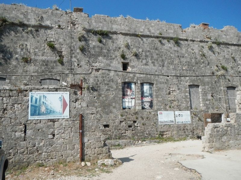
Croatian:Izardena 1806.-1812. u urijeme francuske vlasti u Dubrovniku i posvećena Napoleonu I. Od 1815. do 1882. austrijska je vojska proširuje i nadograđuje. U Domovinskom rate, 1991.-1995., tvedava je postals simbol . . . — — Map (db m126977) HM
Near Ulica Vrata od Pila close to Stradun (Placa).
Croatian:
PLAN GRADA S OBILJEŽENIM OŠTEĆENJIMA NASTALIM U AGRESIJI JUGOSLAVENSKE ARMIJE SRBA I CRNOGORACA NA DUBROVNIK 1991-1992 GODINE
English:
City map with the sites of damage caused by the . . . — — Map (db m126979) HM
Only the English text (bottom) has been transcribed. To view the Croatian text (top), click on the marker image to enlarge and display it.
Marco Polo, the famous medieval figure, explorer, traveller and travel writer. The place of his . . . — — Map (db m127112) HM
Only the English text (bottom) has been transcribed. To view the Croatian text (top), click on the marker image to enlarge and display it.
We apologize for possible inconvenience caused by temporary works. -- The Town of Korčula . . . — — Map (db m127110) HM
Only the English text (bottom) has been transcribed. To view the Croatian text (top), click on the marker image to enlarge and display it.
The journey of Marco Polo to China began in 1271. His father Nicola and uncle Mateo traveled a . . . — — Map (db m127111) HM
Only the English text (bottom) has been transcribed. To view the Croatian text (top), click on the marker image to enlarge and display it.
The famous naval battle between Venice and Genoa took place in the Pelješac Channel, along the . . . — — Map (db m127109) HM
On Obala Franje Tuđmana at Foša, on the right when traveling north on Obala Franje Tuđmana.
is situated on the island of the same name and it encompasses administratively the settlements of Čara, Pudnat, Žmovo, Račišće and the town of Korčula itself. Korkyra Melaina, the wooded Korčula, as it was named by the . . . — — Map (db m127106) HM
Kuća
Pelješkog pomorskog društva
Čija su 33 jedrenjaka
plovila morima svijeta
1865-1887
u spomen sto godišnjice
1965.
English translation
House of the Pelješac Maritime Society, whose 33 sailing ships . . . — — Map (db m270520) HM
Only the English text (bottom) has been transcribed. To view the Croatian text (top), click on the marker image to enlarge and display it.
The first Arsenal was built between 1292 and 1331 and it was used as a shipyard for galleys. New . . . — — Map (db m127191) HM
On Kroz Grodu at Marije Maričić, on the left when traveling north on Kroz Grodu.
Only the English text (bottom) has been transcribed. To view the Croatian text (top), click on the marker image to enlarge and display it.
The Benedictine Convent has been located here since 1664, originally the residential complex of . . . — — Map (db m127150) HM
Only the English text (bottom) has been transcribed. To view the Croatian text (top), click on the marker image to enlarge and display it.
The Gothic-Renaissance church was first mentioned in the 14th cent. It had a very important role . . . — — Map (db m127194) HM
On Ulica Matija Ivanića close to Dr. Mate Milicica.
Only the English text (bottom) has been transcribed. To view the Croatian text (top), click on the marker image to enlarge and display it.
The late Gothic Church of the Holy Spirit was built at the end of the 15th cent. by the . . . — — Map (db m127247) HM
On Trg Marka Miličića close to Ulica Matija Ivanića.
Only the English text (bottom) has been transcribed. To view the Croatian text (top), click on the marker image to enlarge and display it.
City walls enclose the northern part of the city and they are connected with the Fortica fortress. . . . — — Map (db m127244) HM
On Dr. Mate Milicica close to Petra Hektorovica, on the left when traveling north.
Only the English text (bottom) has been transcribed. To view the Croatian text (top), click on the marker image to enlarge and display it.
Building of medieval City Walls started after the decision of the Venetian authorities in 1278. . . . — — Map (db m127147) HM
Only the English text (bottom) has been transcribed. To view the Croatian text (top), click on the marker image to enlarge and display it.
Building of medieval City Walls started after the decision of the Venetian authorities in 1278. . . . — — Map (db m127151) HM
Only the English text (bottom) has been transcribed. To view the Croatian text (top), click on the marker image to enlarge and display it.
Originally in the defensive system of the city walls, Clock Tower used to belong the Duke's . . . — — Map (db m127195) HM
On etra Hektorovica near Dr. Mate Milicica, on the right when traveling west.
Only the English text (bottom) has been transcribed. To view the Croatian text (top), click on the marker image to enlarge and display it.
Gothic Jakša palace wast built at the end of the 15th cent. next to the southern city walls. The . . . — — Map (db m127149) HM
On Trg Sv. Stjepana close to River, on the right when traveling east.
Only the English text (bottom) has been transcribed. To view the Croatian text (top), click on the marker image to enlarge and display it.
The lower Paladini Palace was built by the galley commander and knight Nikiola Paladinić in . . . — — Map (db m127240) HM
Only the English text (bottom) has been transcribed. To view the Croatian text (top), click on the marker image to enlarge and display it.
City walls enclose the northern part of the city and they are connected with the Frotica . . . — — Map (db m127186) HM
On Dr. Mate Milicica close to Petra Hektorovica, on the left when traveling north.
Only the English text (bottom) has been transcribed. To view the Croatian text (top), click on the marker image to enlarge and display it.
City walls enclose the northern part of the city and they are connected with the Frotica . . . — — Map (db m127146) HM
On Trg Sv. Stjepana close to Riva, on the right when traveling east.
Only the English text (bottom) has been transcribed. To view the Croatian text (top), click on the marker image to enlarge and display it.
Central square in the city of Hvar or Piazza is the largest square in Dalmatia. Originally it was . . . — — Map (db m127241) HM
Only the English text (bottom) has been transcribed. To view the Croatian text (top), click on the marker image to enlarge and display it.
Palace Užižić, earlier known as the Hektorović Palace incorrectly, was built about . . . — — Map (db m127188) HM
On Unnamed Road at Unnamed Road, on the left when traveling west on Unnamed Road.
Only the English text (bottom) has been transcribed. To view the Croatian text (top), click on the marker image to enlarge and display it.
Vapnenica is one of several local words denoting a limekiln, When burnt, the piled stone burns . . . — — Map (db m127145) HM
On Ulica kralja Tomislava close to Ulica Natka Nodlia, on the right when traveling east.
The text of this marker appear at the bottom in five languages; Croatian, Italian, English, German and French. Only the English text (center) has been transcribed. To view the text in another language, click on the marker image to enlarge and . . . — — Map (db m128401) HM
On Poljana kraljice Jelene at Ulica Julija Nepota on Poljana kraljice Jelene.
The text of this marker appear at the bottom in five languages; Croatian, Italian, English, German and French. Only the English text (center) has been transcribed. To view the text in another language, click on the marker image to enlarge and . . . — — Map (db m128443) HM
On Poljana kraljice Jelene close to Ulica Julija Nepota.
The text of this marker appear at the bottom in five languages; Croatian, Italian, English, German and French. Only the English text (center) has been transcribed. To view the text in another language, click on the marker image to enlarge and . . . — — Map (db m128423) HM
On Ulica kralja Tomislava close to Ulica Natka Nodlia, on the left when traveling east.
The text of this marker appear at the bottom in five languages; Croatian, Italian, English, German and French. Only the English text (center) has been transcribed. To view the text in another language, click on the marker image to enlarge and . . . — — Map (db m128392) HM
Near Ulica kralja Tomislava close to Ulica Natka Nodlia.
The text of this marker appear at the bottom in five languages; Croatian, Italian, English, German and French. Only the English text (center) has been transcribed. To view the text in another language , click on the marker image to enlarge and . . . — — Map (db m128387) HM
Only the English text (right) has been transcribed. To view the Croatian text (left), click on the marker image to enlarge and display it.
The little church built in the 6th century in the sentries' walkway above the Iron Gate of . . . — — Map (db m128108) HM
Only the English text (right) has been transcribed. To view the Croatian text (left), click on the marker image to enlarge and display it.
The mausoleum of the Emperor Diocletian was built at the beginning of the 4th century, as one of . . . — — Map (db m127356) HM
On Obala Hrvatskog narodnog preporoda close to Obala Lazareta.
The text of this marker appear at the bottom in five languages; Croatian, Italian, English, German and French. Only the English text (center) has been transcribed. To view the text in another language , click on the marker image to enlarge and . . . — — Map (db m128230) HM
The text of this marker appear at the bottom in five languages; Croatian, Italian, English, German and French. Only the English text (right) has been transcribed. To view the text in another language , click on the marker image to enlarge and . . . — — Map (db m128213) HM
Julius Nepos (C. 430-480) was a western emperor (474-480) during the last stage of the western Roman Empire he reigned. At first, over Italy and adjoining areas yet held by the western empire. As of 475, he had influence only over Dalmatia, having . . . — — Map (db m127597) HM
Near Ulica Kraj Svetog Ivana close to Adamova Ulica.
The Temple of Jupiter (Croatian: Jupiterov hram) is a temple dedicated to the Jupiter, Ancient Roman God of sky and thunder and king of the Gods. Temple is located in the western part of the Diocletian's palace near the Peristyle, the central square . . . — — Map (db m127358) HM
On Obala Lazareta close to Poljana kneza Trpimira.
The text of this marker appear at the bottom in five languages; Croatian, Italian, English, German and French. Only the English text (right) has been transcribed. To view the text in another language , click on the marker image to enlarge and . . . — — Map (db m128215) HM
Croatian: U ovoj se kući (prema predaji) 18. VII. 1450. rodio
Marko Marulić
prozom i u "versih harvacki slažući
po običaju naših začinjavc"
začetke udari hrvatskoj umjetničkoj . . . — — Map (db m127596) HM
The text of this marker appear at the bottom in five languages; Croatian, Italian, English, German and French. Only the English text (center) has been transcribed. To view the text in another language, click on the marker image to enlarge and . . . — — Map (db m128390) HM
On Obala Lazareta close to Poljana kneza Trpimira.
The text of this marker appear at the bottom in five languages; Croatian, Italian, English, German and French. Only the English text (right) has been transcribed. To view the text in another language , click on the marker image to enlarge and . . . — — Map (db m128216) HM
On Poljana kraljice Jelene close to Ulica Frane Bulića.
Only the English text (right) has been transcribed. To view the Croatian text (left), click on the marker image to enlarge and display it.
The three-storey building in Classicist style was designed for the building of the Classics High . . . — — Map (db m128104) HM
On Ulica kralja Petra Krešimira IV close to Try Peristil, on the right when traveling west.
Only the English text (right) has been transcribed. To view the Croatian text (left), click on the marker image to enlarge and display it.
A Late Gothic palace of the wealthy merchant, later ennobled, Giovanni Battista De Gubbio of the . . . — — Map (db m127599) HM
On Bosanska Ulica close to Narodni Trg, on the right when traveling north.
Only the English text (right) has been transcribed. To view the Croatian text (left), click on the marker image to enlarge and display it.
The Gothic palace of the old Split patrician family of Cambi was built in the first half of the . . . — — Map (db m127414) HM
On Ulica Majstora Jurja close to Dioklecijanova Ulica, on the right when traveling west.
Only the English text (right) has been transcribed. To view the Croatian text (left), click on the marker image to enlarge and display it.
One of the first little churches in Diocletian's Palace, it was built in the 5th-6th century in . . . — — Map (db m127415) HM
On Poljana kraljice Jelene at Dioklecijanova Ulica on Poljana kraljice Jelene.
Only the English text (right) has been transcribed. To view the Croatian text (left), click on the marker image to enlarge and display it.
The Church of St Roche with its Renaissance façade was created in 1516 through the conversion of . . . — — Map (db m128101) HM
On Ulica Marka Marulića at Narodni trg, on the right when traveling north on Ulica Marka Marulića.
Only the English text (right) has been transcribed. To view the Croatian text (left), click on the marker image to enlarge and display it.
The palace was built in 1394 for the Split nobleman Cipriano de Ciprianis (C. Žaninić . . . — — Map (db m127320) HM
On Papalićeva Ulica close to Dioklecijanova Ulica, on the right when traveling east.
Only the English text (right) has been transcribed. To view the Croatian text (left), click on the marker image to enlarge and display it.
This is an originally Romanesque house of the 13th century, with Gothic and Renaissance . . . — — Map (db m127417) HM
On Ulica Majstora Jurja close to Ulica Dujma Vušković, on the left when traveling west.
Only the English text (right) has been transcribed. To view the Croatian text (left), click on the marker image to enlarge and display it.
A Late Gothic palace of the second half of the 15th century, the design and execution of which . . . — — Map (db m127416) HM
On Trg Peristil at Ulica kralja Petra Krešimira lV on Trg Peristil.
Only the English text (right) has been transcribed. To view the Croatian text (left), click on the marker image to enlarge and display it.
The medieval house of the old Split patrician family of Grisogono was constructed on the corner . . . — — Map (db m128106) HM
Only the English text (right) has been transcribed. To view the Croatian text (left), click on the marker image to enlarge and display it.
The remains of this Late Gothic palace of the mid-15th century, which suffered numerous . . . — — Map (db m128112) HM
Only the English text (right) has been transcribed. To view the Croatian text (left), click on the marker image to enlarge and display it.
The Renaissance palace of the patrician family of Karepić, which moved from Trogir to . . . — — Map (db m127361) HM
On Papalićeva Ulica near Ulica Julija Nepota, on the left when traveling east.
Only the English text (right) has been transcribed. To view the Croatian text (left), click on the marker image to enlarge and display it.
The Late Gothic palace that was put up in the mid-15th century by the patrician Split . . . — — Map (db m127590) HM
Only the English text (right) has been transcribed. To view the Croatian text (left), click on the marker image to enlarge and display it.
A Late Gothic palace of the second half of the 15th century in which, according to tradition, . . . — — Map (db m127591) HM
Only the English text (right) has been transcribed. To view the Croatian text (left), click on the marker image to enlarge and display it.
This palace in the Baroque style with the characteristic sequence of round openings for shops on . . . — — Map (db m127374) HM
Only the English text (right) has been transcribed. To view the Croatian text (left), click on the marker image to enlarge and display it.
A complex on the site of the one-time triclinium and the residential sector of Diocletian's . . . — — Map (db m127322) HM
Only the English text (right) has been transcribed. To view the Croatian text (left), click on the marker image to enlarge and display it.
The Renaissance palace of an old Split patrician family of the 16th century. It was extended in . . . — — Map (db m127413) HM
On Marmontova Ulica 1 at Neretvanska Ulica on Marmontova Ulica 1.
Only the English text (right) has been transcribed. To view the Croatian text (left), click on the marker image to enlarge and display it.
This building of 1903 designed by Kamilo Tončić is an important specimen, with its . . . — — Map (db m127321) HM
Only the English text (right) has been transcribed. To view the Croatian text (left), click on the marker image to enlarge and display it.
The old Gothic town hall is the only remaining building complex that was knocked down in 1825 . . . — — Map (db m127371) HM
On Franjevački Trg close to Ulica Silvija Strahumira Kranjčevića, on the left when traveling east.
The text of this marker appear in three languages: Croatian (top), German (middle) and English (bottom). Only the English text has been transcribed. To view the text in another language, click on the marker image to enlarge and display them. . . . — — Map (db m128541) HM
On Uršulinska Ulica close to Ulica Andrije K. Miošića, on the left when traveling south.
The text of this marker appear in three languages: Croatian (top), English (middle) and German (bottom). Only the English text has been transcribed. To view the text in another language, click on the marker image to enlarge and display them. . . . — — Map (db m128540) HM
On Franjevački Trg close to Ulica Silvija Strahumira Kranjčevića, on the left when traveling south.
The text of this marker appear in three languages: Croatian (left), German (center) and English (right). Only the English text has been transcribed. To view the text in another language, click on the marker image to enlarge and display them. . . . — — Map (db m128651) HM
On Trg kralja Tomislava at Ulica Ljudevita Gaja, in the median on Trg kralja Tomislava.
The text of this marker appear in three languages: Croatian (top), German (middle) and English (bottom). Only the English text has been transcribed. To view the text in another language, click on the marker image to enlarge and display them. . . . — — Map (db m128722) HM
On Pavlinska Ulica at VTrg kralja Tomislava, on the right when traveling east on Pavlinska Ulica.
The text of this marker appear in three languages: Croatian (top), German (middle) and English (bottom). Only the English text has been transcribed. To view the text in another language, click on the marker image to enlarge and display them. . . . — — Map (db m128728) HM
On Pavlinska Ulica close to Trg kralja Tomislava, on the right when traveling east.
The text of this marker appear in three languages: Croatian (left), German (middle) and English (right). Only the English text has been transcribed. To view the text in another language, click on the marker image to enlarge and display them. . . . — — Map (db m128872) HM
On Ulica Silvija Strahumira Kranjčevića close to Franjevački Trg, on the right when traveling south.
The text of this marker appear in three languages: Croatian (left), German (center) and English (right). Only the English text has been transcribed. To view the text in another language, click on the marker image to enlarge and display them. . . . — — Map (db m128601) HM
On Franjevački Trg at Trg kralja Tomislava, on the right when traveling east on Franjevački Trg.
The text of this marker appear in three languages: Croatian (top), German (middle) and English (bottom). Only the English text has been transcribed. To view the text in another language, click on the marker image to enlarge and display them. . . . — — Map (db m128871) HM
On Trg kralja Tomislava close to Franjevački Trg, on the left when traveling north.
The text of this marker appear in three languages: Croatian (top), German (middle) and English (bottom). Only the English text has been transcribed. To view the text in another language, click on the marker image to enlarge and display them. . . . — — Map (db m128721) HM
On Trg kralja Tomislava at Franjevački Trg, on the left when traveling north on Trg kralja Tomislava.
The text of this marker appear in three languages: Croatian (top), German (middle) and English (bottom). Only the English text has been transcribed. To view the text in another language, click on the marker image to enlarge and display them. . . . — — Map (db m128719) HM
On Bakačeva Ulica close to Ulica Silvija Strahumira Kranjčevića.
The text of this marker appear in three languages: Croatian (top), English (middle) and German (bottom). Only the English text has been transcribed. To view the text in another language, click on the marker image to enlarge and display them. . . . — — Map (db m128875) HM
On Ulica Ivana Gundulića close to Ulica Silvija Strahumira Kranjčevića, on the right when traveling east.
The text of this marker appear in three languages: Croatian (left), German (middle) and English (right). Only the English text has been transcribed. To view the text in another language, click on the marker image to enlarge and display them. . . . — — Map (db m128648) HM
On Trg kralja Tomislava at Pavlinska Ulica on Trg kralja Tomislava.
The text of this marker appear in three languages: Croatian (top), German (middle) and English (bottom). Only the English text has been transcribed. To view the text in another language, click on the marker image to enlarge and display them. . . . — — Map (db m128727) HM
On Franjevački Trg at Ulica Silvija Strahumira Kranjčevića, on the right when traveling west on Franjevački Trg.
The text of this marker appear in three languages: Croatian (top), German (middle) and English (bottom). Only the English text has been transcribed. To view the text in another language, click on the marker image to enlarge and display them. . . . — — Map (db m128873) HM
On Trg Miljenka Stančića at Bakačeva Ulica, on the left when traveling south on Trg Miljenka Stančića.
The text of this marker appear in three languages: Croatian (top), German (middle) and English (bottom). Only the English text has been transcribed. To view the text in another language, click on the marker image to enlarge and display them. . . . — — Map (db m128537) HM
On Franjevački Trg close to Ulica Silvija Strahumira Kranjčevića, on the left when traveling east.
The text of this marker appear in three languages: Croatian (left), English (middle) and German (right). Only the English text has been transcribed. To view the text in another language, click on the marker image to enlarge and display them. . . . — — Map (db m128591) HM WM
On Bakačeva Ulica close to Ulica Silvija Strahumira Kranjčevića.
The text of this marker appear in three languages: Croatian (top), German (middle) and English (bottom). Only the English text has been transcribed. To view the text in another language, click on the marker image to enlarge and display them. . . . — — Map (db m128908) HM
On Uršulinska Ulica at Ulica Ivana Padovca, on the left when traveling south on Uršulinska Ulica.
The text of this marker appear in three languages: Croatian (top), German (middle) and English (bottom). Only the English text has been transcribed. To view the text in another language, click on the marker image to enlarge and display them. . . . — — Map (db m128538) HM
On Uršulinska Ulica close to Ulica Andrije K. Miošića, on the right when traveling south.
The text of this marker appear in three languages: Croatian (top), German (middle) and English (bottom). Only the English text has been transcribed. To view the text in another language, click on the marker image to enlarge and display them. . . . — — Map (db m128539) HM
Near Bakačeva Ulica close to Ulica Silvija Strahumira Kranjčevića.
The text of this marker appears on the righthand side in three languages: Croatian (top), English (middle) and German (bottom). Only the English text has been transcribed. To view the text in another language, click on the marker image to enlarge . . . — — Map (db m128909) HM
The text of this marker appear in three languages: Croatian (top), German (middle) and English (bottom). Only the English text has been transcribed. To view the text in another language, click on the marker image to enlarge and display them. . . . — — Map (db m128874) HM
On Ulica Ivana Gundulića close to Ulica Silvija Strahumira Kranjčevića.
The text of this marker appear in five languages: Croatian, on top, followed by English, German, French and Italian. Only the English text has been transcribed. To view the text in another language, click on the marker image to enlarge and . . . — — Map (db m128596) HM
On Ulica Nikole Tesle at Preradoviæeva Ulica, on the right when traveling east on Ulica Nikole Tesle.
Croatian:
U Ovoj Kuci Je Živio I Umro
Znameniti Hrvatski Prosvjetitelj,
Preporoditelj, Polihistor I Leksikograf
Bogoslav Šulek
20.IV.1816 - 30.XI.1896
Rodom Slovak Srcem I Dušom Hrvat
Svoj Je Život I . . . — — Map (db m128932) HM
On Trg Svetog Marka, on the left when traveling north.
Smatram Svojom Dužnošću・Da Kao
Rodeni Sin Svoje Zemlje Pomognem
Gradu Zagrebu U Svakom Pogledu
Savjetom I Činom - Rekao Je U Ovoj Zgradi
Nikola Tesla
24 Svibnja 1892・Godine
Kad Je . . . — — Map (db m128937) HM
On Trg Sv. Marka (St. Marks Square), on the left when traveling north.
(Croatian:)
Ovdje Je Do G. 1810. Stajala Stara Gradska Vijećnica. G. 1833. Položen Je Temelj Kazalištu I Redutnoj Dvorani.
7. I. 1835. Bila Je Prva Kazališna Predstava Na Je Prva Hrvatska Drama Juran I Sofija: Od Ivana Pl. . . . — — Map (db m128964) HM
Javni zahod za potrebe posjetitelja u Vrtu je postavljen kod ulaza vec
1892., no zamijenjen je novim objektom 1905. Tada je iz Beca mladi
arhitekt Milan Lenuci (danas dobro poznat po urbanistickom
ostvarenju Zelene potkove) donio ideju . . . — — Map (db m270083) HM