2548 entries match your criteria. Entries 201 through 300 are listed.⊲ Previous 100 — Next 100 ⊳
Historical Markers and War Memorials in the United Kingdom
By Michael Herrick, August 18, 2018
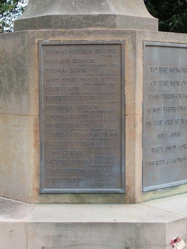
Castle Eden War Memorial
| 201 ► United Kingdom, England, County Durham, Hartlepool — Castle Eden War Memorial — |
| On England Route B1281 at Stockton Road, on the left when traveling east on State Route B1281. | |||
| 202 ► United Kingdom, England, County Durham, Horden — Horden Colliery — |
| Near Kilburn Drive at Blackhills Road, on the right when traveling north. | |||
| 203 ► United Kingdom, England, County Durham, Rookhope — Rookhope War Memorial — |
| On Front Street at unnamed road, 3 miles north of A689 in Eastgate, on the right when traveling north on Front Street. | |||
| 204 ► United Kingdom, England, County Durham, Seaham — Eleven ‘O’ One — Tommy - World War One Soldier — |
| On North Terrace at Tempest Road, on the left when traveling south on North Terrace. | |||
| 205 ► United Kingdom, England, County Durham, Seaham — Seaham Cenotaph — |
| On North Terrace at Tempest Road, on the left when traveling south on North Terrace. | |||
| 206 ► United Kingdom, England, County Durham, Wolsingham — Millenium Window — |
| On Front Street (England Route A689) at Market Place (England Route B6296), on the left when traveling east on Front Street. | |||
| 207 ► United Kingdom, England, County Durham, Wolsingham — Wolsingham War Memorial — |
| On Front Street (England Route A689) at Market Place (England Route B6296), on the left when traveling east on Front Street. | |||
| 208 ► United Kingdom, England, Cumbria, Brougham — The Castle of Robert de Vieuxpont — Brougham Castle — |
| Near Regional Route 71. | |||
| 209 ► United Kingdom, England, Cumbria, Brougham — The Keep in the 14th Century — Brougham Castle — |
| Near Regional Route 71. | |||
| 210 ► United Kingdom, England, Cumbria, Burgh by Sands — King Edward I Statue — |
| 211 ► United Kingdom, England, Cumbria, Carlisle — The Citadel or Court Houses — |
| Near English Street. | |||
| 212 ► United Kingdom, England, Cumbria, Penrith — Great Dockray — Millennium Trail — |
| On Great Dockray, on the left when traveling south. | |||
| 213 ► United Kingdom, England, Cumbria, Penrith — Home for a Future King — Penrith Castle — |
| Near Ullswater Road. | |||
| 214 ► United Kingdom, England, Cumbria, Penrith — Penrith Castle — |
| On Ullswater Road. | |||
| 215 ► United Kingdom, England, Cumbria, Penrith — St Andrew's Churchyard — Millennium Trail — |
| Near Saint Andrews Churchyard. | |||
| 216 ► United Kingdom, England, Cumbria, Penrith — Welcome to Penrith Castle — |
| Near Castle Terrace. | |||
| 217 ► United Kingdom, England, Derby, City Centre — The Friary — |
| On Friar Gate just east of Stafford Street, on the left when traveling west. | |||
| 218 ► United Kingdom, England, Derbyshire, Chesterfield — Chesterfield Station — Trans Pennine Trail — |
| On Crow Lane. | |||
| 219 ► United Kingdom, England, Derbyshire, Ilkeston — Welcome to Park Cemetery — |
| On Cantelupe Road, on the left when traveling west. | |||
| 220 ► United Kingdom, England, Devon, Axminster — Abbeyfield — |
| On Silver Street at Church Street, on the left when traveling north on Silver Street. | |||
| 221 ► United Kingdom, England, Devon, Axminster — Axminster War Memorial — |
| On West Street (England Route A358) at Church Street, on the left when traveling south on West Street. | |||
| 222 ► United Kingdom, England, Devon, Axminster — Cattle Market — |
| On Musbury Road at Church Street, on the right when traveling north on Musbury Road. | |||
| 223 ► United Kingdom, England, Devon, Axminster — Jubilee of Queen Victoria — |
| On West Street (Route A358) at Silver Street, on the left when traveling south on West Street. | |||
| 224 ► United Kingdom, England, Devon, Axminster — Law Chambers — |
| On Silver Street at Church Street, on the right when traveling north on Silver Street. | |||
| 225 ► United Kingdom, England, Devon, Axminster — Rose Cottage — |
| On South Street at Cooombe Lane, on the right when traveling north on South Street. | |||
| 226 ► United Kingdom, England, Devon, Axminster — The Old Carpet Factory — |
| On Silver Street at Church Street, on the right when traveling north on Silver Street. | |||
| 227 ► United Kingdom, England, Devon, Axminster — The Trafalgar Way — Axminster — |
| On Victoria Place at West Street, on the right when traveling west on Victoria Place. | |||
| 228 ► United Kingdom, England, Devon, Exeter — Philip Freeman/Friedman Wartime Firewatcher — |
| On St. Marks Ave.. | |||
| 229 ► United Kingdom, England, Devon, Kilmington — Kilmington War Memorial — |
| On Gammons Hill (Route A35) at Shute Road, on the left when traveling west on Gammons Hill. | |||
| 230 ► United Kingdom, England, Devon, Kilmington — The Trafalgar Way — Kilmington — |
| On The Green, 0.2 kilometers north of The Street, on the right when traveling north. | |||
| 231 ► United Kingdom, England, Dorset, Abbotsbury — Abbotsbury Swannery — |
| Near New Barn Road, 0.6 kilometers south of Church Road, on the right when traveling south. | |||
| 232 ► United Kingdom, England, Dorset, Blandford Forum — 1731 Fire — |
| On East Street close to Church Lane, on the left when traveling east. | |||
| 233 ► United Kingdom, England, Dorset, Blandford Forum — Blandford Forum War Memorial — |
| On East Street close to West Street, on the left when traveling east. | |||
| 234 ► United Kingdom, England, Dorset, Blandford Forum — Jack Counter VC — |
| On East Street at Church Lane, on the left when traveling east on East Street. | |||
| 235 ► United Kingdom, England, Dorset, Blandford Forum — The Bastards' House — Blandford Civic Society — |
| On East Street at Church Lane, on the right when traveling east on East Street. | |||
| 236 ► United Kingdom, England, Dorset, Blandford Forum — The Battle of Blandford — |
| On West Street close to River Mews, on the left when traveling north. | |||
| 237 ► United Kingdom, England, Dorset, Blandford Forum — The Trafalgar Way — Blandford Forum — |
| On West Street at Market Place, on the right when traveling north on West Street. | |||
| 238 ► United Kingdom, England, Dorset, Bovington — Centurion Mark 12 — |
| On King George V Road at Linsay Road, on the left when traveling south on King George V Road. | |||
| 239 ► United Kingdom, England, Dorset, Bovington — Challenger I Main Battle Tank — |
| Near King George V Road at Linsay Road, on the left when traveling south. | |||
| 240 ► United Kingdom, England, Dorset, Bovington — FV603B Armoured Personnel Carrier — |
| Near King George V Road at Linsay Road, on the left when traveling south. | |||
| 241 ► United Kingdom, England, Dorset, Bovington — Household Cavalry and Royal Armoured Corps Memorial — |
| Near King George V Road at Linsay Road, on the left when traveling south. | |||
| 242 ► United Kingdom, England, Dorset, Bovington — M4A1 Medium Tank Grizzly — |
| On King George V Road at Linsay Road, on the left when traveling south on King George V Road. | |||
| 243 ► United Kingdom, England, Dorset, Bovington — Royal Tank Regiment Memorial Statue — |
| Near King George V Road at Linsay Road, on the left when traveling south. | |||
| 244 ► United Kingdom, England, Dorset, Bovington — Tank Infantry Mark IV — |
| Near King George V Road at Linsay Road, on the left when traveling south. | |||
| 245 ► United Kingdom, England, Dorset, Bovington — The Kuwait Arena — |
| Near King George V Road at Linsay Road, on the left when traveling south. | |||
| 246 ► United Kingdom, England, Dorset, Bovington — The Lawrence of Arabia Trail — The Tank Museum — |
| Near King George V Road at Linsay Road, on the left when traveling south. | |||
| 247 ► United Kingdom, England, Dorset, Bridport — Bucky Doo Square — |
| Near South Street at East Street (England Route B3162), on the left when traveling south. | |||
| 248 ► United Kingdom, England, Dorset, Bridport — King Edward Tree — |
| Near South Street at East Street (England Route B3162), on the left when traveling south. | |||
| 249 ► United Kingdom, England, Dorset, Bridport — The Trafalgar Way — Bridport — |
| On East Street at Chancery Lane, on the left when traveling west on East Street. | |||
| 250 ► United Kingdom, England, Dorset, Christchurch — Christchurch Castle and Norman House — Symbol of Norman Power — |
| Near Castle Street. | |||
| 251 ► United Kingdom, England, Dorset, Christchurch — Priory Church — |
| On Church Street. | |||
| 252 ► United Kingdom, England, Dorset, Christchurch — The Ducking Stool — |
| Near Ducking Stool Lane. | |||
| 253 ► United Kingdom, England, Dorset, Christchurch — The Town of Christchurch-Twynham — |
| On Castle Street, on the right when traveling east. | |||
| 254 ► United Kingdom, England, Dorset, Christchurch — World War II Memorial — |
| On Quay Road. | |||
| 255 ► United Kingdom, England, Dorset, Dewlish — Dewlish War Memorial — |
| On Long Lane, 3.2 kilometers north of Warren Road, on the left when traveling north. | |||
| 256 ► United Kingdom, England, Dorset, Dorchester — Benjamin Ferrey Architect — |
| On High East Street close to Corn Hill, on the right when traveling west. | |||
| 257 ► United Kingdom, England, Dorset, Dorchester — Benjamin Ferrey Architect — |
| On High West Street close to Trinity Street, on the right when traveling west. | |||
| 258 ► United Kingdom, England, Dorset, Dorchester — Dorchester World War II Monument — |
| On Bridport Road (England Route B3150) at Poundbury Road, on the right when traveling west on Bridport Road. | |||
| 259 ► United Kingdom, England, Dorset, Dorchester — Holy Trinity Church World War I Memorial — |
| On High West Street at Trinity Street, on the right when traveling west on High West Street. | |||
| 260 ► United Kingdom, England, Dorset, Dorchester — St Peter’s Parish World War I Memorial — |
| On High East Street at Corn Hill, on the right when traveling west on High East Street. | |||
| 261 ► United Kingdom, England, Dorset, Dorchester — The Roman Walls — |
| On West Wall Walks Road close to Bowling Alley Walk, on the left when traveling south. | |||
| 262 ► United Kingdom, England, Dorset, Dorchester — The Town Pump — |
| On High West Street close to Cornhill, on the left when traveling west. | |||
| 263 ► United Kingdom, England, Dorset, Dorchester — The Trafalgar Way — Dorchester — |
| On Trinity Street at Prince’s Street, on the right when traveling north on Trinity Street. | |||
| 264 ► United Kingdom, England, Dorset, Dorchester — Tolpuddle Martyrs — |
| On High West Street close to N Square, on the right when traveling west. | |||
| 265 ► United Kingdom, England, Dorset, Lower Ansty — Fox Inn — |
| Near Hartfoot Lane at Aller Lane, on the right when traveling north. | |||
| 266 ► United Kingdom, England, Dorset, Poole — Lifeboat Service — |
| On High Street, on the right when traveling west. | |||
| 267 ► United Kingdom, England, Dorset, Portland — A Brief History — |
| On Chiswell, on the left when traveling north. | |||
| 268 ► United Kingdom, England, Dorset, Weymouth — The Black Dog — |
| On St Mary Street, on the right when traveling north. | |||
| 269 ► United Kingdom, England, East Sussex, Battle — Battle Formation — Battle of Hastings, 1066 — |
| Near High Street at Park Lane, on the right when traveling south. | |||
| 270 ► United Kingdom, England, East Sussex, Battle — Battle town and the abbey’s estates — Battle of Hastings, 1066 — |
| Near High Street at Park Lane, on the right when traveling south. | |||
| 271 ► United Kingdom, England, East Sussex, Battle — Battlefield to Vegetable Garden — Battle of Hastings, 1066 — |
| Near High Street at Park Lane, on the right when traveling south. | |||
| 272 ► United Kingdom, England, East Sussex, Battle — Beehives in the Walled Garden — Battle of Hastings, 1066 — |
| Near High Street at Park Lane, on the right when traveling south. | |||
| 273 ► United Kingdom, England, East Sussex, Battle — Dairy and Icehouse — |
| Near High Street at Park Lane, on the right when traveling south. | |||
| 274 ► United Kingdom, England, East Sussex, Battle — Dusk. William Victorious — Battle of Hastings, 1066 — |
| Near High Street at Park Lane, on the right when traveling south. | |||
| 275 ► United Kingdom, England, East Sussex, Battle — East Range of Cloister — |
| Near High Street at Park Lane, on the right when traveling south. | |||
| 276 ► United Kingdom, England, East Sussex, Battle — Great Gatehouse — Battle of Hastings, 1066 — |
| Near High Street at Park Lane, on the right when traveling south. | |||
| 277 ► United Kingdom, England, East Sussex, Battle — On the very spot — Battle of Hastings, 1066 — |
| Near High Street at Park Lane, on the right when traveling south. | |||
| 278 ► United Kingdom, England, East Sussex, Battle — Parlour — |
| Near High Street at Park Lane, on the right when traveling south. | |||
| 279 ► United Kingdom, England, East Sussex, Battle — Rebuilding the Abbey Church — |
| Near High Street at Park Lane, on the right when traveling south. | |||
| 280 ► United Kingdom, England, East Sussex, Battle — Reredorter — Battle of Hastings, 1066 — |
| Near High Street at Park Lane, on the right when traveling south. | |||
| 281 ► United Kingdom, England, East Sussex, Battle — Stalemate — Battle of Hastings, 1066 — |
| Near High Street at Park Lane, on the right when traveling south. | |||
| 282 ► United Kingdom, England, East Sussex, Battle — The 11th-century Church — |
| Near High Street at Park Lane, on the right when traveling south. | |||
| 283 ► United Kingdom, England, East Sussex, Battle — The Abbey and its History — Battle of Hastings, 1066 — |
| Near High Street at Park Lane, on the right when traveling south. | |||
| 284 ► United Kingdom, England, East Sussex, Battle — The Afternoon Assaults — Battle of Hastings, 1066 — |
| Near High Street at Park Lane, on the right when traveling south. | |||
| 285 ► United Kingdom, England, East Sussex, Battle — The Afternoon Assaults: Norman Trick Tactics — |
| Near High Street at Park Lane, on the right when traveling south. | |||
| 286 ► United Kingdom, England, East Sussex, Battle — The Battle of Hastings and Battle Abbey — Battle of Hastings, 1066 — |
| Near High Street at Park Lane, on the right when traveling south. | |||
| 287 ► United Kingdom, England, East Sussex, Battle — The Chapter House — |
| Near High Street at Park Lane, on the right when traveling south. | |||
| 288 ► United Kingdom, England, East Sussex, Battle — The Cloister — |
| Near High Street at Park Lane, on the right when traveling south. | |||
| 289 ► United Kingdom, England, East Sussex, Battle — The Dormitory — |
| Near High Street at Park Lane, on the right when traveling south. | |||
| 290 ► United Kingdom, England, East Sussex, Battle — The Duchess of Cleveland’s Walled Garden — Battle of Hastings, 1066 — |
| Near High Street at Park Lane, on the right when traveling south. | |||
| 291 ► United Kingdom, England, East Sussex, Battle — The East Range — Battle of Hastings, 1066 — |
| Near High Street at Park Lane, on the right when traveling south. | |||
| 292 ► United Kingdom, England, East Sussex, Battle — The First Norman Attack — Battle of Hastings, 1066 — |
| Near High Street at Park Lane, on the right when traveling south. | |||
| 293 ► United Kingdom, England, East Sussex, Battle — The First Norman Attack — Battle of Hastings, 1066 — |
| Near High Street at Park Lane, on the right when traveling south. | |||
| 294 ► United Kingdom, England, East Sussex, Battle — The Great Gatehouse — Battle of Hastings, 1066 — |
| Near High Street at Park Lane, on the right when traveling south. | |||
| 295 ► United Kingdom, England, East Sussex, Battle — The High Altar of Battle Abbey — |
| Near High Street at Park Lane, on the right when traveling south. | |||
| 296 ► United Kingdom, England, East Sussex, Battle — The Norman Counter-attack — Battle of Hastings, 1066 — |
| Near High Street at Park Lane, on the right when traveling south. | |||
| 297 ► United Kingdom, England, East Sussex, Battle — The Norman Retreat — Battle of Hastings, 1066 — |
| Near High Street at Park Lane, on the right when traveling south. | |||
| 298 ► United Kingdom, England, East Sussex, Battle — The Outer Court — Battle of Hastings, 1066 — |
| Near High Street at Park Lane, on the right when traveling south. | |||
| 299 ► United Kingdom, England, East Sussex, Battle — The Refectory — |
| Near High Street at Park Lane, on the right when traveling south. | |||
| 300 ► United Kingdom, England, East Sussex, Battle — The Weakened Shield Wall — Battle of Hastings, 1066 — |
| Near High Street at Park Lane, on the right when traveling south. | |||
2548 entries matched your criteria. Entries 201 through 300 are listed above. ⊲ Previous 100 — Next 100 ⊳