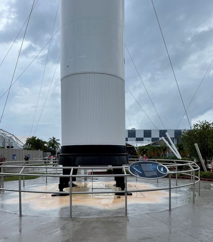
Near Space Commerce Way at NASA Parkway West, on the left when traveling east.
The first challenge was getting the hardware into space. But even the biggest rocket would be no more than fireworks if we couldn’t ride along – even if was just electronically for the time being. The devices and systems needed for space . . . — — Map (db m176646) HM
Near South Sykes Creek Parkway close to Fortenberry Road, on the right when traveling north.
Wt: 24 tons 46 mm cannon 45mph
Use: reconnaissance Crew: 4
Replaced World War II M24 Chaffee Tank
Manufacturer: Cadillac Motor Car Division of GM
Production: Cleveland, Ohio 1951-1954
Total Manufactured: 5,467
Worldwide Service . . . — — Map (db m164643) HM
Near NASA Parkway West (State Road 405) east of E Avenue SW, on the right when traveling east.
Saturn V, the United States’ largest and most powerful launch vehicle, was designed to hurl American astronauts in an Apollo capsule to the Moon. Composed of three stages and an instrument unit, the Saturn V, which stood 111 meters (363 feet) tall, . . . — — Map (db m105211) HM
Near Space Commerce Way at NASA Parkway West, on the left when traveling east.
Less than three years after Sputnik, NASA began test firing the Saturn I, the first launch vehicle created specifically for the space program. It was the largest rocket ever built in America and lead to the development of the huge Saturn V. The . . . — — Map (db m176664) HM
On Space Commerce Way at NASA Parkway West, on the left when traveling east on Space Commerce Way.
America’s newfound enthusiasm for space opened the door for an army of scientific visionaries who had dreamed of this opportunity for generations. It wasn’t just telescopes anymore. It was going there, taking notes, building the immeasurable . . . — — Map (db m176329) HM
Near Space Commerce Way at NASA Parkway West, on the left when traveling east.
Looking into the rearview mirror, we can only shake our heads at the fear and paranoia that chained two powerful nations to a seesaw of guided missiles and possible nuclear destruction. In that mirror we should also remember that it was the Cold . . . — — Map (db m176565) HM
Near Space Commerce Way at NASA Parkway West, on the left when traveling east.
What began as a competition of fear in 1958 became a quest for common ground 17 years later. On July 15, 1975, Russia launched their Soyuz spacecraft into orbit. Seven hours later, the Saturn IB launched an Apollo Command Service Module fitted . . . — — Map (db m176585) HM
Near Space Commerce Way at NASA Parkway West, on the left when traveling east.
The most powerful liquid-fueled rocket engine ever produced, the F-1 engine, was a critical component in sending astronauts to the moon during the Apollo Program. Developed under the direction of Wernher von Braun, the Saturn V rocket was the . . . — — Map (db m176600) HM
Near Space Commerce Way at NASA Parkway West, on the left when traveling east.
The Delta was the fourth configuration of the Thor-Able launch vehicle. Although not part of the human space program, and never achieving the fame of the Redstone, Atlas or Saturn, the Delta and its 34 variations have been the workhorse of . . . — — Map (db m176638) HM
Near Space Commerce Way 1.2 miles south of NASA Parkway West, on the left when traveling east.
This countdown clock from Kennedy Space Center’s Press Site is considered one of the most-viewed timekeepers in the world, second only to London’s Big Ben Clock. Built in 1969 during the Apollo program, the clock counted down launches for the . . . — — Map (db m176218) HM
Near Space Commerce Way at NASA Parkway West, on the left when traveling east.
If the Mercury missions proved that humans could survive and work in the most hostile environment ever explored, it was the Gemini Program that tested and proved the skills and systems we needed to get to the moon and back.
On June 3, . . . — — Map (db m176724) HM
On State Road A1A, on the right when traveling south.
The men and women of the Air Force Eastern Test Range proudly dedicate this monument to our national progress in missile and space technology in recognition of the American revolution Bicentennial. Erected on site of support elements for early space . . . — — Map (db m57602) HM
The first group of astronauts selected for the Space Transportation System (STS) Program began training in 1978.
This group of men and women followed in the footsteps of the Mercury, Gemini, Apollo, Manned Orbiting Laboratory (MOL) Skylab and . . . — — Map (db m113138) HM
Near Kennedy Parkway North 0.2 miles north of Astronaut Road, on the right when traveling north.
Michael Collins ★ Neal Armstrong. ★ Edwin “Buzz” Aldrin
"The Eagle Has Landed"
In honor of the Apollo II crew
and the men and women who made their spaceflight possible
— — Map (db m188474) HM
Near Kennedy Parkway North 6 miles north of NASA Parkway West, on the right when traveling north.
Date: July 26 - August 7, 1971
Command Module: Endeavor
Lunar Module: Falcon
Command Module Pilot: Alfred Worden
Lunar Module Pilot: James Irwin
Commander: David Scott . . . — — Map (db m176495) HM
Near Kennedy Parkway North 6 miles north of NASA Parkway West, on the right when traveling north.
Date: March 3-13, 1969
Command Module: Gumdrop
Lunar Module: Spider
Command Module Pilot: David Scott
Lunar Module Pilot: Russell Schweickart
Commander: James McDivitt
Near Orange Street at South Washington Avenue (U.S. 1), on the right when traveling east.
Name Origin:
Named for a Woods Hole Oceanographic Institute Sailing Ship of exploration in the 20th century.
Flight History:
First flight October 3, 1985.
Atlantis was launched into space 33 times and, during 4,848 orbits, flew 126 . . . — — Map (db m113083) HM
Near Orange Street at South Washington Avenue, on the right when traveling east.
Name Origin:
Named for a British exploration ship that sailed in the 19th Century, as well as the Apollo 17 lunar module.
Flight History:
First flight April 4, 1983.
Challenger completed 995 orbits during 10 missions beginning in 1983. . . . — — Map (db m113067) HM
Near Orange Street at South Washington Avenue, on the right when traveling east.
Name Origin:
Boston-based ship that explored the Pacific Northwest during the 18th century.
Flight History:
First flight April 12, 1981.
Columbia was the first Space Shuttle Orbiter to launch into space, flying 28 times. In 2003, on . . . — — Map (db m113062) HM
On Orange Street at Indian River Ave on Orange Street.
Name Origin:
Named for two famous British ships of exploration in the 17th and 18th centuries.
Flight History:
First flight August 30, 1984. Discovery was NASA’s “workhorse shuttle’. During 39 missions, between 1984 and 2011, it spent a . . . — — Map (db m113074) HM
Near Orange Street at South Washington Avenue (U.S. 1), on the right when traveling east.
Name Origin:
Enterprise was named for the spaceship from the Star Trek television series.
Flight & Test Orbiter:
First free flight August 12, 1977.
Enterprise was used for the Approach and Landing test program, making five free . . . — — Map (db m113001) HM
Near Broad Street at Indian River Avenue, on the left when traveling east.
Jules Verne’s mythical journey to the Moon in the 1880’s
was similar to the Apollo 11 launched on July 16, 1969
Both had three man crews
Both landed in the Pacific Ocean
Both used retro-rockets for descent
Both flights blasted off . . . — — Map (db m112256) HM
Near Broad Street 0.1 miles east of Indian River Avenue, on the left when traveling east.
"Look across the Indian River… it is from the tract of land east of Titusville that the United States will fire its hopes toward the moon… From now on, Titusville will be known as space exploration headquarters." - . . . — — Map (db m141292) HM
On Pine Street at South Hopkins Avenue (U.S. 1), on the left when traveling east on Pine Street.
The LR91 was an American liquid-propellant rocket engine, which was used on the second stages of the Titan I intercontinental ballistic missiles and launch vehicles. This model offered an average of 105,000 pounds of thrust.
This particular . . . — — Map (db m164379) HM
Mercury Project
Initiated in 1958, completed in 1963. Project Mercury was United States’ first man-in-space program. Over 2,000,000 people from many government agencies and aerospace corporations combining their skills and experiences into . . . — — Map (db m116582) HM
On Pine Street at South Hopkins Avenue (U.S. 1), on the left when traveling east on Pine Street.
The RL-10 was the world’s first operational liquid hydrogen/liquid oxygen high energy restartable 2nd stage rocket engine used in space.
Each individual engine produced 15,000 pounds of thrust. On January 29, 1964, a six-engine cluster of . . . — — Map (db m164387) HM
Near Kennedy Parkway North 0.2 miles north of Astronaut Road, on the right when traveling north.
These trees, each representing a crewed Apollo mission, are descendants of the original Moon trees grown with seeds astronaut Stuart Roosa carried to the Moon on Apollo 14. The garden’s figure eight shape represents the spacecraft’s slingshot . . . — — Map (db m188483) HM
On Bunker Avenue near 1 Bunker Avenue, on the right when traveling south.
Front line, ¼-ton, 4X4 was a variant of the M-38A1 Military Jeep, with its body lengthened by twenty inches, heavier suspension, and provisions for three patients on litters. The spare tire and jerry can of the M-170 were mounted in the body tub . . . — — Map (db m181337) WM
Near U.S. 301 0.2 miles south of East Dr. Martin Luther King Jr. Boulevard, on the right when traveling south.
In July 1958, Lebanon was threatened by a civil war between Maronite Christians and Muslims. Tensions with Egypt had escalated earlier in 1956 when pro-western President Camille Chamoun, a Christian, did not break diplomatic relations with the . . . — — Map (db m265144) HM WM
Near U.S. 301 0.2 miles south of East Dr. Martin Luther King Jr. Boulevard, on the right when traveling south.
The second United States occupation of the Dominican Republic began when the United States Marines Corps entered Santo Domingo on April 28, 1965 in the Dominican Civil War. They were later joined, beginning the following day by most of the United . . . — — Map (db m194506) WM
Near U.S. 301 0.2 miles south of East Dr. Martin Luther King Jr. Boulevard, on the right when traveling south.
National Liberation Front (FMLN) a coalition of five left-wing guerrilla groups. However this conflict evolved into a proxy war between the United States and the Communist elements of Nicaragua and Cuba. The United States was able to prevail by . . . — — Map (db m194165) HM WM
Near U.S. 301 0.2 miles south of East Dr. Martin Luther King Jr. Boulevard, on the right when traveling south.
The Cuban missile crisis — known as the October crisis in Cuba and the Caribbean crisis (Russian: Карибский кризис, tr. Karibskiy krizis) in the USSR — was . . . — — Map (db m265327) HM WM
Near U.S. 301 0.2 miles south of East Dr. Martin Luther King Jr. Boulevard, on the right when traveling south.
"I have seen in your eyes a fire of determination to get this war job done quickly. My confidence in you is total, our cause is just. Now you must be the thunder and lightning of Desert Storm."
Near U.S. 301 0.2 miles south of East Dr. Martin Luther King Jr. Boulevard, on the right when traveling south.
In 1973 Libya claimed the Gulf of Sidra as a closed bay and part of its territorial waters. This prompted the United States to conduct Freedom of Navigation (FON) operations in the area once the claim did not meet the criteria established by . . . — — Map (db m194776) HM WM
Near U.S. 301 0.2 miles south of East Dr. Martin Luther King Jr. Boulevard, on the right when traveling south.
Operation Odyssey Dawn was the U.S. code name for the US part of the international military operation in Libya to enforce United Nations Security Council Resolution 1973 during the initial period of 19-31 March 2011, which continued afterwards . . . — — Map (db m193980) HM WM
Near Tampa Bypass Canal Trail at U.S. 301, on the right when traveling west.
On 5 January 1968, Pueblo left Yokosuka, Japan, in transit to Sasebo, Japan, from where she left on 11 January 1968, headed northward through the Tsushima Strait into the Sea of Japan. She left with specific orders to intercept and conduct . . . — — Map (db m193251) HM
Near U.S. 301 0.2 miles south of East Dr. Martin Luther King Jr. Boulevard, on the right when traveling south.
In Memory of Richard 'Dick’ Arens, Major USAF (Ret)
Major Arens was a Vietnam veteran who flew 443 combat missions as a Forward Air Controller (FAC) in the O-1 BIRD DOG. His military flying career also included flying the B-58 . . . — — Map (db m193732) HM WM
Near U.S. 301 0.2 miles south of East Dr. Martin Luther King Jr. Boulevard, on the right when traveling south.
During the multinational occupation of post-World War Il Germany, the Soviet Union blocked the Western Allies’
railway, road and canal access to the sectors of Berlin under Allied control. Their aim was to force the western powers to allow the . . . — — Map (db m194108) HM WM
Near U.S. 301 0.2 miles south of East Dr. Martin Luther King Jr. Boulevard, on the right when traveling south.
Naval, (Hydrogen Peroxide) Propulsion
973 lbs. Torpex Explosive Charge
Range: 13,700 yards at a speed of 46 knots
This type was in service from 1944 to 1975
This example is a non-explosive dummy.
Sign provided by . . . — — Map (db m193417) HM
Near U.S. 301 0.2 miles south of East Dr. Martin Luther King Jr. Boulevard.
The USS Liberty Incident was an attack on a United States Navy technical research ship, USS Liberty, by Israeli Air Force jet fighter aircraft and Israeli Navy motor torpedo boats, on 8 June 1967, during the Six-Day War. The combined air and sea . . . — — Map (db m193283) HM
On West 5th Avenue at North Donnelly Street, on the left when traveling west on West 5th Avenue.
In 1925, James Simpson built the Simpson Hotel as Mount Dora's first fireproof hotel. As part of the fireproofing, concrete, steel, and red brick were used in the building's construction. The electrical wiring was encased in water pipes with a . . . — — Map (db m287564) HM
On NW 14th Street at NW 2nd Avenue, on the right when traveling east on NW 14th Street.
On this site, which was officially known as the Florida City Shelter of the Catholic Welfare Bureau’s Children’s Program, thousands of Operation Pedro Pan children found refuge from Communist Cuba between 1961 and 1966. Operation Pedro Pan . . . — — Map (db m71917) HM
On Southwest 13th Avenue north of Southwest 12th Street, on the left when traveling south.
[Spanish:]
Al Martirologio del Presidio Político Cubano
Obra erigida por la institución “Presidio Político Histórico Cubano”
Miami Septiembre 1 de 1986
Los que luchan viven Los que contemplan vegetan . . . — — Map (db m295360) WM
On Southwest 13th Avenue at Southwest 10th Street, on the left when traveling north on Southwest 13th Avenue.
[Español:]
Esta calle para honra a las mujeres del presidio politico cubano, quienes por seis decadas —hasta el presente han sufrido enfrentandose a la dictadura de Fidel y Raul Castro. Durante la guerra fria, las mujeres . . . — — Map (db m295352) HM
On Southwest 13th Avenue north of Southwest 12th Street, on the left when traveling south.
[English:]
This Monument is dedicated to the men and women who suffered long sentences, torture, repression, inhuman treatment and cruelty in prisons when facing the Castro-Communist tyranny beginning in the year of 1959. . . . — — Map (db m295362) HM
On Southwest 13th Avenue south of Southwest 11th Street, on the left when traveling south.
[English:]
This sculptural complex pays homage to the exiled Cuban journalists, victims of the totalitarian regime that gained power in 1959. The chosen pyramids and triangles symbolize the power of the word, truth, and the . . . — — Map (db m295358) HM
On Southwest 13th Avenue at Southwest 10th Street, on the right when traveling south on Southwest 13th Avenue.
Dedicated to the more than 14,000 Cuban children that were sent to live free in America by their parents in “Operation Pedro Pan.”
(Spanish) La libertad no se mendiga, se conquista con el filo del machete. A. Maceo . . . — — Map (db m295353) HM
Near Southwest 13th Avenue south of Southwest 11th Street.
[Spanish:]
Un infatigable escritor y periodista que luchó tenazmente, desde 1925, para evitar la siniestra conjura del comunismo internacional, en su trágico afán de apoderarse de Cuba… y profetizó, además, la desaparición del . . . — — Map (db m295357) HM
On Biscayne Boulevard north of Northeast 3rd Street, on the right when traveling north.
From Asociacion Interamericana de Hombres de Empresa. Miami Chapter. Place Miami Beach Convention Hall.
For the past 17 years, this nation has seen thousands of people fleeing from the unbearable oppression of a communist regime. We are . . . — — Map (db m297658) HM
On Biscayne Boulevard south of Northeast 4th Street, on the right when traveling north.
Dedicated by the City of Miami to the everlasting friendship of our neighboring countries 1960 Commissioners Robert King High, Mayor • Henry L. Balaban • George W. Dubreuil • Joseph X. Dumond • B. E. Hearn Melvin L. Reese, City Manager
. . . — — Map (db m297660) WM
On Biscayne Boulevard (U.S. 1) at NE 6th Street, on the right when traveling south on Biscayne Boulevard.
2012, Bronze 132 x 89 x 64 in. The Tower of Snow by distinguished Cuban-born artist Enrique Martínez Celaya honors the 50th anniversary of Operation Pedro Pan, which brought thousands of Cuban children, without their parents, to the United States . . . — — Map (db m71941) HM
Near Southwest 13th Avenue at Southwest 8th Street, on the right when traveling south.
A la lucha guerrillera anticomunista que tuvo lugar en Cuba de 1960 a 1966. Este monumento es para honrar a los hombres y mujeres que enfrentaron con las armas a la tiranía castrista en montañas y llanos; a los guías y a las líneas de . . . — — Map (db m295323) HM WM
On Southwest 13th Avenue at Tamiami Trail, in the median on Southwest 13th Avenue.
During 1960 and early 1961, Cuban exiles from Miami flew from Opa-Locka airport to Guatemala to become part of the almost 1,300 men of Brigade 2506 who were recruited, trained, and equipped by the CIA during the Eisenhower . . . — — Map (db m269010) HM
Near Southwest 13th Avenue at Southwest 8th Street, on the right when traveling south.
[English:]
This memorial was built an homage to Nestor Antonio “Tony” Izquierdo, a great fighter for the freedom of the United States and for the freedom of Cuba and who died on June 10, 1979, in a plane crash in Nicaragua where . . . — — Map (db m295325) HM
On Overseas Highway (U.S. 1 at milepost 78), 1.9 miles south of Old State Road 4a, on the left when traveling south.
This plaque is in memory of the many Cubans who were desperate to leave Castros' communist Cuba. They left their homes and families trying to cross the 90 miles of sea in rafts, innertubes or anything that would float.
Not knowing what rough . . . — — Map (db m83553) HM
Cold War
For the first time following a war, the military did not abandon Key West. As relations with the Soviet Union deteriorated, the Navy increased its shore-based and afloat organizations making Key West the largest anti-submarine . . . — — Map (db m224157) HM WM
Cuban Missile Crisis
Following the discovery of Russian nuclear missile installations in Cuba on October 15, 1962, large numbers of military troops and aircraft began arriving in Key West while destroyers and submarines in the harbor . . . — — Map (db m224166) HM WM
Near Wall Street north of Tifts Street, on the left when traveling north.
During October, 1962, United States intelligence sources confirmed Soviet construction of nuclear missile sites in Cuba. This provocation, coupled with the strains of the Cold War, was a direct nuclear threat to the United States. Fearing . . . — — Map (db m246013) HM
• Longest serving U.S. coastal fortification (1861-1947)
• Originally sited 1,100 feet off the island of Key West to protect its harbor
• Held by the Union Army for the duration of the American Civil War
• Never . . . — — Map (db m240158) HM
History of Fort Taylor
Fort Taylor served faithfully through the American Civil War and was called the "Gibraltar of the Florida Straits", even though it never fired a single shot in defense. It protected the harbor from attack, and served as . . . — — Map (db m240152) HM
On Front Street, on the right when traveling south.
Built in 1890 on the waterfront as a two-family dwelling for the base commandant and paymaster, this building was known as Quarters A and B. It was converted into a single-family residence in 1911. President William Howard Taft visited this site in . . . — — Map (db m32659) HM
Greater love has
no man than this,
that a man lay
down his life for
his friends.
John 15:13
On the night of
April 1980, these
men gave their
lives in the
gallant attempt
to free the
American hostages
in . . . — — Map (db m100438) HM
In April 1996, Special Operations Command Europe (SOCEUR) responded to a crisis in Liberia, where a civil war endangered Americans and other foreign nationals. The US deployed forces quickly to save lives, protect the American Embassy, and . . . — — Map (db m99776) HM
Violence in Somalia was precipitated by a series of civil war, famine, and disease which cost the lives of an estimated 350,000 people. In December 1992, US troops were sent to help contain the lawlessness in Somalia and create a safe . . . — — Map (db m99782) HM
Operation Uphold Democracy was the name given to the restoration of the democracy in Haiti. The US, expecting civil unrest and military opposition, deployed a large force to the area, which could overcome any opposition and restore order to . . . — — Map (db m99778) HM
Operations in Bosnia-Herzegovina took on many different names between 1993-1998. Whether it was Operation Joint Endeavor, Joint Guard, Deny Flight, Deliberate Force, or Joint Forge, the special operations mission remained relatively . . . — — Map (db m99777) HM
Near Kirkman Road (Florida Route 435) 0.1 miles north of Major Boulevard.
On this site on March 8, 1983, President Ronald Reagan gave a speech
to the National Association of Evangelicals in which he described the
Soviet Union as an "evil empire." Given at the height of the Cold War,
President Reagan knew that victory . . . — — Map (db m297253) HM
On Medulla Road 0.1 miles south of James C. Ray Drive, on the left when traveling north.
Once owned by Howard Hughes, the craft was converted to a “planeboat” after sustaining catastrophic damage during Hurricane Cleo (1964).
Donated by Dave Drummer — — Map (db m193391) HM
On Rocky Road north of James C. Ray Drive, on the right when traveling north.
This is the military version of the DC-3. The C-47 has the unique distinction of participating in the Berlin Airlift in the late 1940s. — — Map (db m193323) HM
On James C. Ray Drive at Peggy Brown Road, on the right when traveling west on James C. Ray Drive.
The F-14 first flew in December 1970, replacing the F-4 Phantom II. The F-14 served as the U.S. Navy’s primary maritime air superiority fighter into the 1990s. The Tomcat was retired from the U.S. Navy’s active fleet on 22 September 2006, having . . . — — Map (db m193383) WM
On James C. Ray Drive 0.1 miles east of Medulla Road, on the right when traveling east.
Approximately 60 countries across 4 continents have flown the Russian designed supersonic jet. With 13,996 produced, the MiG-21 holds the record for being the most produced supersonic aircraft. #7708 served in the Slovak Air Force before retiring . . . — — Map (db m193387) HM
Near James C. Ray Drive just east of Peggy Brown Road, on the right when traveling east.
This aircraft was built by Lockheed in the early 1950s to demonstrate the operation of a vertical takeoff and landing fighter for protecting convoys.
Lockheed Chief Test Pilot Herman “Fish” Salmon piloted the first test flight on June 16, . . . — — Map (db m193336) HM
Near Willing Street 0.1 miles west of Caroline Street.
1948 - 1991
The Cold War
April, 1961
Bay of Pigs Invasion
October 1962
Cuban Missile Crisis
November 20, 1970
Son Tay Raid
1979 - 1981
Iranian Hostage Crisis
. . . — — Map (db m152684) WM
On Caroline Street at Elmira Street, on the left when traveling south on Caroline Street.
Ship's Bell Of
USS Kenneth Whiting (AV-14)
Presented To Santa Rosa County
By The
U.S. Naval Auxiliary Air Station
Whiting Field
21 October 1961 — — Map (db m151841) WM
On Red Cleveland Blvd 0.1 miles south of Marquette Ave. when traveling north.
In Memoriam
Speartips Combat Deployments
(Southeast Asia)
USS Constellation (CVA-64) 28 March 1967 – 4 December 1967
USS America (CVA-66) April 1970 – 21 December 1970.
USS Constellation (CVA-64) 5 January 1973 . . . — — Map (db m137117) HM WM
Near West Seminole Boulevard at North Park Avenue, on the right when traveling west.
The U.S. Navy
Enlisted Bombardier/Navigator
These brave, courageous men, by filling the vacant Officer
Bombardier/Navigator billets, enabled the U.S. Navy to carry
out its nuclear weapon delivery mission during the “Cold War” . . . — — Map (db m189173) WM
Near Red Cleveland Boulevard at Marquette Avenue, on the right when traveling north.
These brave, courageous men, by filling the vacant Officer Bombardier/Navigator billets, enabled the U.S. Navy to carry out its nuclear weapon delivery mission during the "Cold War" flying in carrier-based Naval aircraft
AJ Savage • A3 . . . — — Map (db m188724) WM
Near Florida Route A1A 0.3 miles south of Jackson Way, on the right when traveling north.
This Iranian gunboat, Swedish made and armed with Russian weapons, is one of two boats recovered by SEALs during Operation Earnest Will in the Persian Gulf [1987-1988]. One boat was recovered adrift following a brief surface engagement. This boat . . . — — Map (db m186493) HM
1430 entries matched your criteria. Entries 201 through 300 are listed above. ⊲ Previous 100 — Next 100 ⊳