Across this driveway stood the old Quaker (Friends) meeting house and school. At the monthly meeting of the Friends dated Jan. 1, 1731, it was concluded that “ye meeting for worship shall be removed from John Sculls (house) and shall . . . — — Map (db m92416) HM
On Upper Pomona Road, 0.2 miles west of English Creek-Port Republic Road (County Road 575), on the right when traveling west.
Clark's Mills Meeting House, built by Thomas Clark about 1762, where preached the Rev. John Brainerd, stood on site of Clark Burying Ground. Thomas Clark, builder of the church, Thomas, Adrial, and Parker Clark, Revolutionary soldiers, are buried . . . — — Map (db m40582) HM
Near Park Avenue near Main Street (Route 575), on the right when traveling south.
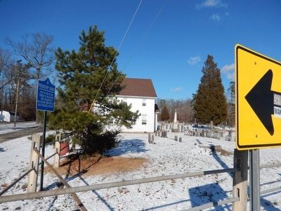
Built by Micajah Smith about 1800. Named "Methodist Union Chapel at Blackman's Mills" when incorporated in 1837. Micajah Smith, John Van Sant, privateer captains, and Jonas Morse and James Bell, Revolutionary soldiers, are buried in the Church Yard. — — Map (db m40587) HM
On W. New York Avenue at 1st Street on W. New York Avenue.
And his immediate family, Grandson of John Somers, First settler, 1693, member of 3rd Regiment, Gloucester County militia. Monument erected 1850 in memory of his son, Master Commandant Richard Somers, U.S.N. 1778-1804. Site restored 1981. — — Map (db m92407) HM WM
On Cedar Street, on the left when traveling north.
Francis Jackson, a freed slave, purchased 7 ¾ acres of woodland here in 1868. Later it would include the black cemetery and “a plain neat little church” built about 1873. The Pastor, Rev. Nicholas Fr. Jackson, lived nearby. The cemetery had 72 . . . — — Map (db m7509) HM
This final resting place of early Closter settlers was established by Barent and Resolvert Nagel on their 1,030-acre tract jointly purchased in 1710. The first burial is believed to be Jan Adriansen, c. 1721. The Nagel brothers divided their land . . . — — Map (db m63546) HM
Near Susan Drive, on the right when traveling east.
This active graveyard dates to the earliest settlement period of Closter’s history. Documented burials date to circa 1722 and include Dutch pioneer families with names like Vervalen, Naugle (Nagle), DeClark, Ferdon, Parsells, Auryansen, Demarest, . . . — — Map (db m63551) HM
Near Everett Road at Bogert Road, on the right when traveling east.
“Here lies the remains of Douwe Talema, who died on the 11th day of May 1779 in his Ninetieth Year. This aged Man at his Residence near this Place was wilfully and barbarously murdered by a Party of Tories. Traitors to their country who . . . — — Map (db m63547) HM
On Everett Road at Bogert Road, on the right when traveling east on Everett Road.
Sautes Tave’s Begraven Ground Pre-Revolutionary Cemetery Placed by David Demarest Chapter Daughters of the American Revolution May 30th, 1957 — — Map (db m63548) HM
On Engle Street (County Route 501), on the right when traveling north.
Built in 1860 on Palisade Avenue as “The Englewood Presbyterian Church”, it was the first church established in the city. A new, larger church was built on the original site and the old building was taken down, stone by stone, and re-erected at . . . — — Map (db m7011) HM
On Spotswood Road, 0.1 miles west of Delmar Avenue, on the left when traveling west.
Located on the boundary between two Hopper farms, the cemetery was shared by both families and their relatives for almost one hundred years. The earliest known burial was in 1804. — — Map (db m36966) HM
On Moore Street at Court Street, on the left when traveling south on Moore Street.
Archibald Campbell – 1730 – 12/28/1798, age 68. Born on the Isle of Man, came to Hackensack in 1765. Tavern keeper, host to General George Washington. Hackensack’s first Postmaster. Exemplary in all the duties of life, a . . . — — Map (db m62947) HM
On Court Street at Moore Street, on the right when traveling west on Court Street.
In memory of the Honorable Brigadier Gen. Enoch Poor of the State of New Hampshire who departed this life on the 8 day of Sept. 1780 aged 44 Years.---------------Washington, Lafayette and a portion of the American army attended the burial of Gen. . . . — — Map (db m62951) HM
On Court St. at Church St., on the left when traveling east on Court St..
Earliest records of this pioneer Dutch church, dated 1686, mark it as the second oldest in New Jersey. Old stones embedded in the east wall show the initials of founding families and first settlers.
The old burying ground contains the grave of . . . — — Map (db m6820) HM
On Hudson Street, on the right when traveling north.
Soldiers of the Revolution are buried in this cemetery of the True Reformed Dutch Church Deeded by Robert Campbell March 8, 1833 Erected by the Bergen County Historical Society 1937 — — Map (db m7229) HM
In use for nearly two hundred years, largely by the Blauvelt family, the earliest known burial was in 1722. The cemetery contains the graves of members of other early Bergen County families, veterans of the American Revolution and slaves. Some of . . . — — Map (db m7877) HM
On Old Hook Road at Bogerts Mill Road, on the left when traveling east on Old Hook Road.
Farmer David Perry had devised by his will, signed on July 18, 1868 that:
"the burying ground where the same now is, westerly of my dwelling house, of the use of 40' square, I give unto all my children to be kept by them and their . . . — — Map (db m241777) HM
On Broad Avenue at Lakeview Avenue, on the left when traveling north on Broad Avenue.
In colonial times this was the site of a slave burial ground. In 1784 slaves comprised almost one forth of the population of the township. — — Map (db m7462) HM
On Summit Place, 0.5 miles north of U.S. 46, on the right when traveling south.
Purchase in 1860 for the “coloured population of Hackensack” and in 1901 incorporated by African-American Trustees as the Gethsemane Cemetery. The one acre lot has about 500 interments of free blacks, former slaves as well as a number of . . . — — Map (db m43693) HM
In 1713, eleven German Palatine families settled in this area and organized into a congregation under Lutheran Pastor Justus Falckner. About 1720, they built a log church near this site. It was replaced prior to 1739 with a larger structure, and . . . — — Map (db m13359) HM
On River Road at Patrolman Ray Woods Lane, on the left when traveling north on River Road.
Site of the French Church and Cemetery of Kinkachemeck, New Jersey. Deeded to David Desmarest June 8, 1677 by Tapan Indians.
Erected by the Bergen County Historical Society 1935. — — Map (db m7234) HM
On Paramus Road at West Century Road, on the right when traveling north on Paramus Road.
George Washington
Kneeling in Prayer
by
Donald DeLue
Erected in Commemoration
of the
Fiftieth Anniversary
of the
George Washington
Memorial Park
Cemetery Association
1939 - 1989 — — Map (db m32427) HM
On Spring Valley Road at Viola Way, on the left when traveling south on Spring Valley Road.
The historic cemetery directly in the rear of the Behnke farm contains the graves of descendants of early settlers in this area including a least two local farmer-militiamen of the American Revolution, Jacobus Brouwer and Henry Banta, as well as . . . — — Map (db m8345) HM
On Red Oak Drive at Rivervale Road, on the right when traveling east on Red Oak Drive.
Late one night in 1778, the woods you are standing in suddenly echoed with the sounds of battle. A surprise attack by British soldiers nearly destroyed an American regiment, Baylor’s 3rd Continental Light Dragoons. Today, this park tells the story . . . — — Map (db m8455) HM
On Red Oak Drive, on the right when traveling east.
The evening of September 27, 1778, found Baylor’s Dragoons settling for the night near this site. The neighborhood’s name, Overkill, came from the small bridge “Over de kill”, a kill being a creek or river to the Jersey Dutch settlers. It . . . — — Map (db m8454) HM
On Red Oak Drive at Rivervale Road, on the right when traveling east on Red Oak Drive.
“This millstone is the only visible marker of the Baylor Massacre in existence today. On September 28, 1778, a detail of Baylor’s Continental Dragoons camping at Haring’s Tannery in River Vale was betrayed into the hands of the British by a Tory . . . — — Map (db m7876) HM
On Red Oak Drive at Rivervale Road, on the right when traveling east on Red Oak Drive.
In memory of American soldiers killed during the Revolutionary War in the “Baylor Massacre” on September 28, 1778. Lt. Col. George Baylor’s 3rd Regiment of Continental Dragoons took quarters for the night on several nearby farms. Tories betrayed . . . — — Map (db m7874) HM
On Red Oak Drive at Rivervale Road, on the right when traveling east on Red Oak Drive.
Six soldiers of those killed in the Baylor Massacre were buried here in three abandoned tan vats. The vats were part of a small tan yard which existed here before the Revolution.
The gravesite was discovered in 1967 and the soldiers were . . . — — Map (db m7875) HM
On Red Oak Drive at Rivervale Road, on the right when traveling east on Red Oak Drive.
The American army may have had trouble supplying its soldiers and keeping them fit for fighting, but in one way the Americans were superior: their propaganda writers were experts at whipping up anti-British feelings. An incident like the Baylor . . . — — Map (db m8474) HM
On Red Oak Drive at Rivervale Road, on the right when traveling east on Red Oak Drive.
The Aftermath Imagine the scene in the early morning daylight of the morning of September 28, 1778 at Overkill:
. American soldiers were dead, wounded and missing. Some escaped, others were British captives. . Major Charles Clough lay dying. . . . — — Map (db m8472) HM
On East Saddle River Road at Old Stone Church Road, on the right when traveling south on East Saddle River Road.
Known as The Old Stone Church It has been ministering to this area since 1784. The present structure of native stone was completed in 1819. Buried here are: The Rev. Stephen Goetschius minister 1819-1835 The Rev. Dr. Isaac Van Kampen minister . . . — — Map (db m29899) HM
On Knights Court west of Saddle River Road, on the left when traveling west.
Known by this name for generations, it once was part of the Hopper family farm. Believed to have been a burial ground for slaves and freed blacks, there once were many stones, most without marks. In 1910, the surviving stones with inscriptions were . . . — — Map (db m29909) HM
On Wyckoff Avenue, on the right when traveling north.
Once known as the Reformed Dutch Church of Wyckoff, this was the first church to be erected in the Township. It was established by members of Ponds Church at Oakland who lived in this area. They constructed the building of local stone and timber on . . . — — Map (db m12403) HM
Erected 1914 by
E. B. Tantum
To commemorate the devoted service
to his country of
George S. Bowers
Company F 8th Regiment
N. J. Volunteer Infantry
And all other loyal soldiers and sailors
who suffered untold misery starvation and . . . — — Map (db m36422) HM
Here lie the remains of the honorable Elias Boudinot, LLD
Born on the 2nd of May 1740
He died on the 24th of Oct. 1821
His life was an exhibition of fervent piety of useful talent and of extensive benevolence.
His death was the . . . — — Map (db m125025)
On West Broad Street east of Locust Avenue, in the median.
The City of Burlington is numbered among the oldest and, at one time, the most influential towns in New Jersey. At Holland's behest, Walloon settlers from southern Belgium arrived at present-day Burlington Island in 1624 and their community . . . — — Map (db m220859) HM
On W Broad Street west of Wood Street, on the right when traveling west.
In July 1695, a group of local residents, including John Tatham, Edward Hunloke, and Nathaniel Westland, purchased a lot on this site on the west side of Wood Street "for the Conveniency of a burying place for themselves and also for all other . . . — — Map (db m172333) HM
Opened in 1840 and originally owned by a group called the Christian Brethren. Later named Fairview Christian Cemetery. Currently, has no owner but maintained by the members of Trinity Church. — — Map (db m102401) HM
Land purchased from Samuel and Hannah Louden in 1859. The Methodist Cemetery Association owned it and supervised burials for many decades. Currently, Methodist Church Trustees oversee care. — — Map (db m102607) HM
In 1912, eight acres of land were made into a park-like cemetery. Unattended, it fell into disrepair. By 1971, the last remains were moved to Monument Cemetery in Edgewater Park. — — Map (db m102894) HM
The Religious Society of Friends (Quakers) established this graveyard in 1759 along with the beginning of Upper Evesham Meeting that now is called Medford Monthly Meeting. The first recorded burial was that of Mark Stratton in the same year. Plain, . . . — — Map (db m79451) HM
On Chairville Road at Marlton Pike (Route 70), on the right when traveling north on Chairville Road.
Adonijah Peacock, a casualty of the gunpowder explosion of 1777 lies here among several generations of his family descendants. 1847-1997 — — Map (db m102409) HM
On Stokes Road (County Route 541) north of Himmelein Road, on the left when traveling south.
Purchased for $120 by Evesham in 1813 from Enoch and Hannah Stratton for a public burying ground. Became part of Medford upon the founding of the township in 1847. 1847-1997 — — Map (db m44972) HM
On Branch Street at Filbert Street, on the right when traveling east on Branch Street.
Burials are thought to have started here in the 1820's. The earliest legible date is 1836. Old area family names include Braddock, Prickett, Riley, Kirby and Stackhouse. — — Map (db m44779) HM
On East Main Street at Chester Avenue on East Main Street.
He was well known as a maker of grandfather clocks. Circa 1775-1832.
For a number of years he was a member of the township committee.
A Quaker, he died in 1832 and is buried in the Friends Graveyard across Main Street.
The building, later . . . — — Map (db m24651) HM
In 1743, John Penn deeded to Evesham Twp. this one acre of land for "strangers deceased, therein, Negro slaves, and poor...for evermore." — — Map (db m79416) HM
Deeded by Samuel Richards to Church Trustees: Jesse Richards, Thomas S. Richards, John Richards, Samuel B. Finch, Thomas Sordan, Samuel Bareford and Henry Brown; on June 13, 1826. — — Map (db m79514) HM
On Highland Road at Springfield Meeting House Road, on the left when traveling north on Highland Road.
This Site was placed in the National
and New Jersey State Historical Registers
in 1979.
The Meeting House, situated at the
intersection of two Indian Trails, is one
of the oldest in Burlington County.
Early Quakers worshipped here . . . — — Map (db m35918) HM
In 1805, this land was deeded by William and Sarah Wilkens to be used by residents of Tabernacle. "As long as Wheels of Time shall not cease to roll". — — Map (db m79464) HM
On Carranza Road at Medford Lakes Road/Chatsworth Road (County Route 532), on the right when traveling north on Carranza Road.
Site "The Tabernacle in the
Wilderness"
Established 1778 by
John Brainerd.
Both whites and indians
worshipped here.
Used as school until 1885. — — Map (db m35222) HM
On Speedwell Place Road, 0.3 miles Friendship-Speedwell Road, on the left when traveling north.
A wandering priest
made this hallowed ground
for all time.
Graves marked by
heavy pine slabs.
Only stone inscribed,
Charles Wills 1839. — — Map (db m36801) HM
On Clementon Road (County Road 534) just west of Franklin, on the right when traveling west.
In remembrance of all buried here
including:
Lenape Indians — Hessian Soldiers
Arthur R. Eldred
First Eagle Scout of the Boy Scouts of America
Aug. 21, 1912
Capt. Carlton R. Rouh U.S.M.C.
Awarded Congressional . . . — — Map (db m146761) HM WM
Near Haddon Avenue, 0.1 miles east of Vesper Boulevard, on the right when traveling west.
Author of Leaves of Grass, the most extraordinary piece of wit and wisdom
that America has yet contributed. His life was an affirmation of freedom.
His poetry was a celebration of life and his philosophy was a preparation for death. . . . — — Map (db m171891) HM
On Station Avenue at Melvin Avenue on Station Avenue.
1626 On this high bank along the Timber Creek was the Indian Village of Armewamex
1730 John Ashbrook in his will reserved “…one whole acre where the burying place now is for the use of the neighborhood.” Making this the . . . — — Map (db m94917) HM WM
On Lynne Avenue at Elm Avenue, on the left when traveling south on Lynne Avenue.
Near this site, in 1681, Mark Newby, William Bates, Thomas Thackara, George Goldsmith, Thomas Sharp, Robert Zane and other immigrants from Ireland, who came here in quest of religious liberty, founded the First Friends Meeting of Old Gloucester . . . — — Map (db m169752) HM
On Haddon Avenue at Mechanic Street, on the right when traveling west on Haddon Avenue.
In Memory of
Elizabeth Haddon.
Daughter of John Haddon of London.
Wife of John Estaugh.
She was
Founder and Proprietor
of Haddonfield N.J.
Born 1680- Emigrated 1701.
Married 1702 Died 1762.
Buried near this tablet.
Originator of the . . . — — Map (db m171424) HM
On Friends Avenue at Lake Street, on the left when traveling west on Friends Avenue.
Established 1721 by Haddonfield monthly meeting of the Religious Society of Friends. Elizabeth Haddon, the founder of Haddonfield, was buried here upon her death in 1762. According to Quaker custom at the time, her grave is unmarked. In the early . . . — — Map (db m225583) HM
On Mouldy Road east of White Horse Pike (U.S. 30), on the left when traveling east.
Mount Peace Cemetery has been placed on the National Register of Historic Places in 2009 by the United States Department of the Interior. William G. Pomeroy Foundation 2020 — — Map (db m203269) HM
Near Washington Street, on the right when traveling east.
Born in Allentown, Pennsylvania May 16, 1830. Moved to Cape May (then Cape Island) in 1848 as carpenter and builder. In 1861 one of first enlisted from Cape May and assigned as 2nd Lt. of Special Guard at the capitol in Washington. Commissioned 2nd . . . — — Map (db m10812) HM
Old Broad Street Presbyterian Church was constructed in the meeting house form, rectangular in plan, with the pulpit placed on the north gable end wall and a U-shaped balcony on the other sides. The north elevation, facing Broad Street, is the . . . — — Map (db m64508) HM
On Broad Street West (New Jersey Route 49) just west of South Lawrence Street, on the right when traveling east.
These patriots, original members of the Society of the Cincinnati in the State of New Jersey, lie buried in this churchyard.
Captain Seth Bowen
Ensign Almarin Brooks
Surgeon Ebenezer Elmer
Lieutenant Eli Elmer
Lieutenant James . . . — — Map (db m153722) HM WM
Near N Valley Avenue near Fairmount Avenue, on the left when traveling north.
Charles K. Landis was born in Philadelphia to Michael and Mary Landis. He passed the Bar Exam at the age of 19 and started practicing law at that time. He had a growing interest in land development and founded the town of Colville,now called Elwood. . . . — — Map (db m174735) HM
On Rutgers Street / Belleville Tnpk (New Jersey Route 7), on the right when traveling east.
Josiah Hornblower is buried in this cemetery along with his wife and many of Belleville’s early settlers. Sixty-two Revolutionary soldiers are also buried here. It could be that no other town in the United States . . . — — Map (db m32586) HM
Near Rutgers Street (New Jersey Route 7) at Main Street, on the right when traveling east.
In 1753, he brought from England and erected the first steam (“Fire”) engine in this country. The Newcomen Society April 24, 1929 — — Map (db m84975) HM
On Belleville Tnpk (New Jersey Route 7) at Main Street, on the right when traveling east on Belleville Tnpk.
John Bayley • Henry Brown • Isaac Brown • John Brown • Henry Cadmus • Issac Cadmus • John H. Cadmus • John P. Cadmus • Peter Cadmus • Lt. Col. Thomas Cadmus • James Campbell • Minard Cumen • Capt. Amos Dodd • Thomas Doremus • Anthony Francisco • . . . — — Map (db m54164) HM
On Bloomfield Avenue (New Jersey Route 507), on the right when traveling east.
Land given in 1779 for a church and for “…a place of burial for said Congregation and Inhabitants.” Contains graves of early Caldwell area families, including veterans of The American Revolution, The War of 1812, The Civil War . . . — — Map (db m32288) HM
On Broad Street at Branford Place, on the right when traveling north on Broad Street.
A Memorial to the Revolutionary War Soldiers and Patriots who are known to be buried in the cemetery adjoining this church. John Alling • Samuel Alling • Jabez Baldwin • Moses Baldwin • Sylvanias Baldwin • Stephen Baldwin • David Bankds • Nathaniel . . . — — Map (db m40822) HM
On Broadway at Nursery Street, on the right when traveling north on Broadway.
Mount Pleasant, Newark's oldest remaining cemetery, opened in 1844. One of the first secular cemeteries, it is a masterpiece of landscaping. Its 36 rolling acres and varied monuments reflect romantic Victorian attitudes toward death. Many New Jersey . . . — — Map (db m45834) HM
On Main Street (County Route 659) at Scotland Road (County Route 638), on the right when traveling east on Main Street.
This statue was dedicated Friday, June 14th, 1907, centennial of first town meeting of Orange, also the 130th Anniversary of the adoption of the Stars and Stripes as our national emblem. In memory of the men and women of this community who assisted . . . — — Map (db m7789) HM
On Valley Street at Fifth Street, on the right when traveling south on Valley Street.
( inscription around the base )
This Park was Dedicated in 1971 to the Memory of the Villagers, Veterans and Citizens Interred in the South Orange Cemetery 1825 – 1926
497 names are listed of those who were interred in the cemetery . . . — — Map (db m238308) HM
In order to express forever the appreciation of the Japanese people of the service done by the late Thomas Alva Edison for the welfare of mankind, we respectfully present herewith a stone lantern as a memorial gift to his tomb. . . . — — Map (db m137105) HM
On Tuckahoe Road (County Route 555) at Sheridan Avenue, on the left when traveling south on Tuckahoe Road.
The History
The 22nd United States Colored Infantry (USCT) was organized in January 1864. With 681 Jerseymen on its rolls it was the most “Jersey” of all USCT regiments. The Regiment left Philadelphia for Virginia at the end of January . . . — — Map (db m174937) HM
On County Route 519 at Oak Summit Road, on the right when traveling north on County Route 519.
Dedicated to the Revolutionary and Civil War soldiers whose sacrifice will forever shape the course of history.
Dedicated by Eagle Scout Chris Wozniak, 2008 — — Map (db m18884) HM
On Center Street, on the right when traveling west.
Born in High Bridge in 1808 to the iron-making family, he lived in Clinton. Hunterdon's only Civil War general. Killed in 1862 at Manassas, Va. while leading the 1st NJ Brigade. Buried west of the church. — — Map (db m18182) HM
On Main Street, on the right when traveling north.
The first confirmed burial here was 1794 concurrent with the erection of the church. It originally had a section for "colored and strangers" who were eventually honored with a 1999 monument. Today, it is the resting place of founding church members, . . . — — Map (db m83102) HM
On Croton Road (County Road 579) south of Nixon Farm Road, on the right when traveling north.
Established 1764 by Quakers as burial site for non-members of their Society. In mid-1700s, a cemetery for enslaved Africans was sited across the road. By mid-1800s the slaves stones were torn out and the graves plowed over. — — Map (db m208535) HM
On Anthony Road, 0.9 miles east of Hollow Road, on the right when traveling west.
It served as a burial ground from 1844 to 1915. Built by "Stuttering Jake" Swackhammer for the ministry of his uncle, Rev. Lambert Swackhammer, an opponent of slavery and alcohol, its church members over the years were predominantly of the Lutheran . . . — — Map (db m83711) HM
On N. Union Street at Church Street, on the right when traveling south on N. Union Street.
Revolutionary War Lieutenant, and pallbearer of George Washington is buried here, along with Sam Holcombe, one of Gen. Washington's spies. — — Map (db m16861) HM
On Cherry Street just north of Corporate Drive, on the right when traveling north.
The German Rockaway now Lebanon Reformed Dutch Reformed Church was established in the area of Lebanon & Pottersville between 1731 - 1747. The exact date & location unknown.
Three buildings have stood upon this site, the first of which was a log . . . — — Map (db m26480) HM
On New Jersey Route 202, on the right when traveling north.
Erected in memory of the citizen soldiers of Amwell Township who, commanded by Captain John Schenck, on December 14th 1776, met and drove from this field a column of the British 16th Light Dragoons, after killing their commander, Cornet Francis . . . — — Map (db m31959) HM
On Frontage Road, on the right when traveling south.
In an 1889 Ringoes magazine, James Monroe Hoagland wrote of a cemetery of about 100 graves. It has been obliterated by plowing but was located in the field to your right. John Hoagland and other early farmers and settlers are said to have been . . . — — Map (db m92448) HM
On County Road 579 at milepost 15.5, on the left when traveling north.
19th century family graveyard. Over 100 graves of local residents. Captain Jacob Servis, aide to Gen. Washington at Yorktown buried here. Stone wall built in 1848. — — Map (db m62918) HM
On Old York Road (New Jersey Route 179), on the right when traveling south.
Prior to 1750 an Anglican church built of logs, later stone. Only portions of cemetery remain. Dr. Gershom Craven, who treated General Lafayette, is buried here. All graves face east as was the custom of the times. — — Map (db m16733) HM
To commemorate the valour of
Captain Daniel Bray.
Who with a few patriotic citizens braved the enemy and collected enough boats from along the river to make possible the memorable crossing of the ice-laden Delaware of General Washington . . . — — Map (db m16591) HM
216 entries matched your criteria. The first 100 are listed above. Next 100 ⊳