14010 entries match your criteria. Entries 101 through 200 are listed.⊲ Previous 100 — Next 100 ⊳
Cemeteries & Burial Sites Topic
By Mark Hilton
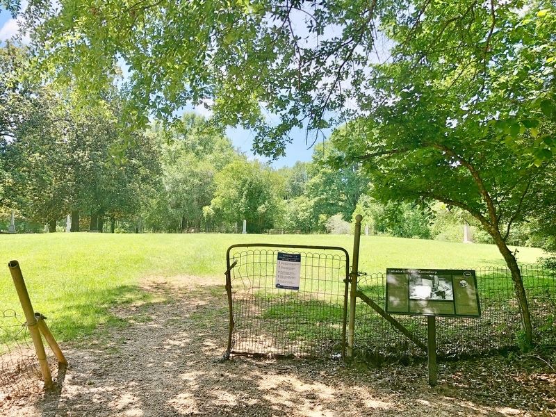
Cahaba's "New" Cemetery and Marker
101 ► Alabama, Dallas County, Cahaba — Cahaba's "New" Cemetery —  |
| On Oak Street 0.6 miles south of Capitol Avenue, on the right when traveling south. | |||
| 102 ► Alabama, Dallas County, Cahaba — Cahawba's African American Cemetery — |
| On Oak Street at Seven North Street, on the right when traveling north on Oak Street. | |||
| 103 ► Alabama, Dallas County, Cahaba — Memorials for Prisoners of War — |
| Near Cahaba Road. | |||
| 104 ► Alabama, Dallas County, Cahaba — New Cemetery — |
| On Oak Street, on the right when traveling south. | |||
| 105 ► Alabama, Dallas County, Cahaba — Old Cemetery — |
| Near Cahaba Road, on the right when traveling north. | |||
| 106 ► Alabama, Dallas County, Marion Junction — Prosperity Cemetery |
| Near County Road 189 0.4 miles west of County Road 45. Reported missing. | |||
| 107 ► Alabama, Dallas County, Orrville — Whitt Cemetery — |
| On County Road 9 0.4 miles north of State Route 22, on the left when traveling north. | |||
| 108 ► Alabama, Dallas County, Plantersville — Plantersville Union Church Cemetery — Dallas County — |
| On Mulberry Street at Rosebud Drive, on the right when traveling east on Mulberry Street. | |||
| 109 ► Alabama, Dallas County, Pleasant Hill — Mount Carmel Church — |
| On County Road 12 0.1 miles east of County Road 7, on the right when traveling east. | |||
| 110 ► Alabama, Dallas County, Selma — Live Oak Cemetery — |
| On Kings Street south of Dallas Avenue (State Highway 22), on the right when traveling south. | |||
| 111 ► Alabama, Dallas County, Selma — Valley Creek Presbyterian Church — One of state’s first Presbyterian churches — |
| On State Highway 22 at County Road 65, on the right when traveling south on State Highway 22. | |||
| 112 ► Alabama, Dallas County, Selma — William Rufus de Vane King — 1786-1853 — |
| On Kings Street south of Dallas Avenue (State Highway 22), on the right when traveling south. | |||
| 113 ► Alabama, Dallas County, Valley Grande — Childers Chapel — |
| On County Road 37 north of County Road 65, on the right when traveling north. | |||
| 114 ► Alabama, DeKalb County, Fort Payne — Site of the Willstown Mission — 1823-1839 — |
| On 38th Street Northeast south of Godfrey Avenue, on the right when traveling south. | |||
| 115 ► Alabama, Elmore County, Holtville — Cain's Chapel United Methodist Church and Cemetery — Elmore County — |
| On Lightwood Road north of Holtville Road (Alabama Route 111), on the right when traveling north. | |||
| 116 ► Alabama, Elmore County, Millbrook, The Columns subdivision — Alexander McKeithen Family Cemetery — Elmore County — |
| Near Hastings Hollow east of Plantation Crossing, on the right when traveling east. | |||
| 117 ► Alabama, Escambia County, Brewton — Franklin Cemetery — Escambia County — |
| Near Union Cemetery Road 0.2 miles north of College Drive, on the left when traveling north. | |||
| 118 ► Alabama, Escambia County, Brewton — Pilgrims' Rest Cemetery — |
| On Alco Drive 0.2 miles south of Blacksher Lane, on the right when traveling south. | |||
| 119 ► Alabama, Escambia County, Brewton — Union Cemetery — |
| Near Union Cemetery Road 0.2 miles north of College Drive, on the left when traveling north. | |||
| 120 ► Alabama, Etowah County, Gadsden — Southern Hill Cemetery — Etowah County — |
| Near South Sixth Street 0.2 miles south of Oak Street. | |||
| 121 ► Alabama, Etowah County, Gadsden — Whites Chapel Cemetery — Etowah County — Established 1879 — |
| On Whites Chapel Road north of High School Road, on the right when traveling south. | |||
| 122 ► Alabama, Etowah County, Gadsden, Alabama City — Clayton Cemetery — Etowah County — |
| On Dwight Avenue 0.1 miles south of Lookout Ave, on the right when traveling north. | |||
| 123 ► Alabama, Etowah County, Rainbow City — Harmony Baptist Church — |
| On Rainbow Drive (U.S. 411) at Cemetery Road, on the right when traveling east on Rainbow Drive. | |||
| 124 ► Alabama, Etowah County, Rainbow City — Old Harmony Cemetery — |
| On Rainbow Drive (U.S. 411) east of Peteet Street, on the right when traveling east. | |||
| 125 ► Alabama, Etowah County, Rainbow City — Site of 1784 Indian Massacre — |
| On Rainbow Drive (U.S. 411) east of Peteet Street, on the right when traveling east. | |||
| 126 ► Alabama, Fayette County, Bankston — New Liberty Church and Cemetery / O'Possum Trot School — Fayette County — |
| On New Liberty Road 0.1 miles north of Alabama Highway 102, on the left when traveling north. | |||
| 127 ► Alabama, Fayette County, Bankston — Zion Church & Byler Road — Fayette County — |
| On County Road 93 at Zion Road, on the left when traveling north on County Road 93. | |||
| 128 ► Alabama, Fayette County, Eldridge — Tidwell Cemetery — Fayette County — |
| On Old Stage Coach Road 0.3 miles west of Alabama Highway 13, on the right when traveling south. | |||
| 129 ► Alabama, Fayette County, Fowlers Crossroads — Dobbs, Alabama — Fayette County — |
| On State Highway 13 north of Arthur Smith Road, on the left when traveling north. | |||
| 130 ► Alabama, Fayette County, Newtonville — Shady Grove Missionary Baptist Church and Cemetery — Fayette County — |
| Near County Road 100 0.3 miles east of Center Road, on the right when traveling west. | |||
| 131 ► Alabama, Franklin County, Russellville — Counts Family Cemetery — |
| On County Road 78, on the right. | |||
| 132 ► Alabama, Geneva County, Hartford — Earliest Church In Hartford — |
| On North Shiloh Road, on the right when traveling south. | |||
| 133 ► Alabama, Geneva County, Slocomb — Countyline Missionary Baptist Church — Slocomb, Alabama — |
| Near County Line Drive east of Kelly Street when traveling south. | |||
| 134 ► Alabama, Geneva County, Slocomb — Pleasant Hill Baptist Church Cemetery — Geneva County — |
| On Pleasent Hill Road 0.1 miles south of Airport Road (County Route 85), on the left when traveling north. | |||
| 135 ► Alabama, Greene County, Jena — Zion Hill Missionary Baptist Church Cemetery — Greene County — |
| Near County Road 156 east of Zion Hill Church Road, on the right when traveling east. | |||
| 136 ► Alabama, Henry County, Abbeville — The First Baptist Church of Abbeville / Abbeville Pioneer Cemetery — |
| Near East College Street north of East College Street, on the left when traveling east. | |||
| 137 ► Alabama, Henry County, Haleburg — Mt. Zion Baptist Church — |
| On Stovall Drive 0.5 miles south of Hayden Street, on the left when traveling south. | |||
| 138 ► Alabama, Henry County, Headland — Piney Grove Primitive Baptist Church and Cemetery — |
| On Broad Street (Alabama Route 173) 0.8 miles south of County Road 17, on the right when traveling south. | |||
| 139 ► Alabama, Henry County, Newville — Newville Baptist Church / Newville Baptist Church Cemetery — |
| On West Columbia Road 0.2 miles east of County Road 7, on the right when traveling east. | |||
| 140 ► Alabama, Henry County, Newville — Old Center Methodist Church / Old Center Cemetery — |
| On County Road 89 at County Road 109, on the right when traveling south on County Road 89. | |||
| 141 ► Alabama, Henry County, Newville — Union Springs Missionary Baptist Church And Cemetery — |
| On County Road 73 0.3 miles north of County Road 138, on the left when traveling north. | |||
| 142 ► Alabama, Houston County, Columbia — Columbia Cemetery — Houston County — |
| Near West Church Street west of North Washington Street. | |||
| 143 ► Alabama, Houston County, Gordon — Gordon Cemetery / Early Gordon Leaders — |
| On Main Street (Alabama Route 95) 0.1 miles north of Hall Street (County Road 81), on the left when traveling north. | |||
| 144 ► Alabama, Houston County, Gordon — Pilgrim Rest Baptist Church-East — |
| On Pilgrim Church Road 0.2 miles north of County Road 4, on the right when traveling north. | |||
| 145 ► Alabama, Houston County, Rehobeth — Big Creek United Methodist Church / Joseph Watford Revolutionary War Veteran — |
| On Alabama Route 605 0.5 miles south of Boys Club Road, on the left when traveling south. | |||
| 146 ► Alabama, Jackson County, Gurley — Clay Cemetery — Jackson County — |
| On Herefordshire Road east of Hereford Rd, on the right when traveling east. | |||
| 147 ► Alabama, Jackson County, Hollywood — Bellefonte Cemetery / Town of Bellefonte — |
| On Bellefonte Road (County Road 33) 0.8 miles east of Lee Highway/John T Reid Parkway (U.S. 72), on the left when traveling east. | |||
| 148 ► Alabama, Jackson County, Hollywood — Old Baptist Cemetery — Jackson County — |
| Near Alabama Route 42 0.2 miles north of Route 36, on the right when traveling north. | |||
| 149 ► Alabama, Jackson County, Princeton — Russell William Clay Cemetery — Jackson County — |
| On County Road 509 west of County Road 3, on the left when traveling west. | |||
| 150 ► Alabama, Jackson County, Scottsboro — Cedar Hill Cemetery — |
| Near Cedar Hill Drive at West Appletree Street, on the right when traveling south. | |||
| 151 ► Alabama, Jackson County, Scottsboro — M5 — National Cemeteries — |
| Near Heroes Drive west of Jefferson Drive, on the right when traveling west. | |||
| 152 ► Alabama, Jackson County, Scottsboro — Robert Thomas Scott, Sr. / Robert Thomas Scott, Sr. — Scottsboro Founder / Successful Pioneer — |
| Near Veterans Drive (Alabama Route 35) north of Lee Highway (U.S. 72), on the right when traveling north. | |||
| 153 ► Alabama, Jefferson County, Bessemer — Hosea Holcombe — 1780-1841 — "Alabama's first church historian" — |
| On 14th Street South (State Highway 150) south of Fairfax Avenue, on the right when traveling south. | |||
| 154 ► Alabama, Jefferson County, Bessemer — Union Baptist Church And Cemetery — |
| On County Road 18, on the left when traveling west. | |||
| 155 ► Alabama, Jefferson County, Birmingham, Arlington - West End — United Confederate Veterans — Camp Hardee No. 39 — |
| On Martin Luther King Drive, on the right when traveling south. | |||
| 156 ► Alabama, Jefferson County, Birmingham, Fountain Heights — Capt. Charles Linn — (1814-1882) — |
| Near 19th Street North north of 11th Avenue North, on the left when traveling north. | |||
| 157 ► Alabama, Jefferson County, Birmingham, Fountain Heights — In Memory of the Pioneers — |
| Near 19th Street North. | |||
| 158 ► Alabama, Jefferson County, Birmingham, Fountain Heights — Oak Hill Cemetery — 1871 – 1971 — D A R — |
| Near 19th Street North. | |||
| 159 ► Alabama, Jefferson County, Birmingham, Redmont Park — Lane Park — |
| On Cahaba Road at Park Lane, on the right when traveling north on Cahaba Road. | |||
| 160 ► Alabama, Jefferson County, Birmingham, South Roebuck — Wilson Chapel And Cemetery — ("The Little Brown Church in the Wildwood") — |
| On Cumberland Drive at Balcourt Drive, on the right when traveling east on Cumberland Drive. | |||
| 161 ► Alabama, Jefferson County, Birmingham, Woodlawn — 1963 Church Bombing Victims — |
| Near Messer Airport Highway at University Avenue, on the right when traveling north. | |||
| 162 ► Alabama, Jefferson County, Birmingham, Woodlawn — Forrest Camp No. 1435 — |
| On 60th Street North, in the median. | |||
| 163 ► Alabama, Jefferson County, Birmingham, Woodlawn — United Confederate Veterans — |
| On 60th Place South, in the median. | |||
| 164 ► Alabama, Jefferson County, Birmingham, Zion City — Zion Memorial Gardens — |
| On Tarrant Huffman Road at Marshall Avenue, on the left when traveling west on Tarrant Huffman Road. | |||
| 165 ► Alabama, Jefferson County, Clay — Clay Methodist Cemetery — Jefferson County — |
| On Clay-Palmerdale Road at Old Springville Road, on the right when traveling north on Clay-Palmerdale Road. | |||
| 166 ► Alabama, Jefferson County, Clay — Mount Calvary Cemetery — Clay, Alabama — formerly Ayers, Alabama — |
| On Cedar Mountain Road, on the right when traveling west. | |||
| 167 ► Alabama, Jefferson County, Clay — Pioneer Massey Cemetery — |
| Near Advent Circle. | |||
| 168 ► Alabama, Jefferson County, Clay — Wear Cemetery — |
| On Old Springville Road / County Road 30, on the left when traveling north. | |||
| 169 ► Alabama, Jefferson County, Homewood — Union Hill Cemetery — |
| On Hollywood Boulevard east of Malaga Avenue, on the left when traveling east. | |||
| 170 ► Alabama, Jefferson County, Homewood — Union Hill Cemetery, Union Hill Methodist Episcopal Church, Union Hill School — |
| On Hollywood Blvd at Union Hill Drive, on the left when traveling east on Hollywood Blvd. | |||
| 171 ► Alabama, Jefferson County, Hoover — Patton Chapel Church 1866 — |
| On Patton Chapel Road west of Montgomery Highway (U.S. 31), on the right when traveling west. | |||
| 172 ► Alabama, Jefferson County, Hueytown, Dolomite — Bethlehem Church Cemetery — |
| On Allison-Bonnett Memorial Drive at Tin Mill Road, on the right when traveling west on Allison-Bonnett Memorial Drive. | |||
| 173 ► Alabama, Jefferson County, Irondale — New Hope Cemetery — Jefferson County — |
| On Grantswood Road, on the right when traveling east. | |||
| 174 ► Alabama, Jefferson County, Leeds — Mt. Hebron Cemetery — Jefferson County — |
| Near Eastern Valley Road (State Road 119), on the right when traveling east. | |||
| 175 ► Alabama, Jefferson County, Leeds — Shiloh Cemetery — Established Circa 1820 — |
| On Ashville Road Northeast at Morgan Street Northeast, on the right when traveling west on Ashville Road Northeast. | |||
| 176 ► Alabama, Jefferson County, Mount Olive — Graham Cemetery — |
| On Mount Olive Road 0.3 miles north of Whitten Road, on the right when traveling north. | |||
| 177 ► Alabama, Jefferson County, Mulga — Historic Lakeview Cemetery — |
| On Port Birmingham Rd (State Highway 269) at Finland Road, on the right when traveling west on Port Birmingham Rd. | |||
| 178 ► Alabama, Jefferson County, Trussville — Mt. Nebo Cemetery — Jefferson County — |
| On Gadsden Highway 0.1 miles east of Calumet Parkway, on the right when traveling east. | |||
| 179 ► Alabama, Jefferson County, Trussville — Trussville Memorial Cemetery — Jefferson County — |
| On Main Street (U.S. 11) east of City Hall Drive, on the right when traveling west. | |||
| 180 ► Alabama, Lauderdale County, Elgin — Daniel White — Settled Here in 1818 — |
| On Lee Highway (U.S. 72) 0.7 miles west of County Road 583, on the left when traveling west. | |||
| 181 ► Alabama, Lauderdale County, Florence — "Mountain" Tom Clark — Hanged September 4, 1872 — |
| On Tennessee Street. | |||
| 182 ► Alabama, Lauderdale County, Florence — Florence Cemetery — -1818- — |
| On East College Street, on the right when traveling east. | |||
| 183 ► Alabama, Lauderdale County, Florence — Governor Hugh McVay Home Site and Cemetery — |
| On N. Cox Creek Parkway. | |||
| 184 ► Alabama, Lauderdale County, Florence — Hickory Hill Plantation Slave Cemetery — |
| On Surveyor Road near Cloverdale Road ( Route 157), on the left when traveling west. | |||
| 185 ► Alabama, Lauderdale County, Florence — John Coffee: 1772-1833 — |
| On Surveyor Road 0.2 miles west of Cloverdale Road, on the left when traveling west. | |||
| 186 ► Alabama, Lauderdale County, Florence — Old Pleasant Grove Primitive Baptist Church & Cemetery — Lauderdale County — |
| On County Route 34 0.1 miles south of County Route 94, on the right when traveling south. | |||
| 187 ► Alabama, Lauderdale County, Florence — Pesthouse and Cemetery / Pestilences — 1866 / "Prior to 20th Century" — |
| On Wildwood Park Road at Waterloo Road on Wildwood Park Road. | |||
| 188 ► Alabama, Lauderdale County, Florence — Pleasant Hill United Methodist Church Cemetery — — Established prior to 1843 — — |
| On County Road 222 west of County Road 231, on the right when traveling west. | |||
| 189 ► Alabama, Lauderdale County, Florence — Soldier's Rest — -1862- — |
| On South Magnolia Street, on the right when traveling north. | |||
| 190 ► Alabama, Lauderdale County, Florence — Wesley Chapel United Methodist Church and Cemetery — Church Organized 1818: — First Cemetery Burial 1819 — |
| On County Road 15. | |||
| 191 ► Alabama, Lauderdale County, Florence — Wilson Family Cemetery 19th Century / Slave Cemetery 19th Century — |
| On Plantation Springs Drive. | |||
| 192 ► Alabama, Lauderdale County, Greenhill — Tabernacle Cemetery — Lauderdale County — |
| On County Road 47 at County Road 140, on the left when traveling north on County Road 47. | |||
| 193 ► Alabama, Lauderdale County, Killen — Gabriel Butler Cemetery — Circa 1809 — |
| Near County Road 421 1 mile north of U.S. 72, on the left when traveling north. | |||
| 194 ► Alabama, Lauderdale County, Lexington — Grassy Memorial Chapel and Cemetery — |
| On Alabama Route 64 at County Road 89, on the right when traveling west on Alabama Route 64. | |||
| 195 ► Alabama, Lauderdale County, Lexington — Mount Pleasant Baptist Church — 1854 — |
| On County Road 71 0.1 miles north of County Road 478, on the right when traveling north. | |||
| 196 ► Alabama, Lauderdale County, Rogersville — Bettie Anne Highway — |
| On County Road 568 at County Road 51, on the left when traveling west on County Road 568. | |||
| 197 ► Alabama, Lauderdale County, Rogersville — Gabriel “Old Gabe” Butler — 1779~1856 — |
| On CR 421. | |||
| 198 ► Alabama, Lauderdale County, Rogersville — Liberty Church / Liberty Cemetery — |
| On Lee Street (County Route 66) at Hickory Drive, on the left when traveling west on Lee Street. | |||
| 199 ► Alabama, Lawrence County, Courtland — Courtland Cemetery — -1819- — |
| On Van Buren Street 0.1 miles north of Jefferson Street. | |||
| 200 ► Alabama, Lawrence County, Moulton — McDaniel Cemetery #1 / McDaniel Family Pioneers — Lawrence County — c. 1819 — |
| On County Route 334 north of County Road 87, on the right when traveling north. | |||
14010 entries matched your criteria. Entries 101 through 200 are listed above. ⊲ Previous 100 — Next 100 ⊳