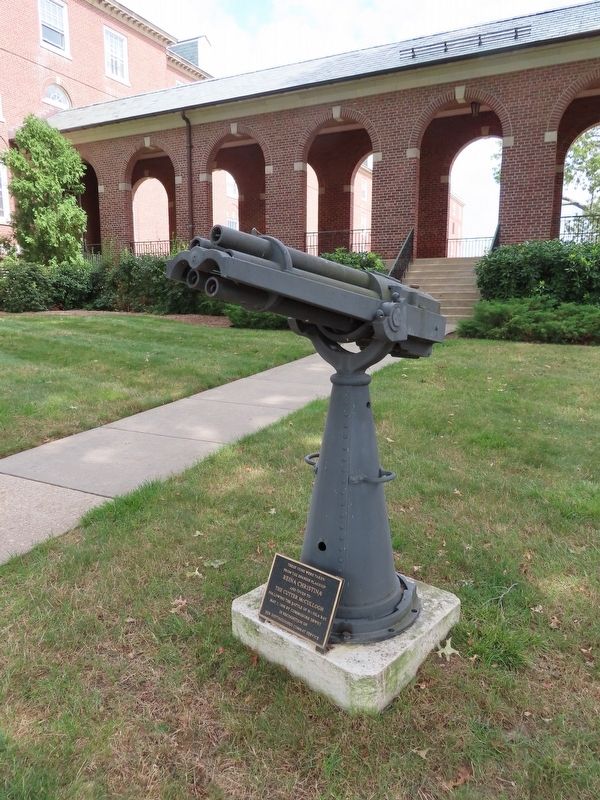
On Crescent Street at Broadway, on the left when traveling south on Crescent Street.
In Memoriam - U.S.S. Maine -
destroyed in Havana Harbor
February 15th 1898.
This tablet is cast from metal recovered from the U.S.S. Maine. — — Map (db m101859) WM
On Rope Ferry Road (Connecticut Route 156) west of Great Neck Road ( Route 213), on the left when traveling west.
1861 In Memoriam 1865
Civil War
To Honor Those Patriots From The Land Waterford Who Courageously Responded Beginning With Fort Sumter, S.C. 12 April 61 And Ending With Lee’s Surender at Appomattox, VA 9 April 65
John nmi Allen · Thomas M. . . . — — Map (db m220743) WM
On Old Ridgefield Road at Glen Side Road, on the left when traveling north on Old Ridgefield Road.
Wilton Veterans Memorial
Honoring
Those who served
Revolutionary War 1775 – 1784
War of 1812 1812 – 1814
Mexican War 1846 – 1848
Civil War 1861 1865
Spanish – American War 1989 – 1902 . . . — — Map (db m32254) WM
On Martin Luther King Jr. Boulevard North just east of East Water Street, in the median.
Of the eighteen Delawareans who have been awarded the Medal of Honor since it was established by an Act of Congress in 1862, fifteen received the medal for actions during the 19th century — twelve from the Civil War, one from the Indian Wars in . . . — — Map (db m198966) HM WM
On West 18th Street at Baynard Boulevard on West 18th Street.
African American Medal of Honor Recipients Memorial
The Medal of Honor takes its place in our country as the highest award for military valor. The honor, awarded by the President in the name of Congress, may only be accorded an . . . — — Map (db m173924) HM WM
Near North Church Street (U.S. 13) at East 7th Street, on the right when traveling north.
In 1862, he transferred to Maj. Gen. Ulysses S. Grant's army, serving in staff and engineering positions.
He was promoted to staff Lieutenant Colonel and Inspector General of the Army of Tennessee. He took part in the Vicksburg campaign. In . . . — — Map (db m174845) HM
The United States Navy's ties to Cape Henlopen spanned nearly 100 years. The Navy first came to the Cape in 1898 to build a signal tower during the Spanish American War. In the 20th century, the Navy kept a communications station he, beginning with . . . — — Map (db m79201) HM
On State Road (Delaware Route 1B) just south of Rehoboth Avenue ( Route 1A), on the right when traveling south.
Alexander Hand, 1862 •
Charles B. Tanner, 1862 •
James Parke Postles, 1863 •
John B. Maberry, 1863 •
Bernard McCarren, 1863 •
John Shilling III, 1864 •
Henry A du Pont, 1864 •
David E. Buckingham, 1865 •
Samuel Rodmond Smith, 1865 . . . — — Map (db m206354) WM
On Pennsylvania Avenue Northwest at 17th Street Northwest, on the right when traveling east on Pennsylvania Avenue Northwest.
These five-inch brass trophy guns were captured from the Spanish Arsenal at Cavete, in the Phillipine Islands on May 1, 1898, following the defeat of the Spanish Squadron in Manila Bay by the United States Navy. Admiral Dewey, the hero of the . . . — — Map (db m71257) HM
On N Street Northwest west of Connecticut Avenue Northwest, on the left when traveling east.
Theodore Roosevelt resided in a number of houses in Dupont Circle. Two still standing are 1215 19th St. and 1820 Jefferson St. In 1898, he lived at 1810 N St. (below, since razed). That year he led a volunteer cavalry called the Rough Riders . . . — — Map (db m96038) HM
On Pennsylvania Avenue Northwest at 9th Street Northwest, on the right when traveling east on Pennsylvania Avenue Northwest.
The National Archives, keeper of the nation's founding documents and most important federal government records, occupies this important spot halfway between the Capitol and the White House. Before the Archives building was constructed, federal . . . — — Map (db m57217) HM
On Reservoir Road Northwest at 39th Street Northwest, on the right when traveling east on Reservoir Road Northwest.
Georgetown University Hospital, set atop a row of hills along Reservoir Road, promotes good health through patient care, research and education. Founded in 1898 and shaped by Georgetown's Catholic Jesuit heritage, the hospital consistently has . . . — — Map (db m113906) HM
On Upland Trail at Swamp Trail, on the right when traveling north on Upland Trail.
Union troops occupied this island one month after the Civil War broke out in April 1861. Following the Emancipation Proclamation in 1863, African Americans that enlisted in the Union Army trained to fight here.
Once prepared for battle, . . . — — Map (db m150051) HM
On Isaac Hull Avenue, SE north of Anacostia Riverwalk Trail, on the right when traveling south.
These two guns, originally known as breech-loading rifles, are trained in a southerly direction, to either side of the flagpole.
Gun on East side, registry no. 21, manufactured in 1896 here at the Navy Yard mounted on USS PURITAN (Monitor #1, . . . — — Map (db m52098) HM
On Sicard Street Southeast south of Isaac Hull Avenue Southeast, on the right when traveling north.
On display in Willard Park, named for the early 20th century commandant of the Yard, are naval artifacts from the nineteenth and twentieth centuries. Behind you is the gun mount from the battleship Maine, sunk on the eve of the . . . — — Map (db m89380) HM WM
On Ohio Drive Southwest 0.2 miles west of Buckeye Drive Southwest, on the right when traveling west.
Smaller plaque on the urn El recuerdo del “Maine” tendrá eterna duración durante los siglos los lazos de la amistad entre la tierra de Cuba y la tierra de los Estados Unidos de Norte América. —Gerardo Machado
Plaque . . . — — Map (db m7871) HM
On Wick Drive west of Defense Boulevard, on the right when traveling west.
This Hontoria 140 mm. (5.9 in.) naval gun was taken from the Spanish cruiser Almirante Oquendo following her capture at the Battle of Santiago de Cuba on 3 July 1898 during the Spanish-American War. Almirante Oquendo, of the Infanta Maria . . . — — Map (db m63901) HM
On Young Street at Sunny Point Drive, on the left when traveling east on Young Street. Reported missing.
This house was built prior to 1900 by Gen. John B. Castleman, a veteran of the Civil War and the Spanish-American War. Gen. Castleman, from Louisville, KY., used this as his winter home for many years.
The General was active in political and . . . — — Map (db m235880) HM
Near Oak Street south of East Hibiscus Boulevard, on the right when traveling north.
>br>The Spanish-American War began when Cuban
revolutionaries attempted to gain freedom from Spanish control. American interests in Cuba became the initiative for America to join the revolutionaries and to declare war on Spain. The war took place . . . — — Map (db m195341) WM
On West Marion Avenue at Harvey Street, on the left when traveling north on West Marion Avenue.
A founder of Punta Gorda, he was a resident until his death. Served as a member of the Florida House of Representatives in 1893, 1895, 1903 and was House Speaker in 1905. He resigned as Brig. Gen. of the Florida Militia and enlisted as a Private in . . . — — Map (db m167300) HM
On East 5th Street just west of Ionia Street, on the right when traveling west.
On April 25, 1898, the United States declared war on Spain after the explosion of the U.S.S. Maine in Havana harbor resulted in the deaths of 260 Americans. When President William McKinley called for 125,000 volunteers, camps were established to . . . — — Map (db m165852) HM
On Main Street N (State Route 5) (U.S. 1), on the right when traveling north.
This tablet marks the camp site
of the
Forty-Ninth Regiment Iowa Volunteer Infantry
Colonel William G. Dows
Commanding
1898-1899
War with Spain — — Map (db m58576) HM
On East Wright Street at North Tarragona Street, on the right when traveling west on East Wright Street.
June 1, 1898, Col. Theodore Roosevelt and 170 of his Rough Riders (Indians, cowboys, policemen, clubmen, millionaires, etc.) welcomed here en route to Spanish-American War. There were 6 trains with men, horses and equipment of 1st U.S. Volunteer . . . — — Map (db m72270) HM
Near Fort Pickens Road 9.8 miles Pensacola Beach Boulevard (State Road 399).
On the brink of war with Spain after the USS "Maine" battleship was sunk in Havana Harbor, Cuba, in February 1898, the U.S. Army installed a minefield in the Pensacola Harbor entrance. Leaving a 1000-foot opening, the Corps of Engineers placed two . . . — — Map (db m80095) HM
On 5th Avenue East (County Highway 12) at 2nd Street Northeast, on the right when traveling east on 5th Avenue East.
The Statue The 6-foot tall bronze statue perched atop the 5½ foot high concrete pedestal is entitled, “The Price of Freedom.” It was sculpted by L’Deane Trueblood of St. George, Utah and cast by Metal Arts Foundry of Lehi, Utah. It . . . — — Map (db m299399) HM WM
Near U.S. 301 0.2 miles south of East Dr. Martin Luther King Jr. Boulevard, on the right when traveling south.
The Philippine-American War, also known as the Philippine War of Independence or the Philippine Insurrection (1899 -1902), was an armed conflict between the United States and Filipino revolutionaries. The conflict arose from the struggle of the . . . — — Map (db m194588) HM WM
Near Anderson Boulevard (Florida Route 679) 1.5 miles west of Pinellas Bayway South, on the left when traveling west. Reported unreadable.
This structure was built in response to the Spanish American War. It had two mounted 8-inch guns. The structure was completely rebuilt in 1901 to mount two 3-inch rapid fire guns. These light weight guns would protect the mine fields in the north . . . — — Map (db m254608) HM
Near Anderson Boulevard (Florida Route 679) 1.5 miles west of Pinellas Bayway South, on the left when traveling west.
1898
In memory of trooper John O’Neal
1st U.S. Volunteer Cavalry Regiment "Rough Riders”
and all
returning War of 1898 veterans who
suffered quarantine on this island in July of 1898.
Funded By
The 1st U.S. Volunteer Cavalry . . . — — Map (db m255439) WM
Near N US Highway 301 (U.S. 301) 0.2 miles south of E Dr. Martin Luther King Jr. Blvd.
Spanish-American War
The emergence of the United States
as a world power
U.S. First Volunteer Cavalry
“Rough Riders”
The Spanish-American War 1898
“Do what you can, with what you have, where . . . — — Map (db m197655) WM
On North Franklin Street just north of East Kennedy Boulevard (State Road 60), on the right when traveling south.
On June 3, 1898, when Tampa was a
cluster of old weather beaten houses
floating on an ocean of sand, Teddy
Roosevelt and the Rough Riders
disembarked from their seven train
convoy in Ybor City, five miles from
Tampa City Hall.
They . . . — — Map (db m15569) HM
On Bayshore Boulevard at South Plant Avenue, on the right when traveling south on Bayshore Boulevard.
Clarissa 'Clara' Harlowe Barton traveled through Tampa, in 1898, on her way to and from Cuba during the Spanish American War. Barton often stayed at the home of J. Mack Towne, which was located just north of this marker at 350 Plant Avenue. There . . . — — Map (db m156548) HM
On South Newport Avenue at Kennedy Boulevard ( Route 60), on the right when traveling south on South Newport Avenue.
On the evening of June 9, 1898, the 1st U.S. Volunteer Cavalry Regiment, "The Rough Riders," were ordered to leave their encampment (approximately one mile northwest of here) and proceed to Port Tampa
(on the eastern shore of Old Tampa Bay) as part . . . — — Map (db m236683) HM
On West Kennedy Boulevard, on the right when traveling west.
( North face )
This spot was headquarters
for Roosevelt Rough Riders.
Wheeler Cavalry and the
First Florida Troops 1898
( Northeast face )
This war brought the blue
of the cold bleak north and
the gray of the . . . — — Map (db m19979) HM
On North Howard Avenue north of West Gray Street, on the left when traveling north. Reported missing.
At the outbreak of the Spanish-American War, this area, a sand flat without a tree, but surrounded by an extensive forest, was the camp site of Theodore Roosevelt's Rough Riders, the most unusual regiment in the history of the U. S. Army. . . . — — Map (db m130109) HM
On North Armenia Avenue at West Lemon Street, on the right when traveling south on North Armenia Avenue.
At the outbreak of the Spanish-American War, this area was the campsite of the 1st United States Volunteer Cavalry Regiment commanded by Colonel Leonard Wood (Medal of Honor recipient) and later Lieutenant Colonel Theodore Roosevelt.
Known as . . . — — Map (db m132476) HM
On June 14, 1898, Lt. Col. Theodore Roosevelt
and the First United States Volunteer Cavalry,
known as the Rough Riders, embarked from Port
Tampa for victory in the Spanish-American War.
The Tampa Bay Hotel was used as headquarters
for . . . — — Map (db m20160) HM
On West Kennedy Boulevard near University Drive, on the right when traveling west.
Henry B. Plant built this ornate Moorish structure at a cost of $3 million. Opened in 1891, it became the social and cultural center of early Tampa. During the Spanish American War it was headquarters for troops going to Cuba and housed such . . . — — Map (db m20020) HM
On South Ferdinand Avenue just north of West Tacon Street, on the left when traveling north.
Theodore Roosevelt was the Assistant Secretary of the Navy when the battleship U.S.S. Maine was sunk in Havana Harbor. After the United States declared war on Spain in April 1898, initiating the Spanish American War, Roosevelt resigned his . . . — — Map (db m111049) HM
On Picnic Island Boulevard at Commerce Street, on the right when traveling south on Picnic Island Boulevard. Reported permanently removed.
On the morning of June 9, 1898, the 1st U.S. Volunteer Cavalry Regiment, “The Rough Riders,” disembarked from an empty coal train (approximately 1 mile east of here) joining 16,000 U.S. Army troops mobilizing in Port Tampa for the invasion of . . . — — Map (db m296630) HM
On Picnic Island Boulevard west of Commerce Street, on the right when traveling south.
On the morning of June 9, 1898, the 1st U.S. Volunteer Cavalry Regiment, "The Rough Riders," disembarked from an empty coal train (approximately 1 mile east of here) joining 16.000 US Army troops mobilizing in Port Tampa for the invasion of Cuba . . . — — Map (db m296640) HM
On Picnic Island Boulevard 0.4 miles west of Port Tampa Drive, in the median. Reported missing.
During the Spanish-American War in 1898, Port Tampa was the port of embarkation for U.S. Troops going to Cuba to fight An area known as Picnic Island was where the soldiers practiced close order drill and simple maneuvers while tented here. It also . . . — — Map (db m130375) HM
On South West Shore Boulevard at Interbay Boulevard, on the right when traveling north on South West Shore Boulevard.
From April to June, 1898, Tampa served as port of embarkation for U.S. troops on their way to Cuba. Some 30,000 troops arrived in Tampa and 16,000 embarked from Port Tampa on June 7. The Tampa Bay Hotel was headquarters for the force's leaders . . . — — Map (db m13635) HM
On West Prescott Street 0.1 miles east of South Westshore Boulevard, on the left when traveling east.
On the morning of June 9, 1898, the 1st U.S. Volunteer Cavalry Regiment, "The Rough Riders." arrived in this vicinity via an empty coal train originally boarded near the Tampa Bay Hotel (approximately 7 miles to the northeast). That morning. the . . . — — Map (db m254046) HM
On East Columbus Drive at North Central Avenue, on the left when traveling east on East Columbus Drive.
African-Americans have served valiantly in all of America's wars. Although black soldiers fought and died in previous conflicts, they were not permitted to enlist as army regulars until after the Civil War. Organized into separate infantry and . . . — — Map (db m32837) HM
On East 7th Avenue (State Road 45) near 14th Avenue.
On this corner was located El Liceo Cubano, a tobacco stripping house converted into a Cuban social center in 1886. This is the cradle of Cuban independence. Here, on Nov. 26-27, 1891, Jose Marti delivered the two speeches, "Con Todos y Para Todos" . . . — — Map (db m15157) HM
Cuban exiles in the 1890's met to plot for independence at a restaurant operated on this site by the patriot Antonio Menendez, a Chinese from Cuba.
Many revolutionaries on their way to join the Mambi Army in Cuba, were given warm welcome and free . . . — — Map (db m15295) HM
On E. 7th Avenue near 17th Street, on the right when traveling east.
Cuban patriots used this corner for street meetings in 1895. Among the speakers was Orestes Ferrara, young Italian revolutionary. In his Garibaldi red shirt, Ferrara stirred the Cuban exiles to fighting frenzy against Spanish oppression.
The . . . — — Map (db m8939) HM
On E. 7th Avenue, on the right when traveling west. Reported permanently removed.
Las Novedades was founded on this site when Ybor City was a tiny village. Its proprietor was Manuel (Canuto) Menendez. The coffee shop was a favorite rendezvous for the pioneer cigarmakers of Sanchez y Haya Cigar Factory located across the . . . — — Map (db m152237) HM
On East 7th Avenue (La Séptima) west of North 22nd Street, on the right when traveling east.
The intersection of Seventh Avenue and Twentysecond Street was a sandy cross-road connecting three army encampments in the Ybor City area during the Spanish-American War.
At this cross-road was located a water-trough where the Rough Riders . . . — — Map (db m33805) HM
On East 5th Avenue at North Baker Street, on the right when traveling west on East 5th Avenue.
Dedicated to Walter D. Patton Department Commander of Florida United Spanish War Veterans 1942 • 1943 by Department Auxiliary U.S.W.V. May 9, 1943 — — Map (db m261170) WM
Near East Fort King Street 0.1 miles south of East Silver Springs Boulevard.
Ocala Rifles
Unit became Co. 1, 2nd Batt FLA Troops
Supported U.S. Spanish - American War in Cuba
Served April - December 1898
Present day Ocalans are descendants of early veterans
Thus a tradition of area service continues . . . — — Map (db m198863) HM WM
Carlos Manuel de Cespedes de Cespedes was the son of Carlos M. de Cespedes a lawyer and wealthy Cuban planter who first raised the cry of "Cuba Libre" at his home in Bavamo
Cuba on October 10, 1868. His father is known as the great Liberator and . . . — — Map (db m223681) HM
After the USS Maine battleship was sunk in Havana, Cuba, in February 1898, the US military strengthened its operations in the Gulf of Mexico and Caribbean to protect strategically important shipping lanes. This concrete pad is all that . . . — — Map (db m225119) HM
On Truman Avenue (U.S. 1) at Elizabeth Street, on the right when traveling north on Truman Avenue.
Built by the Sisters of the Holy Names of Jesus and Mary, a Canadian Order which first established a school here in 1868. Designed by William Kerr of Ireland, of Romanesque style, with dormered, mansard roofs and central tower. In the . . . — — Map (db m101297) HM
One of 3 civil war era forts built in Key West. At the onset of the Civil War, the Union seized control of the fort preventing it from falling into Confederate hands. It played an important role curtailing the threat of Confederate blockade runners. . . . — — Map (db m240149) HM
The Northwest Bastion provides an excellent view of the Key West Harbor. To the left (south) is the main ship channel and to the right (north) is the main harbor.
Blockade Headquarters
Key West was the headquarters of the East Coast . . . — — Map (db m240183) HM
On Duval Street north of Eaton Street, on the right when traveling north.
The Martin Hellings House, constructed c. 1892 by Captain Martin L. Hellings, is one of only a few historic houses in Key West not built of wood. Hellings was a native of Pennsylvania and a Union soldier in the Civil War. In 1881, Hellings married . . . — — Map (db m265052) HM
Spanish American War
On January 24, 1898, the battleship USS Maine sailed from Key West for Havana to protect the lives of American citizens threatened by riots. Three weeks later, on February 15, a mysterious explosion sank the . . . — — Map (db m224161) HM WM
On Truman Avenue (U.S. 1) at Elizabeth Street, on the right when traveling north on Truman Avenue.
(side 1)
In April of 1898 it was graciously offered and converted to a 400 bed United States Army Hospital for the treatment of soldiers and sailors, ill with dangerous tropical diseases or wounded in battle, during Cuba's War of . . . — — Map (db m101295) HM
On Atlantic Boulevard at White Street, on the left when traveling south on Atlantic Boulevard.
This structure is one of three Civil War era forts in Key West. They were built as a defensive chain around the island and support for Fort Jefferson in the Dry Tortugas. No cannons were ever fired and no soldier died in battle at this . . . — — Map (db m85261) HM
On Wall Street at Exchange Street, on the left when traveling north on Wall Street.
William Wall came to Key West in 1824 as a shipwreck victim. Seven years later he had amassed a substantial fortune as a pioneer in the island's burgeoning cigar industry. Behind the building were docks and "coaling stations" used to supply . . . — — Map (db m222621) HM
On State Road A1A 0.2 miles north of Center Street, on the right when traveling north.
The waterfront location of today’s Sawfish Bay Park played a major role in the prehistoric and historic settlement of the Jupiter area. First inhabited during the Archaic Period 5,000 years ago, this site provided access to an intricate . . . — — Map (db m96953) HM
Near Anderson Boulevard (State Road 679) 0.4 miles west of Pinellas Bayway.
After the United States' entry into the Spanish American War, Tampa citizens demanded increased coastal defenses. In November 1898, construction began on a new military post on Mullet Key. Fort De Soto, named in 1900, featured 29 post buildings, . . . — — Map (db m120357) HM
Near Anderson Boulevard (State Highway 679) 1.5 miles west of Pinellas Bayway South, on the left when traveling west.
May 11, 1963 This park is gratefully dedicated in memory of the American Patriots who served their country during the Spanish American War 1898 — — Map (db m131886) WM
Near Anderson Boulevard (State Highway 679) 1.5 miles west of Pinellas Bayway South, on the left when traveling west.
This 6-inch Rapid Fire Armstrong Rifle was purchased from England in 1898, because the United States did not yet have the capability to produce a small, rapid fire weapon for the defense of its principal harbors. The advent of the Spanish-American . . . — — Map (db m131889) HM
On Lake Morton Drive at South Massachusetts Avenue, on the left when traveling east on Lake Morton Drive.
Camp Massachusetts, one of the five encampments in Lakeland during the Spanish-American War, bordered part of Lake Morton. Pvt. Wesley S. Brass, of Company I, died here and was given "a funeral that a Marshal of France might have deserved..." The . . . — — Map (db m51437) HM
On West Peachtree Street at North Virginia Avenue, on the left when traveling west on West Peachtree Street.
The 10th Cavalry, one of four all black regiments in the regular army at the outbreak of the Spanish-American War, camped at this site on the shore of Lake Wire in the spring of 1898 while awaiting transport to Cuba to fight in the Spanish-American . . . — — Map (db m130419) HM
Near North Indian River Drive 0.1 miles south of Seaway Drive ( Route A1A), on the left when traveling south.
In Memoriam
U.S.S. Maine
Destroyed in Havana Harbor
February 15th 1898
This tablet is cast from metal recovered from the U.S.S. Maine. — — Map (db m213717) HM WM
On Silver Beach Avenue 0.5 miles east of City Island Parkway, on the right when traveling east.
On April 25, 1898, the United States declared war with Spain following the Cuban War of Independence and the sinking of the U.S.S. Maine in the harbor at Havana. The result was the 1898 Treaty of Paris, which allowed temporary control of Cuba, . . . — — Map (db m154697) WM
On E Washington Street at College Avenue, on the right when traveling west on E Washington Street.
“You triumphed over obstacles which would have overcome men less brave and determined.”President McKinley Dedicated to The Veterans of 1898 to 1902 by the Camps and Auxiliaries of the Department of Georgia United States War . . . — — Map (db m120240) WM
On West Central Avenue (U.S. 319) at Main Street, in the median on West Central Avenue.
“You triumphed over obstacles which would have overcome men less brave and determined”
President McKinley
(On base of soldier):
Hiker of ‘98
Dedicated to the Veterans of 1898 -1902
By the Camps and Auxiliaries . . . — — Map (db m62952) WM
On East Bay Street south of Rossiter Place, on the left when traveling east.
On the front, south side is inscribed:
Dedicate May 4, 1986
To honor the members of the
Chatham Artillery
Servants of God, Country,
State and Community
—
Soldiers in War
Patriots in Peace
On the east side . . . — — Map (db m163909) HM
On Bull Street at W Park Avenue, in the median on Bull Street.
[South Face (front)]:
To those
Georgians who
volunteered and
served their
country in the
Spanish American
War
[North Face (back)]:
Spanish * War * Veterans
1898 - 1902
Philippine Islands, Cuba, Porto Rico, . . . — — Map (db m10589) HM
Cockspur Island saw one more military use
after the War Between the States. During the
Spanish American War, a small force was
garrisoned here to protect the river mouth.
They operated the controls for electric
mines in the Savannah River, . . . — — Map (db m15064) HM
On Meddin Drive 0.1 miles north of Veterans Drive, on the right when traveling north.
The Legislature of Georgia in 1786 passed a law providing for a fort on Cockspur or Tybee Island to be named in honor of General James Screven, Revolutionary War hero. It was never built by the state. In 1808 the Federal government obtained . . . — — Map (db m210473) HM
On Meddin Avenue near Robinson Avenue, on the left when traveling north.
Activated just prior to the Spanish-American War and inactivated at the close of World War II, Fort Screven served as a military post for almost 50 years. During that time, Fort Screven was a coast artillery installation, an infantry post, District . . . — — Map (db m13076) HM
On Washington Street (Georgia Route 39) 0 miles south of Carroll Street, on the right when traveling south.
Organized in 1836 under the command of Col. J. E. Brown, for 74 years the Fort Gaines Guards was one of the best and, later, the oldest military organization in western Georgia. Kept intact between wars, the Guards fought in the Indian and Mexican . . . — — Map (db m47097) HM
On Wheeler Drive at Hood Avenue, on the right when traveling south on Wheeler Drive.
Named in honor of Maj. General Joseph Wheeler (USMA 1859), commander of the 2nd Cavalry Corps, Army of Tennessee, CSA.
A renowned raider, he guarded the flanks of the Confederate Army, with headquarters near present Depot site, covering the . . . — — Map (db m170084) HM
On Broad Street west of Riverside Parkway Northeast, on the right when traveling west.
“You triumphed over obstacles
which would have overcome men
less brave and determined”
President McKinley
Dedicated to the veterans
of 1898 to 1902 by Department of Georgia
National Auxiliary United Spanish . . . — — Map (db m171069) WM
Philippine Islands Cuba Porto Rico “The Hiker" The volunteer soldier, who marched afoot, to triumph over obstacles on foreign lands and seas, to free op- pressed peoples, to unite our strife-torn nation, to secure world . . . — — Map (db m215781) WM
On G Street at Reynolds Street, on the right when traveling west on G Street.
“You triumphed over obstacles which would have overcome men less brave and determined”
President McKinley
Hiker of ’98 (On base of soldier)
Dedicated to the Veterans of 1898 -1902
By the Department of Georgia and . . . — — Map (db m62953) WM
On Spring Street at Green Street, on the right when traveling east on Spring Street.
“You triumphed over obstacles which would have overcome men less brave and determined”
President McKinley
Dedicated to the Veterans of 1898 - 1902
By Department of Georgia
National Auxiliary United Spanish War Veterans . . . — — Map (db m60433) HM
On Thomaston Street (Georgia Route 36) 0.1 miles north of Holmes Street, on the right when traveling north.
Co. B – 121st Infantry
Barnesville, Georgia
“Old Gray Bonnet”
This memorial is dedicated to all who served with the Barnesville Blues. This company served actively as a part of Georgia’s National Guard in four wars. They . . . — — Map (db m25976) HM
On North Ashley Street (Business U.S. 41) just north of West Central Avenue (U.S. 84/221), on the left when traveling north.
Erected AD. 1949 by J. O. Varnedoe Camp No. 14 U. S. W. V. and their friends in memory of Spanish American War Veterans ——— Sixteen million World War Veterans wonder when wars will cease — — Map (db m197600) WM
On Second Avenue (Georgia Route 85) at 32nd Street, on the right when traveling north on Second Avenue.
Main entrance to site of Camp Conrad, where a brigade of 3,500 troops was stationed in the winter of 1898-99 (Spanish-American War). Camp site occupied space between Third and Sixth Avenues and 29th and 33rd Sts. Brigade was composed of 160th . . . — — Map (db m42184) HM
On Broadway 0 miles south of 5th Street, in the median.
“You triumphed over obstacles which would have overcome men less brave and determined”
President McKinley
Dedicated to the Veterans of 1898 to 1902 Camps and Auxiliaries of the Department of Georgia
United Spanish War . . . — — Map (db m57362) HM
On Victory Drive (U.S. 27) 0.1 miles south of 10th Avenue, on the right when traveling north.
Side 1:
In 1890, availability of lots at Linwood Cemetery, the oldest institution of the Columbus city government, was becoming scarce. At that time, the city acquired additional property on 10th Avenue which became Riverdale Cemetery. . . . — — Map (db m82689) HM
On 9th Street 0 miles west of First Avenue, on the right when traveling west.
Site of the last armory of the Columbus Guards, a noted military company chartered by the Georgia Legislature in 1843 and organized in 1835. They served voluntarily in the Indian War, 1836; the War with Mexico, 1846; the War Between the States, the . . . — — Map (db m43951) HM
On Williamson Zebulon Road (U.S. 362) at 2nd District Road, on the left when traveling north on Williamson Zebulon Road.
The people of Williamson honor their veterans from
Civil War
Spanish American War
World War I
World War II
Korean War
Vietnam War
Desert Storm
"May there be peace over the land" — — Map (db m264473) WM
1098 entries matched your criteria. Entries 101 through 200 are listed above. ⊲ Previous 100 — Next 100 ⊳