Guided to Hiddenwood Cliff by Sioux and Arikara scouts, General George Armstrong Custer and the 7th Cavalry camped on this famed buffalo hunting spot on July 8, 1874. The Custer Expedition was on its way to the Black Hills in South Dakota and . . . — — Map (db m113252) HM
On Pacific Avenue at 3rd Street, on the left when traveling west on Pacific Avenue.
The Yellowstone Expedition of 1876, organized to suppress the hostile Sioux, marched from Fort Abraham Lincoln May 17, 1876.
The Expedition camped at the junction of Davis Creek and the Little Missouri River, four miles south of Medora on May . . . — — Map (db m154256) HM
On Pacific Avenue, on the right when traveling west.
The Little Missouri Badlands played a key strategic role in the conflict between American Indians and the expanding United States. General Alfred Sully in 1864 led the first military expedition to cross the badlands. The expedition of 2,200 men . . . — — Map (db m87805) HM
On Fort Dilts Road, on the left when traveling west.
On this site in September 1864 an immigrant train, under the command of Capt. James L. Fisk, bound for the gold fields of Montana, was besieged by hostile Sioux Indians, despite the fact that an armed escort of 50 U. S. Cavalrymen had been provided . . . — — Map (db m33923) HM
On this spot, July 31, 1863, occurred the first Masonic ceremony held in the present state of North Dakota. It was the Masonic funeral of Lieutenant Fred J. Holt Beaver, an Englishman and Oxonian, and a volunteer soldier, attached to the staff of . . . — — Map (db m234899) HM
On S 5th Street south of E Main Street, on the right when traveling south.
From approximately this spot on July 5, 1876, Colonel Clement A. Lounsberry, the founder of the Bismarck Tribune in a feat of newspaper enterprise that overcame many obstacles, flashed - - by telegraph - - to the New York Herald the first account of . . . — — Map (db m85829) HM
On 34th Street South East, 0.3 miles west of 137th Avenue South East, on the right when traveling west.
August 16, 1863, General Sibley marched over this spot with 3400 soldiers on his return after driving the Indians across the Missouri River. — — Map (db m169803) HM
Near 45th Street South just south of 15th Avenue South, on the right when traveling south.
The son of a Kentucky frontiersman, Lincoln had to struggle for a living and for learning. Five months before receiving his party's nomination for President, he sketched his life: "I was born February 12, 1809, in Hardin County, Kentucky. My . . . — — Map (db m238199) HM
On 150th Avenue Southeast near 47th Street Southeast, on the left when traveling south.
The Maple Creek crossing at old Watson was probably used as early as 1825 by Selkirk colonists moving from Pembina area to Fort Snelling. They were followed in 1843 by the fur brigades of Kittson and Rolette. Major Woods crossed here in 1849, en . . . — — Map (db m175424) HM
On Killdeer Mount Battlefield Road, on the right when traveling north.
On July 28, 1864, a U.S. military force, commanded by General Alfred Sully, attacked several groups of the Dakota, Nakota, and Lakota (Sioux) Nations camped at this location. Major Sioux leaders included Medicine Bear and Sitting Bull. Sully's force . . . — — Map (db m152945) HM
On 4th Street Northeast (State Highway 16) just east of North Central Avenue, on the left when traveling east.
The Yellowstone Expedition of 1876 organized to quell the hostile Sioux marched from Fort Abraham Lincoln May 17, 1876 and passed within three fourths of a mile to the south of this marker on June 3, 1876. Between Sentinel Butte and Beach . . . — — Map (db m202891) HM
On State Highway 1, 0.4 miles south of 8th Street NE, on the left when traveling south.
Named for Captain Charles B. Atchison, assistant commissary and acting ordnance officer, on the staff of General H. H. Sibley. This camp was used as a base for Sibley's Operations to the Missouri River in pursuit of the Sioux Indians and was . . . — — Map (db m200660) WM
Near 73rd Avenue Southeast near 86th Avenue Southeast.
In memory of soldiers of the 6th Iowa and 2nd Nebraska Cavalry killed on this ground in battle with Sioux Indians, Sept 3rd and 5th, 1863 — — Map (db m176198) HM WM
Near 73rd Avenue Southeast near 86th Avenue Southeast.
On September 3 and 5, 1863, United States cavalry here engaged Yanktonai
and Hunkpatina Sioux in the bloodiest battle fought on North Dakota soil
during the Indian wars.
The battle at Whitestone Hill resulted from the 1862 rebellion of . . . — — Map (db m175571) HM
Fort Rice was a United States military post established to provide protection for white settlers who had just commenced to penetrate the territory of Dakota and as a military base for operations against hostile Indian tribes.
The post was . . . — — Map (db m154080) HM WM
In 1866-1868, Indian councils were held at the post. The most important of these was the Great Council with the Sioux bands in July 1886. A key leader of the Lakota, Thathanka Iyotake (Sitting Bull), refused to participate. Father Pierre Jean De . . . — — Map (db m154294) HM WM
The commanding officer’s quarters was one of seven frame residences (called Officers Row) built n 1873 to house cavalry officers stationed at Fort Abraham Lincoln. The first commanding officer and tenant was Lt. Colonel (Brevet Major General) George . . . — — Map (db m96771) HM
Near Fort Lincoln Road, 1.8 miles north of State Route 1806, on the right when traveling south.
This United States military post was established as Fort KcKeen, June 14, 2872 by companies "B" and "C" of the 6th Infantry under the command of Lieutenant-Colonel Daniel Huston Jr. It was named in commemoration of Colonel H. Boyd McKeen of the 81st . . . — — Map (db m153168) HM
On Fort Lincoln Road, on the left when traveling north.
This hand carved boundary marker was once located along the western edge of the Fort Abraham Lincoln Military Reservation.
President Ulysses S. Grant established the Fort Abraham Lincoln Military Reservation on February 11, 1873. The . . . — — Map (db m227236) HM
Charles Page, a civilian worker at Fort Abraham Lincoln who froze to death in the fall of 1873, was the first recorded burial in the cemetery. Freezing, gangrene, gunshot wounds, and other illnesses and injuries were typical causes of death. After . . . — — Map (db m227882) HM
Near 8th Street North, 0.7 miles south of Interstate 94, on the right when traveling south.
The Yellowstone Expedition of 1876, organized to quell the hostile Sioux, marched from Fort Abraham Lincoln May 17, 1876, and camped a short distance in a southerly direction of this marker on May 19, 1876. The trail extends to the banks of the . . . — — Map (db m234874) HM
Near Broadway North (County Highway 4) south of Abercrombie Street.
The reconstructed cannon
bastion in front of you shows
what the fortifications at Fort
Abercrombie might have looked
like during the siege in 1862.
Prior to the siege, defensive
fortifications around Fort
Abercrombie simply did not exist. . . . — — Map (db m177318) HM
On Broadway North (County Road 4) 0.2 miles south of Abercrombie Street, on the left when traveling south.
Fort Abercrombie, the first United States military post to be established
in what is now North Dakota, was authorized at this point in 1857 and was
named in honor of Lt. Col. John J. Abercrombie, The extensive trade
between Canada and the . . . — — Map (db m175574) HM WM
On Broadway North (County Road 4) near Abercrombie Street, on the left when traveling south.
You are standing in roughly the same spot where a photographer
took this picture of Fort Abercrombie's headquarters building.
The headquarters building is in the foreground of the photograph.
It stood one-and-a-half stories tall and had a porch . . . — — Map (db m176709) HM
On Broadway North (County Road 4) near Abercrombie Street, on the left when traveling north.
The sutler's store was a log building situated on
the southeast side of the fort. Sutlers were civilian
contractors who supplied forts with items the army
would not or could not supply. They sold food
such as eggs, milk, cheese, and vegetables, . . . — — Map (db m176636) HM WM
On Main Street North at 4th Avenue Northwest, on the left when traveling north on Main Street North.
The Yellowstone Expedition of 1876, organized to quell the hostile Sioux, marched from Fort Abraham Lincoln May 17, 1876, and camped about three miles south of Belfield on May 26, 1876. From this campsite Custer’s route extends south to the . . . — — Map (db m234870) HM
On Interstate 94, on the right when traveling west.
Cultural Conflicts Set the Stage During the late 1880s, miners, traders, and homesteaders rushed to the West, pushing Northern Plains tribes into ever smaller remnants of their homelands. Treaties between the U.S. government and the tribes were . . . — — Map (db m87215) HM
On Interstate 94, on the right when traveling west.
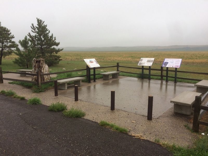
Between 1864 and 1876, five military expeditions crossed this windswept country. Though only a couple of skirmishes occurred in the badlands, their stories hold a significant place in the history of the Great Sioux War. Lieutenant Colonel George . . . — — Map (db m87216) HM
Near 81st Avenue Southwest, 0.6 miles north of 50th Street Southwest.
General Alfred Sully, Commander of a United States military expedition to Dakota Territory to punish hostile Sioux, established a base camp on this site on July 26, 1864. Sully left his surplus supplies and equipment and an immigrant train wish was . . . — — Map (db m156144) HM WM
On North Avenue East (State Highway 8) just west of 88th Avenue Southwest (State Highway 8), on the left when traveling east.
The Yellowstone Expedition of 1876, organized to quell the hostile Sioux, marched from Fort Abraham Lincoln May 17, 1876, and camped near Young Mans Butte about two miles east of this marker on May 23, 1876. Between Young Mans Butte and . . . — — Map (db m234898) HM
On Main Street West at Dagnault Avenue, on the left when traveling west on Main Street West.
The Yellowstone Expedition of 1876, organized to quell the hostile Sioux, marched from Fort Abraham Lincoln May 17, 1876, and camped about eight miles west of this marker on May 24, 1876. Custer’s Calvary route passes three miles south of Taylor, . . . — — Map (db m234897) HM
Fort Seward, formerly Fort Cross, was established June 3, 1872. The post was built on a bluff overlooking the confluence of the James River and Pipestone Creek. Although the Sioux Indians had recently been settled on reservations, occasional . . . — — Map (db m112678) HM
On 4th Street Northwest, 0.2 miles 8th Ave NW, on the right when traveling west.
A United States military post providing quarters for two companies of infantry. It was named for Wm H. Seward, wo served as Secretary of State under Abraham Lincoln.
The post protected workers who were building the Northern Pacific Railway . . . — — Map (db m112683) HM
Established 1872
Abandoned 1877
Officer In Command
Captain John H. Patterson
in the Spring of 1876 two companies of the 7th Cavalry
were encamped in this valley for three weeks.
In the Indian Campaign which followed, these . . . — — Map (db m112671) HM
On 16th Street Southeast east of 53rd Avenue Southeast, on the right when traveling west.
J.J. Dittbenner and Carl Simondet, father And grandfather of John J. Dittbenner and G.H. Newman, Sr. Local Pioneers were Soldiers with the expedition — — Map (db m175437) HM WM
Near 39th Lane Northwest near 153rd Avenue Northwest.
This building was constructed in 1871 as the post commanding officers' quarters. It served in that capacity until 1889, when a new commanding officers' quarters was built near the north side of the post. The single most important event that . . . — — Map (db m143159) HM
Fort Buford a United States Military Post named in honor of General John Buford of Gettysburg fame was established on this location in the fall of 1866. Preceding it on this site were two trading posts. Fort William erected in 1833 and Fort Mortimer . . . — — Map (db m96746) HM