By Mark Hilton, December 17, 2013
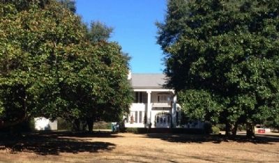
Buena Vista Plantation Home
| On County Road 4, 0.1 miles west of Buena Vista Boulevard, on the right when traveling west. |
| On Main Steet at South Chestnut Sreet, on the right when traveling east on Main Steet. |
| On South Court Street at West 3rd Street, on the left when traveling south on South Court Street. |
| On Main Street at Manci Avenue, on the right when traveling south on Main Street. |
| On 24 N Section Street at Fairhope Avenue, on the right when traveling north on 24 N Section Street. |
| On Jenkins Farm Road, 0.2 miles east of U.S. 90, on the right when traveling east. |
| On West Louisville Avenue, on the right when traveling east. |
| On North Midway Street, on the right when traveling north. |
| On West Barbour Street, on the left when traveling west. |
| On North Eufaula Avenue (U.S. 431) 0.1 miles north of Broad Street, in the median. |
| Near State Park Road south of Furnace Road (County Route 62), on the right when traveling south. |
| On State Park Road south of Furnace Road (County Road 62), on the left when traveling south. |
| On North Prairie Street, on the right when traveling south. |
| On Noble Street north of East 10th Street, on the right when traveling north. |
| On Noble Street north of West 10th Street, on the left when traveling north. |
| On Gurnee Avenue north of West 10th Street, on the left when traveling north. |
| On Noble Street south of West 11th Street, on the right when traveling south. |
| On Noble Street south of West 11th Street, on the right when traveling south. |
| On Noble Street south of West 11th Street, on the right when traveling south. |
| On Noble Street south of West 11th Street, on the right when traveling south. |
| On Gurnee Avenue at West 11th Street, on the right when traveling south on Gurnee Avenue. |
| On Noble Street south of 12th Street, on the right when traveling south. |
| On Walnut Avenue at 12th Street, on the right when traveling south on Walnut Avenue. |
| On Noble Street north of East 12th Street, on the right when traveling north. |
| On Noble Street north of East 12th Street, on the right when traveling north. |
| On Noble Street south of West 13th Street, on the right when traveling south. |
| On Noble Street at West 13th Street, on the right when traveling south on Noble Street. |
| On Atlanta Avenue at West 10th Street, on the right when traveling south on Atlanta Avenue. |
| On Noble Street at East 13th Street, on the right when traveling north on Noble Street. |
| On Noble Street at West 13th Street, on the right when traveling south on Noble Street. |
| On Gurnee Avenue north of West 13th Street, on the right when traveling north. |
| On Williams Avenue at East 10th Street, on the left when traveling north on Williams Avenue. |
| On West 10th Street at Atlanta Avenue, on the right when traveling west on West 10th Street. |
| On West 15th Street at Glenaddie Avenue, on the right when traveling east on West 15th Street. |
| On West 15th Street at Glenaddie Avenue, on the right when traveling west on West 15th Street. |
| On Noble Street north of West 9th Street, on the left when traveling north. |
| On Noble Street south of West 10th Street, on the right when traveling south. |
| On Noble Street north of East 9th Street, on the right when traveling north. |
| On Noble Street south of West 10th Street, on the right when traveling south. |
| On West 11th Street at Noble Street, on the right when traveling east on West 11th Street. |
| On Noble Street at East 12th Street, on the right when traveling north on Noble Street. |
| On A Street Southwest near H Avenue Southwest, on the right when traveling west. |
| On Ladiga Street Southeast at Church Avenue Southeast, on the right when traveling east on Ladiga Street Southeast. |
| On Pelham Road (State Highway 21) at 5th Street NE, on the right when traveling north on Pelham Road. |
| On Main Street at Mc Kibbon Street, on the right when traveling north on Main Street. |
| Near Tuscahoma Road (County Route 43) 0.1 miles south of County Route 27, on the right when traveling south. |
| On West Cobb Street at South Jackson Street (Alabama Route 295), on the right when traveling west on West Cobb Street. |
| On West Cobb Street at North Jackson Street (Alabama Route 295), on the right when traveling west on West Cobb Street. |
| On Putnam Street at Court Street, on the right when traveling east on Putnam Street. |
| Near Cedar Lane (County Road 15) 0.7 miles south of U.S. 72, on the right when traveling east. |
| On Middle School Road north of Old Lee Highway (County Road 20), on the left when traveling north. |
| On Lime Kiln Road at Houston Street, on the right when traveling north on Lime Kiln Road. |
| On S. Wilson Dam Highway, 1 mile Kimberley Drive. |
| On East 34th Street north of East 14th Avenue, on the right when traveling north. |
| On South Main Street at 4th Street, on the right when traveling south on South Main Street. |
| On South Cave Street at East 7th Street, on the right when traveling north on South Cave Street. |
| On East 8th Street, on the left. |
| On Depot Square north of Mill Street, on the right when traveling south. |
| On Forest Avenue at West 9th Street, on the right when traveling south on Forest Avenue. |
| On 6th Avenue Southeast south of 1st Street Northeast, on the right when traveling south. |
| On East Broad Street (Alabama Route 27) 0.2 miles east of Union Street (Alabama Route 123), on the right when traveling east. |
| On East Broad Street (Alabama Route 27) at Mutual Street, on the left when traveling east on East Broad Street. |
| Near 2nd Street North near Vine Street. Reported permanently removed. |
| Near 2nd Street North. Reported permanently removed. |
| On Union Street at Furniss Avenue, on the left when traveling north on Union Street. |
| On Union Street at McLeod Avenue, on the left when traveling south on Union Street. |
| On Mabry Street south of Jeff Davis Avenue, on the right. |
| On County Road 52 at County Road 293, on the left when traveling west on County Road 52. |
| On McCurdy Avenue North (State Highway 75) at Main Street (State Highway 35), on the right when traveling south on McCurdy Avenue North. |
| On Chestnut Street at South 9th Street, on the right when traveling east on Chestnut Street. |
| On South Academy Street south of East Campbell Avenue, on the right when traveling south. |
| On Erwin Street at Tuscaloosa Street, on the left when traveling west on Erwin Street. |
| On Main Street at Castleman Street, on the right when traveling west on Main Street. |
| On Alabama Route 61 south of Beech Street, on the right when traveling south. |
| On Alabama Route 61 at Cemetery Street, on the right when traveling north on State Route 61. |
| On South Scott Street at College Avenue, on the right when traveling north on South Scott Street. |
| On E Peachtree Street, on the right when traveling west. |
| Near County Road 25 south of Paradise Lane, on the right when traveling south. |
| On City Park Road, 0.2 miles south of Kentucky Avenue (Alabama Road 117), on the right when traveling south. |
| On Eastern Valley Road (County Road 18) 0.1 miles north of Rosser Loop Drive, on the left when traveling north. |
| On Arlington Avenue at 19th Street South, on the right when traveling west on Arlington Avenue. |
| Near Valley View Drive west of Richard Arrington Jr Boulevard South. |
| Near 20th Street North at 1st Avenue North (U.S. 11), on the right when traveling south. |
| On 26th Street South at Hatcher Place on 26th Street South. |
| On Richard Arrington, Jr. Blvd North at 3rd Avenue North, on the left when traveling north on Richard Arrington, Jr. Blvd North. |
| On 1st Avenue North (U.S. 78) at Richard Arrington Jr. Boulevard South, on the right when traveling east on 1st Avenue North. |
| On 6th Avenue North at 20th Street North, on the left when traveling west on 6th Avenue North. |
| On 5th Avenue North at 18th Street North, on the right when traveling east on 5th Avenue North. |
| On Highland Avenue at 29th Street South, on the right when traveling west on Highland Avenue. |
| Near Tannehill Road, 0.5 miles north of Tannehill Park, on the right when traveling north. |
| Near Tannehill Road, 0.5 miles north of Tannehill Park, on the right when traveling north. |
| On Eastern Valley Road (County Road 18) at Vintage Lane, on the left when traveling west on Eastern Valley Road. |
| On South Cox Creek Parkway near River Heritage Park. |
| On Jackson Road (County Road 41) 0.8 miles south of West Rasch Road (County Road 16), on the right when traveling south. |
| On Gilbert Circle, on the right when traveling east. |
| On Hamilton Street west of Monroe Street, on the right when traveling west. |
15353 entries matched your criteria. The first 100 are listed above.
Next 100 ⊳