On U.S. 50/56 just west of South Walnut Street, on the right when traveling west.
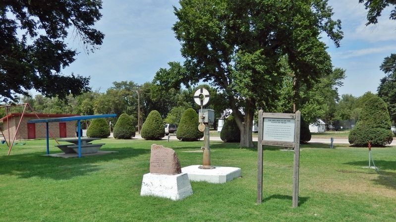
North of this point one mile, the Santa Fe Trail’s Dry Route ran southwest to merge with the Wet Route at the Caches, two miles west of present Dodge City. At a later date, the Dry Route ran one mile south of this point to merge with the Wet Route . . . — — Map (db m213913) HM
On 9th Street near Washington Street, on the left when traveling west.
Officially organized and founded as a city in 1870, the first street laid out and used was known as Edwards Street (now west 9th). The heart of Ellis' business district started and grew here offering such services as hotels, saloons, general . . . — — Map (db m59173) HM
On 10th Street (Old U.S. 40) near Washington Street, on the left when traveling west.
The Walter P. Chrysler Home was built in 1889 by Walter's father Henry, his brother Ed, and Walter himself. Walter lived in the home from 1889 to 1897. During this period, the Kansas Pacific Railway employed Walter as an engine wiper and later as a . . . — — Map (db m59064) HM
On 9th Street near Washington Street, on the left when traveling west.
Built in 1872 of native limestone from a quarry 2 miles east of Ellis, The Ellis House was the scene of colorful functions and dances drawing people from a radius of up to 100 miles. Centrally located halfway between Kansas City and Denver, it . . . — — Map (db m76615) HM
On 9th Street at Jefferson Street, on the right when traveling west on 9th Street.
Owned by Patrick Hickey, the first Hickey Building was a collection of wooden structures that served as the M.M. Fuller law office, the printshop for the Ellis Headlight newspaper, Ramsey's Barber Shop and the A.J. Cromb Candy & Notions store. . . . — — Map (db m59176) HM
On West 10th Street west of Main Street, on the right when traveling west.
James H. "Dog" Kelley, who ran a saloon and gambling hall on this site, was involved in the assault upon Sheriff Peter Lanahan on July 16, 1871, at Henry "Lon" Kelly's Saloon west of here. When Lanahan's bullets nearly hit him, "Dog" was so enraged . . . — — Map (db m96512) HM
The foundation before you marks the stone bake house, where all the fort's bread was baked. The inner rectangular foundation at the east (right) end marks the oven, while the foundation of the pantry is in the west (left) end. The original wooden . . . — — Map (db m59749) HM
On West 10th Street, 0.1 miles west of Main Street, on the right when traveling west.
Cy Goddard’s Saloon and Dance Hall is one of several places reported to have been the spot where General Custer's brother Tom and some troopers of the Seventh Cavalry tangled with "Wild Bill" Hickok on July 17, 1870. After wounding two soldiers, one . . . — — Map (db m96404) HM
On West 10th Street west of Main Street, on the right when traveling west.
The Goddard brothers - Cyrus F., George W. & Edwin F. - who had run the city restaurant in Leavenworth before coming to Hays City, opened a provisioning store for freighters, plainsmen, railroaders and others on this site under the curious name of . . . — — Map (db m96509) HM
On Fort Street at West 12th Street, on the right when traveling south on Fort Street.
The Armes Dance Hall, originally named the Globe Theater, was built on this site in 1867 by Major George Armes with money raised by his younger brother in Leavenworth, ostensibly to erect an Episcopal church. Later the building was moved to Fort . . . — — Map (db m96491) HM
On Fort Street at West 10th Street, on the right when traveling south on Fort Street.
On December 28, 1867, Charles DeCropper shot and killed Cornelius Doyle in the corner doorway of Henry P. Fields Star Restaurant, which stood on this site. Fields later sold the lot to Miss Ida May, who turned it over to Jim Curry. Alleged slayer of . . . — — Map (db m96517) HM
On West 10th Street west of Main Street, on the right when traveling west.
Kate Burns and Mike Coffey ran a saloon on this site, probably as early as 1869. On the very day J.B. “Wild Bill” Hickok became Sheriff of Ellis County, August 23, 1869, Father Sebastian Favre united Kate and Mike in matrimony at Hays . . . — — Map (db m96505) HM
The four wooden frame buildings that comprised "Sudsville" or "Laundress Row," were located approximately 100 yards behind and to the left of this sign. Each building housed four laundresses and their families in two 12' by 12' rooms. Laundresses . . . — — Map (db m59752) HM
On Main Street at 9th Street, on the left when traveling north on Main Street.
Originally this was the site of the warehouse of a large shipping firm which ran bull trains to Mexico during the days when Hays City was "the end of the line." The owner, Miguel Antonio Otero, had acted as Territorial Governor of New Mexico in . . . — — Map (db m59797) HM
Each post had its trader or sutler that sold general merchandise to soldiers. The trader was the only civilian allowed to operate a business for profit on a military fort. The trader's store at Fort Hays was located 50 feet behind this sign.
The . . . — — Map (db m59768) HM
On West 10th Street west of Main Street, on the right when traveling west.
One of Hays City’s earliest post offices was in Evans’ grocery store. Here on June 23,1869, clerk A. B. Webster, afterwards mayor and marshal of Dodge City, shot and killed Joseph N. Weiss. Joe was proprietor of the local Omaha Saloon, a former . . . — — Map (db m96501) HM
On West 10th Street west of Main Street, on the right when traveling west.
The first hotel in Hays City was moved here by J.D. Perry in 1867 from Rome, the little town W.F. "Buffalo Bill" Cody and others tried to start a mile to the west. Cody and his wife resided at the Hays Perry for a time, and Tom Custer's name appears . . . — — Map (db m96518) HM
On West 10th Street at Main Street, on the right when traveling west on West 10th Street.
County Commissioner Dennis Ryan and County Treasurer Mike Caplice ran the Pioneer Store, a general outfitting firm on this corner from 1867 to 1870. Their wagon driver, Allmeyer, was gravely wounded by a man named Cole on October 8, 1869. After a . . . — — Map (db m96513) HM
On West 10th Street west of Fort Street, on the right when traveling west.
More than a dozen brothels lined this and Fort Streets during Hays City’s untamed years, 1867-1874. On this site stood a house owned at various times by the notorious Jim Curry, by his girl friend, Miss Ida May, and A.J. Peacock, who later fought . . . — — Map (db m96395) HM
On West 10th Street west of Main Street, on the right when traveling west.
This was the favorite gathering place of soldiers from nearby Fort Hays, British Colonists from Victoria, such famous personages as "Wild Bill" Hickok, "Buffalo Bill" Cody and Generals George A. Custer, Phil Sheridan and Nelson A. Miles. Three . . . — — Map (db m96506) HM
On West 9th Street at Fort Street, on the right when traveling east on West 9th Street.
This second largest house built in 1867 was run by George Boggs and Thomas Ranahan, who sold the hotel in 1868 to Bob Wright, post trader at Fort Dodge. Later that year, Ranahan was one of only 20 Hays citizens who signed up with the famous Forsyth . . . — — Map (db m96496) HM
On 8th Street at Main Street, on the left when traveling west on 8th Street.
Built as a dry goods store by Hill P. Wilson in 1874, this stone building was the home of the Government Land Office from 1875 till 1877, and possibly as late as 1879, when the office was moved to WaKeeney. Thousands of pioneers filed homestead and . . . — — Map (db m59796) HM
On West 10th Street west of Main Street, on the right when traveling west.
Paddy Walsh killed Charles Blunt, an ex-policeman from Leavenworth, in a barroom fight in Ellsworth on September 25, 1867. By November he was in Hays City, located on South Fort Street. Within nine months it was reported that Walsh had shot and . . . — — Map (db m96402) HM
On West 10th Street west of Main Street, on the right when traveling west.
Moses Waters (1841-1889) and Henry Murray opened a saloon on this site in 1869. In partnership with James Hanrahan, Waters operated a second saloon, the Occident, in Dodge City. Waters was post sutler at Fort Riley from 1875 to 1889. Jack Hill, one . . . — — Map (db m96504) HM
On South Main Street near Douglas Avenue (Kansas Highway 14), on the right when traveling west.
Directly across South Main Street, a double building housed the general store owned by Jerome Beebe. He sold groceries, wines and liquor, and reapers and plows. The events of Sunday, August 15, 1873, led up to the shoot-out that killed Sheriff . . . — — Map (db m54172) HM
On Kansas Avenue near South Main Street, on the right when traveling south.
The Drovers Cottage was originally built in Abilene by Joseph McCoy. Jim and Louisa Gore ran a friendly house and the Texans felt very much at home among their fellow cattlemen at the Cottage. In 1872, two-thirds of the original hotel was moved to . . . — — Map (db m54147) HM
On North Main Street at Lincoln Avenue, on the right when traveling east on North Main Street.
Arthur Larkin was one of Ellsworth's first businessmen. The Larkin House was his first establishment, but it burned in 1869 destroying the entire block. Mr. Larkin then determined to build the finest structure possible on the corner of North Main . . . — — Map (db m54118) HM
On Douglas Avenue (State Highway 14) at South Main Street, on the right when traveling south on Douglas Avenue.
In typical frontier fashion, Ellsworth was established along the railroad grade, even before the rails were in place. Ellsworth has two main streets paralleling the track. The Plaza was a common area open to freight hauling teams and family buggies . . . — — Map (db m54169) HM
On South Main Street near Douglas Avenue (Kansas Highway 14), on the left when traveling west.
Fires plagued the businesses on South Main Street throughout the early years. The last of three devastating fires occurred in November 1875 destroying this entire block. Except one building near the center of the block, the buildings were entirely . . . — — Map (db m54152) HM
On Douglas Avenue (State Highway 14) at South Main Street, on the left when traveling south on Douglas Avenue.
The Old Cattle Trail into Ellsworth passed down Douglas Avenue (Hwy. 14). Cattle were herded through town and circled to the west where they were penned in the extensive Kansas Pacific Stockyards (7). John Kelly's American House hotel, next door to . . . — — Map (db m54171) HM
On South Main Street near Lincoln Street, on the right when traveling west.
Nicknamed "Gambler's Roost", Brennan's Saloon on the south side of this street was a favorite of the sporting crowd. One of the most notorious gunmen in the west, Ben Thompson, ran the Faro tables here. Dick Clark was considered the premier gambler . . . — — Map (db m54173) HM
On South Main Street near Lincoln Avenue, on the left when traveling east.
The Depots, just north of this sign were the natural gathering place for frontier towns. The area bustled with actiivity as dray (delivery) operators came and went with freight for local business. Of course, information from "back East" arrived . . . — — Map (db m54180) HM
On North Main Street at Colorado Avenue, on the left when traveling west on North Main Street.
The stockyards were to your left on the location of today's old CK elevator. The photo to the left was actually taken from a location west of here. It shows scattered buildings in the background. Ellsworth was slowly growing to the north.
In . . . — — Map (db m54123) HM
On South Main Street near Kansas Avenue, on the left when traveling west.
Cowboys could get the latest in hand-made boots at the sign of the big red boot! John Mueller, (standing in front of the doorway next to the seated children) opened for business at this location in the early 1870's. Texans, just in off the trail, . . . — — Map (db m54148) HM
On South Main Street near Douglas Avenue (Kansas Highway 14), on the left when traveling east.
Snake Row had many different kinds of saloons. Nick Lentz offered medicinal baths. On August 15, 1873, Ben Thompson confronted fellow gambler John Sterling in Lentz's saloon across the street from this sign. The disagreement was about the winnings . . . — — Map (db m54198) HM
On Douglas Avenue (State Highway 14) at North Main Street, on the right when traveling north on Douglas Avenue.
The Seitz Drug Store, founded across the street in 1868 on the corner of North Main and Douglas Avenue, was advertised as the oldest established drugstore in western Kansas. The claim still holds true as it is still in existence one block north on . . . — — Map (db m54200) HM
On South Main Street near Douglas Avenue, on the left when traveling west.
David W. Powers began freighting on the Smoky Hill Trail in the early 1860's. His bull trains were outfitted at Leavenworth destined for Denver, Colorado and going as far as Salt Lake City, Utah. Powers established a bank in Salina, Kansas, in 1870 . . . — — Map (db m54151) HM
On South Main Street at Colorado Avenue, on the right when traveling west on South Main Street.
During Ellsworth's frontier days, most of the business activity occurred along the two streets paralleling the railroad tracks. As the Texas cattle trade moved from Abilene to Ellsworth, the tradition of the Texans dominating the Plaza persisted. . . . — — Map (db m54127) HM
On South Main Street near Douglas Avenue (Kansas Highway 14), on the left when traveling east.
Mayer Goldsoll's Old Reliable House was a popular mercantile with the Texas cowboys. Goldsoll also had stores in Abilene, Russell, Great Bend, and Denison, Texas. In 1873, Ellsworth's Old Reliable House recorded $150,000 dollars in business! It was . . . — — Map (db m54199) HM
On North Main Street at Court Street, on the right when traveling east on North Main Street.
View of the Plaza looking west. The Grand Central Hotel (9) is on the right. The depot (14) is in the center of the Plaza and the Drovers Cottage (5) can be seen in the distance just to the left side of the depot. Had you been standing here on a . . . — — Map (db m54110) HM
On 27th Street at Avenue D, on the left when traveling west on 27th Street.
Wilson's distinctive limestone architecture is the enduring legacy of its early town builders. Many downtown commercial buildings reflect the subtle stylistic references typical of rural Kansas town centers. In addition to regional materials like . . . — — Map (db m200936) HM
On Main Street (U.S. 50) near Pine Street, on the left when traveling north.
Would the founding fathers of Garden City recognize their town? Brothers James and William Fulton, who came hunting wild horses, filed homesteads in 1878 along the Arkansas River, laying plans for a town in unsettled region. The third town . . . — — Map (db m65853) HM
On Main Street (U.S. 50) north of Laurel Street, on the left when traveling north.
According to a newspaper article of October 25, 1928, the $88,000 contract for the building of a new movie theater on Main Street had been awarded. The projected seating capacity was to be 700 seats, 600 on the ground floor and 100 in the . . . — — Map (db m65847) HM
On Wyatt Earp Boulevard west of 3rd Avenue, on the right when traveling west.
The Santa Fe Trail was a busy overland route for fifty years before Dodge City was founded. The heavy freight wagons rumbled along where you are now standing. In 1865, Fort Dodge was established to provide protection for wagon trains and to . . . — — Map (db m65270) HM
On Central Avenue at Front Street, on the left when traveling north on Central Avenue.
For decades, Dodge City's existence was tied to the railroad. When the first train arrived on the newly-laid Atchison, Topeka & Santa Fe Railroad tracks in September 1872, stacks of buffalo hides were already waiting to be transported to eastern . . . — — Map (db m65283) HM
On Front Street at 2nd Avenue, on the left when traveling west on Front Street.
The first structure built on the future site of Dodge City was a three-room sod house. Constructed by Henry L. Sitler, it was near the dusty ruts of the Santa Fe Trail, approximately 500 feet southwest of where you now stand. The "soddie" was . . . — — Map (db m65273) HM
On Wyatt Earp Boulevard (Business U.S. 50) 0.1 miles east of Matt Down Road, on the right when traveling east.
"If you stood on the hill above Dodge City, there was traffic as far as you could see, 24-hours a day; seven days a week on the Santa Fe Trail." —Henry L. Sitler, early settler Fort Dodge was established on the Santa Fe Trail in 1859 to protect . . . — — Map (db m204346) HM
On Wyatt Earp Boulevard at 2nd Avenue, on the right when traveling west on Wyatt Earp Boulevard.
This statue commemorates the Texas Longhorn that gave Dodge City its place in history as "Queen of the Cowtowns." The Longhorns are descendants of Spanish cattle brought to Mexico in the 16th century. Between 1875 and 1886, over 4 million head . . . — — Map (db m65271) HM
On 2nd Avenue at Spruce Street, on the left when traveling north on 2nd Avenue.
In the mid 1880s, economic factors contributed to a change in Dodge City's character. The cowtown era ended with the last Texas cattle drives in 1885. Two severe blizzards in that period destroyed the local range cattle industry. At the same . . . — — Map (db m65356) HM
On Front Street at 2nd Avenue, on the left when traveling west on Front Street.
Dodge City became the buffalo-hunting capital of the world soon after it was founded in 1872. Within three years, however, the buffalo herds were depleted to the point that Dodge needed a new source of income. Longhorn cattle filled that need. . . . — — Map (db m65274) HM
Near 5th Avenue just north of West Wyatt Earp Boulevard, on the right when traveling north.
The railroad played a significant role in the prosperity of early Dodge City. When the railhead was established here in 1872, Dodge City became the ideal location for shipping buffalo hides to points east on the Atchinson, Topeka and Santa Fe . . . — — Map (db m230435) HM
On Spruce Street west of 2nd Avenue, on the right when traveling west.
This garden stands as a tribute to J. C. Denious and his family, who owned and operated the "Dodge City Daily Globe" from 1910 to 1988. The newspaper has a history dating back to 1878 as a weekly publication, but Denious is credited as the Father . . . — — Map (db m65330) HM
On Front Street at 2nd Avenue, on the left when traveling west on Front Street.
This map depicts businesses known to have existed along Dodge City's Front Street between 1878 and 1882. As the town grew, other establishments were located farther north of Front Street, as well as south of the railroad tracks. Modern street . . . — — Map (db m65272) HM
On U.S. 400 at Sheridan Street, on the left when traveling west on U.S. 400.
In the fall of 1867, the Fort Hays-Fort Dodge Road was developed to transport merchandise, mail and passengers from the newly founded railhead at Hays City to Fort Dodge and on to Santa Fe via the established route of the Santa Fe Trail. Thus, . . . — — Map (db m65424) HM
On Pershing Street at Garfield Street, on the left when traveling west on Pershing Street.
Twin storehouses, each 130 ft. by 30 ft., and a bakery were the first stone buildings to be completed in 1867. The second storehouse stood a few yards to the east. The north ends of each building were partitioned to provide offices for post . . . — — Map (db m65427) HM
On Sheridan Street south of U.S. 400, on the left when traveling south.
The Fort Dodge "sutler" store and buildings stood near this location. The civilian who kept a store in connection with a fort was known as the "sutler." He paid a fee for a monopoly to conduct all buying and selling on the military reservation. . . . — — Map (db m65409) HM
has been designated a
Registered National
Historic Landmark
under the provisions of the
Historic Sites Act of August 21, 1935
This site possesses exceptional value
in commemorating or illustrating
the history of the United . . . — — Map (db m65494) HM
Unlike the emigrant trails that took travelers west to Utah, Oregon, and California, the Santa Fe Trail mainly handled commercial traffic moving east and west.
When Santa Fe became part of the United States in 1848 after the Mexican-American . . . — — Map (db m65519) HM
Pioneered by William Becknell in 1821, the Santa Fe Trail was a 900-mile overland road that connected Franklin, Missouri, with Santa Fe, New Mexico, and was an important commercial trade route. Near here, trail travelers had to decide which route . . . — — Map (db m65496) HM
Eighteen Miles a Day
Hundreds of freight wagons laden with trade items once lumbered by here, passing just uphill from where you are standing. Large caravans took six to ten weeks to travel the 900 miles between Mexico (present-day New . . . — — Map (db m65512) HM
Local men, boys, and animals sweated long and hard to build the Eureka Irrigation Canal between 1884 and 1887. The long line below the ridge is a remnant of this early effort to irrigate semi-arid lands using the only reliable water source then . . . — — Map (db m65493) HM
For 60 years, this prairie soil was torn by the hooves of mules, oxen, and horses, and compacted by the weight of the large freight wagons they pulled. The wagons of a caravan traveled four abreast to avoid dust and to quickly form defensive . . . — — Map (db m65440) HM
You are standing on a bluff above the Arkansas River, an international boundary between the United States and Mexico during the early years of the Santa Fe Trail. This area was prone to flooding and the ruts offer an excellent illustration of how . . . — — Map (db m65495) HM
On Main Street at 2nd Street, on the right when traveling south on Main Street.
The panoramic photo reproduced here was taken by J.C. Bandholtz in 1909. Panoramas were the rage at that time. The view takes in the 100 block south on the left and the 200 block south on the right.
The east side of the 200 block was placed on . . . — — Map (db m67477) HM
On Main Street at 4th Street, on the right when traveling south on Main Street.
Location, location, location
The Baptists built a stone church on the east side of the 400 block in 1867. The photo above shows it as well as a "tabernacle" tent erected for a Kansas Baptist Convention in 1869. By the 1890s, the Baptists . . . — — Map (db m67615) HM
This building, constructed in 1888, served as Division headquarters of the Southern Kansas Railway. This was a subsidiary and later became a part of the Santa Fe system. When the Santa Fe moved into a new station, the old stone depot which had . . . — — Map (db m46884) HM
On Tecumseh Street, on the right when traveling west.
The Leavenworth, Lawrence & Galveston was the first railroad built south of the transcontinental Union Pacific which passed through Lawrence. Building the 30 miles of track to Ottawa in 1867-8 was difficult. Veterans of the UP construction, . . . — — Map (db m50753) HM
On Main Street near 2nd Street, on the left when traveling south.
Built by William T. Pickrell, this building was originally used to sell agricultural implements. Other early businesses at this address included a millinery, barber shop, photography studio, billiard hall, restaurant, confectionary, jeweler and . . . — — Map (db m50754) HM
This building was built by L. W. Shepherd & B. C. McQuesten as a bank. It was the first location of Peoples National Bank, which bought the property in 1872 and then relocated to 137 S. Main around a decade later. Originally, it had arched window . . . — — Map (db m59072) HM
Is a block of commercial structures built between 1872 and 1900 of late Victorian styling with Renaissance, Eclectic and some Classical features. The buildings are individualistic but have the same underlying style and character. Their uniqueness . . . — — Map (db m46885) HM
On Sheridan Avenue, 0.1 miles west of Pleasanton Avenue, on the left when traveling west.
This structure is named for Mose Waters, the post sutler who built it in 1888 as a general store and recreation center. It became the first post exchange in 1897 and was converted to living quarters in 1930. — — Map (db m80760) HM
On North Washington Street (Alternate U.S. 77) at West 7th Street, on the right when traveling south on North Washington Street.
616 N. Washington: Cozy Theater Opening in November 1918, the Cozy Theater had the finest motion picture equipment in the Midwest. The building shows influences from the "Prairie School" of architecture originating at the 1893 Chicago World's . . . — — Map (db m131577) HM
On North Washington Street (Alternate U.S. 77) at East 8th Street, on the right when traveling north on North Washington Street.
722 N. Washington: Masonic Temple Constructed in 1881, the Masons have occupied the building since 1916. The main floor has housed a variety of stores including Ziegler Hardware, Waters Hardware, and department or clothing stores under the . . . — — Map (db m131575) HM
On North Washington Street (Alternate U.S. 77) at West 7th Street, on the right when traveling south on North Washington Street.
130 West Seventh Street: This building was apparently built before the turn-of-the-century. It housed Gross Furniture, a firm dating to 1860. Later it was occupied by various groceries, cafes, and shops.
103 West 7th Street: George Smith . . . — — Map (db m131576) HM
On North Washington Street (Alternate U.S. 77) at East 8th Street, on the right when traveling north on North Washington Street.
816 N. Washington: Baskin/Clewell Drug Store Here, in 1978, the last of the "old-fashioned drug stores” in junction City closed. Built in 1904 by pharmacist C.H. Baskin, the building was acquired by Charles Clewell in 1917. Eventually his . . . — — Map (db m131574) HM
On Washington Avenue, on the left when traveling west.
Eager for word from loved ones back home, people gathered at the St. Francis Hotel when the mail wagon arrived. The right, upright section of this building was the original limestone St. Francis Hotel, Nicodemus' first stone building along the . . . — — Map (db m154732) HM
On Washington Avenue at 2nd Street, on the left when traveling east on Washington Avenue.
"Nicodemus was growing into a busy little town. New houses were being built by people coming in. Different enterprises began to originate. Conditions began to improve."— Nettie Craig Teacher 1886
Main Street Nicodemus grew out of hard . . . — — Map (db m131531) HM
On State Highway 25, 14.4 miles north of U.S. 56, on the left when traveling north.
About two miles west were the Lower Springs of the Cimarron River, known today as Wagon Bed Springs. For early-day travelers on the famous Santa Fe Trail, the springs were an “oasis” in dry weather. Several shortcuts of the trail converged here, . . . — — Map (db m213735) HM
Near South Main Street (State Highway 23) 0.1 miles south of West Avenue E, on the right when traveling south.
Cimarron, settled in 1878, got its name as the starting point at one time of the shorter Cimarron or dry route to Santa Fe. Here the Santa Fe Trail divided, one branch heading directly southwest, the other (present US 50) following the Arkansas . . . — — Map (db m204576) HM
On U.S. 54, 0.5 miles west of County Route 33, on the left when traveling west.
This county lies almost wholly within one of the world's great beef cattle feeding grounds, the Bluestem pasture region of Kansas. The area, more popularly known as the Flint Hills, extends across the state from north to south in a narrow oval two . . . — — Map (db m55990) HM
On Main Street (State Highway 44) west of Lawrence Avenue, on the left when traveling west.
May 10, 1902, marked the driving of the spike in Anthony, Ks, which was the beginning of the KCMO Railroad in the United States. Mayor Brown of Anthony, Ks, presented the KCMO vice-president with a $40,000 Bond from the Citizens of Anthony to aid . . . — — Map (db m62837) HM
On Main Street at 2nd Street, on the right when traveling south on Main Street.
Site of the first public building in Halstead, Kansas
Erected in March 1873 by G. W. Sweezy
It was a two story frame building 32 feet by 42 feet used as a commercial hotel and known as
The Sweezy Hotel
After fifty nine years of use, the . . . — — Map (db m81281) HM
On Main Street south of 2nd Street, on the left when traveling south.
This stone building was erected in 1879 after a disastrous fire wiped out many frame buildings on Main Street. Bergtholdt had a farm implement agency in the south section until 1885. That year Henry Riesen and David Dyck opened a hardware store. . . . — — Map (db m81279) HM
On North Main Street at East Smith Street, on the right when traveling north on North Main Street.
Plaque on front of building at 100 N. Main St. This is the oldest building still standing in the business row on Main Street. It was built in 1887 just after the town was officially organized. This building housed the first post office in . . . — — Map (db m170410) HM
On North Main Street (State Highway 15) at West Broadway Street, on the left when traveling north on North Main Street.
Five generations of the Anderson family have operated Newton's oldest retail business for over 100 years on Main Street. Founder Phillip Murray Anderson began his business in 1892 selling newspapers on Santa Fe trains. In 1894 he opened a newsstand . . . — — Map (db m166282) HM
On 1st Street near Oak Street, on the right when traveling east.
This Victorian house was built for Bernhard and Wilhelmina Warkentin in 1886-87. Bernhard was born in 1847 in the Mennonite village of Altonau, Ukraine. His father was a prominent miller. In 1872 he came to the U.S. to find new land. His letters . . . — — Map (db m56848) HM
On North Main Street (Kansas Route 15) at West 6th Street, on the left when traveling north on North Main Street.
Midland National Bank opened March 3, 1893 in a building located on the northeast corner of Fifth and Main. Grant Hornaday was the bank's president, J.H. McNair, vice-president and Don Kinney, cashier. The bank purchased this site in 1896 for $6000 . . . — — Map (db m166216) HM
550 entries matched your criteria. Entries 201 through 300 are listed above. ⊲ Previous 100 — Next 100 ⊳