On Main Street (Massachusetts Route 9) at Gothic Street, on the right when traveling south on Main Street.
On the corner across Center Street, at 135 Main, stands the Old Bank, designed by William Fenno Pratt and built in 1866. Its cast iron front was a modern innovation at the time. It was here that the largest bank robbery in the history of the . . . — — Map (db m194870) HM
Near Main Street (Massachusetts Route 10) at Masonic Street, on the right when traveling east.
Commercial development along upper Main Street followed the industrial expansion spurred by the Civil War. As Northampton became a manufacturing center, its business district expanded to accommodate a growing and changing population. In the 1860s . . . — — Map (db m138438) HM
On Huntington Road (Massachusetts Route 112) at Buffington Hill Road, on the right when traveling south on Huntington Road.
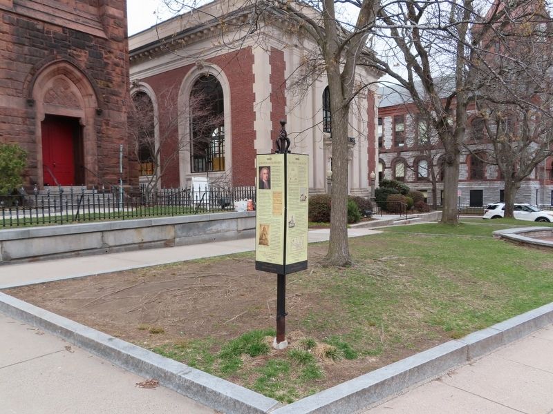
General LaFayette, friend of America in its struggle for liberty,
visited Worthington June 13, 1825.
Was a guest overnight at the tavern
then located on this site. — — Map (db m155524) HM
On Liberty Square Road, 0.2 miles north of Massachusetts Avenue (Massachusetts Route 111), on the left when traveling north.
Henderson Inches operated a sawmill on this site circa 1806–1865. The mill was used to clear his large oak woods which extended east and west of this location. The mill foundation, millrace and dam are visible before you.
Henry David . . . — — Map (db m108986) HM
On Story Street at Mt. Auburn Street, on the right when traveling south on Story Street.
Harriet A. Jacobs was born into
slavery in Edenton, North
Carolina, to Delilah Horniblow and Daniel Jacobs.
Harriet and her brother John (who
later lectured for the abolitionist
movement) were orphaned at an early
age and passed down to . . . — — Map (db m176358) HM
On Ames Street at Broadway, on the left when traveling south on Ames Street.
Past, Present, Future is a mural designed by youth artists in the Teen Public Art Program at The Community Art Center in the fall of 2021. Lead by artist and Teen Public Art Program Manager, Jack O'Hearn, each teen created their own artwork based . . . — — Map (db m215198) HM
On Main Street just west of Wadsworth Street, on the left when traveling east.
The Looking Glass invites you to gaze backward and forward in time. Imagine Cambridge's first building boom spurred by the opening of the West Boston Bridge (on the site of the Longfellow Bridge) in 1793. Catch a glimpse in the other direction of . . . — — Map (db m215196) HM
On Main Street at Wadsworth Street, on the right when traveling west on Main Street.
The Looking Glass invites you to gaze backward and forward in time. Imagine Cambridge's first building boom spurred by the opening of the West Boston Bridge (on the site of the Longfellow Bridge) in 1793. Catch a glimpse in the other direction of . . . — — Map (db m215197) HM
On Massachusetts Avenue (Massachusetts Route 2A) south of Church Street, on the right when traveling south.
Richard T. Greener, the first African American to graduate from Harvard College, had a distinguished career in public service.
Greener was born in Philadelphia. His father, a sailor, disappeared in the Gold Rush in 1853. The family moved to . . . — — Map (db m215383) HM
On Broadway west of Galileo Galilei Way, on the right when traveling east.
This park is dedicated in memory of
Danny Lewin
May 14, 1970 - September 11, 2001
Co-founder and Chief Technology Officer
Akamai Technologies, Inc. — — Map (db m215200) HM WM
On Massachusetts Avenue (Massachusetts Route 2A) south of Peabody Street, on the right when traveling north.
Erected in memory of
John "Muggsie" Kelly
March 6, 1923 - May 18, 1982
He gave his life during construction
Harvard Square Station — — Map (db m215384) HM
On Massachusetts Avenue (Massachusetts Route 2A) at Garden Street, on the right when traveling south on Massachusetts Avenue.
Beginnings
Cambridge was founded in 1630 as a new settlement meant by the Puritan leaders in Boston to be their permanent capital. The site chosen was a low hill three miles up the Charles River and hence safe from attack by sea. Streets . . . — — Map (db m215376) HM
On Massachusetts Avenue (Massachusetts Route 2A) at Garden Street, on the left when traveling north on Massachusetts Avenue.
A Revolution in Cambridge
March on Elmwood
On September 1 and 2, 1774, hundreds of New England militiamen gathered on the Cambridge Common to demand the resignation of three members of the Mandamus Council recently appointed by . . . — — Map (db m215365) HM
On Garden Street east of Mason Street, on the right when traveling west.
He represented those who had no voice, position or power. He exemplified those principles on which this nation was founded.
Proclamation of the City of Cambridge, 2008
The five black panels are . . . — — Map (db m215348) HM WM
On Mount Auburn Street (Massachusetts Route 2A) east of Plympton Street, on the left when traveling east.
Here Joan Baez and Bob Dylan sang duets, Muddy Waters played the blues, and Tom Rush, the Charles River Valley Boys and Eric Von Schmidt led the 60s folk revival. — — Map (db m215316) HM
On Norfolk Street at Washington Street, on the right when traveling south on Norfolk Street.
Lewis and John Milton Clarke, who were among the many contributors to the antislavery cause in Cambridge, were born in Madison County, Kentucky. They were the sons of an elderly white Revolutionary War veteran and a mulatto daughter of Samuel . . . — — Map (db m215275) HM
On Webster Avenue at Clark Street, on the right when traveling south on Webster Avenue.
Lunsford Lane was a successful businessman who purchased his freedom and then had to flee the South the escape the anger of resentful whites.
Lane, who was born in Raleigh, North Carolina, grew up as the slave of a prominent citizen of the . . . — — Map (db m215265) HM
On Webster Avenue just north of Lilac Court, on the right when traveling north.
William Wells Brown, an escaped slave who became the first African American novelist, was born on the Kentucky plantation of Dr. John Young. Later he was owned by three different masters in the St. Louis area. At one point he was a handyman in . . . — — Map (db m215264) HM
On Harrington Road at Bedford Street (Massachusetts Route 225), on the right when traveling west on Harrington Road.
This building was constructed in 1822 to house the Lexington Academy, a private school. In 1839, Horace Mann, Secretary to the Massachusetts Board of Education, persuaded the state to establish the nation's first normal schools, or teachers' . . . — — Map (db m198019) HM
On Suffolk Street north of Father Morissette Boulevard, on the right when traveling north.
In 1864, the Lowell Daily Courier reported that "all the cotton manufactories of any importance in this city have been quiet as the grave."
The outbreak of the Civil War severed the supply of slave-produced cotton. Many of Lowell's corporations . . . — — Map (db m117855) HM
On Suffolk Street north of Father Morissette Boulevard, on the left when traveling north.
Wannalancit Mills blended the old with the new. Formed in the late 1920s, Wannalancit moved into the aging Suffolk Mills two decades later and adapted surplus machinery for the production of new types of fabrics—rayon, polyester, and . . . — — Map (db m117820) HM
By the late 1840’s, slavery was a defining political issue in northern cities. The topic was hotly debated in Lowell and created unlikely political alliances.
Abolitionists like William Lloyd Garrison visited Lowell as early as the 1830’s and . . . — — Map (db m168920) HM
On John Street, 0.1 miles north of French Street, on the right when traveling north.
The Boott Cotton Mills complex is one of the finest examples of mill architecture in the United States. The mill complex you see today resulted from many decades of expansion and adaption.
[Top left diagram]
1830s
Four mill buildings were . . . — — Map (db m117856) HM
On Shattuck Street south of Merrimack Street, on the left when traveling south.
Lowell was founded upon the confluence of the Merrimack and Concord Rivers to become a nineteenth-century textile manufacturing empire. The city later faced urban decline when industry left the region. On January 3, 1989, George L. Duncan, a . . . — — Map (db m117778) HM
Boott Dam
Beneath the gatehouse to your left is a dam that controls the level of water in the Eastern canal. When the water is high, the excess spills into the Merrimack Wasteway and returns to the Merrimack River.
Booth Penstock . . . — — Map (db m117815) HM
This sculpture is a tribute to Lowell's nineteenth century "mill girls". The intertwined figures also represent the struggles and aspirations of all women throughout time — — Map (db m66208) HM
To the right stands a boardinghouse block built in 1837, for the Boott Cotton Mills workers. Dozens of company-owned boardinghouses served as home for the thousands of young, single women - Lowell's "mill girls."
This block was one of eight owned . . . — — Map (db m117814) HM
Irish laborers were vital in digging and maintaining the canals. The mills required a smooth and even flow of water to ensure efficiency and profit.
Before 1850, Yankee mill managers considered Irishmen fit to dig canals and construct mills, . . . — — Map (db m66056) HM
On Suffolk Street at Father Morissette Boulevard, on the right when traveling north on Suffolk Street.
The productivity of thousands of millworkers depended on the skill of gatekeepers like those who worked here at Tremont Gatehouse. By opening and closing sluice gates inside the small brick structure, the gatekeeper controlled the flow of water and . . . — — Map (db m66210) HM
Lowell’s first company-owned boardinghouses were built across the canal in 1823, to house young women workers from rural New England.
Neat rows of boardinghouses once lined the streets of Lowell. The companies hoped that a moral, clean, and safe . . . — — Map (db m66202) HM
On Dutton Street north of Market Street, on the right when traveling north.
[The fireman] put his left foot on the lever that swings open the firebox door, to look at the searing inferno within as he...hurled shovelful after shovelful of coal...
R.M. Neal, 1950
High Green and the Bark Peelers . . . — — Map (db m117775) HM
The first Lowell Manufacturing Company buildings were constructed along Pawtucket Canal in 1828 in order to make use of Lowell’s abundant water power. The two steam-powered building in this courtyard, however, were erected in 1882 and 1902 as the . . . — — Map (db m65900) HM
On Suffolk Street north of Father Morissette Boulevard, on the right when traveling north.
Site: Tremont Yard at Western Canal.
Material: Bronze and granite.
A stele is a standing stone or slab with textured or inscribed surfaces which serves as a monument. This sculpture commemorates the wide variety of life generated by the . . . — — Map (db m66211) HM
On Father Morissette Boulevard west of Suffolk Street, on the right when traveling west.
The original Suffolk Mill buildings, constructed in 1831, were razed and rebuilt during the idle business years of the Civil War. Only the 1831 counting house survives. The company merged with the Tremont Mills across Suffolk Street in 1871, and new . . . — — Map (db m117840) HM
The opening of the Merrimack Manufacturing Company on this site in 1823, marked the beginning of America’s first industrial city.
The Merrimack was the largest of Lowell’s mill complexes. By 1848, it employed over 2,000 workers and produced . . . — — Map (db m66200) HM
High above the courtyard of the Boott Cotton Mills stands a clock tower, crowned by a street bell. The bells chimed six times each day, summoning workers to and from their machines. In the new industrial cities of America, the factory bell replaced . . . — — Map (db m66203) HM
The Park tells the human story of the American Industrial Revolution and the changing role of technology in a 19th and 20th century setting. — — Map (db m65901) HM
On Main Street (Route 28) at Washington Street, on the right when traveling south on Main Street.
One-eighth of a mile to "the
simple home of an ordinary man,
not wealthy, not particularly
distinguished, but a type of the
God-fearing yeomanry .... as
Ephraim Parker left it, it
remains today an unchanged
relic in the midst of a . . . — — Map (db m48840) HM
On Massachusetts Route 2A near Parker Road, on the right when traveling west.
Built before 1747 and kept from 1758 to 1790 by Obadiah Sawtell, "the old landlord." He was a delegate to the Provincial Congress. Here the men gathered at the alarm on April 19, 1775. — — Map (db m48815) HM
On Skilton Avenue at Pearl Street, on the left when traveling north on Skilton Avenue.
Somerville was once an open rural area. Since the American Revolution, the area has experienced steady growth. In 1895, Charles E. Gilman, a major landowner in the area, established his estate at the location of this park.
In 1971 the Kemp . . . — — Map (db m243059) HM
On Boston Post Road (U.S. 20) at Concord Road, on the right when traveling west on Boston Post Road.
To the left is the site of Hop Brook Mill, erected in 1659 by virtue of a town grant to Thomas and Peter Noyes, "to build and maintain a mill to grind the corn of the settlers." It is now the property of Henry Ford. — — Map (db m48812) HM
On South Street, 0.1 miles north of Norumbega Road, on the left when traveling south.
On this site stood the Roberts Paper Mill, a prominent example of a thriving industry in Waltham in the nineteenth and early twentieth centuries.
One can see the prosperity that the mills generated by visiting Gore Place,
Main Street in . . . — — Map (db m222225) HM
On Charles River Road near Beachwood Avenue, on the right when traveling east. Reported missing.
HERE LANDED ROGER CLAP AND THE DORCHESTER MEN JUNE 1630
We went up the Charles River, until the river grew narrow and shallow, and there we landed our goods with much labor and toil, the bank being steep; and night coming on, we were informed . . . — — Map (db m43363) HM
On Arlington Road at Hudson Street, on the right when traveling south on Arlington Road.
Old Middlesex Canal
Horn Pond Locks
Along what is now Arlington Road were formerly located three sets of
double locks on the Old Middlesex Canal.
These sets of 80 foot by 11 foot chambers effected a rise of fifty feet for
the . . . — — Map (db m133905) HM
On Mendon Street (Massachusetts Route 140) at Thayer Road, on the left when traveling east on Mendon Street.
Bellingham Town Center circa - 1910 The Center of Bellingham as it appeared in 1910 with the old Thayer Store and Post Office. This building still stands directly across from the Town Hall. The house in the background was part of the Walnut Farm . . . — — Map (db m195711) HM
On Mendon Street (Massachusetts Route 140) at Thayer Road, on the left when traveling east on Mendon Street.
Maple Street North Bellingham circa 1910 A view of Maple Street looking North toward Hartford Avenue. This photograph shows two woolen mills built in the 1800's. The first building on the right (with the workers standing outside) was built in . . . — — Map (db m195707) HM
On Mendon Street (Massachusetts Route 140) at Thayer Road, on the left when traveling east on Mendon Street.
Original Town Common circa - 1898 The Bellingham Police Department now stands on the original green of the Town Common. The small building in the center was the town's lock-up facility which was erected in 1875. The two-room Massey School House . . . — — Map (db m195740) HM
On Mendon Street (Massachusetts Route 140) at Thayer Road, on the left when traveling east on Mendon Street.
Town Center circa 1898 This is a panoramic view of the Town Center as it appeared in 1898. On the left sits the Bellingham Town Hall which was constructed in 1802. This early photograph depicts this historical building as it appeared almost one . . . — — Map (db m195741) HM
In this building in 1801 Paul Revere-famed " Midnight Rider" Patriot and silversmith- founded an industry as well as a business.
Here he rolled copper successfully for the first time in America. Thus beginning one of the most vital industries . . . — — Map (db m56048) HM
On Lakeview Road, on the right when traveling south.
Hervey Pettee built a thread mill at this site in 1813. A spring freshet in 1831 washed out the dam and ruined the factory. A stone structure soon replaced it. Charles Freeman & Son later operated a wool scouring mill. The flood of Feb. 2, 1886 tore . . . — — Map (db m55874) HM
On North Street, on the left when traveling north.
Populated by members of the Morse family since the early 1700's, this section of Foxborough was known as Morseville. By 1737, Jedediah Morse had dammed the Neponset River forming Crack Rock Pond and built both a saw mill and a bloomery forge near . . . — — Map (db m55879) HM
On South St at Paula Lane, on the left when traveling north on South St.
To help support its public school,Dorchester set aside a 650 acre farm in this vicinity which it leased in 1710 to Robert Calef for a total of 308 years. Solomon Hews was operating a tavern here in 1728 when governor William Burnet and the . . . — — Map (db m55885) HM
The Reservoir on Powder House Hill The circular granite structure to the rear of the town hall lot is the reservoir erected by Union Straw Works in 1858. A windmill provided power to draw water up from the reservoir which was then gravity fed . . . — — Map (db m55875) HM
Union Straw Works Members of the Carpenter family became engaged in various straw manufacturing operations. In 1843 they built the Great Bonnet Shop at 18-22 Wall Street and in 1845 the Hamlet House at 12-16 Wall St. Erastus P. Carpenter then . . . — — Map (db m55881) HM
On Main Street (Massachusetts Route 109) at South Street, on the left when traveling west on Main Street.
Straw hats were manufactured in Medfield beginning in 1801, which grew to become a significant industry in the town's history for 155 years. These images show workers at The Excelsior Hat Factory run by Col. Mitchell, located where Montrose School . . . — — Map (db m218994) HM
On Granite Rail Court, on the right when traveling east.
National Historic Civil Engineering Landmark.
The Granite Railway
Designated by the American Society of Civil Engineers 1976
This marker commemorates the 150th anniversary of the ground breaking for the first commercial railroad in the . . . — — Map (db m49466) HM
On Washington Street, on the right when traveling north.
Nathaniel Winsor, Jr. House A Property of The Duxbury Rural & Historical Society
www.duxburyhistory.org
Federal Homes on Washington St. The term “Federal” refers to an architectural style popular between 1780-1830. It is . . . — — Map (db m150422) HM
On Washington Street, on the right when traveling south.
Reynolds-Maxwell Garden
Around 1800, this area of the Blue Fish River was thriving with shipyards, wharves, saw pits, mills and warehouses. By 1900, Duxbury Village (as it was known then) was Duxbury's main commercial district with livery . . . — — Map (db m149421) HM
On Tremont Street north of Depot Street, on the right when traveling north.
The Beginning of the Bradford House “How comes the house, not quite finished yet I suppose…” Gershom Bradford aboard the brig Mercury, to his wife Sally, December 31, 1807. Sarah (Sally) Hickling Bradford supervised the . . . — — Map (db m150330) HM
On Main Street (Massachusetts Route 3A) near Plain Street (Massachusetts Route 139), on the left when traveling north.
Site of first grist mill in Marshfield. Built by Josiah Winslow and William Ford prior to 1657.
Dunham’s saw mill 1814-1835 Duxbury and So. River Manufacturing Co.
Erected by Marshfield Historical Commission 1971 — — Map (db m218898) HM
Near Water Street south of Cannon Street, on the right when traveling east.
1752
Professional shipbuilding began. Originally, the builders used the abundant timber found in the area woods. Boats were built and launched on the Mattapoisett River. However, most of the larger ships were constructed at the . . . — — Map (db m88214) HM
Near Water Street at Union Street, on the left when traveling north.
Brewster Gardens Brewster Gardens was created in 1921-1923 through the imagination, dedication and persistence of several Plymount women as part of the Plymouth's Tercentenary celebration of the landing of the pilgrims. It encompasses the . . . — — Map (db m151301) HM
On Summer Street at Spring Lane, on the left when traveling west on Summer Street.
"In April and May come up another kind of fish which they call herring or old wives in infinite schools, into a small river running under town, and so into a great pond or lake of a mile broad, where they cast their spawn, the water of the said . . . — — Map (db m220694) HM
Left side Inscription
Tremont Nail Company has been designated a National Historical Landmark by American Society for Metals Established in 1819, Tremont Nail Company had made nails continuously for more than 150 years, and one of the few . . . — — Map (db m85626) HM
1814- 1930
Near this site stood a cotton factory which was partially burned by the British during the War of 1812.
Erected and dedicated by the Noble Everett Chapter Daughters of the American Revolution 1930 — — Map (db m85624) HM WM
On Commonwealth Avenue (Massachusetts Route 2) west of Arlington Street, in the median.
Alexander Hamilton,
Born in the island of
Nevis, West Indies
in January 1757,
died in New York 12 July 1804.
Orator, writer, soldier, jurist, financier. Although his particular province was treasury, his genius pervaded the whole . . . — — Map (db m215027) HM
On Piedmont Street at Shawmut Street, on the left when traveling east on Piedmont Street.
In memory of the more than 490 people who died as a result of the Cocoanut Grove fire on November 28 1942
As a result of this terrible tragedy major changes were made in the fire codes and improvements in the treatment of burn victims not . . . — — Map (db m40673) HM
On Willow Street just south of Acorn Street, on the right when traveling south.
In the early 19th century, many well-to-do families built row houses between and on the sites of once spacious estates. Servants and tradesmen, who found jobs within the wealthy houses, lived conveniently nearby, often, according to local . . . — — Map (db m215112) HM
Near Beacon Street at Brimmer Street, on the right when traveling west.
Previously known as the Bull & Finch
Pub, Cheers Beacon Hill's rise to stardom
is a classic "Hollywood” story... only it
happened in Boston!
Three producers were looking to create
a sitcom about a neighborhood bar. One
producer suggested . . . — — Map (db m176876) HM
On Boylston Street west of Tremont Street, on the right when traveling east.
The Colonial Theatre opened in 1900 and is considered one of America's most elegant theatres. Designed by architect Clarence Blackhall, its rich history includes many memorable performances and world premieres, among them George Gershwin's "Porgy & . . . — — Map (db m215194) HM
On Boylston Street at Charles Street, on the left when traveling east on Boylston Street.
Author, scholar, outstanding citizen of Boston and public benefactor
Acknowledged as the founder of the credit union movement in the United States — — Map (db m176119) HM
On Phillips Street east of Lindall Court, on the right when traveling west.
A free Black man, physician, dentist, lawyer and abolitionist distinguished for his professional and civic contributions to the Boston community — — Map (db m215105) HM
This 1833 view of Boston from the west end of the Navy Yard shows a harbor full of busy activity. The steeple of the Old North Church is still a prominent landmark.
[courtesy Library of Congress]
The Navy Yard in the War of 1812
When . . . — — Map (db m191802) HM
Near 3rd Street, on the right when traveling south.
USS Constitution first entered Dry Dock 1 in 1833. Though she was the first ship to test the new dry dock system, the tough oak hull of “Old Ironsides” had already seen several repairs. To rebuild the ship, woodworkers selected . . . — — Map (db m71539) HM WM
On Constitution Road south of 2nd Avenue, on the right when traveling north.
Breakthrough evokes the Navy Yard workers' struggle transitioning from wartime shipbuilding to peacetime operations. During World War II, the Navy Yard employed 50,000 civilian workers; by 1946, only 9,500 remained. Per draftsman Allan . . . — — Map (db m215676) HM
On 1st Avenue at Baxter Road, on the right when traveling east on 1st Avenue.
Liquid Sunshine recognizes simple pleasures amidst harsh working conditions at the Navy Yard. Virginia Wilder Parker recalled her experiences as a welder working in the dry docks: "… It was quite dangerous… [In summer] it would be so . . . — — Map (db m215739) HM
Near 3rd Avenue east of 6th Street, on the right when traveling east.
on this site in August of 1941, nine founder members with Philip D. Johnson, a radiographer at the Boston Naval Shipyard as their leader, formed the American Society for Nondestructive Testing. Initially chartered as the American Industrial . . . — — Map (db m215744) HM
When the Federal government established a navy yard in Massachusetts in 1800, it naturally looked to Boston Harbor. A thriving town of more than 34,000 people, Boston was home to hundreds of skilled ship carpenters, riggers, caulkers, and other . . . — — Map (db m60133) HM
On 3rd Street south of 1st Avenue, on the right when traveling north.
Constructed in 1853, Building 10 is typical of structures in the Charlestown Navy Yard: it has seen many uses and been modified numerous times to meet the Navy's changing needs. The structure was also moved to this location from elsewhere on Pier . . . — — Map (db m215733) HM
On 1st Avenue east of Terry Ring, on the right when traveling east.
This property is part of
the Boston Naval Shipyard
Historic District, listed in the
National Register
of Historic Places
by the United States
Department of the Interior.
1865 — — Map (db m215745) HM
The Charlestown Navy Yard was established in 1800 to build, repair, and supply the nation's warships. For 174 years the yard expanded and adapted to serve a growing, changing navy.
In early years, skilled workers build and repaired wooden . . . — — Map (db m191822) HM
One of our nation's first naval shipyards was established here at Moulton's Point, Charlestown, in 1800, and remained active until 1971. During that period, the yard contributed greatly to the birth and growth of American naval power, and was the . . . — — Map (db m192056) HM
Welcome to the Charlestown Navy Yard, home of USS Constitution (Old Ironsides), a place of shipbuilding, repair and outfitting for over 200 years. Enjoy the story of the yard, the ships it served and the people that kept them . . . — — Map (db m215734) HM
Near 3rd Street south of Freedom Trail, on the right when traveling south.
Building 10
Pitch House and Oakum Loft
Black smoke billowed from Building 10 when it first opened in 1853. There, pine tree sap was boiled down into the tar and pitch that kept wooden ships like USS Constitution watertight. . . . — — Map (db m215731) HM
On Monument Avenue at Main Street, on the right when traveling north on Monument Avenue.
Though constructed in 1792 during the Federal Period, the Hurd House is in the Georgian style. It served for its first century as the John Hurd family residence. The ground floor became commercial around 1872.
Two salient features marked the . . . — — Map (db m176357) HM
During the day, workers at the Charlestown Navy Yard built, repaired, and supplied American warships. In the evening, theses men left for their homes. Only the Commandant, a few administrative officers, and a detachment of Marines stayed behind. . . . — — Map (db m191803) HM
By 1940 this navy yard supported a powerful fleet of modern steel ships. Where once carpenters, joiners, and sail- makers responded to the morning shipyard bell, now a shrill steam whistle summoned welders, boilermakers, and electronics specialists . . . — — Map (db m191801) HM
In its first years, the navy yard consisted of a small dock and several wooden storehouses, surrounded by mud flats and rolling pastures. In 1812, the commandant noted:
"the establishment… afforded no advantage or facility for . . . — — Map (db m60130) HM
Thousands of civilians spent their work days in the yard, then returned home to their Boston neighborhoods. For a few naval personnel, however; the yard was both a work-place and a home. For those who lived here, whether in the luxurious . . . — — Map (db m145105) HM
406 entries matched your criteria. Entries 201 through 300 are listed above. ⊲ Previous 100 — Next 100 ⊳