On South Record Street just south of Main Street, on the right when traveling south.
The first organized effort on behalf of women's suffrage in Texas occurred in May 1893, when the Texas Equal Rights Association (T.E.R.A.), later known as the League of Women Voters of Texas, was formed at a convention held at Dallas' Windsor . . . — — Map (db m157871) HM
On Park Street, on the right when traveling south.
The Grapevine Springs, which flow into the Elm Fork of the Trinity River, have attracted visitors for more than 2,000 years. In 1843, Republic of Texas President Sam Houston camped here during treaty negotiations with Native Americans. The treaty . . . — — Map (db m151095) HM
On South Murphy Road at Skyline Drive, on the right when traveling north on South Murphy Road.
Herring Hogge Cemetery on South Murphy road and Skyline was established in the 1870's and contains the graves of the Herring, Hogge, and McAmis families who were among the earliest settlers in Collin County. Daniel Herring (1812-1882) was born in . . . — — Map (db m246104) HM
On Young Street at Browder Street, on the right when traveling east on Young Street.
Pioneer John Neely Bryan (1810 - 1877) settled on the banks of the Trinity River just west of this site in 1841. A town he called Dallas grew up around his cabin. Chosen as county seat four years after the creation of Dallas County in 1846, the . . . — — Map (db m160234) HM
On Main Street at S Fifth Street, on the right when traveling east on Main Street.
The early 20th century development of the automobile led to major changes in the road systems throughout the U.S. The 1916 Federal Aid Road Act, which supplied matching funds to states for the upgrade of roads, was sponsored by Alabama Senator . . . — — Map (db m243587) HM
On Lumley Road north of James W. Aston Boulevard, on the left when traveling north.
John P. (1827-1899) and Martha (Oden) (1835-1872) Potter, pioneer citizens of the Republic of Texas, bought a farm near the Haught's Store Community in 1860. When their son William L. Potter died in July 1861 he was the first to be buried on this . . . — — Map (db m304403) HM
On Historic Town Square at E Main Street, on the right when traveling west on Historic Town Square.
Madison Moultrie Miller (1814-1860) came to Texas from Alabama in 1844. Enlisting in the Texas Rangers, he served under W.A.A. (Bigfoot) Wallace until 1846. Examining the Ten Mile Creek area, he selected a homestead and courted and won Mary (Polly) . . . — — Map (db m300515) HM
The Texas Declaration of Independence specifically noted the lack of a public education system as one compelling reason for establishing a separate republic. Later, as a result, Republic of Texas President Mirabeau B. Lamar led the congress in . . . — — Map (db m247356) HM
This cemetery represents the last remaining physical reminder of the community of people who worked and lived on a vast commercial farm here known as the Dallas County Trinity Farms from about 1915 to 1946. The farm covered about 3,000 acres of . . . — — Map (db m152235) HM
On Swiss Avenue, on the right when traveling south.
The roots of the Harris-Savage House go back to 1843, when pioneers William W. Cochran (1807-1853), the first Dallas County Clerk, and his wife, Nancy Jane Hughes (1817-1877), lived in Peters Colony. Their grandson, William (Will) Randolph Harris . . . — — Map (db m152040) HM
On Munger Avenue at Market Street, on the right when traveling west on Munger Avenue.
During the early days of the Republic of Texas, settlers and pioneers coming from the United States entered Texas by crossing the Red River in Northwest Red River County. On the north side of that crossing was the terminus of a U.S. Military . . . — — Map (db m28828) HM
On Historic Town Square at E Main Street, on the right when traveling west on Historic Town Square.
A Bledsoe (1801-1882) arrived in this area in 1846, coming from Missouri, to which he had emigrated from Lancaster, Garrard County, Kentucky about 1830. Stories say his father looked at him when he was born and commented approvingly, "He is a . . . — — Map (db m300516) HM
On North Center Street at East Division Street (State Highway 180), on the right when traveling south on North Center Street.
The Bankhead Highway, often referred to locally as the “Dallas Pike” east of Center Street and the “Fort Worth Pike” west of that road, played an important role in Arlington's future by connecting it to Dallas, Fort Worth, . . . — — Map (db m69468) HM
On South Record Street just south of Main Street, on the right when traveling south.
Although the ratification of the 19th amendment to the U.S. Constitution granted women the right to vote in 1920, women were not permitted to serve on juries in Texas until 1954. Efforts to add women to jury lists began soon after passage of the . . . — — Map (db m157921) HM
On Commerce Street 0.1 miles west of N Houston Street, on the right when traveling west.
Jane Elkins is significant to Dallas County and statewide history. Born into slavery around 1800, she was the first documented enslaved person purchased in Dallas County, which was created by the Texas Legislature in 1846. On March 17, 1844, Edward . . . — — Map (db m305996) HM
Near Valley View Lane east of William Dodson Parkway, on the left when traveling east.
William Myers (b.1753) and his wife Flora moved from Virginia to Kentucky, where the last of their ten children, David Myers, was born. David married fellow Kentuckian Letitia Reddish (1801-1885) in 1820. They moved to Indiana in 1829 and to . . . — — Map (db m145910) HM
Near Commerce Street, on the right when traveling east.
Edward C. Mills and his family were among the first settlers in Eastern Dallas County, arriving in 1847, to claim a Peters Colony 640-acre headright on Rowlett's Creek. Mills Cemetery was established in October 1854 with the burial of Edward's . . . — — Map (db m149757) HM
Located within the Laurel Oaks Memorial Park cemetery, Bennett Family Gardens is the final resting place for many of eastern Dallas County's early settlers. Hiram Bennett (1796-1888) moved to Texas in 1845 with his family after receiving a land . . . — — Map (db m209511) HM
On South Colony Boulevard at Blair Oaks Drive, on the left when traveling west on South Colony Boulevard.
Born in Casper, Wyoming, David G. Fox Jr. graduated from Highland Park High School and then attended Texas A&M University for a year and a half before serving as a Navy pilot in World War II. After the war, Fox continued his education at Southern . . . — — Map (db m234597) HM
Near Pemberton Hill Road south of Lake June Road, on the left when traveling south.
Big Spring, a natural water feature located in the White Rock Creek Valley near its mouth on the Trinity River in Dallas County, was claimed in 1842 by John Beeman, the patriarch of the first family to settle permanently in the county. Prior to . . . — — Map (db m170308) HM
On Gano Street at Main Street, on the right when traveling south on Gano Street.
Indian tribes were once attracted to this park site by a series of natural springs, which became known as Browder Springs after Edward C. Browder (1825 - 1875) acquired the property in 1845. The springs figured in legislation which made Dallas the . . . — — Map (db m164944) HM
Near Dalgreen Street, on the right when traveling west.
A reflection of the pioneer heritage in this part of Dallas County, Cox Cemetery contains more than 400 marked graves and an estimated 100 unmarked burials. The oldest tombstone dates to 1848 and marks the grave of Margaret Frances Dixon, the . . . — — Map (db m151481) HM
Near West Kiest Boulevard west of Coombs Creek Drive, on the right when traveling west.
Abraham and Lucy (Myers) Bast and their seven children moved here from Kentucky to join the Peters Colony. In 1859, Abraham Bast donated one acre for a nondenominational church and school on the south side of Five Mile Creek. The adjacent burial . . . — — Map (db m305474) HM
On Hall Street at Hall Street, on the right when traveling north on Hall Street.
Two St. Louis dentists, Dr. David E. Morrow and Dr. Thomas G. Bradford, began seeking a site in Texas for a dental college in the early 1900s. Although most Dallas dentists opposed a local dental school, others viewed the growing commercial center . . . — — Map (db m152051) HM
On Swiss Avenue, on the right when traveling north.
West Texas rancher William J. Lewis, a native of Maryland, and his wife Willie (Newberry) of Dallas had this residence constructed in 1915-17. Designed by architects Hal Thompson and Marion Fooshee, it features influences of English Georgian and . . . — — Map (db m151387) HM
On West Irving Boulevard west of North Sowers Road, on the right when traveling west.
Permanent settlement in this part of Dallas County began before the Civil War with the establishment of small farming communities and supply centers. In the early years of the 20th century, while working on the construction of the Rock Island . . . — — Map (db m150535) HM
Near Southridge Drive, on the right when traveling north.
Rowlett was first known as Morris, the name given to the post office that was established here in 1880. Austin Morris served as the first postmaster. In 1889, three years after the Greenville & Dallas Railroad (later the MK&T) was built through . . . — — Map (db m149760) HM
Accompanying the agricultural boom in the late 19th century was the influx of immigrant German and Swiss farm families to the northeastern portion of Dallas County. Among the German families buying farms near Rowlett was Johann Christian Herfurth . . . — — Map (db m149739) HM
On South Stewart Street west of Silver Creek Road, on the right when traveling south.
William M. Rice first came to Texas in 1834 and settled in what is now Nacogdoches County, where he was involved in frontier defense and served a an alcalde in the Mexican government. He served in the Texas Revolution and was wounded in the . . . — — Map (db m147092) HM
On South Cockrell Hill Road, on the right when traveling north.
First permanent structure built on the west side of the Trinity River in Dallas, this cabin of hand-hewn logs was erected in 1845 by Judge William H. Hord (d. 1901), Dallas County Judge, 1848-50, who brought his family here by covered wagon from . . . — — Map (db m153633) HM
On East 9th Street, on the left when traveling east.
In 1891, the newly incorporated town of Oak Cliff voted to seek bids on a school building. The cornerstone was laid at Patton (then St. George) and 10th Streets for Oak Cliff Central School in September 1892 under the auspices of the Masonic Grand . . . — — Map (db m152525) HM
Once a buffalo trail, Scyene Road was one of the earliest roads in Dallas County. It linked the community of Scyene with Dallas, one day's journey by wagon to the west, and with Jefferson and Shreveport to the east. Named for a town in ancient . . . — — Map (db m147580) HM
In 1891, O.S. Riggen (1852-1891) purchased 60 acres in rural Dallas County, outside the city limits, with the vision to establish a rural garden cemetery. Riggen succeeded in interesting others to join the venture, but died before his vision could . . . — — Map (db m274190) HM
On Lakeside Drive, on the right when traveling south.
A post-World War II population boom transformed the metroplex, including Mesquite, with a population then numbering about 1,600. In 1947, as new roads and subdivisions connected previously rural communities, the city's first park was developed. . . . — — Map (db m150862) HM
Prior to 1886, this area served as farm and ranch land for a handful of settlers. During that year, the Gulf, Colorado and Santa Fe Railroad indicated a desire to build tracks through the vicinity and William Sachse (1820-1899) donated land for . . . — — Map (db m149083) HM
On Barnes Bridge Road west of Bobtown/Collins Road, on the left when traveling west.
The sixteenth family in Dallas County. Came by covered wagon and flatboat from Kentucky to Texas in 1843 as members of the Peters Colony. Arrived in Dallas County (then unorganized) in 1844. On a 640-acre grant (2 mi. east) from Mercer's Colony, . . . — — Map (db m150782) HM
On County Highway 206 at County Highway 281, on the left when traveling north on County Highway 206.
Elisha and Margaret (Peggy) Ann Mannon Chambers immigrated to Texas in 1847 with their seven children. Elisha took up two headrights in Collin and Dallas counties, donating a piece of his homestead for the creation of a cemetery and a school in . . . — — Map (db m307870) HM
On Main Street at South Houston Street, on the left when traveling east on Main Street.
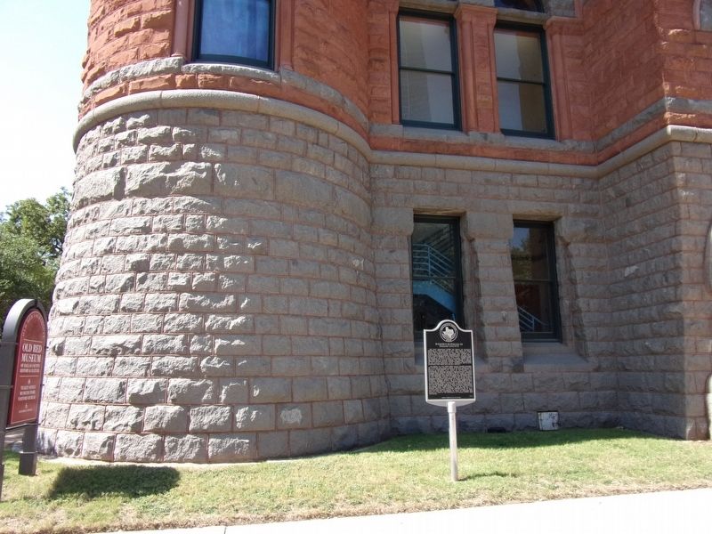
This site was purchased by Dallas County in 1913 for a new jail and courts building. Designed by local architect H. A. Overbeck (1861-1942), the steel-framed building, finished in 1915 at a cost of $585,982, is clad with granite, terra cotta, and . . . — — Map (db m219767) HM
Kentucky native William S. Beaty came to Texas during its early days as a Republic and received a grant of 640 acres of land. He and his brother, Josiah, who arrived in 1836, settled along the Trinity River in what is now Dallas County. The . . . — — Map (db m153615) HM
Designed by the prominent Dallas architectural firm of Lang and Witchell, this Gothic Revival style building was erected in 1927-28 to house Dallas County records, offices, and courtrooms. First known as the Hall of Records, the current name was . . . — — Map (db m43461) HM
Georgia native Trezevant Calhoun Hawpe, a widower, moved from Tennessee to Dallas County with his son. He married Electa Underwood Bethurum in 1848. Elected Dallas County sheriff in 1850, he served two terms. He later was justice of the peace and . . . — — Map (db m159784) HM
On Main Street at North Akard Street on Main Street. Reported missing.
Lynching in AmericaIn the summer of 1860, three enslaved Black men were falsely accused of arson, which enraged enslavers and white residents in Dallas. The three men were lynched by a white mob and an order was issued that every enslaved Black . . . — — Map (db m215184) HM
A native of France and a veteran of the Crimean War, Clement LeTot (b. 1836) settled in northwest Dallas County in 1874. He was the founder and leading citizen of the town of Letot, which was established in 1881 along the rail line. As was the . . . — — Map (db m149248) HM
On Calvary Street, on the right when traveling west.
This area of Dallas County was settled by former African American slaves shortly after the conclusion of the American Civil War. Freedman's Cemetery, a graveyard for African Americans, was established in 1869 on one acre of land purchased by . . . — — Map (db m149056) HM
On Swiss Avenue, on the right when traveling north. Reported missing.
On May 4, 1917, a group of 17 doctors' wives met to discuss a proposal by Mrs. John O. McReynolds to form a woman's auxiliary to the Dallas County Medical Society - the first group of its kind in the country. With the nation's entry into WWI and . . . — — Map (db m151398) HM
On Highway 352/Scyene Road, on the right when traveling east.
In the 1840s, settlers held public meetings under a tree at this site. Beginning in the 1850s, several successive 2-story frame buildings stood here and housed Masonic Lodge, church, elections, and social activities. Scyene Meeting Place housed . . . — — Map (db m155816) HM
On Dowdy Ferry Road 0.3 miles east of Trout Drive, on the left when traveling east.
Illinois native Alanson Dawdy (1826 - 1901) came to Dallas County in 1847. In 1854, he was granted a license to operate a ferry at this site on the Trinity River, the southernmost crossing at the time. An important route for citizens living on . . . — — Map (db m162118) HM
On Historic Town Square at E Main Street, on the right when traveling west on Historic Town Square.
The first white settler on Ten Mile Creek, then called Pleasant Run, in what later became Dallas County, then in Robertson County was Elder Roderick Rawlins (1776 1844) who led a party of approximately thirty persons from Greene County, Illinois, . . . — — Map (db m300512) HM
On North 8th Street (Business U.S. 67) north of W Avenue F, on the right when traveling north.
In the spring of 1848, the Larkin Newton family arrived in this area from Neosho, Missouri, in response to a 640-acre land grant awarded to them through the Peters Colony. Their contract required them to be on their land with a home constructed by . . . — — Map (db m282992) HM
On North Railroad Street, on the left when traveling north.
Farmer, rancher, merchant, and ginner. Born in Ohio, in 1850 he moved to Pleasant Run, Dallas County, Texas. Married Miss Emily Beeman, the daughter of James J. Beeman, Dallas pioneer. Although a Unionist, as a loyal Texan he made shoes for . . . — — Map (db m226063) HM
This cemetery was developed adjacent to the site of the Bear Creek Missionary Baptist Church, which was organized in 1853. The earliest marked grave is that of Hiram Jackson Farris (d. 1858), the infant son of G.W. and Mary Farris. Isham Crowley . . . — — Map (db m214272) HM
Near East Northside Drive north of Cold Springs Road, on the right when traveling north.
Among the early settlers of Fort Worth, Charles Biggers (C.B.) Daggett (1812-1888) was born in Canada and moved to Indiana when he was eight years old. Around 1839–40, His family moved to Shelby County, Texas, where they participated in the . . . — — Map (db m190872) HM
On Gano Street at S St Paul Street on Gano Street.
Proprietors Eula and Mary Mole and their family built and operated this hotel near the Katy and Frisco railroad tracks. Many guests were traveling salesmen, called "drummers" because they drummed up business for their employers. Limited space meant . . . — — Map (db m264401) HM
Designated as public land in John Neely Bryan's 1844 city plat, this was the site of a log courthouse built after Dallas County was created in 1846. When Dallas won election as permanent county seat in 1850, Bryan deeded the property to the county, . . . — — Map (db m157874) HM
On Saint Francis Avenue, on the right when traveling south.
New York native Warren Angus Ferris (1810 - 1873) spent six years as a trapper and chronicler of the American West before moving to the Republic of Texas in late 1836. As official surveyor for Nacogdoches County he surveyed the Three Forks of the . . . — — Map (db m151485) HM
On North Dallas Avenue, on the right when traveling south.
Madison Moultrie Miller (1814-60) came west from Alabama and served under W. W. "Bigfoot" Wallace in 1844-45 as a Texas Ranger. Settling here in 1846 with a motherless daughter and son, he soon married Mary (Polly) Parks Rawlins, daughter of this . . . — — Map (db m152608) HM
Near Hickok Road, on the right when traveling west.
Second Catholic church organized in Dallas County, Sacred Heart owes its origins to the devotion of an Irishman, Patrick McEntee (1846 - 1921), who came to Texas in 1874. Farmer and merchant, McEntee helped build the railroad in this area. . . . — — Map (db m149770) HM
On Illinois Street (Farm to Market Road 407) east of County Highway 2264, on the right when traveling east.
This community was called "Illinois Settlement" by the early families who immigrated here. Later, it became known as "Fairview". J. F. Thurmond (1853-1945) and his wife Amanda Elizabeth Merrifield arrived in 1880 from Dallas County, Texas. In . . . — — Map (db m192227) HM
On 1st Street North west of Vine Street, on the left when traveling west.
[Newspaper notice]
Masonic,
The Regularly Constituted Lodges of Ancient York Masons, Chartered, Dispenced, or associated within the State of Alabama, are respectfully requested to meet, by their representatives, at the Town of Cahawba, . . . — — Map (db m217238) HM
On West Pioneer Drive at North Sowers Road, on the left when traveling west on West Pioneer Drive.
Pioneer Drive, a continuous thoroughfare running from State Highway 161 to Loop 12, resulted from connecting three separate country lanes, Sowers Road, Lively Street, and Hurwitz Road. Through the years, road improvements resulted in the joining of . . . — — Map (db m263348) HM
On Christi Lane east of South Moore Road, on the right when traveling east.
James Parrish came to Texas from Ohio prior to 1844 as a member of the Peters Colony. He and his wife Eliza Jane (Record) moved to Dallas County about 1848. They established a home in this area on the Elm Fork of the Trinity River which became known . . . — — Map (db m151114) HM
President John Fitzgerald Kennedy (1917-1963) was assassinated in Dallas, two hundred
yards from this location, on November 22, 1963. This event changed the city-and the
world-forever. Dedicated on June 24, 1970, the John F. Kennedy Memorial . . . — — Map (db m244629) HM
On Preston Road (State Highway 289) at Spring Valley Road, on the right when traveling north on Preston Road.
Mount Pisgah Missionary Baptist Church, affectionately known as “The Rock,” and established in 1864, is the oldest African American Church in Dallas County. The church was named for the mountain peak from which Moses viewed the promised land. . . . — — Map (db m259000) HM
From its first recorded burial, this has been the burial ground for many of Dallas County's prominent white and African American families. In about 1850, Captain William C. McKamy, his wife, Rachel, and their family moved here from Tennessee. . . . — — Map (db m265331) HM
Near West Arapaho Road east of Civic Center Drive.
The town of Richardson can trace its beginnings to an earlier community in this area named Breckenridge. Founded in the 1840s by settlers from Kentucky, Tennessee, and other southern states, Breckenridge was located south of present Richardson. . . . — — Map (db m293813) HM
On Smithfield Road at Chapman Drive, on the left when traveling north on Smithfield Road.
William and Mary Turner moved from Dallas County to a 300-acre farm near here in 1856. According to local tradition William soon built split log benches at his home for his neighbors use as a site for study and worship. By year's end they had formed . . . — — Map (db m264150) HM
On County Highway 1638 west of Highway 2952, on the right when traveling west.
The watershed of the West Fork of the Trinity River is fed by a large acreage located in Jack and Wise counties. This flows southeastward downriver toward Tarrant and Dallas counties where it eventually merges with the Clear, Elm and East Forks . . . — — Map (db m178180) HM
On Commerce Street 0.1 miles N Houston Street, on the right when traveling west.
Shadow Lines interlaces elements of shadow, light, time, and memory. Composed of a semicircular wall of weathered steel on a circular concrete plaza, the memorial creates a serene place for reflection and commemoration. Like a gnomon on a . . . — — Map (db m310282) HM
On Main Street near S. Record Street, on the right when traveling east. Reported permanently removed.
President John Fitzgerald Kennedy (1917-1963) was assassinated in Dallas, Texas on November 22, 1963. This event changed the city – and the world – forever. As a tribute to this extraordinary man, John F. Kennedy Memorial Plaza was dedicated on . . . — — Map (db m4672) HM
Near Cahaba Road at Capitol Street, on the right when traveling north. Reported permanently removed.
"We by-and-by discovered...a pair of those
splendid birds, the Ivory-billed Woodpeckers
(Picus principalis). They were engaged in
rapping some tall dead pines, in a dense part of
the forest, which rang with their loud notes." . . . — — Map (db m112801) HM
On Beckley Avenue near Commerce Avenue, on the right when traveling north.
Lynching in America
Thousands of Black people were victims of lynching in the United States between
1865 and 1950. During this era, lynching emerged as the most notorious and public
form of racial terrorism, used to enforce racial . . . — — Map (db m244468) HM
On South Main Street 0.1 miles north of East Texas Street, on the right when traveling north.
"The wind goeth toward the south, and turneth about unto the north; it whirleth about continually, and the wind returneth again according to his circuits."
Ecclesiastes 1:6
Standing alone on the prairie...perhaps the most visible . . . — — Map (db m194102) HM
Thin black lines indicate changes in relevance. Between each pair of lines entries are ordered geographically but all have the same relevance.
* Inflectional forms of words are their plurals, singulars, and possessives as well as gramatical tenses and similar variations.