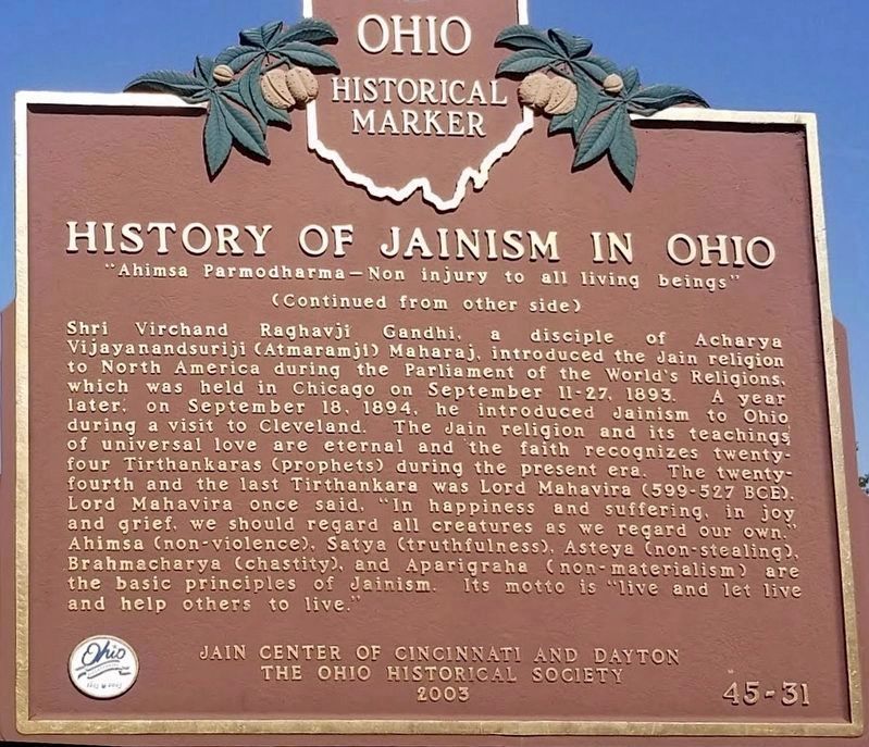
First Jain Temple in Ohio
"Souls render service to one another"
The Jain Center of Cincinnati and Dayton was established on April 22, 1979 as a non-profit tax-exempt organization under the laws of the United States and the State of Ohio. . . . — — Map (db m24073) HM
On Reily Millville Road at Bunker Hill-Woods Road, on the right when traveling east on Reily Millville Road.
During the American Civil War, this was the motto of the Peace Democrats, also known as "Copperheads". Butler County was home to a large Copperhead faction during the war years. The Copperheads were led by Ohio Senator Clement Vallandigham and . . . — — Map (db m275325) HM
On Hamilton-Trenton Road at Busenbark Road, on the right when traveling north on Hamilton-Trenton Road.
Busenbark
In 1833, Robert Busenbark deeded land to the directors of School District No. 6 for Busenbark School. Twenty years later, Robert and son David granted a right-of-way on their property for a station on the Cincinnati, Hamilton & . . . — — Map (db m28533) HM
On Wessel Drive 0.3 miles east of Pleasant Avenue (U.S. 127), on the right when traveling east.
American Revolution 1775 - 1783 •
War Of 1812 1812 - 1815 •
Indian Wars 1817 - 1898 •
Mexican War 1846 - 1848 •
Civil War 1861 - 1865 •
Spanish American War 1898 - 1902 •
World War I 1917 - 1918 •
World War II 1941 - 1945 •
Korean . . . — — Map (db m275772) WM
Elisha Morgan purchased 48.6 acres in Fairfield Township, part of the Symmes Purchase, in 1817. The Farm Mansion was built shortly after he settled the land. The house incorporates two prevalent architectural styles in southwest Ohio in the . . . — — Map (db m224980) HM
On Seward Road at Dixie Hwy (Ohio Route 4), on the left when traveling south on Seward Road.
Sergeant • Northern Continental Army
Captain James Osgood’s Company of Rangers
enlisted July 15, 1775
born February 22, 1745, in Rumsford, NH
died July 22, 1823 in Butler Co., OH
marker placed by John Reily Chapter, NSDAR
and . . . — — Map (db m116555) HM WM
On Wessel Drive 0.3 miles east of Pleasant Avenue (U.S. 127), on the right when traveling east.
To honor the memory of Fairfield City and Township citizens who sacrificed their lives in defense of their country dedicated in the observance of the bicentennial of our nation on Memorial Day May 31st 1976. — — Map (db m275776) WM
Near Ross Road south of Mack Road, on the right when traveling south.
The Hay Garden features an antique hand pump that was
donated by Ed and Kathy Creighton. The original pump
was just outside the side door of the mansion.
John Hay, the owner in 1831, was the father of Mary Ann
Hay, first wife of David Huston. . . . — — Map (db m116704) HM
On Ross Road at Devonian Drive, on the right when traveling south on Ross Road.
The Heritage Garden's first planting in 2007 was donated by Friends of Elisha Morgan. The two American redbuds are in memory of Sarah Brown Morgan, the first wife of Elisha Morgan. The Morgans purchased the property at the request of daughter Leah . . . — — Map (db m275797) HM
On Dixie Highway (Ohio Route 4) west of Holden Boulevard, on the right when traveling west.
For generations everyone from prince to pauper arrived in Cincinnati at the "public landing" along the banks of the Ohio River. "The Landing" as the local population knew it, greeted the new arrivals to the young city and still serves as a social . . . — — Map (db m201219) HM
On Ross Road at Devonian Drive, on the right when traveling south on Ross Road.
The Kitchen Garden is in memory of Elizabeth LaBoyteaux Morgan, the second wife of Elisha Morgan. The 1820 census shows two adults and six children living in the two-room "mansion."
Gardens of this type were typically located next to the house, . . . — — Map (db m275793) HM
On River Road at Lakeside Drive, on the right when traveling north on River Road.
Miami Chapel Cemetery. Around 1843, local Methodists organized a new Methodist Episcopal church at Fair Play and later erected a brick chapel. The congregation was short-lived, however, and fell into decline after one of its leading members, . . . — — Map (db m158422) HM
On Ross Road at Devonian Drive, on the right when traveling south on Ross Road.
This perennial border uses the design created by Victor H. Ries and distributed in a 1932 Ohio State bulletin. Mr. Reis was the founder of the Ohio Association on of Garden Clubs.
Ohio The Four Seasons Garden Club which donated this border and . . . — — Map (db m275795) HM
On Wessel Drive at Pleasant Avenue (U.S. 127), on the right when traveling east on Wessel Drive.
A nation that honors its veterans is a nation dedicated to the preservation of a freedom won by the sacrifice of life itself. These emblems are appropriately dedicated to the valiant dead of the armed forces who ventured far, fought bravely, and . . . — — Map (db m275779) WM
The rose garden is dedicated to Jenny Ross, wife of Alonzo M. Ross. They purchased the property in 1879 and all their children were born on the farm, which they named "Rose Hill." This garden, including the trellis, plants and an automatic drip . . . — — Map (db m275796) HM
On Wessel Drive 0.3 miles east of Pleasant Avenue (U.S. 127), on the right when traveling east.
The 105mm Howitzer was designed to provide the tactical commander with light towed field artillery capable of supporting infantry units in combat.
Specifications
Weight 4980 lbs.
Maximum Firing Range 14,000 Meters
Maximum Rate Of Fire . . . — — Map (db m275769) HM WM
On Ross Road at Devonian Drive, on the right when traveling south on Ross Road.
The grape vineyard, pear and apple trees are in memory of David Huston and brothers Joseph and Alonzo Ross. The Hustons owned this property from 1849 to 1871, when it was sold to the Ross brothers. Both the Huston and the Ross families grew grapes . . . — — Map (db m275792) HM
Near Heaton Street at Miami Street, on the right when traveling west.
This Memorial is dedicated to the men and women who proudly served our country and are laid here to rest on this sacred ground. Their sacrifices will never be forgotten.
God bless the U.S.A. — — Map (db m275732) WM
On Dayton Street at North 6th Street, on the right when traveling east on Dayton Street.
With swirling flood water debris at this level, picture in your mind the devastation produced in this historic district by this force of naturel.
Dedicated to the memory and preservation efforts of Sherry Corbett and Nancy Tryloff. — — Map (db m275725) HM
On North Martin Luther King, Jr. Boulevard (U.S. 127) at High Street, on the left when traveling north on North Martin Luther King, Jr. Boulevard.
Abraham Lincoln spoke from the rear of a Cincinnati, Hamilton & Dayton Railroad passenger train on Saturday September 17, 1859, to about 1000 people at South Fourth and Ludlow streets (about 785 feet south of here). Lincoln, elected president of the . . . — — Map (db m122279) HM
On Dayton Street, on the left when traveling east.
On this site stood a square two-story brick farmhouse occupied by
Wiiliam Bebb and built in 1835.
After he was elected nineteenth Governor of Ohio, William Bebb
sold his house in 1848 to William Beckett, founder of Beckett Paper
Company, who . . . — — Map (db m116670) HM
On Reily Millville Rd (County Route 29), on the left when traveling west.
Bunker Hill The Millville, Reilly and Milton Turnpike brought prosperity to the
village now renamed Bunker Hill. School House No. 10 stood nearby from 1849-1857. By 1860 clothing manufacturing was the major business here. A Post Office was . . . — — Map (db m107801) HM
On South D Street at Home Avenue, on the right when traveling south on South D Street.
The Civil War created orphaned and impoverished children across the nation. To establish a home for area children, a group of Hamilton women met with Reverends Thane Miller and Benjamin W. Chidlaw in January 1869. By May, the women had rented a . . . — — Map (db m137852) HM
On High Street (Ohio Route 129/177), on the right when traveling east.
Butler County was created on March 24, 1803, about three weeks after Ohio became a state. Hamilton won the competition for the county seat, thanks to Israel Ludlow, Hamilton's founder. Ludlow's donation of the public square secured the county . . . — — Map (db m28546) HM
On North B Street at Black Street, on the left when traveling north on North B Street. Reported missing.
The Champion Coated Paper Company began production here April 15, 1894, with nine employees under the direction of Peter G. Thomson (1851-1931), a Cincinnati businessman, who had incorporated the firm in November 1893. Thomson, previously a . . . — — Map (db m275718) HM
On North Martin Luther King, Jr. Boulevard (U.S. 127) at High Street, on the right when traveling north on North Martin Luther King, Jr. Boulevard.
110 yards from the back of this marker on the present southeast corner of 4th and Butler Streets stood the Cosmopolitan Arms Company, founded by Edward Gwyn and Abner C. Campbell, where carbines for the Union Army were manufactured during the Civil . . . — — Map (db m122283) HM
On Hancock Avenue north of Bender Avenue, on the right when traveling north.
Crawford Woods was the country estate of the Crawford family for nearly 125 years and a popular location for family picnics and Sunday School outings for East Hamilton residents for decades before it became a multiple-use Hamilton park.
The 10-room . . . — — Map (db m201354) HM
On High Street (Ohio Route 129/177) west of Monument Street, on the right when traveling east.
Mills were essential in the settlers' struggle to convert their land from a debt to an asset. Financial survival depended on access to grist mills, saw mills and carding mills - the trading complexes and community centers on the Ohio frontier. . . . — — Map (db m73595) HM
On Main Street (Ohio Route 129) at South "D" Street, on the right when traveling east on Main Street.
Author Side Raised and educated in St. Louis, author Fannie Hurst (1885-1968) was born in Hamilton at 918 Central Avenue, the home of her maternal grandparents. She was the daughter of Rose Koppel and Samuel Hurst. Already a writer as a student . . . — — Map (db m122411) HM
On High Street (Ohio Route 129/177) west of Monument Street, on the right when traveling east.
Because water was the most efficient way to transport goods, most early Ohio roads led to a navigable stream, such as the Great Miami River. Through the 1820s, much of Butler County's abundant agriculture output found its way to market on . . . — — Map (db m73593) HM
On High Street (Ohio Route 129/177) west of Monument Street, on the right when traveling east.
March 25, 1913, a record Great Miami River flood hit Hamilton, claiming more than 200 lives, leaving about 10,000 homeless and causing more than $10 million in property damage. Local survivors helped create the Miami Conservancy District - a . . . — — Map (db m73594) HM
On High Street (Ohio Route 129/177) at Monument Avenue, on the right when traveling east on High Street.
Built by General St. Clair in 1791, on his campaign against the Indians.
It was enlarged in 1792 and used by General Wayne in 1793, on his march to Fallen Timbers. — — Map (db m30661) HM
On High Street (Ohio Route 129/177) at the east bank of the Great Miami River, on the left when traveling west on High Street.
On this spot in the year of our
Lord 1791 General Arthur St. Clair
founded Fort Hamilton. Here, in 1793
General Anthony Wayne organized his
expedition against the Indians which
gave to this Republic five great states.
Here our . . . — — Map (db m30657) HM
On High Street (Ohio Route 129/177) west of Riverfront Plaza, on the right when traveling west.
Frederick Gottleib Mueller (1873-1947) was commissioned to design this Art Deco structure, the first erected as a Hamilton municipal building, in cooperation with other Hamilton architects, George Barkman and R. E. Smith. This building was . . . — — Map (db m290627) HM
On High Street (Ohio Route 129/177) west of Monument Street, on the right when traveling east.
Pierre-Joseph Celron, sieur de Bienville, with 200 to 250 French soldiers and some Indians, was sent in 1749 to renew and strengthen France's claim to the Ohio country and drive out the British. During navigation of the Allegheny, Ohio and Great . . . — — Map (db m73591) HM
On Hamilton Eaton Road Anthony Wayne Trail (U.S. 127) at Spring Road (County Route 286), on the right when traveling north on Hamilton Eaton Road Anthony Wayne Trail.
Gen. Anthony Wayne
and his men camped here at
Five Mile Spring
September 1793 — — Map (db m97797) HM
On Airport Drive at Bobmeyer Road, in the median on Airport Drive.
The Hogan Family owned and operated what was known as the Hamilton Airport for over 52 years. Airplane owner and pilot, Carl "Pop" Muhlberger and aviation enthusiast and farmer, Joe Hogan, co-founded the airport in July 1929. Muhlberger taught Joe . . . — — Map (db m225373) HM
On High Street (Ohio Route 129/177) west of Monument Street, on the left when traveling east.
The privately developed Hamilton Hydraulic opened Jan. 27, 1845, providing cheap, reliable water power and starting Hamilton's era of industrial growth and diversification. Water was diverted into the hydraulic canal system from the Great Miami . . . — — Map (db m73598) HM
On North 3rd Street at Buckeye Street, on the right when traveling north on North 3rd Street.
Two-time Caldecott Award winner Robert McCloskey (1914-2003) walked through the doors of this library many times as a child. McCloskey was born in Hamilton and his first book, Lentil, featured several Hamilton scenes including this . . . — — Map (db m275736) HM
On High Street (Ohio Route 129/177) at Monument Street, on the left when traveling east on High Street.
Heritage Hall features rotating historical exhibits highlighting Hamilton's rich industrial and business heritage. It is the home of the Robert McCloskey Museum which honors the famous children's author and artist. Three of his books reflect his . . . — — Map (db m73633) HM
On Main Street-High Street (Ohio Route 129/177) at the Ross Avenue Ramp, on the right when traveling east on Main Street-High Street.
The filled Spandrel concrete arch bridge previously located at this crossing was constructed by A.J. Yawger & Company in 1914 after the Flood of 1913. It was the fourth structure to cross the Great Miami River at this location. The bridge . . . — — Map (db m73596) HM
On Riverfront Plaza at Buckeye Street, on the right on Riverfront Plaza.
John Stewart Black (1891-1936) was a Vaudeville performer and songwriter who penned the classic "Paper Doll." He is also remembered for "Dardanella," which he called his "gift to the musical world." "Dardanella", recorded by the Ben Selvin . . . — — Map (db m158421) HM
On Third Street, on the right when traveling north.
Side A
Clark Lane built this library in 1866 and donated it to the people of Hamilton two years later. The 1913 Great Miami River flood catastrophe damaged much of the building and many of its books and records. The refurbished library . . . — — Map (db m122413) HM
Side A:
James Elrick, a local carpenter, built the Lane-Hooven House in 1863 for Clark Lane (1823-1907), a Hamilton industrialist and philanthropist. Lane, who first came to the area at age twenty-one as a blacksmith, resided in the house for . . . — — Map (db m28775) HM
On High Street (Ohio Route 129/177) at Riverfront Plaza, on the right when traveling west on High Street.
The popular character from the first book by Hamilton native and award winning author and illustrator Robert McClosky
A gift from the Hamilton Community Foundation in celebration of its 50th Anniversary Sculpture by Nancy Sebon — — Map (db m199393) HM
On High Street (Ohio Route 129/177) at Front Street, on the right when traveling west on High Street.
This park was established by the Hamilton Community Foundation on land owned by the city. It was one of several major legacy gifts to Hamilton by the Foundation in celebration of its 50th Anniversary. The Foundation wished to honor Hamilton's . . . — — Map (db m73638) HM
On Reily Millville Road at Cochran Road, on the right when traveling west on Reily Millville Road.
Lewis-Sample Farmstead. The farmstead shares the name of the Lewis and Sample families, two owners since European-descended settlers began moving into the Ohio County in the late 1700s. Andrew (1762-1847) and Martha Lewis (1774-1852) acquired . . . — — Map (db m157034) HM
On High Street (Ohio Route 129/177) west of Monument Street, on the left when traveling east.
The site for Fort Hamilton was chosen because of a ford on the Great Miami River at the approximate site of the High - Main Street Bridge. That shallow crossing was believed to have been on an ancient Indian trail known as the Wabash Trail. The . . . — — Map (db m73615) HM
On South Monument Avenue, on the right when traveling south.
This log building, which was erected while this part of the country was still a wilderness, is a silent tribute to the courageous and hardy Americans who preceded you who read this. This tribute symbolizes the strength and character of which we . . . — — Map (db m30660) HM
On Chestnut Street west of South 4th Street, on the left when traveling west.
Pilgrim Baptist Church. On January 9, 1919, a group of eight men and three women, being led by the Holy Spirit, met at a house on Wallace Street to form a new black Missionary Baptist Church in Hamilton, Ohio. The group quickly raised $150 to . . . — — Map (db m206449) HM
On South 3rd Street at Sycamore Street, on the right when traveling north on South 3rd Street.
Born in 1762 in New Jersey. He Enlisted in 1782 from Philadelphia for the war in the Light Horse and marched to Carlisle as a Private under Col Richard Butler, He guarded the British prisoners at Lancaster in 1783. He served again in the War of 1812 . . . — — Map (db m305136) HM
On High Street (Route 129) west of North Monument Avenue, on the right when traveling west.
A gift to the city of Hamilton in recognition of America's Bicentennial. Purchased thru the contributions of its citizens. This is one of the two replica bells cast for use in the state of Ohio by the Whitechapel Bell Foundry, maker of the original . . . — — Map (db m199737) HM
On Ross Avenue at B Street, on the right when traveling south on Ross Avenue.
Rossville was settled in April 1801 shortly after the U.S. Government initiated land sales west of the Great Miami River. Its original proprietors--John Sutherland, Henry Brown, Jacob Burnet, James Smith and William Ruffin--named the town in honor . . . — — Map (db m28790) HM
On High Street (Ohio Route 129/177) west of Monument Street, on the left when traveling east.
Fort Hamilton was completed Sept. 30, 1791, and occupied by the U. S. Army commanded by Gen. Arthur St. Clair. The supply base was the first in a chain of outposts north of Cincinnati (Fort Washington) in the Northwest Territory. The log . . . — — Map (db m73600) HM
On Monument Avenue at High Street ( Route 129/177), on the right when traveling south on Monument Avenue.
Side A: Soldiers, Sailors, and Pioneers Monument
The Soldiers, Sailors, and Pioneers Monument was planned and promoted by Butler County Civil War veterans and financed by a county levy in 1899. The monument, built of Indiana Limestone, is . . . — — Map (db m30705) HM
On South Third Street near Charles Str, on the left when traveling south.
- “I declare the earth is hollow and habitable within,” said John Cleves Symmes in summarizing his “Theory of Concentric Spheres and Solar Voids” to a doubting scientific world in the early 1820’s. His theory is commemorated . . . — — Map (db m116622) HM
On High Street (Ohio Route 129/177) west of Monument Street, on the left when traveling east.
Relaxing by the Great Miami, Hamiltonia dreams. She dreams of children presenting her with the Helmet of Hope, a symbol for a bright future.
- Norikazu T. Tsuchiya, Sculptor — — Map (db m73597) HM
On High Street at Martin Luther King Jr. Boulevard (Route 177), on the right when traveling east on High Street.
The sculpture takes the form of an open doorway, a visual metaphor for democracy. The doorway is an image of both welcome and arrival at a key place of entry into the city.
A foundation of stone is represented by a carved stone column in . . . — — Map (db m275721) HM
On South Third Street, on the left when traveling south.
Capt. John Cleves Symmes
as a philosopher,
and the originator of
‘Symmes Theory of Concentric
Spheres and Polar voids.’
He contended that the Earth
is hollow and habitable
within.
Capt.
John C. Symmes
a Native of
New . . . — — Map (db m116618) HM
Side A
The dimensions of the canal channel were 26 feet wide at the bottom and 40 feet wide at the top. The depth of the canal averaged four and one-half feet. The 12 locks were 80 feet long with 14-foot wide interior chambers which could . . . — — Map (db m122419) HM
On North 6th Street at Butler Street, on the right when traveling south on North 6th Street.
This lich gate is similar to the one at Bladon Parish, in Oxfordshire, England, where Winston Churchill is buried alongside his father and his American mother.
This lich gate was dedicated on May 29, 1977, as a bicentennial gesture linking the . . . — — Map (db m275723) HM
On Butler Street at Center Street, on the right when traveling west on Butler Street.
An Episcopal Congregation was first established in Hamilton in 1823 as part of a missionary movement under Bishop Philander Chase who later became the founder of Kenyon College in Gambier, Ohio. The present building was designed by Cincinnati . . . — — Map (db m122284) HM
On High Street (Ohio Route 129/177) at Monument Street, on the right when traveling west on High Street.
May all who pause and are refreshed here reflect on those who went forth from their homes to defend American freedom
————————
This fountain, erected 1949, was conceived and sponsored by the . . . — — Map (db m73622) WM
On Reigart Road 0.3 miles north of Springcrest Drive, on the right when traveling east.
In grateful recognition of Walter A. Rentschler whose interest in and love for this area and its natural and historical features has resulted in Miami-Erie Canal/Rentschler Forest Preserve, now encompassing 226 acres. He personally donated 143 acres . . . — — Map (db m275798) HM
On Heaton Street, on the right when traveling south.
Warren Gard (1873-1929), son of Samuel Z. Gard and Mary Duke, was born in Hamilton, Ohio. He established his practice in Hamilton after graduating from Cincinnati Law School and being admitted to the Ohio Bar in 1894. Gard served as Butler County . . . — — Map (db m122416) HM
On Reigart Road 0.6 miles north of Springcrest Drive, on the right when traveling west.
One of the first parks in the the MetroParks of Butler County system, Rentschler Forest MetroPark was established in the 1960s through private, state and non-profit land donations. Enjoy the 125-acre park's award winning playground, hike the . . . — — Map (db m275801) HM
On Monument Avenue, on the right when traveling south.
Author William Dean Howells (1837-1920) spent his boyhood from 1840 to 1848 in Hamilton. Called the "Dean of American Letters," Howells wrote 35 novels, 35 plays, 34 miscellaneous books, 6 books of literary criticism, 4 books of poetry, and hundreds . . . — — Map (db m28772) HM
On Bebb Park Lane 0.5 miles south of Cininnatti Brookville Road, on the right when traveling north.
Located along the Indiana state line, Governor Bebb MetroPark was established in 1961 as the fourth park in the MetroParks of Butler County park system. The park began as a 10-acre parcel, and has evolved into a 269-acre local outdoor destination . . . — — Map (db m275327) HM
On Bebb Park Lane at Cininnatti Brookville Road, on the right when traveling south on Bebb Park Lane.
This pioneer cabin built in 1799 was owned by Edward Bebe, father of William and first Welshman to settle in Morgan Township, Butler County. Originally the cabin stood on the same Dry Fork Creek about 4 miles southeast of this site. Here William . . . — — Map (db m275349) HM
On Central Avenue (Ohio Route 122) at N. Verity Parkway ( Route 73), on the right when traveling west on Central Avenue.
Canal boats were designed to haul freight up to 80 tons. Pulled usually by mules, they traveled at approximately three miles per hour.
[Photos] Left, freighters on the Miami & Erie Canal just south of Third Street (now Central Avenue) in 1910. . . . — — Map (db m30422) HM
On Central Avenue (Ohio Route 122) at N. Verity Parkway ( Route 73), on the right when traveling west on Central Avenue.
Canal locks were built to raise and lower boats as the elevation of the land changed. There were 106 locks on the Miami & Erie Canal to overcome a difference in elevation of 512 feet.
The Excello Lock, left, was the first lock completed on the . . . — — Map (db m30423) HM
On North Verity Parkway (Ohio Route 4) at Tytus Avenue, on the left when traveling north on North Verity Parkway.
At Middletown, Ohio, on July 21, 1825, ground was first
broken for the Miami-Erie Canal, which eventually
linked Cincinnati and Toledo. The canal created much
change in the region, including increased population
and commercial, political, and . . . — — Map (db m134879) HM
1943 entries matched your criteria. The first 100 are listed above. Next 100 ⊳