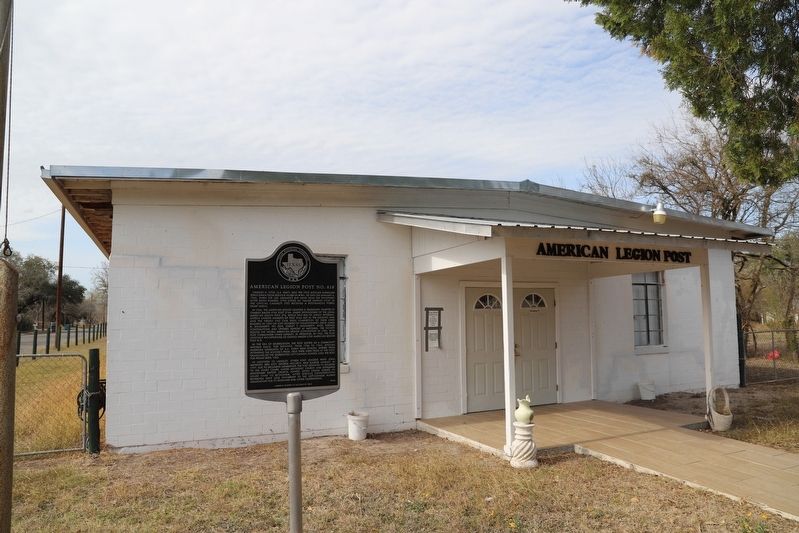
On West Hefferman Street, on the right when traveling west.
Charles H. Lytle, U.S. Navy, was the first African American serviceman from Beeville killed in WWII. He died on January 4, 1945, when the USS Ommaney Bay sank near the Philippines after being bombed. Lytle (listed as "Major Charles Lytle” in the . . . — — Map (db m205626) HM
On West Corpus Christi Street, on the right when traveling east.
Statesman, soldier and ambassador, Barnard Elliot Bee, Sr., was a significant figure during Texas’ years as a republic (1836-45). He was born in South Carolina to federal judge, Thomas Bee, and Susannah (Bulline) Bee. In 1809, he married Ann Wragg . . . — — Map (db m132429) HM
On Corpus Christi Street, on the right when traveling east.
Bee County was created in 1857 from parts of five neighboring counties. The first county seat was located seven miles east of this site, and the first commissioners court was held on the banks of Medio Creek in February 1858. The city's earliest . . . — — Map (db m32200) HM
With the coming of the railroad to Beeville in the spring of 1886, Mississippi native William Oscar McCurdy (1866-1913) visited his aunt and uncle here. After spending several days, McCurdy, a printer and editor, decided to stay, becoming a . . . — — Map (db m205672) HM
On Corpus Christi Street, on the right when traveling east.
Long before Mexico granted land (1834) on Poesta Creek to the first settlers, Anne Burke and James Heffernan, savage Indians roamed this valley at will.
Their colony, although successful at first, soon met disaster. In 1836 James Heffernan, his . . . — — Map (db m202007) HM
On North Saint Marys Street at West Bowie Street, on the right when traveling south on North Saint Marys Street.
The first post office was established in Beeville in 1859, the year after the town's founding. The 1918 building was the first Beeville post office constructed on Federal
property - previous locations were county- or privately-owned. The building . . . — — Map (db m132430) HM
I was born free American as American can be America who did I love thee I fought for this land of the free I gave the blood off this body of mine Patriotism you reward me ever so kind I gave the sweat off my back As an American, . . . — — Map (db m213787) HM WM
On North Burke Street 0.1 miles north of West Corpus Christi Street (U.S. 59), on the right when traveling north.
In the years following the Civil War and the emancipation of slaves across the country, African Americans began organizing church congregations throughout Texas. Early pastors served as circuit riders traveling to preach for several congregations . . . — — Map (db m180892) HM
On Farm to Market Road 799 at County Road 347, on the right when traveling west on Farm to Market Road 799.
This congregation, orginally known as Lapara Baptist Church, was organized on Aug. 12, 1877, by 32 charter members. Services were held under a brush arbor and in a schoolhouse before a sanctuary was erected on Lapara Creek. The building was moved . . . — — Map (db m294818) HM
On West Corpus Christi Street west of South Washington Street (Business U.S. 181), on the right when traveling east.
The Commercial National Bank of Beeville traces its history to January 1893 when several prominent citizens met to organize a financial institution. Elected as officers were Dr. L.B. Creath, A.G. Kennedy, John I. Clare, and D.C. Stone. The bank . . . — — Map (db m32293) HM
On Corpus Christi Street at Washington Street, on the left when traveling east on Corpus Christi Street.
Early models of the A4 entered service in 1956 and were produced over a longer time than any other jet in the world. Its simplicity and effectiveness allowed numerous improved models to be developed. The A4 series was used extensively in Vietnam and . . . — — Map (db m32265) HM
On Business U.S. 181J at U.S. 181, on the right when traveling south on U.S. 181JBusiness .
From pack trails and wagon roads that marked this area at least 300 years, have developed such modern roads as U.S. Highway 181. The old trails of Indians, wild cattle and mustang horses formed highways for 17th, 18th and 19th century . . . — — Map (db m206886) HM
Block 1, Beeville original townsite, donated 1859 by Anne Burke. First owned by G.W. McClanahan, land was bought 1862 by county for "Public Burying Ground". In 1872, H.W. Wilson donated northeast strip, land was added on the northwest, and Court . . . — — Map (db m206891) HM
On North Saint Mary's Street at East Kennedy Street, on the right when traveling north on North Saint Mary's Street.
This church was organized in 1869 as the Beeville Baptist Church. Its first sanctuary was built near Poesta Creek in 1871. The congregation grew quickly, emerging as the largest among the 39 members of the Regional Blanco Baptist Association by . . . — — Map (db m180920) HM
On West Corpus Christi Street, on the right when traveling west.
Victorian architecture. Built 1892 by grocer J.C. Thompson (1836-1905) of brick from Calavaros Kiln near Elmendorf. Upstairs in 1892 was law office of Lon C. Hill, who later founded Harlingen.
Afterward on second floor was . . . — — Map (db m132431) HM
On East Cleveland Street at North Saint Mary's Street, on the right when traveling east on East Cleveland Street.
In 1861, three years after Bee County was organized, the Rev. Berry Merchant of Corpus Christi assisted Beeville Methodists in establishing the Methodist Episcopal Church, South. Between 1862 and 1870, circuit riding preachers ministered to the . . . — — Map (db m180933) HM
On East Houston Street, on the right when traveling east.
Beeville, the county seat of Bee County since 1860, did not have a secure bank until 1890, when the First National Bank of Beeville opened for business. Prior to that year, the town's only banking facility was A.C. Jones' general store, where some . . . — — Map (db m32296) HM
On West Walton Street west of North Saint Marys Street, on the right when traveling west.
Presbyterians in Beeville began meeting together informally as early as 1885. In 1890-91 the Rev. Henry Ruffner Laird (1842-1925) was sent to officially organize a congregation in Beeville, and this church was begun with twenty-six charter . . . — — Map (db m207386) HM
Built in 1890 by Will H. and Julia George of materials from early house on land inherited from her father, Maj. J.H. Wood (Texas Cattle Empire Builder) who came from New York to join Texas War for Independence. Remodeled in 1900, house is raised . . . — — Map (db m207402) HM
In 1901, after nearby Evergreen Cemetery had begun to run out of burial space, local undertaker Christopher Rotzien purchased land adjacent to the St. Joseph Cemetery. The same year, the Eeds family purchased plots in the cemetery and Margaret Ann . . . — — Map (db m207403) HM
On North Washington Street (Business U.S. 181) at West Cleveland Street, on the right when traveling north on North Washington Street.
Born in 1912 to Gutzon Borglum, sculptor of Mount Rushmore, Lincoln assisted his father on the monument's construction. He oversaw completion after his father's death and served as superintendent of Mount Rushmore National Memorial until 1944. He . . . — — Map (db m180934) HM
On North Leverman Street at West Corpus Christi Street, on the left when traveling north on North Leverman Street.
This church, organized in 1888, was originally known as Jones Chapel Methodist Episcopal Church. At first, it was part of a circuit, and ministers often traveled by stagecoach or horseback as they rotated Sunday services among churches. Jones Chapel . . . — — Map (db m180905) HM
On West Corpus Christi Street (U.S. 59) at North Burke Street, on the right when traveling west on West Corpus Christi Street.
With few formal schools available, education for many African Americans in the 19th century came through church instruction. In 1876, the first African American school in Bee County began in Stephen Canada's store seven miles north of Beeville. The . . . — — Map (db m180882) HM
On West Corpus Christi Street (U.S. 59) at North Burke Street, on the right when traveling west on West Corpus Christi Street.
Constructed 1925
Named for Mose Lott and Allen Canada, the Two Men Responsible for Building the First School for Black Children in Beeville and Dedicated to the Education of All People — — Map (db m180887) HM
On East Corpus Christi Street, on the right when traveling east.
Oldest business structure in Beeville, erected about 1867 on east side of courthouse square, near Poesta Creek. General store, lodging house, post office. Pioneer western style, with southern porches.
Built by G.W. McClanahan, Beeville's first . . . — — Map (db m202000) HM
Named by the Spaniards about 1800 because of its midway position between the San Antonio and Nueces Rivers. Rises in Karnes County; empties into Mission River. Crossed by explorers, padres, soldiers, settlers who traveled on three early ox-cart . . . — — Map (db m202009) HM
On West Corpus Christi Street at S Washington St, on the left when traveling west on West Corpus Christi Street.
In 1942, Beeville's municipal airport was offered to the U.S. Navy for training naval pilots who would serve in WWII. Naval Auxiliary Air Station Chase Field (NAAS Chase Field) first opened in 1943 as a training facility for U.S. Navy aviators. The . . . — — Map (db m289425) HM
On North Washington Street (Business U.S. 181) at West Corpus Christi Street, on the right when traveling north on North Washington Street.
San Antonio businessman Albert Praeger (1864-1930) moved to Beeville in the 1890s to open a hardware store and tin shop. He built this Romanesque Revival structure in 1906 to house his business, which included buggies and wagons as well as barbed . . . — — Map (db m132433) HM
On East Gramman Street at North Filmore Street, on the right when traveling west on East Gramman Street.
The emergence of this church is associated with Catholic Services held by itinerant missionaries in the homes of predominantly Irish settlers located along the Texas Gulf Coast in the late 1840s. The oldest written record of St. Joseph's Catholic . . . — — Map (db m180943) HM
This cemetery has served the Catholic population of Beeville since the late 19th century, when the town experienced impressive growth. Noted bishop Peter Verdaguer of the Brownsville Diocese purchased land here from T.H. Nott in 1891, and the . . . — — Map (db m211537) HM
On East Corpus Christi Street at North Adams Street, on the right when traveling west on East Corpus Christi Street.
First unit, transept, built 1893 on this site purchased in 1890 from heirs of G.W. McClanahan. In 1910, Nave added with funds from sale of block of land given to the missionary jurisdiction of western Texas by English born H.W. Wilson, 1888. Early . . . — — Map (db m180939) HM
On East Hefferman Street 0.2 miles west of Bypass U.S. 181, on the right when traveling west.
This historic African American burial ground is associated with two congregations organized in the 1880s. Many buried here were members of Bethlehem Missionary Baptist Church or Jones Chapel United Methodist Church. Some burials took place prior to . . . — — Map (db m32235) HM
On West Bowie Street at North Madison Avenue, on the right when traveling west on West Bowie Street.
On June 14, 1886, the first San Antonio and Aransas Pass (SA&AP) train arrived in Beeville to a cheering crowd. The arrival marked the combined efforts of SA&AP president Uriah Lott; Beeville merchant, banker and cattleman Captain A.C. Jones; and . . . — — Map (db m180919) HM
On West Crockett Street at N Hahl Street, on the left when traveling west on West Crockett Street.
In remembrance of those Tuleta residents who gave their lives in service to their country. Their sacrifice to keep our Nation free shall never be forgotten. — — Map (db m289424) WM
On North Jackson Street at West 1st Street on North Jackson Street.
In the years before Texas became an independent Republic, Hispanic and Irish settlers established ranches and farms in this area. Their children received education at home or in community schools. Bee County organized in 1858, and in 1860 . . . — — Map (db m180909) HM
As superintendent of the Beeville school system for 34 years, William Eldridge Madderra (1870-1936) was responsible for much of the development of the town's early educational programs. Madderra, for whom a local school building is named, . . . — — Map (db m212002) HM
On Farm to Market Road 2441 0.8 miles north of State Highway 202, on the right when traveling north.
The First Baptist Church in Refugio County was organized on April 22, 1855 and met in the Doughty Schoolhouse near Refugio. In 1865, the first sanctuary was erected (5 Mi.W) and named for the cattle brand of member and benefactor N.R. McDaniel. The . . . — — Map (db m180952) HM
On Farm to Market Road 2441 0.5 miles north of State Highway 202, on the right when traveling north.
The present St. Catherine Catholic Church of Blanconia was built and dedicated, on this site, on October 17, 1926. On the banks of the Blanco Creek, approximately one mile east, the first church named Our Lady of the Rosary, was erected in 1875 by . . . — — Map (db m180949) HM
On U.S. 181 0.4 miles south of South Bee Street, on the right when traveling south.
Settlement dates from about 1850. First town, 2 miles west, was called San Domingo for its location near junction of San Domingo and dry Medio Creeks. After railroad was built, 1886, citizens moved to Walton (new flag station) to be on line. Name . . . — — Map (db m121886) HM
On U.S. 181 at Main Street (Farm to Market Road 623), on the right when traveling north on U.S. 181. Reported missing.
Named for Col. Barnard E. Bee (1787-1853), who served Republic of Texas as Secretary of War, Secretary of State, and Minister to the United States. County was created by legislative act on Dec. 8, 1857; organized Jan. 25, 1858, from land earlier in . . . — — Map (db m297385) HM
On North Commerce Street, on the right when traveling north.
Built in 1905. First church to serve the needs of Protestants in Pettus. Called a Christian Church at request of land donor, Mrs. S.B. Hodges. Contributions came from all denominations. On August 29, 1906, the First Christian Church (Disciples of . . . — — Map (db m290725) HM
On U.S. 181 south of Mineral Avenue, on the right when traveling south.
Oil capital of Bee County, Pettus was settled in the 1850's when John Freeman Pettus set up his sprawling ranch about 4 miles south of here.
The son of one of Stephen F. Austin's first 300 colonists, Pettus was an extensive cattle and horse . . . — — Map (db m211746) HM
On U.S. 181 north of Sullivan Street, on the right when traveling north.
Earliest known residents were Karankawa Indians who named creek. On this stream was one of the most famous ranches in early Texas, occupied in 1805 by Don Martin de Leon, who in 1824 founded Victoria.
In 1830's Irish colonists came by way of . . . — — Map (db m202006) HM
A few yards south passes Papalote Creek, crossed by the fierce Karankawa Indians who found kite-shaped pebbles and named it Papalote, which means,"kite-shaped" or "wing-shaped". Along its banks came the leaders of the Power and Hewetson colonists, . . . — — Map (db m202002) HM
On U.S. 181 0.2 miles south of Farm to Market Road 1465, on the right when traveling south.
The Rev. Peter Unzicker led a group of Illinois settlers here in 1906. Buying 53.4 acres of land of the original Uranga Grant and later Chittim-Miller Ranch, he founded Tuleta, named for the daughter of J. M. Chittim. A rail depot and post office . . . — — Map (db m121884) HM
On Sherwood Road at Gross Lane, on the right when traveling east on Sherwood Road.
This farming community was a growing settlement in July of 1867 when a group of Indians on horseback attacked Romanus Gross, age 51, and his 19-year-old son George on land belonging to the elder Gross' son-in-law, Michael Kauffmann. A party of men . . . — — Map (db m155710) HM
Near New Sulphur Springs Road east of Foster Road, on the left when traveling east.
Land for this schoolhouse was given to Bexar County in 1919 by Albert F. Boldt. During that year this two-room building was constructed by local resident Fritz Gembler. From 1919 until 1960 it served as an educational facility for the children of . . . — — Map (db m205699) HM
On Staff Post Road at Liscum Road, on the left when traveling east on Staff Post Road.
Introduced in 1953 as part of a "family" of tank designs. The elliptical hull and turret provided greater armor protection while the M-41 90mm gun increased offensive power. Variants of the M-48 series saw service in Europe, the Middle East and . . . — — Map (db m31804) HM
Introduced in 1953 to provide armor protected mobility to infantry squad operating with tanks. Variants included cargo carrier, ambulance, mortar carrier and reconnaissance vehicle.
Weight • 42,000 lb
Crew • 12
Made by • Ford Motor Co. . . . — — Map (db m31810) HM
Near Liscum Road, on the right when traveling south. Reported permanently removed.
Adoption of the 3" field gun in 1902 gave the US Army its first rapid fire, breechloading gun with a hydrospring recoil system capable of indirect fire. The complete gun section included the gun and a caisson with 70 rounds of fixed ammunition. . . . — — Map (db m31613) HM
On Liscum Road south of Wilson Street, on the left when traveling south.
This brick wall, built circa 1890, replaced the original wood fence which enclosed the corrals, stables and wagon parks for the quartermaster depot in The Quandrangle. The two nearby buildings served as blacksmith and wheelright shops. — — Map (db m85540) HM
On Wilson Street at Road S-22, on the right when traveling east on Wilson Street.
In March, 1916, President Woodrow Wilson ordered General John J. Pershing to lead an expedition into Mexico to punish Pancho Villa, the Mexican revolutionary whose troops crossed the U.S.-Mexico border and attacked the town of Columbus, New . . . — — Map (db m85539) HM
On Scenic Loop Road at Cedar Crest Drive, on the left when traveling north on Scenic Loop Road.
Businessman E.N. Requa developed Scenic Loop Playground on 320 acres north of San Antonio as a rural recreational resort within easy commuting distance from the city. Requa intended the area to be used as a retreat from the stresses of modern life . . . — — Map (db m163812) HM
On Old Bandera Road 0.1 miles south of Floore Road, on the right when traveling north.
Arnold Gugger, son of Swiss-born Helotes Pioneers Anton and Marie Gugger, built this house and store circa 1881. Its site on the east bank of Helotes Creek was ideal for Gugger’s blacksmith shop, general store and saloon, and Arnold and wife . . . — — Map (db m163155) HM
On Old Bandera Road south of Floore Drive, on the right when traveling north.
According to archeologists, human occupation of the Helotes area dates to about 7000 years before present, when small bands of Nomadic Indians who migrated seasonally in search of food and game camped in this vicinity.
Early Texas Pioneer John . . . — — Map (db m46922) HM
On Old Bandera Road at Floore Road, on the right when traveling north on Old Bandera Road.
In 1945, as the Second World War drew to a close, John T. Floore, manager of San Antonio's Majestic Theatre, purchased land in this vicinity. He created the Floore Subdivision, planning it as a center for the community of Helotes, which had . . . — — Map (db m163150) HM
On Bandera Road (State Highway 16) 0.1 miles west of Helotes Canyon Drive, on the right when traveling west.
Ryall Luther White (1878-1962) was born in Jasper, Texas to John Luther Calvin White and Texanna Priscilla Ryall White. He married his wife, Ethel Gertrude Smyth, in 1907 and began working for his father-in-law as the manager of the Uvalde Rock . . . — — Map (db m163142) HM
On Scenic Loop Road at Marnoch Road on Scenic Loop Road.
Scottish surgeon Dr. George Frederick Marnoch (1802-1870) purchased more than 1500 acres at this site in the fall of 1858. In January 1859, Marnoch commissioned famed San Antonio architect and builder John M. Fries to construct this house near . . . — — Map (db m163145) HM
In memory of all personnel of the 43rd Bomb Group, Fifth Air Force, who participated in the B-17 and B-24 campaigns in the southwest Pacific during WWII. — — Map (db m255383) WM
Group headquarters and squadrons - 756th. 757th. 758th. 759th. 304th. Bombardment Wing (H) 15th. Air Force; Cerignola, Italy 1944-1945
In memory of the former members who lost their lives during World War II and the deceased members of this . . . — — Map (db m255355) WM
This twin turbofan attack aircraft carries up to 16,000 pounds (7,257 kg) of external payload, plus an internally mounted 30mm rapid-fire cannon with high velocity ammunition capable of penetrating the latest tanks and heavily armoured vehicles. It . . . — — Map (db m254833) HM
The A-26, a follow-up airplane to the A-20 Havoc, made it's first flight on July 10, 1942. Production delivery began in August 1943, and on Nov. 19, 1944, it went into combat over Europe. It was used for level bombing, ground strafing and rocket . . . — — Map (db m255338) HM
On the evening of Nov. 1, 1964, most aircrews were bunked out in their "Hooches", their aircraft parked in neat rows on the ramps at Bien Hoa AB, South Vietnam. Shortly after midnight, Viet Cong mortar shells began raining down. Airmen Jester and . . . — — Map (db m255081) HM
The AT-6 Advanced Trainer was one of the most widely used aircraft in history. Evolving from the BC-1 Basic Combat Trainer ordered in 1937, 15,495 Texans were built between 1938 and 1945. The Army Air Forces procured 10,057 AT-6s; others went to the . . . — — Map (db m254836) HM
The Flying Fortress is one of the most famous airplanes ever built. The B-17 prototype first flew on July 28, 1935. Few B-17s were in service on December 7, 1941, but production quickly accelerated. The aircraft served in every World War II combat . . . — — Map (db m255370) HM
The Consolidated Vultee designed B-24 was the most widely used four-engine bomber of World War II. More than 18,000 were built to fly long-range bombing missions in all theaters of the war. Its great range also made it useful for anti-submarine . . . — — Map (db m255361) HM
Near Bong Avenue south of Luke Blvd, on the left when traveling west.
To the men of the 490th Bombardment Squadron, Medium, China-Burma-India. Sept. 15, 1942 - Nov. 2, 1945.
Renowned in C-B-I as the "Burma Bridge Busters", the men of the 490th utilized the B-25 to destroy vital supply lines of the invading . . . — — Map (db m255341) WM
The B-25 medium bomber was one of America's most famous airplanes of World War II. It was the type used by General Doolittle for the Tokyo Raid on April 18, 1942. Subsequently, it saw duty in every combat area being flown by the Dutch, British, . . . — — Map (db m255346) HM
In tribute to all personnel of the 3rd. Bombardment Group, Light, Night Intruder, who served during the Korean Conflict, 25 June 1950 to 27 July 1953. We pay particular tribute to: Captain John Springer Walmsley, Jr., Pilot, Killed in Action 14 . . . — — Map (db m255321) WM
The B-29 design began early in 1940 in response to specifications for a high altitude long range "Superbomber" to replace the B-17 and B-24 bombers. The Boeing XB-29 prototype first flew in September 1942. Part of the advance design featured a . . . — — Map (db m255387) HM
The first of two B-52 prototypes flew on 15 April 1952 and B-52A production models first flew on 5 August 1954. One significant change from the production model was in flight deck layout, which changed the pilot tandem seating to side by side. . . . — — Map (db m255083) HM
The B-57 is a modified version of the English Electric Canberra, which was first flown in Britain on May 13, 1949, and later produced for the Royal Air Force. After the Korean War began in 1950, the Air Force looked for a medium jet bomber to . . . — — Map (db m255080) HM
The B-66 was developed from the Navy's A-3D Skywarrior. Although no prototypes were built, the A-3D was extensively redesigned to meet Air Force needs for a tactical light bomber and reconnaissance aircraft. The USAF version was first flown 25 June . . . — — Map (db m255088) HM
One of the more famous people to learn the art of military aviation in the AT-6 Texan was Charles “Chuck” Yeager, who gained fame on Oct 14, 1947, as the first man to break the sound barrier. He enlisted as a private in the Army Air Corps in . . . — — Map (db m254841) HM
The Air Force acquired a total of 101 DC-6C's for service with Military Air Transport Service (MATS), under the designation C-118A, following development under military contracts of the prototype DC-6. Designated XC-112A, this prototype first flew . . . — — Map (db m255279) HM
The C-119, developed from the World War II Fairchild C-82, was designed to carry cargo, personnel, litter patients, and mechanized equipment, and to drop cargo and troops by parachute. The first C-119 made its initial flight in November 1947 and by . . . — — Map (db m255274) HM
The C-121, so designated by the Air Force in 1948, was developed from the C-69 military transport that had originated as a commercial transport for Transworld and Pan American Airlines. The C-69s were assigned to Air Transport Command during the . . . — — Map (db m255525) HM
The "Provider" was a short-range assault transport used to airlift troops and cargo onto short runways and unprepared airstrips. Designed by the Chase Aircraft Co., the C-123 evolved from earlier designs for large assault gliders. The first . . . — — Map (db m255269) HM
The C-131A was equipped for casualty evacuation and the airlift of either litter or ambulatory patients. The C-131A could accommodate a maximum of 27 litter or 32 ambulatory patients. It was first delivered to the Military Air Transport Service on . . . — — Map (db m255389) HM
Few aircraft are as well-known as the C-47, or "Gooney Bird" as it was nicknamed. The aircraft was adapted from the DC-3 commercial airliner that appeared in 1936. The first C-47s were ordered in 1940 and by the end of World War II, the United . . . — — Map (db m255292) HM
The C-9A Nightingale is the only aircraft in the USAF inventory that was specifically designed for the movement of litter and ambulatory patients. It provided service to not only the military services but also the Department of Veterans Affairs and . . . — — Map (db m255393) HM
Chief Steincamp's Air Force career took many unexpected turns before his ultimate retirement Aug. 1, 1970. On May 8, 1944, then Lieutenant Steincamp was escorting bombers on a raid over Germany. On the way back to England, the left engine of his . . . — — Map (db m255026) HM
Although Chief Barnes was a crew chief and flight engineer aboard a wide variety of aircraft, including the C-118, he cast a much broader shadow later in his career when he was named the fourth Chief Master Sergeant of the Air Force in October 1978. . . . — — Map (db m255278) HM
During the war in Southeast Asia, the Air Force gave the venerable C-119 "Flying Boxcar" a new lease on life as the Stinger gunship. Sergeant Petrie was an illuminator operator aboard a Stinger the evening of Feb. 28, 1971, looking for trucks near . . . — — Map (db m255272) HM
The North American designed F-100 was the first operational aircraft to fly faster than sound in level flight. Design started in 1948 in an attempt to improve the speed of the then experimental F-86. On 29 October 1953, Lt Col F.L. "Pete" Everest . . . — — Map (db m255077) HM
The F-15 Eagle was one of the most reliable U.S. fighter with an advanced guidance system that displays steering/weapon system information on a screen for the pilot. During Desert Shield and Desert Storm, the F-15 provided a defensive umbrella that . . . — — Map (db m254830) HM
The F-16 evolved from a 1972 Air Force lightweight fighter prototype program which sought a small, lightweight, low cost, air superiority day fighter designed for high performance and ease of maintenance. The YF-17 was selected the winner, over the . . . — — Map (db m254831) HM
First flown in May 1958, the Phantom II orignally was developed for U.S. Navy fleet defense and entered service in 1961. The Air Force evaluated it for close air support, interdiction and counter-air operations and, in 1962, approved the Air Force . . . — — Map (db m255092) HM
The F-82 was the last propeller-driven fighter acquired in quantity by the Air Force. It appears to be two Mustang fuselages on one wing, but in reality it was a totally new design. Its purpose was to provide a fighter carrying a pilot and . . . — — Map (db m255246) HM
On George Avenue at Nellis Street, on the right when traveling south on George Avenue.
The F-84F Thunderstreak was an advanced, swept-wing design built from the straight-wing F-84 "Thunderjet." The rich history of the Thunderstreak includes combat action over the skies of Korea and becoming one of the first fighter aircraft in the . . . — — Map (db m254797) HM
On George Avenue at Nellis Street, on the right when traveling south on George Avenue.
The F-86, the Air Force's first swept-wing jet fighter, made its initial flight on October 1, 1947. The first production model flew on May 20, 1948, and on September 15, 1948, an F-86A set a new world speed record of 670.9 mph. Originally designed . . . — — Map (db m254765) HM
On Femoyer Street at Metzger Drive, on the right when traveling west on Femoyer Street.
Nemo was a two-year-old black and brown German shepherd owned by Air Force Sergeant Samuel Cooks, Jr., at K. I. Sawyer Air Force Base near Marquette, Michigan. In the summer of 1964 Nemo was procured by the Air Force and shipped to Lackland AFB, . . . — — Map (db m254804) HM
HH-43 lives saved as reported by the Air Force Times • 1964-1972 in South East Asia more than 1880 persons were saved from certain death or capture.
Pararescueman William H. (Pitts) Pitsenbarger was posthumously awarded the Medal of Honor for . . . — — Map (db m255251) WM
The SR-71 was developed to replace the U-2 as a long-range, advanced, strategic reconnaissance aircraft and was originally developed using the Lockheed A-12 and YF-12A airframe design. The SR-71 structure is 80% titanium and 15% composite materials . . . — — Map (db m255388) HM
For combat aircrews the danger isn't always from flak and enemy fighters. It sometimes comes from within as Staff Sgt. Henry "Red" Erwin found out April 12, 1945, during a B-29 mission over Koriyama, Japan. One of the young radio operator's duties . . . — — Map (db m255384) HM
1658 entries matched your criteria. The first 100 are listed above. Next 100 ⊳