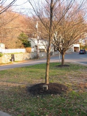
On Elm Street (Connecticut Route 243) at Platt Street, on the right when traveling north on Elm Street.
American Liberty Elm
Dedicated by the Derby Historical
Society July 10, 2002
on the 250th Anniversary of the
Birth of General David Humphreys
1752 – 1818
Sponsored by
The City of Ansonia — — Map (db m25567) HM
On Elm Street (Connecticut Route 243) at Platt Street, on the right when traveling north on Elm Street.
Here the first settlers came in 1654 and established a settlement called Uptown Derby. It is now part of the City of Ansonia, incorporated in 1889.
South of this green is the home of General David Humphreys who, as aide-de-camp to General George . . . — — Map (db m25564) HM
On East Main Street at Water Street, on the right when traveling north on East Main Street.
[ Center Panel ]
Lest We Forget This memorial is dedicated by the grateful citizens of the City of Ansonia to preserve and honor the memory of all those brave men and women who served our country so selflessly in time of conflict.
. . . — — Map (db m25537) WM
On Main Street at Water Street, on the right when traveling north on Main Street.
In observance of the U.S. Bicentennial, Elizabeth Clarke Hull Chapter NSDAR marks the site of a Charter Oak seedling given to the City of Ansonia Oct. 27, 1966, by former Mayor Frank P. Fitzpatrick
May 15, 1976 — — Map (db m25407) HM
On Elm Street (Route 243) at Platt Street, on the right when traveling north on Elm Street.
[Marker Front]: To The Memory
Of These Pupils of The
Elm Street School
Who Made the Supreme Sacrifice
For Their Country During
The World War
This Monument Is Dedicated
William F. Bresnahan 18th. Inf. 1st. Div, . . . — — Map (db m25566) HM
On Wakelee Avenue at Pork Hollow Street, on the right when traveling north on Wakelee Avenue.
Pork Hollow. Near this spot where hidden military stores belonging to the army of the Revolution during Tryon’s raid through Connecticut. — — Map (db m29526) HM
On Maple Avenue near Burton Road, on the left when traveling east.
The lands of Beacon Falls first appear in history when Milford was settled in 1639. Northern boundary of Milford was Beacon Hill Brook, separating the hunting grounds of the Paugasuck and Tunxis Indians. In 1675 the land became part of Derby. . . . — — Map (db m21932) HM
Near North Brooksvale Road at Danard Place, on the left when traveling west.
In the early 1800's, the Farmington Canal was built between Northampton and New haven; Irish immigrants dug the canal by hand.
The Canal (sic) locks controlled the flow of the water to compensate for the slope of the land. Farmers living nearby . . . — — Map (db m27567) HM
On South Main Street (Connecticut Route 10) at Wallingford Road, on the right when traveling north on South Main Street.
This old stone was brought from the center of Prospect early in 1899 by a group of Cheshire young men to serve as a “Stepping Stone” for those attending the church which then stood on the east edge of the present green. — — Map (db m48429) HM
On Church Drive at South Main Street ( Route 10), on the left when traveling north on Church Drive.
Settled in 1695 as Wallingford “West Farms”, this area obtained status as the village of New Cheshire in 1723. It was incorporated as a town in 1780. Cheshire became famous for its agricultural productivity and light manufacturing. Copper was . . . — — Map (db m22371) HM
On South Main Street (Connecticut Route 10) at Wallingford Road, on the left when traveling north on South Main Street.
[South face] Lincoln [North face] Foote [ Admiral Andrew Hull Foote ] [East plaque] Erected to The Memory of Those Who Enlisted From The Town of Cheshire in The Civil War 1861 – 1865 Capt. Timothy Guilford Lieut. . . . — — Map (db m22380) HM
On South Main Street (Connecticut Route 10) at Wallingford Road, on the right when traveling north on South Main Street.
On This Tablet Are Inscribed The Honored Names Of the Men of Cheshire Who Went Forth To Fight in the Great War For Humanity and Justice 1917 – 1919
Wilbur W. Adkins • Richard H. Atwood • Earle W. Barnes • George S. Barton • William H. . . . — — Map (db m22403) HM
Near South Main Street (Connecticut Route 10) 0.1 miles south of Chipman Drive, on the left when traveling south.
The Medal of Honor Plaza and “Living Classroom” Dedicated May 26, 1996
Alfred C. Adinolfi, U.S. Air Force, Chairman and Town Councilman
S. Kenneth Baril, U.S. Army • Harold Mosher, U.S. Army • John White, U.S. Navy • Henry E. . . . — — Map (db m22456) HM
On Main Street at Water Street, on the right when traveling west on Main Street.
[ Right tablet ]
Roll of Honor
Employees Of
Birmingham Iron Foundry
Who Served Their Country
In the World War
1917 – 1919
Dominick Ferrazzoli • J. Kanconvitch • August Romagnoli • Theodore V. Busk • Joseph . . . — — Map (db m25608) HM
On Derby Avenue (Connecticut Route 115) at Academy Hill Road, on the left when traveling south on Derby Avenue.
[Marker front]: Birthplace of two distinguished wartime heroes
General David Humphreys, aide-de-camp to General George Washington, accepted the British colors at the surrender at Yorktown, Virginia. Friend of both Washington and . . . — — Map (db m25568) HM
On Elizabeth Street at 5th Street, on the right when traveling north on Elizabeth Street.
In
memory of the
men of Derby and Huntington
who fell
in the service of their country
in the
War of the Rebellion
1861 – 1865
as
defenders of liberty and
nationality Gettysburg
— — Map (db m25384) WM
On Elizabeth Street at 5th Street, on the right when traveling north on Elizabeth Street.
Dedicated to Those Who Made the Supreme Sacrifice and Advanced the American Ideals of Liberty and the Brotherhood of Man
Korea
James Ellingwood Towle 1st Lt. U.S.A.F.
Vietnam
Norman Edward Dawson Jr. P.F.C. U.S.M.C. • George Albert Kurtyka . . . — — Map (db m25404) WM
On Elizabeth Street at 5th Street, on the right when traveling north on Elizabeth Street.
[ West Face ]
Dedicated To The Memory
Veterans
Derby, Conn.
World War I
World War II
Korean War
Vietnam
[ Northwest Face ]
Always Faithful
[ Southwest Face ]
This We’ll Defend
[ Northeast . . . — — Map (db m25386) WM
On Whittemore Road (Connecticut Route 188) at Store Road, on the left when traveling west on Whittemore Road.
At the site of Perrotti's West Street Pizza & Pub the trolley passed under Route 188 and then was moved from its original site at Westover School in 1908. The Bissell Store became the Ferrante and Delaney Store and was destroyed by fire in 1940. . . . — — Map (db m290554) HM
On North Street at Middlebury Road ( Route 64), on the left when traveling north on North Street.
This old house was once part of the Julius and Augusta Bronson Farm. The family of Samuel and Sarah Fenn owned it from 1887 to 1923. This house was purchased by the Blick Family in 1936 and the Middlebury Garage was established in 1937. The house . . . — — Map (db m29491) HM
On Middlebury Road (Connecticut Route 64) at Christian Road, on the left when traveling west on Middlebury Road.
The trolley bed was located where we now have the Greenway Trail.
The picture was taken in 1910. it was common for trolley companies to build and operate recreation facilities to provide a passenger base for the line. The Amusement Park was such . . . — — Map (db m29496) HM
On Whittemore Road (Connecticut Route 188) at Village Green, on the left when traveling west on Whittemore Road.
The name of the town derives from the central
position its meeting house occupies, six
miles from three older neighbors, Waterbury,
Southbury and Woodbury.
Winter ecclesiastical privileges, permitting
local church services, were . . . — — Map (db m19689) HM
On Store Road at Middlebury Road ( Route 64), on the right when traveling north on Store Road.
Westover School located across from the Green was once the location of the original Blacksmith Shop. It was later relocated to Store Rd. near the spot where the old trolley waiting room was once located. The blacksmith shop has a long history dating . . . — — Map (db m29530) HM
On Whittemore Road (Connecticut Route 188) at Village Green, on the left when traveling west on Whittemore Road.
Middlebury Honors Those Who Have Served
In The Wars Of Their Country
French – Indian War
Abner Munson
Revolutionary War
David Abbott, Benjamin Bemont, Aaron Benedict, Enos Benham, Samuel Benham, Edward Blackman, Michael Bowers, . . . — — Map (db m29503) WM
On Middlebury Road (Connecticut Route 64) 0.1 miles west of Charcoal Avenue, on the right when traveling east.
In this vicinity
French Troops under
Rochambeau
enroute to Yorktown
encamped during June 1781
Erected by the state
and
Mattatuck Branch,
Sons Amer. Rev.
Cooperating — — Map (db m19690) HM
On Middlebury Road (Route 64) at Regan Road, on the right when traveling east on Middlebury Road.
On this site in 1949 the volunteers of the Middlebury Volunteer Fire Department, using donated and salvaged materials, built a fire station on land donated by the Vaszauskas family.
Pictured are the original 1941 Ford LaFrance, 1947 International . . . — — Map (db m29532) HM
On Middlebury Road (Connecticut Route 64) at Tranquility Road, on the left when traveling west on Middlebury Road.
The Trolley Line, which serviced passengers from Waterbury to Middlebury and then on to Woodbury, also carried ice and produce.
During the winter months, 200,000 pounds of ice was harvested at Lake Quassapaug and carried by trolley to . . . — — Map (db m29494) HM
On Cedar Street at Church Street, on the right when traveling east on Cedar Street.
Roll Of Honor
American Legion Home
Naugatuck Post No 17
This Building Is Dedicated
To The Memory Of These Men
Who Made The Supreme Sacrifice
In World War II
And
In Honor Of
The Men And Women Of Naugatuck
Who Served In The Armed . . . — — Map (db m83094) WM
On Maple Street at South Main Street on Maple Street.
Originally called Salem Bridge, Naugatuck was settled in 1702 as a farming community, and, as the Industrial Revolution began, quickly transformed into a mill town. The Naugatuck River is ultimately linked to the borough's settlement and . . . — — Map (db m304245) HM
On Church Street at Division Street, on the right when traveling south on Church Street.
These lands were settled in 1702 by Samuel Hickox, Jr. of Mattatuck, now called Waterbury. Eight years later he began operation of a fulling mill, the first of many and diverse industries to follow. The earliest school was built in 1731 and the . . . — — Map (db m23917) HM
On Meadow Street (Connecticut Route 63) at Division Street, on the right when traveling south on Meadow Street.
[ east face ]
Victory is Consecrated by a Righteous Peace
[ north face ]
In Time of Peril the State is Fortified by Discipline Learned in Peace
[ south face ]
Armed and Resolute Might . . . — — Map (db m23961) HM
On Church Street at Division Street, on the right when traveling south on Church Street.
Erected by the Citizens of
Naugatuck
A.D. 1885.
In memory of her sons
who fought to maintain
the Union
1861-1865.
The deeds of those
who died in defense
of the government
of . . . — — Map (db m23920) WM
On Church Street at Division Street, on the right when traveling south on Church Street.
Naugatuck Honors the Men and Women who Served Their Country in Time of Need
[ Center panel ]
Vietnam
Alho, Antonio L. • Brewer, Samuel A. • Carney, James P. • Fabrisi, Pail E. • Holland, Joseph P. • Schultz, John P. . . . — — Map (db m23918) WM
On Rubber Avenue at Andrew Avenue, on the right when traveling west on Rubber Avenue.
In Honor Of
The Employees Of
Goodyear’s India Rubber Glove
Manufacturing Company
Who At The Call Of Their Country
Laid Aside Their Vocations And Entered
The Service To Fight In The Great War
For World-Wide Liberty
1917 – . . . — — Map (db m83083) WM
On Rubber Avenue at Andrew Avenue, on the right when traveling west on Rubber Avenue.
In Honor Of
The Employees Of
Goodyear’s Metallic Rubber Shoe
Company
Who At The Call Of Their Country
Laid Aside Their Vocations And Entered
The Service To Fight In The Great War
For World-Wide Liberty
1917 – 1919
Samuel W.K. . . . — — Map (db m83084) WM
On Rubber Avenue at Andrew Avenue, on the right when traveling west on Rubber Avenue. Reported permanently removed.
In Honor Of
The Employees Of
United States Rubber Company
• Jersey Factory •
Who At The Call Of Their Country
Laid Aside Their Vocations And Entered
The Service To Fight In The Great War
For World-Wide Liberty
1917 – 1919
Henry J. . . . — — Map (db m241145) WM
On Oxford Road (Connecticut Route 67) at Old State Road 3, on the right when traveling north on Oxford Road.
Our Hero Dead World War II
Sgt. David S. Miles • Pvt. Albert Vaivoda • Capt. Kenyon S Congdon • 1st Lieut. Cornella A. Wyckoff, M.D. • P.F.C. Edwin H. Cassidy • P.F.C. S. Robert O’Donovan • Pvt. Alvin H. Treat • S/Sgt. Louis F. Smith • P.F.C. . . . — — Map (db m19477) HM
On Oxford Road (Connecticut Route 67) 0.5 miles north of Academy Road, on the right when traveling north.
Originally part of Derby, Oxford was settled by people pushing inland from Derby, Stratford, and New Haven. Land was acquired in five purchases from the Paugussett and Pootatuck Indians. The first grant of settlement appears in Derby records of . . . — — Map (db m19478) HM
On Oxford Road (Connecticut Route 67) at Academy Road ( Route 42), on the right when traveling north on Oxford Road.
Erected in Honor of
Those from Oxford
Who Served Their Country
In the World War
1917 – 1919
Albert E. Arnold · Maurice C. Barry · Carl Benson · Frank W. Carlson · Ole S. Christensen · Albert G. Dahinden · Ralph E. Davis · Thomas F. . . . — — Map (db m137349) WM
On Center Street near Church Street, on the right when traveling north.
Marker Front:
On the boundary where Waterbury and Cheshire met, homes were built as early as 1712. Schools were opened and, in 1778, a separatist church. The Congregational Church, “Columbia Parish,” was established in 1797 by . . . — — Map (db m22516) HM
On Church Street at Center Street, on the right when traveling south on Church Street.
[ West plaque ]
Prospect 1906 To the Loyal Sons Of Prospect Who Served in the Wars Of Our Country “The noblest motive Is the public good.”
[ South plaque ]
Our World War Veterans Beers, Harry J. Berglund, Reuben . . . — — Map (db m22519) HM
Near Cheshire Road (Connecticut Route 68) 0.1 miles west of Chatfield Road, on the left when traveling west.
This Military Display is Dedicated to the Memory of Fellow Veteran, W.O. Michael Aaron Kight Who Lost His Life In Vietnam on May 19, 1967 — — Map (db m22458) HM
On Derby Avenue at Broad Street ( Route 313), on the right on Derby Avenue.
High hills and deep valley – broad river and rocky falls.
In 1650 “Nawcatock”, an Indian village. Today the river bears the name.
In 1678, “Amaugsuck”, the fishing place where the waters pour down.
From 1738, . . . — — Map (db m19991) HM
Near Spruce Street at Garden Street, on the right when traveling west.
1950 1955 Korean War
Alberti, Joseph M. • *Aldo, Joseph A. • Anderson, Edmund C. • Andrews, Louis M., Jr. • Annillo, Frederick C. • Aquilla, Salvatore M. • Ashton, Charles J. • Bacha, Donald A. • Bacha, George, Jr. • Bailey, Howard E., Jr. • . . . — — Map (db m27418) WM
Near Spruce Street at Garden Street, on the right when traveling west.
1964 1975 Vietnam War
Albiondi, William F., Jr. • Abromaitis, Stanley C., Jr. • Ainsworth, Robert C. • Ajello, Donald J. • Albro, David R. • Allen, Noble E., Jr. • Ambrose, Anthony J. • Anderson, Glenwood D, • Anderson, Michael L. • Anglace, . . . — — Map (db m27417) HM
Near Spruce Street at Garden Street, on the right when traveling west.
1917 – 1918 1941 – 1945
In Honor Of
The Men and Women of Seymour
Who Served in the Armed Forces of Our Country
World War I
[ The World War I tablet lists 327 names. The names listed below have a star indicating they did not . . . — — Map (db m27655) HM
On Wakeley Street at Deforest Street, on the right when traveling south on Wakeley Street.
The Naugatuck River abounded with runs of migratory (diadromous) fish prior to the arrival of European colonists. These fish runs had been an important food source for Native Peoples for centuries and this exact spot — at the foot of a gorge . . . — — Map (db m101374) HM
Near Roxbury Road (Connecticut Route 67) at Main Street N (U.S. 6), on the right when traveling west.
The stone marker in the enclosure represents thesite of the encampment of the first 15 settlers and their families from Stratford in the area known as Pomperaug in the spring of 1673. It was made a town and called Woodbury. The south section was . . . — — Map (db m226926) HM
On Russian Village Road 0.1 miles west of Ichabod Road, on the right when traveling west.
Russian Village: A Brief History
Formerly known as “Churaevka,” Russian Village was established in 1925 as an artistic community for Russians who fled to America after the Revolution of 1917. The village was created by two Russian writers, . . . — — Map (db m26865) HM
On South Britain Road (Connecticut Route 172) at East Flat Hill Road, on the left when traveling north on South Britain Road.
South Britain Congregational Church
Jehu Minor, First Pastor
1761 Twenty nine persons petitioned the General Assembly for four months winter preaching after traveling to Southbury for thirty years.
1766 First South Britain Ecclesiastic Society . . . — — Map (db m52786) HM
Near Main Street South 0.1 miles east of Flood Bridge Road.
In 1659 this area was part of a large tract of land bought from the Paugussett Indians by prospective settlers from Stratford. The boundaries of this purchase, from which several towns were later formed, extended from the Pootatuck River on the . . . — — Map (db m12255) HM
On S Britain Road (Connecticut Route 172) at E Flat Hill Road, on the left when traveling north on S Britain Road.
In this church, the citizens of Southbury met for a special town
meeting on November 23, 1937, to create a zoning commission to
prevent the establishment of Camp General von Steuben by the
German-American Bund, a pro-Nazi organization. The camp . . . — — Map (db m210307) HM
On Main Street South 0.1 miles Flood Bridge Road, on the right when traveling east.
In memory of the Veterans of all wars
In honor of those from Southbury who served in the Korean Conflict 1950 – 1955 (east face)
In honor of those from Southbury who served in the Vietnam Conflict 1964 – 1975 (west face) — — Map (db m19270) WM
On Main Street South 0.1 miles Flood Bridge Road, on the right when traveling east.
In honor of those from Southbury who served in the World War 1917-1919
Joseph Alseph • Jesse M. Bailey •
Thomas Bale • William C. Ballard •
Edward Bayon •
Ernest H. Beardsley • Harold A. Benedict •
Joseph Birtkus •
Edward L. Bradley • . . . — — Map (db m19258) HM
On Main Street South at Flood Bridge Road, on the left when traveling west on Main Street South.
June 1781, Rochambeau's four French regiments crossed this Victory Town's bridge over the Housatonic River to join Washington's army encamped at White Plains and march to Yorktown. In 1782, they returned the same way.
Massachusetts . . . — — Map (db m303651) HM
On South Main Street north of Scovill Street, on the left when traveling north.
“We let a river shower its banks with a spirit that invades the people living there, and we protect that river, knowing without its blessing the people have no source of soul. A river sings a holy song conveying the mysterious truth . . . — — Map (db m304242) HM
On Highland Avenue at Sunnyside Avenue, on the right when traveling north on Highland Avenue.
The first settlement of Waterbury was made on land in this region about 1675. The settlement was abandoned during King Philip’s War and was resumed around the present Waterbury green after 1677. — — Map (db m23600) HM
On W. Main Street at Leavenworth Street, on the right when traveling east on W. Main Street.
In this vicinity stood
the fortified house of Ensign Stanley
into which the colonists fled
from unfriendly Indians
1700.
The Clark Tavern
which was repeatedly occupied by
detachments of Revolutionary War soldiers
and
the Academy, . . . — — Map (db m116383) HM
On Meadow Street at Bank Street, on the right when traveling north on Meadow Street.
[ main panel ]
"Their bodies are buried in peace;
but their name liveth for evermore."
Ecclesiastes 44:14
In Flanders Fields
by John McCrae
In Flanders fields the poppies blow
Between the crosses, row on row,
That mark . . . — — Map (db m36021) HM
On East Main Street at Silver Street, on the right when traveling east on East Main Street.
Hamilton Park
Given in Memory Of
David Boughton Hamilton
1824 – 1898
Manufacturer Banker State Senator
Captain 5th Regiment
Connecticut Voluteers
Public-Spirited Citizen
This land adjacent to Rogers and Brothers Silver . . . — — Map (db m35979) HM
On Highland Avenue at Sunnyside Avenue, on the right when traveling north on Highland Avenue.
Plymouth Rock does not mark a beginning or an end. It marks a revelation of that which is without beginning and without end. A purpose shining through eternity with a resplendent light undimmed even by the imperfections of men and a response an . . . — — Map (db m24216) HM
On West Main Street at Prospect Street, on the right when traveling west on West Main Street.
"I must say, having been here at three o'clock in the morning and now at six-thirty in the evening, that Waterbury is either the easiest city in the United States to get a crowd in, or it has the best democrats in the United States. In any case, . . . — — Map (db m36066) HM
On Grand Street at Church Street, on the right when traveling west on Grand Street.
John Prince Elton
1865 – 1948
Mayor of the City of Waterbury 1903 – 1905
Bequeathed to the city this site on which
was the home of the Elton Family. True to
the tradition of his forebears, he devoted
his lifetime to the . . . — — Map (db m35978) HM
On Silver Street Expressway (Connecticut Route 69) at East Main Street, on the right when traveling east on Silver Street Expressway.
During World War I and II, millions of dollars worth of Liberty, War and Victory Bonds were sold from this tiny house on The Green, demonstrating the commitment of Waterburians to freedom. Young men were encouraged to sign up for the duration at . . . — — Map (db m22367) HM
On West Main Street west of Prospect Street, on the right when traveling west.
Born - April 5, 1908, Waterbury, Connecticut
Died - August 2, 1945, Pacific Ocean
On July 30, 1945, the USS Indianapolis (CA-35) was struck by Japanese torpedoes in the Pacific Ocean and sunk. That day, 1,197 men went in the shark infested . . . — — Map (db m304243) HM WM
Near East Main Street, on the left when traveling west.
This memorial was erected by Patriotic Citizens and Statesmen to commemorate two French Soldiers of Rochambeau's Army who volunteered to fight for American Independence under Washington, enroute from Newport to Yorktown, died and were buried here, . . . — — Map (db m36024) HM
On Freight Street aka Veterans Memorial Boulevard at Riverside Street, on the right when traveling west on Freight Street aka Veterans Memorial Boulevard.
[ south side of bridge ]
In Memoriam
Remember Pearl Harbor
Keep America Alert!
To Those
Who Made The Supreme Sacrifice
During The Attack On Pearl Harbor
07:55 AM, 7 December 1941
Dedicated By
The Leopoldville Memorial . . . — — Map (db m36072) HM
(Center):In memory of the POW / MIA Soldiers from Waterbury who bravely served our nation in all conflicts.
You Are Not Forgotten!
(Left):Sgt. Victor J. Choinere U.S. Army
DoB Nov. 1931 – Date MIA Nov. 1950
Cpl. Dennis Rush . . . — — Map (db m20134) WM
On West Main Street at Church Street, on the right when traveling east on West Main Street.
The present settlement of Waterbury
was made on land in this region.
The original settlement known
as Town Plot was abandoned
during King Philip’s War and the
town site was moved to this location
in 1677.
The Mattatuck Historical . . . — — Map (db m116385) HM
On Meadow Street at Grand Street, on the left when traveling south on Meadow Street.
Reverend Michael Joseph McGivney 1852 – 1890
Founder of The Knights of Columbus New Haven, Conn. March 29, 1882
[ back ]
Erected March 29, 1957 by the Supreme Council Knights of Columbus at the Birthplace . . . — — Map (db m24039) HM
On Church Street near West Main Street, on the right when traveling south.
Established from England in 1732 by the Venerable Society for the Propagation of the Gospel in Foreign Parts. In 1797 re-named St. Johns Church — — Map (db m36069) HM
On Meadow Street 0.1 miles south of Grand Street, on the left when traveling south.
These stones from the first cemetery in Waterbury, now the site of Library Park, were placed here at the suggestion of various patriotic organizations — — Map (db m24041) HM
658 entries matched your criteria. The first 100 are listed above. Next 100 ⊳