201 entries match your criteria. Entries 101 through 200 are listed.⊲ Previous 100 — The final 1 ⊳
NYC Parks Historical Markers
The purpose of this NYC Parks & Recreation program is to place historical identification markers which describe the history of the site, park improvements, and the biography of the person for whom the park is named. These historical signs also offer virtual and physical context to parks, playgrounds, monuments, and landmarks across New York City.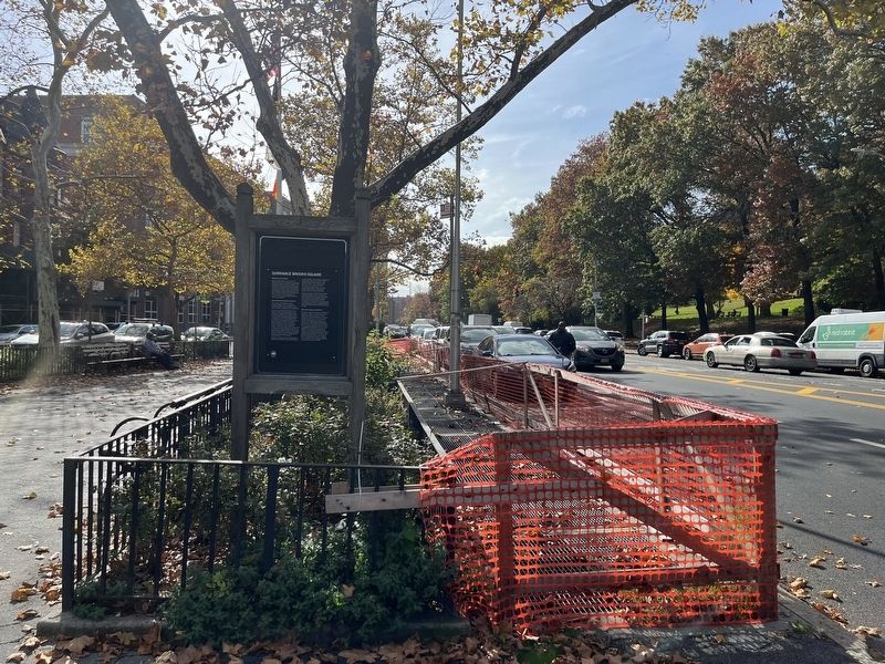
By Devry Becker Jones (CC0), November 5, 2022
Dorrance Brooks Square Marker
| 101 ► New York, New York County, Manhattan, Central Harlem — Dorrance Brooks Square — |
| On West 137th Street at St. Nicholas Avenue, on the left when traveling west on West 137th Street. | |||
| 102 ► New York, New York County, Manhattan, Central Harlem — Dorrance Brooks Square — .038 Acre — |
| On Edgecombe Avenue at West 136th Street, on the left when traveling north on Edgecombe Avenue. | |||
| 103 ► New York, New York County, Manhattan, Central Harlem — GreenThumb — |
| On St. Nicholas Avenue just north of West 117th Street, on the right when traveling south. | |||
| 104 ► New York, New York County, Manhattan, Central Harlem — 301 — Howard Bennett Playground — |
| On West 135th Street at Lenox Terrace Place, on the right when traveling west on West 135th Street. | |||
| 105 ► New York, New York County, Manhattan, Central Harlem — Jackie Robinson Pool — Jackie Robinson Park — |
| Near Bradhurst Avenue just north of West 145th Street, on the left when traveling north. | |||
| 106 ► New York, New York County, Manhattan, Central Harlem — Martin Luther King Jr. Playground — 1 acre — |
| On Malcolm X Boulevard north of West 113th Street, on the right when traveling north. | |||
| 107 ► New York, New York County, Manhattan, Central Harlem — Martin Luther King Jr. Playground — 1 acre — |
| On West 114th Street east of Malcolm X Boulevard, on the left when traveling west. | |||
| 108 ► New York, New York County, Manhattan, Central Harlem — Seligman Fountain — Morningside Park — |
| On Morningside Avenue west of East 114th Street, on the right when traveling south. | |||
| 109 ► New York, New York County, Manhattan, Central Harlem — Swing Low: Harriet Tubman Memorial — Harriet Tubman Triangle — |
| On Frederick Douglass Boulevard at West 122nd Street on Frederick Douglass Boulevard. | |||
| 110 ► New York, New York County, Manhattan, Central Park South — Simon Bolivar Statue — Central Park South — |
| On 59th Street at Avenue of the Americas, on the right when traveling west on 59th Street. | |||
| 111 ► New York, New York County, Manhattan, Central Park West Historic District — Central Park Wildlife Conservation Center — Central Park — |
| On Park Road, 0.1 miles north of Grand Army Plaza, on the left when traveling north. | |||
| 112 ► New York, New York County, Manhattan, Central Park West Historic District — Lehman Gates — Tisch Zoo - Central Park — |
| Near 65th Street Transverse. | |||
| 113 ► New York, New York County, Manhattan, Central Park West Historic District — Robert Burns Statue — |
| Near The Mall. | |||
| 114 ► New York, New York County, Manhattan, Central Park West Historic District — Sheep Meadow — |
| On West Drive just north of East 65th Street, on the right when traveling north. | |||
| 115 ► New York, New York County, Manhattan, Central Park West Historic District — The Arsenal — |
| Near Fifth Avenue near East 64th Street. | |||
| 116 ► New York, New York County, Manhattan, Central Park West Historic District — The Falconer Statue — Central Park — |
| On 72nd Street Transverse Road at Central Park Driveway, on the left when traveling west on 72nd Street Transverse Road. | |||
| 117 ► New York, New York County, Manhattan, Central Park West Historic District — Welcome to the Dene Slope — |
| Near East Drive, 0.1 miles north of East 65th Street, on the right when traveling north. | |||
| 118 ► New York, New York County, Manhattan, Chelsea — Chelsea Doughboy Statue — Chelsea Park — |
| On 9th Avenue near 28th Avenue, on the right when traveling south. | |||
| 119 ► New York, New York County, Manhattan, Chelsea — Clement Clarke Moore Park — .489 Acre — |
| On 10th Avenue at West 22nd Street, on the right when traveling north on 10th Avenue. | |||
| 120 ► New York, New York County, Manhattan, Chelsea — Dr. Gertrude B. Kelly Playground — .52 Acre — |
| On West 16th Street west of 8th Avenue, on the left when traveling east. | |||
| 121 ► New York, New York County, Manhattan, Chelsea — Penn South Playground — .6 acre — |
| On West 26th Street west of 8th Avenue, on the right when traveling east. | |||
| 122 ► New York, New York County, Manhattan, Chinatown — 300 — 孫中山先生 [Mr. Sun Yat-sen] — 哥倫布公園 中山廣場 — [Columbus Park Zhongshan Plaza] — |
| Near Mulberry Street south of Bayard Street, on the left when traveling north. | |||
| 123 ► New York, New York County, Manhattan, Chinatown — 301 — Dr. Sun Yat-sen — Dr. Sun Yat-sen Plaza, Columbus Park — |
| On Mulberry Street just south of Bayard Street, on the left when traveling north. | |||
| 124 ► New York, New York County, Manhattan, Chinatown — 301 — Dr. Sun Yat-sen — Dr. Sun Yat-sen Plaza, Columbus Park — |
| On Bayard Street west of Mulberry Street, on the right when traveling east. | |||
| 125 ► New York, New York County, Manhattan, Chinatown — Welcome to Columbus Park |
| On Worth Street at Mulberry Street, on the right when traveling west on Worth Street. Reported missing. | |||
| 126 ► New York, New York County, Manhattan, Civic Center — Abraham De Peyster Statue — Thomas Paine Park |
| On Lafayette Street near Worth Street, on the left when traveling south. Reported permanently removed. | |||
| 127 ► New York, New York County, Manhattan, Civic Center — Collect Pond Park — .994 acre |
| On Centre Street near Leonard Street, on the left when traveling north. Reported missing. | |||
| 128 ► New York, New York County, Manhattan, Civic Center — Foley Square |
| On Centre Street at Worth Street, on the right when traveling north on Centre Street. Reported permanently removed. | |||
| 129 ► New York, New York County, Manhattan, Civic Center — Nathan Hale — City Hall Park — |
| Near Broadway, on the left when traveling south. | |||
| 130 ► New York, New York County, Manhattan, Civic Center — September 11, 2001 Living Memorial Grove |
| On Park Row at Broadway, on the left when traveling south on Park Row. Reported missing. | |||
| 131 ► New York, New York County, Manhattan, Civic Center — St. James Square — .05 acre — |
| On St. James Place near James Street, on the right when traveling north. | |||
| 132 ► New York, New York County, Manhattan, Civic Center — The Legendary Collect Pond — |
| On Lafayette Street near Leonard Street, on the right when traveling south. | |||
| 133 ► New York, New York County, Manhattan, Civic Center — Thomas Paine Park — Foley Square — 1.88 acres — |
| On Centre Street near Worth Street, on the left when traveling north. | |||
| 134 ► New York, New York County, Manhattan, East Harlem — Alice Kornegay Triangle — Harlem River Drive — |
| On East 128th Street at Lexington Avenue, on the left when traveling east on East 128th Street. | |||
| 135 ► New York, New York County, Manhattan, East Harlem — GreenThumb — |
| On Lexington Avenue south of East 118th Street, on the right when traveling north. | |||
| 136 ► New York, New York County, Manhattan, East Harlem — GreenThumb — |
| On Pleasant Avenue just north of East 118th Street, on the left when traveling south. | |||
| 137 ► New York, New York County, Manhattan, East Harlem — 300 — Harlem Art Park — .347 acre — |
| On East 120th Street east of Lexington Avenue, on the left when traveling east. | |||
| 138 ► New York, New York County, Manhattan, East Harlem — Pleasant Village Community Garden — .383 acre — |
| On Pleasant Avenue just south of East 119th Street, on the left when traveling south. | |||
| 139 ► New York, New York County, Manhattan, East Harlem — 301 — Thomas Jefferson Pool — Thomas Jefferson Park — |
| On 1st Avenue at East 112th Street, on the right when traveling north on 1st Avenue. | |||
| 140 ► New York, New York County, Manhattan, East Harlem — 300 — White Park — 0.684 acres — |
| On East 106th Street west of 3rd Avenue, on the right when traveling east. | |||
| 141 ► New York, New York County, Manhattan, East Harlem — 301 — White Playground — |
| On East 105th Street west of 3rd Avenue, on the right when traveling west. | |||
| 142 ► New York, New York County, Manhattan, Manhattan Valley — 300 — Anibal Aviles Playground — 1.441 acres — |
| On West 108th Street west of Columbus Avenue, on the left when traveling east. | |||
| 143 ► New York, New York County, Manhattan, Manhattan Valley — 301 — Bloomingdale Park — .715 acre — |
| On Amsterdam Avenue north of West 104th Street, on the right when traveling north. | |||
| 144 ► New York, New York County, Manhattan, Manhattan Valley — Frederick Douglass Playground — 1.945 acres — |
| On Amsterdam Avenue at West 101st Street, on the right when traveling north on Amsterdam Avenue. | |||
| 145 ► New York, New York County, Manhattan, Manhattan Valley — Happy Warrior Playground — 1.652 acres — |
| On Amsterdam Avenue south of West 99th Street, on the right when traveling north. | |||
| 146 ► New York, New York County, Manhattan, Morningside Park — 301 — Morningside Park — |
| On Morningside Avenue south of West 123rd Street, on the right when traveling south. | |||
| 147 ► New York, New York County, Manhattan, Morningside Park — 301 — Morningside Park — |
| On Morningside Avenue just north of West 114th Street, on the right when traveling south. | |||
| 148 ► New York, New York County, Manhattan, Two Bridges — Alfred E. Smith Playground — 1.75 acres — |
| On Catherine Street just south of Monroe Street, on the right when traveling south. | |||
| 149 ► New York, New York County, Manhattan, Two Bridges — Catherine Mall Market — |
| On Cherry Street at Catherine Slip, on the right when traveling east on Cherry Street. | |||
| 150 ► New York, New York County, Manhattan, Two Bridges — Happy Warrior Playground in Alfred E. Smith Park — |
| Near Catherine Street near Catherine Slip. | |||
| 151 ► New York, New York County, Manhattan, Union Square — Abraham Lincoln Statue — Union Square Park |
| Near Union Square W near E 17th Street, on the left when traveling south. Reported permanently removed. | |||
| 152 ► New York, New York County, Manhattan, Union Square — Abraham Lincoln Statue — Union Square Park — |
| On Union Square West at East 16th Street, on the right when traveling north on Union Square West. | |||
| 153 ► New York, New York County, Manhattan, Union Square — George Washington Statue — Union Square Park |
| On East 14th Street east of Union Square East, on the right when traveling west. Reported permanently removed. | |||
| 154 ► New York, New York County, Manhattan, Union Square — 300 — George Washington Statue — Union Square Park |
| On East 14th Street near between Union Square East & West, on the right when traveling south. Reported permanently removed. | |||
| 155 ► New York, New York County, Manhattan, Washington Heights — John T. Brush Stairway — |
| Near Edgecombe Avenue south of West 158th Street, on the right when traveling north. | |||
| 156 ► New York, New York County, Manhattan, West Harlem — Roosevelt Triangle — 0.0035 acre — |
| On Morningside Avenue at Dr. Martin Luther King Jr. Boulevard, on the right when traveling south on Morningside Avenue. | |||
| 157 ► New York, Queens County, Queens, Astoria — 301 — Astoria Pool — Astoria Park — |
| On 19th Street south of 23rd Drive, on the right when traveling south. | |||
| 158 ► New York, Queens County, Queens, Astoria — Flight 587 Memorial Grove — |
| Near Shore Boulevard south of Ditmars Boulevard, on the left when traveling south. | |||
| 159 ► New York, Queens County, Queens, Astoria — 301 — General Slocum Disaster — Astoria Park — |
| On Shore Boulevard, 0.4 miles south of Ditmars Boulevard, on the right when traveling south. | |||
| 160 ► New York, Queens County, Queens, Bayside — Fort Totten Park — 59.5 acres — |
| On Totten Avenue, on the right when traveling north. | |||
| 161 ► New York, Queens County, Queens, Corona — Column of Jerash — Flushing Meadow – Corona Park — |
| Near United Nations Avenue South. | |||
| 162 ► New York, Queens County, Queens, Corona — Flushing Meadows Corona Park — |
| On 111th Street at United Nations Avenue North, on the right when traveling north on 111th Street. | |||
| 163 ► New York, Queens County, Queens, Corona — Gates of Life — Queens Wildlife Conservation Center — Flushing Meadows-Corona Park |
| On Zoo Path at Zoo Bridge, on the right when traveling north on Zoo Path. Reported unreadable. | |||
| 164 ► New York, Queens County, Queens, Corona — 300 — The Unisphere — Flushing Meadows Corona Park — |
| On Avenue of the Americas south of United Nations Avenue North, on the left when traveling north. | |||
| 165 ► New York, Queens County, Queens, Dutch Kills — GreenThumb — |
| On 29th Street south of 39th Avenue, on the left when traveling north. | |||
| 166 ► New York, Queens County, Queens, Flushing — Flushing Meadows Corona Park — |
| On Main Street just south of Elder Avenue, on the left when traveling north. | |||
| 167 ► New York, Queens County, Queens, Flushing — 1100 — Kingsland Homestead — 143-35 37th Ave. — Historic House Trust - New York City — |
| On 37th Avenue, 0.1 miles west of Parsons Boulevard, on the right when traveling west. | |||
| 168 ► New York, Queens County, Queens, Flushing — 1100 — Lewis H. Latimer House — 34-41 137th Street — Lewis Latimer House Museum / Historic House Trust - New York City — |
| On Leavitt Street just north of 137th Street, on the left when traveling north. | |||
| 169 ► New York, Queens County, Queens, Fort Totten — Fort Totten Park — 59.5 acres — |
| On Shore Road at Ordinance Road, on the right when traveling north on Shore Road. | |||
| 170 ► New York, Queens County, Queens, Fort Totten — Main Magazine of Fort Totten — |
| Near Totten Road west of Ordinance Road, on the left when traveling west. | |||
| 171 ► New York, Queens County, Queens, Jamaica — King Manor — 150-03 Jamaica Ave. — |
| On Jamaica Avenue at 150th Street, on the left when traveling east on Jamaica Avenue. | |||
| 172 ► New York, Queens County, Queens, Long Island City — History of Hunter's Point — |
| Near Center Avenue at 51st Avenue, on the left when traveling north. | |||
| 173 ► New York, Queens County, Queens, Long Island City — Hunter's Point South Salt Marsh — |
| Near 57th Avenue at Center Boulevard, on the left when traveling north. | |||
| 174 ► New York, Queens County, Queens, Long Island City — Murray Playground — 2.524 Acres — |
| On 45th Road east of 11th Street, on the left when traveling east. | |||
| 175 ► New York, Queens County, Queens, Long Island City — National Sugar Refining Company — New York refinery on Newtown Creek — History of Hunter's Point — |
| Near 2nd Street east of 57th Avenue, on the left when traveling west. | |||
| 176 ► New York, Queens County, Queens, Long Island City — The Millstones in Queens Plaza — |
| On 41st Avenue at Queens Plaza North, on the left when traveling west on 41st Avenue. | |||
| 177 ► New York, Queens County, Queens, Ozone Park — Maurice A. Fitzgerald Playground — 1.201 Acres — |
| On Atlantic Avenue west of 106th Street, on the right when traveling east. | |||
| 178 ► New York, Queens County, Queens, Sunnyside — 301 — L/Cpl. Thomas P. Noonan Playground — Thomson Hill Park — |
| On Greenpoint Avenue just west of 43rd Street, on the right when traveling west. | |||
| 179 ► New York, Queens County, Queens, Sunnyside — 301 — L/Cpl. Thomas P. Noonan Playground — Thomson Hill Park — |
| Near 47th Avenue west of 43rd Street, on the left when traveling west. | |||
| 180 ► New York, Richmond County, Staten Island, Dongan Hills — 300 — Jerome X. O'Donovan Pond — Reed's Basket Willow Swamp Park — |
| On Chapin Avenue at Salzburg Court, on the left when traveling north on Chapin Avenue. | |||
| 181 ► New York, Richmond County, Staten Island, Fort Wadsworth — Arthur Von Briesen Park — 12.77 acres — NYC Parks — |
| On School Road at Bay Street when traveling north on School Road. | |||
| 182 ► New York, Richmond County, Staten Island, Great Kills — 300 — Seaside Wildlife Nature Park — |
| Near Tennyson Drive at Nelson Avenue, on the right when traveling north. | |||
| 183 ► New York, Richmond County, Staten Island, New Dorp Beach — Corporal Allan F. Kivlehan Park — New Dorp Beach Park — |
| On New Dorp Lane at Cedar Grove Avenue, on the right when traveling east on New Dorp Lane. | |||
| 184 ► New York, Richmond County, Staten Island, Port Richmond — Faber Park and Pool — 4.25 Acres |
| Near Richmond Terrace, on the right when traveling west. Reported permanently removed. | |||
| 185 ► New York, Richmond County, Staten Island, Port Richmond — 301 — Faber Park and Pool — |
| On Richmond Terrace just west of Faber Street, on the right when traveling west. | |||
| 186 ► New York, Richmond County, Staten Island, Prince's Bay — Battle of the Bulge — Belgium and Luxembourg, December 16, 1944 - January 25, 1943 — WWII |
| Near Chester Avenue west of Cornelia Avenue, on the left when traveling west. Reported permanently removed. | |||
| 187 ► New York, Richmond County, Staten Island, Prince's Bay — Battle of the Bulge Memorial — |
| On Chester Avenue west of Cornelia Avenue, on the left when traveling west. | |||
| 188 ► New York, Richmond County, Staten Island, Prince's Bay — Seguine Mansion — Lemon Creek Park |
| Near Seguine Avenue east of Hank Place, on the right when traveling east. Reported permanently removed. | |||
| 189 ► New York, Richmond County, Staten Island, Prince's Bay — Seguine Mansion |
| On Seguine Avenue just south of Hank Place, on the right when traveling south. Reported damaged. | |||
| 190 ► New York, Richmond County, Staten Island, Prince's Bay — World War II: Battle of the Bulge — Belgium and Luxembourg, Dec. 16, 1944 - Jan. 25, 1945 — |
| Near Cornelia Avenue east of Hylan Boulevard. | |||
| 191 ► New York, Richmond County, Staten Island, Rosebank — Alice Austen House — 2 Hylan Blvd. — |
| On Hylan Boulevard just south of Edgewater Street, on the right when traveling north. | |||
| 192 ► New York, Richmond County, Staten Island, Rosebank — Nicholas De Matti Playground — 2.343 acres — |
| On Tompkins Avenue south of Chestnut Avenue, on the left when traveling south. | |||
| 193 ► New York, Richmond County, Staten Island, Silver Lake — Hero Park — 3.024 acres — |
| On Louis Street just west of Howard Avenue, on the right when traveling east. | |||
| 194 ► New York, Richmond County, Staten Island, Silver Lake — 300 — Hero Park — |
| On Louis Street just west of Howard Avenue, on the right when traveling east. | |||
| 195 ► New York, Richmond County, Staten Island, Stapleton — 301 — Rev. Dr. Maggie Howard Playground — |
| On Tompkins Avenue, 0.1 miles south of Tompkins Street, on the right when traveling south. | |||
| 196 ► New York, Richmond County, Staten Island, Stapleton — Stapleton Comfort Station — .107 acre |
| On Water Street at Canal Street, on the left when traveling west on Water Street. Reported damaged. | |||
| 197 ► New York, Richmond County, Staten Island, Stapleton — 300 — Stapleton Waterfront Park — 4.61 Acres — |
| On Water Street at Navy Pier Court, on the right when traveling north on Water Street. | |||
| 198 ► New York, Richmond County, Staten Island, Tottenville — Aesop Park — .902 Acre — |
| On Page Avenue at Bartow Avenue, on the right when traveling north on Page Avenue. | |||
| 199 ► New York, Richmond County, Staten Island, Tottenville — Biddle House — Conference House Park — |
| On Stairway Street west of Satterlee Street, on the right when traveling west. | |||
| 200 ► New York, Richmond County, Staten Island, Tottenville — Conference House — |
| On Satterlee Street north of Hylan Blvd., on the left when traveling north. | |||
201 entries matched your criteria. Entries 101 through 200 are listed above. ⊲ Previous 100 — The final 1 ⊳