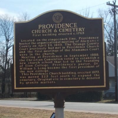
On North Main Street, on the right when traveling north.
Side A Providence was a gathering spot for pioneers in the Haw River basin. Many families and denominations during the eighteenth century used this cemetery. Many early settlers including members of the Turrentine, Sellars, Holt, Harden, . . . — — Map (db m28277) HM
Near Southeast Court Square at East Elm St, on the right when traveling north.
This memorial is dedicated to the nearly 3,000 victims who perished on September 11, 2001 and to the first responders who were willing to sacrifice their lives to save others. It was a day when we all came together as Americans and it brought out . . . — — Map (db m243193) WM
On East Main Street (State Highway 49), on the left when traveling west.
Nathaniel Polk DeShong descended from Huguenot immigrants who settled near the Haw River about a mile and a half north of here. He enlisted on June 21, 1861, at 17 years of age under Capt. James W. Lea “for the War” in the 6th North Carolina State . . . — — Map (db m222823) HM
On North 5th Street (U.S. 70) at South 5th Street (North Carolina Route 119), on the right when traveling east on North 5th Street.
Brigadier general of North Carolina militia, member House of Commons, conventions 1788, 1789, and U.S. Congress. His home stood nearby. — — Map (db m223043) HM
On State Highway 119 at Jim Minor Road, on the right when traveling south on State Highway 119. Reported missing.
(Preface): The Carolinas Campaign began on February 1, 1865, when Union Gen. William T. Sherman led his army north from Savannah, Georgia, after the March to the Sea. Sherman’s objective was to join Gen. Ulysses S. Grant in Virginia to crush . . . — — Map (db m211213) HM
On East Center Street at N. 7th Street, on the right when traveling east on East Center Street.
Colonial trading route, dating from 17th century, from Petersburg, Virginia, to the Catawba and Waxhaw Indians in Carolina, passed nearby. — — Map (db m223046) HM
On Mebane Rogers Road at Wilkerson Trail, on the right when traveling west on Mebane Rogers Road.
One room school built 1911. Used for school 1911-1935. Later used as church, community center.
National Register of Historic Places 1991 — — Map (db m257169) HM
Near Church Road 0.1 miles south of Sissipahaw Way, on the left when traveling south.
Saxapahaw was first settled by the Sissapahaw Indians - a hunting and farming tribe. In 1701, explorer and surveyor John Lawson visited the area and described it as "the flower of the Carolinas". In the mid-1700s, the first European settlers came . . . — — Map (db m215840) HM
Near Church Road 0.1 miles south of Sissipahaw Way, on the left when traveling south.
John Newlin began construction of the Saxapahaw Cotton Mill in 1844. The mill was owned by the Newlin family until it was sold to Edwin Holt in 1873 and was later run by Holt's sons-in-law under the name White-Williamson and Company. The mill . . . — — Map (db m215842) HM
A memorial to British troops who died in the Old Meeting House during Cornwallis encampment here on his retreat from Guilford Courthouse March 1781.
Erected by Troop 46 B.S.A. Henry Overman Leader Who Died Before Completing It. — — Map (db m30558) HM
On East Greensboro-Chapel Hill Road, on the left when traveling east.
Original frontier log dwelling built by Quaker John Allen III. House stood approximately 400 feet southeast. Housed five generations. Moved in 1965 to Alamance Battleground State Historic Site. — — Map (db m30287) HM
Near West Greensboro Chapel Hill Road just north of Sylvan School Road.
Cane Creek Friends Meeting Since 1751. The first Cane Creek Meetinghouse stood about two miles east on land belonging to John Stanfield. The first of four meetinghouses on this site was built in 1764 on land given by William Marshall. The . . . — — Map (db m30682) HM
The Quakers (Society of Friends) were early anti-slavery supporters of the Underground Railroad. Once the war erupted and Alamance County residents chose sides, supporters of the Confederacy regarded the Friends as Unionists. Never attacked directly . . . — — Map (db m45538) HM
Educator, historian, civic leader, farmer, a teacher in the public schools of North Carolina for 32 years. 22 years in this community he motivated his students and the community, his home place stands 2 miles northwest. — — Map (db m30283) HM
A mile south of here is the site of Freedom Hill Wesleyan Methodist Church, a simple frame building that measured 27 by 36 feet and was dedicated in March 1848. When local residents sent a plea for a minister to the Wesleyans in Ohio in 1847, the . . . — — Map (db m46020) HM
Micajah McPherson, a trustee of Freedom Hill Wesleyan Methodist Church and abolitionist, was lynched about a mile and a half southeast of here. Although there are different stories about his lynching, they agree that he was an innocent man lynched . . . — — Map (db m46021) HM
On these grounds, Revolutionaries and Loyalists were buried together in mass graves by people of this neighborhood, who also cared for the wounded in their homes. Additional burials are at Spring Meeting House. — — Map (db m30695) HM
On Snow Camp Road 0.2 miles south of Greensboro-Chapel Hill Road.
Settled by Quakers in 1749. Cornwallis camped in area after Battle of Guilford Courthouse and used home of Simon Dixon as headquarters. — — Map (db m223102) HM
At this site, Patriot militia commanded by Brigadier General John Butler ambushed loyalist militia commanded by Colonel David Fanning in an effort to free prisoners, whom the Loyalist had captured at Hillsborough the previous day.
Although losses . . . — — Map (db m30696) HM
Near East Greensboro Chapel Hill Road at Stockard Road, on the left when traveling east.
In Memory of the Whig and Tory Soldiers who died in the Battle of Lindley's Mill 14th D. 11 Mo. 1781 and were buried here and on the battlefield
Erected 7th Day 10 Mo. 1979 — — Map (db m223104) HM
On East Greensboro Chapel Hill Road at Bradshaw Trail, on the left when traveling east on East Greensboro Chapel Hill Road.
In 1921 Principal E.P. Dixon started high school classes in nearby vacant cotton gin, naming school for the inventor Eli Whitney.
In 1923 high school classes relocated to building on this site. In 1928 a primary grade school building was . . . — — Map (db m33345) HM
On Hiddenite Church Road 0.1 miles north of Miller Road, on the right when traveling north.
In 1914 James Paul Lucas, diamond trader, eccentric, and world traveler, settled at this mansion and kept his collection of curiosities. — — Map (db m210424) HM
On State Highway 90 0.2 miles west of Richard Lane (County Highway 1616), on the right when traveling west.
Noted educator and minister. Founded York Collegiate Institute & numerous academies. Professor at Rutherford College. Grave 5mi. N. — — Map (db m156756) HM
On State Highway 90 0.6 miles east of Wayfound Church Road, on the right when traveling east.
A gem found only in N.C., named for W.E. Hidden, mineralogist of N.Y., who prospected
in this area about 1880. Mines were nearby. — — Map (db m156754) HM
On North Center Street (County Highway 1605) at Main Avenue Drive, on the left when traveling north on North Center Street.
In memory of those who gave their lives so that we might live
Korean
Brown, Clifford
Fox, J.D.
Matlock, Glenn J.
Wike, Carlie A.
Wike, James W.
Viet Nam
Auton, Bobby M.
Daniels, Lunas J.
Daniels, Robert
Deal, . . . — — Map (db m159548) WM
On North Center Street (County Highway 1605) at Main Avenue Drive, on the left when traveling north on North Center Street.
Alexander County Remembers
World War I
1917 - 1918
James A. Allen •
James Brookshire •
Archie Brown •
Charles Cook •
Otis R. Douglas •
Robert L. Eckard •
Tally Drum •
Roy Flowers •
Jessie Hollar •
Hackett Munday • . . . — — Map (db m159550) WM
On Main Avenue Drive, on the right when traveling west.
The Tower
The Bell and cornerstone were remnants of the Alexander County Courthouse fire that occurred August 11, 1967. The repair of the broken bell was accomplished by Rowe B. Campbell, a local businessman. At a later date, both the Bell . . . — — Map (db m156816) WM
On West Main Avenue (State Highway 90) at South Center Street (County Highway 1605), on the left when traveling west on West Main Avenue.
From 1861-65 the heroic sons and daughters of The Old South, under the greatest generals of all times, Robert E. Lee and Stonewall Jackson, fought with gallantry unequaled in all the annals of history. Not for the preservation of slavery, but for . . . — — Map (db m156819) WM
On West Main Avenue (State Highway 90) at South Center Street (County Highway 1605), on the left when traveling west on West Main Avenue.
At 2:00 o'clock p.m. the belch and roar of this Jones six-pounder ceased and out of the grove on Seminary Ridge, Gettysburg, marched the bravest body of infantry that ever careered the fields of battle, to hurl itself against the Union batteries on . . . — — Map (db m156818) WM
On Main Avenue Drive, on the right when traveling west.
Purchased circa 1850 at a total cost of $68.50, this bell called court into session and lent its voice to many other community events.
Before refrigeration, it announced that fresh meat was for sale and when a fire occurred, it sounded the . . . — — Map (db m156817) HM
On West Main Avenue (North Carolina Route 90) at 2nd Street Southwest, on the left when traveling west on West Main Avenue.
The original Charters of Freedom are on display in The Rotunda at the National Archives in Washington, D.C.
The Declaration of Independence was adopted July 4, 1776.
The United States Constitution was adopted . . . — — Map (db m288380) HM
On Main Street (U.S. 52) at Cemetery Street, on the right when traveling south on Main Street.
Free black served as a Baptist pastor at Rocky River Church until law in 1831 barred blacks from public preaching. Buried 500 yards west. — — Map (db m77358) HM
On Andrew Jackson Highway (U.S. 74) at Clark Mountain Road (County Route 1744), on the right when traveling west on Andrew Jackson Highway.
Jurist & Antifederalist leader. Member of court which in 1787 issued the first reported precedent for judicial review. His home stood 3 miles N.E. — — Map (db m77357) HM
On U.S. 52 0.2 miles south of Old Sneedsboro Road ( Highway 1829), on the right when traveling south.
North Carolina. Colonized, 1585-87, by first English settlers in America; permanently settled c. 1650; first to vote readiness for independence, Apr. 12, 1776
South Carolina. Formed in 1712 from part of Carolina, which was . . . — — Map (db m42303) HM
On U.S. 52 at Old Sneedsboro Road ( Highway 1829), on the right when traveling south on U.S. 52. Reported missing.
Laid out 1795. Promoted as inland port town on Pee Dee River by Archibald D. Murphey. Only graveyard remains, five miles southeast. — — Map (db m42309) HM
On Andrew Jackson Highway (U.S. 74) 0.4 miles west of Boylin Road ( Highway 1420), on the right when traveling west.
Here was established the first district in America for a systematic program of land erosion control. Known as the Brown Creek District because it embraced the area of the Brown Creek Watershed, it heralded the beginning of a national program of soil . . . — — Map (db m42349) HM
On Old U.S. 74 east of Williams Street ( Highway 218), on the right when traveling east.
President of National Farmers' Alliance, 1889-1892; began Progressive Farmer, 1886; a founder of NCSU and Meredith College. Was born here. — — Map (db m289846) HM
On North Greene Street (North Carolina Route 109) at East Wade Street, on the right when traveling north on North Greene Street.
In 1900, hundreds of astronomers and newspaper reporters from around the world descended on Wadesboro, the perfect place to view and report on a total solar eclipse that occurred on May 28 at 1:54 PM. The goal was the rare opportunity to study the . . . — — Map (db m244591) HM
On Route 74 at South Main Street, on the right when traveling east on Route 74.
Anson County Training School
1920-1960
A facility for education
of children of color.
Woodlawn School
1960-1961
J.R. Faison School
1961-1985 — — Map (db m94987) HM
On North Greene Street (North Carolina Route 109) just north of West Wade Street, on the left when traveling north.
Fulton Allen, better known as blues singer and guitarist Blind Boy Fuller, lost his vision totally in 1927 and had as his only means of support the occasional income from playing guitar. He listened carefully to phonograph records of such popular . . . — — Map (db m244602) HM
On East Caswell Street (U.S. 74) at Greenwood Lane, on the right when traveling east on East Caswell Street.
Eighteenth-century house built by Patrick Boggan, Revolutionary soldier & a founder of Wadesboro. Now historical museum. Located 2 blocks south. — — Map (db m42321) HM
On Andrew Jackson Highway (U.S. 74) at Anson High School Road ( Highway 1259), on the right when traveling east on Andrew Jackson Highway.
“Father of soil conservation.” First chief of the Soil Conservation Service, U.S. Dept. of Agriculture, 1935-1952. Born 4 miles southwest. — — Map (db m42344) HM
On North Carolina Route 742 at Deep Creek Road, on the right when traveling south on North Carolina Route 742.
At present NC 742, Gen. Wm. T. Sherman's Left Wing (14th & 20th Corps or Army of Georgia), under command of Union Maj. Gen. Henry Slocum and Union Cav. Gen. Judson Kilpatrick, converged with approx. 31,000 Union soldiers of Union Left Wing Army . . . — — Map (db m226582) HM
On East Caswell Street (U.S. 74) at North Park Drive, on the right when traveling west on East Caswell Street.
Associate Justice, State Supreme Court, 1878-1887; Member of Congress, 1873-1877; Member of Confederate Congress; legislator. Home is one mile west. — — Map (db m42320) HM
On East Wade Street at North Greene Street ( Route 109/742), on the right when traveling west on East Wade Street.
(North facing side)
Erected in honor of Anson County soldiers
who served in the World War to preserve
the principles and ideals of American
independence and to vouchsafe to succeeding generations the sublime truth and the sacred trust of . . . — — Map (db m270739) WM
On North Greene Street (North Carolina Route 109/742) near East Martin Street, on the right when traveling north.
(Front side)
The Confederate Flag
Not long unfurled was I known,
for fate was against me:
But I flashed over a pure cause,
and, on land and sea,
so fired the hearts of men unto heroism
that the world honors me.
Within my . . . — — Map (db m270834) WM
On St Johns Church Road at Mt Olive Road, on the right when traveling north on St Johns Church Road.
side 1
Adolph Nussmann
1739-1794
Pioneer minister and founder of the Lutheran Church in North Carolina
side 2
Born in German; educated in the University of Gottingen; called through commissioners Christopher . . . — — Map (db m77377) HM
On Cabarrus Avenue W (State Highway 1002) east of Crowell Drive SW.
Presbyterian. Est. 1867 by Luke Dorland to educate Negro women, Scotia Seminary merged in 1930 with Barber Memorial Institute. Coed since 1954. — — Map (db m43383) HM
On Concord Parkway North (U.S. 29) at Church Street North, on the right when traveling north on Concord Parkway North.
Cannon Mills president, 1921-1962; advanced the marketing of textiles. Civic leader and health care benefactor. Grave is one mile south. — — Map (db m42696) HM
Constructed in 1960 by Bruton Smith, Charlotte Motor Speedway is one of the world's most innovative sports entertainment venues. Known as "America's Home for Racing," the historic complex hosted NASCAR's first official 600-mile race and continues to . . . — — Map (db m145712) HM
On Union Street South just south of Means Avenue Southeast, on the right when traveling south.
This magnificent Concord City Hall was built in 1902 and sadly demolished in 1957. It anchored the northwest corner of South Union Street and Barbrick Avenue and was replaced by a new City Hall built on the same spot, now called the City Hall . . . — — Map (db m175762) HM
Near Rocky River Road (State Road 1139) at Lower Rocky River Road, on the right when traveling south.
Organized about 1751
Cabarrus County
formerly Mecklenburg
Alexander Craighead called as regular pastor April 1758, he instilled principles of civil and religious liberty in the people he served and in 1771-1775 they announced to the world . . . — — Map (db m237988) HM
On Union Street South just north of Means Avenue Southeast, on the right when traveling south.
Mr. Sandy Smith build his North Union Street residence around 1868 on what is now a parking lot at the southeast corner of Killarny Avenue and North Union Street. In 1918 the residence became a YMCA, to be later converted in 1940 to the Community . . . — — Map (db m175763) HM
On Union Street South north of Corban Avenue SW, on the left when traveling north.
Before modern transportation Concord citizens got around on foot or by horse. When people came into town, they needed a place to tie their horses. Here, on Union Street, lie two horse ring remnants from the late 1800s or early 1900s. At one time, . . . — — Map (db m258295) HM
On Union Street North just north of Means Avenue Southeast, on the right when traveling south.
The railroad came to Concord in the 1850's and played an important role in industrial growth. The depot, shown in the lower image, was located on the east side of the railroad tracks near present-day Corban Ave SW. The structure is said to have been . . . — — Map (db m175758) HM
On Union Street South just south of Cabarrus Avenue West (County Road 1002), on the right when traveling south. Reported permanently removed.
Catawba Indians originally inhabited present day Cabarrus County when significant numbers of Dutch, Scots-Irish, German, and Welsh-English families began traveling the Great Wagon Road to North Carolina backcountry in the middle of the eighteenth . . . — — Map (db m258305) HM
On Union Street S just north of Means Avenue Southeast, on the right when traveling south.
This image shows the original Cabarrus County Courthouse, built after the Town of Concord was laid out in 1796 on a 26 acre tract of land called 'Pea Ridge' near the old Indian Trading Path. It was a modest frame structure 30 feet wide and 30 feet . . . — — Map (db m175757) HM
On Union Street North north of Cabarrus Avenue West (County Road 1002), on the left when traveling north.
Horton Building
Commerce and
Merchants Building
1952
National
Register of
Historic Places
by the United States
Department of the
Interior — — Map (db m175773) HM
On Union Street South at Means Avenue Southeast, on the right when traveling north on Union Street South.
This monument erected to the memory of the Confederate dead of Cabarrus County N.C.
With granite and marble and branch of the cypress the emblems of peace shall thy slumbers enshrine then take this memento. 'Tis all we can offer. Oh grave . . . — — Map (db m175747) WM
On Poplar Tent Road 0.2 miles east of Pitts School Road NW, on the right when traveling east.
In memory of Reverend Hezekiah James Balch • Richard Harris • John Phifer • Benjamin Patton • David Reese • Zaccheus Wilson
Signers of the Mecklenburg Declaration of Independence
May 20, 1775 Charlotte, North Carolina — — Map (db m258307) HM
On Union Street S at Corban Street SE (U.S. 601) on Union Street S. Reported permanently removed.
Leader in founding of the Stonewall Jackson Training School, state senator, editor Concord “Standard” (1888-96) and “Uplift.” Home ½ block W. — — Map (db m43378) HM
On Union Street South just north of Means Avenue Southeast, on the right when traveling south.
In the last quarrter of the nineteenth century, many cotton mills were operating in Concord providing employment for great numbers of local citizens while swelling the population. The above is a tribute to Gibson, Coleman, and Odell mills.
The . . . — — Map (db m175761) HM