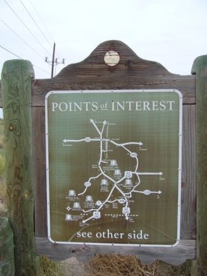
On U.S. 285 at County Road 712, on the right when traveling south on U.S. 285. Reported permanently removed.
In July 1867 Oliver Loving, a partner in the Goodnight-Loving cattle concern, was attacked by Comanches while driving cattle to Fort Sumner. Wounded, Loving held off the attack for two days and nights. With the help of Mexican traders, he made it to . . . — — Map (db m300577) HM
On U.S. 380 at milepost 200.7, on the right when traveling west.
Nomadic Indians and countless buffalo herds dominated this vast plain when the Vásquez de Coronado expedition explored it in 1541. Later it was the focus of Comanchero activity, and in the 19th century it became a center for cattle ranching. The . . . — — Map (db m73464) HM
On U.S. 62 0.6 miles west of NW County Raod, on the right when traveling east.
Named for the family of James Hobbs which homesteaded here in 1907, Hobbs became first a trading village for ranchers and then a major oil town after the discovery of oil by the Midwest Oil Company in 1928. — — Map (db m61441) HM
On Jack Gomez Boulevard 0.1 miles west of North Lovington Highway (New Mexico Highway 18), on the left when traveling west.
Built in 1942, the Hobbs Army Airfield was primarily used to train pilots to operate B-17 Bomber planes. It was built for the U.S. Army Air Forces 50,000 Pilot Training Program and closed in 1948. In 2003 it became Hobbs Industrial Airpark and was . . . — — Map (db m235230) HM
On North Marland Boulevard (U.S. 62/180 at milepost 105.9) at East Snyder Street, on the right when traveling north on North Marland Boulevard.
Following earlier oil discoveries in the Lea
County area, Ronald K. DeFord, of Midwest
Refining Co., now Amoco, came to Hobbs
to survey for a new drilling site. Drilling began
October 12, 1927, oil was discovered at
4,065 feet, and the new well . . . — — Map (db m235222) HM
On U.S. 62 0.3 miles west of NW County Road, on the right when traveling west.
Nomadic Indians and countless buffalo herds dominated the vast plain when the Vasquez de Coronado expedition explored it in 1541. Later it was the focus of Comanchero activity, and in the 19th century it became a center for cattle ranching. The name . . . — — Map (db m61440) HM
On North Lovington Highway (State Highway 18) 0.1 miles south of Gerry, on the right when traveling south. Reported missing.
Having arrived earlier from Texas with a Master’s degree and a dedication to teaching African-American students, Myrtle Attaway Farquhar accepted a position in 1943 at the segregated Booker T. Washington School in Hobbs. She inspired students to . . . — — Map (db m235225) HM
On U.S. 62 1.2 miles west of State Line Road, on the right when traveling west. Reported permanently removed.
A completion of the Discovery Well of the Hobbs Pool six miles south, April 12, 1929 focuses attention upon the potential of New Mexico as a major source of oil and natural gas. Steady development under the state conservation program, gradually . . . — — Map (db m300589) HM
On Main Street (U.S. 82) at East Central Avenue, on the right when traveling north on Main Street.
… that we here highly resolve
that these dead shall not
have died in vain …
– Abraham Lincoln
World War I
Reginald E. Baird • Law G. Barron • Y. C. Blakey • Jesse R. Cross • James H. English • Claud P. Graves • Walter A. Grizzell • . . . — — Map (db m235238) WM
On Hobbs Highway (State Highway 18) 0.2 miles south of East Gilmore Street (County Road 96), on the right when traveling north.
Lovington is named after Robert Florence Love, who founded the town on his homestead in 1908. It was a farming and ranching community until the discovery of the Denton pool after World War II turned it into an oil town. It is the county seat of Lea . . . — — Map (db m235234) HM
On North 4th Street at West Washington Avenue, on the right when traveling south on North 4th Street.
[Top]
has been placed on the
National Register
of Historic Places
by
the United States
Department of the Interior
[Bottom]
Constructed 1935-1937 by J. W. Pyburn, educator and school superintendent. Originally a . . . — — Map (db m235253) HM
On State Road 8 0.1 miles south of Monument Highway, on the right when traveling south.
Settled in 1885 and named for a marker at the springs a few miles west, Monument remained a ranching community until oil was discovered in 1928. The Indian statue, called Geronimo by residents, was erected in 1928 by land developers. Monument has . . . — — Map (db m61442) HM
On Avenue A at 1st Street, on the left when traveling south on Avenue A.
Clarence E. (CE) & Mae Dallas opened the Dallas Cash Grocery in 1926 on their ranch (founded in 1910) at Caprock, NM.
To keep the store stocked CE & sons often traveled 5 days in a wagon drawn by a team of horses – 2 days to Roswell, one . . . — — Map (db m73465) HM
On U.S. 380 at milepost 231, on the right when traveling west.
This is a two sided markerFront of Marker
Dessie Sawyer was a rancher, philanthropist and political activist. Her work with community and charitable organizations advanced her into politics. She became the National Committee Woman . . . — — Map (db m73466) HM
On Billy the Kid Trail (New Mexico Route 48) at Ski Run Road, on the left when traveling north on Billy the Kid Trail.
Elizabeth Gutiérrez Garret wrote the words and music to "O, Fair New Mexico" adopted as New Mexico's state song in 1917. A talented soprano and composer, Elizabeth performed her own songs in concerts across the country. Blind since childhood, . . . — — Map (db m202830) HM
On U.S. 380 at milepost 83.5, on the right when traveling east.
[This is a two-sided marker]
Side A:
Many incidents in the Lincoln County War, 1876-1879, occurred in the area around Capitán. The promoters Charles B. and John A. Eddy platted the townsite in 1900, after building a spur of the . . . — — Map (db m45950) HM
On State Road 48 at milepost 21.1, 1 mile south of U.S. 380, on the right when traveling south.
Many incidents in the Lincoln County War, 1876-1879, occurred in the area around Capitán. The promoters Charles B. and John A. Eddy platted the townsite in 1900, after building a spur of the El Paso & Northeastern Railroad from Carrizozo in order to . . . — — Map (db m45951) HM
On Smokey Bear Boulevard (U.S. 380 at milepost 85.5), on the right when traveling west.
Many incidents in the Lincoln County War, 1876-1879, occurred in the area around Capitan. The promoters Charles B. and John A. Eddy platted the townsite in 1900, after building a spur of the El Paso & Northeastern Railroad from Carrizozo in order to . . . — — Map (db m280150) HM
On U.S. 380 at milepost 91.2, 1.5 miles west of State Road 220, on the left when traveling east.
A pioneer in the preservation of the history of people in Southeastern New Mexico, Eve wrote over 150 articles and numerous books chronicling Mescalero and Chiricahua Apaches, Anglo and Hispanic settlers. Her honesty, patience and determination . . . — — Map (db m45957) HM
On State Road 220 at milepost 13.5, on the left when traveling south.
Fort Stanton, named for Captain Henry Stanton, was established to control the Mescalero Apaches. It was burned and evacuated by Union troops in 1861, held briefly by the Confederates, and then reoccupied by Colonel Kit Carson for the Union in 1862. . . . — — Map (db m45954) HM
On State Road 220 at milepost 13.5, on the right when traveling south.
Established Apr., 1855 by Brig. Gnl. Garland. Named for Capt. Stanton, killed near here in fighting Apaches. One of several forts controlling Indians and aiding westward migration. Partly destroyed, 1861, before a Confederate approach, reoccupied . . . — — Map (db m45955) HM
Near Smokey Bear Boulevard (U.S. 380) at Stanton Avenue (County Road 206).
This is the resting place of the first living Smokey Bear. In 1950 when Smokey was a tiny cub, wildfire burned his forest home in the nearby Capitan Mountains of the Lincoln National Forest. Firefighters found the badly burned cub clinging to a . . . — — Map (db m25111) HM
On Smokey Bear Boulevard (U.S. 380 at milepost 85), on the left when traveling east.
This park commemorates Smokey Bear and describes the history and development of this national symbol of forest fire protection. The original Smokey is buried here within sight of the mountain where he was found orphaned by a fire raging in the . . . — — Map (db m119757) HM
On Central Avenue (U.S. 54 at milepost 125.3), 0.5 miles north of U.S. 380, on the right when traveling south.
Carrizozo, county seat of Lincoln County, was established in 1899, a new town on the El Paso and Northeastern Railroad. The ghost town of White Oaks, once a booming mining camp, is nearby. Billy the Kid, Sheriff Pat Garrett, Governor Lew Wallace, . . . — — Map (db m45909) HM
On Central Avenue (U.S. 54 at milepost 122.5), 0.1 miles south of A Avenue, on the right when traveling north.
Carrizozo, county seat of Lincoln County, was established in 1899, a new town on the El Paso and Northeastern Railroad. The ghost town of White Oaks, once a booming mining camp, is nearby. Billy the Kid, Sheriff Pat Garrett, Governor Lew Wallace, . . . — — Map (db m45914) HM
On U.S. 380 at milepost 64.5, 0.2 miles west of B Avenue, on the right when traveling east.
Carrizozo, county seat of Lincoln County, was established in 1899, a new town on the El Paso and Northeastern Railroad. The ghost town of White Oaks, once a booming mining camp, is nearby. Billy the Kid, Sheriff Pat Garrett, Governor Lew Wallace, . . . — — Map (db m280151) HM
On U.S. 380 at milepost 65.5, 0.5 miles east of U.S. 54, on the right when traveling west.
Carrizozo, county seat of Lincoln County, was established in 1899, a new town on the El Paso and Northeastern Railroad. The ghost town of White Oaks, once a booming mining camp, is nearby. Billy the Kid, Sheriff Pat Garrett, Governor Lew Wallace, . . . — — Map (db m280152) HM
On Central Avenue at Airport Street, on the right when traveling south on Central Avenue.
Carrizozo was founded in 1899 by promoter Charles B. Eddy and his brother John as they built their railroad, the El Paso and Northeastern, from El Paso towards Santa Rosa. A branch line was also built from Carrizozo east to Capitan. In 1905, Eddy . . . — — Map (db m281305) HM
On Eleventh Street at D Avenue, on the right when traveling west on Eleventh Street.
Woman's clubs play an important role in communities by providing volunteer opportunities, performing civic and social improvements, and establishing public buildings and parks. In New Mexico independent woman's clubs formed in the late 19th and . . . — — Map (db m251230) HM
On Central Avenue (U.S. 54) at Airport Street, on the right when traveling south on Central Avenue.
This caboose was moved here to Carrizozo in 1998. While this particular car never rolled through here during its years of service on various lines, it commemorates our founding and rich history as a 'railroad town.'
A caboose was located at the . . . — — Map (db m281303) HM
On U.S. 380 at milepost 64, 1.5 miles west of U.S. 54, on the right when traveling west.
Spanish explorers called this extensive lava flow malpais, or badlands. The river of lava that flowed down this "Valley of Fires" erupted from a volcano some 7 miles north of here about 1000 years ago. Extending through the valley for 44 miles, the . . . — — Map (db m280153) HM
On Main Street (U.S. 54 at milepost 170) north of Duboise Avenue, on the right when traveling north.
The earliest settlers in the area were the Spanish ranchers who raised sheep and cattle on the open rangelands surrounding Corona. In the 1850's, a stage line was established from Las Vegas to White Oaks and Fort Stanton, transporting passengers, . . . — — Map (db m45907) HM
On Main Street (U.S. 54 at milepost 168.5) at Mayeux Road, on the right when traveling south on Main Street.
In late November, 1880, William “Billy the Kid” Bonney, David Rudabaugh and William Wilson were hiding out near here at a store and tavern operated by James Greathouse and a partner named Kuch. The night of November 27, they were . . . — — Map (db m45908) HM
On Billy the Kid Trail (State Road 200) 0.1 miles south of Black Jack Pershing Road, on the left when traveling south.
In memory of
the men and women
of the
American Merchant Marine
-----------------------
American Merchant Marine Veterans
This ancient anchor is a tribute to Merchant Mariners the world over. Donated by Betty Wattam in memory of Joseph . . . — — Map (db m102809) HM
Photo etching caption:
Soldiers of the 10th Infantry Co. E in front of the barracks in 1892
This building, like most, has been modified numerous times to suit the needs of the entities that managed it. Originally built in 1855 as a . . . — — Map (db m86182) HM
On Just north of Kit Carson Road north of State Road 220, on the right when traveling north.
Originally built by the Army in 1876 as four separate buildings, these adobe structures replaced older laundress quarters attached to the barracks. In 1928, they were joined together to create seven apartments for hospital staff.
‘Four women . . . — — Map (db m85351) HM
On Black Jack Pershing Road near State Road 220, on the right when traveling west.
As part of the ‘New Deal’ envisioned by President Roosevelt, a Civilian Conservation Corps (CCC) camp was built in 1934 across the Rio Bravo from the fort. The Fort Stanton CCC employed civilians in soil conservation, forestry and women’s . . . — — Map (db m85347) HM
On Black Jack Pershing Road near State Road 220, on the right when traveling west.
The Catholic chapel was originally built in 1913 on a wing of building 11 across the parade ground. In 1938, buildings 10, 11 and 12 were demolished, but the chapel was left free standing. A new stone façade was added to the old chapel consisting . . . — — Map (db m85868) HM
During the Army era, the fort’s commander and his family lived in this beautiful stone structure. During the Hospital’s tenure, it was the residence of the Medical Officer in Charge. Over the years, it is the only building that has remained . . . — — Map (db m86089) HM
Photo etchings caption:
Building 12, torn down in 1930, was actually attached to Building 13. When it was taken down, a chunk of the roof fell into a lady’s bedroom.
Originally built in 1855 of adobe, the building that occupied this . . . — — Map (db m86189) HM
On Kit Carson Road near State Road 220, on the right when traveling west.
This beautiful building was constructed in 1931 for use by civilian employees of the hospital (and their families) for social activities. Patients utilized the ‘Seaman’s Social Club’ located just to the west of this building. In most aspects of . . . — — Map (db m133552) HM
This building, like most others on the parade ground, was first constructed in 1855 as a single story, stone structure. It included an Adjutant’s office, library, and guard house. Later remodels added a second floor and arched porch. It was known as . . . — — Map (db m85802) HM
On Billy the Kid Trail (State Highway 220) at Black Jack Pershing Road, on the right when traveling west on Billy the Kid Trail.
Named for Captain Henry W. Stanton, Fort Stanton was established May 4, 1855 as a
military fort to protect settlers from Apache attacks. Operated as a military fortification until 1896, it played a part in the Civil War, was the first Tuberculosis . . . — — Map (db m119454) HM
On Cave Canyon Trail, on the left when traveling south.
Fort Stanton Cave
Has been designated a
Registered
Natural Landmark
The site possesses exceptional value as an illustration of the nation's natural heritage and contributes to a better understanding of man's environment . . . — — Map (db m108359)
Established in Eighteen Hundred Fifty Five as a fort and cavalry post to control Geronimo’s Mescalero Apaches. Named after Captain Henry W. Stanton, First United States Dragoons, who was killed in action with the Indians. By a Presidential . . . — — Map (db m121962) HM
James Dolan, Emil Fritz, W.W. Martin and Lawrence Murphy established a business that would become the focus of the Lincoln County War. Fritz and Murphy (and possibly Dolan) served at Fort Stanton as soldiers.
Originally built of adobe in 1879, . . . — — Map (db m85804) HM
T.B. Patients in front of the hospital administration building.
This building was constructed of local stone by troops of the 1st Dragoons and 8th Infantry as a barracks in 1855. It was utilized in that capacity until the fort was closed by the . . . — — Map (db m85808) HM
On Fort Stanton Trail, on the right when traveling east.
During 1945, 17 men of Japanese ancestry were imprisoned here in what was officially known as Japanese Segregation Camp No. 1.
Shortly after Japan’s attack on Pearl Harbor, the federal government confined more than 120,000 Japanese American . . . — — Map (db m121880) HM
On Black Jack Pershing Road at Black Jack Pershing Road, on the left when traveling north on Black Jack Pershing Road.
On the site located 100 yards west of this sign resided the L.G. Murphy Sutler Store (the post trader). Begun in 1866 by Lawrence G. Murphy and Emil Fritz (both former Dragoons stationed at Fort Stanton), it was a large, rambling, adobe structure . . . — — Map (db m123794) HM
This new hospital building replaced the old tubercular hospital (buildings 10 and 11) in 1936. It was state of the art when constructed and boasted a bed capacity of 85 patients and the first elevator in the state of New Mexico.
Doctors that . . . — — Map (db m85869) HM
This building was constructed in 1940 on the site of building 11 (formerly barracks and then the original tubercular hospital). While it does not match the style or construction of most of the original fort buildings, it does reflect the Territorial . . . — — Map (db m85923) HM
Constructed in 1855, this building was originally a single story complex of four quarters for officers and their families. It has evolved over time to be more spacious and comfortable with a second story, bay windows and covered porches. Seen in the . . . — — Map (db m86307) HM
This building was constructed in 1883 of adobe. It was designed to house two officers and their families. During the hospital years, it was used as doctor’s housing, boasting two finely appointed apartments.
What a privilege it was to be . . . — — Map (db m85928) HM
Built in 1855, as a single story, gabled roof structure of simple design and construction, this building housed officers and their families. It was here that 2nd Lieutenant John J. Pershing was quartered in 1887 and where he met his future wife. On . . . — — Map (db m86734) HM
On State Road 220 near Kit Carson Road, on the right when traveling north.
Corrals have stood on this site since 1855. The current rock corrals were built in 1877 to replace older ones that burned. These structures housed horses and mules necessary for Cavalry and freighting operations. When the hospital took over Fort . . . — — Map (db m85775) HM
On Kit Carson Road near State Road 220, on the left when traveling west.
On these terraces were located 40 – 70 tent cottages that housed ambulatory tuberculosis patients between 1900 and 1963. These two man cottages had roll up canvas sides that were kept open for the fresh air regarded as essential to curing . . . — — Map (db m85768) HM
On U.S. 70 at milepost 273.5, on the right when traveling east.
In one of the Lincoln County War’s earliest violent encounters, John H. Tunstall was shot and killed at a nearby site on February 18, 1878. Tunstall’s death set off a series of violent reprisals between his friends, among whom was William . . . — — Map (db m46009) HM
On U.S. 380 at U.S. 70, on the left when traveling west on U.S. 380.
Just 10 miles west on US Highway 380 you will discover one of New Mexico’s hidden treasures, the town of Lincoln. Tucked away in the beautiful Bonito River Valley, Lincoln has barely changed since the Lincoln County War (1878-1881). Lincoln is . . . — — Map (db m79141) HM
On U.S. 70 at milepost 281.2, on the right when traveling east.
This farming and ranching community was the scene of many events associated with the Lincoln County War. In July 1878, a posse ransacked the village while looking for William "Billy the Kid" Bonney and others of the faction known as the "Regulators" . . . — — Map (db m46005) HM
On U.S. 380 at milepost 97.9, on the right when traveling west.
Encamped a few yards away on July 19, 1878 were U.S. troops from Fort Stanton. Allegedly brought to protect lives and property, their presence quickened Murphy party into firing McSween's residence and pillaging the Tunstall store. — — Map (db m45989) HM
On U.S. 380 at milepost 97.8, on the right when traveling east.
Three room adobe, seat of law and justice when Lincoln County was established, 1869. Routine issuing of warrants and records, trials for crimes large and small, all issued from it. Now called Priest's House, belongs with neighboring church. — — Map (db m45971) HM
On Billy The Kid Trail (U.S. 380) 8.4 miles east of State Road 220, on the right when traveling west.
About 1876, the Ellis's fleeing commotion in Fairfax Co., started a store in Lincoln. They supported McSween side during and after the War. Later J.W. Laws made the property into a t.b. sanatorium. His was an early effort to use the Valley's climate. — — Map (db m136244) HM
On U.S. 380 at milepost 98.5, on the right when traveling west.
Side A:
Spanish-speaking settlers established a town here in the 1850's, after the U. S. Army began to control the Mescalero Apaches. First known as Las Placitas del Rio Bonito, the name of the community was changed to Lincoln when . . . — — Map (db m46007) HM
On Billy the Kid Trail (U.S. 380 at milepost 98.4), on the right when traveling east.
This is a two-sided markerSide A:
Spanish-speaking settlers established a town here in the 1850s, after the U.S. Army began to control the Mescalero Apaches. First known as Las Placitas del Río Bonito, the name of the community . . . — — Map (db m119774) HM
On Billy the Kid Trail (U.S. 380) at County Road 002, on the left when traveling east on Billy the Kid Trail.
Camp Capitan for underprivileged young women
flourished at the site of a short-lived CCC camp
for young men near here, thanks to the enterprising
Lucy Lepper Shaw. She studied at the Art Institute
of Chicago and Columbia University, and was . . . — — Map (db m235391) HM
On U.S. 380 at milepost 97.9, on the right when traveling east.
Owned by Montano family, one of first in Lincoln. Operated as a general store by Jose Montano, neutral in Lincoln County War. Its 25 man garrison of McSween men, led by Martin Chaves, were driven out by Col. Dudley and troops in July fight. — — Map (db m45972) HM
On Billy the Kid Trail (U.S. 380 at milepost 97.9), on the right when traveling east.
Jose Montaño mercantile from the late 1860s to CA 1885. Museum of New Mexico.
Site no. 12
A Registered Cultural Property
State of New Mexico — — Map (db m235390) HM
On Billy the Kid Trail (U.S. 380 at milepost 97.5), on the right when traveling east.
Built in 1874, as place of business and residence of L.G. Murphy & Co., a dominant factor in area in 1870's, and headquarters of the Murphy faction during Lincoln County War. Firm failed, and store became county gov't and judicial center for 33 . . . — — Map (db m119775) HM
On U.S. 380 at milepost 97.7, on the right when traveling east.
Built in 1888 by J.J. Dolan, who took part in the L.C. War on the Murphy side, and afterwards was conspicuous in county affairs. In later times the building served as a hotel, the most familiar name being Bonito Inn. — — Map (db m45961) HM
On Billy the Kid Trail (New Mexico Route 380) at County Road 002, on the left when traveling east on Billy the Kid Trail.
Shortly after Civilian Conservation Corp. camp
DF-17-N was established in 1933 under the New
Deal, it was renamed Camp Saturnino Baca for
the founder of Lincoln County. Abandoned after
one summer, it reopened in 1935 for five years
as one of . . . — — Map (db m235397) HM
On U.S. 380 at milepost 97.6, on the right when traveling west.
In this frontier hostelry lodged judges during court terms, court's retainers. Here Robt. M. Ollinger, at table, noon, April 28, 1881, heard shooting from Courthouse, rushed to his death at hands of William H. Bonney. — — Map (db m45960) HM
On Billy the Kid Trail (U.S. 380 at milepost 97.8), on the right when traveling east.
South some 75 yds. was the lone adobe house of J.B. Wilson, noted J.P. in Lincoln Co. War. At night, Mar 17, 1879 he helped Gov. Lew Wallace meet with Bill Bonney, leader of remaining McSween men, and arranged a surrender under promise of protection. — — Map (db m45969) HM
On U.S. 380 at milepost 97.7, on the right when traveling west.
Opening a law office in Lincoln, 1875, Alex A. McSween rebuilt an old adobe into a ten room house. On July 19, 1878, Peppin's posse fired it to oust inmates. Leading victim of this strategm was McSween himself. The burned-down house was never . . . — — Map (db m45992) HM
On Billy the Kid Trail (U.S. 380 at milepost 97.8), on the right when traveling west.
One of Lincoln's earliest structures. Built in the 1850's, its thick walls protected Spanish-Americans against the Apaches. In Lincoln Co. War Murphy's sharpshooters were here stationed. In 1937 Chaves County Historical Society undertook restoration . . . — — Map (db m45990) HM
On U.S. 380 at milepost 97.7, on the right when traveling west.
J.H. Tunstall and A. A. McSween erected-1877. A focal point in Lincoln County War in which both partners were slain. Despite looting by Seven Rivers group, building continued as a store under pioneer merchants, notably John M. Penfield. — — Map (db m45991) HM
On Sudderth Drive 1.4 miles west of U.S. 70, on the left when traveling west.
Part original structure. Famous landmark for 100 years. Originally grist and sawmill. Used as rendezvous by William H. Bonney (Billy, the Kid), Pat Garrett, Johnny Riley, J.J. Pershing (then Lt. at Ft. Stanton) and other historic figures. — — Map (db m46014) HM
Osprey live along mountain lakes and streams where fish are plentiful. These "fish eagles" are excellent fliers with strong legs and powerful talons.
In the 1950s and 1960s the osprey population decreased dramatically from hunting, habitat loss . . . — — Map (db m202823) HM
On U.S. 70 at milepost 264, on the right when traveling west.
Famous New Mexico landmark for over 100 years. Original building still stands and water turns massive water wheel during the summer. Billy the Kid, Pat Garrett and General Pershing visited here. Turn on NM 48, 2.7 miles to west, then proceed 1.4 . . . — — Map (db m46011) HM
On State Road 349, on the right when traveling east.
Her second husband was George Barber. Under the Desert Land Act, they patented 400 acres in 1883. The act required irrigating the land and in 1881 Susan built a dam across Three Rivers stream and a half-mile ditch to convey water to her property. By . . . — — Map (db m280154) HM
On State Road 349, on the right when traveling east.
White Oaks grew rapidly after the discovery of gold in 1869. From tent city to bustling mining town, it was the largest town in Lincoln County with cultural events and an occasional bandit. Gold depletion and failure to grant railroad . . . — — Map (db m280155) HM
On State Route 2001 0.4 miles east of N Scenic Drive.
The Aerobee 150 was a two-stage research rocket with a solid-fuel booster and a liquid-fuel sustainer. 1,037 Aerobee variants flew from November 24, 1947 to January 17, 1985. Many of these were launched from White Sands Missile Range. These . . . — — Map (db m253830) HM
On North White Sands Boulevard at E 10th Street, on the right when traveling south on North White Sands Boulevard.
Center Wall
Airborne
The names listed below are those of men who earned the U.S. Army Airborne Wings. They volunteered out of a neighborhood that measures approximately one quarter of a square mile in area. This is believed to be . . . — — Map (db m263677) WM
On State Route 2001 0.4 miles east of N Scenic Drive.
A boilerplate is a metal mockup of the same external size, weight, and center of gravity as a flight production model. By using a boilerplate, characteristics of the spacecraft design and function could be evaluated without incurring the expense . . . — — Map (db m253681) HM
On North White Sands Boulevard at E 10th Street, on the left when traveling south on North White Sands Boulevard.
In recognition of the brave troopers of the 24th and 25th Infantry Regiments and the 9th and 10th Cavalry Regiments who helped pacify the Tularosa Basin. Bronze sculpted by Jimmy Belmont. — — Map (db m263678) WM
On U.S. 54 at Taylor Ranch Road, on the left when traveling south on U.S. 54.
Rockabilly Hall of Fame inductee Calvin Boles founded Alamogordo-based Yucca Records where Long John Hunter, Bobby Fuller, and Willie Nelson recorded early in their careers. Boles wrote some 500 songs and released 237 LPs and 45s, many recorded in . . . — — Map (db m253619) HM
On North Whitesands Boulevard, on the right when traveling north.
The Orientation Center teaches persons who are blind or visually impaired the skills to live independently and work competitively. Originally part of the New Mexico School for the Blind and Visually Impaired, the “Training Center” opened in 1949 . . . — — Map (db m46076) HM
On North White Sands Boulevard at East 10th Street, on the left when traveling north on North White Sands Boulevard.
This telephone booth weighing approximately 3000 pounds contained a no-dial telephone, directly connecting a caller to a railroad dispatcher/operator. The phone booth was locked to prevent vandalism and other problems. It was constructed in the . . . — — Map (db m250901) HM
On State Route 2001 0.4 miles east of N Scenic Drive.
This is just one "shoe" (link) from the treads of the Crawler-Transporter. Two Crawler-Transporters were built in 1965 and used to move the Apollo-Saturn rockets and Space Shuttle the 3.5 miles (5.6 km) from the Vehicle Assembly Building (VAB) to . . . — — Map (db m253694) HM
On State Route 2001 0.4 miles east of N Scenic Drive.
The "Daisy Track" Decelerator was a sled-track facility used for equipment, animal, and human impact/deceleration (G-force) testing. Housed at the 6571st Aeromedical Research Laboratory at Holloman Air Force Base, the track was operational from 1955 . . . — — Map (db m253675) HM
On State Route 2001 0.4 miles east of N Scenic Drive.
The "Waterbrake" was part of the Daisy Track deceleration system. It was used to stop the sled at the end of the run and provide a very specific G-force (deceleration rate). The Waterbrake has a cylinder inside that is permanently closed at the back . . . — — Map (db m253674) HM
On State Road 54 at Dog Canyon Road, on the right when traveling south on State Road 54.
For the Mescalero Apache, Dog Canyon was a favorite camping area and trail through the Sacramento Mountains. It was the scene of several battles in the 19th century. In 1863 a group of Mescaleros was attacked by soldiers, and the survivors were . . . — — Map (db m280177) HM
On State Route 2001 0.4 miles east of N Scenic Drive.
The F-1 is the most powerful single chamber, liquid-fuel rocket engine ever flown. Five of these engines were used to power the first stage of the Saturn V rocket which carried astronauts to the Moon. The engine was built by the Rocketdyne division . . . — — Map (db m253794) HM