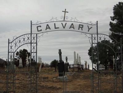
Austin Cemetery
1863
Has Been Placed On The
National Register
Of Historic Places
By The United States Department Of The Interior
& Austin Historical Society
2003 — — Map (db m89531) HM
St. George's Episcopal Church to the east was consecrated in 1878. The Reverend Blackiston swept the congregation with his enthusiasm and eloquence at Easter Service in 1877 to bring forth pledges including the building, retaining wall, pipe organ, . . . — — Map (db m14609) HM
Austin City Hall (1866) Has been placed on the National Register Of Historic Places By the United States Department of the Interior & Austin Historical Society 2003 — — Map (db m89469) HM
In 1880 the Nevada Central Railroad ended at Clifton, just below Austin. Due to exorbitant costs of moving freight to the mining district at the upper end of town, the Superintendent of the Manhattan Silver Mill would be instrumental in developing . . . — — Map (db m156883) HM
Austin Masonic and Oddfellows Hall (1867)
Has Been Placed On The
National Register Of Historic Places By The United States
Department Of The Interior
& Austin Historical Society
2003 — — Map (db m89530) HM
has been placed on the
National Register
of Historic Places
By the United States
Department of the Interior
& Austin Historical Society
2003 — — Map (db m69612) HM
"Went on up the canyon [Simpson Park] which is very wide and
not very steep... on going over the summit the descent was
more abrupt down into the valley... we came to the
Reasses [Reese] River" - Lumin A. Scott, Aug 25, 1859
For guidebook . . . — — Map (db m263656) HM
About one mile northwest lies a natural pass between two low buttes which, prehistorically, the aborigines may have used as a site of ambushing migratory deer herds. Three petroglyph panels are located in this pass. Concerted, cooperative efforts of . . . — — Map (db m14615) HM
Built of lumber from the first International Hotel constructed in Virginia City.
David E. Buel built the hotel after being refused a free lot in Clifton at the mouth of the canyon below.
Buel, Frederick Baker, W.C. Harrington and John E. . . . — — Map (db m69613) HM
Site of the town of Jacobsville is one-half mile north. Founded on the banks of the Reese River in 1859 by George Washington Jacobs who was the first sheriff of Lander County, farmer and businessman, it was the Overland Stage and Mail station and . . . — — Map (db m69649) HM
has been placed on the
National Register
of Historic Places
By the United States
Department of the Interior
& Austin Historical Society
2003 — — Map (db m69610) HM
In 1860, a group of "businessmen" formed the Reese River Navigation Company. The company sent ads and posters back East that showed large streamers on the river towing ore barges up to Battle Mountain. Although nobody knows how the stock was sold, . . . — — Map (db m184153) HM
This simple stone structure, opened to the public in late 1863, was originally operated as a general merchandise store by the firm of Gridley, Hobart and Jacobs. Gridley is best remembered for his 1864 wager which prompted the auctioning of a sack . . . — — Map (db m14612) HM
Standing on this prominent hill is St. Augustine, the oldest Catholic Church in Nevada built in 1866 and is known as the mother church that spawned other catholic churches in Nevada. The church was built from the local quarry and brickyard for . . . — — Map (db m14611) HM
has been placed on the
National Register
of Historic Places
By the United States
Department of the Interior
& Austin Historical Society
2003 — — Map (db m69611) HM
Started in the fall of 1896 and completed in June, 1897, by Ansom Phelps Stokes, mine developer, railroad magnate and member of a prominent eastern family, as a summer home for his sons, principally J.G. Phelps. After the castle (or the tower, as . . . — — Map (db m14436) HM
The Pony Express Trail passed four miles north of Austin through Jacobsville, Simpson's Park and Dry Creek Station. During the Paiute Indian War the stations were burned and two station tenders at Dry Creek were killed and buried there.
. . . — — Map (db m14607) HM
At the heart of every great legend there is a lie, an exaggeration, a falsehood, a distortion, a deception, a myth, or an untruth. Every skilled story teller is a weaver of little lies that form a tale that is worth retelling. Great writers like . . . — — Map (db m184151) HM
The Federal Government historically has supported numerous surveys for the purpose of measuring the domain which extended, after 1848, to the Pacific. These surveys sought railway routes, military relationships, water transport and wagon roads. The . . . — — Map (db m69609) HM
East of the summit, north of the highway, and under a basalt flow lies Toquima Cave. Red, white, and yellow aboriginal drawings (pictographs) decorate its walls.
Usually located near springs, as here, and on migratory big game trails, painted . . . — — Map (db m62126) HM
Frances Williamson, a teacher, helped found and lead the Austin Equal Suffrage League and the Nevada Equal Suffrage Association in 1895. — — Map (db m213135) HM
Battle Mountain's name derives from the mountain range to the southwest, where in 1850 angry California emigrants ambushed a band of Shoshones after the Indians had attacked their wagons.
As a town, it did not spring into existence until . . . — — Map (db m67263) HM
Aurora, founded in 1860, was claimed by both California and Nevada. In 1861, the California legislature created Mono County and fixed the county seat here. In 1863 a border survey showed the camp was in Nevada and the Mono County seat was moved to . . . — — Map (db m49891) HM
This building, the first to be constructed in Hawthorne, is a remnant of the narrow-guage Carson & Colorado Railroad built south from Mound House in 1881. Railroad officials created the town from desert when the first lots were auctioned off on . . . — — Map (db m43175) HM
Formerly known as Six Mile Station, this stage stop and way station provided service between some of the smaller mining camps and Aurora and Bodie, CA during the late 1860's. The area became of greater importance with the arrival of the Carson . . . — — Map (db m37630) HM
Present Mineral Co. Seat -- Former Esmeralda Co. Seat
Townsite selected in 1880 by H. M. Yerington, president of the Carson and Colorado Railroad Co. as a division and distribution site for the new railroad.
The location was adjacent to . . . — — Map (db m44197) HM
Nevada's earliest maps show Walker Lake. Jedediah Smith, the first American into Nevada, passed near here in 1828 during his remarkable trip across the state. Peter Skene Ogden was here in 1829, then Fremont in 1845 with his guide, Joseph Walker for . . . — — Map (db m42358) HM
The history of the Nine Mile Ranch has a long and interesting past, beginning with the Paiute Indians who inhabited this area long before John C. Fremont’s expedition into Nevada in 1843-1844. According to Fremont’s journal he camped in this area . . . — — Map (db m191201) HM
On July 1, 1883 the county seat of Esmeralda County moved from Aurora to Hawthorne. A court house was needed, so a contract to build it for $29125 was awarded. On August 16, 1883 construction began. Corruption and collusion between the contractor . . . — — Map (db m115909) HM
Debuted in the later forties at the Hawthorne Club located at the corner of 5th and E Street, the main intersection of all roads entering Hawthorne. This was a sign of the times with neon lighting. It brightened the intersection with its huge . . . — — Map (db m61068) HM
This memorial dedicated by the Disabled American Veterans and Ladies Auxiliary, Veterans of Foreign Wars and Ladies Auxiliary, American Legion and Ladies Auxiliary and the citizens of Mineral County, Nevada to perpetuate the memory of our valiant . . . — — Map (db m61073) WM
Born July 1840 in Nicaragua. Died February 1, 1915 in Luning, Nevada. Mother of Conchetta, Conception, Juanita, Emma, James A. Marshall, Frank and Frederick Mason.
Ferminia Sarras was born in Nicaragua and immigrated to America in 1867. . . . — — Map (db m311726) HM
Founded in 1873, Belleville flourished by milling the ore from the Northern Belle Mine in Candelaria. The mill located just east of here made its first bullion bar shipment ($9,200) in April, 1875.
Belleville was famous for murders, drunken . . . — — Map (db m89420) HM
Seven miles to the west lie the ghost towns of Candelaria and Metallic City.
Candelaria was presumably named after a mine of that name located in 1885, and also after the Catholic Candelmas Day. Metallic City, the "sin city" of Candelaria, and . . . — — Map (db m42342) HM
Salt pools discovered and developed here in 1862, led to a thriving business by delivering salt to mining mills in Virginia City by camel. Up until this time, the salt was purchased from San Francisco at a rate between 120 & 180 dollars a ton. Sales . . . — — Map (db m89451) HM
Although the area around Walker Lake in the Utah Territory was set aside for “Indian purposes” in 1859, it was not until 15 years later that President Grant signed the executive order formally establishing the Walker River Indian . . . — — Map (db m45076) HM
"This here timeline was originally conceived and written by Mansonian chief Joe Oliver aka EXACT LEE. It was rewritten and gagged up and redrawn by David Silverman aka TUBATRON aka That Flaming Tuba Guy."
Year of the Man 1 . . . — — Map (db m97566) HM
Jesse and Lindsay Applegate headed south from Williamette Valley, Oregon, June 29, 1846, seeking a less hazardous route to that region from the east. On July 21, they came to a large meadow on the Humboldt River, what is now the nearby Rye Patch . . . — — Map (db m67379) HM
Humboldt House or Humboldt Station was originally the point of departure for Humboldt City, Prince Royal, and the mines in that vicinity. In September 1866, it became a stage stop for the historic William (Hill) Beachey Railroad Stage Lines.
. . . — — Map (db m250938) HM
Susan (Susannah) McCord Coon, wife of Isaac Coon, died from the complications of childbirth at this site on August 11, 1860, while on the way to
California from Coles County, Illinois. The child, Robert E. Coon, born on
August 9, survived and . . . — — Map (db m295956) HM
The Applegate-Lassen Trail is a 130 mile stretch of the greater Applegate and Lassen trails which run through Pershing, Humboldt, and Washoe Counties. This section parts from the California Trail at the Humboldt River and Northern end of Rye . . . — — Map (db m244726) HM
The land you presently occupy once stood as a formidable barrier for those who elected to spread westward, and their long-held dreams of prosperity. The account of one Eleazar Stillman Ingalls paints a bleak picture over the canvas of this Grand . . . — — Map (db m166731) HM
"Grass the best I ever saw. Better than any meadow in the
states. There are a large number of campers around us all
cutting grass with sythis" - William R. Brown, Sep 7, 1853
M.E.0. 1996
Guidebook available
Trails West Inc. P.O. Box . . . — — Map (db m263865) HM
"Came to the Sink of St Marys a dreary road, dessolate
as a frozen lake" - William Chamberlain, Aug 4, 1849
M.E.O. 1996
Guidebook available
Trails West Inc. P. O. Box 12035 Reno, Nevada 89510
Emigrant Trail-Humboldt River Route . . . — — Map (db m264103) HM
“Passed down the valley near the slough... the slough water
is considerably impregnated with alkali, but is used for
animals & all other purposes.... No good water below this
slough, nor grass.” - Augustus Ripley Burbank, Aug 30, 1849
. . . — — Map (db m263930) HM
Crazy Corners Saloon was purchased in April of 1978 by Frank and Sandra Myers. When the Myers took over ownership Crazy Corners was not just a bar, it was also a convenience store and gas station. They sold everything from bread to fishing . . . — — Map (db m167005) HM
Dedicated in memory of
Kark O. Olfers
who willed this site and building known as Olfers Garage to the City of Lovelock for the use of the Lovelock Fire Department. A charter member of this department, since June 10, 1934 he served as Chief . . . — — Map (db m46501) HM
Legalized prostitution is part of the colorful chapter in Nevada's history, and Lovelock's paragraph is as red as the lights that marked such establishments.
Irene York owned the La' Belle brothel, which was located "across the tracks" at 140 . . . — — Map (db m238055) HM
Although rarely recognized or celebrated, the members of Northern Nevada's Chinese immigrant population have contributed significantly to the state's history and culture through the building of the Northern Nevada railway system, and their vital . . . — — Map (db m218954) HM
Welcome to Lovelock, where friends, family and lovers come to forever lock their customs symbolically locking one's love on a never-ending chain. It is said that love will endure as long as the lock remains on the chain.
No one knows how or . . . — — Map (db m300450) HM
Mazuma, Nevada was once a small mining town in Pershing County. The name "Mazuma” is
derived from a Yiddish slang word for money. One of four towns settled during the 1907 gold rush in the Seven Troughs Mining District, Mazuma was centrally located . . . — — Map (db m194790) HM
Here was a key point on Nevada's earliest road, the famed Humboldt Trail that brought 165,000 imigrants west in the 1840's and 50's. Travelers named this rich valley the Big Meadows and stopped for water and grass before continuing south to cross . . . — — Map (db m67898) HM
Listed on the National Register of Historic Places, this is the only round court house in daily use in our nation. The circular-hexagon contour was inspired from Thomas Jefferson's library at the University of Virginia. Six Ionic columns in terra . . . — — Map (db m167144) HM
The Seven Troughs Mining District is located at the western slope of the Seven Troughs Mountain Range, just west of Lovelock. The name of the range and mining district comes from the seven water troughs built by a local sheep rancher, Frank M. . . . — — Map (db m167134) HM
The Ice House stood just about 150 feet behind you. It was part of the Pitt Mill & Elevator Company which sold several products including lumber, garden supplies, farm supplies, paint and wall paper. The company was moved to the site around 1912 . . . — — Map (db m166722) HM
Col. Joseph Marzen was born in Germany in 1928 and immigrated to New York City in 1846.
He quickly learned he was born to be a butcher and honed his craft there until he went west to Sacramento, CA in 1851. Not one to settle down yet, he moved on . . . — — Map (db m194789) HM
Rochester was discovered and named in the early 1860s by prospectors from Rochester, New York. The area was relocated in 1912 when Joseph Nenzel discovered large bodies of silver ore which led to the great mining boom a year later. Rochester . . . — — Map (db m168373) HM
Across the road and down about 300 feet was the original Unionville School. Built in 1862, this adobe building was the first public structure in Humboldt County. Used by such organizations as the Union League, Knights of the Golden Circle, the Free . . . — — Map (db m166846) HM
160 entries matched your criteria. Entries 101 through 160 are listed above. ⊲ Previous 100