The fort's most elaborate structure, a two story, Victorian-style mansion, was built in 1884-1885 for about $4,000.00. An expensive home at that time! Among its thirteen rooms (originally designed as a duplex) were a drawing room, a sewing room with . . . — — Map (db m101000) HM
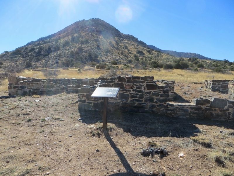
To your right, a spur trail follows a military road 300 yards to the first Fort Bowie ruins.
On July 28, 1862, a 100-man detachment of the 5th California Volunteer Infantry began construction of the primitive fort, completing it two weeks . . . — — Map (db m218624) HM
A Regional Legacy
Cochise. Geronimo. Though their reputations were fierce, the Chiricahua Apaches didn't stop explorers, prospectors, settlers, and merchants from Westward immigration. To establish a lifeline between the East and California, . . . — — Map (db m37761) HM
Enlisted infantrymen found that privacy was not a feature of barracks life. Privates and corporals bunked together in the main room; sergeants occupied small adjoining rooms.
Each soldier stored his military gear and personal belongings on a . . . — — Map (db m101002) HM
Mining activity in Apache Pass started when members of the California Volunteers discovered a, “...gold and quartz bearing ledge...” in 1864. The “Harris Lode” as it became to be known, was later developed by the Apache Pass . . . — — Map (db m100811) HM
Established 1862 following the Battle of Apache Pass, largest conflict in Arizona Indian Wars. Massed Apaches under Cochise and Mangas Coloradas were routed by howitzers fired by California Volunteers attacked in the pass. Fort Bowie overlooked . . . — — Map (db m6994) HM
In March 1854, Lt. John Parke of the Topographical Engineer Corps led a survey party in search of an all-weather route for the transcontinental railroad. After a march of 55 waterless miles through Sulphur Springs Valley, the party entered Apache . . . — — Map (db m100812) HM
The Post Cemetery predated the establishment of Fort Bowie, when soldiers of the California Column were interred here in 1862. The area was unfenced until 1878, when a four-foot adobe wall was erected to protect the graves from desecration by post . . . — — Map (db m68858) HM
The equivalent of the modern army post exchange, the post trader offered for sale items not supplied by the army – toilet articles, sewing supplies, tobacco, medicinal cure-alls, fresh vegetables, canned fruits, and a wide variety of . . . — — Map (db m101003) HM
This frame building with a shingled roof was constructed in 1883 to enlarge the storage space available to the quartermaster. The original adobe storehouse, built in 1868, is immediately to the south.
The post quartermaster and his staff . . . — — Map (db m100954) HM
Two years after the 1872 peace agreement with Cochise, the great Apache chief died. Several hundred Chiricahuas were relocated on the San Carlos Indian Reservation. However, Geronimo and over a hundred of his followers escaped the roundup, to begin . . . — — Map (db m100953) HM
On February 4, 1861, 2nd Lt. George Bascom, and his detachment of 54 men encamped two hundred yards east of here. Bascom’s mission was to find Cochise, recover a kidnapped boy and return livestock assumed taken by the Chiricahua Apaches. . . . — — Map (db m42008) HM
An advance guard of 96 California Volunteers, marching toward the San Simon River to establish a supply depot for the California Column, followed the Butterfield Road through Apache Pass. As they approached the abandoned stage station, Cochise and . . . — — Map (db m100820) HM
In 1857, the government awarded John Butterfield a contract to carry mail by stagecoach between St. Louis and San Francisco. The 2,800-mile route was to be traversed within 25 days. A year later, as the stagecoaches prepared to roll, Butterfiled . . . — — Map (db m100817) HM
The Story: U.S. Indian Agent Thomas Jeffords governed some 900 Chiricahua Apaches here in 1875-76, under the vigilance of the U.S. Army at Fort Bowie.
Cochise, Chiricahua chieftain and friend of Jeffords, died in 1874, leaving the band . . . — — Map (db m100819) HM
The Apache Pass Stage Station was built of stone in July 1858. Within its 6-8 foot-high walls were a kitchen-dining room, sleeping rooms, a storage room for feed and weapons, and a mule corral with portholes in every stall. The stage stopped here . . . — — Map (db m100814) HM
This valley owes its name to the two springs located one mile north of this monument. From 400 A.D. to 1450 A.D. indigenous Indians farmed the region. Their bedrock mortar pits remain on the nearby hill. Later Chiricahua Apaches, Spaniards, . . . — — Map (db m37768) HM
Calcine Motor
October 1906
Weight: 19 tons
Mfg. Copper Queen Reduction Works
Douglas, Arizona Territory
This electric trolley motor was used to pull between 1 and 4 Calcine tank cars loaded from the Roaster Department to the Reverb . . . — — Map (db m269210) HM
At this location on June 5, 1933, First Lady Eleanor Roosevelt, wife of President Franklin Delano Roosevelt, dedicated Douglas International Airport as the first international airport in the United States.
Designed by J. P. Sexton as the . . . — — Map (db m28357) HM
Elizabeth W. Ames, Mayor
City Council
Hector M. Salinas, Ward 1
Richard A. Arzate, Ward 2
Ramon H. Jordan, Ward 3
Harry F. Ames , Ward 4
Margaret Shannon, Ward 5
Rudy Quinonez, Ward 6
R. Delbert Self, City Manager . . . — — Map (db m28295) HM
Built in 1905 by El Paso and Southwest Railroad and the Calumet and Arizona Copper Co., and citizens of Douglas.
Expanded in 1916 to include a gym, a swimming pool and other recreational facilities with additional support provided by the . . . — — Map (db m195862) HM
Library Hall was built in 1901 and has served as a Town Hall, a Church, a School and a Library. The building was given to the City of Douglas in March, 1973, by the Phelps Dodge Corporation. — — Map (db m28298) HM
Has been designated a
National
Historic Landmark
This site possesses National significance
in commemorating the history of the
United States of America
1964 — — Map (db m28301) HM
On May 5, 1862, a Confederate foraging party rounding up cattle near the abandoned Butterfield Overland Mail Station battled a group of Apaches. The soldiers were members of Company A, Governor John R. Baylor's Regiment of Arizona Rangers, under . . . — — Map (db m83149) HM
The San Antonio and San Diego Mail Line began service across Arizona to the Pacific coast in July, 1857. Its route included a stop here near the Dragoon spring. The San Antonio Line was commonly known as the "Jackass Mail" because mules were used . . . — — Map (db m76940) HM
In 1895, seventeen-year-old William Walter Adams left Coleman County, Texas, to visit his older brother, Dave A. Adams, who was one of the first of the Adams family to settle in the Little Dragoon Mountains of Cochise County. "Will," soon decided . . . — — Map (db m216038) HM
Lt. John A. Rucker, 6th Cav. U.S.A. perished in proximity in flooded White River July 11, 1878 attempting to save life of Lt. Austin Henely
Also on this site 1884-1943 ranch headquarters of Gray - Hampe - Rak — — Map (db m42057) HM
Camp Supply served as the base for two companies of Indian Scouts: Company C commanded by 2nd Lieutenant John A. Rucker, and Company D led by 1st Lieutenant Austin Henely. Each Company included between 32 and 40 Scouts who enlisted for 6 months at a . . . — — Map (db m42080) HM
The Bakery was first described in Camp records in May, 1879. It was a log building with an earth roof and an adjacent guardhouse. The nearby storehouse (commissary) was a stockaded tent structure with vertical log walls and a canvas tent roof. In . . . — — Map (db m151079) HM
June, 1876 - The Chiricahua Apache Indian Reservation is abolished. Apaches who are not relocated to other reservations are labeled renegades. Military patrols are sent throughout southeastern Arizona in search of them.
March, 1878 - . . . — — Map (db m42087) HM
Camp Supply became known as Camp Rucker as a result of a tragic incident that took place soon after the camp was established.
On July 11, 1878, a flash flood occurred in White River Canyon (now Rucker Canyon). Lieutenants John A. . . . — — Map (db m151081) HM
Camp Rucker was a ranching headquarters for over 80 years. The first owner was Michael Gray, a Justice of the Peace in Tombstone, Arizona. He moved to Camp Rucker in 1883 under the privileges of a “Squatters Claim.” Gray was strongly . . . — — Map (db m42077) HM
During the Chiricahua Apache Campaign (1861-1886) cavalry troops on maneuvers camped here at a permanent source of water known as Soldiers Hole.
W. C. Sanderson and Ambrose Lyall struck artesian water nearby in 1883.
In 1892 a . . . — — Map (db m28363) HM
The population of the San Pedro Valley, once Native American, was flooded with new cultures in the nineteenth century.
New immigrants from Europe and Mexico were hired to work the mines and stamp mills. The Montezuma Hotel and saloon was once . . . — — Map (db m249897) HM
Fairbank was founded during the 1880's silver mining boom. Once called Kendall, it began as a stagecoach stop on the way to Tombstone, which was then one of the biggest towns in the West. The wild characters that made Tombstone famous also walked . . . — — Map (db m249981) HM
In 1905 the Boquillas Land and Cattle Company evicted most of the town residents. Rather than leave them to their evictors, townspeople knocked their own houses down with sledgehammers.
The schoolhouse was built around 1920 and was used until . . . — — Map (db m249975) HM
The San Pedro Riparian National Conservation Area has a storied past well beyond its designation as a sanctuary for its riparian ecosystem. The following narrative provides a brief history regarding the use of this area as a military installation . . . — — Map (db m250008) HM
The people of Fairbank enjoyed exotic foods such as oysters on the half-shell packed in ice and other goods brought in on the trains. Nearly everything moved by train; building materials, manufactured goods, and foodstuffs came to Fairbank, while . . . — — Map (db m249983) HM
While the silver mines were near Tombstone, the mills that processed the silver ore were along the San Pedro River. Why go to all the trouble to haul heavy wagon loads of ore all that way?
Water! It took enormous amounts of water to run the . . . — — Map (db m249980) HM
Fairbank is the most intact historic townsite along the San Pedro River. It is managed by the Bureau of Land Management (BLM) as part of the San Pedro Riparian National Conservation Area (SPRNCA), established in 1988 to protect its natural and . . . — — Map (db m249872) HM
This jail, built in 1910, replaced a tiny wooden jail which once stood nearby. Constructed entirely of reinforced concrete, it has withstood a hundred years of weather, escape attempts, vandals, neglect, and pillagers (official and otherwise): It . . . — — Map (db m64206) HM
At this location in 1952, a large bone bed was discovered containing the remains of extinct mammoth, tapir, bison and horse. Found with the bones were the weapons and tools of the Indians who had killed and butchered these animals. The bones and . . . — — Map (db m43633) HM
Spanish:
En el año 1539, recordando aún el anuncio de la conquista del imperio inca que occurrió en 1533, el virrey Antonio de Mendoza receloso pero con te a la vez, envió a un sacerdote para comprobar los rumres [rumores] sobre ricas . . . — — Map (db m28255) HM
Situated on the southern route to the Pacific Ocean, it brought law and order to the Arizona Territory, protecting settlers, miners, travelers and immigrants. Its troops won the surrender of Geronimo. Generals Pershing and Wood served here.
As . . . — — Map (db m27897) HM
The remains of this noted gunman and outlaw lie here. A teamster traveling from West Turkey Creek found the body sitting in the fork of a nearby oak tree with a bullet hole in the right temple.
A coroner's jury reported the death to be suicide, . . . — — Map (db m28365) HM
A Post Office was established in the Pearce Camp in 1896. At that time the Soto Bros and Chattman Store served as the first Post Office location with Thomas Chattman as the first appointed postmaster. The Post Office was later relocated to this . . . — — Map (db m64204) HM
Near here Geronimo, last Apache Chieftain, and Nachite with their followers surrendered on Sept. 6th 1886 to General Nelson A. Miles. U. S. Army. Lieutenant Chas. B. Gatewood with Kieta and Martine Apache scouts, risked their lives to enter the camp . . . — — Map (db m28355) HM
Dedicated to the
Engineering Achievements of
Percy Jones, Jr.
1888 –
Chief locating engineer who by sheer genius personally located more miles of Arizona highways than any other person. His college training in mining and geology . . . — — Map (db m37899) HM
Dedicated to the
Engineering Achievements of
Percy Jones, Jr.
1888 –
Chief locating engineer who by sheer genius personally located more miles of Arizona highways than any other person. His college training in mining and geology . . . — — Map (db m37900) HM
Built 1979 – 1980
Master Sergeant
Lorenzo Alvarado
1893 – 1974
In memory of all Americans who served their country with valor and gallantry during World War I and World War II in the pursuit of freedom and liberty for . . . — — Map (db m49433) WM
Constructed in 1956, the William Carmichael Elementary School was the first school to be built in the new Sierra Vista School District. The school first opened its doors on September 5, 1956, with 16 classrooms for 500 children in grades . . . — — Map (db m83848) HM
335 North Garden Avenue
Built in 1905
This is perhaps the oldest building still standing in Sierra Vista. Mr. John Reilly homesteaded the property and received the patent for the land in March of 1911. John Reilly and his wife Ellen sold . . . — — Map (db m27895) HM
The Carmichael House was built by William and Margaret Ziegan Carmichael on 131.05 acres. On December 11, 1911, Margaret, a single woman at the time, purchased the property from John and Ellen Reilly for $8,000. As the years passed, the Carmichael . . . — — Map (db m27894) HM
Dedicated 9, July 1993
In honor of
Command Sergeant Major
Clovis D. Ice
United States Army
1933 – 1991
CSM Ice was a pioneer in military intelligence, airborne and special forces operations. He was a principal developer of . . . — — Map (db m28234) HM
This site is within the Oliver Fry 280-acre homestead, which was filed August 11, 1912; the patent (or deed) was received August 11, 1916. Erwin Fry, the second oldest of Oliver and Elizabeth Fry's ten children, became the owner of this site. In . . . — — Map (db m27892) HM
The Crazyhorse system was fielded in 1985 to meet the need for a capability to locate unique electronic emissions in Central America. It consisted of three RC – 12G airframes converted from C – 12D aircraft by Sanders Associates, . . . — — Map (db m29587) HM
The Mohawk is a high-performance, two-seat, observation aircraft made by the Grumman Corporation. The first model flew in 1959 and the last came off the production line in 1970. First deployed in 1962, it became the mainstay of Army aerial . . . — — Map (db m29588) HM
This cemetery
holds the remains of
18 California Volunteers who died
at Fort Lowell during the Civil War and a
Civil War Veteran of the U.S. Colored Troops.
Their graves are marked with a GAR star.
Sgt. John C. McQuade - Co.B, 2 Calif. . . . — — Map (db m33745) HM
400 W. Fry Blvd.
Built in 1942
Originally constructed as a USO Club on land purchased by the U.S. Government from Mrs. Margaret Carmichael for the sum of $1.00, this facility served military personnel during World War II. It was closed during . . . — — Map (db m27893) HM
Dedicated to the
Arizona Mining, Sand and Gravel Industry
by E.J. Cyr on 1/1/93
History: Built in 1905 by Ingersoll Rand for the Inspiration Consolidated Copper Co. in Miami, Arizona to power a 150 ton air compressor.
Antique wheel . . . — — Map (db m48595) HM
"Buckskin" Frank Leslie killed Billy Claiborne here on November 14th, 1882.
Luke Short killed Charlie Storms here on February 25th, 1881. — — Map (db m269189) HM
In 1877 Ed Schieffelin searched the San Pedro hills for silver. Soldiers at Fort Huachuca warned the prospector that he would only find his tombstone since this land was patrolled by the Apache warrior Geronimo. But Ed found silver, and jokingly . . . — — Map (db m269186) HM
This 1881 double adobe was the site of Garet & Page's Wagon Shop. To your left was the charcoal yard. Charcoal was a primary source of heat for both forges and homes in the early 1880's. This block was part of "Hop Town", the heart of Tombstone's . . . — — Map (db m249782) HM
March 28, 1884
Dan Dowd •
Dan Kelly •
Red Sample •
James Howard •
William Delaney
November 16, 1900
William Halderman •
Thomas Halderman
This gallows is a reconstruction. The original was burned in 1912 at the time . . . — — Map (db m249785) HM
Born in Saginaw, Mich., in 1860, English, a law graduate, moved to Tombstone in 1880. He first worked as a miner, then became a partner in Smith & Goodrich law firm. He also served 3 terms as Cochise County District Attorney.
English's . . . — — Map (db m131100) HM
This structure has been
recorded by the
Historic American
Buildings Survey
of the United States Department
of the Interior for its
archives at the Library of Congress. — — Map (db m48526) HM
Tombstone, Arizona dates to 1877, when prospector Ed Schieffelin discovered silver and named his first mine Tombstone. By 1879, a town had sprung up in a relatively flat area nearby. Gunslingers, gamblers, prospectors, Chinese laborers, and fancy . . . — — Map (db m220542) HM
This Tombstone Cemetery gives mute testimony to the hardships of Western frontier life. The people buried here were housewives, painted ladies, outlaws, gamblers, miners, business men and women, blacksmiths, cowboys and those "who died with their . . . — — Map (db m27926) HM
In 1879, Charles Brown opened the Mohave Hotel and one of the first "hash houses" in a tent on this corner. By 1880 he erected a two story adobe building with what was now called the Brown Hotel on the second floor. He had a kitchen large enough to . . . — — Map (db m249813) HM
Bob Hatch and John Campbell opened a billiard parlor in 1880. Bob Hatch was a colorful character and an amateur thespian. It was said he kept a jar of frogs on the counter as their croaking helped him predict the weather. He followed the Earps to . . . — — Map (db m48516) HM
The Can Can Restaurant was established in 1879 by Quong Kee. It was one of Tombstone's best known restaurants. In 1886 it was purchased by John Henninger who turned it into a first class eating establishment. It had a number of proprietors until . . . — — Map (db m48513) HM
The first business in Tombstone was opened on this corner by J.B. Allen. In 1879 it was purchased by Phillip Smith who opened the Pioneer Store and an agency of the Pima County Bank within the store. When Cochise County was established, Smith . . . — — Map (db m48514) HM
In 1882, construction began on the Cochise County Courthouse. A kiln was constructed and brick makers were hired to make brick to construct the new courthouse. The cornerstone was laid on August 11, 1882 and the beautiful Victorian Building was . . . — — Map (db m249809) HM
Johnny Ringo was a proud member of the Cowboy gang and a business partner of their outlaw leader, Ike Clanton. In March 1882, five months after the Gunfight
at the O.K. Corral, Wyatt Earp's younger brother Morgan was murdered in Tombstone — and . . . — — Map (db m269185) HM
Prospector and miner, whose discoveries of silver in 1877 and 1878 at the Tombstone, Lucky Cuss, Goodenough, Toughnut and Contention mining claims led to the founding of the City of Tombstone.
This statue, created by sculptor Tim Trask of St. . . . — — Map (db m249810) HM
The son of a miner, Ed learned everything about prospecting from his father, except how to strike it rich! For twenty years, Ed prospected the west. He tried the "regular life," but after 18 months remarked: "No better off than I was prospecting, . . . — — Map (db m27933) HM
These “Cowboys” were killed in the Gunfight at the O.K. Corral. Shot in the head, Frank McLaury died instantly on the Fremont Street sidewalk. Wounded, Tom
McLaury and Billy Clanton were carried into this building.
Tom died in minutes, hit by a . . . — — Map (db m269184) HM
The attorney for the Earps' at their 2nd trial after the O.K. Corral gunfight. He wrote 3/4 of the Arizona State Constitution.
2nd Plaque
This property has been placed on the National Register of Historic Places by the United States . . . — — Map (db m249868) HM
In 1879 there were 11 people in Tombstone of Chinese descent. By 1882 there were 250. The area between 2nd and 3rd and Allen and Toughnut was the area where they lived and had businesses, commonly called "Hoptown". The Chinese ran laundries, . . . — — Map (db m131096) HM
This building was built ca 1900 for lawyer's offices, and was converted to apartments when the county seat was moved to Bisbee in 1929. — — Map (db m249784) HM
1848 entries matched your criteria. Entries 101 through 200 are listed above. ⊲ Previous 100 — Next 100 ⊳