By Michael Herrick, November 17, 2010
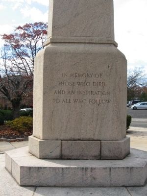
Greenwich World War I Memorial
| On Greenwich Avenue at Arch Street, on the right when traveling south on Greenwich Avenue. |
| On East Putnam Avenue (U.S. 1) at Park Place, on the left when traveling north on East Putnam Avenue. |
| On East Putnam Avenue (U.S. 1) at Old Church Road, on the left when traveling north on East Putnam Avenue. |
| On North Street at Clapboard Ridge Road, on the right when traveling south on North Street. |
| On Greenwich Avenue at Arch Street, on the right when traveling south on Greenwich Avenue. |
| On Maple Avenue at East Putnam Avenue (U.S. 1), on the right when traveling north on Maple Avenue. |
| On Byram Shore Road at Byram Dock Road, on the left when traveling south on Byram Shore Road. |
| On East Putnam Avenue (U.S. 1) at Sinawoy Road, on the left when traveling north on East Putnam Avenue. |
| On Strickland Road at Loughlin Avenue, on the left when traveling south on Strickland Road. |
| Near Strickland Road at River Road, on the right when traveling south. |
| On Sound Beach Avenue, on the left when traveling north. |
| On Monroe Turnpike (Connecticut Route 111) at Church Street, on the left when traveling north on Monroe Turnpike. |
| On Pepper Street at Green Street, on the right when traveling north on Pepper Street. |
| On Pepper Street at Main Street (Connecticut Route 25), on the right when traveling north on Pepper Street. |
| On Main Street (Connecticut Route 25) at Green Street, on the right when traveling south on Main Street. |
| On Main Street (Connecticut Route 25) 0.1 miles north of Knollwood Street, on the right when traveling north. |
| On Main Street (Connecticut Route 25) at Easton Road (Connecticut Route 59), on the right when traveling south on Main Street. |
| On Monroe Turnpike (Route 111) at Church Street, on the left when traveling north on Monroe Turnpike. |
| On Monroe Turnpike (Connecticut Route 111) at Fan Hill Road, on the left when traveling north on Monroe Turnpike. |
| On Fan Hill Road at Church Street, on the left when traveling north on Fan Hill Road. |
| On Main Street (Connecticut Route 25) at Pepper Street, on the left when traveling south on Main Street. |
| On Monroe Turnpike (Connecticut Route 111) at Fan Hill Road, on the left when traveling north on Monroe Turnpike. |
| On Fan Hill Road at Monroe Turnpike (Connecticut Route 111), on the left when traveling south on Fan Hill Road. |
| On Main Street (Connecticut Route 25) at Green Street, on the right when traveling south on Main Street. |
| On Monroe Turnpike (Connecticut Route 111) at Fan Hill Road, on the left when traveling north on Monroe Turnpike. |
| On Main Street (Connecticut Route 25) at Mill Street, on the left when traveling south on Main Street. |
| On Main Street (Connecticut Route 25) at Purdy Hill Road, on the right when traveling north on Main Street. |
| On Monroe Turnpike (Route 111) at Moose Hill Road, on the right when traveling north on Monroe Turnpike. |
| On Main Street (Connecticut Route 124) 0 miles north of East Avenue (Connecticut Route 106), on the left when traveling north. |
| On Oenoke Ridge (Connecticut Route 124) at Pinney Road and Lukes Wood Road, on the right when traveling north on Oenoke Ridge. |
| On Connecticut Route 37, 0.1 miles north of Brush Hill Road (Connecticut Route 39), on the left when traveling north. |
| On Ball Pond Road (Connecticut Route 39) 0.1 miles north of Gilloti Road, on the left when traveling north. |
| On Connecticut Route 37, 0.1 miles north of Brush Hill Road (Route 39), on the left when traveling north. |
| On Main Street (Connecticut Route 25) at Church Hill Road (Connecticut Route 6), on the right when traveling south on Main Street. |
| On Church Hill Road (U.S. 6) at Queen Street, on the right when traveling east on Church Hill Road. |
| On Main Street (Connecticut Route 25) at East Street, on the right when traveling south on Main Street. |
| On Main Street (Connecticut Route 25) at Church Hill Road (U.S. 6), on the right when traveling south on Main Street. |
| On Main Street (Connecticut Route 25) at Schoolhouse Hill Road, on the right when traveling north on Main Street. |
| On Glover Avenue at Main Street (Connecticut Route 25), on the right when traveling west on Glover Avenue. |
| On Main Street (Connecticut Route 25) at Church Hill Road (U.S. 6), on the right when traveling south on Main Street. |
| On Church Hill Road (U.S. 6) at Queen Street, on the right when traveling west on Church Hill Road. |
| On Seaview Avenue at East Avenue, on the left when traveling south on Seaview Avenue. |
| On France Street at Adams Avenue, on the left when traveling north on France Street. |
| On East Avenue, on the right when traveling north. |
| Near Seaside Place, on the right when traveling south. |
| On Hillside Place at Elmwood Avenue, on the right when traveling west on Hillside Place. |
| On Sunset Hill Avenue near East Avenue, on the right when traveling east. |
| On Seaview Avenue at East Avenue, on the left when traveling south on Seaview Avenue. |
| On E Wall Street at Park Street, on the right when traveling east on E Wall Street. |
| On East Avenue at Fort Point Street, on the left when traveling south on East Avenue. |
| On East Avenue at Park Street, on the right when traveling south on East Avenue. |
| On St. Paul’s Place, on the right when traveling west. |
| On Martin Luther King Drive at Washington Street, on the right when traveling west on Martin Luther King Drive. |
| On St. Paul’s Place, on the right when traveling west. |
| On St. Paul’s Place, on the right when traveling west. |
| On Seaview Avenue at East Avenue, on the left when traveling south on Seaview Avenue. |
| On Calf Pasture Beach Road, on the right when traveling north. |
| On Calf Pasture Beach Road, on the left when traveling east. |
| On Calf Pasture Beach Road, on the left when traveling east. |
| On Gregory Boulevard at Marvin Street, in the median on Gregory Boulevard. |
| On Canfield Avenue, on the left when traveling east. |
| On Calf Pasture Beach Road, on the right when traveling east. |
| On Calf Pasture Beach Road, on the right when traveling north. |
| On Ponus Avenue at Nursery Street, on the right when traveling south on Ponus Avenue. |
| On Rowayton Avenue at Wilson Avenue, on the left when traveling south on Rowayton Avenue. |
| Near Putnam Park Road (Connecticut Route 58) at Connecticut Route 107, on the right when traveling south. |
| Near Putnam Park Road (Connecticut Route 58) at Connecticut Route 107, on the right when traveling south. |
| Near Putnam Park Road (Connecticut Route 58) near Connecticut Route 107, on the right when traveling south. |
| On Putnam Park Road (Connecticut Route 107) at Black Rock Turnpike (Connecticut Route 58), on the right when traveling west on Putnam Park Road. |
| Near Putnam Park Road (Connecticut Route 58) near Connecticut Route 107, on the right when traveling south. |
| Near Putnam Park Road (Connecticut Route 58) near Connecticut Route 107, on the right when traveling south. |
| Near Putnam Park Road (Route 58) at Connecticut Route 107, on the right when traveling south. |
| Near Putnam Park Road (Connecticut Route 58) at Connecticut Route 107, on the right when traveling south. |
| Near Putnam Park Road (Connecticut Route 58) near Connecticut Route 107, on the right when traveling south. |
| Near Putnam Park Road (Connecticut Route 58) at Connecticut Route 107, on the right when traveling south. |
| On Cross Highway at Sanfordtown Road, on the left when traveling east on Cross Highway. |
| On Pocahontas Road, on the right when traveling west. |
| On Putnam Park Road (Connecticut Route 107) at Black Rock Turnpike (Connecticut Route 58), on the right when traveling west on Putnam Park Road. |
| On Putnam Park Road (Connecticut Route 107) 0.1 miles east of Lonetown Road, on the right when traveling west. |
| Near Putnam Park Road (Connecticut Route 58) at Connecticut Route 107, on the right when traveling south. |
| Near Putnam Park Road (Connecticut Route 58) at Connecticut Route 107, on the right when traveling south. |
| Near Putnam Park Road (Connecticut Route 58) near Connecticut Route 107, on the right when traveling south. |
| Near Putnam Park Road (Connecticut Route 58) at Connecticut Route 107, on the right when traveling south. |
| On Lonetown Road (Connecticut Route 107) at Hill Road, on the left when traveling south on Lonetown Road. |
| On Black Rock Turnpike (Connecticut Route 58) at Cross Highway, on the left when traveling north on Black Rock Turnpike. |
| On Lonetown Road at Hill Road, on the right when traveling south on Lonetown Road. |
| On Sanfordtown Road at Cross Highway, on the left when traveling south on Sanfordtown Road. |
| On Pocahontas Road, on the right when traveling west. |
| Near Putnam Park Road (Connecticut Route 58), on the right when traveling south. |
| Near Pocahontas Road, on the right when traveling west. |
| On Main Street (Connecticut Route 35) at Catoonah Street, on the right when traveling south on Main Street. |
| Near Main Street (Connecticut Route 33/35) north of King Lane, on the right when traveling north. |
| On Bailey Avenue at Main Street (Connecticut Route 35), on the left when traveling east on Bailey Avenue. Reported missing. |
| On Main Street at Prospect Street, on the right when traveling south on Main Street. |
| On Main Street, on the right when traveling north. |
| On Main Street, on the right when traveling north. |
| On Main Street (Connecticut Route 35) at King Lane, on the right when traveling north on Main Street. |
| On Governor Street at Main Street (Connecticut Route 35), on the right when traveling west on Governor Street. |
2437 entries matched your criteria. Entries 201 through 300 are listed above.
⊲ Previous 100 —
Next 100 ⊳