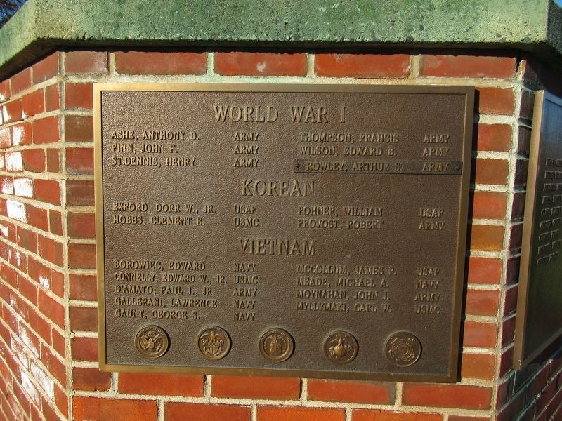
On Main Street at School Street, on the left when traveling south on Main Street.
A nation reveals itself not only by the men it produces, but also by the men it honors and the men it remembers……..
President John F. Kennedy
The Agawam Veteran War Memorial
Dedicated this 27th Day of May 1989
In honor of all Agawam . . . — — Map (db m111456) WM
Near Main Street at River Road, on the right when traveling south.
Massachusetts Veterans Memorial Cemetery
Agawam, Massachusetts
Dedication
May 21, 2001
The Massachusetts Veterans Memorial Cemetery is dedicated to the
Commonwealth’s Veterans and their families, as a lasting memorial and final resting . . . — — Map (db m111242) WM
Near Main Street at River Road, on the right when traveling south.
Dedicated
To
U.S.N. Armed Guard of World War II
The Armed Guard of World War II came into existence on April 15, 1941 as USN Naval Reserves began special gunnery training on September 25, 1941. Orders were given to train 200 officers and 1000 . . . — — Map (db m284439) WM
On Springfield Street close to McKinley Street, on the left when traveling north.
This M-60 Tank Monument
is in Honor of All Veterans
Past - Present - Future
Take a Moment to Honor and
Thank a Veteran for Their
Service and Sacrifice — — Map (db m288933) WM
On Otis Stage Road (Massachusetts Route 23) at N Blandford Road, on the left when traveling east on Otis Stage Road.
Through this place passed General Henry Knox in the winter of 1775 – 1776 to deliver to General George Washington at Cambridge the train of artillery from Fort Ticonderoga used to force the British Army to evacuate Boston. Erected by the . . . — — Map (db m24011) HM
Near Main Street (U.S. 20) 0.1 miles east of Mill Lane Road, on the right when traveling east.
Auctioneer Gordon Reid gathered sixty-seven dealers on this farmland, aptly called “Auction Acres”. He launched the “Greatest Antique Show Under the Sun” envisioning Brimfield as the antiques center of the nation, and during his lifetime, the dream . . . — — Map (db m260042) HM
On Cross Street north of Main Street (U.S. 20), on the right when traveling north.
Dedicated to the men and women of Brimfield
who left their homes to serve a free nation.
May God help us preserve
the memory of their sacrifice.
Erected by the Town
1999
World War II
1941 - 1946
Arnold, H.R. • Arnold, K.F. • . . . — — Map (db m260078) WM
The Civilian Conservation Corps (CCC) was created by president Franklin Roosevelt during the Great Depression to provide employment opportunities and to improve the country’s forest and recreation resources.
Administration and logistics were the . . . — — Map (db m106408) HM
On Sturbridge Road at Brookfield Road, on the right when traveling west on Sturbridge Road.
These of the Hitchcock Free Academy served
their country in the Great War
Died in Service
Mason M. Howlett • Charles Saltzman • Charles M. Streeter
[Honor Roll of Veterans]
Harold L. Andrews • Charles E. Baxter • Ralph H. . . . — — Map (db m118911) WM
On U.S. 20 close to Warren Road ( Route 19), on the left when traveling east.
Two miles distant on Indian Hill is the site of an Indian stronghold and storehouse for corn, Quaboag Old Fort, and of the Indian village of Ashquoach. — — Map (db m48776) HM
Four miles distant on the summit of East Waddaquodduck Mountain is Steerage Rock, a landmark on the Indian trail which became known as the Bay Path and a guidepost to the pioneer settlers of the Connecticut Valley from
Massachusetts Bay in 1636. — — Map (db m88553) HM
On Main Street (U.S. 20) 0.1 miles west of Wales Road ( Route 19), on the right when traveling west.
Nestled between the Quinebaug and Quaboag Rivers and adorned by two natural bodies of water – Little Alum and Sherman Pond – the Brimfield area … was widely used by Native American prior to European contact. Their network of trails, beginning . . . — — Map (db m260087) HM
On Front Street at Center Street ( Route 116), on the right when traveling west on Front Street.
For 150 years this cluster of red brick mill buildings on the Chicopee River served as the community's industrial anchor. The complex was conceived, designed and built by America's first generation of venture capitalists, the legendary Boston . . . — — Map (db m56051) HM
On Front Street at Bonneville Avenue, on the right when traveling east on Front Street.
Top This monument dedicated by the citizens of Chicopee in honor of all who served in the armed forces of the United States during World War Two. This emblem with the spread eagle was awarded to all honorably discharged service personnel. . . . — — Map (db m54843) HM
On Front Street at Bonneville Avenue, on the right when traveling east on Front Street.
Front 1861 Civil War 1865 The War Between the States A family struggle that reunited the nation From Chicopee 931 men served 72 lost their lives while serving their names are recorded on two tablets at the entrance of city hall . . . — — Map (db m54870) HM
On Front Street east of Center Street, on the right when traveling east.
[Plaque]
• Alton E. Phillips, Lieut. Co. E. 1st Mass. Cav, Died of wounds near Rapidan Station Va. May 4 1863
• Francis A. Bushee, Co. F. 1st Mass. Cav. Killed in action at Ashland Station Va. May 11 1864
• Benjamin F. . . . — — Map (db m198115) WM
On Front Street at Bonneville Avenue, on the right when traveling east on Front Street.
Top-front "The Chicopee Veterans Organizations erect this monument to honor all who served in the United States Armed Forces during the Korean War. June 1950 July 1953 Especially remembered are these 13 men who made the supreme sacrifice . . . — — Map (db m54844) WM
On Church Street south of Bridge Street / Broadway Street, on the left when traveling south.
Dedicated to Lt. Gen. Arthur MacArthur U.S. Army by the people of Chicopee, Mass. on September 7, 1942 Born in house at this square June 2, 1845 Died September 5, 1912 — — Map (db m56053) HM
On Front Street near Center Street, on the right when traveling east.
[Plaque]
• Alden Portger, Co. F. 10th Mass. Inf. Died in hospital near Washington, D.C. Oct. 7. 1861.
• George D. Justin, Co. F. 10th Mass. Inf. Died of wounds at Davids Island, N.Y. Aug. 22. 1862.
• Lucien Robertson, Co. F. . . . — — Map (db m198116) WM
On Pvt Szot Drive south of Front Street, on the right when traveling south.
Erected to honor his comrades and him who gave their lives. A war to win that you and I might live and be in this land of the brave and the free — — Map (db m56056) WM
On Front Street at Center Street ( Route 116), on the right when traveling west on Front Street.
The sycamores have survived hurricanes, floods, an industrial revolution and the onslaught of modern urbanization. These handsome trees were growing here in 1848 when the citizens of Cabotville petitioned the legislature for the right to . . . — — Map (db m56052) HM
On Front Street east of Center Street, on the right when traveling east.
This municipal government building, designed by Charles E. Parker, noted Boston architect, is patterned in architectural design after the famous Palazzo Vecchio in Florence, Italy. The unique tower is 147 feet high. Construction work started in 1870 . . . — — Map (db m198113) HM
On Pvt Szot Drive south of Front Street, on the right when traveling south.
Upper Plaque They, too, wanted only to live by the side of this Park and be a friend to man. Instead, off to war they went, by their sense of duty sent, in response to pleas, of peoples, forced to their knees. Some gave all they had others did . . . — — Map (db m56054) WM
On Center Street (Massachusetts Route 116) at Cabot Street, on the right when traveling south on Center Street.
A thousand battles of land and sea and air echo the glory of the valiant deeds of these men who gave their lives in battle. Because of them our lives are free. Because of them our nation lives. May we always honor their memory. Civil War U.S. . . . — — Map (db m56050) WM
On Bonneville Avenue south of Front Street, on the right when traveling north.
Front - Top This campaign ribbon awarded to all who proudly served with the armed forces in Vietnam Front - Left Panel U.S. ARMY MACV 2/62 to 3/73 12 Infantry Divisions 367 units 1t Inf. - 2nd Inf. - 3rd Mech - . . . — — Map (db m54871) HM
On Front Street at Bonneville Avenue, on the right when traveling east on Front Street.
North side CHICOPEE Erects this monument in grateful memory of all her sons who served on land and sea in the World War 1914-1918 West side DIED OF DISEASE Ralph Anderson Charles Bancroft . . . — — Map (db m54869) HM
On Granby Road at Main Road ( Route 57), on the right when traveling north on Granby Road.
The Granville Citizens Park
The park that occupies this small bit of land, along with its immediate surroundings, was once a busy place. Adjacent to the park, J.M. Gibbons' General Store, built in 1851, accommodated not only the Post Office, but . . . — — Map (db m97470) HM
On Main Street at North Road, on the left when traveling east on Main Street.
Site of the
First Church in Hampden
Destroyed by Fire
January 26, 1924
Building erected on
Village Green 1783
Moved to this corner
1838 — — Map (db m263623) HM
On Sturbridge Road at E Brimfield Road, on the right when traveling east on Sturbridge Road.
In memory of
Benjamin Church
1756-1832
Soldier of the American Revolution
served in
General Lee’s Life Guard, 1775
General Artemus Ward’s Life Guard and
Captain Burbank’s Artillery, 1776
General Washington’s Life Guard, 1776
Took . . . — — Map (db m293391) HM WM
On Sand Nill Road at Sturbridge Road, on the right when traveling south on Sand Nill Road.
Dedicated to the men and women
of the town of Holland
who served their country
in its wars
World War I
The names of 8 servicemen
World War II
The names of 34 service men and women — — Map (db m106287) WM
On Hampden Street west of Maple Street, on the left when traveling west.
Dedicated to the memory and honor of those men from Holyoke who gave their lives in the Korean Conflict 1950-1955 Norman Brissette • William G. Carroll • Anthony J. Castro • Roland V. Charpentier • Richard F. Donoghue • Roland J. Dostie • Robert O. . . . — — Map (db m56043) WM
Near Mount Tom Ski Road, on the right when traveling west.
On July 9, 1946 at 10:30 PM a B-17 "Flying-Fortress" bringing twenty-five servicemen home crashed at this site. No one survived. — — Map (db m96098) HM WM
On Jackson Street at Maple Street, on the right when traveling east on Jackson Street.
Dedicated to the memory of 2nd Lt. William J. Sheard Co. G 157th Inf. Regt. 7th Army Sept. 11, 1911 + Dec. 21, 1944 Killed in Action in Germany during World War II Lt. Sheard was a love of sports and a credit to this community in which he lived . . . — — Map (db m56047) WM
On Hampden Street west of Maple Street, on the left when traveling west.
Center monument With sincere appreciation to the men of Holyoke who gave their lives in the Republic of Vietnam. To the men and women called upon to serve during an era of discord and turmoil and did so with great personal strength and . . . — — Map (db m56044) HM
On East Street west of Chestnut Street, on the right when traveling west.
Dedicated to
those citizens
of the
Town of Ludlow
who answered the
call to colors
in our great wars
In Memoriam
World War II
Clarence E. Abair •
Steve Andrusik •
Joseph J. Bigda •
Harry Bosyk •
Aldo Bramucci • . . . — — Map (db m284276) WM
On Riverside Drive east of East Street, on the right when traveling east.
The Ludlow Manufacturing Company had a
vision for the town: create jobs for its residents,
provide housing, schools, recreation and it will
prosper. Prosper the town did. Among the
amenities provided: The Hubbard Memorial
Library, Ludlow . . . — — Map (db m285209) HM
On Riverside Drive, on the right when traveling north on Riverside Drive.
In the heart of Ludlow, a reminder of the
town's industrious past re-emerges: the
restored Ludlow Mills Clock Tower.
Overlooking the Ludlow Mills Complex, this
historic structure stands tall, an enduring
symbol of Ludlow's resilience and . . . — — Map (db m285245) HM
On Riverside Drive south of East Street, on the right when traveling east.
With an area of approximately 27 square miles, Ludlow was originally
renowned for its fertile land, large farms and was largely known to be an
agricultural community. Most farms were between 50 and 100 acres in size
with several dairy farms . . . — — Map (db m285286) HM
On Chestnut Street south of Windsor Street, on the right when traveling south.
Stone marker & bell from original high school
(stone marker)
Built A.D. 1882
by the
Ludlow MFG Co.
(bell)
From Meneelys West Troy N. Y. 1855. — — Map (db m284497) HM
On Winsor Street at Worcester Street, on the right when traveling east on Winsor Street.
(front, center)
Erected in honor of the men and women of Portuguese descent of Ludlow, Mass. who served in World War II
Inaugurated November 14, 1943
(back, center, in Portuguese)
Em honra dos homens e mulheres de . . . — — Map (db m284961) WM
On Winsor Street east of Worcester Street, on the left when traveling west.
Gremio Lusitano & Western Mass Pioneers
In Memory of
Stephanie Santos
Nov 5th 1982 - June 9th 2002
Scored 7 goals and five assists for 19 points to become the first
Minutewoman freshman to lead the team in scoring since Kara . . . — — Map (db m285207) HM
On East Street east of Chestnut Street, on the right when traveling east.
Dedicated
To
U.S.N. Armed Guard of World War II
The Armed Guard of World War II came into existence on April 15, 1941 as USN Naval Reserves began special gunnery training on September 25, 1941. Orders were given to train 200 officers and . . . — — Map (db m284437) HM WM
On East Street at Riverside Drive, on the right when traveling east on East Street.
Incorporated on February 28, 1774. Ludlow was originally part of the city of Springfield. The origin of the name will
probably always remain a mystery but the most likely explanation is that the town was named after Roger Ludlow,
an early . . . — — Map (db m288470) HM
On Riverside Drive 0.2 miles east of East Street, on the right when traveling east.
Since Ludlow began, there have been 7 bridges that spanned the Chicopee River at Wallamanumps Falls. Wallamanumps means
"Red Stone", evidence of Native Americans in this area. Before 1800, a mill owned by Abner Putnam likely spawned the name . . . — — Map (db m288457) HM
On Main Street (Massachusetts Route 32) 0.1 miles north of Park Avenue, on the right when traveling north.
Spanish American War
1898 – 1902
“To what new fates, my country far
and unforeseen of foe or friend,
beneath what unexpected star
compelled to what unchosen end.
World War II
1941 – 1945
Across the sea that knows no beach, . . . — — Map (db m260037) WM
On Sykes Street (Massachusetts Route 181) at Main Street, on the right when traveling north on Sykes Street.
[Script on bell reads]
Presented by Aaron Merrick Es[q]
G[eorge] Holbrook Brookfield Massa
[Foundry]
[Monument dedicated] June 15, 1975 — — Map (db m230823) HM
On Wilbraham Street (U.S. 20) at Main Street ( Route 181), on the left when traveling east on Wilbraham Street.
Through this place passed General Henry Knox in the winter of 1775 – 1776 to deliver to General George Washington at Cambridge the train of artillery from Fort Ticonderoga used to force the British Army to evacuate Boston. Erected by the . . . — — Map (db m24016) HM
On Wilbraham Street (U.S. 20), on the left when traveling east.
Dedicated by Wright Wire Company, 1919, to its employees and their families, for their recreation and pleasure. George Washington, Father of his country – first President of the United States – traveled over this spot in June 1775 on . . . — — Map (db m24388) HM
On General Knox Road at South Quarter Road, on the right when traveling south on General Knox Road.
Through this place passed General Henry Knox in the winter of 1775 – 1776 to deliver to General George Washington at Cambridge the train of artillery from Fort Ticonderoga used to force the British Army to evacuate Boston. Erected by the . . . — — Map (db m24010) HM
On U.S. 202 at Granville Road ( Route 57) when traveling north on U.S. 202.
Southwick
Honors the Memory
And the Glory of Her Sons and Daughters
Who Served
The United States
In War
World War II
Constantine Adasiewicz, Jr. · Raymond E. Aldrich · Elwood H. Anderson · Mabel Anderson · Richard E. Anderson · . . . — — Map (db m109014) WM
On U.S. 202 at Klaus Anderson Road, on the right when traveling north on U.S. 202.
To Honor Those
Who Served Our Country
In War And Peace
Veterans Of Foreign Wars Post 872
American Legion Post 338
And Their Auxilliaries
Bicentennial Year 1976 — — Map (db m109013) WM
On Main Street (Massachusetts Route 21) at Parker Street, on the right when traveling east on Main Street.
Dr. Stanley S. Stusick 1899 1970
Fellow of the
American College Of Surgeons
Veteran of two World Wars
Bay State Medical - President & Senior Surgeon
Ludlow Hospital - Chief of Staff
Served in many positions at
Wing Memorial . . . — — Map (db m288529) HM
On Parker Street (Massachusetts Route 21) just south of Main Street ( Route 141), on the right when traveling north.
Queen of peace,
Patroness of Our Nation
Pray For Us.
Erected by the members of the Immaculate Conception Parish of Indian Orchard, Ludlow and Wilbraham in memory of the men and women who served our country during World Wars I & II dear to . . . — — Map (db m288495) WM
On Armory Street west of Miller Street, on the right when traveling west.
Welcome
to all who visit this sacred space
to honor those remembered here
at the Van Horn - Hungry Hill Monument
☘️ An Irish Blessing ☘️
May the road rise to meet you.
May the wind be always at your . . . — — Map (db m230752) HM
On State Street at Hawley Street, on the right when traveling east on State Street.
The first basketball team was born.
Growth of the Game
Beginning in 1892, basketball grew quickly in local popularity. Thanks to the School's international student body and graduates who set off to work around the world, the game spread . . . — — Map (db m288666) HM
On State Street at Eastern Avenue, on the right when traveling east on State Street.
In memory of the Negro men who gave their lives in Viet Nam in the service of their country
Ronald C. Hurst •
Gus Stovall Jr. •
David L. Owens •
Norman C. Farris •
James C. Starnes — — Map (db m288609) WM
On State Street at Hawley Street, on the right when traveling east on State Street.
James Naismith with his peach basket and soccer ball,
which was the original basketball.
The Challenge to James Naismith
In 1891, James Naismith, a physical education instructor at the School, was challenged
by his supervisor to invent . . . — — Map (db m288814) HM
On State Street at Hawley Street, on the right when traveling east on State Street.
Original building where the sport of basketball was invented in 1891.
The Original Site
The game of "basket ball" was first played in 1891 in what is today Mason Square, in a small gymnasium located in a building owned and operated by the . . . — — Map (db m288827) HM
On State Street at Wilbraham Road, on the right when traveling east on State Street.
(center, both sides)
Long may it wave
Erected in honor of the men and women of Winchester Square District who served in the armed forces of the United States of America in World War Two
(west side, left)
Our nation . . . — — Map (db m288608) WM
On State Street at Hawley Street, on the right when traveling east on State Street. Reported missing.
A monument marking the site of
the first game of
basketball
State & Sherman streets
Springfield, Massachusetts December 21, 1891
Founded and inspired by Aaron Williams
Presented by: The City of Springfield • The Basketball Hall of . . . — — Map (db m288865) HM
On State Street at Hawley Street, on the right when traveling east on State Street.
Rev. David Allen Reed
Springfield College
Springfield College traces its origin to the School for Christian Workers, founded in
1885 by a group of Springfield's business and clergy leaders including Rev. David
Allen Reed, who served as the . . . — — Map (db m289069) HM
In 1845, commanding Officer James W. Ripley and his family moved into a new residence, the large brick home you see in front of you. In addition to serving as the Armory leaders' residence, the home included servants and housekeepers for much of . . . — — Map (db m230757) HM
James W. Ripley, who had such a lasting influence on the Armory’s development, was also responsible for the east-iron fence which extends well over a mile around Armory Square. Partly decorative, the fence also had a security function, being . . . — — Map (db m65837) HM WM
Two outstanding commanding officers, Roswell Lee and James W. Ripley, set the tone for Springfield Armory's development in the first half of the 19th century. They envisioned a "Grand National Armory," with stately buildings arranged around a . . . — — Map (db m107107) HM
On Main Street west of Taylor Street, on the right when traveling west.
These three buildings were originally separate structures. The southern building was built in 1875 by John Olmsted, president of the Springfield Street Railway, for office and warehouse use. Its facade was remodeled in 1895, and the Springfield . . . — — Map (db m158398) HM
On Main Street just east of Crossett Lane, on the right when traveling west.
Now known as Crossett Lane, these three buildings were constructed as separate structures. The three-story Queen Anne style block was erected by Gerard Burbach, who ran the adjacent United States Hotel for many years. It may have served as an annex . . . — — Map (db m158497) HM
Four years after taking command at Springfield Armory in 1841, Maj. James W. Ripley began construction of this residence. When he demolished the existing CO's residence to make room for Main Arsenal, he antagonized the builder of that house, a man . . . — — Map (db m31772) HM
Dr. Seuss National Memorial at the Quadrangle
Theodore Seuss Geisel, known to the world as the beloved children's author and illustrator, Dr. Seuss, was born in Springfield, Massachusetts, in 1904 and drew much of his early inspiration from . . . — — Map (db m270326) HM
On Main Street at Harrison Avenue (Boland Way), on the right when traveling west on Main Street.
Born on Essex Street in the north end of Springfield on October 1, 1911, the youngest of four sons of Irish immigrant parents Michael and Johanna Boland, Eddie Boland lived his early years in the Hungry Hill section of . . . — — Map (db m158400) HM
In 1795, Springfield Armory began manufacturing muskets for the United States Military, on a site where General George Washington authorized weapons to be stored during the Revolutionary War. Within decades, Springfield Armory became the nation's . . . — — Map (db m107114) HM
On Federal Street at State Street, on the right when traveling south on Federal Street.
In 1795, Springfield Armory began manufacturing muskets for the United States Military, on a site where General George Washington authorized weapons to be stored during the Revolutionary War. Within decades, Springfield Armory became the nation's . . . — — Map (db m230762) HM
For well over a century, large stacks of black walnut were stockpiled to air dry in the cavernous Long Storehouse. This wood was used as gunstocks throughout the Springfield Armory's history, from the earliest flintlocks in 1795 to the M14 rifle . . . — — Map (db m230760) HM
The massive building ahead served as Springfield Armory's Main Arsenal, a storage facility for the weapons manufactured here. Constructed between 1847 and 1850 during the term of Commanding Officer James W. Ripley, the building dominated the site . . . — — Map (db m107082) HM
On Main Street west of Bridge Street, on the right when traveling west.
This five-story block was built at a cost of $100,000 by Frank Fuller, a local industrialist. It was designed by architect Frederick Newman, who later lived in one of the residential suites on the top two floors. When completed, the building was the . . . — — Map (db m158397) HM
On State Street, on the right when traveling south.
Through this Place Passed
General Henry Knox
In the Winter of
1775 - 1776
To Deliver To
General George Washington
At Cambridge
The Train of Artillery
From Fort Ticonderoga Used
To Force the British Army
To Evacuate . . . — — Map (db m274773) HM
Near Elm Street just south of Main Street, on the left when traveling south.
Henry Hobson Richardson, the most famous American architect of the late nineteenth century, designed this courthouse. Although Richardson received commissions for seven buildings in Springfield, only the Courthouse and Grace Baptist Church still . . . — — Map (db m158496) HM
On East Columbus Avenue just east of Pynchon Street, on the left when traveling west.
Now used for municipal offices, this limestone structure originally housed the District Court for Springfield and its surrounding towns. The first known district court was established in 1823. This location was selected for its proximity to the . . . — — Map (db m158396) HM
Notice how the land falls off very steeply here. Various commanders at Springfield Armory spent much of the 19th Century grappling with a serious erosion problem on this sandy bluff. Eventually, they resorted to a system of terraces, which . . . — — Map (db m65732) HM WM
Here stood the Parsons Tavern where Washington was entertained
June 30, 1775 traveling in the saddle from Philadelphia to Cambridge to take command of the American forces
October 21, 1789 riding in his coach through the New England . . . — — Map (db m304330) HM
On Federal Street at State Street, on the right when traveling south on Federal Street.
History and innovation coexist at the Springfield Armory National Historic Site and Springfield Technical Community College (STCC). The armory complex now houses both the historic site and the thriving campus as part of an unusual partnership. . . . — — Map (db m230761) HM
History and innovation coexist at the Springfield Armory National Historic Site and Springfield Technical Community College (STCC). The armory complex now houses both the historic site and the thriving campus as part of an unusual partnership. . . . — — Map (db m230763) HM
Near Taylor Street south of Kaynor Street, on the left when traveling south.
The Duryea brothers, Charles and Frank, developed the first successful gasoline-powered car in 1894, right here in Springfield. The second Duryea prototype, the 1895 Duryea, was built on this site. This automobile became known simply as the "1895 . . . — — Map (db m136599) HM
The armory legacy of innovation lives on at Springfield Technical Community College (STCC). Founded in 1967 just before the armory closed down, STCC is located on 35 acres of the Springfield Armory National Historic Site. Now STCC is a major . . . — — Map (db m107111) HM
On Federal Street at State Street, on the right when traveling south on Federal Street.
The armory legacy of innovation lives on at Springfield Technical Community College (STCC). Founded in 1967 just before the armory closed down, STCC is located on 35 acres of the Springfield Armory National Historic Site. Now STCC is a major . . . — — Map (db m230764) HM
Near State Street, on the right when traveling east.
The massive Main Arsenal (199 by 69 feet) was constructed between 1847 and 1850, during Col. James W. Ripley's tenure as commanding officer of Springfield Armory. With its dominating location, the Main Arsenal became the symbol of the Armory and was . . . — — Map (db m31739) HM
240 entries matched your criteria. The first 100 are listed above. Next 100 ⊳