English:
Having demonstrated the feasibility of transatlantic wireless communication in 1901, Guglielmo Marconi established a permanent station on Cape Breton Island in 1902. When the original Table Head site proved too . . . — — Map (db m139300) HM
English:
In 1901 Signor Guglielmo Marconi received the first transatlantic radio message at Signal Hill in St. John’s. On 15 December, 1902, he sent the first West to East message from a new station at Table Head to Poldhu, . . . — — Map (db m139201) HM
English:
During the first half of the 19th century maritime officials took steps to reduce the many navigational risks and shipwrecks along the eastern seaboard of Canada. One of the new lighthouses put up was at Louisbourg, in 1842. It . . . — — Map (db m79965) HM
Three panels are located at this site.
Chabert’s Mission / La mission du marquis de Chabert
English:
In 1750 the Marquis de Chabert, a French astronomer, was commissioned to go to North America to correct the maps of . . . — — Map (db m142944) HM
English:
Here are the ruins of Louisbourg’s first light, the earliest to be erected in Canada and the second in North America. Lit in 1734, it was badly damaged in a fire two years later, then quickly repaired. The replacement lantern was . . . — — Map (db m142960) HM
English:
On this site was erected by France, in 1731, the first Lighthouse Tower, constructed of fireproof materials, in North America.
Near here the British erected batteries to silence the defensive works erected by France. In 1745, . . . — — Map (db m79967) HM
English:
These are the remains of a two and a half storey masonry house built in the late 1730s for merchant and militia captain Julien Fizel and his wife Françoise Tetard.
The house served several purposes: the basement was used as . . . — — Map (db m142961) HM
English:
In 1713, France decided to found Louisbourg to defend her colonial and maritime interests in North America. As capital of the colony of Isle Royale and guardian the Gulf of Saint. Lawrence, it became the most important French . . . — — Map (db m79915) HM
English:
This tablet commemorated the valour and endurance displayed against overwhelming odds, by the French forces, who, in 1745 and again in 1758, garrisoned the defensive batteries on the Island opposite the entrance to the harbour of . . . — — Map (db m79968) HM
French Naval Guns raised
by the Dominion Coal Company in 1895
from the bottom of Louisburg Harbour
and mounted at the Louisburg Railroad Station
presented to the Fortress of Louisburg
National Historic Site
by the
Dominion Steel . . . — — Map (db m142962) HM
English:
This point of land is named after Capt. D.J. Kennelly (ca. 1831-1907), who had a house near here during the late 19th century. An Irish-born industrialist who came to Cape Breton during the 1870s, Kennelly was captivated by . . . — — Map (db m142963) HM
English:
During the 1745 and 1758 sieges the attackers built artillery batteries on Lighthouse Point to silence the Island Battery. This would have allowed warships to enter the harbour for a combined land and sea assault on the town. The . . . — — Map (db m142964) HM
English:
Louisbourg’s destiny has been largely shaped by its harbour. Well-protected, relatively deep and close to the fishing banks, it was the harbour that attracted the French to settle here in the 1700s. In the 19th century ice-free . . . — — Map (db m79963) HM
English:
Captured in Africa at the age of 19 and transported to Ile Royale, where she was sold to a member of the colonial elite, Marie Marguerite Rose is seen to be a key figure of the initial phase of Black slavery in Canada. Gaining her . . . — — Map (db m79917) HM
Two panels make up this marker
Slavery / Esclavage
English:
Marie Marguerite Rose was the name given to a young woman captured in Guinea, Africa, sold to French traders and brought to Louisbourg in 1736 as a slave for . . . — — Map (db m79918) HM
Cape Breton’s mining industry dictated the need of an outlet in Louisbourg to link the various railways around Sydney with Louisbourg’s ice-free harbour, allowing for year-round shipping of coal. The first attempt in 1873 was a narrow, poorly . . . — — Map (db m142965) HM
English: Between 15 May and 15 July the ocean in front of you is dotted with the buoys of the lobster fishery. The Mi’kmaq as well as the French and the English ate lobster and other shellfish during the 18th Century. During the 1754 siege . . . — — Map (db m79941) HM
English: In both sieges the attackers made their initial landings in this cove. In 1745 the French defended the cove with only a small detachment but in 1757 they built and garrisoned extensive fieldworks here. The following year . . . — — Map (db m142966) HM
English: Here, 8th June, 1758, the men of Brigadier General James Wolfe’s brigade, after having been repulsed with heavy loss by the French troops entrenched westward made their gallant and successful landing.
Thus began the operation . . . — — Map (db m79938) HM
Shannon MacLellan — Army William MacLellan — Army John (Buddy) MacDonald — Navy John MacNeil — Navy Harry Roper — Army Vincent Savage — RCAF James J. MacNeil — RAF Alex Donohue — Army Wallace McPhee . . . — — Map (db m151628) WM
The Anderton Shearer-Loader was a widely used coal cutter loader in which the ordinary jib of the longwall coal cutter was replaced by a shear drum capable of cutting a "web" of variable depth. The machine traveled on an armored conveyor and . . . — — Map (db m151727) HM
The armoured face conveyor (AFC) is a very large and robust piece of coal mining equipment that was installed along the full length of an underground longwall face. The coal cutting machine or shearer rode on top of the AFC where it deposited cut . . . — — Map (db m151729) HM
On March 3rd 1973, No. 12 Colliery experienced an underground fire. The fire claimed the life of coal miner Earl Leadbeater. This memorial has been placed here at Colliery Lands Park in his memory. No. 12 Colliery is his resting place as he is . . . — — Map (db m151726) HM
2 leg x 510 tonne yield hydraulically powered longwall roof support. These longwall roof supports were the last set purchased and were used underground at Prince Colliery. Each support was 5 feet wide, weighed 13 tonnes, and had a height range of 48 . . . — — Map (db m151728) HM
Erected to the memory of those killed in explosion in No. 12 Colliery New Waterford July 25th 1917
Gaeton Angelo Aged 24
Yrs. • Frank Pancryk Aged 32
Yrs. • Constantino Boa Aged 22
Yrs. • Isaac Boone Aged 38
Yrs. • George Butt Aged 26 . . . — — Map (db m151635) HM
Dedicated to the Honor and Sacrifice of the Men and Women of New Waterford and surrounding districts who made the supreme sacrifice in two World Wars — — Map (db m151632) WM
(panel 1) In March of 1925, the members of District 26, United Mine Workers of America (UMWA) were earning an average of $3.70 per day. The pits had worked only part time for the past twenty-four months and the miners had been through a . . . — — Map (db m151636) HM
William Davis, a miner, with the British Empire Steel Corporation (BESCO), was employed at the No. 12 Colliery, New Waterford. In 1920, BESCO management began a targeted campaign to break the union. There were 58 strikes in the Sydney Coal Field . . . — — Map (db m151725) HM
The first Boy Scout Troop in North America was formed in this village in 1908 by William Glover (1874-1949), a bookkeeper at the North Atlantic Colliery. He was master of the local Masonic Lodge and director of the St. Paul's Anglican Church Choir. . . . — — Map (db m139294) HM
Flint Island is a treeless little republic sitting in the Atlantic six miles east of Port Morien. The nearest landfall is the Northern Head, approximately two miles west. It is an estimated 800 yards long and 140 yards wide.
The first lighthouse . . . — — Map (db m144074) HM
In 1861, Archibald and Company, a family-run business from North Sydney, opened the Gowrie Mine in Cow Bay. It was the most successful mining operation in Cape Breton in the 19th Century. Preliminary mining commenced at an old pit near the shore. . . . — — Map (db m144075) HM
Français:
Deux mille pieds au sud-est de cet endroit se trouvent les vestiges de la première exploitation régulière d’une mine de charbon en Amérique, commencée par le Français en 1720. Cette industrie, modeste à son origine, est . . . — — Map (db m139292) HM
The history of the village of Port Morien, rooted as it was in mining and fishing, is tightly entwined with Morien Bay itself.
The Mi'kmaq name was "Noolektooch", (Noo-lack-took) meaning "place jammed with ice", or "bivouacking place". Early . . . — — Map (db m144077) HM
Joseph Talmage (J.T.) Irwin purchased a parcel of land in 1917 on the south side of Breakwater Street, with the intention of building an all-purpose store. He operated it for several years. At his death in 1934, his wife, Charlotte, and their . . . — — Map (db m144071) HM
Schooling in Port Morien and Area
Records show that schooling in Cow Bay goes back to 1826. There was a school at Gowrie Mine in 1862, and it burned down in 1880. In 1867, there was a school at South Head, destroyed by fire in 1890, rebuilt, . . . — — Map (db m144072) HM
The Port Morien Project
In the year 2000, a group of interested citizens met to revive an organization in the community, the Port Morien Development Association. It was an organization active in the late 1960s and early 1970s. On February 9, . . . — — Map (db m144073) HM
Commercial coal mining began in Port Morien in 1720 after a mine had been opened to supply The Fortress at Louisbourg. This was the first commercial coal mine in North America. After the English victory at Louisbourg in 1758, the mine remained in . . . — — Map (db m139293) HM
The first recorded commercial fishing activity in Cow Bay occurred when the Bourinot family purchased fish, dried them, and supplied the fishermen.
Lobster factories could be found in both Port Morien and South Head. The factory owned by David . . . — — Map (db m144076) HM
[English] On 3 August 1802, the 245 ton ship, “Northern Friends,” arrived in Sydney Harbour with 415 settlers from Scotland. This marked the first emigration directly from Scotland to Cape Breton and formed the vanguard of the . . . — — Map (db m169199) HM
English: "Voyage after voyage, men who had seen a dozen ships go down about them, men who had been torpedoed once, twice, three times, sailed and sailed again." —Joseph Schull, Merchant Seaman During the Second World War, . . . — — Map (db m171490) HM
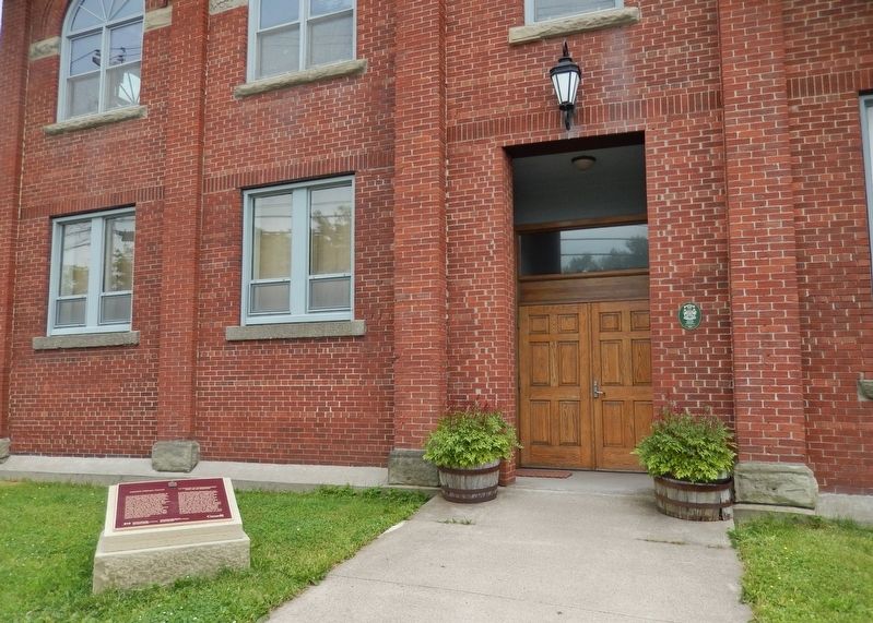
Cossit House was built in 1787 by Reverend Ranna Cossit, the first Anglican Minister in Sydney. It was purchased by the Province of Nova Scotia and the Old Sydney Society in 1976, and opened to the public by the Honourable Vincent J. Maclean, . . . — — Map (db m171097) HM
English:
A distinguished military engineer, of Huguenot descent, Desbarres served in the British Army in North America during the Seven Years’ War, and participated in the capture of Louisbourg in 1758 and of Quebec in 1759. From . . . — — Map (db m140081) HM
This statue stood on top of the Royal Bank of Canada building at the corner of Charlotte and Dorchester Streets from 1901 to 1976. The bank was erected when the Sydney Steel Plant, the major event in the industrialization of the area, was being . . . — — Map (db m171096) HM
English:
A native of Sydney, Bourinot was a journalist and legislative reporter in Halifax before joining the parliamentary staff at Ottawa in 1868. From 1880 to 1902 he served as Clerk of the House and was a recognized authority . . . — — Map (db m140082) HM
Born in Sydney, Cape Breton 1894, Peter enlisted in Canadian Forces after war broke out in 1914. While serving in Europe, he was wounded in France and hospitalized for three months. When hostilities ended in 1918, he earned a law degree from . . . — — Map (db m169201) HM WM
In the Second World War, Sydney Harbour played a vital role in the Battle of the Atlantic and played a critical role in the conduct of the war. Sydney served as a convoy gathering point for supplies being shipped to the United Kingdom and provided . . . — — Map (db m151606) HM
Come and explore the Colonial Town of Old Sydney. Few cities in North America can boast eight buildings erected between 1785 and 1802 within a two-block radius. In season, we invite you to visit these historic buildings: St. Patrick's Church Museum . . . — — Map (db m171099) HM
English:
In the late 19th and early 20th centuries, thousands of immigrants came to Cape Breton from Europe, the West Indies, the United States, and elsewhere to work in iron and steel production. Many settled in Whitney Pier, . . . — — Map (db m139295) HM
English:
During the Second World War the Royal Canadian Navy and the Royal Canadian Air Force protected shipping on vital North Atlantic routes which were the lifeline of the Allies. Army units shared in the defence of the . . . — — Map (db m140130) HM