51 entries match your criteria.
Historical Markers and War Memorials in Cape Breton Region, Nova Scotia
By Cosmos Mariner, July 21, 2019
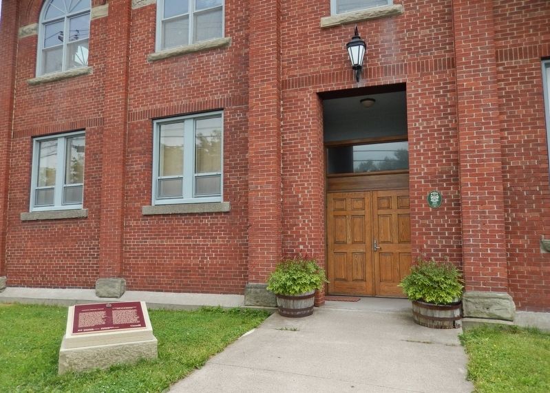
Marconi Wireless Station Marker
(wide view • Old Glace Bay Town Hall in background)
(wide view • Old Glace Bay Town Hall in background)
| 1 ► Nova Scotia, Cape Breton Region, Glace Bay — Marconi Wireless Station / La Station de Communication Sans Fil de Marconi — |
| On McKeen Street north of William Street, on the right when traveling north. | |||
| 2 ► Nova Scotia, Cape Breton Region, Glace Bay — Transatlantic Wireless / T.S.F. Transatlantique / Radiotelegrafico Transatlantico — |
| On Timmerman Street north of Vivian Street, on the left when traveling east. | |||
| 3 ► Nova Scotia, Cape Breton Region, Louisbourg — 19th-Century Lighthouse — Le phare construit au XIXᵉ siècle — |
| Near Havenside Road, on the left when traveling east. | |||
| 4 ► Nova Scotia, Cape Breton Region, Louisbourg — Canada’s First Observatory — Le premier observatoire au Canada — |
| Near Kennington Cove Road. | |||
| 5 ► Nova Scotia, Cape Breton Region, Louisbourg — First Lighthouse — Le premier phare — |
| Near Havenside Road, on the left when traveling east. | |||
| 6 ► Nova Scotia, Cape Breton Region, Louisbourg — First Lighthouse Tower — |
| Near Havenside Road, on the left when traveling east. | |||
| 7 ► Nova Scotia, Cape Breton Region, Louisbourg — Fizel House — Maison Fizel — |
| Near Kennington Cove Road. | |||
| 8 ► Nova Scotia, Cape Breton Region, Louisbourg — Fortress of Louisbourg — La forteresse de Louisbourg — |
| Near Kennington Cove Road. | |||
| 9 ► Nova Scotia, Cape Breton Region, Louisbourg — French Garrison at Louisbourg — |
| Near Havenside Road, on the left when traveling east. | |||
| 10 ► Nova Scotia, Cape Breton Region, Louisbourg — French Naval Guns — |
| On Main Street close to Huntington Avenue, on the left when traveling east. | |||
| 11 ► Nova Scotia, Cape Breton Region, Louisbourg — Kennelly Point — |
| On Havenside Road. | |||
| 12 ► Nova Scotia, Cape Breton Region, Louisbourg — Lighthouse Point — La pointe du phare — |
| On Havenside Road, on the right when traveling east. | |||
| 13 ► Nova Scotia, Cape Breton Region, Louisbourg — Louisbourg Harbour — Le port de Louisbourg — |
| On Havenside Road, on the left when traveling east. | |||
| 14 ► Nova Scotia, Cape Breton Region, Louisbourg — Marie Marguerite Rose — (1717-1757) — |
| 15 ► Nova Scotia, Cape Breton Region, Louisbourg — Slavery / Freedom — Esclavage / Liberté — |
| 16 ► Nova Scotia, Cape Breton Region, Louisbourg — 9 — Sydney and Louisbourg Railway Museum — |
| On Main Street (Nova Scotia Route 22) close to Huntington Avenue, on the left when traveling north. | |||
| 17 ► Nova Scotia, Cape Breton Region, Louisbourg — The Lobster Fishery — Le pêche du homard — |
| On Havenside Road, on the left when traveling east. | |||
| 18 ► Nova Scotia, Cape Breton Region, Louisbourg — The Siege Landing — Débarquement des assiégeants — |
| On Kennington Cove Road, on the left when traveling west. | |||
| 19 ► Nova Scotia, Cape Breton Region, Louisbourg — Wolfe’s Landing — Le débarquement de Wolfe — |
| Near Kennington Cove Road. | |||
| 20 ► Nova Scotia, Cape Breton Region, New Victoria — New Victoria Veterans Who Died Overseas — 1939-1945 — |
| On New Waterford Highway (Nova Scotia Route 28) just east of Daley Road, on the left when traveling east. | |||
| 21 ► Nova Scotia, Cape Breton Region, New Waterford — Anderton Shearer Loader — |
| Near Ellsworth Avenue (Nova Scotia Route 28) at James Street, on the right when traveling east. | |||
| 22 ► Nova Scotia, Cape Breton Region, New Waterford — Armoured Face Conveyor — |
| Near Ellsworth Avenue (Nova Scotia Route 28) at James Street, on the right when traveling east. | |||
| 23 ► Nova Scotia, Cape Breton Region, New Waterford — Earl Leadbeater — Memorial — Colliery Lands Park — |
| Near Ellsworth Avenue (Nova Scotia Route 28) at James Street, on the right when traveling east. | |||
| 24 ► Nova Scotia, Cape Breton Region, New Waterford — Joy — Hydraulically Powered Longwall Roof Support — |
| Near Ellsworth Avenue (Nova Scotia Route 28) at James Street, on the right when traveling east. | |||
| 25 ► Nova Scotia, Cape Breton Region, New Waterford — Miner's Monument — |
| On Plummer Avenue east of Baker Avenue, on the right when traveling east. | |||
| 26 ► Nova Scotia, Cape Breton Region, New Waterford — New Waterford World War Monument — Our Heroic Dead — |
| On Plummer Avenue just east of Baker Avenue, on the right when traveling east. | |||
| 27 ► Nova Scotia, Cape Breton Region, New Waterford — Standing The Gaff — William Davis — 1888-1925 — |
| On Plummer Avenue, 0.03 kilometers east of Baker Avenue, on the right when traveling east. | |||
| 28 ► Nova Scotia, Cape Breton Region, New Waterford — William Davis — Memorial — Colliery Lands Park — |
| Near Ellsworth Avenue (Nova Scotia Route 28) at James Street, on the right when traveling east. | |||
| 29 ► Nova Scotia, Cape Breton Region, Port Morien — First Boy Scout Troop in North America — |
| On Long Beach Road north of Marconi Trail (Route 255), on the right when traveling north. | |||
| 30 ► Nova Scotia, Cape Breton Region, Port Morien — Flint Island Light Station — |
| On Marconi Trail (Nova Scotia Route 255) 0.2 kilometers south of Birch Grove Road, on the right when traveling north. | |||
| 31 ► Nova Scotia, Cape Breton Region, Port Morien — Gowrie and North Atlantic Collieries — |
| On Marconi Trail (Nova Scotia Route 255) 0.2 kilometers south of Birch Grove Road, on the right when traveling north. | |||
| 32 ► Nova Scotia, Cape Breton Region, Port Morien — L'industrie du Charbon au Canada / Canada's Coal Industry — |
| On Long Beach Road, 1 kilometer north of Marconi Trail (Route 255), on the left when traveling north. | |||
| 33 ► Nova Scotia, Cape Breton Region, Port Morien — Morien Bay — |
| On Marconi Trail (Nova Scotia Route 255) 0.2 kilometers south of Birch Grove Road, on the right when traveling north. | |||
| 34 ► Nova Scotia, Cape Breton Region, Port Morien — Morien Businesses of the Past — |
| On Marconi Trail (Nova Scotia Route 255) at Breakwater Street, on the right when traveling north on Marconi Trail. | |||
| 35 ► Nova Scotia, Cape Breton Region, Port Morien — Morien Institutions — |
| On Marconi Trail (Nova Scotia Route 255) at Breakwater Street, on the right when traveling north on Marconi Trail. | |||
| 36 ► Nova Scotia, Cape Breton Region, Port Morien — Morien's Legacy — |
| On Marconi Trail (Nova Scotia Route 255) at Breakwater Street, on the right when traveling north on Marconi Trail. | |||
| 37 ► Nova Scotia, Cape Breton Region, Port Morien — The First Coal Workings in North America — |
| On Long Beach Road north of Marconi Trail (Route 255), on the right when traveling north. | |||
| 38 ► Nova Scotia, Cape Breton Region, Port Morien — The Fishery in Port Morien — |
| On Marconi Trail (Nova Scotia Route 255) 0.2 kilometers south of Birch Grove Road, on the right when traveling north. | |||
| 39 ► Nova Scotia, Cape Breton Region, Sydney — "Northern Friends" — |
| On Esplanade at Amelia Street, on the left when traveling north on Esplanade. | |||
| 40 ► Nova Scotia, Cape Breton Region, Sydney — Canadian Merchant Navy — World War II — |
| Near Esplanade at Dorchester Street, on the left when traveling north. | |||
| 41 ► Nova Scotia, Cape Breton Region, Sydney — Cossit House — Province of Nova Scotia Historic Site — |
| Near Charlotte Street north of York Street, on the right when traveling north. | |||
| 42 ► Nova Scotia, Cape Breton Region, Sydney — J.F.W. DesBarres — 1722 - 1824 — |
| On Esplanade at Dorchester Street, on the right when traveling north on Esplanade. | |||
| 43 ► Nova Scotia, Cape Breton Region, Sydney — Joseph Frederick Wallet DesBarres — 1722-1824 — |
| On Esplanade north of York Street, on the left when traveling north. | |||
| 44 ► Nova Scotia, Cape Breton Region, Sydney — Royal Bank Lion — |
| On Esplanade at York Street, on the left when traveling north on Esplanade. | |||
| 45 ► Nova Scotia, Cape Breton Region, Sydney — Sir John George Bourinot — 1837-1902 — |
| On Esplanade north of York Street, on the left when traveling north. | |||
| 46 ► Nova Scotia, Cape Breton Region, Sydney — Sir Peter D. Macdonald — |
| On Esplanade just north of Amelia Street, on the left when traveling north. | |||
| 47 ► Nova Scotia, Cape Breton Region, Sydney — St. George's Church — |
| Near Charlotte Street at Nepean Street, on the right when traveling north. | |||
| 48 ► Nova Scotia, Cape Breton Region, Sydney — Sydney Harbour in the Second World War — |
| Near Wentworth Street just west of Esplanade (Nova Scotia Route 4), on the left when traveling west. | |||
| 49 ► Nova Scotia, Cape Breton Region, Sydney — Sydney's Heritage Conservation District — |
| Near Esplanade at Dorchester Street, on the right when traveling north. | |||
| 50 ► Nova Scotia, Cape Breton Region, Sydney — The Development of Whitney Pier / L'essor De Whitney Pier — |
| On Victoria Road (Route 28) south of Church Street, on the right when traveling north. | |||
| 51 ► Nova Scotia, Cape Breton Region, Victoria Mines — Atlantic Bulwark / Le Rempart de L'Atlantique — |
| Near New Waterford Highway (Nova Scotia Route 28) 0.6 kilometers east of Cooks Lane, on the left when traveling east. | |||