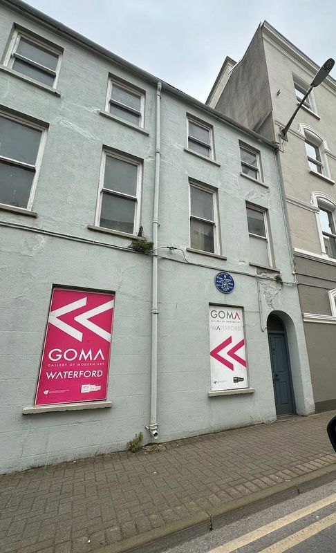
Near Colbeck Street at Henrietta Street, on the left when traveling south.
The Bishop’s Palace
[English:] Built on the site of the medieval palace and described as the finest 18th century ecclesiastical palace in Ireland it was built by the Church of Ireland bishop Charles Este. Appointed bishop . . . — — Map (db m303588) HM
On Greyfriars Street at Coffee House Lane, on the right when traveling north on Greyfriars Street.
This lane lies within the oldest part of the Viking town, the fortress of Dundory at the apex of the Viking Triangle. As late as the 18th century leases of properties in this area still refer to Dundory. During the late Middle Ages the King’s . . . — — Map (db m303718) HM
On Cathedral Square at Henrietta Street, on the left when traveling west on Cathedral Square.
[Gaeilge:] Cearnóg an Bhunreachta Ainmnithe chun comóradh a dhéanamh ar chur i bhfeidhm Bhunreacht na hÉireann 1937 cothrom 80 bliain ó shoin agus in onóir John Joseph Hearne (1893–1969), a rugadh i bPort Láirge agus atá . . . — — Map (db m303671) HM
Near Henrietta Street north of Cathedral Street, on the left when traveling south.
(Panel one)The King’s Highway which leads to the house of the Friars Minor of Waterford. Dean John Collyn, 1468 The laneway to your left leading from Chairman’s Arch was, during the Viking period, part of the main roadway running . . . — — Map (db m303793) HM
On Greyfriars Street near Bailey's New Street, on the left when traveling south.
[English:] Choristers’ Hall and Mayor’s Wine Vault The
Choristers’ Hall is the only part of the medieval deanery building to
survive and was probably built by Stephen de Fulbourne, Bishop of
Waterford, 1270–1286 and a . . . — — Map (db m303714) HM
On Colbeck Street at Henrietta Street, on the left when traveling south on Colbeck Street.
Christ Church Cathedral
[English:] Christ Church Cathedral encapsulates 1,000 years of Christianity in Ireland. A cathedral has stood on this site since 1096 when Malchus, the first bishop of the Viking city, was consecrated . . . — — Map (db m303589) HM
On Broad Street at Arundel Lane, on the left when traveling south on Broad Street.
Honouring and remembering the women of Waterford City and County who sold cockles on these streets for many generations to 1970 — — Map (db m316169) HM
On The Mall at Mall Lane, on the right when traveling east on The Mall.
[Gaeilge:] Cumann Wolfe Tone Is ón áit seo a chéad chuir T.P.Ó Meachair tridhathach na tíre ar foluain 7 Márta 1848 Caomhantas Chathair Phortláirge [English:] Wolfe Tone Club The Irish tricolour was . . . — — Map (db m303521) HM
On Coffee House Lane at Henrietta Street, on the left when traveling east on Coffee House Lane.
Coffee was considered ‘The Devil’s Drink’ until Pope Clement VIII had a taste and baptised it in around 1600.
Find out how it came to Waterford… — — Map (db m316168) HM
Near The Mall at Adelphi Quay, on the left when traveling north.
Dundory Reginald’s Tower [English:] June 2003 To mark the millennium of Reginald’s Tower, Waterford City Council and the Department of the Environment, Heritage & Local Government hosted the 13th International Walled Towns . . . — — Map (db m303500) HM
On Great George's Street at Barronstrand St, on the left when traveling east on Great George's Street.
Edmund Rice conducted business in a premises situated opposite this building prior to founding his first school in Waterford 1802 — — Map (db m303430) HM
On Arundel Lane east of Broad Street, on the left when traveling east.
[Gaeilge:] Chonaith an Bráthair Éamann Ris sa teach seo ón mbliain 1789 go dtí 1802 [English:] Brother Edmund Rice lived in this house from 1789 to 1802 — — Map (db m303471) HM
On Bridge Street at Merchant's Quay, on the left when traveling south on Bridge Street.
[English:] Francis Hearn Dungarvan United Irishman Was hanged on the old Waterford wooden bridge 21 Oct. 1799 for his part in the 1798 Rebellion
[Gaeilge:] Proinsias Ó hEathírn Dún Garbhán Éireannach . . . — — Map (db m304524) HM
On Greyfriars Street north of Bailey's New Street, on the left when traveling south.
[English:] Franciscan Friary In 1241 King Henry III agreed to the building of a Franciscan friary here, giving the friars an annual grant to purchase habits. According to tradition it was built by an Anglo-Norman knight Sir Hugh . . . — — Map (db m303715) HM
On Barronstrand Street at Cathedral Street, on the left when traveling south on Barronstrand Street.
Architect John Roberts designed and built many of Waterford’s most iconic buildings. In 1790 he designed his last building. Find out what happened next… — — Map (db m303427) HM
Near Colbeck Street at Henrietta Street, on the left when traveling south.
[Gaeilge:] In ómós do na Gael go léir idir fhir agus mhná a fuair bás i gcogaí nó ar fiannas les na Náisiúin Aontaithe. [English:] In honour of all those Irishmen and Irishwomen who died in past wars or on service . . . — — Map (db m303669) WM
On Merchants Quay east of Gladstone Street, on the left when traveling east.
[Gaeilge:]
Ór do
Laochra na Saoirse
a throid ar son na
h-Éireann.
[English:]
In memory of all those who fought for Irish freedom.
[Gaeilge:]
Solus na soillse
Radharc na . . . — — Map (db m303392) WM
On Cathedral Square at Henrietta Street, on the left when traveling west on Cathedral Square.
John Condon lived in Wheelbarrow Lane, off Ballybricken, in Waterford City. Enlisting as a private, John was posted to the 2nd Battalion, Royal Irish Regiment and sent to Flanders in December 1914. On the 24th May 1915 during the 2nd Battle of Ypres . . . — — Map (db m303738) WM
On Canada Street at Scotch Quay, on the left when traveling west on Canada Street.
His talent and innovation here at Neptune Shipyard promoted Waterford to a leading centre of iron shipbuilding in the 1850s and 1860s. — — Map (db m304522) HM
On William Street south of George's Quay, on the left when traveling west.
[English:] John J Hearne 1893–1969 Architect of 1937 Irish Constitution & 1st Irish Ambassador to USA 1950–1960 was born here [Gaeilge:] Is anseo a rugadh Seán S Ó hEachtheigeirn 1893–1969 Dreachtóir Bhunreacht na . . . — — Map (db m304518) HM
On Terminus Street at Bridge Street, on the right when traveling east on Terminus Street.
“I see his blood upon the rose And in the stars the glory of his eyes, His body gleams amid eternal snows, His tears fall from the skies.” Joseph Mary Plunkett (21 November 1887–4 May 1916) Irish nationalist, poet, journalist, and a leader . . . — — Map (db m304523) HM
On Parade Quay north of Bailey's New Street, on the left when traveling north.
King Richard II of England 1377-1399 Landed at this Quay in 1394 at the head of the largest armada ever to sail into an Irish Port. — — Map (db m248832) HM
On Cathedral Square east of Henrietta Street, on the left when traveling east.
Chess, the game of kings, princes, knights and merchants. The seven skills a Knight must know are riding, swimming, archery, boxing, hawking, verse-writing and chess. Petrus Alfonsi, c1110 The game of chess with its origins in India in the . . . — — Map (db m303731) HM
On Cathedral Square at Henrietta Street, on the left when traveling east on Cathedral Square.
Madness and Loss in WWI The onset of WW1 sent ripples across Europe. Between 1914 and 1918, 4,800 Waterford men and boys enlisted to fight. Hear their stories… — — Map (db m304473) HM
Near Conduit Lane north of High Street, on the left when traveling north.
[Gaeilge:] Mainistir Dhoiminiceach. Bunaíodh í 1226 ar iarratas lucht na cathrach. Cuireadh faoi chois í 1541. Bhí sí in úsáid mar Theach Cúirte go dtí an 18ú aois. [English:] Black Friars Dominican Priory . . . — — Map (db m303473) HM
On Bailey's New Street at Parade Quay, on the left when traveling south on Bailey's New Street.
“Waterford city is surrounded by a stone wall something less than a mile in circumference with seventeen towers and cannon on them to keep off the savages.” Don Diego Ortiz, Spanish spy, 1574 Today with six of the towers and long stretches . . . — — Map (db m303494) HM
On Colbeck Street at Henrietta Street, on the left when traveling south on Colbeck Street.
(East Plaque:) This monument was unveiled by Michael O’Riordan & Jack J.L. Jones, veterans of the XV International Brigade, on Friday, July 8th, 2004, in the presence of: Jim Nolan, Chairperson of the Organising Committee of the Relatives . . . — — Map (db m303665) WM
On Park Road west of Newtown Road, on the left when traveling west.
The People’s Park The formation of these grounds into a public park was initiated by the late Mr. J. A. Blake M.P. Mayor 1855–6–7, chairman of a committee of citizens, and Lieut. Col. Roberts Hon. Secretary. Completed and handed over to the . . . — — Map (db m304520) HM
On Peter Street west of Henrietta Street, on the left when traveling west.
(Left plaque)[Gaeilge:] Raymond T Chandler Scríobhnóir 1888–1959 Agus cruthaitheoir den bhleachtaire Philip Marlowe ba mhinic é i dtigh seo a uncail agus é óg (Right plaque)[English:] Raymond . . . — — Map (db m304416) HM
On The Mall at Adelphi Quay, on the left when traveling north on The Mall.
[Gaeilge:] Deirtear gurb é Raghnall, Lochlannach, a thóg an túr 1003, ach b’fhéadfadh sé gur sa 12ú aois a tógadh an foirgneamh seo. D’ionsaigh Richard Fitz Gilbert (Strongbow) é 1170 agus d’ionsaigh Perkin Warbeck é 1497. Bhí an . . . — — Map (db m303503) HM
In the year 1003 this Tower was erected by Reginald the Dane In 1171 it was held as a Fortress by Strongbow Earl of Pembroke In 1463 by Statute 3rd Edward 4th a Mint was established here In 1819 it was Reedified in its original Form & . . . — — Map (db m303504) HM
On The Mall at Adelphi Quay, on the left when traveling north on The Mall.
[English:]
Reginald's Tower Reginald’s Tower, also known as Dundory (a word of Irish origin meaning the fort of oak), is the only monument in Ireland named in honour of a Viking – possibly Ragnall or Reginald, the founder . . . — — Map (db m303496) HM
On Olaf Street south of High Street, on the left when traveling south.
St. Olaves Ch. [Gaeilge:] Tógadh an céad eaglais ar an láthair seo, foirgneamh adhmaid is dócha, thart ar AD1050, tráth dá raibh roinnt mhaith eaglaisí ar fud tuaisceart na hEorpa tiomnaithe do Rí na hIorua, Olav Naofa, a . . . — — Map (db m304419) HM
Near Cathedral Square at Henrietta Street, on the left when traveling west.
[Gaeilge:] Seán Ó hEathirn 1893–1969 Cruthaitheoir Bhunreacht na hÉireann 1937 Ard-Choimisinéir na hÉireann chuig Ceanada 1939–1949 Céad Ambasadóir na hÉireann chuig na Stáit Aontaithe 1950–1960 [English:] John J . . . — — Map (db m303703) HM
Near Colbeck Street at Henrietta Street, on the left when traveling south.
September 11th 2001 This piece of steel was retrieved from the ruins of the World Trade Centre. It serves as a memorial to the many lives that were lost during the terrorist attacks on 11th September 2001. Unveiled 16th September 2018 by . . . — — Map (db m303670) WM
On Blackfriars at Conduit Lane, on the left when traveling east on Blackfriars.
Anastasia Fleming married into a silversmithing family, but when her husband died, someone had to take over the business. Find out what happened next… — — Map (db m303472) HM
On Bank Lane at Adelphi Quay, on the left when traveling east on Bank Lane.
The S.S. Coningbeg sailed, homeward bound from Liverpool, 2 days after her sister ship the Formby. On board was a crew of 40 with 4 passengers. The steamer was torpedoed off the East Coast by the same U boat with no warning & all were lost. There . . . — — Map (db m303519) WM
On Bank Lane at Adelphi Quay, on the left when traveling east on Bank Lane.
On December 15th 1917, as the S.S. Formby sailed from Liverpool on her last homeward voyage before Christmas, no doubt the crew of her sister ship wished her “Good luck, see you on the Mall.” Sadly, this was not to be as the steamer was torpedoed . . . — — Map (db m303516) HM WM
On Coffee House Lane at Henrietta Street, on the left when traveling east on Coffee House Lane.
From its foundation in 914 by Vikings, Waterford, Ireland’s oldest city, was one of the island’s chief ports. By the early eighteenth century following the demolition of the medieval town walls along the riverfront, proper quays were constructed. As . . . — — Map (db m303483) HM
On The Mall east of Bank Lane, on the left when traveling east.
Le Théâtre Royal / Theatre Royal [Français:] En 1876, le théâtre du XVIIIe siècle qui occupait une partie de cet édifice fut rénové pour devenir un théâtre en forme de fer à cheval de style victorien. La passion . . . — — Map (db m303535) HM
On Meagher's Quay east of Gladstone Street, on the left when traveling west.
Brigadier General Thomas Francis Meaghar
1823 - 1867
Irish Patriot & American Civil War Hero Born here in 1823 Young Irelander Transported to Tasmania, Australia 1849 U.S. Fighting 69th & Irish Brigade Governor of Montana . . . — — Map (db m303405) HM
On Mall Lane at Adelphi Quay, in the median on Mall Lane.
Thomas Francis Meagher, born in Waterford, came to national prominence through his involvement in Daniel O’Connell’s Repeal Movement, and subsequently as one of the leaders and principal orator of the Young Ireland movement. In March 1848, after . . . — — Map (db m303509) HM
On The Mall / Parnell Street west of Catherine Street, on the right when traveling west.
In this house
Thomas Francis Meagher
young Ireland orator and
American Civil War hero
was arrested
12 July 1848
Is sa tigh seo a gabhadh
Tomás Proinsias Ó Meachair
12 Iúil 1848
oraidi de chuid young . . . — — Map (db m248846) HM
On Barronstrand Street at Cathedral Street on Barronstrand Street.
Thomas Hussey Bishop of Waterford & Lismore 1794 – 1803 Diplomat and first President of Maynooth is buried in these Cathedral Grounds — — Map (db m303421) HM
Near The Mall at Bank Lane, on the left when traveling west.
[Gaeilge:] Bunaíodh Port Láirge sa bhliain 914 agus tá sé níos sine ná na príomhchathracha go léir i dTuaisceart na hEorpa seachas Páras agus Londain. Is í an t-aon chathair Éireannach amháin a choimeád a logainm Lochlannach — . . . — — Map (db m304428) HM
On Bailey's New Street at Parade Quay, on the left when traveling south on Bailey's New Street.
“Get thee a ship and go on the sea and kill men.” Such was the advice of a Norwegian mother to her son in about 850, a time when the Vikings established many bases around Ireland and Britain. Thanks to their skill as shipbuilders and . . . — — Map (db m303493) HM
Born Waterford 1812 Died Pyrenees 1865 “In happy moments day by day the sands of life may pass in swift but tranquil tide away from time’s unerring glass” — — Map (db m303532) HM
Near Terminus Street at Bridge Street, on the right when traveling east.
Past Tracks Proudly Presented by Flahavan’s Waterford Stáisiúin Port Láirge [Gaeilge:] Gadaí an Mhórbhealaigh Lonnaithe 2.5km síos ón stáisiún seo, bunaíodh Scoil an Bhaile Nua i 1798 mar scoil do leanaí Chumann . . . — — Map (db m304525) HM
On Colbeck Street at Parnell Street, on the right when traveling south on Colbeck Street.
This Coat of Arms and Colonnaded Compartment is a replica based upon the original dominant stucco feature of the early eighteenth century “Waterford Arms Hotel” which formerly occupied this site. Many of the details matched those of the Coat of . . . — — Map (db m304430) HM
On Colbeck Street at Parnell Street, on the right when traveling south on Colbeck Street.
In memory of the eleven Waterford volunteers who fought in defence of the Spanish Republic in the ranks of the XVth International Brigade Unveiled by Mayor of Waterford City and County Council Cllr. Seamus Ryan May 1st 2026 — — Map (db m304434) WM
Near Greyfriars Street north of Bailey's New Street, on the left when traveling south.
Luke Wadding left Waterford at 16 but no one could have predicted the lasting impact he would have on his home country. Discover his legacy… — — Map (db m303716) HM
Near Colbeck Street near Henrietta Street, on the left when traveling south.
The Widows’ Apartments The Church of Ireland bishop Dr Hugh Gore who died in 1691 left £1,200 in his will to build apartments for the poor widows of clergymen and to grant each widow £10 per annum. However, his will was disputed and it was not . . . — — Map (db m303572) HM
On Catherine Street at Parnell Street, on the left when traveling south on Catherine Street.
William Vincent Wallace Musician and Composer Born in Waterford Mar. 11, 1812 Died in Paris Oct. 12, 1865 Buried in Kensal Green London Maritana • Lurline ☘☘☘ The Amber Witch etc.Erected by his Admirers . . . — — Map (db m304431) HM