240 entries match your criteria. The first 100 are listed. ⊳
Former U.S. Presidents: #28 Woodrow Wilson Historical Markers
By Sandra Hughes, July 26, 2017
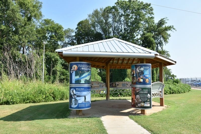
Wilson Dam Setting the Stage Marker Kiosk
| 1 ► Alabama, Colbert County, Muscle Shoals — Wilson Dam: Setting the Stage — |
| Near Reservation Road, 1 mile east of Alabama Route 133, on the left when traveling east. | |||
| 2 ► Alabama, Escambia County, Flomaton — Flomaton, Alabama — |
| On Sidney E Manning Blvd (U.S. 29) at Houston Street, on the right when traveling north on Sidney E Manning Blvd. | |||
| 3 ► Alabama, Lauderdale County, Florence — Woodrow Wilson Park — 1818 — |
| On East Tuscaloosa Street at North Wood Street (County Road 47), on the right when traveling east on East Tuscaloosa Street. | |||
| 4 ► Alabama, Madison County, Huntsville — World War I — Huntsville Madison County Veterans Memorial — |
| On Monroe Street Northwest at Washington Street Northwest, on the left when traveling east on Monroe Street Northwest. | |||
| 5 ► Alabama, Madison County, Huntsville — World War I (Great War)/1914 – 1918 — |
| Near Monroe Street Northwest at Washington Street Northwest, on the left when traveling east. | |||
| 6 ► Alabama, Mobile County, Mobile — On this Spot Woodrow Wilson Said: — October 27, 1913 — 1913 - 1924 — |
| On Conti Street at South Joachim Street, on the left when traveling west on Conti Street. | |||
| 7 ► Alabama, Perry County, Marion — Marion Military Institute — |
| On Washington Street, 0.1 miles north of Grove Street, on the left when traveling north. | |||
| 8 ► Alabama, Sumter County, Demopolis — The Rooster Bridge — |
| On U.S. 80, 3 miles east of State Road 28, on the right when traveling east. | |||
| 9 ► Arizona, Coconino County, Walnut Canyon National Monument — What Happened Here? — |
| 10 ► Arkansas, Woodruff County, Augusta — Augusta Presbyterian Church — |
| On North 3rd Street (Business U.S. 64) at Walnut Street on North 3rd Street. | |||
| 11 ► Arkansas, Woodruff County, Augusta — G-3 — Woodruff County Presbyterian Church — |
| On North 3rd Street (Business U.S. 64) at Walnut Street, on the left when traveling north on North 3rd Street. | |||
| 12 ► California, Los Angeles County, Los Angeles, Downtown Los Angeles — Spring Street — |
| On Spring Street south of 3rd Street, on the right when traveling south. | |||
| 13 ► California, Orange County, Laguna Beach — Historic Moss Point — |
| On Moss Street west of Coast Highway, on the left when traveling west. | |||
| 14 ► California, San Francisco City and County, San Francisco, Northern Waterfront — Herb Caen Way — |
| On The Embarcadero near Washington Street. | |||
| 15 ► California, San Luis Obispo County, Atascadero — Faces of Freedom Veterans Memorial — |
| On California Route 41 at Portola Road, on the left when traveling west on State Route 41. | |||
| 16 ► California, Santa Clara County, Los Gatos — "The Cats" — |
| Near Santa Cruz Highway (California Route 14), on the right when traveling south. | |||
| 17 ► California, Siskiyou County, Hornbook — Founding of the American Legion — |
| On Front Street near Henly-Hornbook Road, on the right when traveling north. | |||
| 18 ► Connecticut, Fairfield County, Stamford, Downtown — Freedom Shrine — |
| On Atlantic Street at Main Street, on the right when traveling north on Atlantic Street. | |||
| 19 ► Connecticut, Litchfield County, Salisbury — Central New England Railroad — |
| On East Main Street near Cobble Road, on the left when traveling south. | |||
| 20 ► Connecticut, Middlesex County, Middletown — Russell House — |
| On High Street at Washington Street, on the right when traveling north on High Street. | |||
| 21 ► Connecticut, New London County, New London, Fort Trumbull — Scientific Research — World War I — |
| Near East Street, on the left when traveling south. | |||
| 22 ► Delaware, New Castle County, Newark — NC-196 — Judge Morris Estate — |
| On Polly Drummond Hill Road, on the right when traveling north. | |||
| 23 ► District of Columbia, Washington, Northeast Washington, Kenilworth Park — Beauty and Business — Kenilworth Aquatic Gardens — National Park Service, U.S. Department of the Interior — |
| On River Trail Northeast just west of Anacostia Avenue Northeast. | |||
| 24 ► District of Columbia, Washington, Northwest Washington, Columbia Heights — The Wilson Center — |
| Near Irving Street Northwest east of 15th Street Northwest, on the right when traveling east. | |||
| 25 ► District of Columbia, Washington, Northwest Washington, Downtown — "The First of Patriots - The Best of Men" — National Mall and Memorial Parks — National Park Service, U.S. Department of the Interior — |
| On 14th Street Northwest at I Street Northwest, on the right when traveling north on 14th Street Northwest. | |||
| 26 ► District of Columbia, Washington, Northwest Washington, Downtown — The Inaugural Parade Tradition — |
| Near 15th Street Northwest south of G Street Northwest, on the right when traveling south. | |||
| 27 ► District of Columbia, Washington, Northwest Washington, Dupont Circle — 326 — Myrtilla Miner — Dupont Circle — Diverse Visions | One Neighborhood — |
| On 20th Street Northwest at N Street Northwest, on the right when traveling north on 20th Street Northwest. | |||
| 28 ► District of Columbia, Washington, Northwest Washington, Dupont Circle — The first houses south and west of Dupont Circle — Dupont Circle — Diverse Visions | One Neighborhood — |
| On 21st Street Northwest at O Street Northwest, on the right when traveling south on 21st Street Northwest. | |||
| 29 ► District of Columbia, Washington, Northwest Washington, Dupont Circle — Tomáš G. Masaryk — |
| On Massachusetts Avenue Northwest at 22nd Street Northwest on Massachusetts Avenue Northwest. | |||
| 30 ► District of Columbia, Washington, Northwest Washington, Federal Triangle — Armistice and Legacy — |
| On Pennsylvania Avenue Northwest just west of 14th Street Northwest, in the median. | |||
| 31 ► District of Columbia, Washington, Northwest Washington, Federal Triangle — 6 — Arts and Artists — Make No Little Plans — Federal Triangle Heritage Trail — |
| Near Pennsylvania Avenue Northwest west of 12th Street Northwest, on the right when traveling east. | |||
| 32 ► District of Columbia, Washington, Northwest Washington, Federal Triangle — World War I Memorial — |
| On 15th Street Northwest at Pennsylvania Avenue Northwest on 15th Street Northwest. | |||
| 33 ► District of Columbia, Washington, Northwest Washington, Federal Triangle — World War I, 1914-1917 — |
| On Pennsylvania Avenue Northwest just west of 14th Street Northwest, in the median. | |||
| 34 ► District of Columbia, Washington, Northwest Washington, Foggy Bottom — Robert Latham Owen — ᎡᎣᏖ ᏞᎺ ᏪO — 1856-1947 — |
| On C Street Northwest at 20th Street Northwest, on the right when traveling west on C Street Northwest. | |||
| 35 ► District of Columbia, Washington, Northwest Washington, Foggy Bottom — The American Red Cross — |
| Near D Street Northwest east of 18th Street Northwest, on the right when traveling west. | |||
| 36 ► District of Columbia, Washington, Northwest Washington, Georgetown — Stephen Osusky — 1889 - 1973 — Paulina Osusky, 1892 - 1979 — |
| Near R Street Northwest just east of 30th Street Northwest, on the left when traveling east. | |||
| 37 ► District of Columbia, Washington, Northwest Washington, Georgetown — The Star-Spangled Banner |
| On M Street Northwest at 34th Street Northwest, on the left when traveling west on M Street Northwest. Reported permanently removed. | |||
| 38 ► District of Columbia, Washington, Northwest Washington, Mount Pleasant — 2 — Upheaval and Activism — Village in the City — Mount Pleasant Heritage Trail — |
| On 16th Street Northwest north of Irving Street Northwest, on the left when traveling north. | |||
| 39 ► District of Columbia, Washington, Northwest Washington, Penn Quarter — 5850-2019 — Alice Paul — 1885 - 1977 — |
| On 14th Street Northwest at Pennsylvania Avenue Northwest, on the right when traveling north on 14th Street Northwest. | |||
| 40 ► District of Columbia, Washington, Northwest Washington, Penn Quarter — Site of Rhodes Tavern — 1799 - 1984 — |
| On F Street Northwest at 15th Street Northwest, on the right when traveling west on F Street Northwest. | |||
| 41 ► District of Columbia, Washington, Northwest Washington, Shaw — 4 — Armed Resistance — Lift Every Voice — Georgia Ave./Pleasant Plains Heritage Trail — |
| On Florida Avenue Northwest (Route 29) east of 7th Street Northwest, on the left when traveling west. | |||
| 42 ► District of Columbia, Washington, Northwest Washington, Sheridan-Kalorama — Robert Emmet — |
| On Massachusetts Avenue Northwest at 24th Street Northwest, on the right when traveling west on Massachusetts Avenue Northwest. | |||
| 43 ► District of Columbia, Washington, Northwest Washington, Sheridan-Kalorama — Robert Emmet: Irish Patriot — Rock Creek Park — National Park Service, U.S. Department of the Interior — |
| On 24th Street Northwest north of Massachusetts Ave Northwest, on the left when traveling north. | |||
| 44 ► District of Columbia, Washington, Northwest Washington, Sheridan-Kalorama — 11 — The Presidents — Sheridan Kalorama — Call Box Restoration Project |
| On Wyoming Avenue Northwest at 23rd Street Northwest, on the right when traveling east on Wyoming Avenue Northwest. Reported damaged. | |||
| 45 ► District of Columbia, Washington, Northwest Washington, Sheridan-Kalorama — Woodrow Wilson House — |
| On S Street Northwest east of 24th Street Northwest, on the right when traveling east. | |||
| 46 ► District of Columbia, Washington, Southeast Washington, Navy Yard — Presidential Fans / Fans! / Congressional Baseball Game — Baseball Americana — |
| Near South Capitol Street Southeast at Potomac Avenue Southeast, on the right when traveling north. | |||
| 47 ► District of Columbia, Washington, Southwest Washington, Joint Base Anacostia-Bolling (JBAB) — In Memory of Col. Raynal C. Bolling — |
| Near McChord Street Southwest east of Brookley Avenue Southwest, on the left when traveling east. | |||
| 48 ► District of Columbia, Washington, Southwest Washington, Southwest Waterfront — "a magnificent waterfront entranceway…" — |
| Near Maine Avenue Southwest at 9th Street Southwest, on the right when traveling east. | |||
| 49 ► District of Columbia, Washington, Southwest Washington, Southwest Waterfront — Cherry Blossoms — |
| On Water Street Southwest just south of M Place Southwest, on the left when traveling north. | |||
| 50 ► District of Columbia, Washington, Southwest Washington, The National Mall — District of Columbia World War Memorial — National Park Service, U.S. Department of the Interior — National Mall & Memorial Parks |
| On Independence Avenue Southwest west of 17th Street Southwest, on the right when traveling west. Reported permanently removed. | |||
| 51 ► Florida, Brevard County, Melbourne — Roesch House — |
| On Highland Avenue. | |||
| 52 ► Florida, Clay County, Starke — Albert Hazen Blanding — 1876 - 1970 — ☆ ☆ ☆ — |
| Near Tallahassee Street south of Minden Street, on the right when traveling north. | |||
| 53 ► Florida, Hillsborough County, Tampa — United States occupation of Haiti — 1915 - 1934 — Hillsborough County Veterans Memorial Park — |
| Near U.S. 301, 0.2 miles south of East Dr. Martin Luther King Jr. Boulevard, on the right when traveling south. | |||
| 54 ► Florida, Lee County, Fort Myers — Manatee Island — |
| On Palm Beach Boulevard. | |||
| 55 ► Florida, Leon County, Tallahassee, Woodland Drives — F-393 — Governor John W. Martin House — |
| On Desoto Park Drive at East Lafayette Street, on the right when traveling south on Desoto Park Drive. | |||
| 56 ► Florida, Pinellas County, St. Petersburg — The United States Veterans Memorial — |
| On 1st Avenue North west of 3rd Street North, on the right when traveling west. | |||
| 57 ► Florida, Santa Rosa County, Milton — World War I — 1914 - 1918 — Santa Rosa Veterans Memorial Plaza — |
| Near Willing Street, 0.1 miles west of Caroline Street. | |||
| 58 ► Florida, Seminole County, Sanford — Mount Vernon Grove — Featured Tree — Mount Vernon Red Maple — |
| Near West 7th Street just west of Myrtle Avenue, on the right when traveling west. | |||
| 59 ► Florida, Volusia County, Deltona — World War I — Deltona Veteran’s Memorial Park — |
| Near Evard Avenue at Elkcam Boulevard, on the left when traveling south. | |||
| 60 ► Florida, Walton County, Santa Rosa Beach — F-795 — Gulf Cemetery — |
| On County Road 393, 1.4 miles south of U.S. 98, on the right when traveling south. | |||
| 61 ► Georgia, Baldwin County, Milledgeville — Carl Vinson • Mary Green Vinson — Nov.18, 1883 - June 1, 1981 Sept. 19, 1887 - Nov. 16, 1950 — |
| Near S. Liberty Street continued, on the left when traveling south. | |||
| 62 ► Georgia, Burke County, Waynesboro — 017-10 — Waynesborough — |
| On E. 6th Street at N. Liberty Street, on the right when traveling west on E. 6th Street. | |||
| 63 ► Georgia, Chatham County, Savannah, Historic District - North — 025-35 — Independent Presbyterian Church — |
| On Bull Street near Oglethorpe Avenue, on the left. | |||
| 64 ► Georgia, DeKalb County, Stone Mountain — The Country Comes Before Me — |
| Near Robert E Lee Boulevard at Memorial Hall Circle, on the right when traveling east. | |||
| 65 ► Georgia, Floyd County, Rome — Ellen Louise Axson Wilson — Wife of the 28th President of the United States — |
| Near Unnamed Cemetery Road, 0.1 miles north of Myrtle Street. | |||
| 66 ► Georgia, Glynn County, Jekyll Island — First Transcontinental Call — |
| On Riverview Dr., on the right when traveling north. | |||
| 67 ► Georgia, Richmond County, Augusta — 121-18 — Boyhood Home of Woodrow Wilson — |
| On 7th Street near Telfair Street, on the right when traveling south. | |||
| 68 ► Georgia, Richmond County, Augusta — 121-6 — Joseph R. Lamar, Associate Justice — Supreme Court of the United States — |
| 69 ► Georgia, Richmond County, Augusta — 121-11 — The First Presbyterian Church — |
| On Telfair Street. | |||
| 70 ► Georgia, Wilkes County, Washington — Wisteria Hall — 1795 — |
| On East Robert Toombs Avenue (Business U.S. 78) at Poplar Drive, on the left when traveling east on East Robert Toombs Avenue. | |||
| 71 ► Illinois, Cook County, Chicago, The Loop District — Blackstone Hotel — Marshall & Fox, architects — 1910 — |
| On East Balboa Avenue near South Michigan Avenue, on the right when traveling west. | |||
| 72 ► Illinois, Kane County, Geneva — World War I — (1917-1918 U.S. Involvement) — |
| 73 ► Illinois, Madison County, Alton — Freedom Shrine — |
| On Tavernier Way, 0.2 miles south of West MacArthur Drive (Illinois Route 111/140), on the left when traveling south. | |||
| 74 ► Illinois, Morgan County, Jacksonville — William Jennings Bryan — |
| On West State Street just east of West Street, on the right when traveling west. | |||
| 75 ► Illinois, Sangamon County, Springfield — The Wedding of the Rose and the Lotus — |
| On 5th Street. | |||
| 76 ► Indiana, Marion County, Indianapolis, Downtown — Madame C.J. Walker Timeline — |
| On Indiana Avenue west of North West Street, on the right when traveling west. | |||
| 77 ► Indiana, Marion County, Indianapolis, Downtown — Whitley County — Organized in 1838 — Named for William Whitley — |
| Near North Blackford Street north of Indianapolis Cultural Trail, on the right when traveling north. | |||
| 78 ► Indiana, Wabash County, North Manchester — 85.2007.1 — Thomas Riley Marshall — |
| On N. Market St, 0.1 miles north of E. 4th Street. | |||
| 79 ► Indiana, Whitley County, Columbia City — Marshall, McNagny & Clugston — Attorneys at Law — |
| On Chauncey Street at Van Buren Street (State Road 30), on the left when traveling north on Chauncey Street. | |||
| 80 ► Indiana, Whitley County, Columbia City — Thomas Riley Marshall — |
| On West Van Buren Street, 0 miles east of Chauncey Street, on the left when traveling west. | |||
| 81 ► Iowa, Cherokee County, Cherokee — Cherokee County Freedom Rock Veterans Memorial — |
| On W Main St at N 6th St on W Main St. | |||
| 82 ► Iowa, Dallas County, Waukee — 24 — Historic Des Moines / Noted Des Moines Residents |
| Near Interstate 80 at milepost 119,, 1.9 miles east of Ute Avenue (County Road R22), on the right when traveling east. Reported permanently removed. | |||
| 83 ► Iowa, Polk County, Mitchellville — 23 — Historic Des Moines / Noted Des Moines Residents — |
| Near Route 80 at milepost 147,, 1.2 miles west of 112 Street NE (County Road S27), on the right when traveling west. | |||
| 84 ► Kansas, Crawford County, Pittsburg — Alexander Howat — Miners’ Memorial at Immigrant Park — |
| On 2nd Street near Pine Street, on the right when traveling west. | |||
| 85 ► Kansas, Pawnee County, Larned — 108 — Birthplace of Farm Credit — |
| On U.S. 56 at milepost 181, on the left when traveling east. | |||
| 86 ► Kansas, Sedgwick County, Wichita — Fifty Star Flag — Bicentennial Flag Memorial — |
| 87 ► Kansas, Shawnee County, Topeka — Corridor of Flags — |
| Near NW Railroad Street near NW Curtis Street, on the left when traveling west. | |||
| 88 ► Kentucky, Rowan County, Morehead — Spirit of the American Doughboy — |
| On Bridge Street at East Main Street, on the right when traveling west on Bridge Street. | |||
| 89 ► Kentucky, Shelby County, Shelbyville — Shelby County WWI Honor Roll — |
| Near 5th Street south of Main Street (Kentucky Route 53), on the right when traveling south. | |||
| 90 ► Louisiana, Ascension Parish, Gonzales — "The War to End War" — - President Woodrow Wilson — |
| Near South Irma Boulevard, 0.3 miles north of East Worthey Street, on the right when traveling north. | |||
| 91 ► Louisiana, Ascension Parish, Gonzales — World War I — The Great War — 1914-1918 — |
| Near South Irma Boulevard, 0.3 miles East Worthey Street, on the right when traveling north. | |||
| 92 ► Maine, Hancock County, Bar Harbor — “Hot Line” to Europe — Acadia National Park — National Park Service, U.S. Department of the Interior — |
| On Otter Cliff Road, on the right when traveling south. | |||
| 93 ► Maryland, Baltimore, Downtown — War Memorial — |
| On East Lexington Street, on the right when traveling east. | |||
| 94 ► Maryland, Baltimore, Madison Park — Woodrow Wilson — 1864-1932 — |
| On Eutaw Place, on the right when traveling south. | |||
| 95 ► Maryland, Baltimore, Mid-Town Belvedere — Mount Royal Station — Icon for the Industrial Age — |
| On Cathedral Street. | |||
| 96 ► Maryland, Baltimore, Mount Vernon — Educating Baltimore: Music, History and Academia — Mount Vernon Cultural Walk — |
| On North Howard Street. | |||
| 97 ► Maryland, Baltimore, Mount Vernon — Lafayette Monument — |
| On North Charles Street at Monument Street, in the median on North Charles Street. | |||
| 98 ► Maryland, Charles County, Indian Head — Railroad at Naval Proving Ground — Indian Head Rail Trail — |
| Near Mattingly Avenue, 0.2 miles south of Indian Head Highway (Maryland Route 210), on the left when traveling south. | |||
| 99 ► Maryland, Frederick County, Frederick — Francis Scott Key — Frederick's Immortal Patriot — 1779 - 1843 — |
| On South Market Street (Maryland Route 355) south of Fox's Alley, on the right when traveling south. | |||
| 100 ► Maryland, Montgomery County, Gaithersburg — Schwartz House / City Hall — Built: 1895 — |
| Near South Summit Avenue close to Old Towne Avenue, on the right when traveling south. | |||
240 entries matched your criteria. The first 100 are listed above. Next 100 ⊳