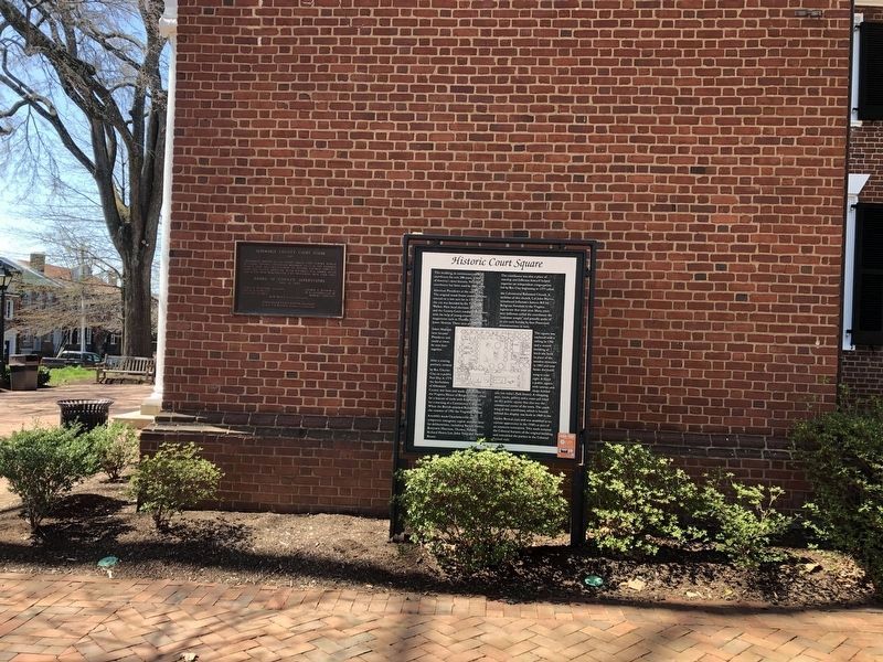
This building, in continuous use as a
courthouse for over 200 years, is one of America’s most historic. No other courthouse has been used by three early
American Presidents at the same time, The original wood frame courthouse was erected on a . . . — — Map (db m19723) HM
Clark County. Area 171 Square Miles. Formed in 1836 from Frederick, and added to from Warren. Named for George Rogers Clark, Conqueror of the Northwest. Lord Fairfax and General Daniel Morgan, Revolutionary hero, lived in this . . . — — Map (db m1394) HM
The gates, which were installed in 1819, were one of the finishing touches to the reconstruction of the White House after it was burned during the War of 1812. The gates were commissioned by President James Monroe and were fabricated at the New . . . — — Map (db m140956) HM
These trees were planted
in commemoration of the
eight Presidents of
the United States
who were sons of Virginia.
George Washington 1789-1797
Thomas Jefferson 1801-1809
James Madison 1809-1817
James Monroe 1817-1825 . . . — — Map (db m241179) HM
Richard Bland Lee (1761-1827)
First Congressional Representative for Northern Virginia to the first three Federal Congresses
A Commissioner to supervise reconstruction of the War of 1812 damaged buildings in the United States . . . — — Map (db m198261) HM
Invasion of Washington City
Following the defeat of American militia forces by British regulars at Bladensburg, Maryland on the afternoon of August 24, 1814, a small British force, consisting mainly of officers, marched into the capital . . . — — Map (db m102960) HM
The United States Congress, attempting to use economic pressure to lift British and French trade restrictions, imposed on American shipping during the Napoleonic Wars, passed the Embargo Act of 1807. Ships were not permitted to leave American . . . — — Map (db m198240) HM
(Panel 1)
The Battle of the White House Gun Battery, September 1-5, 1814, was the first military action in the region after the British attack on Washington. Named for a nearby white house, the battery was located at today’s Fort Belvoir. . . . — — Map (db m98160) HM
Hazel Hill, the home of John Minor (13 May 1761 – 8 June 1816), a close friend of President James Monroe, once occupied this site. Minor served as a soldier in the American Revolution, as a colonel of the Spotsylvania County militia, and as a . . . — — Map (db m195328) HM
In memory of the founders of
the James Monroe Museum and Memorial Library
Rose Gouverneur Hoes
1860 - 1933
and her devoted son
Laurence Gouverneur Hoes
1900 - 1978
great-granddaughter and great-great-grandson of
James . . . — — Map (db m216709) HM
The James Monroe Law Office - Museum and Memorial Library was established as a perpetual memorial, sacred to the memory of James Monroe, and in honor of the principles of just government and righteousness as exemplified in his life and in his . . . — — Map (db m216707) HM
The fort was begun in 1819 and named for President James Monroe. It remained in possession of the Union forces, 1861-65, and from it as a base McClellan began the Peninsular Campaign, 1862. Jefferson Davis was imprisoned here, 1865-67. — — Map (db m10319) HM
Just to the north where Brook Road crosses Brook Run creek was the rendezvous point for the largest U.S. slave revolt ever planned. It was to be here on August 30, 1800, that Gabriel, a slave from nearby Brookfield Plantation, called for hundreds of . . . — — Map (db m15944) HM
Adjacent to this park, in a location known as Young’s Spring (1), Gabriel, a slave of Thomas Prosser, was appointed leader of the rebellion in the summer of 1800. He lived on Brookfield Plantation (2) in Henrico County. His objectives were to . . . — — Map (db m24744) HM
Gabriel, a slave of Thomas Prosser of nearby Brookfield plantation, planned a slave insurrection against Richmond on 30 Aug. 1800. The slaves intended to kidnap Governor James Monroe and compel him to support political, social, and economic equality . . . — — Map (db m15850) HM
Just one block southwest at Young's Spring on Upham Brook, slaves often congregated on weekends to hold religious services and social gatherings. This is where Gabriel, a slave of William Prosser, planned the slave rebellion scheduled for 30 August . . . — — Map (db m24740) HM
On behalf of a grateful nation, President James Monroe invited the Marquis de Lafayette to visit the United States, his adopted country. Lafayette’s tour of all 24 states in 1824 and 1825 drew large crowds and sparked a renewal of patriotism. On 22 . . . — — Map (db m90955) HM
Loudoun County. Area 519 Square Miles. Formed in 1757 from Fairfax and named for Lord Loudoun, titular governor of Virginia and head of the British forces in America, 1756-1758. Oak Hill, President James Monroe's home, is in . . . — — Map (db m64583) HM
The house to the North is Oak Hill. Designed by Thomas Jefferson for James Monroe, it was built about 1823. Monroe lived there for some years. — — Map (db m1452) HM
The Loudoun County Courthouse, first occupied in 1895, is the third on this site, which was designated for that use on the 1759 plat of Leesburg. On 12 Aug. 1776, the Declaration of Independence was read from the doorway of the first courthouse. The . . . — — Map (db m876) HM
Saving the Declaration of Independence. On 22 Aug. 1814, two days before British forces entered Washington, Sec. of State James Monroe ordered government records, including the Declaration of Independence, removed to Virginia for safekeeping. . . . — — Map (db m90422) HM
Temple Hall was the home of William Temple Thomson Mason, son of Thomson Mason of Raspberry Plain and nephew of George Mason, author of the Virginia Declaration of Rights. The house was constructed about 1810 and was the centerpiece for the farm . . . — — Map (db m106399) HM
This Is Temple Hall!
Discover Loudoun County's agricultural roots on a working farm at Temple Hall Farm Regional Park in Leesburg, Virginia. Home of the popular Fall Festival and Corn Maize, visitors can meet heritage breed farm . . . — — Map (db m197006) HM
Loudon County. Area 519 Square Miles. Formed in 1757 from Fairfax, and named for Lord Loudoun, titular governor of Virginia and head of the British forces in America, 1756-1758. Oak Hill, President James Monroe's home, is in . . . — — Map (db m934) HM
Loudoun County. Area 519 Square Miles. Formed in 1757 from Fairfax, and named for Lord Louduon, titular Governor of Virginia, and head of the British Forces in America, 1756-1758. Oak Hill, President James Monroe’s home, is in . . . — — Map (db m64585) HM
In 1814 due to the British advance on Washington, it was deemed wise to remove the Declaration of Independence, the U.S. Constitution, and other valuable state documents to a safe place. They were transported across Chain Bridge into Virginia. The . . . — — Map (db m20118) HM
In this area are buried five soldiers who fought in the American Revolution 1776-1783:
Two of them, the Duffel brothers, are buried on the East side, near the fence:
James (1759-1835) enlisted in the Continental . . . — — Map (db m179670) HM
Moses Myers (1753-1835) was a shipping merchant who came to Norfolk in 1787 from New York. He acquired this site in September 1791 and built his distinguished Federal town house in 1792. It was one of the early brick buildings to be constructed in . . . — — Map (db m35092) HM
Built by Nathaniel Gordon, 1787. Visited by Washington, Jefferson, Madison, Monroe, Philip and James Barbour, Clark, Rives, Randolph, Wirt, Waddell, and other celebrities of Revolutionary, post-Revolutionary, and Confederate War periods. Lafayette . . . — — Map (db m4794) HM
The Carolina Road, earlier an Indian hunting path, roughly approximating Route 15 at this point, derived its name from trade between Frederick, Maryland, and Georgia. Later the road was used by settlers emigrating to western lands. Because of . . . — — Map (db m105) HM
On this site the Virginia Convention ratified the United States Constitution June 25, 1788
In the ratifying convention were Edmund Randolph, James Madison, George Wythe, Henry Lee, John Marshall, Patrick Henry, George Mason and James Monroe . . . — — Map (db m18851) HM
Born in Westmoreland County 28” April 1758.
Died in the City of New York 4“ July 1831.
By order of the General Assembly, his remains were removed to this cemetery 5” July 1858 as an evidence of the affection of Virginia for her good and honored . . . — — Map (db m8017) HM
Fifth President James Monroe was born April 28, 1758 in Westmoreland County, Virginia.
While attending the College of William and Mary he joined in the struggle for independence from Great Britain. James Monroe served with distinction during . . . — — Map (db m95589) HM
The 5th U.S. President, his Monroe Doctrine was the foundation of foreign affairs: America would never again accept colonization by European powers. America would deem any attempt at such colonization dangerous to our peace and safety. Wars in . . . — — Map (db m165933) HM
I should be destitute of feeling I was not deeply affected by the strong proof which my fellow citizens have given me of their confidence in calling me to the high office whose functions I am about to assume. (James Monroe, . . . — — Map (db m176523) HM
Fifth president of the United States, 1817- 1825. Governor of Virginia, 1799 and 1811. Proclaimed the Monroe Doctrine, December 2, 1823.
Declares the Americas no longer subject to European colonization. — — Map (db m11940) HM
In this vicinity stood the Monroe home where James Monroe, fifth president of the United States, was born, April 28, 1758. His father was Spence Monroe and his mother, Elizabeth Jones. He left home at the age of sixteen to enter William and Mary . . . — — Map (db m11585) HM
The James Monroe Building is a nationally-significant historic site attributed to our nation's 5th President, James Monroe. The property's significance dates to the inheritance and active agricultural employ of these lands by Monroe's father, . . . — — Map (db m176509) HM
This marks the birthplace of James Monroe, April 28, 1758
Westmoreland County, Virginia
Attended college of William & Mary; Officer, Continental Army, American Revolution; Married Elizabeth Kortright, 1786; US Senator; Minister . . . — — Map (db m11941) HM
President James Monroe was born here on April 28, 1758 to Spence and Eliza Jones Monroe. He lived on this farm until he left to attend the College of William and Mary. He sold the farm to 1783 following his father's death.
The 500 acre farm, . . . — — Map (db m176501) HM
He has in every instance, maintained the reputation of a brave, active, and sensible officer. (George Washington, 1779)
Turn his soul wrong out side outwards and there is not a speck on it. (Thomas Jefferson, 1787)
There . . . — — Map (db m176526) HM
James Monroe's public service career, the most extensive of any President of the United States, took him far from his Westmoreland County birthplace.
As a student at the College of William and Mary in Williamsburg, Monroe was inspired to . . . — — Map (db m176506) HM
Having commenced my service in early youth, and continued it since with few and short intervals. I have witnessed the great difficulties to which our union has been exposed, and admired by the virtue and intelligence with which they . . . — — Map (db m176529) HM
King George County. Area 180 Square Miles. Formed in 1720 from Richmond, and named for King George I. James Madison, "Father of the American Constitution" and President of the United States, was born in this county. . . . — — Map (db m22268) HM
As one of five children, James Monroe spent the better part of his youth on these lands.
The Home Site
His father, Spence Monroe, was a middling farmer of modest but respectable means and a trained joiner, or cabinet maker. The family . . . — — Map (db m176514) HM
It is only when the people become ignorant and corrupt, when they degenerate into a populace, that they are incapable of exercising their sovereignty. (James Monroe, 1801)
On the morning of December 26, 1776, a small detachment of American Light Infantry, led by Lieutenant James Monroe, aged 19, breached the Hessian defenses at Trenton. This gallant action, in which Monroe was severely wounded, enabled the . . . — — Map (db m11942) HM
As a friend of humanity, I rejoice in the French Revolution, but as a citizen of America, the gratification is a greatly increased.
(James Monroe, 1791)
1794: Commissioned Minister to France by President . . . — — Map (db m176520) HM
The occasion has been judged proper for asserting as a principle in which the rights and interests of the United States are involved that the American continents by the free and independent condition which they have assumed and maintain, are . . . — — Map (db m176524) HM
"The Birthplace of a Nation"
Lying between the Rappahannock and Potomac rivers, the Northern Neck provided fertile land that supported production of tobacco, the first great cash crop of the Virginia colony.
Six counties were formed . . . — — Map (db m176507) HM
Northumberland County. Area 205 square miles. Originally an Indian district called Chicacoan. In 1648 it became Northumberland County, named for an English county. The mouth of the Potomac River is here.
Westmoreland . . . — — Map (db m22471) HM
Here George Washington, while living at Wakefield with a brother, went to school, 1744–1746. Here Union Cavalry came on a raid through the Northern Neck, May 1863. Several miles north of this place, James Monroe, fifth President of the United . . . — — Map (db m22108) HM
In the early 19th century what is today the northwest coast of Washington State might have become a Russian colony, an extension of Alaska, if the Sv. Nikolai voyage had been successful. This could have led to this section of New Albion, the . . . — — Map (db m129579) HM
Marker Front: Formed, 1778, from Botetourt and Montgomery. Named for the river which drains it. This county had many pioneer forts and saw many bloody Indian battles. Here are the world-famed White Sulphur and other mineral springs. . . . — — Map (db m76553) HM
The confluence of the Ohio and Little Kanawha Rivers is known as “the Point.” It was the site of downtown Parkersburg’s earliest settlement and the stopping place for several famous people. George Washington paused here in his trip down . . . — — Map (db m73580) HM
was appointed by President Monroe as a district judge for the northern and western Michigan Territory, which included what is now the state of Wisconsin. Doty set up the region's new court in an empty log building.
Three years later, . . . — — Map (db m43822) HM
161 entries matched your criteria. Entries 101 through 161 are listed above. ⊲ Previous 100