The '89er Trail is a series of 28 historical markers placed where the events took place that helped create the City of Oklahoma City, from the attempts of the Boomers to settle in the Unassigned Lands to the election of the City's first mayor in 1890.
By Mark Hilton, October 21, 2019
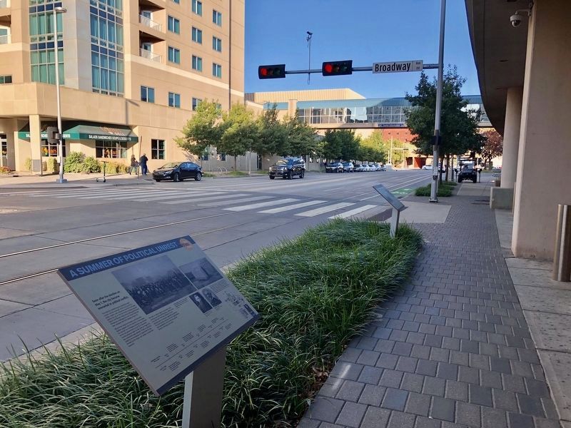
A Summer of Political Unrest Marker in the foreground.
Soon after the election on May 1, the city became ensnarled in political conflict.
The rules for establishing lot ownership were unclear and the attempts of the city council to clarify matters with ordinances and lot certificates sold by . . . — — Map (db m141899) HM
Journalist, Lawyer, Educator, Orator, and Author of Oklahoma City History
Arriving from Kansas on April 22, Angelo C. Scott, age 31 and his brother W.W. Scott started a newspaper, the Oklahoma Times, soon renamed the Journal, the first in . . . — — Map (db m142023) HM
With a margin of only 14 votes, Beale claimed a mandate to overturn seven months of Seminole-dominated city rule. Within a month the city was in chaos and city governance was shut down by federal authorities.
Dr. A. J. Beale, the leader . . . — — Map (db m142036) HM
Cowboy, police chief, legislator, wildcatter, entrepreneur, and developer
Charles Colcord, a native of Kentucky, spent his formative years as a cowboy in western Oklahoma, Texas, and Arizona. In 1889, at age 29, he came to Oklahoma City . . . — — Map (db m141878) HM
Always short on revenue, the City eventually acquired its own building by evicting a saloon.
The Mayor and City Council of Oklahoma City first met on May 3, 1889 in the law office of councilman Ledru Guthrie on the south side of Main . . . — — Map (db m141902) HM
Big Anne Wynn, the town's most prominent madam, pitched a tent on Front Street on the day of the Run to provide female companionship for the overwhelmingly male population.
Disembarking at Santa Fe Station new arrivals encountered a district . . . — — Map (db m141984) HM
An ardent promoter and businessman: perhaps the greatest of the founding fathers
Prior to the Run of 1889, Ohio native Henry Overholser arranged for 10 railroad cars of prefabricated wood-frame buildings and lumber to be waiting for him at . . . — — Map (db m141880) HM
Two days before the Land Run in April, 1889, President Harrison set aside a Military Reservation of 160 acres east of the Santa Fe railroad depot, where soldiers were stationed to keep the peace.
In 1886 the first railroads were built . . . — — Map (db m176269) HM
The Military Reservation was released to Oklahoma City in 1894 and proceeds of lot sales were used to pay for school sites and construction.
Just before the Run of '89, the federal government reserved 160 acres east of the Santa Fe Railroad . . . — — Map (db m176266) HM
Most land claim disputes were resolved by settlement, or purchase and relinquishment. But some required lengthy litigation.
With territorial government authorized by Congress in May, 1890, a formal structure was established for resolving . . . — — Map (db m142054) HM
The Citizens' Survey, begun the day after the Run, was reconciled with the survey of the Seminole Town and Improvement Company at a mass meeting on April 27.
As the Citizens' Committee and its surveyors worked north from the section line at . . . — — Map (db m142009) HM
On Saturday, April 27 the citizens of South Oklahoma elected G. W. Patrick mayor along with a full slate of city officials.
On April 23, 1889, G. W. Patrick began surveying south from the section line at Reno, as the Citizens' Survey began . . . — — Map (db m142057) HM
Lumberman, Banker, and Business Leader
On the afternoon of April 22, T.M. Richardson, and his son T.M. Jr., from Albany, Texas, staked a claim at the northeast corner of Clarke Street (later Grand, and today Sheridan) and Harvey, where the . . . — — Map (db m141891) HM
Captain David Payne and his Boomers defied federal authorities to attempt settlement in the Unassigned Lands.
From the 1830s onward, most of present-day Oklahoma was reserved for Native Americans who had been forcibly relocated from their . . . — — Map (db m118805) HM
A reporter from Harpers Weekly returned to Oklahoma City two months after its birth to find its progress remarkable beyond belief.
William Willard Howard writing an article called "The Building of Oklahoma" in the June 29, 1889 issue of . . . — — Map (db m141907) HM
Promising future prosperity, another railroad crossed downtown.
In August, 1889, an issue surfaced with settlers that would reverberate for years to come. The Choctaw Coal and Railway Company wanted to build a railroad (the "Choctaw Road") . . . — — Map (db m176270) HM
Overnight, a city of tents arose next to the railroad station. But where were the streets and lot lines? Amid the confusion, a mass meeting was called which elected a committee to bring order with a new survey.
Confusion reigned on . . . — — Map (db m142030) HM
A slate of candidates supported by the Seminole Town and Improvement Company, including the temporary mayor William Couch, was elected at the polls on Wednesday, May 1.
At the mass meeting on April 27, after the compromise survey was . . . — — Map (db m142027) HM
The race for free land began at noon on April 22, 1889, with an estimated 50,000 participants from all over the world.
At high noon on a bright and clear Monday, April 22, 1889, a drama roared to life when mounted soldiers fired their guns . . . — — Map (db m141908) HM
Oklahoma City and Guthrie, a dozen other towns, and thousands of farms were settled in a day.
The Run of '89 gave birth to Oklahoma City, which today is the state's capital and largest city. It also marked the beginning of Guthrie, where the . . . — — Map (db m141980) HM
Following enactment of the Organic Act in May, 1890, territorial, county, and city governments were quickly established. Federal townsite laws clarified the procedure for confirming and settling land claims, and a land office opened in Oklahoma . . . — — Map (db m142052) HM
On May 2, 1890, Congress passed long awaited legislation establishing federally sanctioned territorial government for Oklahoma.
The Organic Act defined Oklahoma Territory boundaries to include the lands west of Indian Territory and the . . . — — Map (db m142037) HM
First a boomer, then a sooner, then the first mayor of Oklahoma City, William L. Couch resigned as Mayor on November 11, 1889. Five months later, he died of a gunshot wound by a rival homestead claimant, the day before the first anniversary of the . . . — — Map (db m142056) HM
A visit by influential members of Congress
in September 1889 was the most important
event in Oklahoma since the Run itself.
On Tuesday, September 17, 1889, six congressmen arrived by rail from
Guthrie for a first-hand look at life in the . . . — — Map (db m141875) HM