Built in 1867, the spring house is the oldest remaining structure on the grounds. The famous water from the Big Eddy Springs in Chippewa Falls has served water-bottling companies and the Leinenkugel brewery for over 150 years. It is still used today . . . — — Map (db m236853) HM
Over the years, numerous improvements to bottling and canning capabilities have taken place at Leinenkugel's. Early on, beer was bottled in 64 oz. "picnic bottles," 32 oz. quarts, 12 oz. "pints," and 8 oz. "splits." Leinenkugel's was an early seller . . . — — Map (db m244121) HM
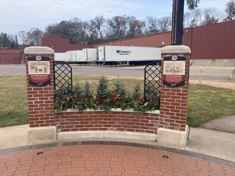
In 1890, Jacob finished construction of the Brew House. This brewery centerpiece remains standing today. Over the next few years, he added an icehouse, bottling house, cooper shop, and sheltering barns for the delivery horses. Future expansions . . . — — Map (db m244124) HM
Millions of years ago the Midwest area of North America was covered by a great inland sea that laid down virgin white Cambrian sandstone. As the sea filled in, most of this sandstone became buried thousands of feet below the surface. The rim . . . — — Map (db m42326) HM
In September of 1873 James Monroe Bingham, a local attorney, State Assemblyman, and future lieutenant governor of the State of Wisconsin, purchased this land which had just been plotted as Block 14 of the Western Addition to the City of Chippewa . . . — — Map (db m42667) HM
This building was built in 1917 in memory of Edward Rutledge.
Mr. Rutledge was born in northern Ireland on March 6, 1834. As a child he moved with his parents to South Mountain, Ontario, Canada where they farmed. At age 16 Edward and his two . . . — — Map (db m39426) HM
First Presbyterian Church is the oldest Protestant Church in the City of Chippewa Falls.
It was organized in 1855 by Rev. W. W. McNair. The first services were held in a log cabin 12 x 14 feet located on the east bank of Duncan Creek, just . . . — — Map (db m42611) HM
Hiram S. Allen was born in Chelsea, Vermont and came to the Chippewa Valley of Wisconsin in 1834. Here he began a long and flourishing career and an active business life. He built the first grist-mill, the first flour-mill, and the first hotel . . . — — Map (db m42343) HM
Sergeant Charles E. Mower, Company A, 34th Infantry, on November 3, 1944, was an assistant squad leader in an attack against strongly defended enemy positions on both sides of a stream running through a wooded gulch near Capoocan, Leyte, Philippine . . . — — Map (db m41559) HM
The soldier bird who was captured in Chippewa County by Chief Sky and taken to Eau Claire by Daniel McCann of Eagle Point. With Company "C" of the Eighth Wisconsin Regiment, he participated in twenty-five battles of the Civil War and was afterwards . . . — — Map (db m38223) HM
The Irvine Park Drive Bridge was an example of a Pratt bridge construction, which was a design used in Wisconsin from 1895-1910. The Milwaukee Bridge and Iron Company fabricated the bridge in 1907. The structure originally crossed Duncan Creek on . . . — — Map (db m38734) HM
Jacob and Josephine Leinenkugel had five children. Though one child passed away as an infant, all four of their remaining children grew up helping out at the brewery.
Mathias "Matt," born in 1866, attended school until he was 16 and began working . . . — — Map (db m244122) HM
The Malt House was constructed during the 1870s and is the oldest existing building on the grounds. Built entirely of stone, it cost $5,000 at the time of its construction. The first floor acted as a dormitory for brewery employees, while the second . . . — — Map (db m244130) HM
On Sunday, May 2, 1937, Wisconsin Power Cooperative was organized by an assembly of farmers for the purpose of developing a generating and transmission facility to provide low-cost electric service for the rural areas of Buffalo, Chippewa, Clark, . . . — — Map (db m13798) HM
Before the 19th-century social reform movement, developmentally disabled people were relegated to almshouses and county poor farms where the “indigent, insane, epileptic and “idiotic” were housed together without regard to . . . — — Map (db m13297) HM
Primarily rural in the 19th century, Wisconsin promoted the state fair to advance better state farming practices. Since 1851 to the present, this fair has been held in southern Wisconsin. Recognizing the impracticality of entering or attending the . . . — — Map (db m223294) HM
Notre Dame was Chippewa County’s first church, the Mother church of all area Catholic Churches. Originally called St. Mary’s (“Our Lady of the Pines”) was a 16' x 18' foot log structure erected in 1856. A carpenter’s bench served as . . . — — Map (db m39975) HM
The building to your right is the oldest commercial building in Chippewa Falls. It was built (Circa 1859) by Peter Morie (Morey) and was used originally as a Saloon and Boarding House for lumberjacks and others. In 1861 at the start of the Civil . . . — — Map (db m55299) HM
One of the most picturesque areas along Duncan Creek Bike Trail is ironically known as Pig Alley. The alley runs from the north end of North Grove Street, along Duncan Creek, to the brewery. This trail got its name in the late 1800s when pigs and . . . — — Map (db m244129) HM
This log house, constructed of hand-hewn White Pine logs, was built by Norwegian immigrant Ole Pederson Bjerke about 1881. Ole and his wife Mari had three sons: Gus, John, and Charles.
Around 1880, Ole had applied for a Homestead in the . . . — — Map (db m43658) HM
Charles was born in Rochester, New York. At the early age of thirteen he entered the provincial seminary of St. Francis near Milwaukee. He graduated in 1864 and then entered the American College at Louvain, Belgium. There he earned two divinity . . . — — Map (db m39937) HM
He gave his life to the Jaycees and to his community, in the belief that service to humanity is the best work of life. We shall not forget...
Ronald P. Anders Memorial Pure Water Fountain was constructed by the Chippewa Falls Jaycees and . . . — — Map (db m41525) HM
In 1904 on this 25 acre site between the Chippewa River and the Soo Line Railroad tracks, sugar processing became a new industry in the Chippewa Valley. The Chippewa Sugar Company was incorporated and a huge six-story sugar beet factory was . . . — — Map (db m42693) HM
This Columbia Street site was the location of the ornate pioneer mansion built by Hiram Stores Allen. Called the founder of Chippewa Falls, Hiram built the first grist-mill, the first flour-mill, and the first hotel in Chippewa Falls. He operated . . . — — Map (db m38891) HM
Chippewa Falls was born with the logging era and with it came support industries such as shoe factories. One of the most important tools for the loggers was strong boots. In 1869, Colliche Vinette was the first shoemaker to come to town. The area . . . — — Map (db m38822) HM
Joseph Sokup opened Sokup’s Market in Downtown Chippewa Falls around 1891 on the northwest corner of Bay and Willow Streets. He built the current grocery store at 624 N. Bridge Street in 1894. The market is one of the oldest family owned businesses . . . — — Map (db m55380) HM
The barn was an integral part of the brewery, providing shelter for livestock and housing wagons used to build the brewery and deliver the beer. In December 1903, Chippewa Times wrote: "Possessing one horse and a democrat wagon, [John] Miller could . . . — — Map (db m244125) HM
Sunny Valley School, originally called Goethel School was built in 1903 approximately eight miles west of Chippewa Falls on State Highway 29 where it crosses County Highway T. The one room schoolhouse served the north half of School District No. 5, . . . — — Map (db m43255) HM
This waiting shelter at the northern most point of service is the only physical structure remaining of what was once the 12½ mile long Eau Claire/Chippewa Falls interurban electric streetcar line.
In 1897, Boston financier Arthur Appleyard . . . — — Map (db m39822) HM
This Federal Post Office Building was built in 1910 at a cost of $90,000. The property was purchased from the Thornton estate for $10,000. The Neo-Classical design style was often used by governmental architects of the Treasury Department during the . . . — — Map (db m39009) HM
Chippewa Fall's oldest industry. In 1867, Jacob Leinenkugel, the son of a Bavarian brewmaster, came to Northern Wisconsin searching for a promising location to build a brewery. He settled on this spot purchasing the land from lumberman Hiram S. . . . — — Map (db m42360) HM
The City of Chippewa Falls was organized around two moving bodies of water, the Chippewa River and its tributary Duncan Creek. Bridges soon became necessary with rapid expansion of the transportation system in the late 19th and early . . . — — Map (db m38806) HM
Built in 1871 by Alexander Wiley Sr. and Nels Elikson, the rooming house over the years was home for hundreds of immigrants, lumber jacks, mill workers, farm hands and log drivers (known as river pigs). In 1887 Wiley Sr. became the sole owner and . . . — — Map (db m42697) HM
Before there were numbered highways in the United States there were names attached to roads to help motorists navigate from town to town or from county to county. In 1912 no one thought in terms of an inter-state highway. However, a small band of . . . — — Map (db m42158) HM
As early as 1846, Methodists were meeting in Chippewa Falls, with Thomas Randall preaching to his neighbors in a boarding house owned by the Chippewa Lumber and Boom Company. On March 10, 1860, Reverend Thomas Harwood, the first assigned . . . — — Map (db m42615) HM
William Irvine was born in Mount Carroll, Illinois of Scotch-Irish ancestry. He came to the Chippewa Valley when he was 14 years old to work for his brother-in-law, who was captain of a raft boat towing lumber from Chippewa Falls to Mississippi . . . — — Map (db m38788) HM
From 1882 to 1962, the Chippewa Woolen Mill played an important role in the economy of Chippewa Falls. The mill was established for the purpose of supplying the men working in the lumber trade with warm, dependable clothing. During the 1920s, the . . . — — Map (db m237868) HM
The Cobban Bridge, constructed in 1908 by the Modern Steel Structural Company of Waukesha, is a two-span Pennsylvania overhead truss type bridge and is the oldest of its kind in Wisconsin. Originally it crossed the Chippewa River just upstream from . . . — — Map (db m12761) HM
In 1912, after a permanent dam was built across the Chippewa River near this location, the Cornell Wood Products Company, a large paper milling operation, began production here. The company manufactured paper products, cardboard and wallboard. The . . . — — Map (db m45015) HM
This tablet was erected in 1931
by The Women's Club of
Cornell, Wisconsin
and serves a twofold purpose.
—
On the hillside below, unmarked and obliterated, are many Indian graves of days long past. At a later period this plot . . . — — Map (db m46047) HM
Ezra Cornell was the man who founded the City of Cornell, Wisconsin, but actually never lived here. Cornell was born in 1807 in New York State of Quaker parents. He was a farmer, inventor, businessman, statesman, and a philanthropist. He . . . — — Map (db m46026) HM
Jean Brunet is one of the most noteworthy pioneers of the Chippewa Valley. Born in France in 1791, Brunet immigrated to this country in 1818 and moved to Chippewa Falls in 1828. He built the first dams on the Chippewa River at Chippewa . . . — — Map (db m46018) HM
The Cornell Pulpwood Stacker is believed to be the last of its kind in the world and is listed in the State and National Register of Public Places. Designed and constructed in 1911-12 by the Joors Manufacturing Co., of England for the Cornell . . . — — Map (db m46068) HM
This cemetery with original records written in Czech dated October 22, 1905, nestles in the heart of the Bohemian farm settlement ¼ mile north of their Fraternal Hall on Highway 27.
The 33 families who cleared the land and plotted it into 10' x . . . — — Map (db m45268) HM
This is the former site of a dam, a grindstone and an electrical power plant, locally known as "Stanley's Mill." It was also used as a log sluiceway and popular recreation area. First used on December 26, 1877, the electrical plant furnished power . . . — — Map (db m48998) HM
On July 7, 1905, sixteen loggers of the Chippewa Lumber and Boom Company attempted to break a log jam on the Chippewa River at Holcombe below Little Falls dam, one of the largest wooden dams in the world. The batteau boat they were riding in reached . . . — — Map (db m45434) HM
The Holcombe Indian was known to river men along the Chippewa since 1876. Called the King of the Chippewa River, he stood guard on the old Holcombe (Little Falls) Dam and was a most welcome site to lumberjacks driving their logs down the river to . . . — — Map (db m45431) HM
In the Spring of 1861 a band of hungry Chippewa Indians came to the McCann farm just across the river from here and traded a young eagle for corn. The eagle became a family pet. When Company C, 8th Wisconsin was organized at Eau Claire for Civil War . . . — — Map (db m49313) HM
This wayside is part of the old McCann farm, childhood home of Old Abe, the War Eagle. In the Spring of 1861 a band of hungry Chippewa came to the McCann farm and traded a young eagle for corn. The eagle became a family pet. When Company C, Eighth . . . — — Map (db m13984) HM
The present Village of New Auburn approximates the site of Cartwright Mill, founded in 1875 by David J. and Paul W. Cartwright. To the original sawmill, powered by steam, they added a lath, shingle, and planing mill. Some buildings were of brick . . . — — Map (db m45182) HM
A 1928 act of Congress made obsolete World War I weapons available to municipalities and veteran's organizations for commemorative purposes. The Stanley American Legion Post requested this 5-inch bore artillery piece and it was dedicated on Memorial . . . — — Map (db m42131) HM
Before there were numbered highways in the United States there were names attached to roads to help motorists navigate from town to town or from county to county. In 1912 no one thought in terms of an inter-state highway. However, a small band of . . . — — Map (db m42144) HM
In 1847, a German by the name of George Myers arrived in Chippewa Falls looking for a tract of land for farming purposes. Prior to that time no one had attempted to cultivate any larger spot of ground than a garden patch. He chose this tract of . . . — — Map (db m55590) HM
In the early 1850's, settlers from Rhine, Bavaria, Bohemia, and Luxembourg came to this part of Wisconsin now known as Tilden Township. They vowed to build a church in honor of the "Blessed Virgin Mother of God" giving thanks for their safe voyage . . . — — Map (db m55397) HM
At his father's cheese factory about one mile south and one mile west of here, Joseph F. Steinwand in 1885 developed a new and unique type of cheese. He named it for the township in which his father, Ambrose Steinwand, Sr., had built northern Clark . . . — — Map (db m9189) HM
This tree was a landmark near the Iron-Ashland Co. line northeast of Glidden, Wis. The first section of 20 ft. is in Glidden. Les got the next cut of 12 ft.
The tree measured 6 ft. on the stump. The tree was 144 ft. high. The first limb was 65 . . . — — Map (db m22327) HM
The first coast-to-coast auto route across the northern tier of states.
"A Good Road from Plymouth Rock to Puget Sound"
Before 1912 Railroads dominated long distance transportation. Local roads were dust and mud. There was little . . . — — Map (db m43262) HM
The Mormons, Clark County's first loggers, came in 1844 and established camps between Wedge's Creek and Greenwood to cut timber for their Illinois city of Nauvoo. After the murder of their leader Joseph Smith at Carthage, Illinois in mid-1844, the . . . — — Map (db m103977) HM
1st Cemetery in the Loyal Township
Child of Daniel & Mary Mack 1858
Daniel Mack 1866
13th child of Erastus & Maria Mack 1860
Mary Benedict Mack 1874
Frank Castner 1877
Infant child of John & Lydia Castner 1880
Twin infants of . . . — — Map (db m21947) HM
All Gave Some
Some Gave All
This memorial is dedicated to our Loyal area veterans of the past and present for their bravery, service, and sacrifice in times of peace and war while protecting the principles of our United States of America. . . . — — Map (db m49534) HM
When a lad of 14 he went as a substitute for his brother in law that his sister and her 7 little ones might not be deprived of a husband and father’s care.
Served as Private in N. Y. Militia.
Was in Battle of Niagara.
Honorably discharged . . . — — Map (db m9691) HM
The Clark County Historical Society
1897 Jail Museum
has been placed on the
National Register
of Historic Places
by the United States
Department of the Interior
December 8, 1978
. . . — — Map (db m41452) HM
Originally used for threshing grain in the area by William Neville, this steam engine was owned by Martin "Max" Feuerstein from the 1930s through the 1960s to power a sawmill along 18th Street on Neillsville's northside. This sawmill produced lumber . . . — — Map (db m41389) HM
Most of the topographical features to be seen here can probably be attributed to deposits or moraines left when the glacier receded. The castellated hills or mounds northwest of Neillsville are of greater geological significance and interest, . . . — — Map (db m9851) HM
Dickinson-Hoesly
House
has been recognized as a
Historic Landmark
by the
Neillsville Historic
Preservation Commission
1891
(lower plaque)
2012
Wisconsin Centennial Property
Build 1891 for Decatur and . . . — — Map (db m76734) HM
Honoring the men and women from Wisconsin who served in Vietnam.
We left pieces of ourselves in Vietnam. We brought parts of Vietnam home.
Each fragmented figure supports the others. A close inspection of the figure with the helmet reveals . . . — — Map (db m25146) HM
During World War II this was a symbol for the American serviceman. Any place in the world where one of them went he would see it. It was found in restrooms, on trucks, tanks, ships, bombed out walls, and almost any place it could be painted, penned, . . . — — Map (db m18637) HM
General Sturdevant, chief architect and father of the Alcan Highway, was born in Neillsville and married Beth Youmans of this city. During forty years of devoted service General Sturdevant was awarded the Distinguished Service Cross, the Bronze . . . — — Map (db m30863) HM
This memorial statue was envisioned to serve as a touchstone where the quiet tears of unresolved grief from mothers, fathers, brothers, sisters, relatives and friends could be shed in an honorific setting and be strengthened by the groundswell of . . . — — Map (db m29599) WM
This property
has been placed on the
National Register
of Historic Places
by the United States
Department of the Interior
Neillsville
Post Office
1937
Henry Morgenthau Jr
Secretary of the Treasury . . . — — Map (db m47630) HM
We, the Korean Veterans Tribute Committee, designed this tribute to convey to you insight into the hardships and isolation experienced by our troops.
The three bronze figures represent bitter cold, extreme heat and seemingly never ending monsoons. . . . — — Map (db m78738) WM
Side A Neillsville has strong ties to the majestic white pine forests of the Wisconsin Territory. These forests along the Black River and its tributaries drew members of the Church of Jesus Christ of Latter-day Saints in 1841. Remembered . . . — — Map (db m185567) HM
In Honor and Remembrance of
the Women of Wisconsin
Who Have Served Our Nation
Dedicated September 19, 1992
Donated by
The Wisconsin Women and Men
of Vietnam Veterans of America — — Map (db m78718) WM
Site of The Worden Church
of the Brethren
Erected in 1904
Destroyed by tornado in 1958
Dedicated Sept. 28, 1975
by members and friends — — Map (db m22324) HM
Planted in honor of those who lost
their lives in the tragic events on
September 11, 2001
The American Liberty elm was named after "The Liberty Tree": Our Country's first Symbol of Freedom. On the morning of August 14, 1765, the people . . . — — Map (db m47912) HM
St. Hedwig's
In 1891, a wooden church was built and named St. Hedwig's for a queen of Poland. In 1904, the present-day structure was built and accommodated the growing congregation with seating for 700 people. Members of the congregation . . . — — Map (db m48771) HM
This memorial is dedicated to the life of David J. Jones Born in Cambria, WI, June 20, 1880. Davy grew up in Cambria playing baseball with well known local players such as the Dodge Brothers, Willard and Ben. Davy was an aggressive leadoff . . . — — Map (db m66065) HM
On this site in 1844, John Langdon & his four sons erected a sawmill, a dam & gristmill. Other early settlers by the names of McConochie, Dodge, Torbert, & Williams joined in construction. The original place name of Langdon's Mill, later became . . . — — Map (db m66352) HM
This 1892 Richardsonian Romanesque building was designed by T.D. Allen of Minneapolis using local materials. It originally housed the Library, Kindergarten and Fire Station in addition to the City Offices, Police Departments and Auditorium. The . . . — — Map (db m67231) HM
The Prairie Style Library was designed by Louis W. Claude (former associate of Louis Sullivan) and Edward F. Starck of Madison, Wisconsin, and built with funding from Andrew Carnegie and the Columbus Women's Club. The library was dedicated November . . . — — Map (db m28344) HM
In 1919, Bank President J. Russell Wheeler and his wife, Anna May Wheeler, retained Architect Louis Sullivan. Known as the father of the skyscraper, Sullivan was to design a building that would give the bank an image of financial security, civic . . . — — Map (db m67230) HM
Governor James Taylor Lewis · 1819 – 1904
Governor James T. Lewis, the ninth Governor of Wisconsin (1864-66), led the state through the tumultuous conclusion of the Civil War. He was born in New York State and in 1845 settled in . . . — — Map (db m22918) HM
The citizens of the
Township of Elba
purchased this land
in 1947 as a memorial
to the men and women
who served their country
in World War II.
1995 — — Map (db m65642) WM
At this location, in 1846, Alfred A. Brayton constructed a log and earth dam across the Crawfish River and erected a saw mill.From this saw mill the village of Fall River was built. — — Map (db m150747) HM
A congregation of German settlers had been worshipping in a log cabin about 200 feet north of this sign, on property homesteaded by James Inglehart in 1846.
In 1867 the congregation decided to build a church.
James Inglehart offered this . . . — — Map (db m74235) HM
The Palmer Tree, a stately burr oak was a mere acorn in front of the Palmer Family log cabin, when Lodi was settled in 1848. Its testimony to a peaceful community continues, as it stands proudly to welcome all who enter the Lodi Valley Historical . . . — — Map (db m33882) HM
Merrimac’s first permanent settler, Chester Mattson, obtained a territorial charter in 1848 to provide ferry service across the Wisconsin River. The State Legislature of 1851 authorized a road, subsequently to become State Trunk Highway 113, to . . . — — Map (db m1932) HM
Historic Pardeeville
In 1848, New York native and Milwaukee merchant, John S. Pardee hired agents to oversee his Fox River land holdings and to establish business operations from this location. Yates Ashley, the most notable of Pardee's . . . — — Map (db m215748) HM
3247 entries matched your criteria. Entries 201 through 300 are listed above. ⊲ Previous 100 — Next 100 ⊳