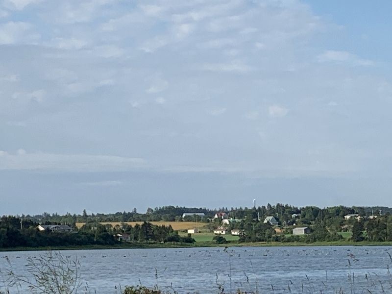
Established in 1720, Havre Saint
Pierre was once the largest
settlement in the colony of Isle Saint
Jean. On a summer day in the 1730s
this was a busy place. Here - a fleet
of tiny shallops, sails snapping as
they set out for the . . . — — Map (db m139397) HM
Early British settlers were more
interested in farming than in
fishing. By the early 1800s, a small
village began to grow farther
inland. Here the bay was narrow
and easily crossed - first by ferry,
later by bridge. St. Peters . . . — — Map (db m139407) HM
Near Anderson Road (Prince Edward Island Route 225) just east of Somerset Street (Prince Edward Island Route 109), on the right when traveling east.
English:
The first settlers in Kinkora were farmers. The community that developed has depended upon agriculture ever since. After the Dominion Government launched a dairy initiative in 1891, Kinkora responded and in 1900 opened a . . . — — Map (db m141171) HM
Near Anderson Road (Prince Edward Island Route 225) just east of Somerset Street (Prince Edward Island Route 109), on the right when traveling east.
This granite mill stone was mfg in France in the late 1800’s and imported to PEI in 1890’s. Mill stones were used in cereal grain grist mills to crush various cereal grains to yield flour for bread. This mill stone was purchased and used by Patrick . . . — — Map (db m151773) HM
Near Anderson Road (Prince Edward Island Route 225) just east of Somerset Street (Prince Edward Island Route 109), on the right when traveling east.
English:
The poetry of Ireland is immediately evident in a name that explains much about the community in and around the village. Building the Anderson Road in 1832 opened up the district for farming. Irish families, experienced . . . — — Map (db m141170) HM
Near Lady Slipper Drive North (Prince Edward Island Route 12) 0.1 kilometers north of Main Drive East (Veteran's Memorial Highway) (Prince Edward Island Route 2), on the right when traveling north.
Français:
Du 13 au 15 août 1884, Miscouche est la scène de la deuxième Convention nationale des Acadiens. Quelque 150 délégués officiels des trois provinces Maritimes se réunissent pour poursuivre les discussions entamées en 1881 . . . — — Map (db m142398) HM
Near Main Drive East (Veteran's Memorial Highway) (Prince Edward Island Route 2) 0.2 kilometers east of Lady Slipper Drive North (Prince Edward Island Route 12), on the left when traveling east.
Français:
Vers 1808, des familles écossaises catholiques, les Steele, McNeil et Gillis, sont les premières à s'établir dans l'emplacement actuel de Miscouche. En 1816, un groupe de familles acadiennes, qui habite la baie de . . . — — Map (db m142394) HM
On Lady Slipper Drive North (Prince Edward Island Route 12) just north of Main Drive East (Veteran's Memorial Highway) (Prince Edward Island Route 2), on the right when traveling north.
Français:
En 1890, la paroisse de Miscouche compte 683 Acadiens francophones et 137 anglophones, principalement d'origine écossaise. La majorité des paroissiens vivent sur la ferme, bien que les activités économiques sont assez . . . — — Map (db m142396) HM
Near Main Drive East (Veteran's Memorial Highway) (Prince Edward Island Route 2) 0.2 kilometers east of Lady Slipper Drive North (Prince Edward Island Route 12), on the left when traveling east.
Français:
Le premier établissement acadien sur les rives de la baie de Malpèque remonte à 1728. Il était situé du côté ouest là où se trouve aujourd’hui la région de Port Hill. En 1752, cette communauté agricole comptait 32 . . . — — Map (db m142401) HM
On Main Drive East (Veteran's Memorial Highway) (Prince Edward Island Route 2) just east of Lady Slipper Drive North (Prince Edward Island Route 12), on the left when traveling east.
Français:
La Base militaire de Summerside a eu un impact important sur la vie socio-économique de Miscouche pendant les 50 années de son existence (1941-1991). De nombreux paroissiens y ont trouvé de l'emploi et la communauté . . . — — Map (db m142395) HM
On Western Road, 0.1 kilometers north of Macisaac Road (Prince Edward Island Route 127), on the right when traveling north.
English: About the time of Confederation, Wellington was a small rural community located around Goodwin's Corner on the western road. It was named after Arthur Wellesley, the Duke of Wellington; the British general who defeated . . . — — Map (db m151770) HM
Near Point Prim Road (Prince Edward Island Route 209) 11 kilometers west of Trans-Canada Highway (National Route 1).
English:
Late in the summer of 1864, two events descended upon the city of Charlottetown. One was a circus; the other, a political conference. Of the two, it was the circus that captured the attention of Islanders. But it was the . . . — — Map (db m140250) HM
History of the Cavendish Area.
There is archaeological evidence that ancestors of the present-day Mi’kmaq lived on the shores of nearby New London Bay. It is very likely these early Islanders would have travelled here to hunt, . . . — — Map (db m139369) HM
Sea Stories From the first peoples through modern times, the fishery has been vital
to the people living along this shore. As Lucy Maud Montgomery
remembered: Many of the farmers had a fishing house on the shore field
of their . . . — — Map (db m139429) HM
On Grafton Street at Water Street (Prince Edward Island Route 1), on the right when traveling east on Grafton Street.
English: "From the beginning, the river drew people to settle its banks and use its waters to reach the settlements..." The Hillsborough River, Elsitkuk as the Mi'kmaq would say, is the Island's largest river. It runs east . . . — — Map (db m149601) HM
On Veterans Memorial Highway (St. Peters Road) (Prince Edward Island Route 2) just south of Oakland Drive, on the left when traveling south.
In 1786 John Cambridge purchased approximately 300 acres along Wright's Creek, which was then called Bird Island Creek. Around 1800 he built a 22 foot-high mill dam at the head of tide on the creek, and went on to build a saw mill, grist mill and . . . — — Map (db m140303) HM
On Grafton Street at Water Street (Prince Edward Island Route 1), on the right when traveling east on Grafton Street.
English: Across Charlottetown Harbour on the west side was the home base for the Acadians in the early years of the 1700's. It was called Port-la-Joye and Fort Amherst by the English. The Mi'kmaq called it Skma qan which . . . — — Map (db m149600) HM
On Kent Street near Queen Street, on the left when traveling east.
Samuel Holland Report Sept 14, 1767
The Capital to be called Charlotte Town is proposed to be built on a point of the harbor of Port Joy, betwixt York and Hillsborough Rivers, as being one of the best, and nearly central Parts of the . . . — — Map (db m207811) HM
English:
Great George Street is richly evocative of both its 18th-century origins and its subsequent development as one of Charlottetown's principal streets. Clearly focused to Province House, the seat of Island government and the . . . — — Map (db m80200) HM
On Queen Street, on the right when traveling south.
Samuel Holland was appointed Surveyor General for the eastern seaboard of North America by the Board of Trade and Plantations in London England. In 1764, he began his survey and his plan outlined 67 lots, 3 counties and 14 parishes. He also . . . — — Map (db m202745) HM
On Water Street (Prince Edward Island Route 1) at Grafton Street, on the left when traveling north on Water Street.
English: In 1768 Charles Morris, a Halifax Surveyor, was directed to lay out the town under the directions of the Board of Trade and Plantations in London. Later the Island's first British Governor, Walter Patterson, through his . . . — — Map (db m149900) HM
On Water Street (Prince Edward Island Route 1) at Grafton Street, on the left when traveling north on Water Street.
English: The site of Charlottetown was chosen by Surveyor General Samuel Holland on his survey of St. John's Island. Now called Prince Edward Island, it was once called Epekwitk, which means "lying on the water", by the . . . — — Map (db m149904) HM
Near Hache Gallant Drive, 1.2 kilometers east of Prince Edward Island Route 19, on the left when traveling east.
English: Working out of Fort Amherst between 1764 and 1765, Captain Samuel Holland, an engineer, directed a small team to produce an accurate survey of every inch of St. John's Island. It was the first phase of a major survey of . . . — — Map (db m151802) HM
Near Hache Gallant Drive, 1.2 kilometers east of Prince Edward Island Route 19, on the left when traveling east.
English: ”It is three years since the last refugee arrived on the island. They had to endure heavy losses and great hardship in getting here, and on arrival, they found themselves so to speak destitute… My Lord, unless you . . . — — Map (db m151801) HM
Near Hache Gallant Drive, 1.5 kilometers east of Prince Edward Island Route 19.
English: With Island history as your backdrop, you're looking out at Charlottetown Harbour, the Hillsborough River, Governors Island, and the bluffs of Keppoch. In the summertime, this waterway hosts an abundance of . . . — — Map (db m151792) HM
Near Hache Gallant Drive, 1.2 kilometers east of Prince Edward Island Route 19, on the left when traveling east.
English: Michel Haché-Gallant and Anne Cormier were the first Acadians to join the French colonists at Port-la-Joye. They arrived in 1720 from Beaubassin with four of their children. By 1730, eight Gallant children owned properties . . . — — Map (db m151797) HM
Near Hache Gallant Drive, 1.2 kilometers east of Prince Edward Island Route 19, on the left when traveling east.
Français:Première famille acadienne établie en permanence à L’Île-du-Prince-Édouard Ancêtres des familles Gallant et Haché du Canada et des États-Unis arrivés à Port-La-Joye en 1720 Monument érigé en 1965 par leurs . . . — — Map (db m151800) HM
Near Hache Gallant Drive, 1.2 kilometers east of Prince Edward Island Route 19, on the left when traveling east.
English: This timeline presents events that helped shape the history of Port-la-Joye—Fort Amherst, Prince Edward Island and Canada. Port-la-Joye was an imperial outpost for France for 38 years. For another ten years, Fort . . . — — Map (db m151804) HM
Near Hache Gallant Drive, 1.2 kilometers east of Prince Edward Island Route 19, on the left when traveling east.
English:We are in Port la Joye, one of the most beautiful harbours that the eye can behold. —Louis Denys de la Ronde, November 6, 1721 In 1720, three hundred men, women and children were brought from France to . . . — — Map (db m151803) HM
Near Haché Gallant Drive, 1.2 kilometers east of Prince Edward Island Route 19, on the left when traveling east.
English:
From 1720 to 1768 this site was an important colonial base, first for France and later Great Britain. One of the first permanent French settlements on the island, Port-la-Joye served as the seat of colonial government for . . . — — Map (db m139447) HM
Near Hache Gallant Drive, 1.2 kilometers east of Prince Edward Island Route 19, on the left when traveling east.
English: Lieutenant-Colonel Andrew Rollo arrived with a force of five hundred soldiers and took possession of Port-la-Joye on behalf of the British on August 17, 1758. The French governor at Louisbourg had given up both Île . . . — — Map (db m151799) HM
Near Haché Gallant Drive, 1.2 kilometers east of Prince Edward Island Route 19, on the left when traveling east.
English:
Undertaken here in 1758, this expulsion was one of the largest and the deadliest of the Acadian deportations that took place between 1755 and 1762. As part of a strategy to dismantle the French colony of Île Saint-Jean . . . — — Map (db m139446) HM
Near Hache Gallant Drive, 1.2 kilometers east of Prince Edward Island Route 19, on the left when traveling east.
English: There has been an aboriginal presence on the Island for at least ten thousand years. The Mi’kmaq became allies and important trading partners with the French in the 1600s and later sided with them in battles against the . . . — — Map (db m151798) HM